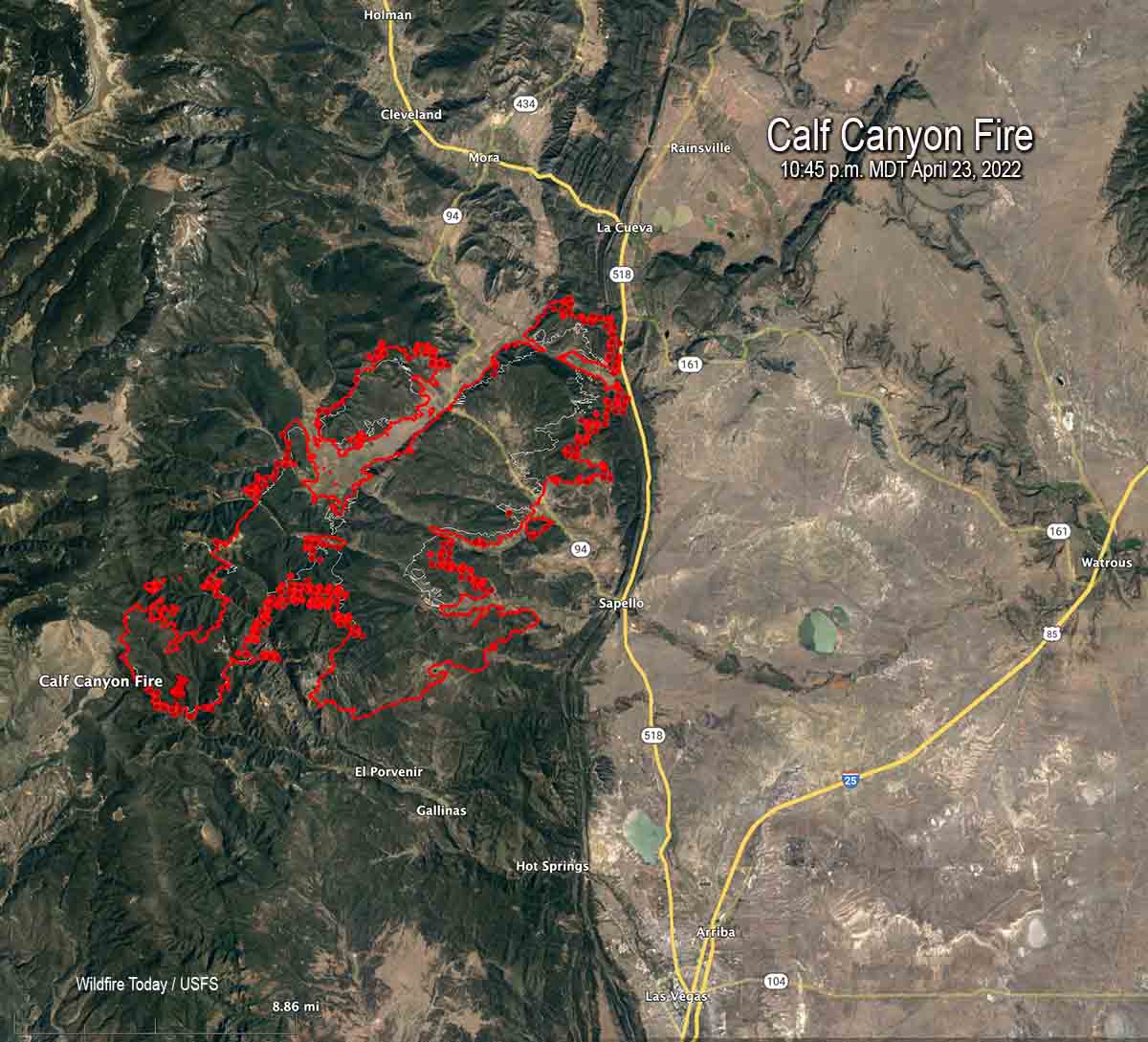
Updated 8:53 a.m. MDT April 24, 2022
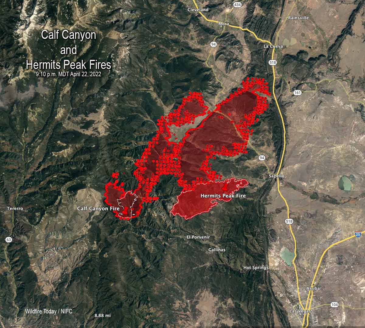
Calf Canyon/Hermits Peak Fire
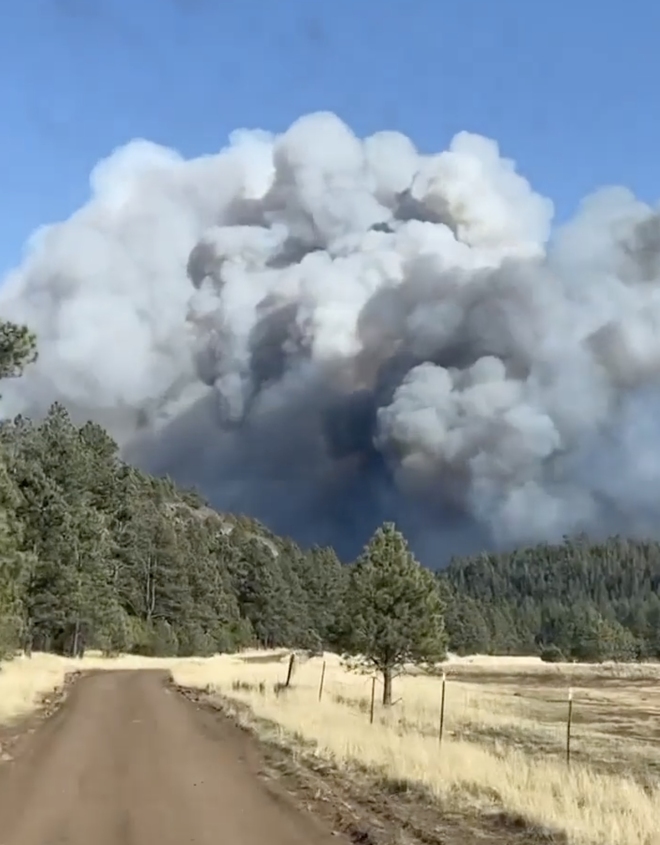
As the wind speeds decreased from the gale force conditions seen Friday, firefighters on the Calf Canyon and Hermits Peak fires that burned together were able to re-engage Saturday. The blazes are about 10 miles north of Las Vegas, New Mexico.
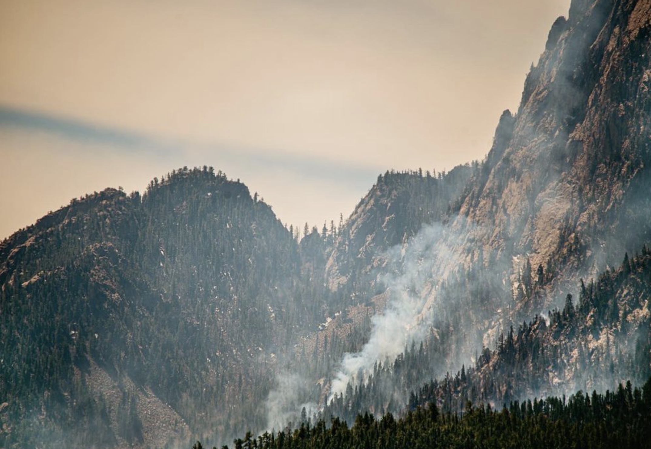
Crews are working on structure protection out ahead of the fire, removing fuel near homes in order to reduce their vulnerability. Dozers are putting in fire line where the terrain permits and the seven hand crews are working in steeper, less rocky areas.
Click to see all articles on Wildfire Today, including the most recent, about the Calf Canyon, Hermits Peak, and Cooks Peak fires.
Even though the fires have merged they are still being treated separately in reports. The combined size determined by a mapping flight at 10:45 p.m. Saturday was 54,004 acres.
“We don’t have enough resources to do everything we want to do at one time so we have to prioritize the resources we have at the right location,” said Incident Commander Carl Schwope in a briefing Saturday evening.
Reports filed Friday night showed that only seven hand crews were assigned and only one of those was a higher qualified Type 1 crew. A total of 526 personnel were on the fire.
The Incident Management Team that is handling both incidents has ordered “hundreds” of resources, but those orders can only be filled if the personnel and equipment are available.
As of Saturday evening the fire had not crossed the 518 road near the junction of road 161, but it was close and the fire was active in that area.
The Hermits Peak Fire was caused by a prescribed fire that escaped on the Santa Fe National Forest at 4:30 p.m. April 6, 2022. No cause has been released for the Calf Canyon Fire first reported on April 19.
Cooks Peak Fire
The Cooks Peak Fire nine miles south of Cimarron, NM was less active than the Calf Canyon Fire, but its spread was also slowed by a decrease in winds. A mapping flight Saturday night determined it had grown to 51,982 acres.
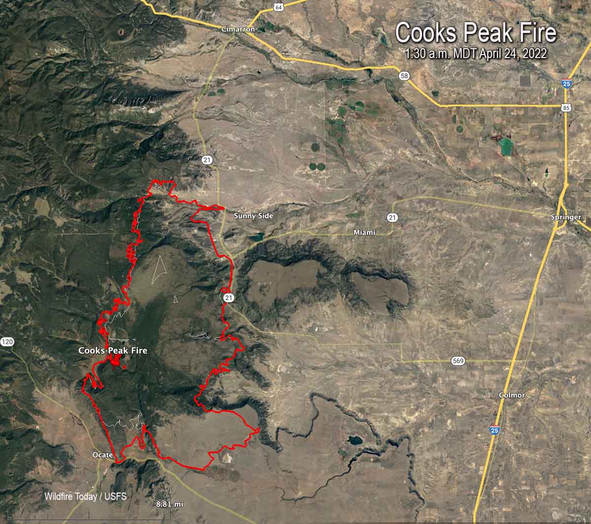
Reports submitted Friday evening showed there were only nine hand crews assigned, with one being a highest qualified Type 1 crew. A total of 383 personnel were on the fire.
8:26 a.m. MDT April 23, 2022
Strong winds and low humidities combined to cause two fires to merge and spread 10 miles through dry vegetation in Northern New Mexico Friday. A third fire was also very active. Those fires have now burned a total of approximately 88,000 acres.
Calf Canyon and Hermits Peak Fires
The Calf Canyon Fire merged with the rejuvenated Hermits Peak Fire which had been nearly contained but took off and ran parallel with the Calf Fire. Spot fires igniting far in advance contributed to the rapid rate of spread. The blaze is about 9 miles northwest of Las Vegas, New Mexico.
The fire crossed Highway 94 and continued for another 4 miles. At 3 a.m. Saturday satellite data showed it to be very close to Highway 518 just south of Buena Vista and the highway 161 intersection.
“This is a very devastating and life-threatening fire event that we are going through,” said Incident Commander Carl Schwope in a Friday evening briefing. “This will continue through the night and into tomorrow…It is very difficult for firefighters to engage in this dynamic environment.”
At publication time the Incident Management Team had not released a new accurate size for the fire, but it is likely that the combined size of the two fires is more than 40,000 acres.
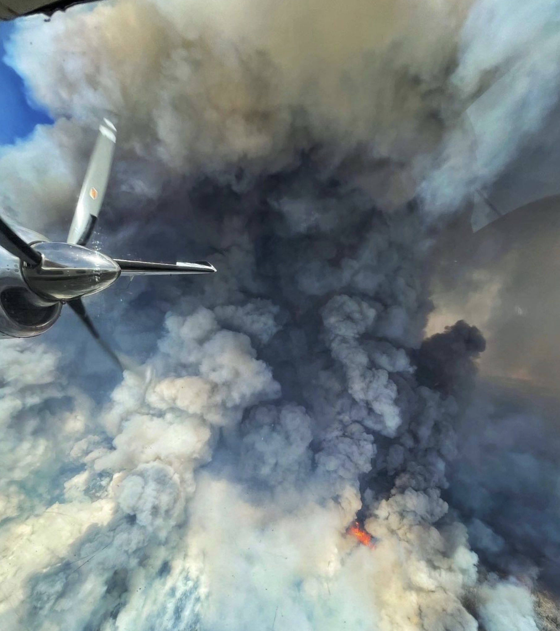
With the strong winds and dense smoke close to the ground and all aircraft being grounded due to the strong winds, firefighters did not have real time intelligence about the location of the fire. As of the 6 p.m. briefing they still did not know the details about the extent of the blaze as they stood in front of a map with rough-drawn lines showing the estimated perimeters.
Operations Section Chief Jason Coil said in the briefing that with the strong winds and low humidity still in the forecast, going forward firefighters will be looking for areas where they can secure the fire to prevent its growth, and identifying areas where they can pull away from the very active fire when it pulses through, and then re-engage quickly to try to minimize damage to homes.
San Miguel and Mora Counties have the latest evacuation information on Facebook.
The incident management team has ordered hundreds of additional resources including drones which may be able to fly in some areas to provide intelligence while piloted aircraft can’t be used due the smoke and wind.
At 9:10 p.m. Friday a piloted fixed wing aircraft was able to use infrared sensors to detect heat through the smoke to produce the map seen here.
On Friday the fire impacted areas with structures, but as of that evening the extent of damaged homes was unknown.
The Hermits Peak Fire which started April 6 had been winding down and firefighters were mostly engaged in mopup, but apparently the wind found a burning ember and blew it across the fire line and it took off, blackening even more additional acres than the Calf Canyon Fire did at the same time. The Calf Canyon Fire started April 19. As the wind speeds decreased during the night the two fires which had just barely touched by 9 p.m. were able to become more active on the flanks and they spread out laterally, increasing the merging of the edges.
The winds monitored at a weather station near Las Vegas, NM recorded sustained speeds Friday afternoon of 40 to 50 mph with gusts up to 67 while the relative humidity dropped as low as 6 percent. After sunset the speeds lowered to 30 mph and by dawn were out of the west-southwest at 18 mph.
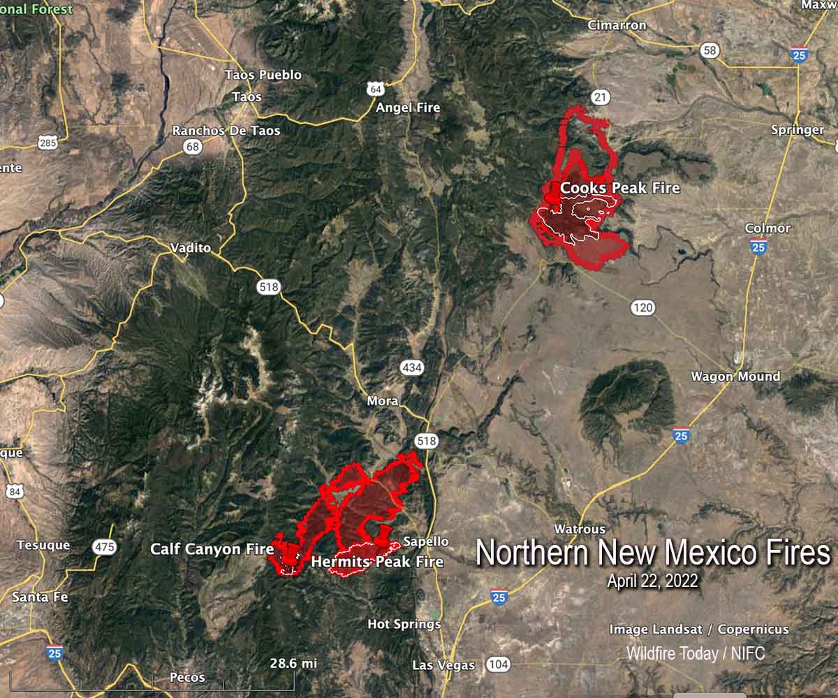
Cooks Peak Fire
The Cooks Peak Fire was also very active Friday, spreading primarily to the north for nearly eight miles pushed by strong winds. Surprisingly, it also grew two miles to the southeast. At 1 a.m. on Saturday it was about nine miles south of Cimarron and and 30 miles east of Taos. It has burned approximately 48,500 acres.
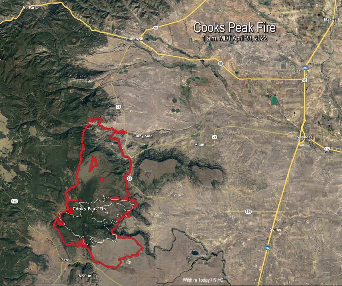
The Mora County Sheriff’s office has evacuation information on their Facebook page.