
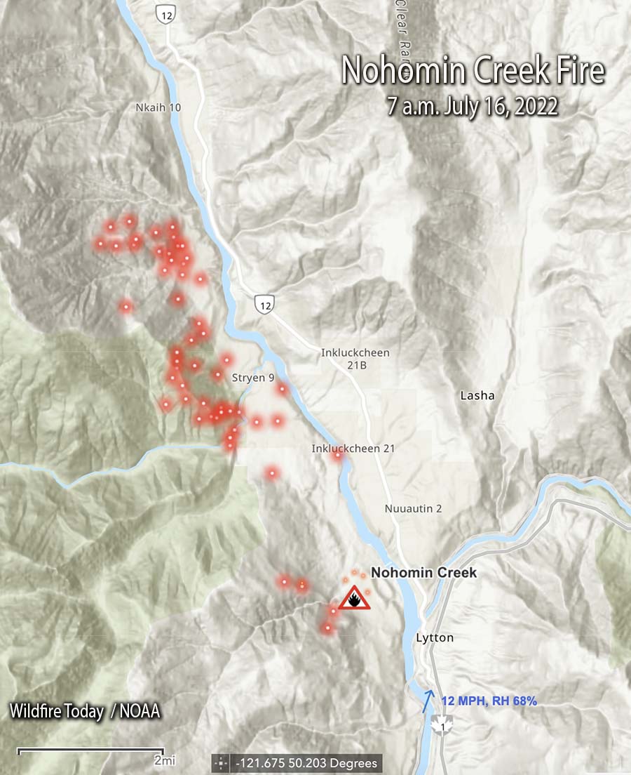
Updated 6:59 p.m. MDT July 16, 2022
The British Columbia Fire Service reported at 4:02 p.m. Saturday that the fire activity on the Nohomin Creek Fire northwest of Lytton, BC has been stable today and no major growth was observed. Ground crews and aviation resources are working on the south, east, and north flanks. The western flank is moving upslope in steep, difficult to access terrain, the agency said.
The Stein Valley Nlaka’pamux Heritage Park is partially closed. Currently, there are no impacts to Highway 1 or Highway 12. The Lytton Ferry is closed in both directions.
There was no update on the size, and it is still reported at 1,500 hectares (3,700 acres).
10:32 a.m. MDT July 16, 2022
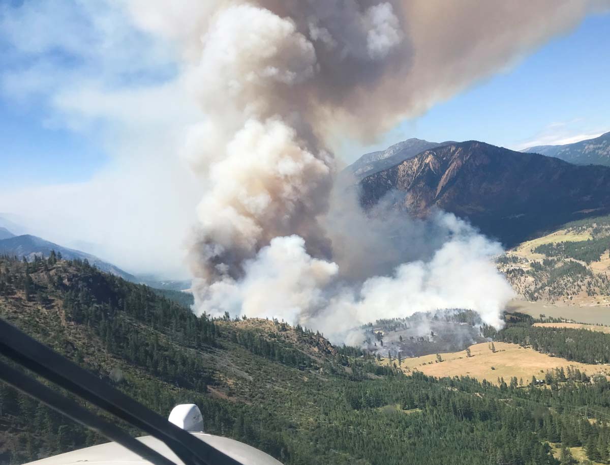
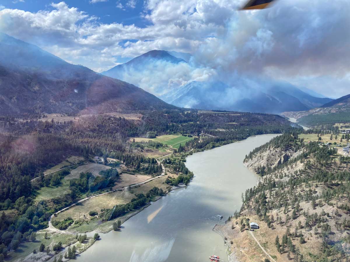
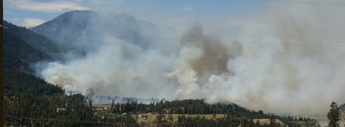
The Nohomin Creek Fire on the west side of the Fraser River northwest of Lytton, British Columbia has burned approximately 1,500 hectares (3,700 acres) since it was reported Thursday July 14. Judging from these photos shot that day it spread very rapidly.
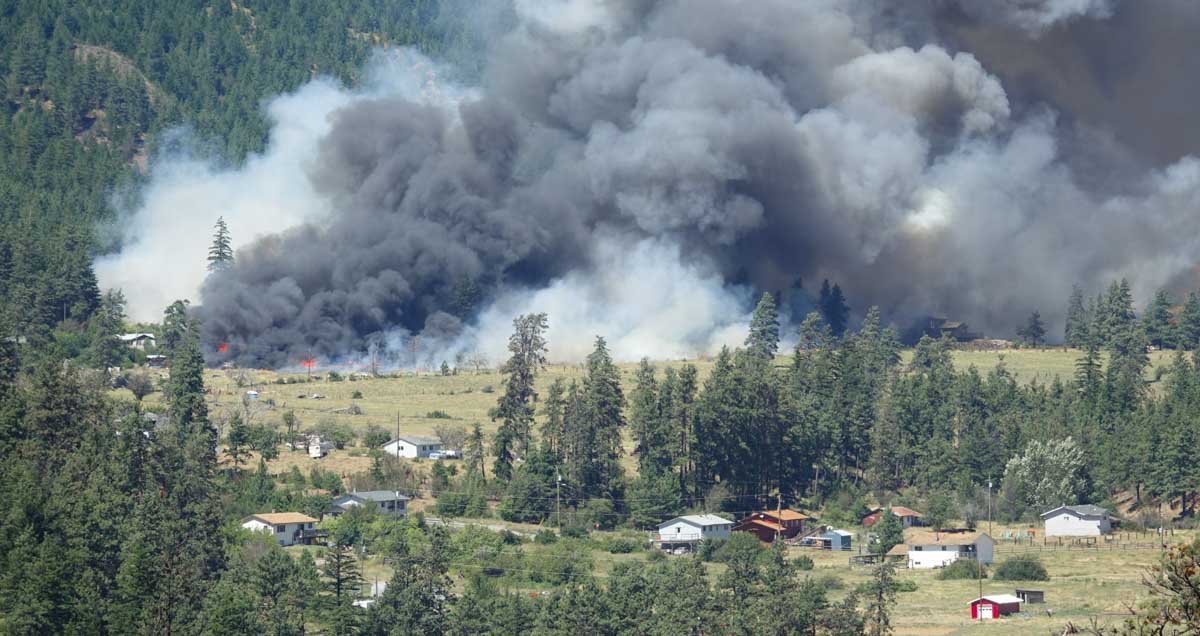
Fire officials said Friday that at least six homes have been destroyed, and that number could rise.
The BC Wildfire Service reports that the fire behavior is rank four and rank five, meaning it is crowning, has a moderate to fast rate of spread, and is exhibiting short-range spotting.
Winds of 30 to 40 kilometers per hour (19 to 26 miles per hour) are pushing the fire west away from communities, according to the BC Wildfire Service in a Friday evening update. At that time there were no impacts to Highway 1 or Highway 12. The Lytton Ferry is closed in both directions.
The two photos below were taken the day the fire started.
Evacuations are in effect. Lytton First Nation has the details.
In late June of 2021 the Lytton Creek Fire burned more than 83,700 hectares (206,000 acres) and destroyed 90 percent of the village of Lytton. Two civilians were killed in the fire.
