
11:20 a.m. PDT August 7, 2022
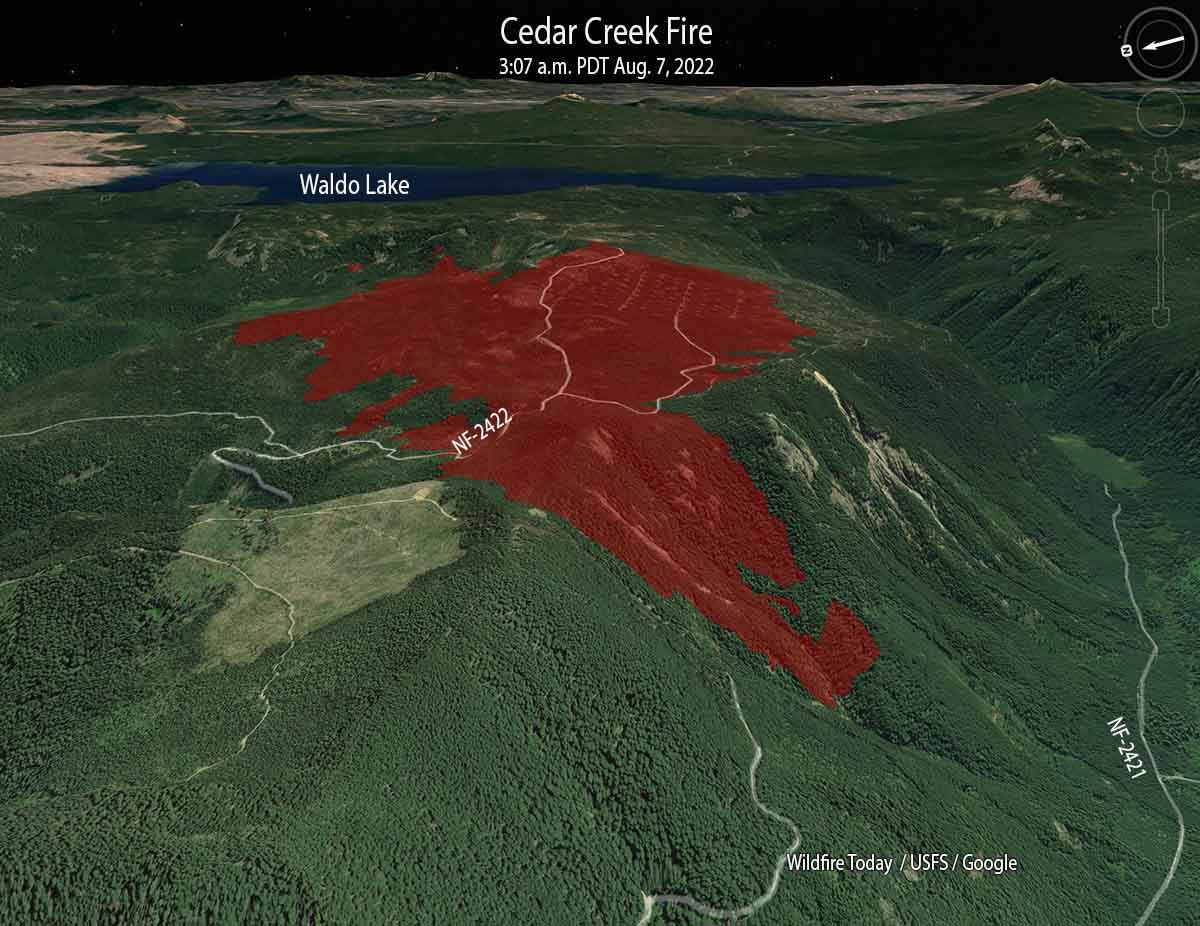
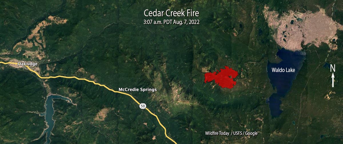
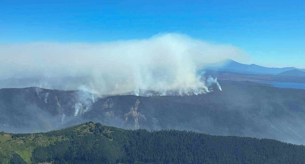
The Cedar Creek Fire on the Willamette National Forest in Western Oregon was very active when it was mapped by a fixed wing aircraft at about 10 p.m. Saturday, and also during a satellite overflight at 3 a.m. Sunday. Spot fires were observed 800 feet ahead of the main fire.
It has burned 1,822 acres since it started from a lightning strike August 1, one of 20 to 30 fires ignited by lightning that night. Most of it is burning on a plateau with a steep slope on the south side. The blaze is north of Highway 58, 14 air miles east of Oakridge, and 2 miles west of Waldo Lake.
A Type 1 incident management team assumed command on August 5. Since then the team has been scouting for opportunities to safely engage the fire.
Currently there are no evacuations in effect.
Update at 11:57 a.m. PDT August 9 2022.
It turns out that there is a major error in the National Interagency Fire Center fire history database. In the map below we created using their data, the polygon shown as the 68,000-acre 1991 Warner Creek Fire is completely in error and does not exist at that scale or at that location. The polygon that was not identified in the NIFC database that we labeled as “Unknown fire name in the 1990s”, is actually the 8,900-acre Warner Creek Fire of 1991. We regret the error. This is not the first time we have seen gross errors in the NIFC fire history database, especially for Oregon, and causes us to question ever using it again.
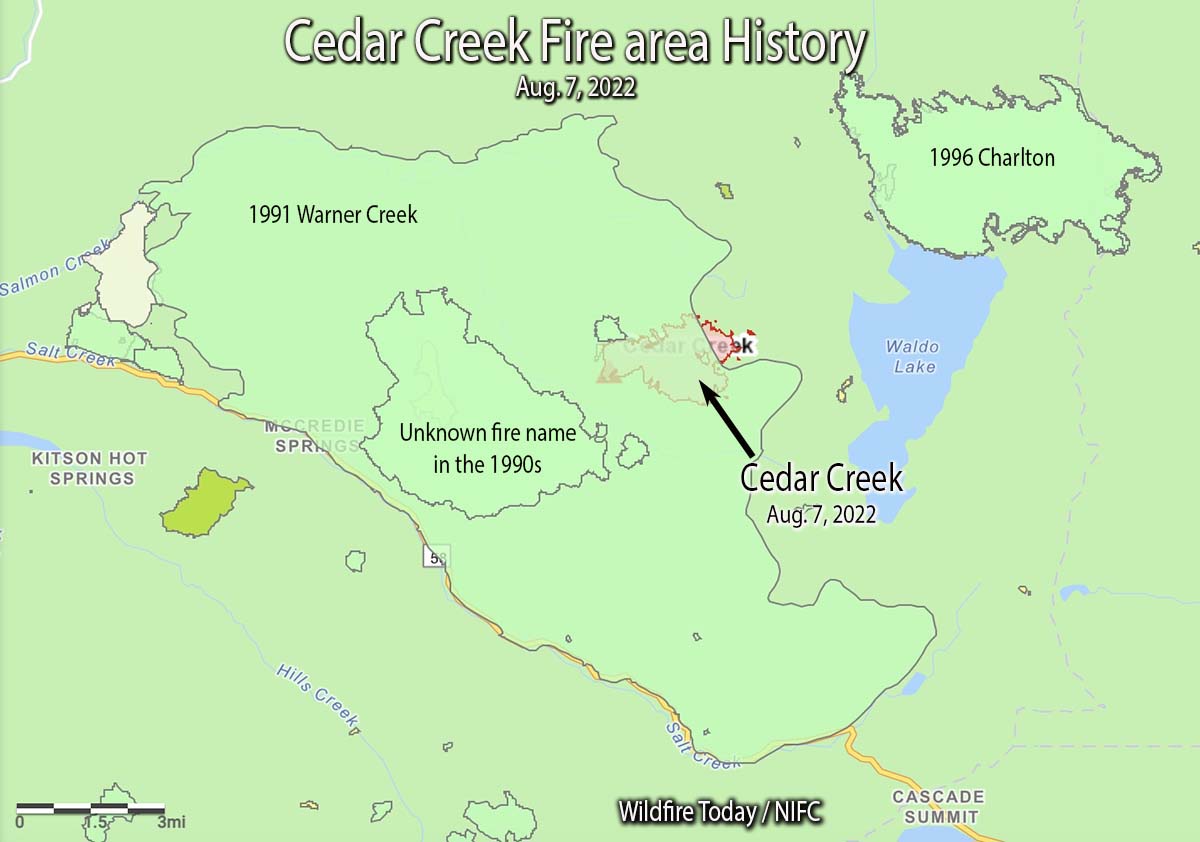
The 1996 Charlton Fire which burned 9,000 acres is 3 miles to the northeast on the north side of Waldo Lake.
In the video below recorded Sunday morning, Operations Section Chief Kyle Cannon describes the current situation.

Reminds me of 2015’s Collier Butte Fire near Agness, OR. They (Doug Johnson’s IMT) took about 4 days clearing escape routes to/from the fire edge, before having firefighters on some of the perimeter.
This year feels more like 2020 regarding western Oregon. I have been watching the Cedar Creek fire and a challenge for firefighters is the steep terrain as mentioned in the story, “Most of it is burning on a plateau with a steep slope on the south side.” Thanks for the update.
Ya, that’s what firefighters always do, (scout control lines) Bad title