
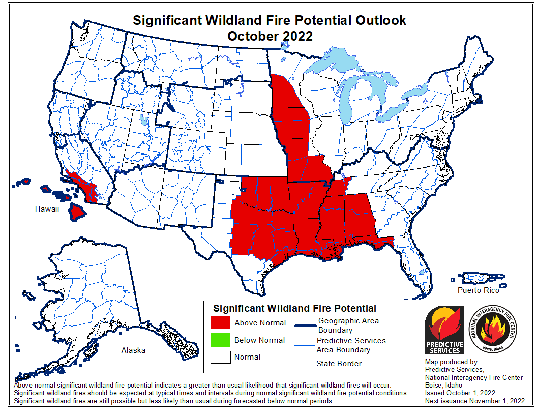
The forecast for wildland fire potential issued October 1 by the National Interagency Fire Center predicts that the wildfire potential shifts to the south-central United States over the next several months. Most of California has received more than the average amount of rain recently.
However some of the Southern California mountain areas have not received much wetting rain, therefore the prediction there is for above normal fire potential in October and November, possibly into December. The first widespread wetting rain this fall will likely follow two to three offshore wind events in Southern California.
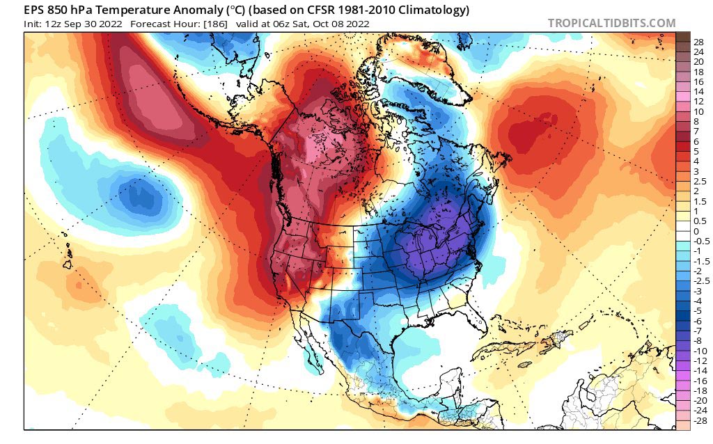
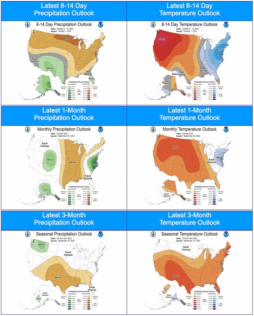
NIFC’s monthly forecasts are for the next four months, but in the shorter term, by the end of this week temperatures in the western US and Canada are expected to be 5C to 10C degrees above average for the date.
The fire potential text and maps from NIFC shown here represent the cumulative forecasts of the ten Geographic Area Predictive Services Units and the National Predictive Services Unit. Additional graphics are included from other sources.
Below:
- Excerpts from the NIFC narrative report for the next four months;
- Additional NIFC monthly graphical outlooks;
- NOAA’s temperature and precipitation forecasts;
- Drought Monitor;
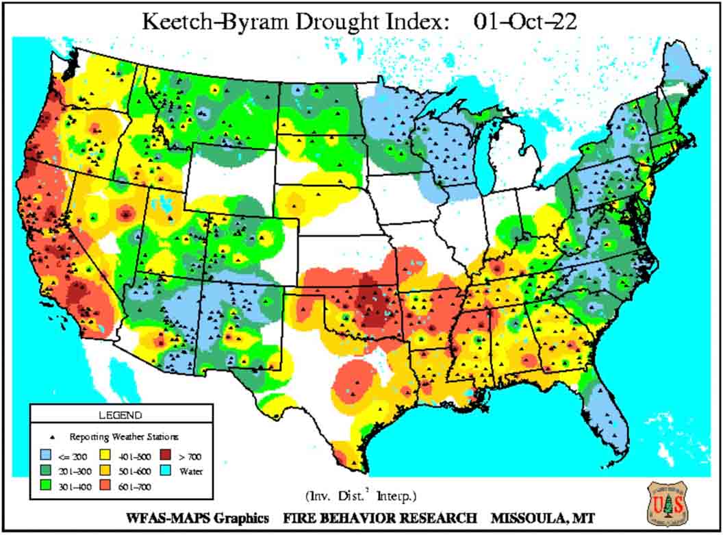
- Keetch-Byram Drought Index;
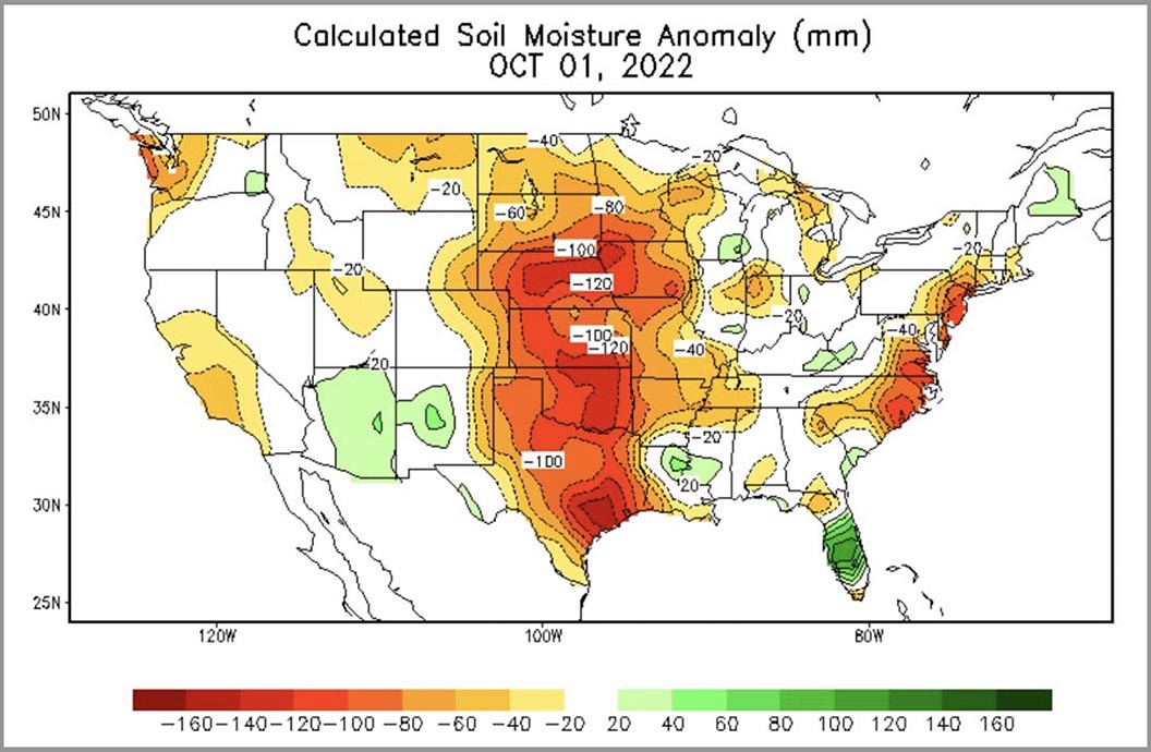
- Soil moisture.
“Drought continues in much of the West, with expanding and intensifying drought in portions of the Northwest, Idaho, and Montana due to warmer and drier than normal conditions in September. Most of California received well above normal rainfall for the month and much of the Northeast did as well, helping to reduce drought in New England. Warmer and drier than normal conditions also occurred in much of the southern and northern Plains into parts of the Southeast, Texas, and Midwest.
“Near normal temperatures and near to above normal precipitation are likely for portions of the Pacific Northwest and northern Rockies into early winter. Near to below normal precipitation is forecast for the rest of the West through the southern and central Plains into the Gulf Coast and Southeast, barring any landfalling tropical cyclones on the Gulf and Atlantic Coasts. Near to above normal temperatures and near normal precipitation are forecast for the Midwest through the Mid-Atlantic and Northeast.
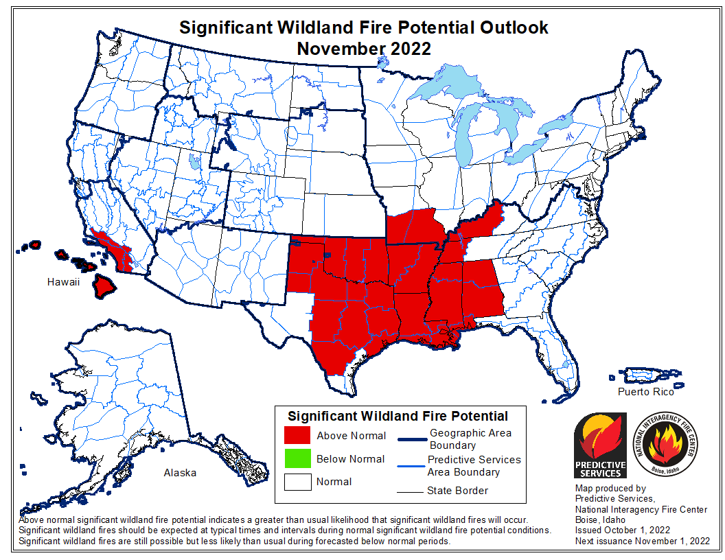
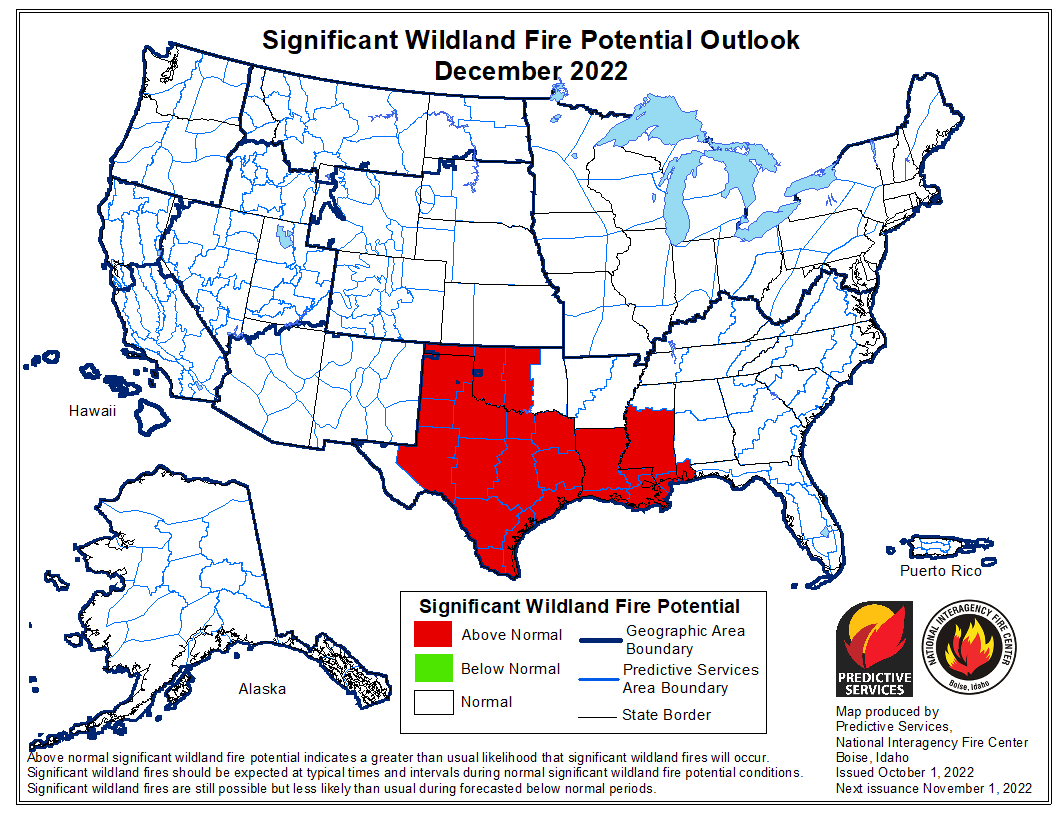
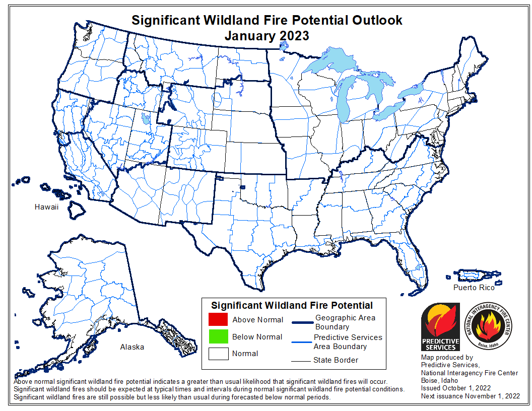
“Above normal significant potential is forecast for much of Oklahoma, Texas, the Lower Mississippi Valley, and central Gulf Coast into December. Above normal potential is likely for much of the Mississippi Valley in October and the western Ohio Valley through the Ozarks into November. Southern Area is forecast to return to near normal significant fire potential during January.
“The Transverse and Peninsular Ranges of southern California to the coast, areas prone to Santa Ana winds, will have above normal significant potential October through November, before returning to normal potential in December. The Hawai’ian Islands will continue to have above normal potential, especially lee sides, through November before returning to normal potential in December. All the US is forecast to have near normal significant fire potential during January.”


Conscientiously, I cannot/won’t take a fire assignment in any of those states. I dissent.