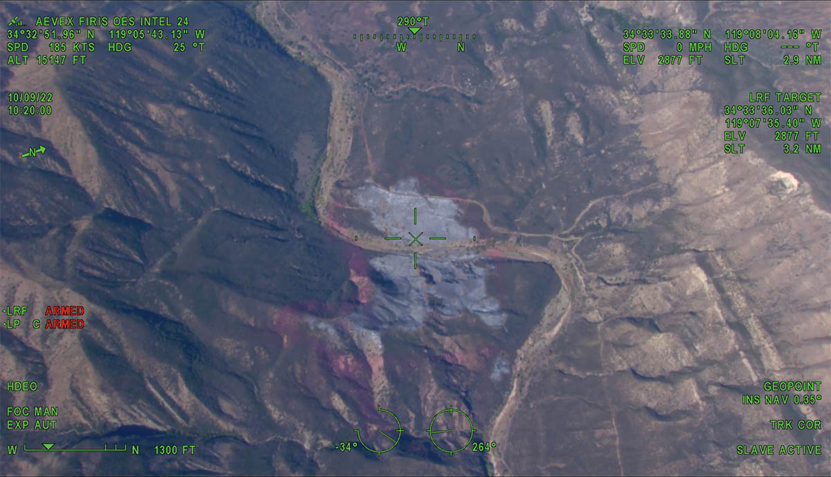
11:36 a.m. PDT Oct. 9, 2022
Aircraft were over the Howard Fire Sunday morning, including a lead plane and water-dropping helicopters.
The FIRIS OES 24 aircraft created an updated map at about 10 a.m. showing that the fire had grown to 85 acres, an increase of 10 acres since it was mapped Saturday evening.
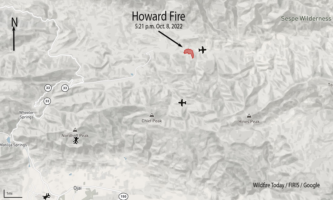
The incident is 8 miles northeast of Ojai, California. It is burning on both sides of Sespe Creek and the 20W13 Road, 6 miles east of Highway 33.
FIRIS was able to see fire retardant around much of the fire as well as hand-constructed and dozer-constructed fire line on portions of the perimeter. The video below is from FIRIS.
7:15 p.m. PDT October 8, 2022
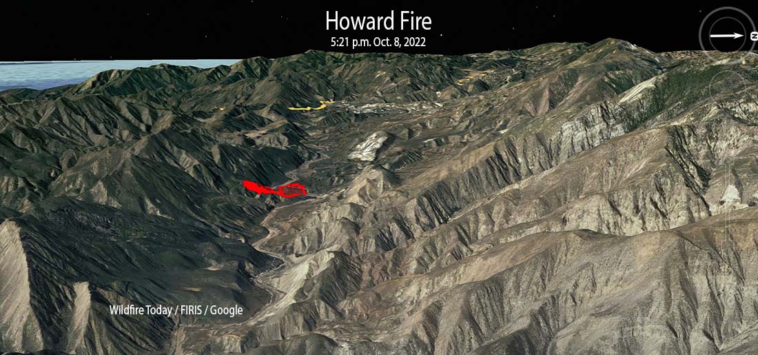
The Howard Fire started Saturday afternoon in a remote area 8 miles northeast of Ojai, California. It is burning on both sides of Sespe Creek and the 20W13 Road 6 miles east of Highway 33.
At about 5:50 the incident commander estimated it had burned 80 to 85 acres. About half an hour earlier it was mapped by the FIRIS aircraft at 75 acres.
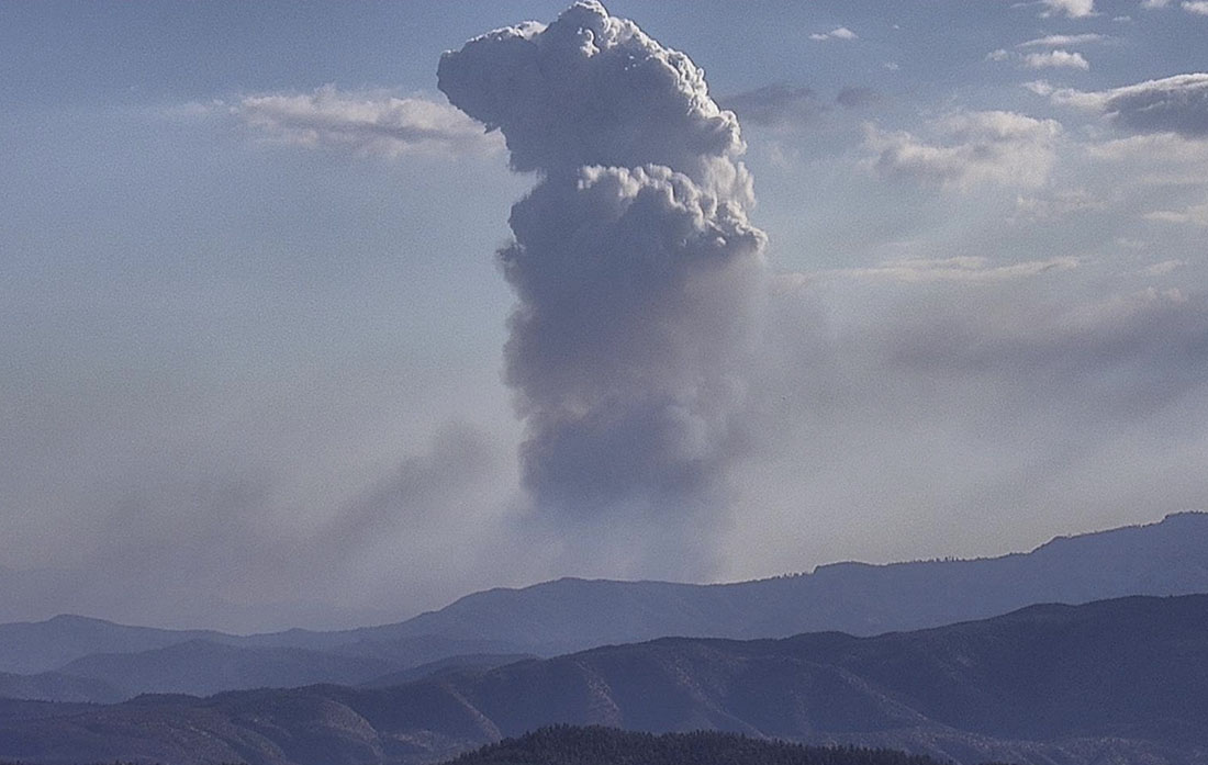
For the first hour or so it was growing quickly putting up a convection column of smoke. Firefighters said it had the potential for 1,000 acres, but after aggressive initial attack by hand crews and aircraft in the difficult terrain, little smoke was seen as the sun was setting. Air tankers were able to complete a retardant line around 80 percent of the blaze by flight cutoff time. Orders were placed for aircraft to be available on the fire Sunday morning.
Several hikers were rescued by fire department helicopters.