Photos of retardant dropped in Sespe Creek during Howard Fire

Map retardant Sespe Creek Howard Fire
Map showing location of photos of retardant near Sespe Creek at the Howard Fire. The red area is the western side of the fire Oct. 12, 2022. The photo locations were obtained from the metadata in the iPhone photos.

A lawsuit filed Tuesday alleged that the US Forest Service has polluted waterways by firefighting air tankers inadvertently dropping fire retardant in or near waterways in violation of the Clean Water Act and a policy adopted by the Forest Service and other federal agencies in 2011. The policy requires that retardant not be dropped within 300 feet of a waterway on federal land.

Retardant near Sespe Creek at the Howard Fire
Photo 1. Retardant near Sespe Creek at the Howard Fire. Oct. 12, 2022. Peter Deneen.

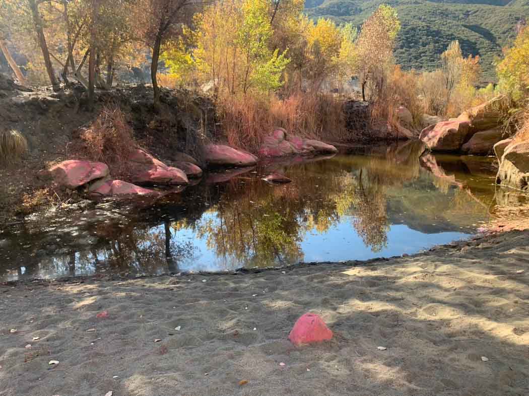
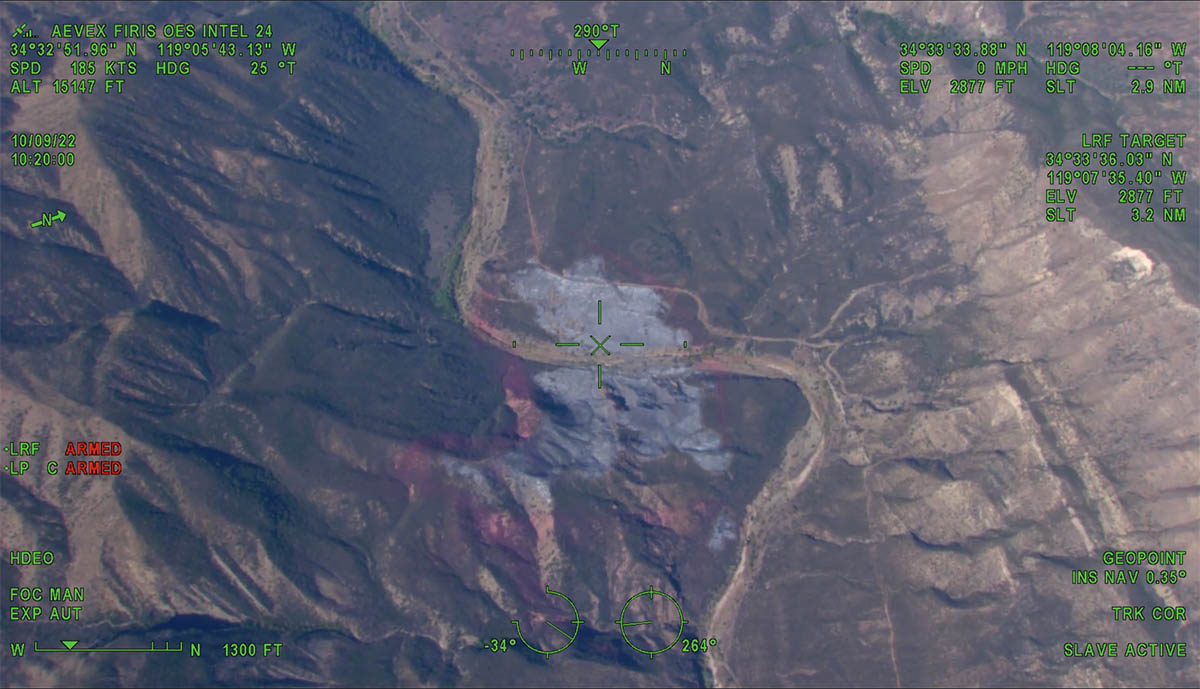
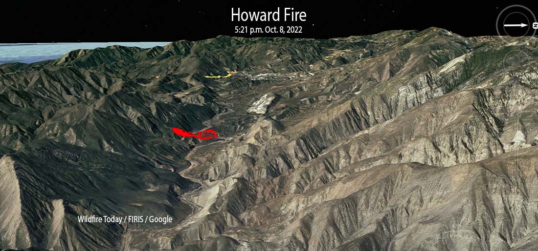
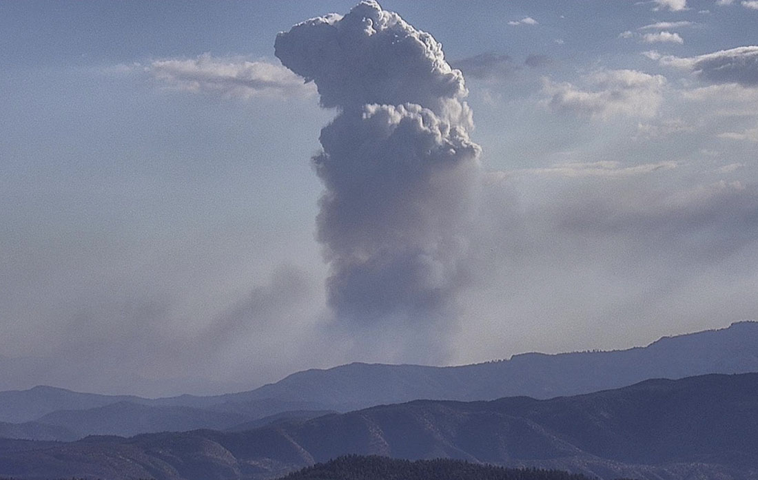
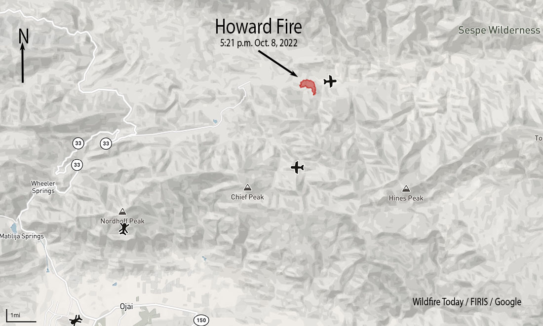
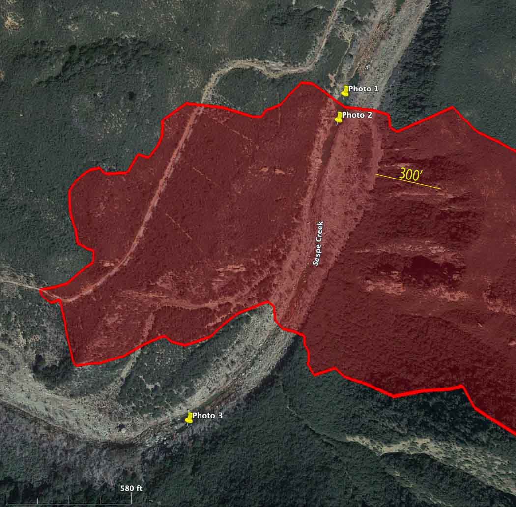
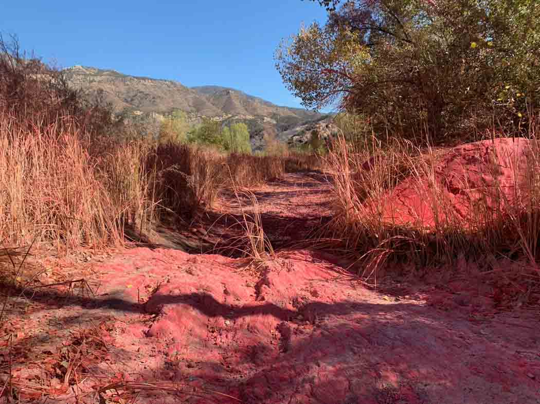
Fire Aviation has acquired photos and a video that reportedly show signs of retardant being dropped into Sespe Creek on the Los Padres National Forest 8 miles northeast of Ojai, California October 8, 2022. The photos were shot by Pete Deneen on October 12, 2022 at the 85-acre Howard Fire. The creek is designated a “wild and scenic river” and is in a wilderness area.

Retardant near Sespe Creek at the Howard Fire
Photo 2. Retardant near Sespe Creek at the Howard Fire. Oct. 12, 2022. Peter Deneen.

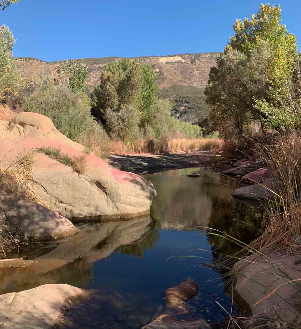
The photos show retardant on rocks and other objects very close to water in Sespe Creek.

Retardant near Sespe Creek at the Howard Fire
Photo 3. Retardant in a dry area of Sespe Creek at the Howard Fire. Oct. 12, 2022. Peter Deneen.

Some organisms, including aquatic threatened and endangered species or their habitats, can be adversely affected by retardants. In addition, retardant in water is a pollutant.

According to US Forest Service data, between 2012 and 2019, the Forest Service discharged retardant on at least 376 occasions totaling 761,282 gallons from aircraft directly into national forest waterways.

In the video below Mr. Deneen explains that there were two locations where retardant was dropped very close to the creek. In one case the aircraft may have turned as it was dropping to follow the creek for several hundred yards, or a second drop accounted for the retardant in the waterway.

The lawsuit was filed Oct. 11 by the Forest Service Employees for Environmental Ethics, FSEEE. In the group’s complaint they are seeking:

  • A declaration that the Forest Service’s placement of retardant in waterways is a violation of the Clean Water Act.
  • An injunction “to compel the Forest Service to comply with applicable environmental statutes, prevent irreparable harm, and satisfy the public interest.”
  • Reimbursement for FSEEE’s costs, expenses, expert witness fees, and attorney fees.
  • “Such further relief as may be just, proper, and equitable.”

More about FSEEE’s history of protesting retardant, and the federal government’s policy of retardant avoidance areas established in 2011.

Howard Fire ignites northeast of Ojai, Calif.

11:36 a.m. PDT Oct. 9, 2022

Howard Fire photo, 1020 a.m. Oct. 9, 2022
Howard Fire photo, looking west at 10:20 a.m. Oct. 9, 2022. FIRIS.

Aircraft were over the Howard Fire Sunday morning, including a lead plane and water-dropping helicopters.

The FIRIS OES 24 aircraft created an updated map at about 10 a.m. showing that the fire had grown to 85 acres, an increase of 10 acres since it was mapped Saturday evening.

The incident is 8 miles northeast of Ojai, California. It is burning on both sides of Sespe Creek and the 20W13 Road, 6 miles east of Highway 33.

FIRIS was able to see fire retardant around much of the fire as well as hand-constructed and dozer-constructed fire line on portions of the perimeter. The video below is from FIRIS.


7:15 p.m. PDT October 8, 2022

Howard Fire 3-D map 5:21 p.m. Oct. 8, 2022
Howard Fire 3-D map (in red) 5:21 p.m. Oct. 8, 2022

The Howard Fire started Saturday afternoon in a remote area 8 miles northeast of Ojai, California. It is burning on both sides of Sespe Creek and the 20W13 Road 6 miles east of Highway 33.

At about 5:50 the incident commander estimated it had burned 80 to 85 acres. About half an hour earlier it was mapped by the FIRIS aircraft at 75 acres.

Howard Fire
Howard Fire, looking southeast from Tecuyamtn1 camera at 4:32 p.m. Oct. 8, 2022. AlertWildfire.

For the first hour or so it was growing quickly putting up a convection column of smoke. Firefighters said it had the potential for 1,000 acres, but after aggressive initial attack by hand crews and aircraft in the difficult terrain, little smoke was seen as the sun was setting. Air tankers were able to complete a retardant line around 80 percent of the blaze by flight cutoff time. Orders were placed for aircraft to be available on the fire Sunday morning.

Several hikers were rescued by fire department helicopters.

Howard Fire map 5:21 p.m. Oct. 8, 2022