
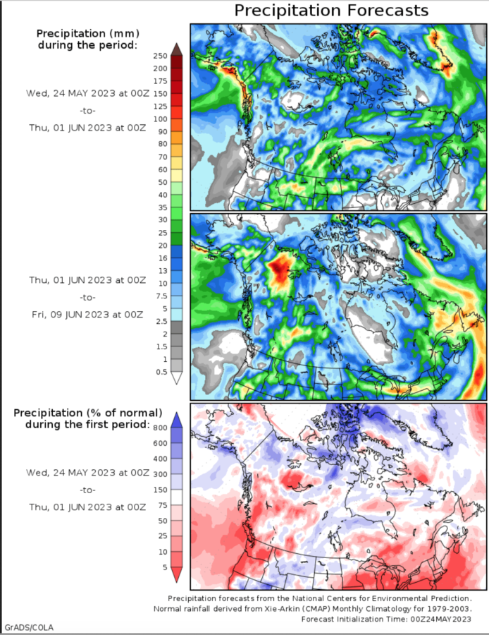
Western Canadian communities and firefighters may catch a welcome break next week with a forecast for precipitation — perhaps a good amount. Over the next week, areas along the Canadian Rockies may receive more than 100 mm (3.9 inches) while the Alberta-Saskatchewan border area may receive 20 mm (less than an inch), with soil moisture predicted to rise throughout the fire-impacted areas. This will likely slow fire spread and smoke volume, though fires at such scale will continue to produce smoke. An overall increase in humidity should lower fire danger.
The western provinces have experienced weeks of active fire behavior and growth, with an intensity comparable to that seen in the 2016 fires that burned Fort McMurray, Alberta and the heat domes and fires of 2021, when fires burned Lytton, British Columbia.
Phys.org reported that some 2,500 firefighters from across Canada backed by 400 military personnel have been deployed across Alberta and that more foreign help has been requested — with crews and incident management teams from the United States, Mexico, Australia, and New Zealand.
At one point nearly 30,000 Alberta residents were evacuated from their homes. Hazardous air quality and low visibility due to smoke were reported from British Columbia to Saskatchewan and as far south as Colorado and northern Texas.
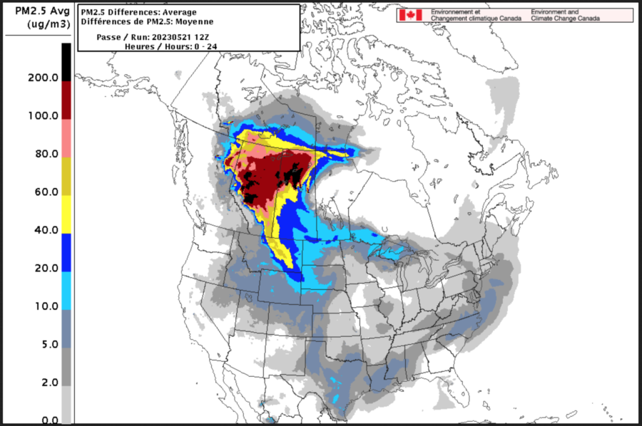
05/21 map
Situation Reports – National
The home page of the Canadian Wildland Fire Information System features maps of weather, fire behavior, and hot spots.
The Canadian Interagency Forest Fire Center Situation Report for May 20 indicated area burned to-date of 2.1 million hectares (nearly 5.2 million acres), with 15 new fires for a total of 226 currently active fires. Of those fires, 90 are identified as out of control. Canada is in its tenth day at its highest preparedness level of 5.
Situation Reports – Provinces with highest fire activity
- Alberta
- Saskatchewan
- British Columbia: Current Wildfire Situation Map and Current Wildfire Evacuation Information
Climate Change and Fire
In the Climate Atlas of Canada, an article on “Forest Fires and Climate Change” examines the impacts of climate change on Canadian fires and summarizes studies by Mike Flannigan and other scientists who predict that by 2100, western Canada will see a 50 percent increase in the number of dry, windy days that let fires start and spread, whereas eastern Canada will see an even more dramatic 200 percent to 300 percent increase in this kind of fire weather. And by 2040, fire management costs are expected to double.
Flannigan, a professor of wildland fire at the University of Alberta, explores the impact in more detail on his website. “Fire is the major stand-renewing agent for much of the Canadian forest,” he says, “greatly influencing forest structure and function.”
The research he summarized indicates that the observed increases in area burned in Canada during the last four decades is the result of human-induced climate change. Additionally, he says it appears that temperature is the most important predictor of area burned in Canada with warmer temperatures associated with increased area burned.
Based on a 2005 analysis, Flannigan says current estimates are that an average of over 2 million hectares burn annually in Canada. Just shy of the third week of May, Canada has already recorded 2.1 million hectares burned.
