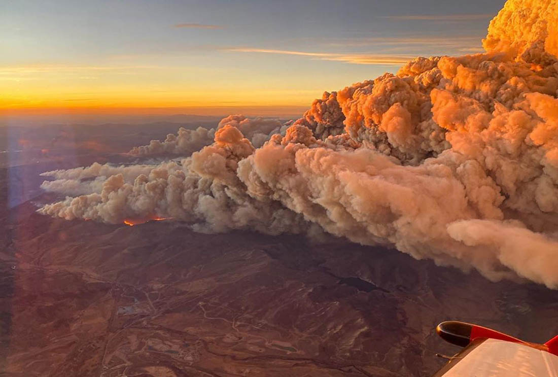
Silverado Fire in Orange County, Southern California threatens structures

Most of the fire is between Santiago Canyon Road and Portola Parkway

Updated October 27, 2020   |    5 p.m. PDT

In a briefing late Tuesday afternoon Orange County Fire Authority Chief Brian Fennessy said the Silverado Fire had burned 12,600 acres, and 78,000 homes have been evacuated.

The Orange County Sheriff’s Department website has the latest information about evacuations.

(To see all articles on Wildfire Today about the Silverado Fire, including the most recent, click here.)

An Incident Management Team from CAL FIRE, Team 6, will assume command of both the Blue Ridge and Silverado Fires Tuesday night.

The two fires had access to 14 helicopters and a variable number of fixed wing air tankers Tuesday.

Both of the firefighters that were seriously burned Monday on the Silverado Fire are still in critical condition.


Update October 27, 2020   |   12:14 p.m. PDT
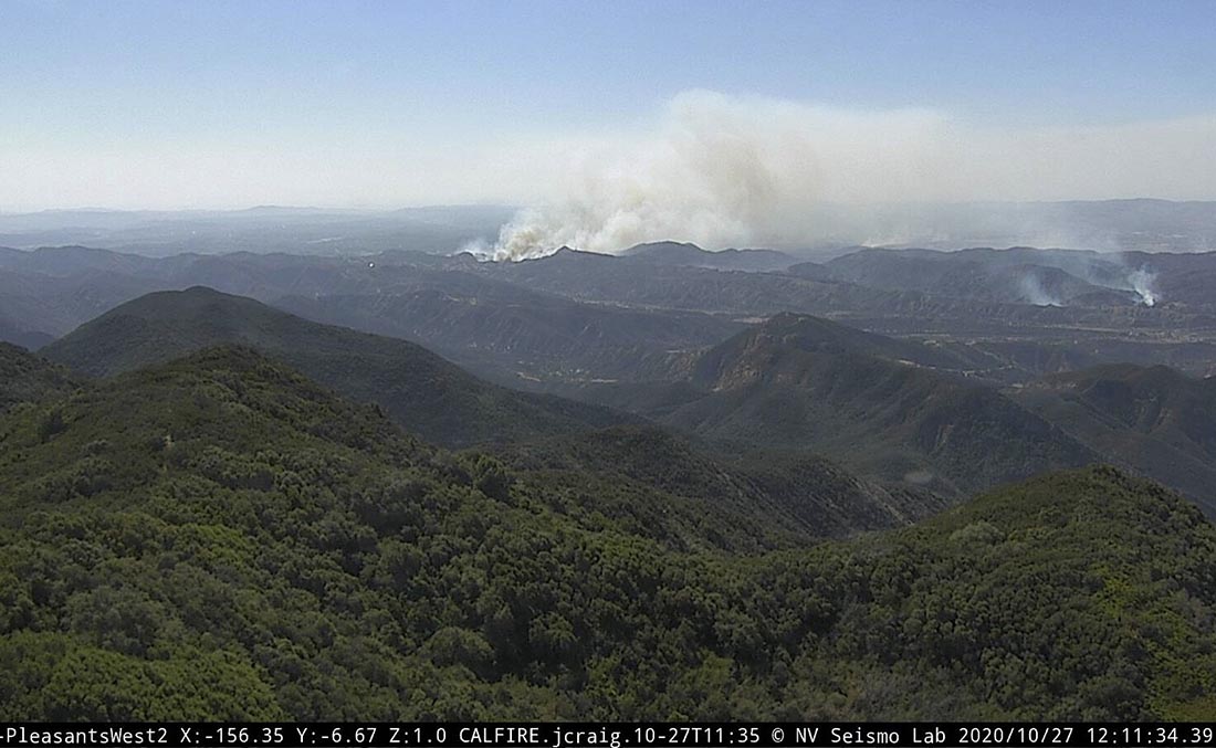
Silverado Fire
Silverado Fire as seen from Pleasants Peak at 12:11 p.m. Oct. 27, 2020. Looking southwest.

At 9 a.m. PDT Tuesday Orange County authorities said the Silverado Fire had burned 11,200 acres and 76,000 residents have been evacuated.

The weather forecast calls for decreasing winds after 2 p.m. PDT Tuesday, which should give firefighters a better chance to slow the spread of the fire.


Updated October 27, 2020   |   5:26 a.m. PDT

The map above shows the hot areas on the Silverado Fire at 11 p.m. PDT Oct. 26, 2020. The perimeter was not mapped because there was not enough heat for the sensors on the fixed wing aircraft to detect. Many areas that burned had cooled by the time the fire was mapped. You can zoom in and move around on the map.

At 9:26 p.m. Monday Orange County fire authorities said the Silverado Fire had burned 7,200 acres.
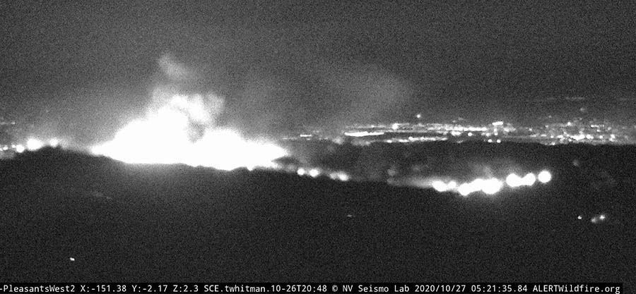
Silverado Fire
Silverado Fire as seen from Pleasants Peak at 5:21 a.m. PDT Oct. 27, 2020, looking southwest.

The fire was active throughout the night, but less so than during the day due to a decrease in winds. Those winds began to increase around 3 a.m. Tuesday morning as expected and more flare-ups were occurring, including near Limestone Canyon Road and Limestone Ridge Road.

Several helicopters worked the fire for most of the night, dropping water and assisting firefighters on the ground.
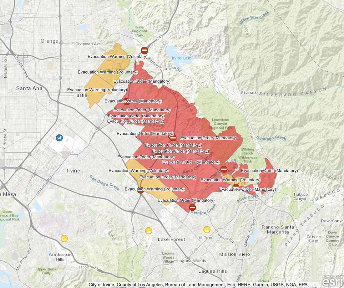
Silverado Fire evacuation zones
Silverado Fire evacuation and warning zones at 5 a.m. PDT Oct. 27, 2020. These zones can change on a minute by minute basis. Visit Orange County’s website for current information.

Updated October 26, 2020   |   5:21 p.m. PDT

At 4:30 p.m. on Monday Orange County Fire Authority Chief Brian Fennessy said the Silverado Fire had burned 7,200 acres and 22,000 homes have been evacuated. There have been no reports of structures being destroyed, the Chief said.

Chief Fennessy said two firefighters working on the County’s hand crew were gravely injured on the Silverado Fire. They suffered serious burns and have been intubated.

“They were working near what we call the heel of the fire, where the fire started,” the Chief said. “We don’t have any information about what occurred. We have requested an accident review team from the state to come in and do the investigation… I was with them when their families arrived. We are giving them all the support we can, not only through our Chaplin program, but we have a very comprehensive peer behavioral health program.”

Continue reading “Silverado Fire in Orange County, Southern California threatens structures”

Firefighters stop East Troublesome Fire outside Estes Park, Colorado

Operations Chief said they had a “very good day” Saturday

October 25, 2020   |   8:10 a.m. MDT

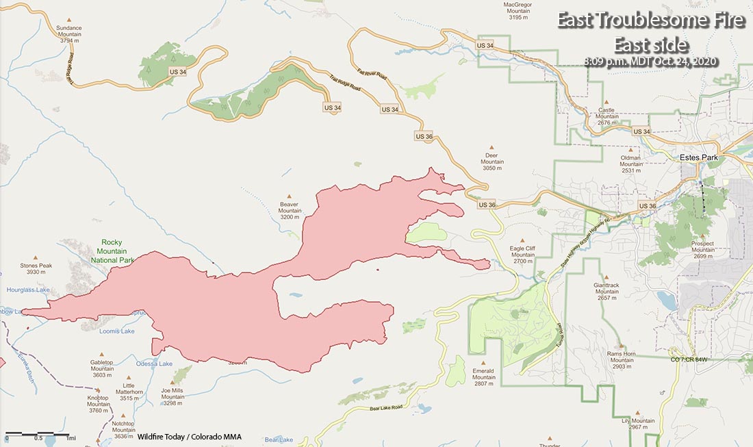
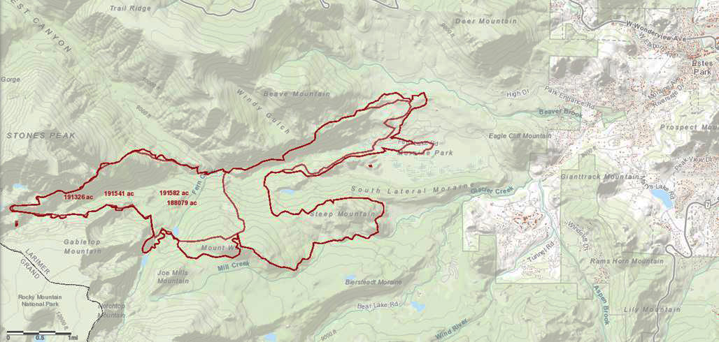
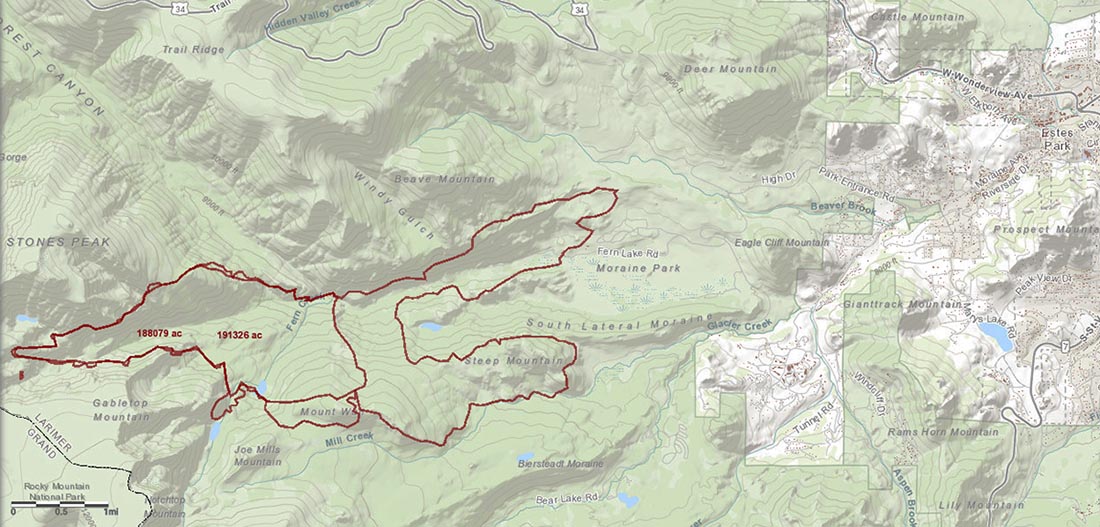
Map of the east side of the East Troublesome Fire near Estes Park
Map of the east side of the East Troublesome Fire near Estes Park.

Firefighters on the Cameron Peak Fire tasked with handling the portion of the East Troublesome Fire threatening Estes Park did some serious firefighting Saturday, stopping the fire before it could spread into the wildland urban interface. They used existing fuel treatment areas where the vegetation had been thinned or removed, as an anchor from which to conduct a firing operation to widen the buffer between the fire and the community.

Paul Delmerico, the Operations Section Chief, Saturday night:

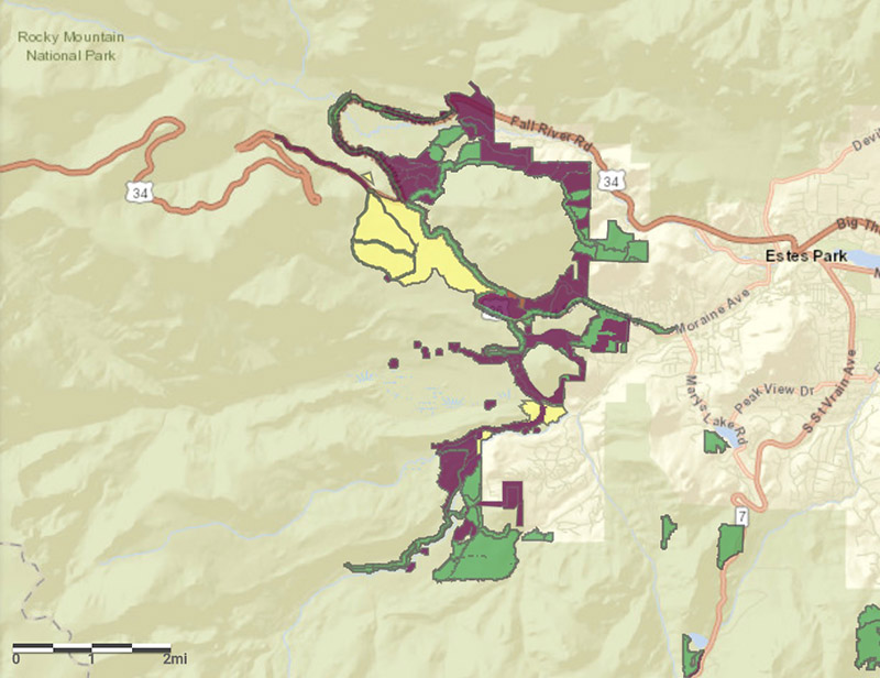
The fuels treatments helped significantly. Those fuels treatments are what gave us a really good defensive start to our day today when we saw that. It gave us something to work off of and to build off of.

The fire made a run just north of Moraine Park.Our firefighters picked up that [fuel treatment] and did a firing operation and held it just north of Moraine Park and then we had a couple of hand crews in there today and we picked that up with direct hand line. We were able to go up and over the ridge and back down and tie it in with existing road systems.

Our firefighters out there are doing a heck of a job. We had a really good day today, considering the fuel conditions and the weather conditions.

Hazardous Fuel Treatments near Estes Park
Previously constructed Hazardous Fuel Treatments near Estes Park, current October 24, 2020. It is not clear if the projects were prescribed fire, mechanical vegetation treatment, or both.

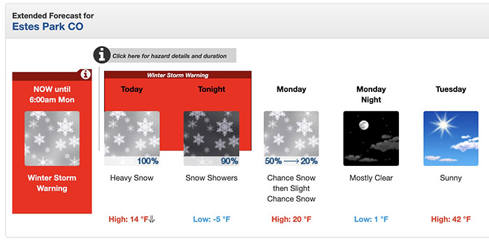
Saturday evening rain followed by snow put at least a pause on the fire activity. Six to twelve inches are in the forecast through Monday. The final status of the fire will depend on the weather over the next several weeks. If it continues to be wet, it could be the demise of the fire; however, fires can sometimes survive for months under a blanket of snow. If the humidity continues to be very low with no additional precipitation much of the snow could evaporate (or sublimate) reducing how much water moves into the vegetation and the soil.

Estes Park weather forecast
Forecast at 9 a.m. MDT October 25, 2020.

Firefighters were also successful on the portion of the East Troublesome Fire west of the Continental Divide before the rain and/or snow began Saturday evening. The strong winds did not result in any major catastrophic runs.

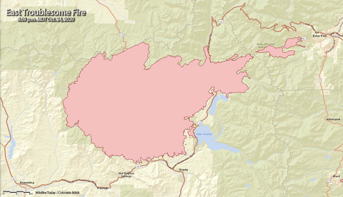
Map of the East Troublesome Fire
Map of the East Troublesome Fire, 8:09 p.m. MDT October 24, 2020.

Very high to extreme fire danger in store for parts of California Sunday through Tuesday

October 24, 2020   |   6:46 p.m. PDT

Extreme fire danger
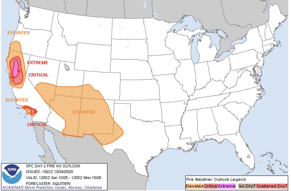
Storm Prediction Center forecast for Sunday. Extreme fire danger.

A major weather event that will affect wildland fire danger begins in California Sunday morning. NOAA’s Storm Prediction Center does not often predict extreme fire weather, but they have done just that to warn of a wind event with very low humidities for parts of California Sunday through Tuesday. At times the wind will be very strong and the relative humidity will drop below five percent in some locations.

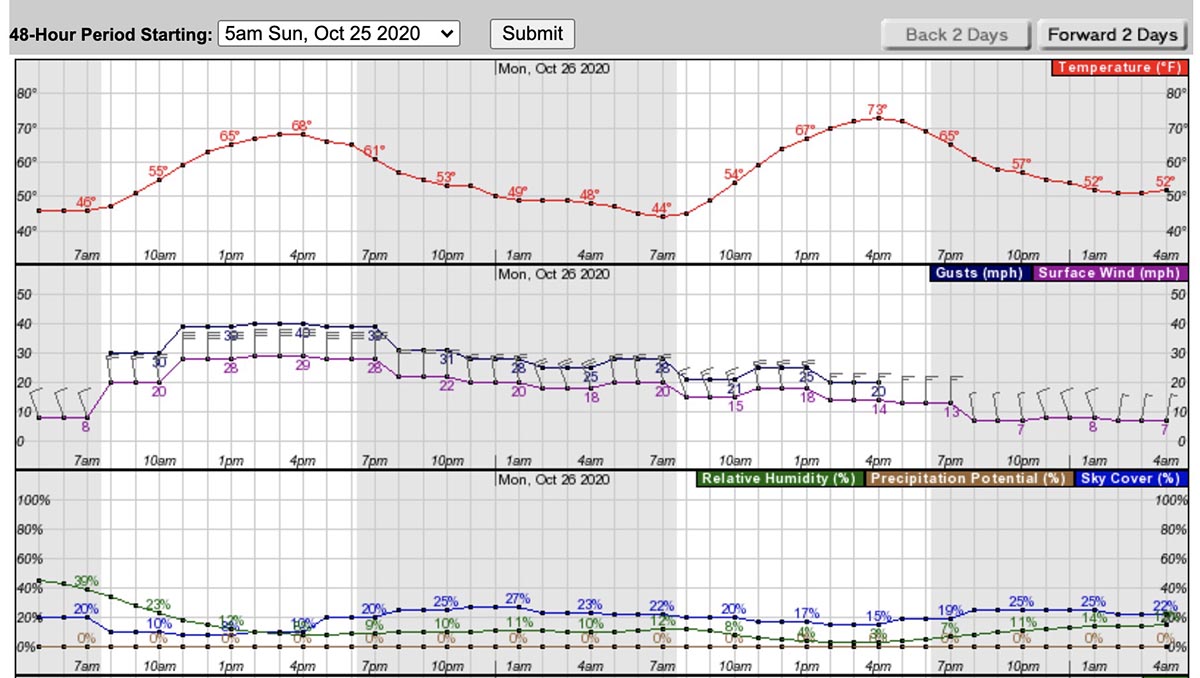
Check out the forecast for Red Bluff in Northern California —  on Sunday, 29 mph north winds with gusts to 40, and 10 percent relative humidity. On Monday, 18 gusting to 25 with 5 percent RH.

Weather forecast for Red Bluff, CA
Weather forecast for Red Bluff, CA Sunday and Monday

The extreme weather will begin in Northern California on Sunday then work its way to the southern part of the state on Monday and Tuesday.

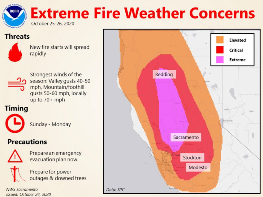
Fire weather Sunday and Monday
Fire weather Sunday and Monday, Northern California

The forecast for Riverside in Southern California beginning early Monday morning: 26 to 30 mph north winds gusting to 45, with 8 percent RH; then Tuesday, 18 to 20 mph gusting to 30 with 10 percent RH.

Weather Forecast Riverside, CA
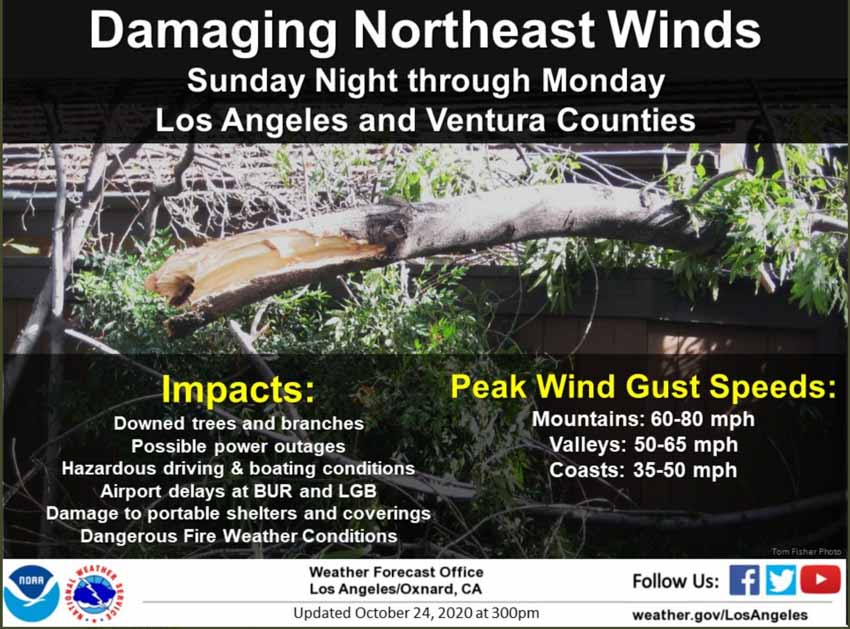
Fire weather Sunday and Monday
Fire weather Sunday and Monday Los Angeles and Ventura Counties.

With five to nine inches of snow beginning tonight on three fires in Colorado, I wonder if they can spare any crews or overhead personnel in case they are needed in California? Of course the 192,000-acre East Troublesome Fire after burning for 11 days only has 5 crews and 336 personnel, but the 206,000-acre Cameron Peak Fire next door has 42 crews and 1,903 personnel. The 10,000-acre Calwood Fire that has not spread for days now has snow, 10 crews, and 495 personnel. The National Multi-Agency Coordinating Group may have already made decisions along these lines.

As we wrote earlier today, of the 113 Interagency Hotshot Crews in the U.S., only about 35 are still funded and available for fighting fire. In two weeks that number drops to around 13 according to projections in a September 30, 2020 planning document compiled by an Area Command Team (ACT).

Very few fires have burned in Rocky Mountain National Park in the last 40 years

There is plenty of fuel available for the East Troublesome Fire

October 24, 2020   |   2:56 p.m. MDT

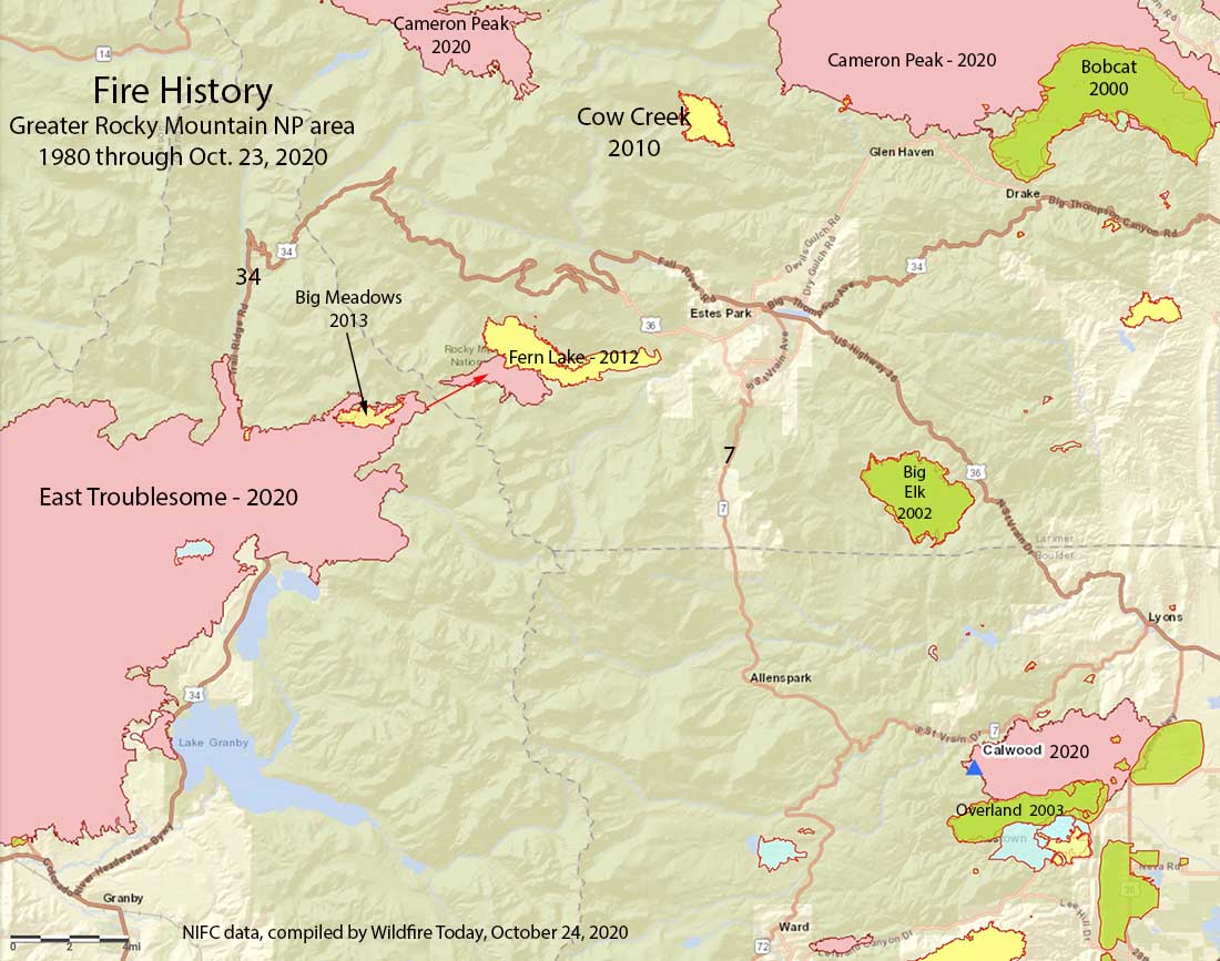
Map of the Fire history of Rocky Mountain National Park
Map of the wildfire history of Rocky Mountain National Park from 1980 through October 23, 2020. The east and west boundaries of the park are close to highways 34 and 7.

Very few large wildland fires have burned in Rocky Mountain National Park in the last 40 years. Official records show only one that has exceeded 1,000 acres — the Fern Lake Fire that covered 3,330 acres in 2012. There were a couple of fires in the late 1970s west of Allenspark that each burned less than 1,000 acres.

To see all articles on Wildfire Today about the East Troublesome Fire, including the most recent, click here.

There is an unofficial report that the East Troublesome Fire burned through the footprint of the Fern Lake Fire before noon today, October 24. The 643-acre Big Meadows Fire of 2013 has also been burned over.

Hazardous Fuel Treatments near Estes Park
Hazardous Fuel Treatments near Estes Park, current October 24, 2020. It is not clear if the projects were prescribed fire, mechanical vegetation treatment, or both.

The bottom line is, most of the vegetation in the park has not been visited by fire in recorded history. This means a fire burning in a fire-starved forest under the current drought conditions and a strong wind, would be virtually impossible to stop until those conditions change. And a big change is due after sunset today with rain followed by snow which will continue through Monday.

At 10 a.m. Saturday the East Troublesome Fire was mapped at 191,000 acres and was spreading to the east.

Wildland firefighters are scarce this time of the year

About one-third of the Hotshot Crews that started the season are still working

October 24, 2020   |   11:38 p.m. MDT

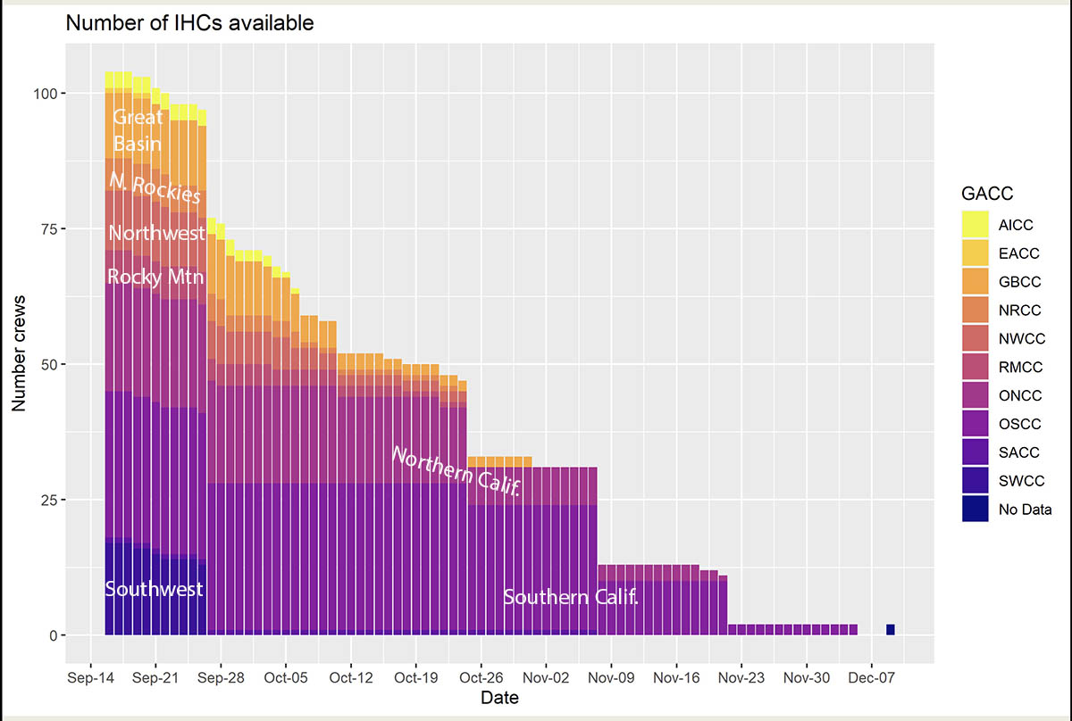
Interagency Hotshot Crews availability, 2020
Interagency Hotshot Crews availability, 2020. Data compiled by Area Command Team 2 September 30, 2020. Notations on the chart about the geographic areas were made by Wildfire Today.

The East Troublesome Fire near Estes Park, at this point is the second largest fire in the recorded history of Colorado. The top three all burned this year.

  1. Cameron Peak, 2020, 206,977 acres
  2. East Troublesome, 2020, 188,389 acres
  3. Pine Gulch, 2020, 139,007 acres
  4. Hayman Fire, 2002, 138,144 acres

During the wind event that is unfolding as this is being written, it is conceivable that the East Troublesome Fire could become the largest. For a fire this size, over 188,000 acres, it has a relatively small number of firefighters assigned, 424 as of Saturday morning. The nearby Cameron Peak Fire has 1,903 personnel and that fire has taken over the portion of the East Troublesome Fire east of the Continental Divide in Rocky Mountain National Park.

Wildland fire resources are scarce this time of the year with many crews losing their funding in September and October. Of the 113 Interagency Hotshot Crews in the U.S., only about 35 are still funded and available for fighting fire. In two weeks that number drops to around 13 according to projections in a planning document compiled September 30, 2020 by an Area Command Team (ACT).

The functions of Scott Jalbert’s ACT that is in Colorado now is to provide decision support to Multi-Agency Coordination Groups for allocating scarce resources and help mitigate the span of control for the local Agency Administrator. They also ensure that incidents are properly managed, coordinate team transitions, and evaluate Incident Management Teams.

The western fire season is long from being over. Red Flag Warnings are in effect on Saturday or Sunday in Colorado, New Mexico, Utah, and California. Weather forecasters expect winds could reach 100 mph in some exposed areas in California’s North Bay and East Bay on Sunday, while other nearby locations could see winds up to 40 mph.

Strong winds Saturday could push East Troublesome Fire closer to Estes Park

Two people who refused to evacuate were killed in the Colorado fire

Updated October 24, 2020   |   6:35 p.m. MDT

East Troublesome Fire
Map, east side of the East Troublesome Fire at 4:45 p.m. MDT Oct. 24, 2020.

At about 5:50 p.m. there was a report of sleet and light rain at the fire, which has paused at Bear Lake Road, about a mile west of Estes Park.

The weather station near Estes Park recorded wind speeds Saturday afternoon at 10 to 15 mph with gusts above 30 mph, while the relative humidity was in the low 20s and the temperature was 53 degrees.

East Troublesome Fire
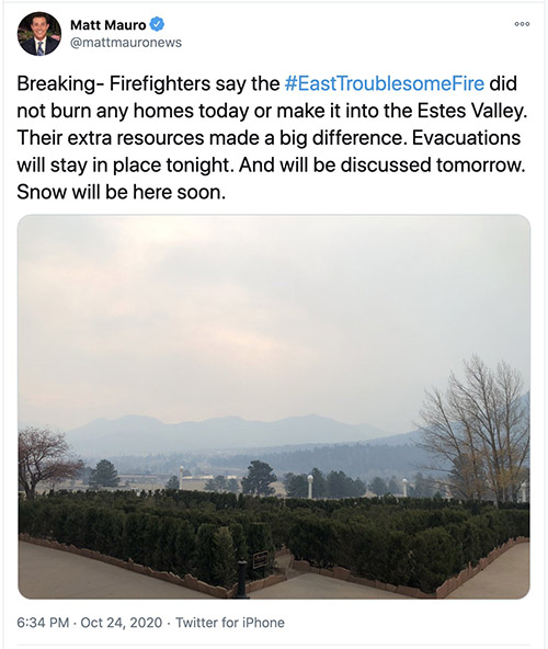
Mr. Mauro is an anchor and reporter at @KDVR, FOX31, and @channel2kwgn

Updated October 24, 2020   |   1:48 p.m. MDT

map East Troublesome Fire in Rocky Mountain National Park
Map of the Thompson Zone of the East Troublesome Fire in Rocky Mountain National Park. Colorado Multi-Mission Aircraft map at noon MDT Oct. 24, 2020. Estes Park is at upper-right..

Updated map of the East Troublesome Fire — noon October 24. At noon the fire was well into Moraine Park and was approaching Beaver Brook.


Updated October 24, 2020   |   12:12 p.m. MDT

map East Troublesome Fire in Rocky Mountain National Park
Map of the Thompson Zone of the East Troublesome Fire in Rocky Mountain National Park. Colorado Multi-Mission Aircraft map at about 10 a.m. MDT Oct. 24, 2020. Estes Park is at upper-right.

Colorado’s Multi-Mission aircraft mapped the portion of the East Troublesome Fire that is in Rocky Mountain National Park at 10 a.m. Saturday and determined that since Friday it had spread east about two miles. At that time it had almost reached Moraine Park Campground. The entire fire now covers about 191,000 acres.

A weather station near Estes Park has been recording strong winds since Friday night. The latest, at 11:24 a.m Saturday, was 14 mph with gusts to 37 mph, with 24 percent relative humidity and temperature of 54 degrees. This wind direction, if it continues, will push the fire toward Estes Park.

Additional evacuations have been ordered. https://nocoalert.org


October 24, 2020   |   9:13 a.m. MDT

East Troublesome Fire October 21, 2020
East Troublesome Fire October 21, 2020 as seen from Colorado’s Multi-Mission Aircraft.

An elderly couple who refused to evacuate were killed when their home near Grand Lake, Colorado burned in the East Troublesome Fire. Grand County Sheriff Brett Schroetlin read a statement from their family describing how officials and a family friend drove through roadblocks Wednesday to rescue the couple, but their offers to leave were refused.

Strong winds during the Red Flag Warning in effect Saturday could cause the 188,389-acre fire to spread farther to the east in the general direction of Estes Park.

(You can zoom in and move around on the map below. The red line is the perimeter at 12:40 a.m. MDT Oct. 24, 2020. The thin black line was the APPROXIMATE perimeter mapped through partial cloud cover at 8:30 p.m. MDT Oct. 22, 2020. The red shaded areas represent intense heat.)

In spite of the temperature dropping to 16 degrees near Estes Park Friday morning, overflights Friday night by a satellite and a fixed wing mapping aircraft detected intense heat in what began as a spot fire that jumped across the 10,000 to 12,000-foot elevation Continental Divide. As the East Troublesome Fire rapidly burned toward the Divide on Thursday, burning embers were carried up into the smoke column and transported more than a mile ahead, starting the spot fire on the northwest side of Mt. Wuh about 7 miles west of Estes Park.

Friday morning it was approximately 1,400 acres but was held in check during the day by very high humidity; as the weather changed it became active early Saturday morning. A satellite overflight at 3:42 a.m. showed that it had spread over a mile to the east and southeast beyond the perimeter mapped by a mapping aircraft at 12:40 a.m. A weather station near Estes Park recorded the humidity dropping into the 20s and the wind speeds increasing after 9 p.m. Friday. A gust of 46 mph occurred around 5 a.m.

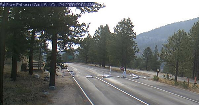
A web camera at Rocky Mountain National Park’s Fall River entrance had previously shown fence-like barriers blocking the road while the park is closed, but at 9:01 a.m. Saturday the barriers were laying flat on the road, possibly blown over.

Fall River Entrance Cam
Fall River Entrance Cam at Rocky Mountain National Park, at 9:06 a.m. October 24, 2020. NPS photo.

The forecast for Estes Park Saturday calls for the passage of a cold front bringing strong 22 mph winds out of the west gusting above 30 mph, with relative humidity in the low 20s. But beginning at sunset rain followed by snow is expected which will continue through Monday, possibly amounting to about 9 inches of snow.

To see all articles on Wildfire Today about the East Troublesome Fire, including the most recent, click here.

West of the Divide, in the Grand Lake and Granby areas, the forecast is similar — very strong west winds with rain and then snow Saturday evening.

Firefighters have made progress in the last two days on the west and south sides of the fire, putting in fireline and conducting burnouts in the Granby area, which could reduce the threat during the wind event Saturday. They have also been working on the southeast side near Grand Lake to tie in gaps in the firelines.

Incident Commander Noel Livingston said Saturday morning that the north side could be very active during the strong winds, but there is no threat to structures in that area.

The portion of the fire east of the Divide is designated as the Thompson Zone and is being managed by resources on the Cameron Peak Fire about 12 air miles to the northwest. A relief Incident Management Team has been ordered for that Zone, California IMT 4 led by Jay Kurth.