Lessons learned on Colorado’s Cameron Peak Fire where 76 people tested positive for COVID-19

Two fire personnel were hospitalized and 273 had to be quarantined while the fire was being suppressed

 Cameron Peak Fire COVID
Temperature check station for firefighters on the Cameron Peak Fire, InciWeb, posted Sept. 27, 2020.

The largest wildfire in the recorded history of Colorado, the Cameron Peak Fire, will be remembered for the 209,913 acres that burned, but also for how COVID-19 affected the personnel and the suppression of the fire.

A Facilitated Learning Analysis conducted by a team of seven people found that in the months after the fire started on August 13, 2020 west of Fort Collins, 76 workers at the fire tested positive for the virus and a total of 273 had to be quarantined at various times over the course of the fire. Two were hospitalized.

Cameron Peak Fire
Cameron Peak Fire smoke plume at Boyd Lake, InciWeb, Oct. 14, 2020.

The Analysis is lengthy, full of facts about how the outbreak affected the personnel and the management of the fire. The document has 250 Lessons Learned which are broken down into 14 types of resources (e.g. Finance Unit, Contractors) and 7 categories (e.g. COVID mitigations and testing/contact tracing).

It’s a lot to digest, but it’s best to start with the eight-minute video.

The report was written relatively early in the incident when only 21 had tested positive and 214 had been quarantined.

Of the two individuals that had to be hospitalized, one, called “Rico” in the report, was thought to be so close to death that tentative plans were being made about steps that would have to be taken after his demise, complicated by the fact that he was not a federal or state employee, but worked on an engine for an out of state contractor.

“Being a contract employee, could travel for his family be paid for? What about an Honor Guard or giving them a flag?” the report said. “There was confusion within the local unit, the fire management teams, and the RO about what could legally be done for different classifications of employees (federal, AD, contract, etc.) and this created a lot of tension. Everyone wanted to honor the intention set by the Chief to take care of people. However, the boundaries posed by the contract, policy, and federal purchasing law were limiting everyone to act on their desire to help.”

Rico was admitted to the hospital on August 24 and by the 31st was placed on a ventilator. The machine breathed for him while in a medically induced coma until he was weaned off on October 7. In December he was released to a rehab center.

Surprisingly, this wasn’t Rico’s first time dealing with COVID-19. According to the report he had been hospitalized back in the spring with complications from COVID-19.
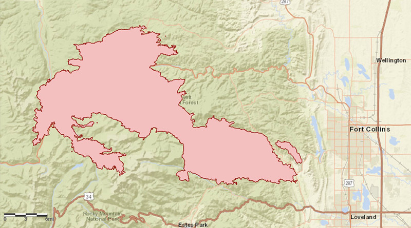
Map of Cameron Peak Fire
Map of Cameron Peak Fire, December 1, 2020. NIFC.

This was the first time in the United States that a person on a large wildfire had to be admitted to a hospital due to the pandemic. There were dozens of unanticipated issues that developed as 273 tested positive. It created issues that none of the personnel on the nine incident management teams that rotated through the incident had ever dealt with.

In reading the report and learning about one unique problem after another, it seemed like everything that could have gone wrong did go wrong in dealing with the multiple COVID-19 breakouts on the fire. The term that kept popping into my mind was, sh**show.

For example, a firefighter on an AD crew from another region who had COVID-19 symptoms was dropped off at the hospital for testing. Called “Brett” in the report, he tested positive, but was not admitted and was released at 5:30 a.m. There was no one keeping track of him, no liaison, and he waited outside the hospital for 14 hours until he was transported to a hotel for quarantine. He had nothing. All of his gear was at the fire. Obviously he needed a few necessities to exist on his own for what could be two weeks. Transporting Brett’s gear bag to the hotel proved to be challenging, since it was suspected of being compromised by the virus. The Incident Management Team WANTED to help, but they were hamstrung by policies that would not allow Forest Service funds to be used to buy this kid a change of underwear or shaving equipment.

Continue reading “Lessons learned on Colorado’s Cameron Peak Fire where 76 people tested positive for COVID-19”

Firefighter on Cameron Peak Fire developed COVID-19, spent 39 days on a ventilator

December 1, 2020   |    10:39 a.m. MDT

Jason Phillips
Jason Phillips. Credit: Jason Phillips

After Jason Phillips worked for three weeks fighting the Cameron Peak Fire in Colorado, he then spent more than five weeks on a ventilator. Mr. Phillips is a firefighter based in Washington state and works for a wildfire contractor, Choleta Fire Services.

On August 25 he came down with COVID-19 symptoms.

“By that afternoon, my life was turned upside down. I couldn’t breathe. I couldn’t keep [anything] down. My whole entire body was shaking so bad, I couldn’t hold a pencil to write my own name,” Mr. Phillips said.

According to 9News, he tested negative for COVID-19 at the Poudre Valley Hospital emergency room. He left, then came back later, tested positive and was put on a ventilator in the intensive care unit. Doctors said at the time he had a 50-50 chance of surviving.

After being released from the ICU he was sent to an acute care and rehab facility. He hopes to return home this week but is partially paralyzed from the waist down.

There are reports that during the course of the Cameron Peak Fire dozens of personnel were quarantined after possible exposure to COVID-19.

In early November a spokesperson for the U.S. Forest Service said 219 of their firefighters had tested positive for COVID-19 this year. CAL FIRE said at the time 141 of their employees had tested positive.

Since it started August 13, 2020 the Cameron Peak Fire, the largest in the recorded history of Colorado, has burned 208,913 acres, destroyed 444 structures, and has cost over $133 million to suppress. There are still 271 personnel assigned including 3 hand crews, 10 engines, and 1 helicopter.

Map of Cameron Peak Fire
Map of Cameron Peak Fire, December 1, 2020. NIFC.

Update at 4:10 p.m. MDT December 1, 2020. This article originally mentioned that Mr. Phillips was a U.S. Forest Service firefighter, based on reporting by 9News. Subsequently, we found that he was not a USFS employee and works for a contractor, Choleta, instead. 9News will be editing their article.

Cameron Peak Fire spreads south and east

The fire is west of Fort Collins, Colorado

Updated October 18, 2020   |   7:52 a.m. MDT

The map above shows the perimeter of the Cameron Peak Fire collected by a USFS fixed wing aircraft at 9:47 p.m. MDT Oct. 17, 2020. The red shaded areas represent intense heat. Processed by Wildfire Today. The preliminary mapped size was 203,251 acres, a number that may be fine-tuned later.


Updated October 17, 2020   |   12:50 p.m. MDT

We are trying something new on Wildfire Today — creating a Google Map containing the perimeter of the Cameron Peak Fire. One of the main differences from our usual maps is that you can zoom in to see more detail. But keep in mind the perimeter is the approximate location, and can rapidly change as the fire spreads. The data came, as usual, from an overnight USFS fixed wing mapping flight. Let us know your thoughts about this type of map.


Updated October 17, 2020   |   7:53 a.m. MDT

Cameron Peak Fire map
Map of the active part of the Cameron Peak Fire. The red line was the perimeter at 9:58 p.m. MDT October 15, 2020. The white line was the perimeter about 24 hours before.

Strong winds throughout Friday night pushed the Cameron Peak Fire to the south and east. After 7 p.m. sustained wind speeds at the Colorado State University Mountain Campus weather station were from the west-southwest at 23 to 39 mph gusting at 35 to 66 mph.

Extreme fire behavior and spotting a mile ahead has been reported by firefighters. Approximately 31,220 structures are threatened.

In light of the strong winds, the incident management team ordered an additional 200 structural fire engines with associated supervisory personnel.

Since the fire started August 13, four residences and 96 other structures have been destroyed.

A fixed wing aircraft mapping flight at 10:20 p.m. Friday showed the fire edge had spread about two miles to the south over the previous 24 hours. Satellite overflights around 3 a.m. showed significant additional heat to the south, but the sensors could have been detecting heat in the smoke column, rather than fire on the ground.

The weather forecast for the east side of the fire on Saturday predicts sustained 22 to 28 mph winds out of the west-northwest gusting at 37 to 46 mph. The high temperature should be 60 degrees with 28 percent relative humidity. The wind will decrease after sunset, slowing to 3 to 5 mph out of the south or southwest by 12 p.m.

The mapping flight at 10:20 p.m. Friday estimated the size of the Cameron Peak Fire at 187,537 acres, but that figure may be fine-tuned by the incident management team, especially if they include fire spread that occurred after the flight.

Cameron Peak Fire
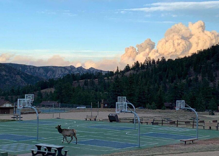
Cameron Peak Fire, as seen from the Estes Park YMCA October 16, 2020. InciWeb.

Updated October 16, 2020   |   9 p.m. MDT

Map Cameron Peak Fire Colorado
Map of the Cameron Peak Fire. The red line was the perimeter at 9:58 p.m. MDT October 15, 2020. The red dots represent heat detected by a satellite at 1:24 p.m. MDT October 16, 2020.

The Cameron Peak Fire west of Fort Collins, Colorado has been extremely active on Friday, forcing firefighters to withdraw for their own safety from Miller Creek, The Retreat, and Storm Mountain.

Additional mandatory evacuations were ordered for Highway 34 from the Dam Store to just west of Soul Shine Road. More voluntary evacuations are also in effect. Larimer Emergency Telephone Authority (LETA) has details about the evacuations. NOCOALERT has maps of the areas.

Friday evening the incident management team reported the fire had burned 173,536 acres.

Cameron Peak Fire Colorado smoke
Cameron Peak Fire, from the Estes Park Safeway 10-16-2020. InciWeb.

Since 1 a.m. on Friday the weather has been very favorable for rapid fire spread. Overnight a weather station at the Colorado State University Mountain Campus recorded 30 degrees, relative humidity in the mid-teens, and a 10 mph west wind gusting at 20 to 30 mph.

Conditions worsened after sunrise Friday with temperature in the 50s, humidity remaining in the mid-teens, and 10 to 30 mph southwest to west winds gusting at 22 to 48 mph. By 6 p.m. the wind had calmed a bit — 10 mph with gusts of 20 to 35 mph.

The weather forecast for the east side of the Cameron Peak Fire calls for very strong winds Friday night through 10 p.m. Saturday, 22 to 29 mph out of the west or northwest gusting at 29 to 46 mph. The high temperature will be in the low 60s Saturday and around 50 Sunday. The relative humidity will be around 30 percent Saturday and in the high 40s Sunday. These conditions could be favorable to additional spread of the fire to the east Friday night and Saturday.

Breezy conditions take over Sunday at noon through Tuesday with 8 to 10 mph winds out of the west gusting at 17 to 22 mph. The minimum humidity will be around 40 percent.

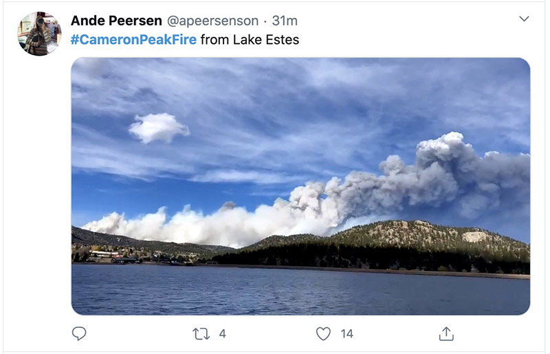
Cameron Peak Fire Colorado smoke
Cameron Peak Fire by @Apeersenson. Posted at 5:29 p.m. MDT 10-16-2020.
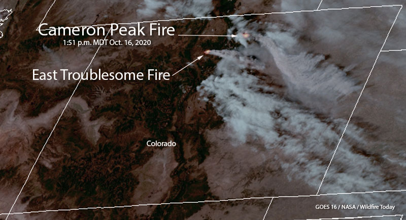
Cameron Peak Fire Colorado satellite photo
Cameron Peak Fire. Satellite photo at 1:51 p.m. MDT 10-16-2020.
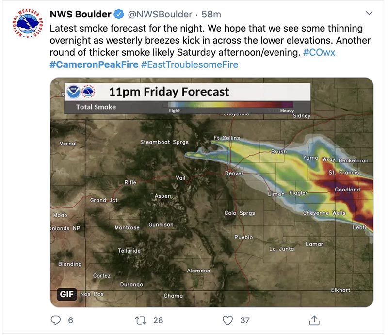
smoke forecast Cameron Peak Fire Colorado
Cameron Peak Fire smoke forecast for 11 p.m. Friday 10-16-2020.

Strong winds push Cameron Peak Fire east, prompting more evacuations

The 135,000-acre fire is west of Fort Collins, Colorado

Updated October 15, 2020   |   7:33 a.m. MDT

Map of the Cameron Peak Fire 3:06 a.m. MDT October 15, 2020
Map of the Cameron Peak Fire. The red line was the perimeter at 7:46 p.m. MDT October 13, 2020. The red dots represent heat detected by a satellite at 3:06 a.m. MDT October 15, 2020.

By mid-afternoon on Wednesday the very strong winds gusting to 50 mph that pushed the Cameron Peak Fire about 17 miles to the east toward Fort Collins slowed. A satellite showed very little spread east of Buckhorn Road which is about 6 miles west of Horsetooth Reservoir. Most of the additional acres Wednesday night were on the south side of the 17-mile run, northeast of Rocky Mountain National Park.

At 6:16 a.m. Thursday the Incident Management Team reported the fire had grown to 164,140 acres.

To see all articles on Wildfire Today about the Cameron Peak Fire including the most recent, click here.

Overnight a weather station at the CSU Mountain Campus recorded 5 mph winds out of the west gusting at 10 to 14 mph while the relative humidity remained low, in the low 20s, with a low temperature of 30 degrees.

A mapping flight scheduled for Wednesday night had to be cancelled due to clouds over the fire.

The weather forecast for Fort Collins calls for a shift in the wind, to come out of the east. This could reduce the smoke in the city and the threat to property between Buckhorn Road and Horsetooth Reservoir.


Updated October 14, 2020   |    10:36 p.m. MDT

Map Cameron Peak Fire, Oct. 14, 2020
Map of Cameron Peak Fire, afternoon of Oct. 14, 2020. Incident Management Team.

The Incident Management Team updated their map of the Cameron Peak Fire which was pushed by strong winds about 17 miles to the east Tuesday night and Wednesday. By mid-afternoon Wednesday it had reached Buckhorn Road about 6 miles west of Horsetooth Reservoir.

During the extreme growth of the fire structures burned, but until the intensity of the blaze decreases it could be days before the details will be available.

Now at 158,300 acres, it has become the largest fire in the recorded history of Colorado, surpassing the Pine Gulch Fire which blackened 139,007 acres north of Grand Junction a month ago.

The huge pyrocumulus cloud that formed over the fire was creating rain 100 miles downstream from the smoke plume at 9 p.m. MDT Wednesday.

Cameron Fire pyrocumulus radar


Updated: October 14, 2020   |    4:18 p.m. MDT

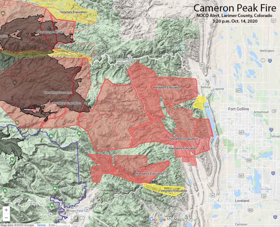
Map showing Cameron Peak evacuations 3:20 p.m. MDT, October 14, 2020
Map showing Cameron Peak evacuations at 3:20 p.m. MDT, October 14, 2020. Map by NOCO Alert, Larimer County.

The map above shows the mandatory evacuations have extended east to Horsetooth Reservoir.

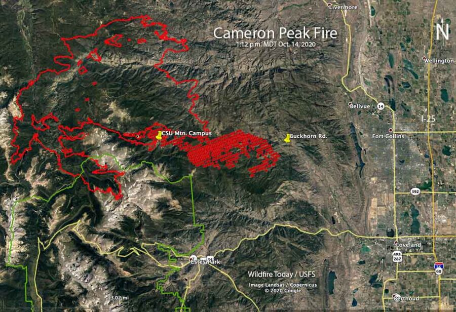
A satellite pass at 1:12 p.m. MDT Wednesday, below, shows the spread of the Cameron Peak Fire to the east. At that time is was 8 miles west of Horsetooth Reservoir.

Map of the Cameron Peak Fire
Map of the Cameron Peak Fire. The red line was the perimeter at 7:46 p.m. MDT October 13, 2020. The red dots represent heat detected by a satellite at 1:12 p.m. MDT October 14, 2020.

October 14, 2020   |    3:15 p.m. MDT

Cameron Peak Fire evacuations
Cameron Peak evacuations October 14, 2020. Map by NOCO Alert, Larimer County.

Very strong winds that began after sunset Tuesday caused the Cameron Peak Fire to become much more active. Mandatory and voluntary evacuations are in effect west of Fort Collins, Colorado (see the map above). This is a rapidly evolving situation.

To see all articles on Wildfire Today about the Cameron Peak Fire, including the most recent, click here.

Wednesday afternoon at about 2 p.m. the Larimer County Sheriff ordered the immediate mandatory evacuation of Redstone Canyon, advising, “Do not delay leaving to gather belongings or make efforts to protect your home or business. For updates, text the word LCEVAC to 888777 from your cell phone. We will communicate information to that key word as needed.”

The Larimer County webpage also has information about the Cameron Peak Fire. Evacuation information can be found at nocoalert.org.

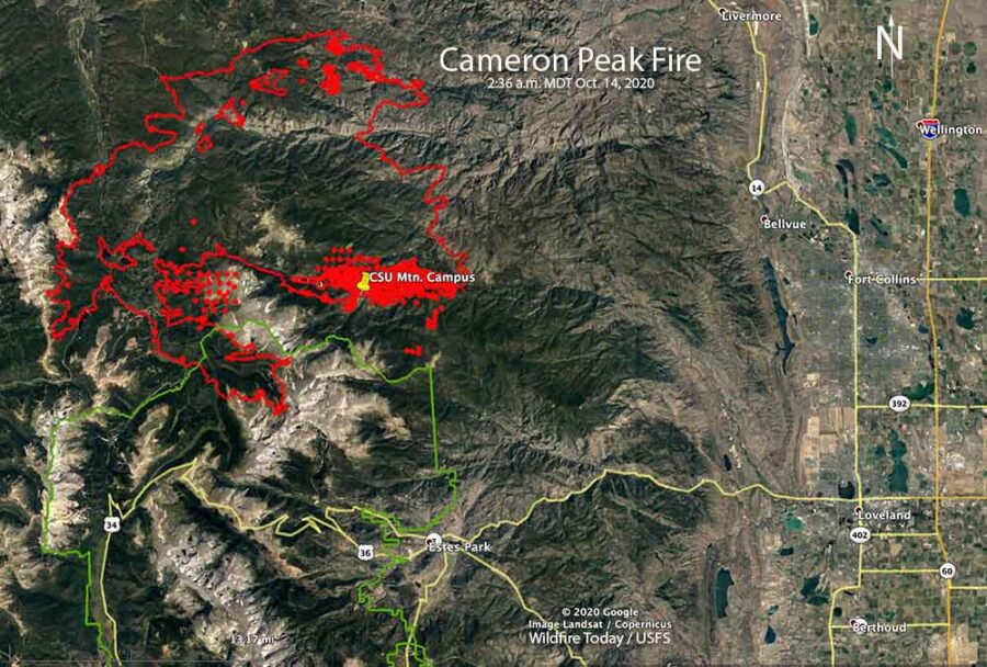
Cameron Peak Fire map
Map of the Cameron Peak Fire. The red line was the perimeter at 7:46 p.m. MDT October 13, 2020. The red dots and the solid red area represent heat detected by a satellite at 2:36 a.m. MDT October 14, 2020.

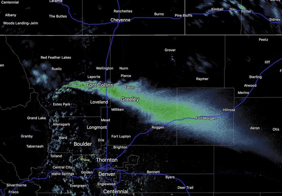
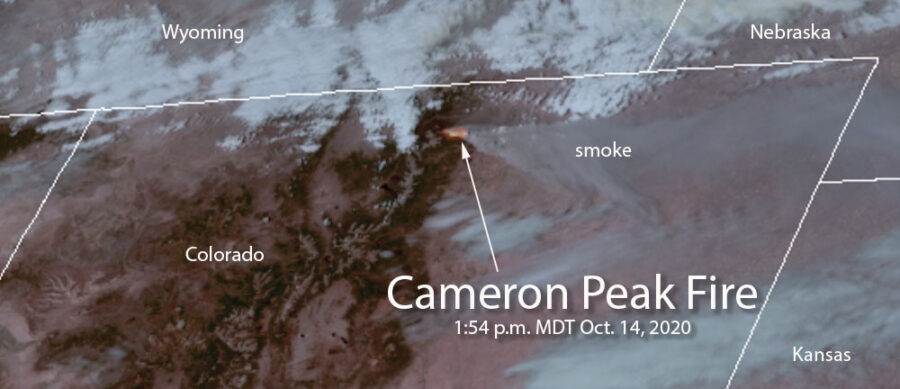
The Incident Management Team reported at 1 p.m. Wednesday that the fire was on top of Signal Mountain, and had spread approximately 10 miles east of the Colorado State University Mountain Campus (CSU). It was spreading to the east and east-southeast, in the general direction of Fort Collins. The smoke plume from the fire is massive and is being detected by radar and satellites.

Cameron Peak Fire radar smoke
Smoke from the Cameron Peak Fire shows up on radar at 1:55 p.m. MDT October 14, 2020.

Tuesday afternoon the weather station at the CSU Mountain Campus recorded 8 to 16 mph winds out of the west gusting at 20 to 38 mph. After sunset the speed increased throughout the night and into Wednesday afternoon blowing out of the west-southwest at 20 to 35 mph gusting at 33 to 50 mph, with a peak gust of 60 at 11:32 a.m. Wednesday. The relative humidity was in the low 20s all night and rose to the high 20s Wednesday afternoon with the temperature in the 30s.

Cameron Peak Fire satellite image
Satellite image showing heat and smoke from the Cameron Peak Fire at 1:54 p.m. MDT October 14, 2020.

Rain and snow slow Mullen and Cameron Peak Fires in Colorado and Wyoming

Very strong, dry winds, and sun are in the forecast

October 11, 2020   |   10:44 p.m. MDT

Big Laramie Volunteer Fire Department Station 4
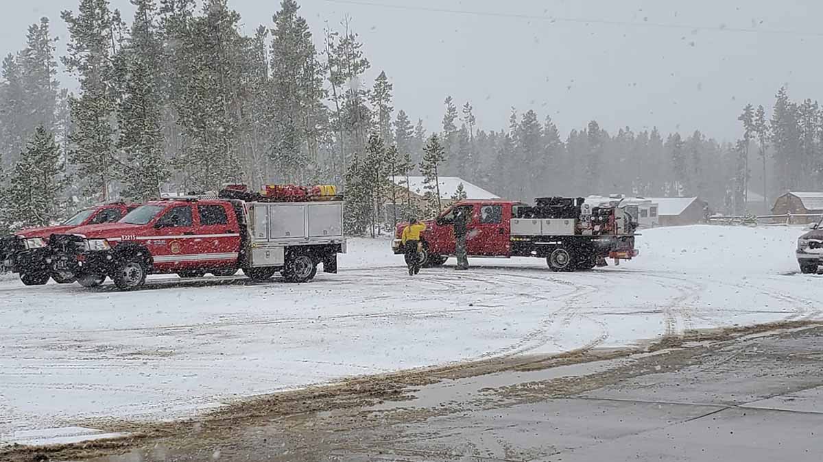
Photo by Big Laramie Volunteer Fire Department Station 4, in Wyoming near the Mullen Fire.

Rain and snow hit portions of three fires in north-central Colorado Sunday slowing the spread of the Cameron Peak, Middle Fork, and Mullen Fires.

The Mullen Fire which extends across the state line into Wyoming had received one-half to two inches of snow by mid-afternoon Sunday in the higher elevations. The fire has burned 175,535 acres in the two states.

To see all articles on Wildfire Today about the Cameron Peak Fire, including the most recent, click here.

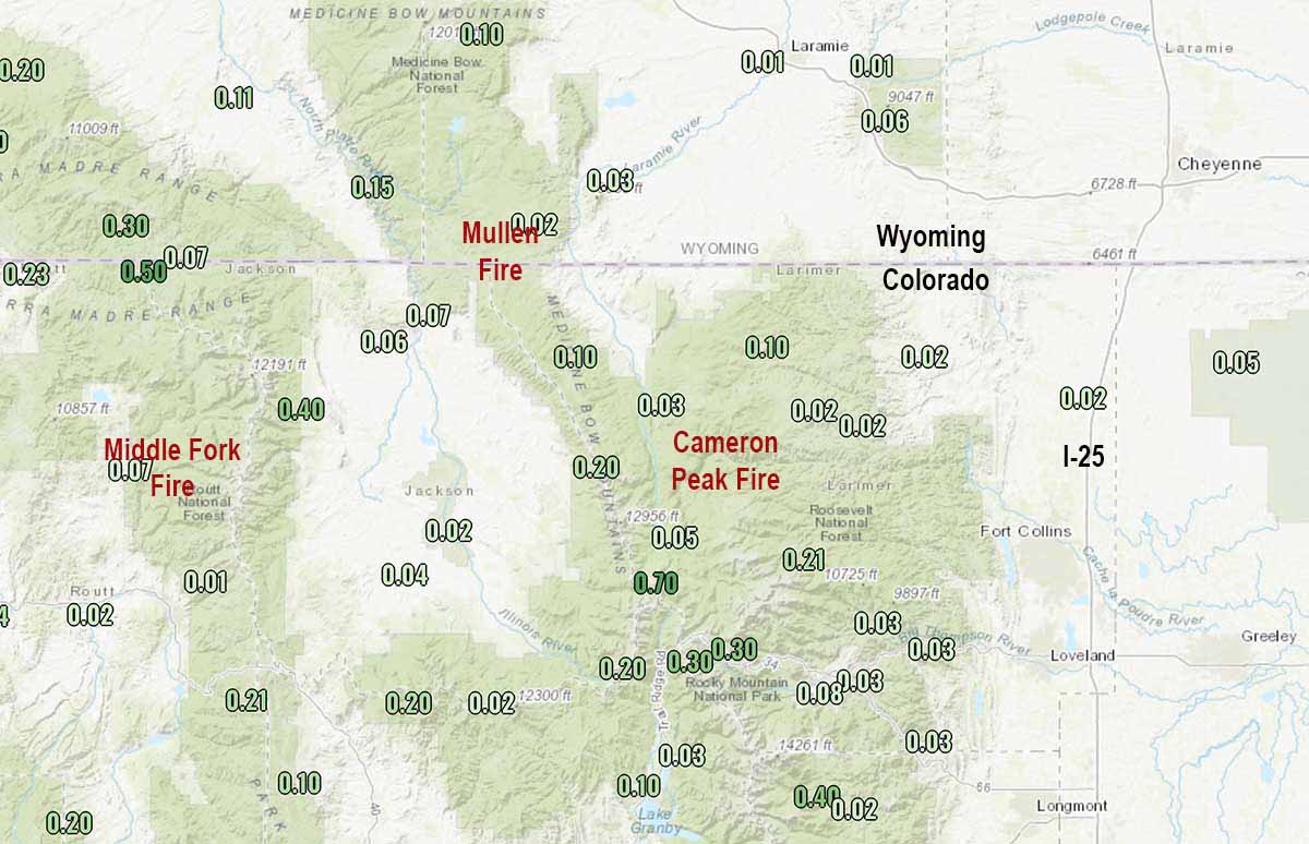
The 134,559-acre Cameron Peak Fire, which burned up to the Colorado State University Mountain Campus, received about one inch of snow in the higher elevations.

A weather station near the 17,832-acre Middle Fork Fire north of Steamboat Springs recorded 0.07″ of precipitation Sunday.

Precipitation October 9 through 11, 2020
Precipitation October 11, 2020 through 10 p.m. MDT.

Strong winds are in the forecast for the area through Wednesday. The temperature in the higher elevations of the Mullen Fire will reach about 20 degrees or lower Sunday night. The forecast for Cowdrey, Colorado near the Mullen Fire calls for mostly sunny skies Monday through Wednesday, high temperatures around 60, relative humidity of 20 percent, and afternoon winds gusting at 30 to 50 mph out of the west and southwest.

A small amount of rain or snow is unlikely to completely put out these fires which are mostly burning in timber. It will be interesting to see how much the fuels dry out in the next three days with very strong winds, sun, and low humidities.


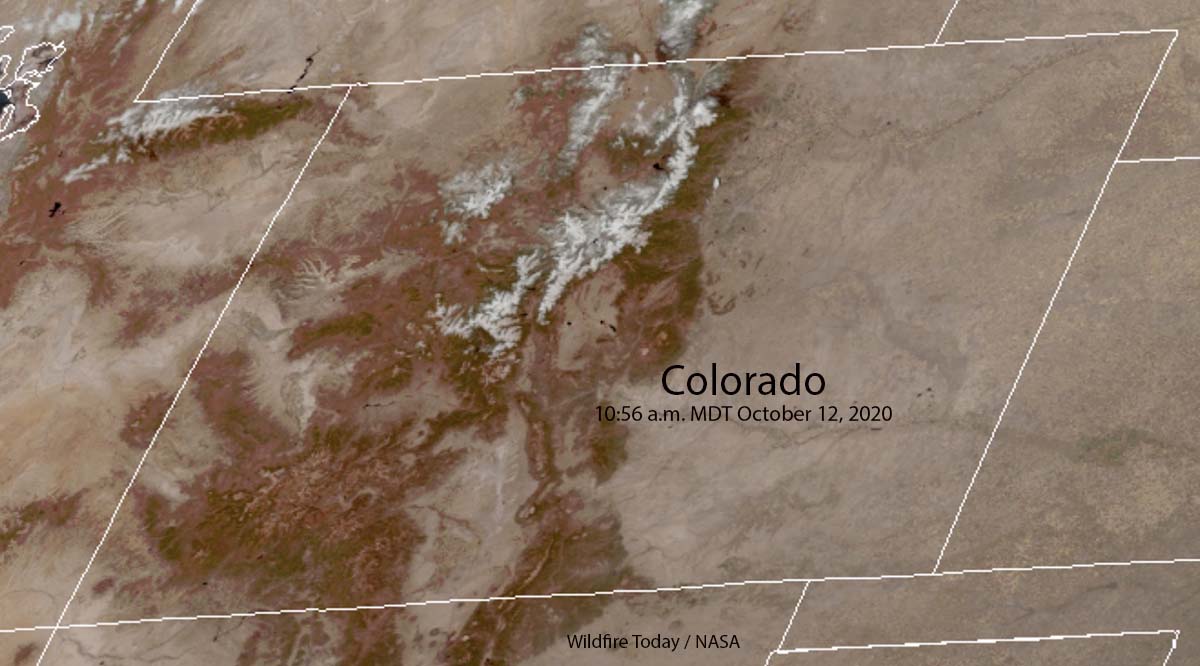
UPDATE at 12:10 p.m. MDT October 12, 2020. The satellite photo below shows snow in the mountains of north-central Colorado at 10:56 a.m. MDT October 12, 2020.

Colorado snow mountains fires
Satellite photo showing snow in the mountains of north-central Colorado at 10:56 a.m. MDT October 12, 2020.
Cameron Peak Fire snow
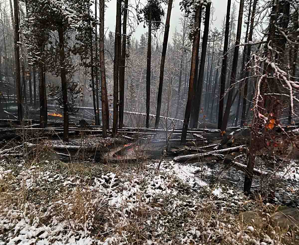
Cameron Peak Fire still burns with snow on the ground, October 11, 2020. Incident Management Team photo.
CSU campus status fire
President of Colorado State University

Cameron Peak Fire threatens Mountain Campus of Colorado St. Univ.

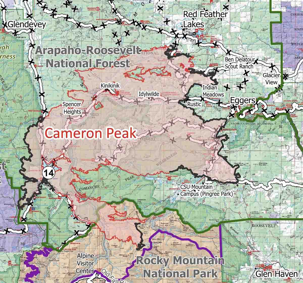
Map of the Cameron Peak Fire
Map of the Cameron Peak Fire Oct. 9, 2020. USFS map.

The 131,231-acre Cameron Peak Fire threatened to spread through the Mountain Campus of Colorado State University Friday afternoon. The fire is 20 air miles west of Fort Collins, CO.

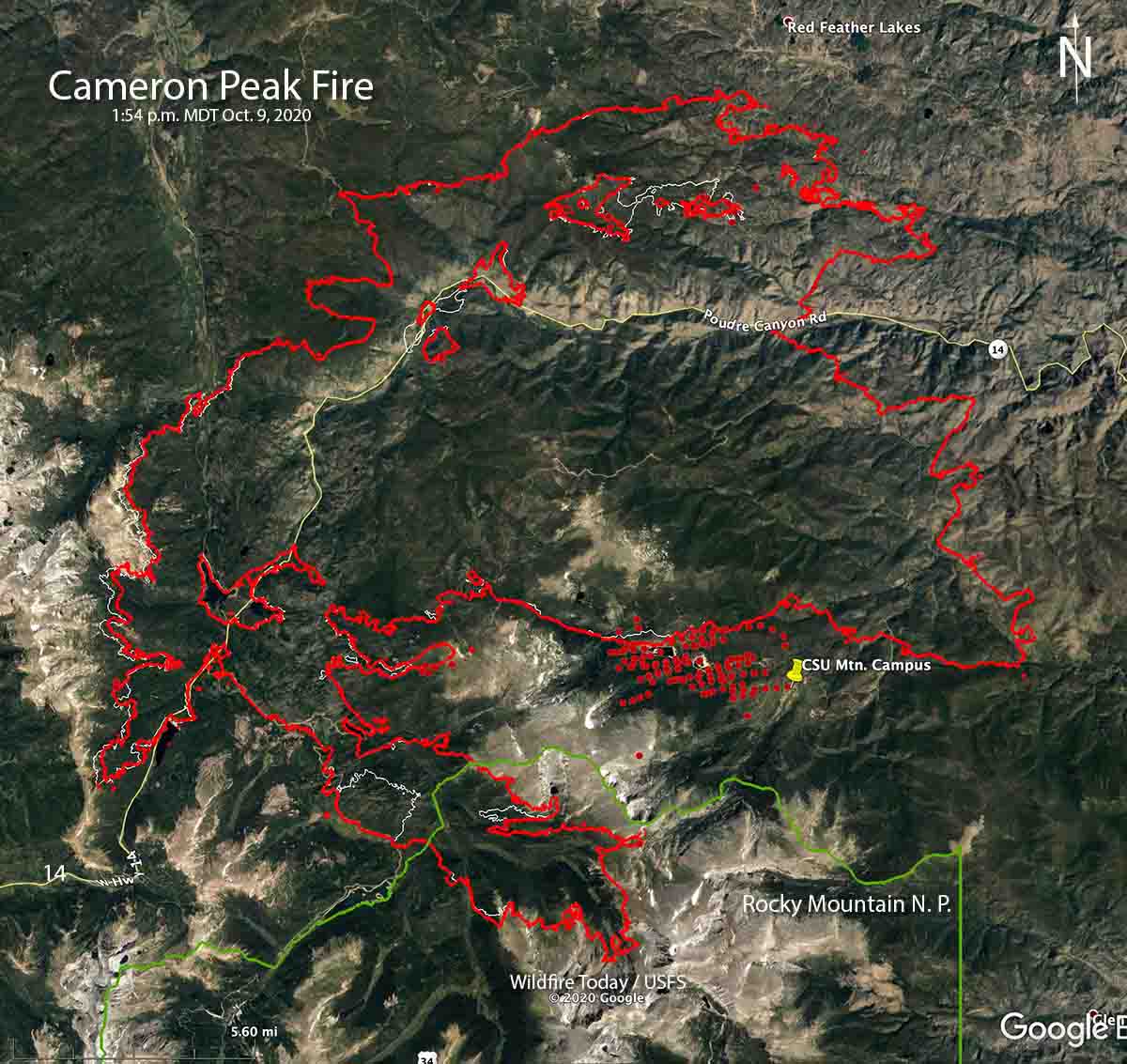
At 1:54 p.m MDT a satellite detected heat from the fire just west of the facilities. Wind out of the southwest at 9 to 12 mph with gusts to 24 were recorded at a weather station near the campus Friday afternoon. The breezy conditions with 15 percent relative humidity and low fuel moisture set up a situation that put the facilities at risk.

To see all articles on Wildfire Today about the Cameron Peak Fire, including the most recent, click here.

The area near the campus was the part of the fire showing the most heat during the satellite overflight.

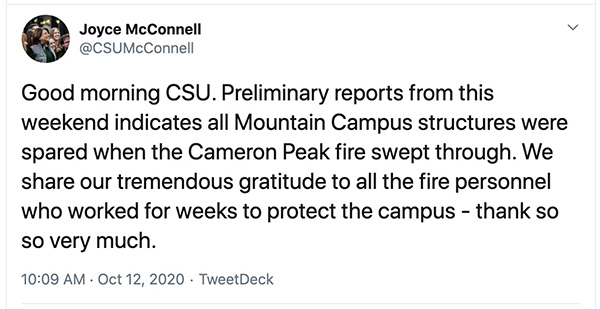
“I am deeply sorry to have to tell you all that according to our teams on the ground, the Cameron Peak Fire is expected to move through our Mountain Campus today,” said CSU President Joyce McConnell in a message on the University’s web site Friday October 9. “Fire activity picked up at 1:30 this morning and today is expected to be a very active fire day, with low humidity and extreme fire behavior. I can assure you that the Incident Command Center Crew has strong point protection in place at the campus, including hoses, portable water reservoirs, and sprinklers. The crews have been working on this plan for weeks; in the early stages of the fire they did mitigation around the campus that will be helpful as well. They have also focused on protecting other threatened structures in the area.”

Additional evacuations were ordered around the Cameron Peak Fire Friday.

Map of the Cameron Peak Fire
Map of the Cameron Peak Fire. The red dots represent heat detected by a satellite at 1:54 p.m MDT Oct. 9, 2020. The red line was the perimeter at 8:55 p.m. MDT October 8, 2020.
CSU Mountain Campus
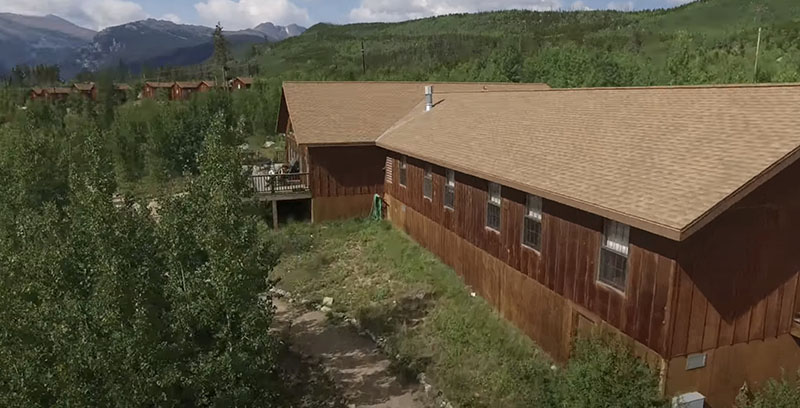
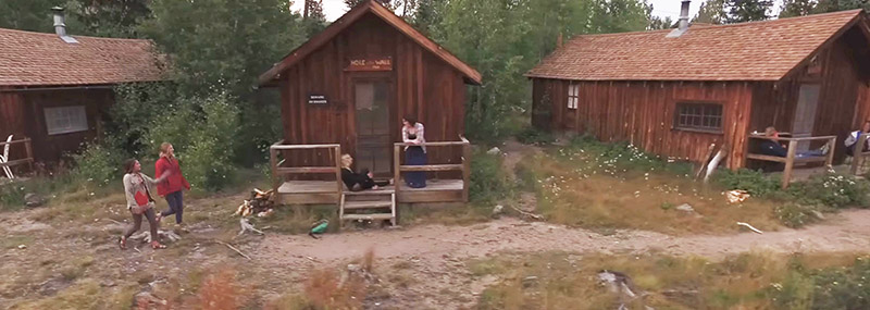
Structures at the Colorado State University Mountain Campus. Undated CSU file photo.
CSU Mountain Campus
Structures at the Colorado State University Mountain Campus. Undated CSU file photo.

Thanks and a tip of the hat go out to L M.