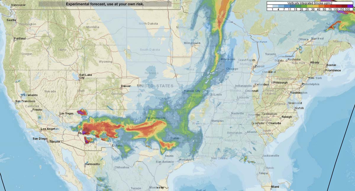
The forecast for the distribution of smoke from wildfires at 7 p.m. MDT Saturday looks rather bleak for areas of Arizona, New Mexico, Texas, and Oklahoma.
News and opinion about wildland fire
Forecast for the distribution of smoke from wildfires Saturday evening
Firefighters have been conducting back burns out ahead of the fire
(Originally published at 10:09 a.m. MDT June 20, 2020)

The Bighorn Fire north of Tucson, Arizona grew by 5,740 acres Friday to bring the total up to 42,798 acres.
Firefighters have been conducting back burns out ahead of the fire which they hope will serve as barriers to fire spread south of the community of Oracle along Old Mount Lemmon Highway near Peppersauce. They have also been constructing firelines on the west side of the Catalina Highway.
(To see all articles on Wildfire Today about the Bighorn Fire including the most recent, click here.)
For information about evacuations in Pima County contact visit pima.gov/bighorn. In Pinal County check the Sheriff’s Office Facebook page.
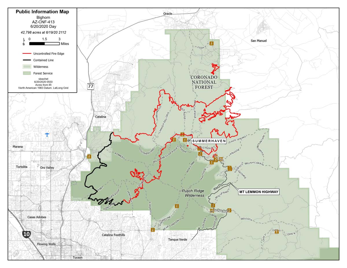
The map below shows the growth of the Bighorn Fire over a 24-hour period.
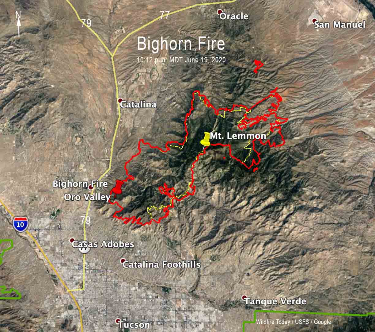
Firefighting resources assigned to the fire include 20 hand crews, 64 engines, 18 water tenders, 6 dozers, and 7 helicopters for a total of 894 personnel.

The fire has grown to 184,086 acres
(UPDATED at 4:50 p.m. MDT June 22, 2020)
Firefighters are starting to get a pretty good handle on the Bush Fire. The perimeter has not changed in a couple of days and any smoke seen is from previously unburned interior islands or firefighters cleaning up the edges by burnout out to remove fuel that is new the firelines. The latest mapping shows it has burned 184,086 acres.
The Central Fire north of Phoenix east of New River, Arizona spread to the east Sunday to the top of New River Mesa, growing to 4,517 acres according to a mapping flight at 12:08 a.m Monday. More information about that fire is on Wildfire Today.

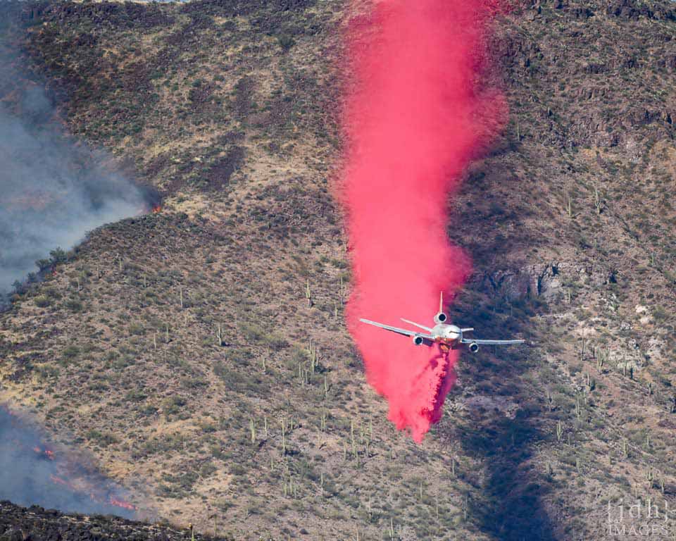
More photos of the DC-10 on the Central Fire.
(UPDATED at 11:13 a.m. MDT June 20, 2020)

Firefighters on Friday made more progress in tying in the east edge of the Bush Fire along Highway 188 north of Theodore Roosevelt Lake. On Saturday they will be burning along the SR 87 / Beeline Highway to create a buffer for fire backing downslope from the top of Mount Ord. Firefighters are using aerial ignition from helicopters to help slowly back the fire downslope to minimize post-fire impacts in the area.
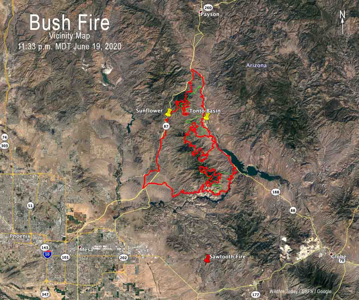
A fixed wing mapping flight Friday night at 11:33 MDT determined that the fire had burned 174,397 acres, a 24-hour increase of 23,397 acres.
For all articles on Wildfire Today about the Bush Fire northeast of Phoenix including the most recent, click here.
On the southeast side, smoke will also be visible as the fire continues to burn a large pocket of unburned vegetation within the fire’s interior.
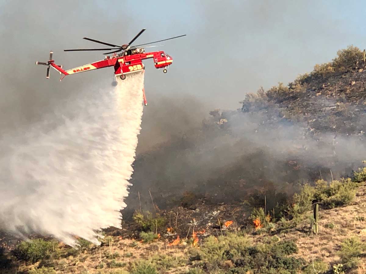
Dee Hines, an Information Officer for the Bush Fire, said firefighters are allowing the south edge of the fire north of Apache Lake and the Salt River to naturally back slowly down the hill. Mr. Hines described the terrain as steep, rough, and rocky and the fire behavior as “creeping”.
The wind has moderated over the last couple of days, allowing firefighters to make significant progress on the huge fire. That trend is expected to continue through Tuesday with daytime breezes out of the southwest or west at 5 to 10 mph. But it being the desert, temperatures will be over 100 degrees in the lower elevations with relative humidity in the single digits. And there’s no chance of rain.
Areas that remain under “Go” evacuation notices include Brownsville, Jake’s Corner, Slate Creek, Pioneer Pass, Tonto Basin, Punkin Center, Sunflower, and residents and visitors to Apache Lake.
Firefighting resources assigned to the fire include 19 hand crews, 41 engines, 5 bulldozers, 19 water tenders, and 7 helicopters for a total of 759 personnel.
(Originally published at 8:58 a.m. MDT June 19, 2020)
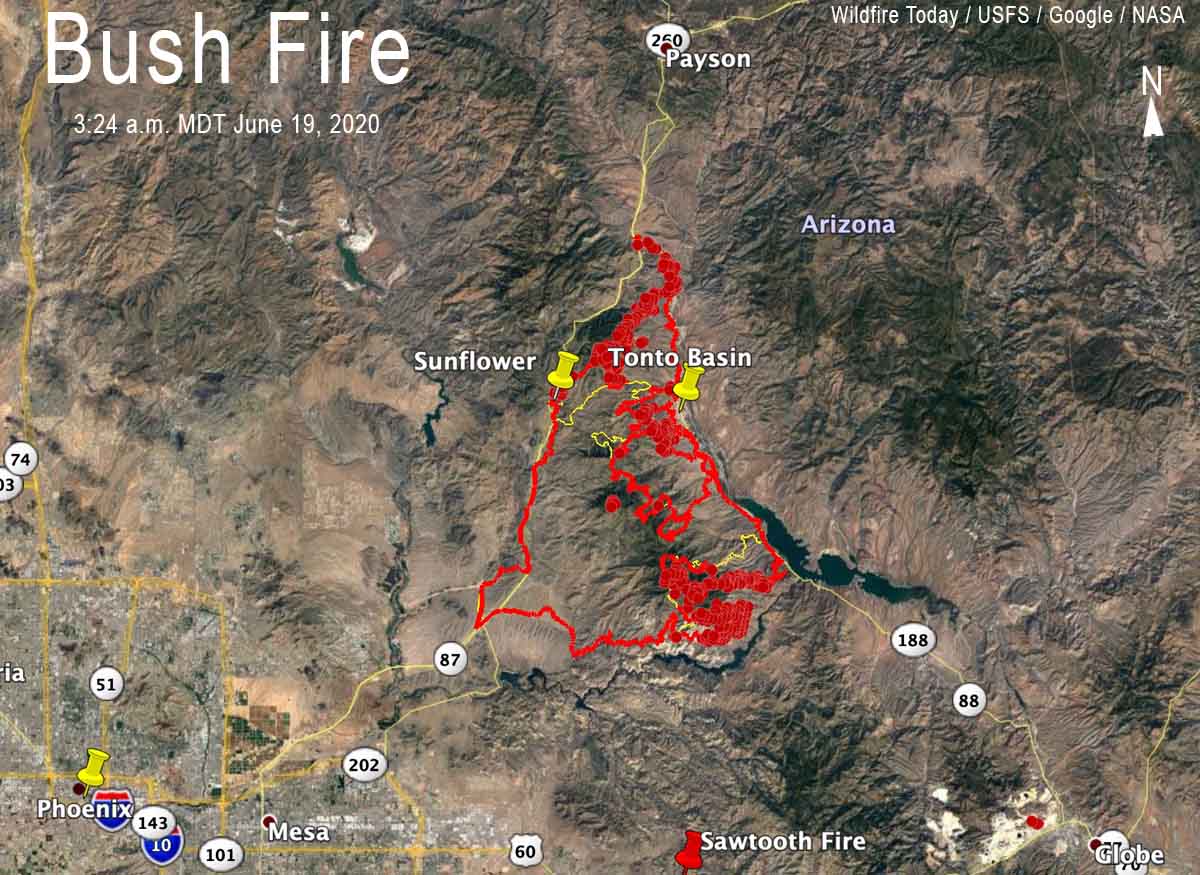
Over the last few days firefighters on the Bush Fire have dropped back to Highway 188 and initiated backfire and burnout tactics. After the fire made a run several days ago spreading rapidly downhill almost reaching the highway, they began using fire to remove the fuel near the highway allowing the flames to move up and merge with the main fire.
Judging from imagery collected by a fixed wing mapping aircraft and later a satellite at 3:24 a.m. Friday, it appears that they are close to completing that mission, a limited mission, of stopping the portion of the fire along Highway 188 on the east side of the fire. After they get it completely fired out along the highway, then they will need to hold those 28 miles of fireline between Jakes Corner (at the intersection of Highway 188 and 87) and the Lake Theodore Roosevelt dam.
Firefighters will still have two other large sections of the fire to secure: the 15 miles of Highway 87 south of Jakes Corner to Sunflower, and approximately 20 miles along the Salt River and Apache Lake on the south side. If the weather cooperates the piece north of Sunflower should not be very difficult to fire out after the east side is taken care of. The area along the river is very rugged and difficult to access, and there is a chance the fire could ignite spot fires across the river, which would be a whole new ball game in difficult country. The fire has been very active five miles west of Roosevelt near the river.
The fire is 12 miles south of Payson, 17 miles northeast of Mesa, and 28 miles northwest of Globe.
Thursday the fire grew by another 36,134 acres to bring the total up to 151,075 acres according to data collected on the 11:18 p.m. MDT June 18 mapping flight. The firing operations on the north side will add thousands more.
The fire grew to over 31,000 acres Wednesday
(UPDATED at 12:10 p.m. MDT June 19, 2020)
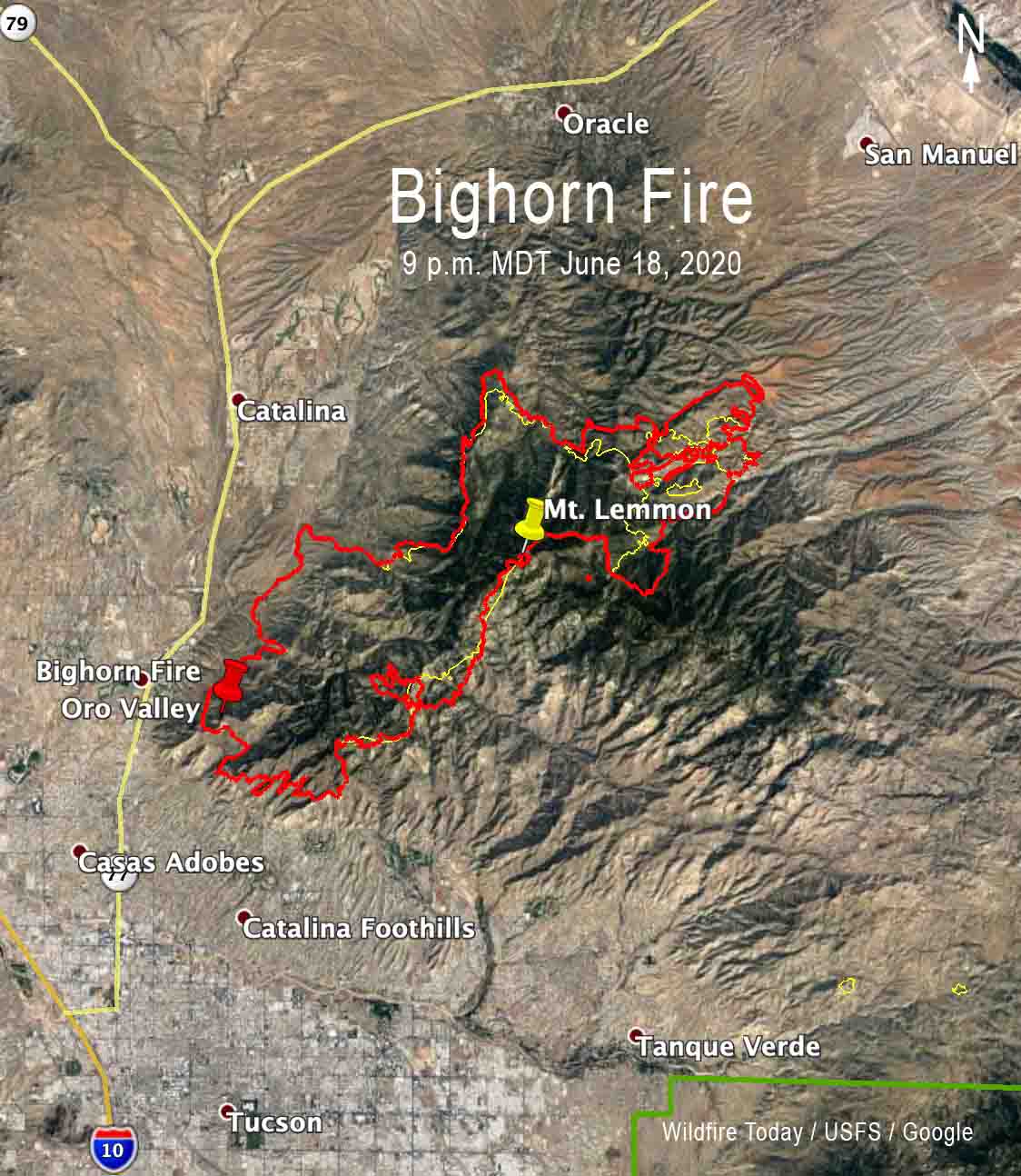
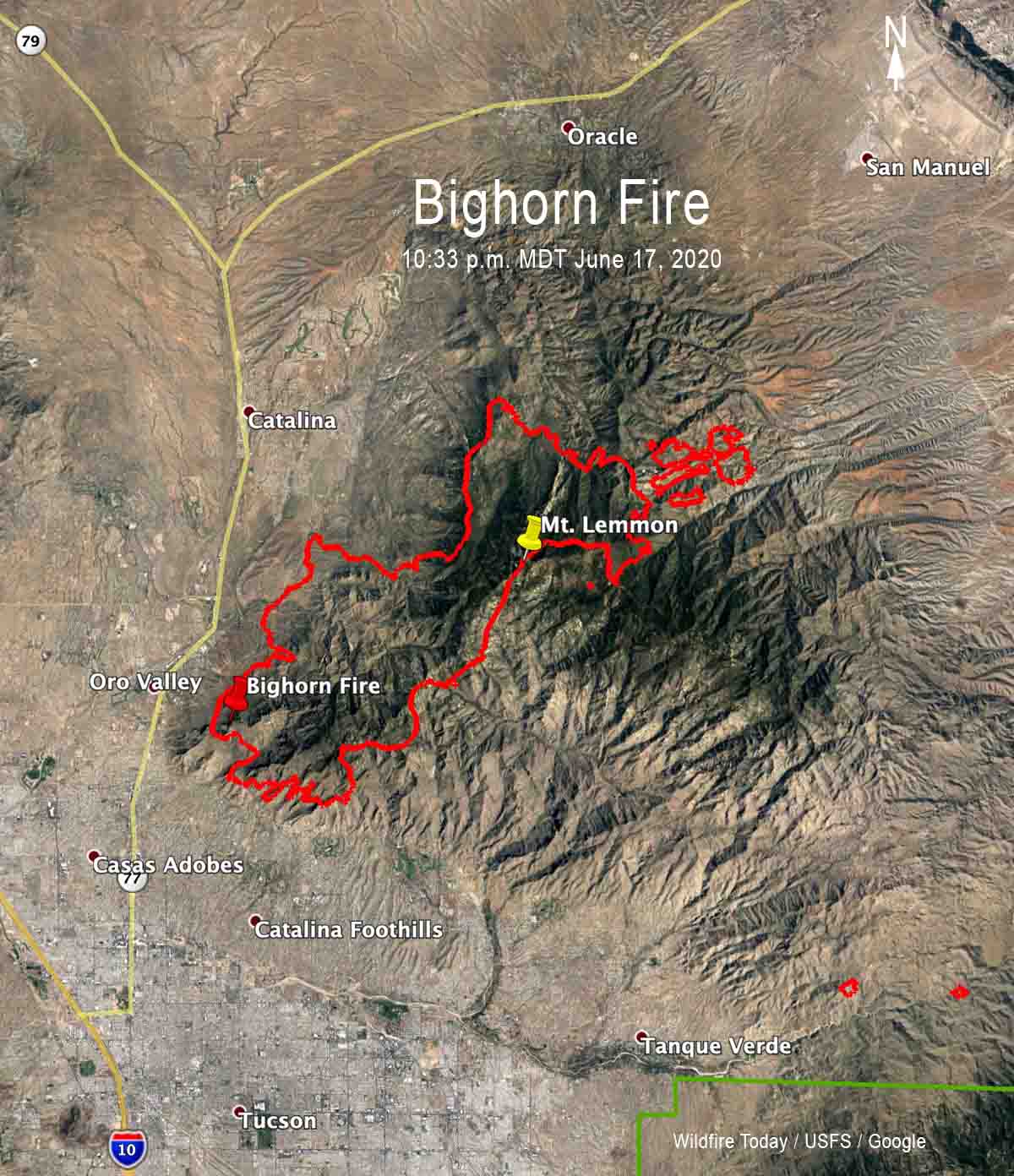
Thursday’s decreasing winds gave firefighters on the Bighorn Fire somewhat of a break, at least when compared with the difficult conditions on Wednesday that pushed the blaze northeast over Mt. Lemmon. Hand crews and personnel on fire engines were able to make progress, said Operations Section Chief Travis Mayberry.
(To see all articles on Wildfire Today about the Bighorn Fire including the most recent, click here.)
The lower wind speeds Friday could result in smoke being more visible in the communities near the fire. Weather forecasters expect temperatures of around 100 degrees with very low relative humidity.
Thursday night the fire was mapped at 37,058 acres, an increase of 5,850 acres in 24 hours.

Fire managers expect growth to the northeast in Cañada del Oro and Alder Canyons on Friday. Crews working south of Oracle and San Manuel will tie in containment lines today, in preparation for additional firing operations Friday evening. Firefighters on Mt. Lemmon are using an assortment of tools, including controlled burning, to protect the communities along the Catalina Highway.
As the high winds that had been keeping the fire burning on Samaniego Ridge and the top of Ventana Canyon subside, the fire may move downslope at a moderate pace. Firefighters will have to wait to engage some sections of the fire until after it transitions onto less steep terrain.
(Originally published at 1:35 p.m. MDT June 18, 2020)
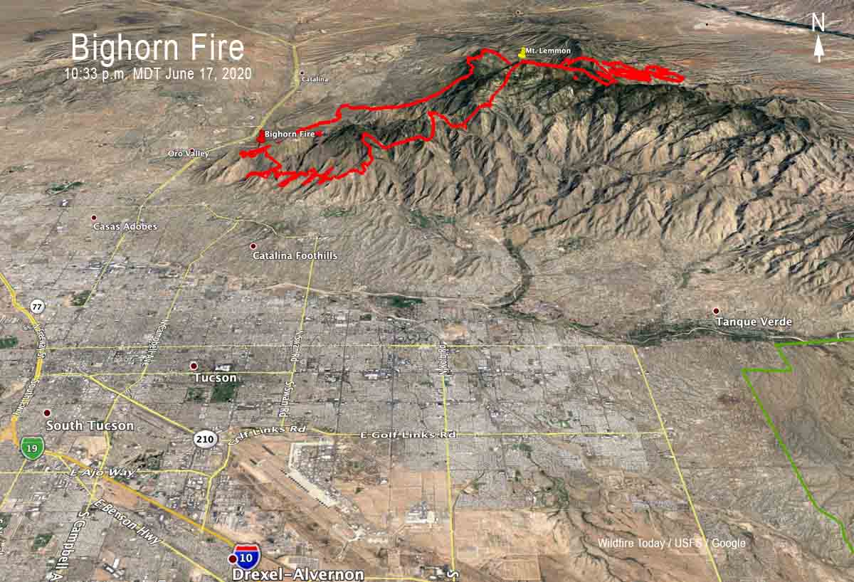
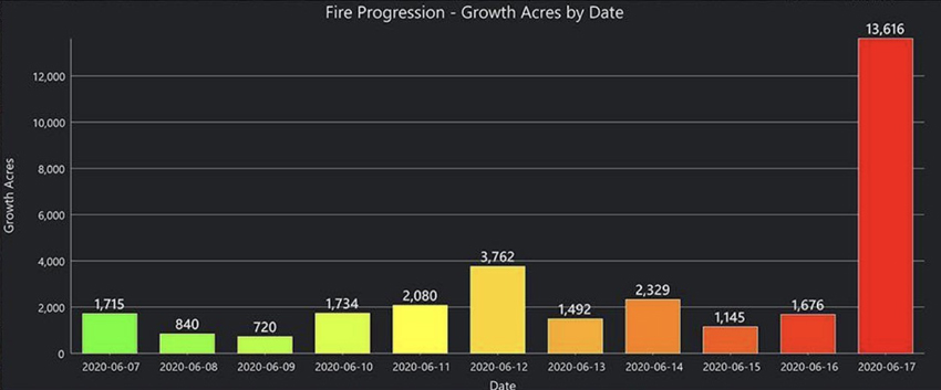
Since it started June 5 from a lightning strike the Bighorn Fire five miles north of Tucson has been adding less than 4,000 acres every day, until Wednesday when strong winds pushed it past Mt. Lemmon, growing by about 13,000 acres to bring the total up to 31,208 acres.
Firefighting resources assigned to the fire include 15 hand crews, 60 engines, 8 helicopters, 12 water tenders, and 6 dozers.
From the Incident Management Team Thursday morning:
“Today, fire managers anticipate the fire will move towards Charouleau Gap, depending on wind direction and temperatures. Fire crews and air support are in place preparing and widening fire lines for this expected spread of the fire. On Mt. Lemmon, the fire moved through Oracle Ridge and generated spot fires in Stratton Canyon. Expect highly visible smoke as those areas burn together today. Crews working overnight implemented controlled burns along the Catalina Highway corridor. Firing operations will continue today, if necessary, to protect values at risk.
“Air operations including fixed-wing airtankers were up early this morning, dropping water and fire retardant to slow the fire’s spread. Winds will continue to be a factor today, but less so than yesterday. The fire burning in the Ventana Canyon area and along Samaniego Ridge will be monitored by air support today. Minimal downslope backing of the fire is anticipated in that area. Crews will tie together the two containment lines north of the fire perimeter to protect the communities of Oracle and San Manuel.”

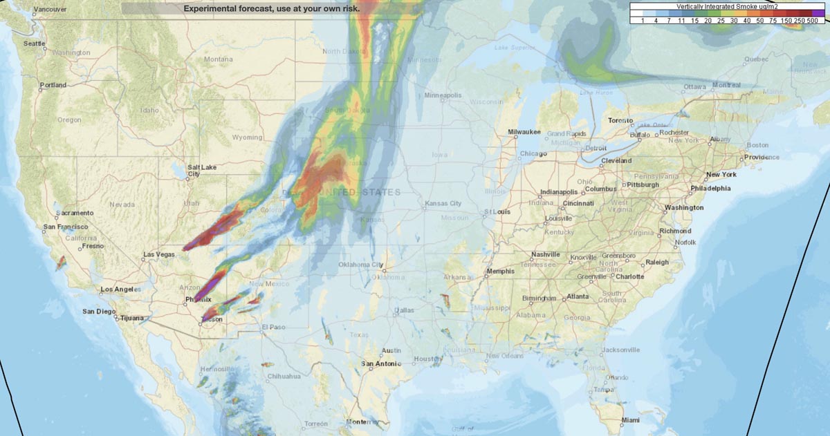
This is the forecast for the distribution of vertically integrated and near surface smoke at 7 p.m. MDT June 17, 2020. By NOAA.
The locations especially hard hit are areas in Arizona, Utah, Colorado, New Mexico, Kansas, and Nebraska.
Nine firefighters and pilots were killed when the Sikorsky S-61N crashed in 2008
(This article first appeared on Fire Aviation)
A judge has refused to reduce the sentence for Steven Metheny, 50, the former Vice President of Carson Helicopters whose falsification of records for a Sikorsky S-61N helicopter under contract to the U.S. Forest Service led to the deaths of nine firefighters and crew members.
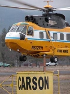
Metheny was accused of falsifying performance charts and the weights of helicopters his company had under contract to the U.S. Forest Service for supporting wildland fire operations. As of a result of his fraud, a Carson helicopter crashed while trying to lift off with too much weight from a remote helispot on the Iron 44 Fire on the Shasta-Trinity National Forest near Weaverville, California in 2008. He was sentenced to 12 years and 7 months in prison in 2015 for attempting to defraud the government out of more than $32 million and has been serving time in Lompoc, California.
Nine people were killed, including the pilot-in-command, a U.S. Forest Service check pilot, and seven firefighters. The copilot and three firefighters were seriously injured.
Below is an excerpt from a June 16, 2020 article in the Mail Tribune:
…[Metheny] argued last year that he wouldn’t have pleaded guilty in November 2014 to a count of conspiracy to commit mail fraud and wire fraud in U.S. District Court in Medford for lying about helicopter weight limits — which caused the Aug. 5, 2008, Iron 44 crash near Weaverville, California — had he known crash victims were going to be allowed to testify at his sentencing, or that he’d be ordered to repay tens of millions of dollars in restitution upon release from prison.
In a 13-page court order filed May 27, U.S. District Court Judge Ann Aiken denied Metheny’s motion to vacate or correct his June 2015 sentence, saying it doesn’t match Metheny’s allegations of ineffective counsel by his defense lawyer, Steven Meyers, nor does it match the court record.
Judge Aiken also presided over Metheny’s trial.
Metheny went to great lengths after the crash to attempt to conceal the fraud. When he knew that investigators would be examining the company’s operations, he directed other employees to remove weight from other similar helicopters, including taking off a fuel cell and replacing a very heavy battery with an empty shell of a battery. Some of the employees refused to participate in that deception, with one explaining that he was done lying about the helicopter’s weight.
During the trial defense lawyer Steven Myers argued that the helicopter pilot could have avoided the crash by doing a standard maneuver on takeoff, where the pilot hovers and checks his gauges.
Judge Aiken dismissed that argument, noting her father had flown helicopters in the Korean War, crashing 13 times. “Whether the gauges were right or not, the pilot didn’t have the right information,” Aiken told Metheny.
The Forest Service awarded contracts to Carson, including option years, amounting to over $51,000,000. Carson received $18,831,891.12 prior to the FS canceling the contracts.
Levi Phillips, 45, the former maintenance chief of Carson Helicopters, agreed to cooperate with authorities in the case against Mr. Metheny and pleaded guilty to a single charge of fraud. He was sentenced to 25 months in prison to be followed by 3 years of supervised probation.
According to the National Transportation Safety Board, there was “intentional wrong-doing” by Carson Helicopters that under-stated the weight of the helicopter and over-stated its performance in the documents they provided to the U.S. Forest Service when bidding on their firefighting contract. The NTSB estimated that the actual empty weight of the helicopter was 13,845 pounds, while Carson Helicopters stated in their contract proposal that the weight was 12,013 pounds. For the purpose of load calculations on the day of the crash, the pilot assumed the weight to be 12,408 pounds, which was 1,437 pounds less than the actual weight estimated by the NTSB. According to the NTSB, for the mission of flying the firefighters off the helispot that day, the helicopter was already over the allowable weight even without the firefighters on board.
In Mr. Metheny’s plea agreement there was an admission that the helicopters had not actually been weighed.
Killed in the crash were pilot Roark Schwanenberg, 54; USFS check pilot Jim Ramage, 63; and firefighters Shawn Blazer, 30; Scott Charlson, 25; Matthew Hammer, 23; Edrik Gomez, 19; Bryan Rich, 29; David Steele, 19; and Steven “Caleb” Renno, 21. The copilot and three other firefighters were seriously injured.
Thanks and a tip of the hat go out to Kelly. Typos or errors, report them HERE.