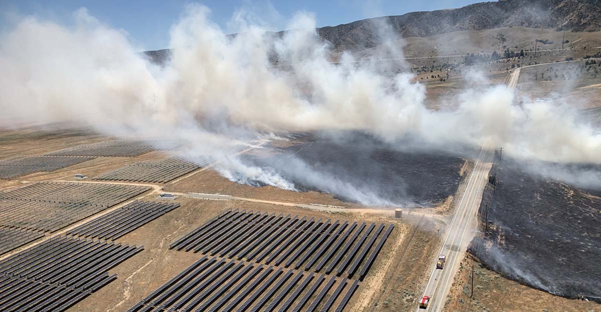
A vegetation fire near Lancaster, California burned very close to a solar generating facility at 110th Street West and West Avenue K on Sunday.
The Kilo Fire went to two alarms but the spread was stopped at 65 acres.
News and opinion about wildland fire
Near Lancaster

A vegetation fire near Lancaster, California burned very close to a solar generating facility at 110th Street West and West Avenue K on Sunday.
The Kilo Fire went to two alarms but the spread was stopped at 65 acres.

Smoke spreads toward Sacramento
(UPDATED at 5:58 p.m. PDT June 7, 2020)
The Quail Fire southwest of Winters, California has been mapped at 1,837 acres. CAL FIRE reports that mandatory residential evacuations have been lifted.
The number of structures destroyed remains at three.
(UPDATED at 9:25 a.m. PDT June 7, 2020)
CAL FIRE reported at 8 a.m. Sunday that the Quail Fire southwest of Winters, California has burned 1,400 acres with three structures destroyed and 100 structures still threatened. They also report that it is 10 percent contained, however for many agencies containment numbers are extremely subjective and may or may not accurately reflect the percent of the fire perimeter that is contained.
Evacuations are still in effect.
Resources assigned include 30 engines, 7 hand crews, and 9 dozers for a total of 600 personnel.
(UPDATED at 6:21 a.m. PDT June 7, 2020)
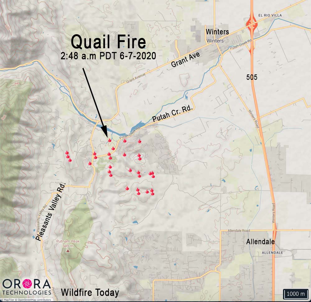
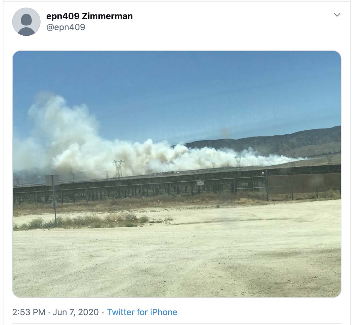
The spread of the fire slowed considerably overnight.
At 6:50 a.m. Sunday at a weather station south of the fire it was 53 degrees, 56 percent relative humidity, and the wind was out of the west-northwest at 7 mph gusting to 16.
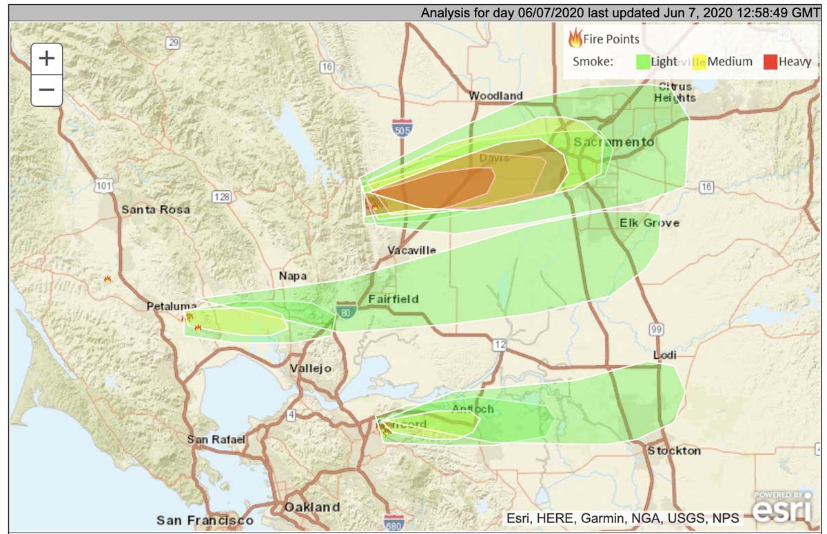
NOAA predicts the smoke will continue to spread to the east toward Sacramento.
(12:22 a.m. PDT June 7, 2020)
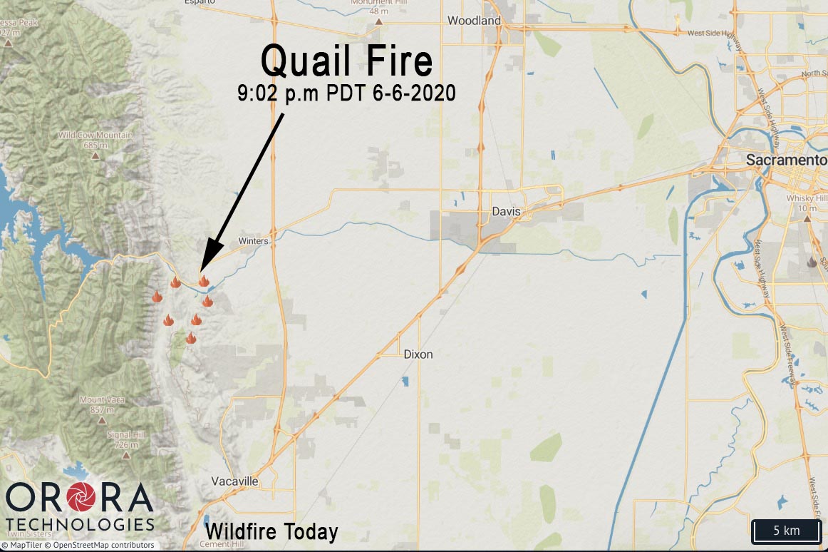
The Quail Fire that started Saturday afternoon southwest of Winters, California has burned about 1,200 acres west of Davis according to a 9 p.m. PDT update from CAL FIRE. Evacuations are in progress.
It was initially reported near the intersection of Quail Canyon Road and Pleasants Valley Road south of Highway 128 approximately 9 miles north of Vacaville and 13 miles west of Davis.
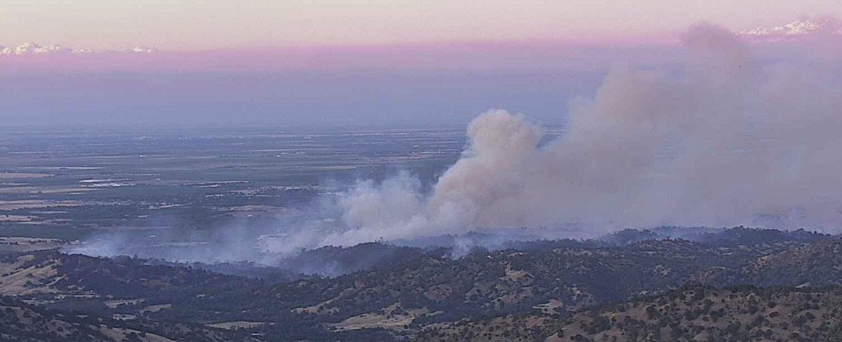
An evacuation Center is located at 3 Oaks Community Center, 1100 Alamo Dr., Vacaville, CA 95687.
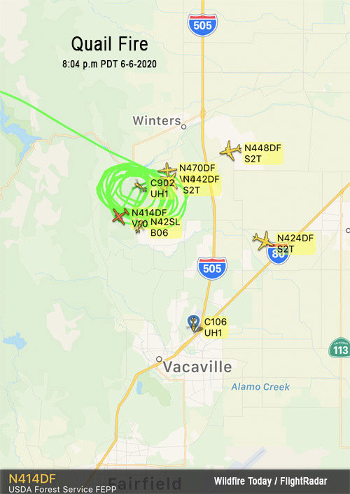
At 9:45 p.m. MDT the Incident Commander requested an additional four strike teams (5 engines each) of any type of engines, immediate need. Approximately 100 structures were threatened, according to CAL FIRE.
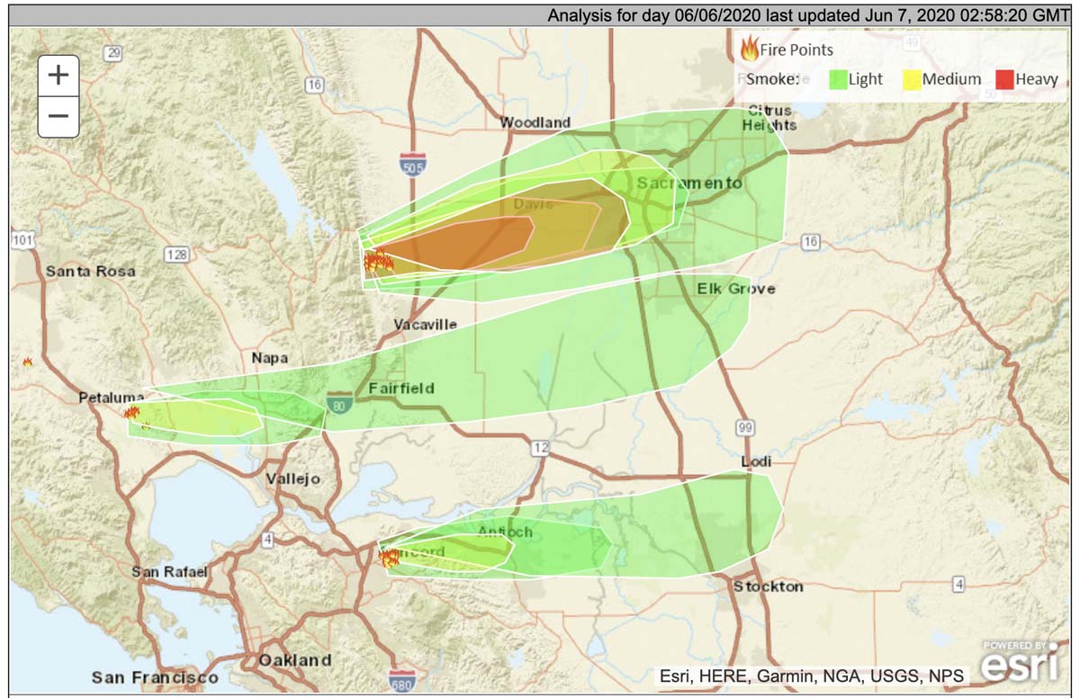
Smoke from the Quail and other fires in the North Bay area is predicted to spread to the east affecting residents in Davis, Sacramento, Fairfield, Elk Grove, and Concord.
The wind in the fire area is predicted to be out of the west-northwest Saturday night at 16 gusting to 23 mph at 10 p.m., decreasing to 9 mph by sunrise. The maximum relative humidity overnight will be 65 percent, then will drop into the low 20s by Sunday afternoon, with an air temperature of 75 degrees.
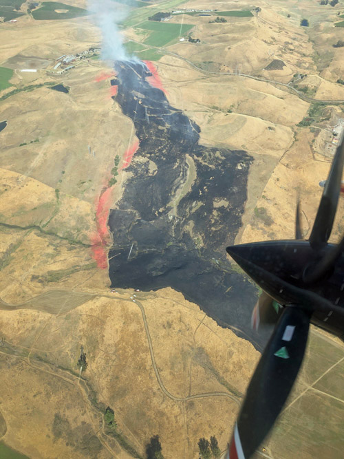
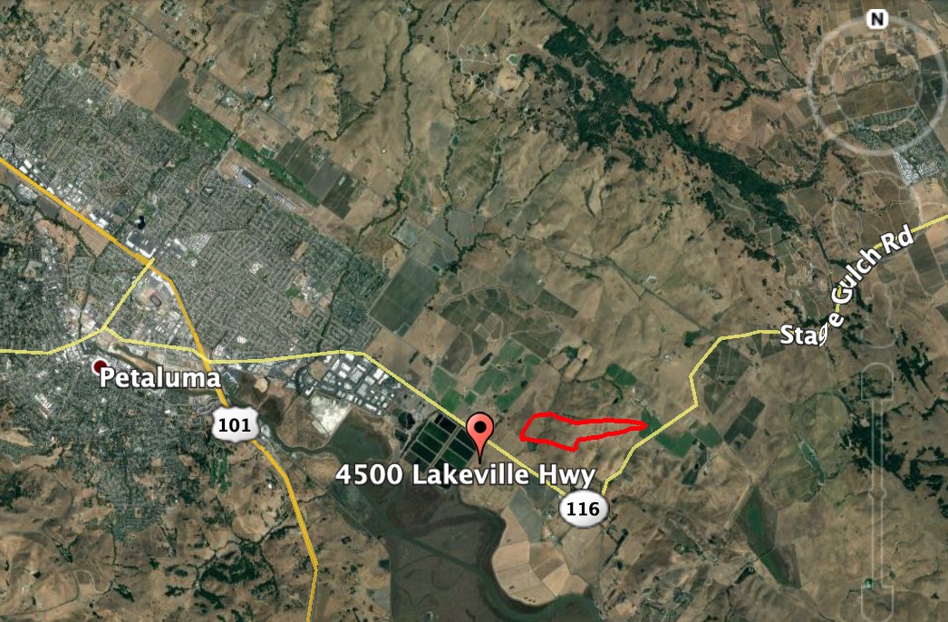
Yesterday the Lakeville Fire southeast of Petaluma, California burned about 141 acres before being suppressed by firefighters assisted by air tankers. The origin of the fire was near the 4500 block of Lakeville Highway.
If the firefighters in the photo below (at top/right) are carrying drip torches as it appears, they may be burning out from a retardant line to consume the fuel between the retardant and an already burned area.
#LakevilleFire from Stage Gulch Rd. Petaluma / Sonoma around 5PM pic.twitter.com/xYroypfe8Y
— Guthrie Ikat (@GuthrieIkat) June 6, 2020
Recent drone photos of the remains of a tree lookout in Oregon

Years ago, in order to detect new ignitions of wildfires, land management agencies occasionally took advantage of tall trees on hilltops, building platforms near the top with ladders or other climbing aids below.
Using his Phantom 3 Pro drone, Steven Stenkamp shot photos of a what remains of a tree lookout on the Deschutes National forest in Central Oregon. Pumice Springs lookout was built in 1930 and used for less than 10 years, Mr. Stenkap said.
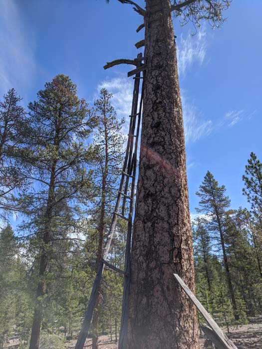
“The Pumice Springs Lookout had a ladder for about 20 feet, then 2 x 4s for about another 10,” Mr. Stenkap told us. “From there, the lookout used branches until he (or she) was about 10 feet from the platform where there was, and still is, another section of ladder. According to the data from the drone the platform is at 81 feet. The lookout was also known as Sand Springs lookout. The tree is just about equal distance from each of those springs.”

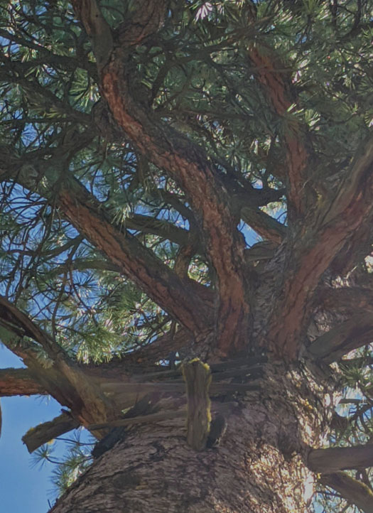

Before he retired, Mr. Stenkap’s duties at the Bend Fire Department in Oregon included flying a DJI Phantom 3 Pro drone.
When the Senate Energy and Natural Resources Committee holds their hearing at 10 a.m. EDT June 9, 2020 on “Wildfire Management in the Midst of COVID-19” neither U.S. Forest Service Chief Vicki Christiansen or Fire and Aviation Director Shawna Legarza are slated to be present. Usually the Chief testifies at hearings about the Forest Service, and since Ms. Legarza testified last year at a hearing about expectations for the fire season, there was speculation that she would attend this one as well.
It is likely that the Senators will ask about the results from the Aerial Firefighting Use and Effectiveness Study that has been going on for eight years. Chief Christiansen has been testifying for the last two years before this committee saying it would be released “soon”. When pressed in February by Colorado Senator Cory Gardner, who last year made his opinion about the delay very clear, she said it would be released “this Spring.” Senator Gardner said, “Before June?” She said, “Yes.”
I asked Ms. Legarza by email why she was not going to testify, and she replied, “Normally the Fire Director does not testify. Last year was the first time ever. Was a great experience. I am very appreciative of all the work the committee has done while I have been in this job.”
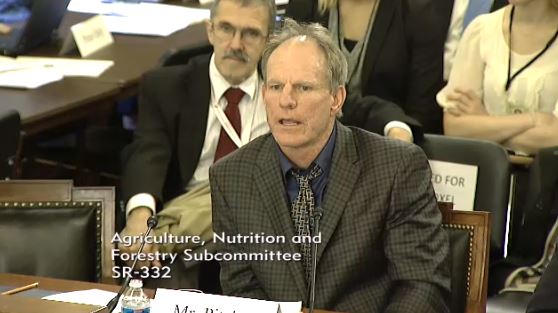
A quick search of Wildfire Today found two examples of former Fire Director Tom Harbour attending congressional committee hearings. On October 17, 2011 he testified before a subcommittee of the House of Representatives’ Homeland Security committee at a field hearing in Austin entitled “Texas Wildfire Review: Did Bureaucracy Prevent a Timely Response?” On November 5, 2013 he sat directly behind the witnesses but did not testify at a hearing before the Senate Subcommittee on Conservation, Forestry and Natural Resources titled, “Shortchanging Our Forests: How Tight Budgets and Management Decisions Can Increase the Risk of Wildfire”.
I obtained from a Washington insider the list of government employees who ARE slated to testify Tuesday:
Some of the Senators and witnesses may appear virtually instead of in person. The current Senate rules during the pandemic do not allow spectators at committee meetings or hearings.
For Throwback Thursday I found a good news story — much needed during these turbulent times. Published March 21, 2015, it feels like it was a thousand years ago:

The six-year-old son of a wildland firefighter was one of 15 filmmakers to be invited to show a video at a film festival at the White House. Noah Gue worked with his father, Michael Gue, a firefighter with the U.S. Forest Service in Bozeman, Montana, to make the film to help raise awareness of climate change and inspire conservation. Noah’s parents produced the film in which he is the on-screen narrator. He also got a credit for editing. The film was selected to be shown Friday at the second White House Student Film Festival.
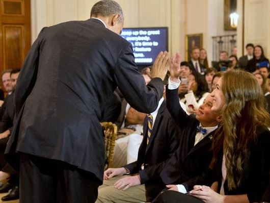

The fact that Noah had a loose front tooth did not escape the notice of President Obama who mentioned it in his opening remarks at the event. Here are some excerpts from the official transcript:
Thank you so much, everybody! Have a seat. Well, hello, everybody, and welcome to the second annual White House Film Festival. (Applause.) It’s like the Sundance or Cannes of film festivals that are open to the public through a government website. (Laughter.) It may also be the only film festival where one of the entrants has his tooth loose. (Laughter.) And may pull it out right here at the ceremony. (Laughter.)
[and later]
…Today, we’re celebrating a 6-year-old in Montana. Is that you? (Applause.) He’s the guy without — he’s missing teeth. (Laughter.) But he’s also challenging us to see conservation through a child’s eyes…
Noah’s father, Michael, is a prolific photographer, as is his wife who is a wedding photographer. We have featured Michael’s fire pictures a couple of times on Wildfire Today, HERE and HERE. His Instagram account has over 7,000 followers…
Congratulations to Noah and Michael!