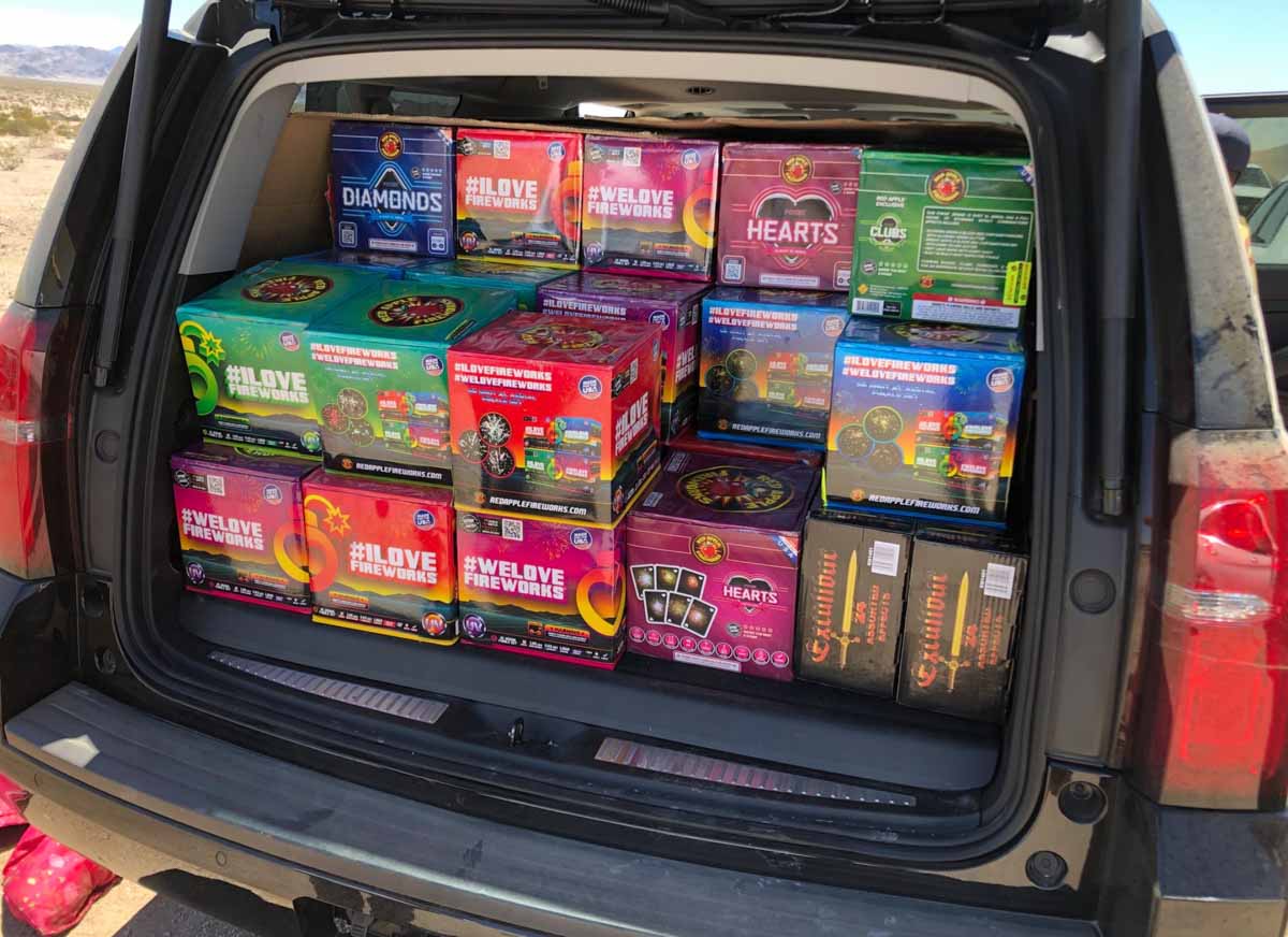
Law enforcement task force seizes 125,124 pounds of illegal fireworks

Fireworks seized Southern California
Fireworks seized in Southern California. CAL FIRE photo.

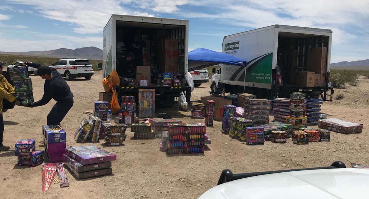
Recently four agencies in Southern California worked together to seize 125,124 pounds of illegal fireworks in San Bernardino County. The officers involved were from CAL FIRE, State Fire Marshall’s Office, San Bernardino County District Attorney’s Office, and Redlands Fire Department.

“Every pound of illegal fireworks confiscated potentially reduces fire starts as well as injuries and death caused by their use”, stated Glenn Barley, Unit Chief of the CAL FIRE San Bernardino Unit.

It is illegal in California to transport, possess, use or store fireworks in areas that do not allow use. Safe and sane fireworks are only approved in certain jurisdictions and must remain in the community where they are purchased.

According to the NFPA, fireworks start an average of 18,500 fires per year in the United States, including 1,300 structure fires, 300 vehicle fires, and 16,900 vegetation and other fires.

In 2017, U.S. hospital emergency rooms treated an estimated 12,900 people for fireworks-related injuries; 54% of those injuries were to the extremities and 36% were to the head. Children younger than 15 years of age accounted for more than one-third (36%) of the estimated 2017 injuries. These injury estimates were obtained or derived from the Consumer Product Safety Commission’s 2015 Fireworks Annual Report by Yongling Tu.
Fireworks seized Southern California
Fireworks seized in Southern California. CAL FIRE photo.

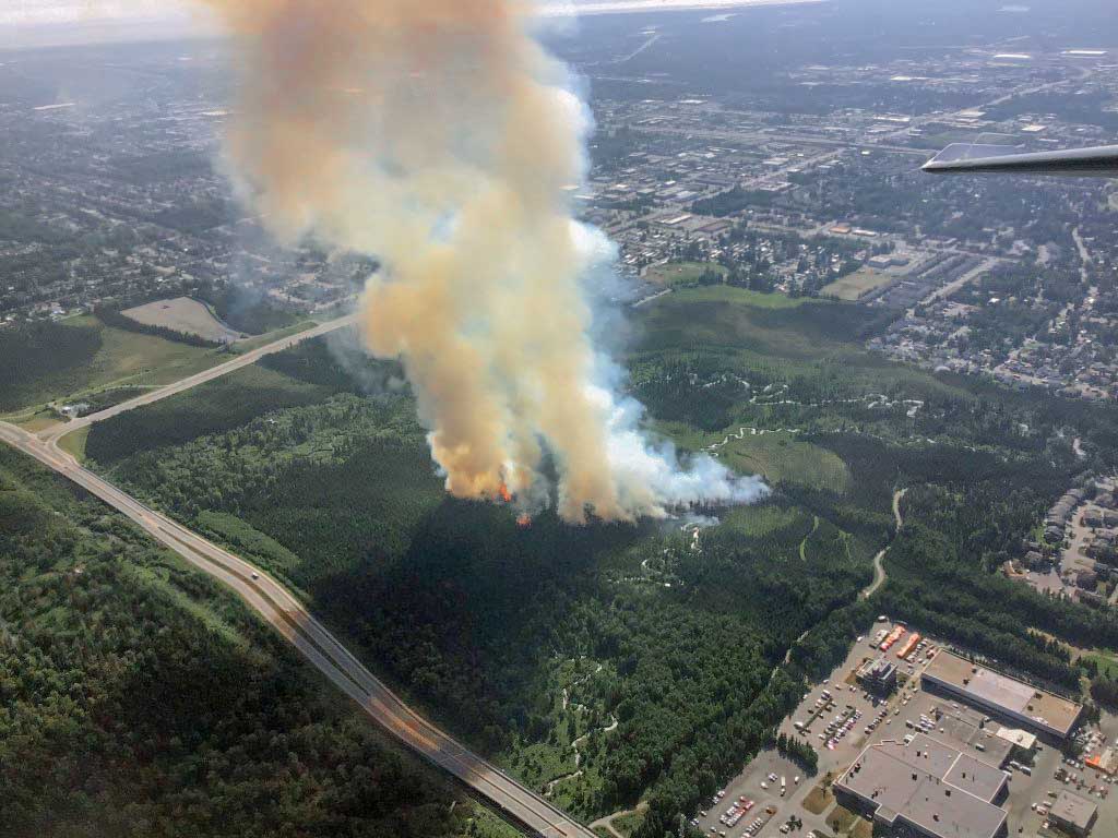
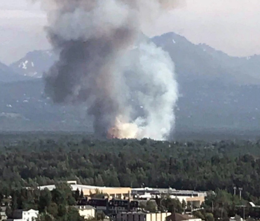
Wildfire burns 25 acres in Anchorage, Alaska

M.L.K. Fire Anchorage
Smoke rises from a wildfire in East Anchorage on Tuesday afternoon, July 2, 2019. Photo by Jason Jordet/Alaska Division of Forestry.

(Originally published at 3:53 p.m. July 3, 2019 ADT)

Two 20-person crews and additional firefighters from the Alaska Division of Forestry are working Wednesday to contain the 25-acre M.L.K. Fire in East Anchorage, Alaska.

The fire which was reported at 4:28 p.m. on Tuesday, spread quickly in or near the Bureau of Land Management’s Campbell Tract but Wednesday afternoon it is holding at 25 acres. On Tuesday three air tankers and a helicopter dropped water and retardant helping to slow the spread of the fire. Smokejumpers worked into the early morning hours Wednesday looking for hotspots. Firefighters also placed a hose line around the fire to provide a water supply to extinguish any hot spots found.

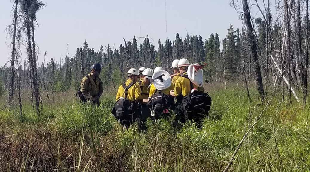
M.L.K. Fire Anchorage
A squad of firefighters from Mat-Su Area Forestry walk into the M.L.K. Fire to begin mop up operations on Wednesday morning, July 3, 2019. Photo by Stephanie Bishop/Alaska Division of Forestry.

Tuesday afternoon the Baker River Interagency Hotshot Crew from Washington responded to the fire from the Swan Lake Fire on the Kenai Peninsula and the Gannett Glacier Type 2 Initial Attack Crew was pulled from a fire near Lake Louise to assist with containment. A task force of four engines was also brought up from the Swan Lake Fire. A total of 66 personnel are assigned to the fire.

Today the two crews and the firefighters from the Mat-Su Area forestry office are focused on creating a chain saw line – cutting a swath through the vegetation around the perimeter of the fire to keep it from expanding. Fire managers expect to complete containment this evening.

M.L.K. Fire Anchorage
The MLK Fire burning in East Anchorage on Tuesday, July 2. BLM/AFS photo.

(Most of the text above is courtesy of the BLM/AFS)

There were no reports of injuries or burned structures. Soon after it started a few dozen people, including part of a mobile home park, were ordered to evacuate, but that was cancelled by 7 p.m.

The video below posted by the Alaska Division of Forestry, shows impressive flames that firefighters reported to be 60-feet long.

The blaze burned primarily in Black Spruce but slowed considerably as it moved into hardwoods.

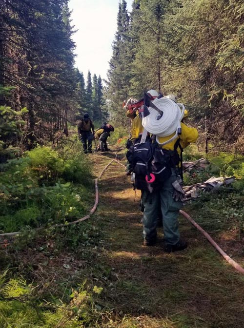
M.L.K. Fire Anchorage
Firefighters from Mat-Su Area Forestry haul hose and other supplies down a trail to access and mop up the M.L.K. Fire in East Anchorage on Wednesday, July 3, 2019. Photo by Stephanie Bishop/Alaska Division of Forestry.


The article was revised to correctly indicate that the Baker River Hotshots’ home base is in Washington.

Thanks and a tip of the hat go out to Steven. Typos or errors, report them HERE.

Pine Lodge Fire reaches Capitan Peak

The fire is 16 miles east of Capitan, New Mexico

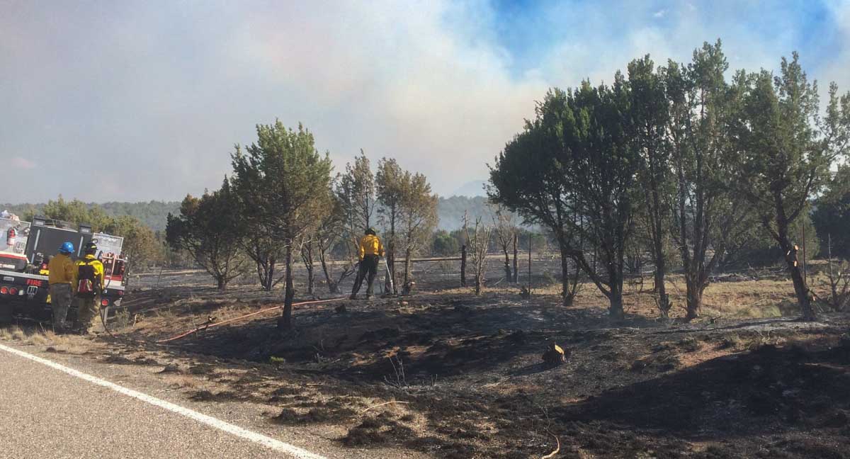
Pine Lodge Fire Mopup
Firefighters mopup near a highway on the Pine Lodge Fire. Uploaded to InciWeb July 3, 2019.

The Pine Lodge Fire reached Capitan and Sunset Peaks yesterday and is visible on the south side of the Capitan Mountain Range and from Hwy 380 and Hwy 70. Low to moderate fire behavior will continue due to outflow winds from thunderstorms, but due to higher humidities and lack of fuel, minimal fire growth in expected.

The 14,783-acre  fire continues to burn on the north and south sides of the Capitan Mountains in the wilderness area. Fire activity is minimal near containment lines and continues to consume unburned pockets of fuel within the lines, but all fire lines are holding well.

The fire was reported June 19 and is now 16 miles east of Capitan, New Mexico.

Crews continue to patrol and mop-up along fire lines as needed. Fire activity is being monitored in the Copeland Canyon and Peachtree Canyon drainages to keep the fire from moving west. The fire may continue to creep further into the Wilderness. Rehabilitation work from suppression activity is ongoing.

There are 145 suppression and support personnel remaining with the Pecos Type 3 Incident Management Team. Additional cooperating and assisting organizations include State of New Mexico, Lincoln County Sheriff Department, NM State Police and Otero County Electric Coop.

(Some of the text above is from InciWeb)

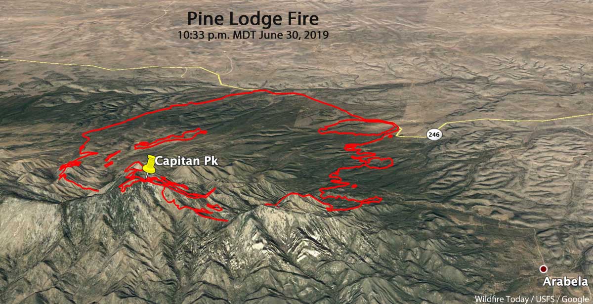
Pine Lodge Fire 3-d map
3-D map of the Pine Lodge Fire at 10:33 p.m. MDT June 30, 2019. Looking north.
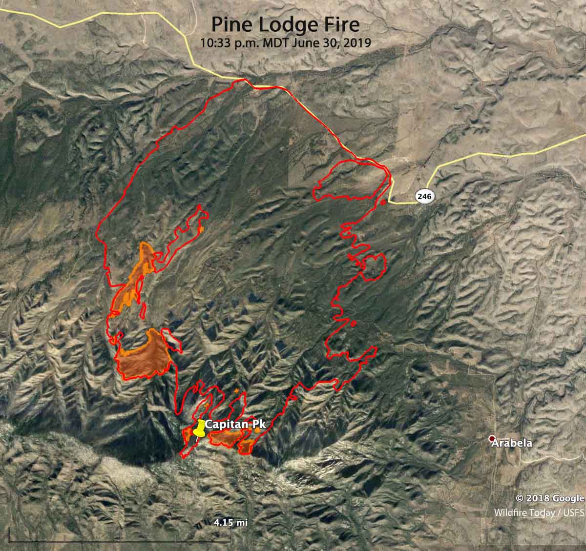
Pine Lodge Fire map
Map of the Pine Lodge Fire at 10:33 p.m. MDT June 30, 2019.

Germany: Largest wildfire in Mecklenburg-Western Pomerania’s history brought under control

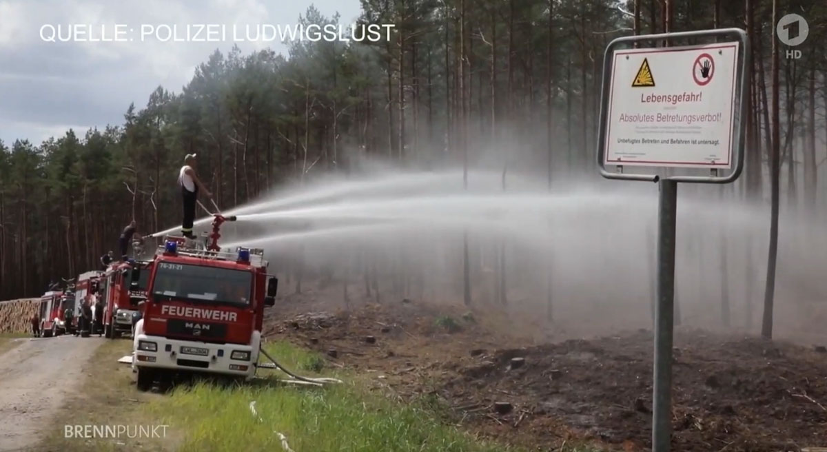
wildfire Germany
Firefighters battle a wildfire in Mecklenburg-Vorpommern. Screen grab from Tagesschau video.

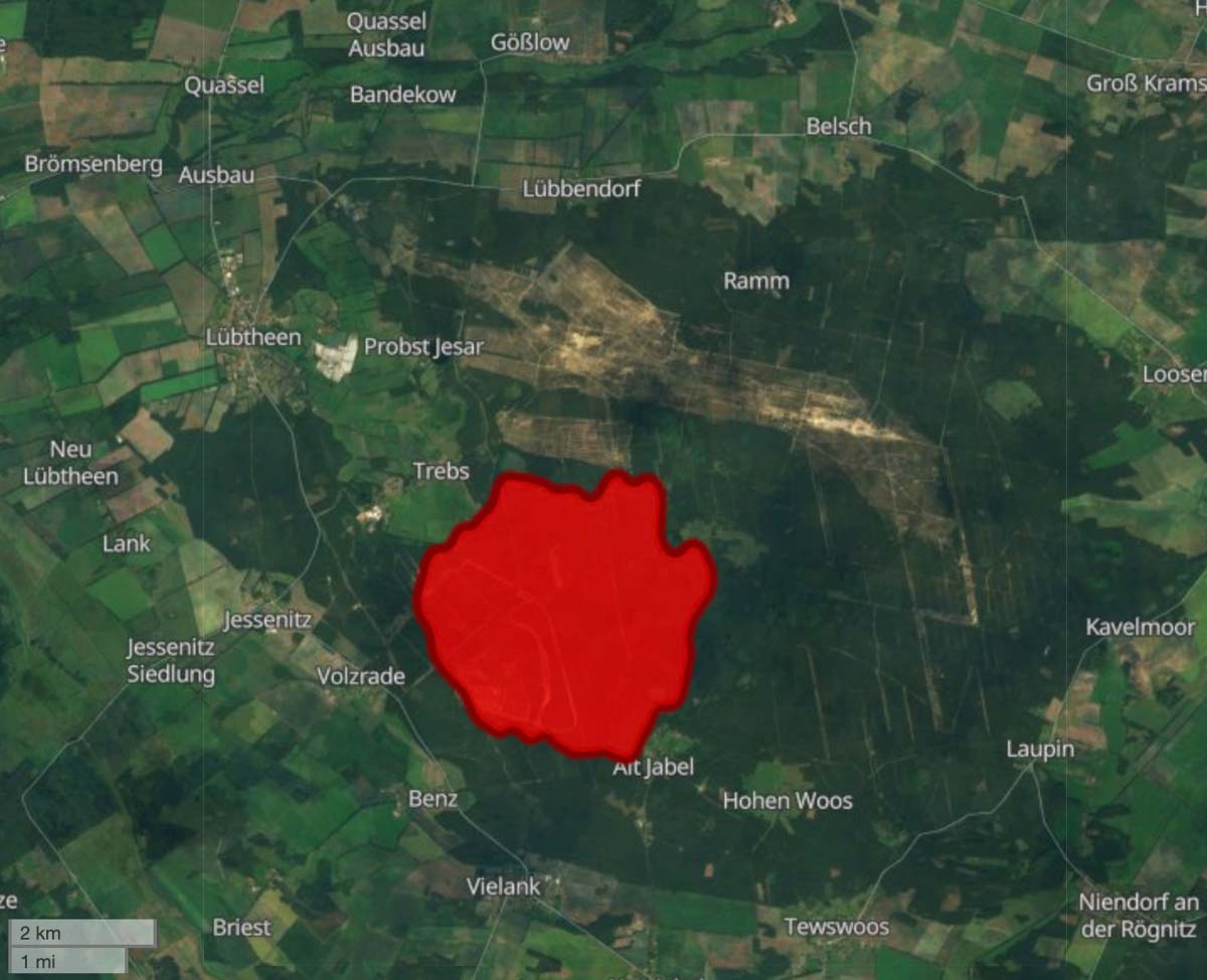
The largest fire in the recorded history of Germany’s state of Mecklenburg-Western Pomerania has been brought under control. The fire started last week and was thought to have been suppressed on Friday, but on Sunday it either flared up again or was reignited by an arsonist, authorities said.

Below is an excerpt from DW.com:

“We have the fire under control now,” said district administrator Stefan Sternberg. The fire has been contained on all sides, he added. Of the 1,200 hectares (2,965 acres) affected, 700 hectares were still burning, Sternburg said on Wednesday morning. The reduction was partially due to the lower temperatures overnight and it was possible some fires could be fanned by higher, daytime temperatures.

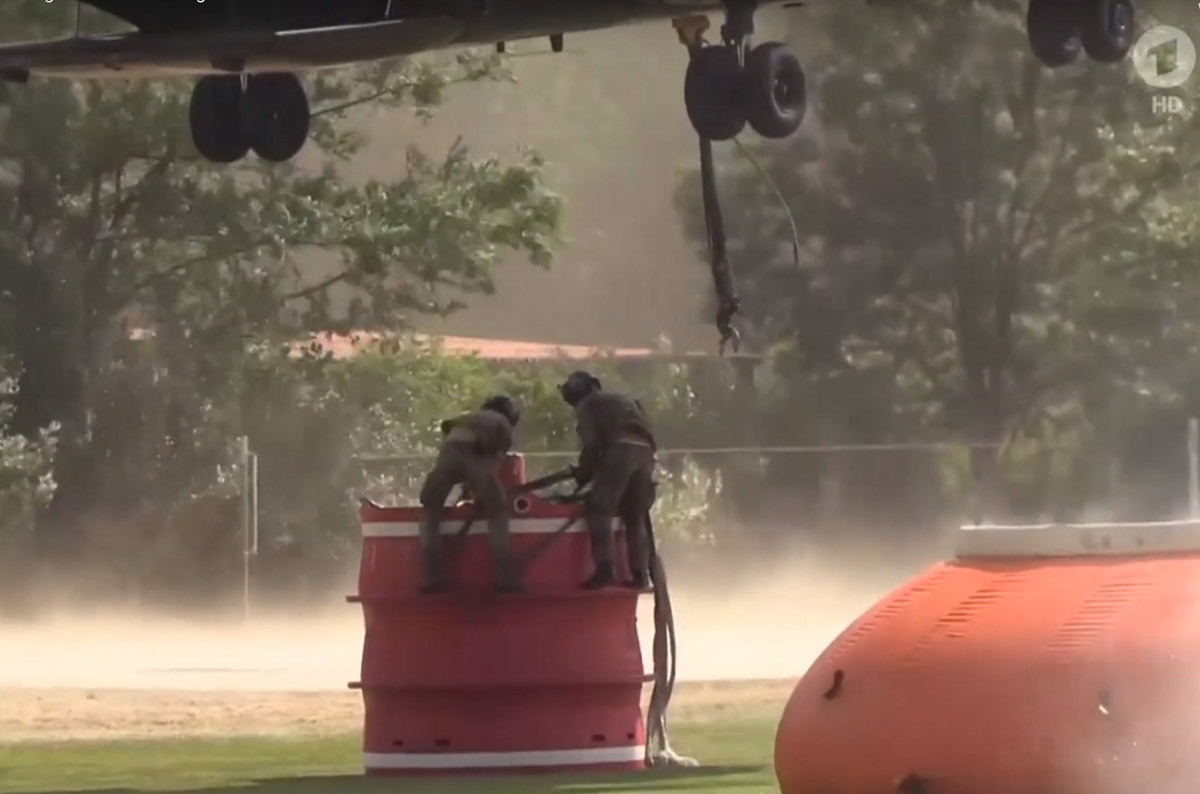
The fires had been contained by creating avenues and pathways between wooded areas. There was some concern Wednesday that winds could cause the fires to move over the gaps.With more than 2,000 firefighters and rescue crews working around the clock, the military commander in the state said emergency forces were “going from defense to offense” to extinguish the fire. Armored recovery vehicles were deployed to clear paths through the forest for firefighters, who have had to take extra precautions to avoid the old munitions. Up to eight firefighting helicopters supported the operation.

The fire burned in an area that was bombed heavily during World War II and still has ammunition, mines, grenades and explosives. Since then the military has used the area for training, adding still more unexploded ordnance.

The video below is narrated in German, but non-German speakers can skip through and view interesting scenes of firefighting in Europe.

wildfire Germany
Soldiers rig a water bucket before it is attached to a helicopter for battling a fire in Germany. Screen grab from Tagesschau video.
wildfire Germany
Map showing the location of the wildfire in Germany. Copernicus Emergency Management Service.

Video released about Native Fire in the Southern Plains

Posted on Categories UncategorizedTags

Native Fire Video

Produced in in partnership with Injunuity, the Bureau of Indian Affairs has released  “Native Fire,” an educational video about prescribed fire.

It covers Native American’s historic use of fire and addresses how traditional practices in the southern plains have influenced its modern-day application. In the video, fire research specialists speak to this history and address some of the complex challenges facing land managers today.

The 13-minute video also explains why fire is an essential and timeless tool that is necessary for maintaining and restoring ecosystems that evolved with fire.

Wildfire activity increases in Manitoba and Ontario

The Red 023 Fire near Sandy Lake in Ontario made a 20 kilometer run Monday afternoon and night

wildfires Manitoba Ontario June 2 2019
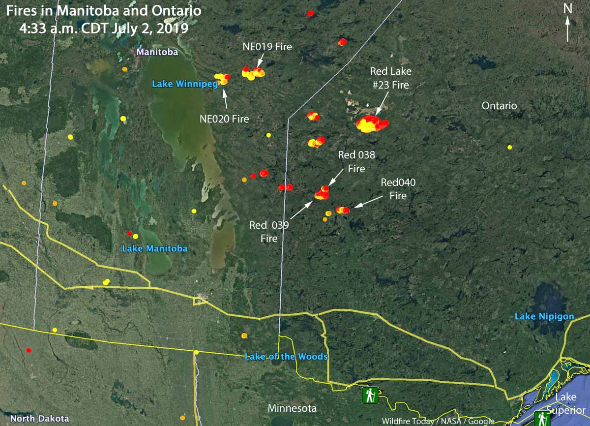
Map showing the locations of wildfires in Eastern Manitoba and northwest Ontario at 4:33 a.m. CDT July 2, 2019.

Wildfire activity in Canada has spread from British Columbia and Alberta, east to the provinces of Manitoba and Ontario. In the last several days about a dozen fires have grown much larger in Eastern Manitoba and Northwestern Ontario. Winds out of the west Monday afternoon and night forced some of blazes to grow substantially to the east and northeast.

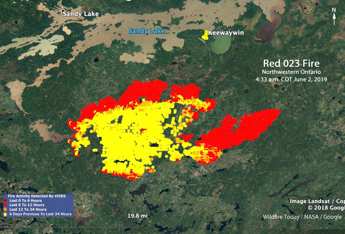
The largest in the area is in Northwestern Ontario, the Red 023 Fire that started June 15. As illustrated in the map below, between 2:42 p.m. July 1 and 4:33 a.m. CDT July 2 the fire ran east for about 20 kilometers (13 miles). Early Tuesday morning it was 4 miles south of Sandy Lake and six miles southwest of the community of Keewaywin.

The Ontario Ministry of Natural Resources and Forestry’s latest estimate of the size of the Red 023 Fire was 37,390 Ha (92,392 acres). After the major run, our very, very unofficial estimate using satellite data estimates that it has grown to at least 54,000 Ha (130,000 acres).

Map Red 023 fire Keewaywin Ontario Sandy Lake
Map showing heat on the Red 023 Fire detected by a satellite as late as 4:33 a.m. CDT July 2, 2019. The red areas burned between 2:42 p.m. July 1 and 4:33 a.m. CDT July2.

There are three large fires in Ontario northwest of Trout Lake that all started June 30. (See the map at the top of the article) The sizes were reported by the Ontario Ministry of Natural Resources and Forestry on July 1, 2019:

  • Red 038 Fire, 1,100 Ha (2,700 a)
  • Red 039 Fire, 10,000 Ha (24,700 a)
  • Red 040 Fire, 2,832 Ha (7,100 a)

Two of the larger fires in Manitoba are the NE 020 Fire and the NE 019 Fire, east of Lake Winnipeg and southeast of Playgreen Lake, both reported in mid-June. Their reported sizes are 11,000 Ha (27,000 acres) and 9,000 Ha  (22,000 acres), respectively.

The weather forecast for the Pikangikum, Ontario area through Saturday calls for temperatures in the mid to high 70s F, partly cloudy or sunny, winds generally out of the west during the day at 5 to 12 mph, and very little chance of rain.

The map below shows the forecast for the distribution of wildfire smoke from the fires in Alaska, Manitoba, and Ontario at 7 p.m. CDT July 3, 2019.

Smoke Forecast wildfires Canada
Forecast for the distribution of wildfire smoke at 7 p.m. CDT July 3, 2019, produced July 2 by the Canadian government. The forecast only includes the area within the black border.