Great Smoky Mountains NP completes two prescribed fires

Near Wears Valley and Cades Cove

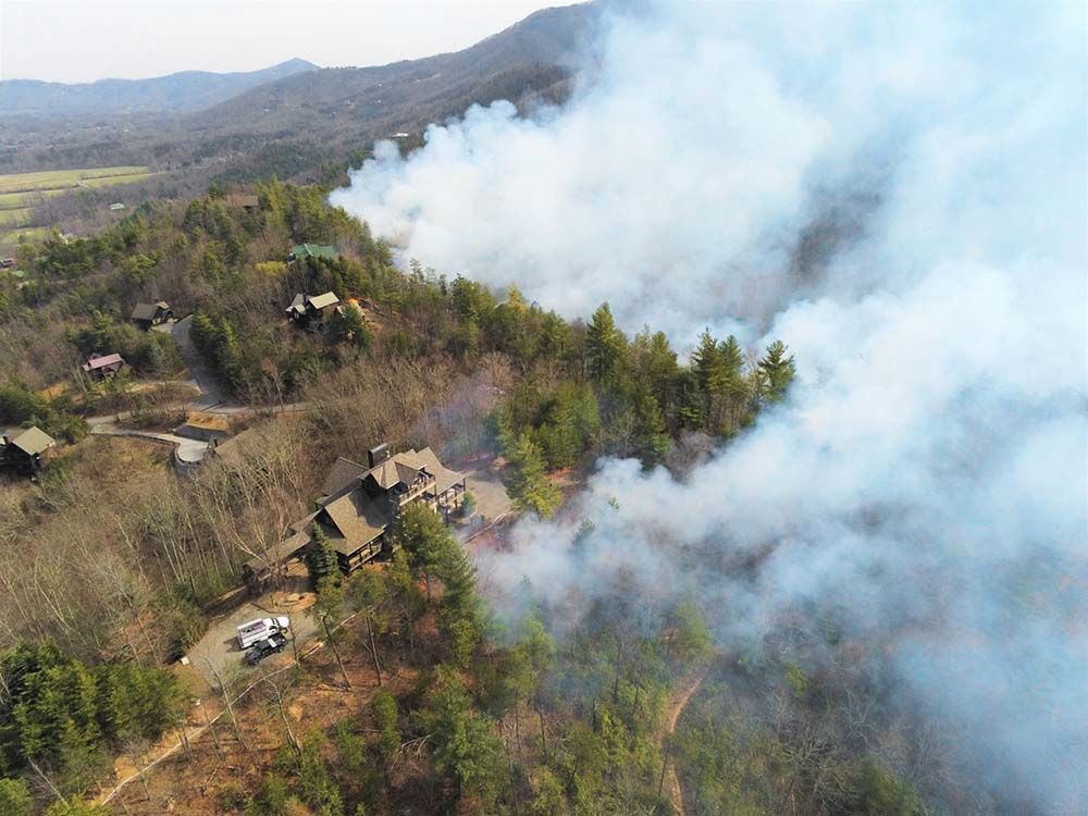
Prescribed fire in Great Smoky Mountains NP
Prescribed fire in Great Smoky Mountains National Park, March 9, 2021. NPS photo.

Great Smoky Mountains National Park successfully completed a 175-acre prescribed burn along a half-mile of the park boundary in Wears Valley on Tuesday, March 9. The objective of the project was to reduce the amount of flammable vegetation along the park’s boundary near homes, as well as maintaining an open woodland habitat for drought-tolerant trees like oak and pine.

“The wildland fire specialists did an outstanding job planning, prepping, and executing this prescribed burn in an ongoing effort to help communities along our boundary to create Firewise space between their homes and parklands,” said Chief Ranger Lisa Hendy.

Crews established a 3,000-ft hose lay for added protection around homes at the top of the ridge and along the boundary before implementing the prescribed burn. A small test burn was conducted to confirm fire behavior before the prescribed fire was allowed to burn slowly down the slope towards Metcalf Bottoms Picnic Area. As expected, smoke was visible throughout the operations across the Wears Valley area.

Flame lengths and fire behavior were within prescription throughout the operations as the low-intensity fire backed down the slope over a six-hour period until the burn reached the natural and manmade control lines at the bottom. Crews remained on scene overnight and continued to staff the area for several days to check control lines and monitor fire activity.

Crews from the Cherokee National Forest, Bureau of Indian Affairs in Cherokee, Townsend Volunteer Fire Department, Pittman Center Volunteer Fire Department, Waldens Creek Volunteer Fire Department, The Nature Conservancy, AmeriCorp, and employees from Great Smoky Mountains National Park, Congaree National Park, and Chickamauga-Chattanooga National Military Park provided assistance throughout the burn operations including site preparation and post-burn monitoring.

In preparation for the prescribed burn operation, crews spent several days clearing brush and leaf litter along the park boundary and Indian Camp Branch, which successfully served as fire control lines to keep the fire within its planned boundaries. The 175-acre unit was bounded by Wear Cove Gap Road, Indian Camp Branch, Little River, and the park boundary along Roundtop Trail.

In February the park conducted a prescribed burn in the Cades Cove area, 90 acres in the Rowans Branch unit along Sparks Lane and 338 acres of the Primitive Baptist Church unit along Hyatt Lane.

Prescribed fire in Great Smoky Mountains NP
Prescribed burn in the Cades Cove area of Great Smoky Mountains National Park. NPS photo.

Firefighters in New Jersey are taking advantage of good weather to conduct prescribed burns

The New Jersey Forest Fire Service hopes to treat 30,000 acres this year

New Jersey Forest Fire Service prescribed fire
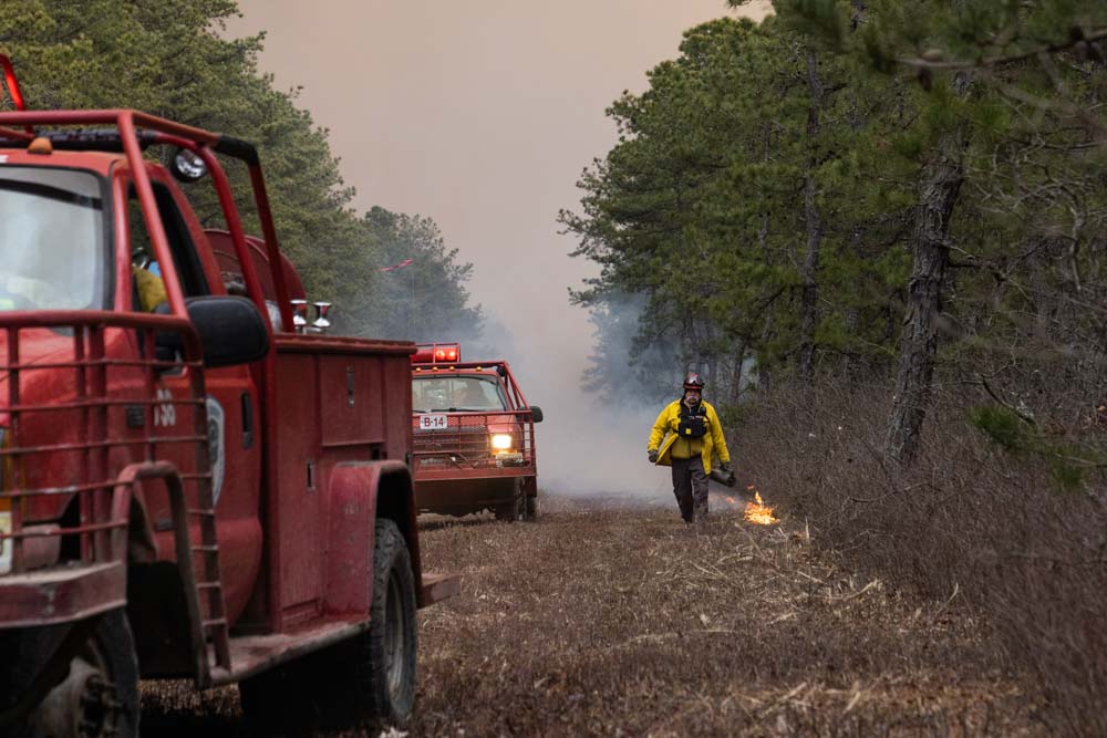
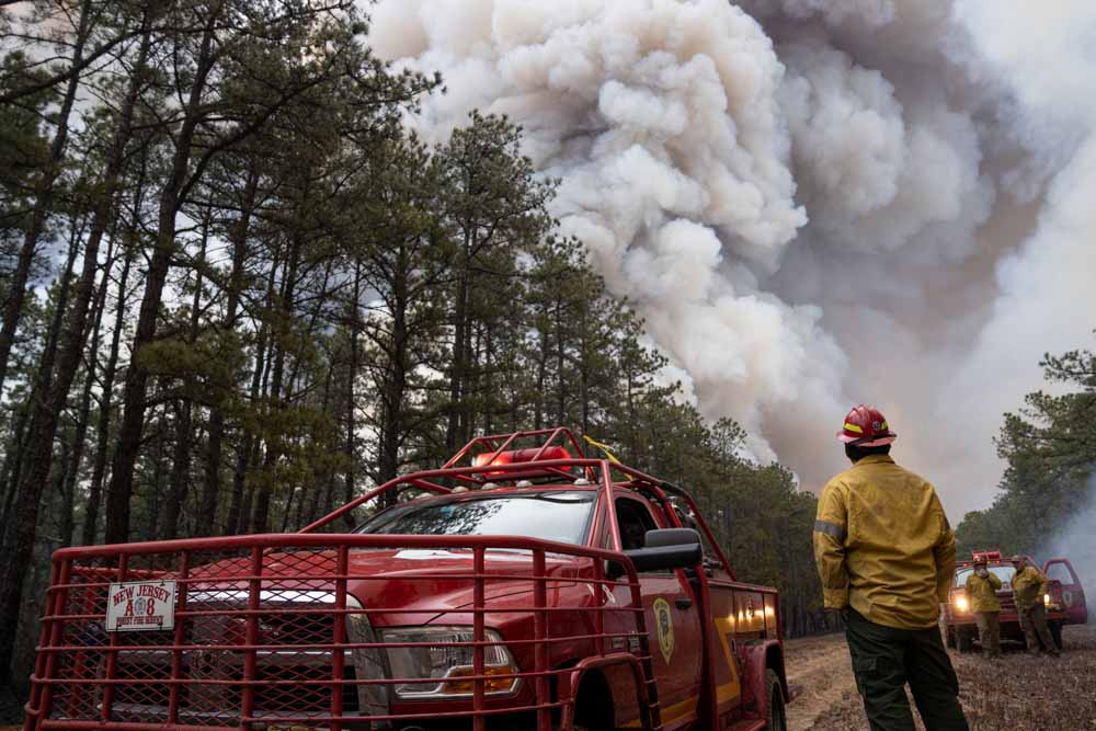
Prescribed fire conducted March 6, 2021 by the New Jersey Forest Fire Service. NJFFS photo by James Douglass.

Due to much of the state being covered in snow during the month of February and with a goal of completing prescribed burns by March 15 looming, New Jersey Forest Fire Service crews are working hard to make up for lost time. Their crews started burning last week during the first good weather window of 2021, with a 9,000-acre goal for the weekend. The agency considers the prescribed burning program to be one of its primary tools to reduce hazardous fuels that that can increase the intensity of wildfires.

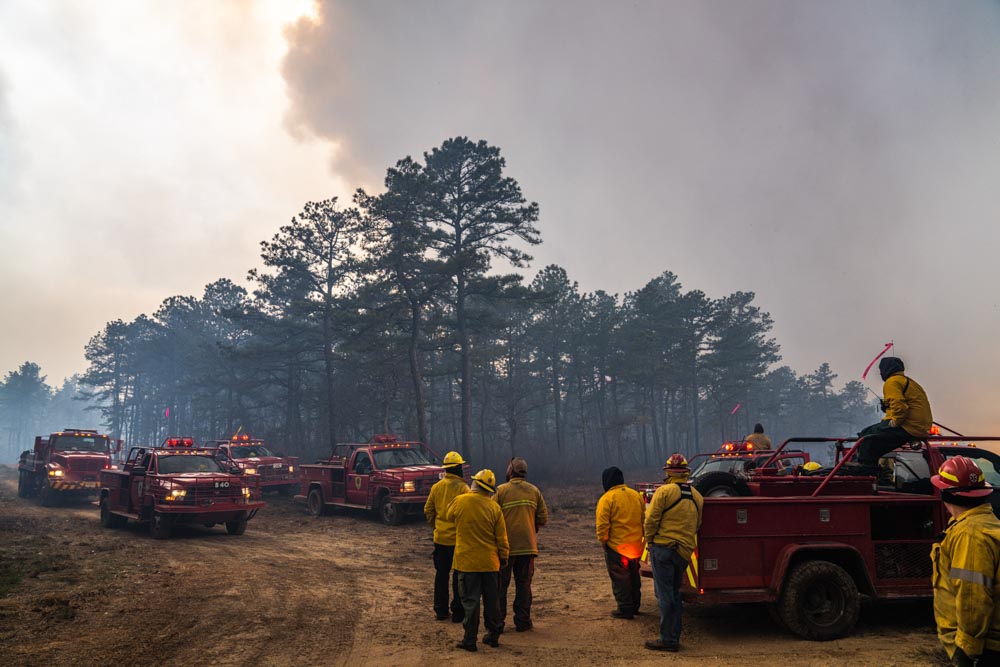
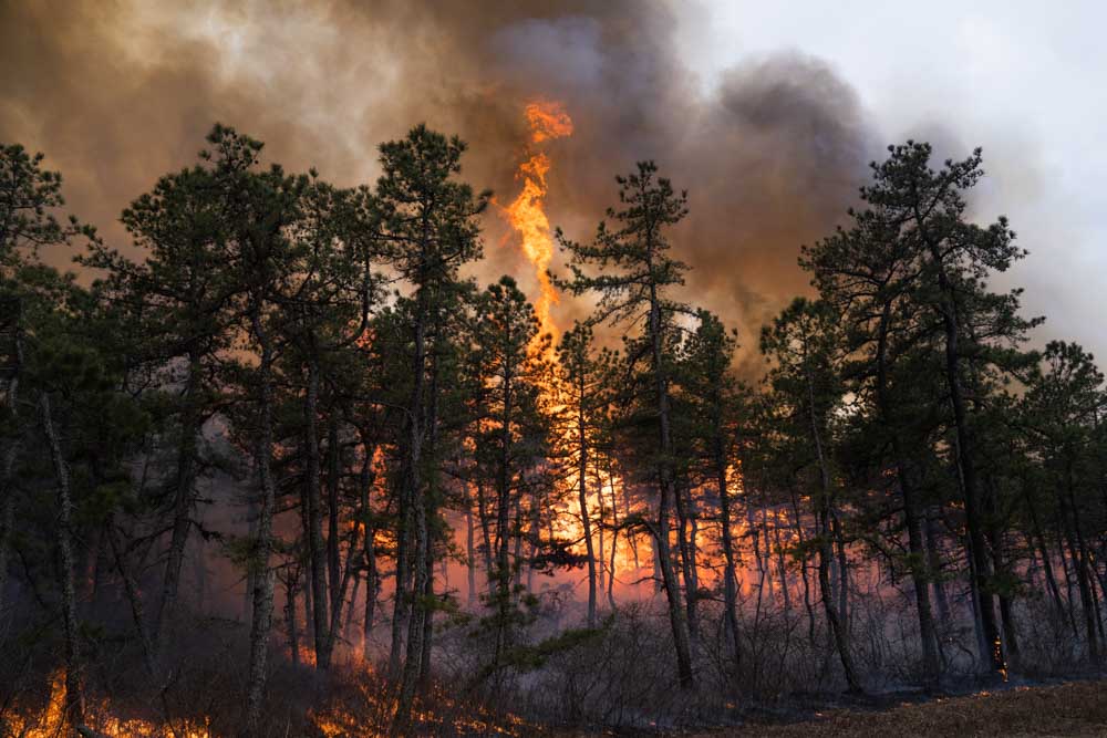
These photos were taken March 6 by James Douglass at a 2,300-acre prescribed burn at the Warren Grove Gunnery Range in the heart of the Pine Barrens of New Jersey.

New Jersey Forest Fire Service prescribed fire
Prescribed fire conducted March 6, 2021 by the New Jersey Forest Fire Service. NJFFS photo by James Douglass.

This year the NJFFS anticipates conducting prescribed burns on at least 30,000 acres depending on weather conditions. Most burns occur on state-owned property such as state forests, parks, wildlife management areas, and other government lands. The Forest Fire Service also assists private landowners and nonprofit organizations to meet their management objectives through prescribed burning.

In 2020, the Forest Fire Service completed burns on 18,854 acres of state-owned lands, 5,006 acres of other government-owned land, and 2,268 acres of privately owned property, for a total of 26,128 acres.

New Jersey Forest Fire Service prescribed fire
Firefighter uses a compressed air-powered ignition device during a prescribed fire March 6, 2021 conducted by the New Jersey Forest Fire Service. NJFFS photo by James Douglass.
New Jersey Forest Fire Service prescribed fire
Prescribed fire conducted March 6, 2021 by the New Jersey Forest Fire Service. NJFFS photo by James Douglass.
New Jersey Forest Fire Service prescribed fire
Prescribed fire conducted March 6, 2021 by the New Jersey Forest Fire Service. NJFFS photo by James Douglass.

Black Hills National Forest conducts 380-acre prescribed fire

Red Flag Warning in effect for the area Saturday

Victoria Prescribed Fire, Black Hills National Forest
Victoria Prescribed Fire, Black Hills National Forest. USFS photo by Matt Daigle.

The Black Hills National Forest conducted a 380-acre prescribed fire Wednesday through Friday of this week approximately 5 miles southwest of Rapid City, SD.

Today, Saturday March 6, a Red Flag Warning is in effect for the area.

“Warm temperatures and dry fuels, combined with very low humidity and gusty south to southwest winds, will result in extreme fire danger across the area,” the National Weather Service said in an advisory Saturday.

The forecast for Saturday predicts 17 to 24 mph winds out of the southeast and a minimum relative humidity of 11 percent. The strong winds are expected to continue Saturday night shifting to come from the west and then the northwest, with the RH ranging from 24 to 48 percent.

Red Flag Warning Black Hills
Red Flag Warning Black Hills, March 6, 2021.

The photos below were posted by Great Plains Fire Information Friday March 5, 2021.

Victoria Prescribed Fire, Black Hills National Forest
Victoria Prescribed Fire, Black Hills National Forest. USFS photo.
Victoria Prescribed Fire, Black Hills National Forest
Victoria Prescribed Fire, Black Hills National Forest. USFS photo by Matt Daigle.

Two escaped prescribed fires in California

Calvert Fire map
Map showing location of the Calvert Fire March 1, 2021

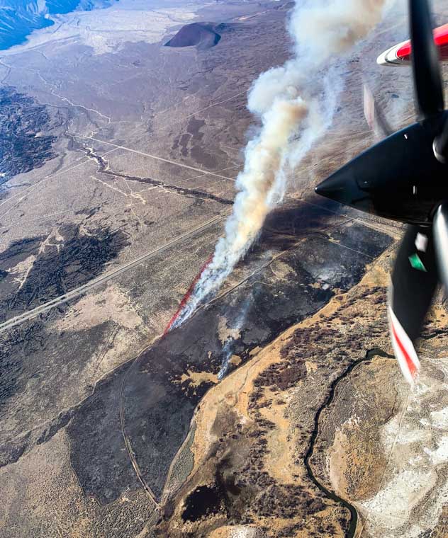
The spread of an escaped prescribed fire 11 miles south of Big Pine, California was stopped Monday on the east side of Hwy. 395 by firefighters from the California Department of Forestry and Fire Protection.

The plan by the CAL FIRE San Bernardino Unit was to ignite the project at 8 a.m. Monday but a change in wind direction surprised the crews and caused the blaze to escape the project boundary and was declared an escape at 11 a.m.

The new fire named Calvert was mapped at 262 acres by the Fire Integrated Real-Time Intelligence System (FIRIS) operated in a fixed wing aircraft by Orange County Fire Authority. FIRIS has proven to be an incredibly valuable resource for providing real time video intelligence, fire spread projections, and situational awareness during wildfire suppression.

We need about a dozen more FIRIS units.

Calvert Fire
Photo of the Calvert Fire, by AA120, March 1, 2021.

Still another escaped prescribed fire in Southern California:

There is a report that another prescribed fire escaped in California, this time it was Tuesday near Clear Creek Station in the Angeles National Forest. The escape was named Clear Fire.

There were approximately three other wildfires in SoCal Tuesday in Meade Valley and the Perris area.

The article was corrected to indicate that the Calvert Fire was Monday, not Tuesday.

Learning from the centuries-old prescribed fire practices of Native Americans

Slater or Devil Fire
Slater/Devil Fire complex, September 15, 2020. InciWeb.

National Geographic has a long, interesting article about the differences in Northern California forests before and after the resident native Americans were prohibited from continuing their practice of prescribed burning. The author, Charles C. Mann, interviewed members of the Karuk tribe that were affected by last summer’s fires, including the Slater Fire that destroyed hundreds of structures near Happy Camp. They are hoping to restore, in a current-day context, a more robust prescribed fire program.

Below is an excerpt:


…The anti-flame campaign profoundly altered the American environment. Wildfire had been common in western forests. Much or most of that burning was due to the area’s first humans, who torched away the undergrowth that fueled future fires before it could build to dangerous levels. Thousands of years of controlled, targeted combustion created a landscape that was a patchwork of new and old burns—meadows, berry patches, park-like woodland, and so on. As these flames ceased, a new kind of forest emerged: a nearly fire-free ecosystem that was unlike anything that had existed since the end of the Ice Age.

[Kathy] McCovey is a retired Forest Service anthropologist. With [Joe] Jerry, she belongs to a Karuk fire-lighting brigade. For years they had been begging the Forest Service to let them burn the brush on the slopes around their homes. If you don’t let us burn, they had warned, there will be a catastrophic fire.

“Whoops,” McCovey said.

When something—lightning, a campfire, a downed utility line, a spark from a tool hitting a rock—sets the forest debris on fire, the flames climb the “fuel ladder” to shrubbery and young trees, then jump to the crowns of the older trees, creating a high wall of flame that can be caught by the wind. “We’re going to have to get these trees out,” she said, pointing to the mass of fire-blasted fir around us. “If they don’t, in five years it will burn again and be worse.” (Here’s how wildfires get started—and how to stop them.)

To McCovey, the problem was not just that the new forests were flammable. It was that they were “a food desert for animals and people.” The Forest Service and western state governments, like her ancestors, had managed the forest—had, in effect, farmed it. But the Forest Service and the states had farmed the forest to produce a single commodity: timber. McCovey’s ancestors had farmed the landscape for many reasons.

(end of excerpt)


More information is at the Indigenous Peoples Burn Network, a growing collaboration of Native nations, partnered with nonprofit organizations, academic researchers, and government agencies. It is a support network among Native American communities that are revitalizing their traditional fire practices in a contemporary context.

TBT: Senator John Kyl on reducing budgets for fuel reduction

Kiabab NF Gov Prairie Rx 1-2014
Kiabab National Forest in Arizona, Government Prairie prescribed fire, January, 2014.

For Throwback Thursday, let’s take another look at an article published on Wildfire Today February 12, 2008 about a topic that is still an issue 12 years later.


Senator John Kyl, a Republican from Arizona, in an article on his web site criticizes the President’s proposed budget for 2009 which reduces the funds allocated for fuel treatments.

“With almost 48 percent of the proposed budget going toward fire fighting, the Forest Service might be more appropriately called the “Fire Service.”

I believe funding for fighting fires must be complemented by adequate funding for preventing them. Proactive management of our forests not only is the best tool in combating wildfires, it is critical to restoring forest health and improving habitats for diverse species.

Typically, there are two complimentary methods of treatment: mechanical thinning of brush and smaller diameter trees, and prescribed burning. These treatments open up forests so they are less susceptible to “hot” crown fires. More importantly, reducing competition for soil nutrients, water, and sunlight immediately enhances the health of the trees, allowing them to grow bigger and fend off diseases and deadly insects like bark beetles.”