Researchers determine escape route travel times for firefighters

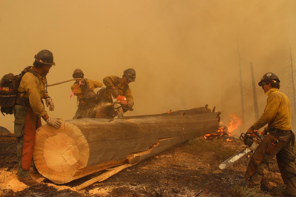
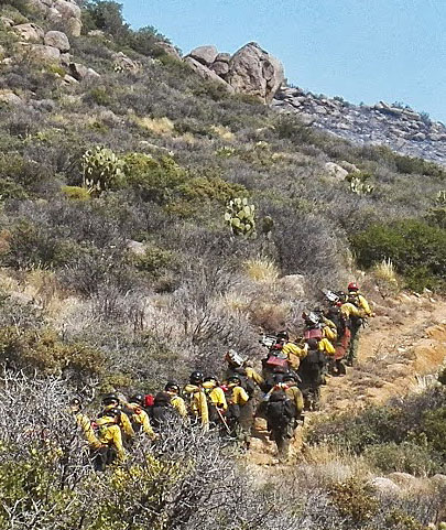
Granite Mountain Hotshots hike to the fire, June 30, 2013
Granite Mountain Hotshots hike to the Yarnell Hill Fire, the morning of June 30, 2013. Photo by Joy Collura.

When crews of wildland firefighters in a remote area have to quickly move to a safer location due to an approaching flaming front, they hike on what they call an escape route to get to a safety zone where they can be out of danger without having to deploy their fire shelters. An average of 11 firefighters die each year while fighting fire. Of these deaths, about 44 percent are caused by entrapment or burnover events.

A key to moving to a safety zone is the travel time. Underestimating the required time can be fatal, in the worst of circumstances. That may or may not have been one of the many factors involved in the deaths of 19 firefighters on the 2013 Yarnell Hill Fire in Arizona.

Firefighters know how long it takes them to hike the three miles within less than 45 minutes while carrying 45 pounds as required by the Pack Test, or Work Capacity Test. From that it’s pretty easy to calculate their miles per hour. But that is on flat ground, a situation that is not always the case when escaping from a wildfire. Throw in steep uphill or downhill slopes, and the times will increase.

Previous research on the subject includes:

A new study uses a different database for the speed at which fire crews can hike. It is titled, “Modeling Wildland Firefighter Travel Rates by Terrain Slope: Results from GPS-Tracking of Type 1 Crew Movement.” (download, 2.3 Mb)

As the name implies, instead of using public crowd-sourced hiking speed data, the researchers issued GPS units to nine Type 1 Interagency Hotshot Crews in the Spring of 2019. Nine of the 11 participating IHCs received seven GPS units each, and the other two received 20 GPS units each. In addition to the GPS units, crews were provided with data collection sheets and armbands to carry the GPS units.

Using data collected by firefighters — a uniquely physically fit population that usually carries heavy loads while moving —  provides a set of robust, adjustable travel rate models built from instantaneous travel rate data that can be applied in a variety of contexts.

The data was collected while on training hikes. Rather than rely on GPS for elevation, which is not always accurate, only locations having the more accurate lidar data were used.

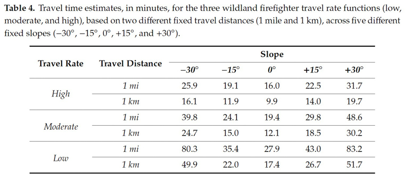
The tables below are from the research paper.

Results -- travel times by slope


Demographics of the Type 1 crews.

Here is an excerpt from the paper:

“The effects of the slope on the instantaneous travel rate were assessed by three models generated using non-linear quantile regression, representing low (bottom third), moderate (middle third), and high (upper third) rates of travel, which were validated using k-fold cross-validation. The models peak at about -3o (downhill) slope, similar to previous slope-dependent travel rate functions. The moderate firefighter travel rate model mostly predicts faster movement than previous slope-dependent travel rate functions, suggesting that firefighters generally move faster than non-firefighting personnel while hiking. Steepness was also found to have a smaller effect on firefighter travel rates than previously predicted. The travel rate functions produced by this study provide guidelines for firefighter escape route travel rates and allow for more accurate and flexible wildland firefighting safety planning.”


The authors of the paper are, Patrick R. Sullivan, Michael J. Campbell, Philip E. Dennison, Simon C. Brewer, and Bret W. Butler.

Satellite photo of smoky Western skies

September 17, 2020 | 7:24 a.m. PDT

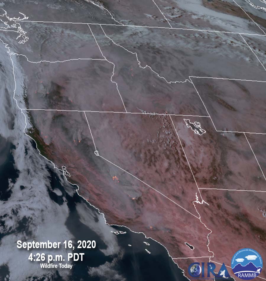
smoky western skies Satellite photo at 4:26 p.m. MDT Sept. 17, 2020
Satellite photo at 4:26 p.m. MDT Sept. 16, 2020. (an earlier photo had an incorrect date)

The satellite photo shows smoky skies in the Western states caused by wildfires in California and Oregon.

Current information about air quality and smoke can be found at https://wildfiretoday.com/tag/smoke/

Smoke and air quality maps for September 17, 2020

September 17, 2020 | 7 a.m. PDT

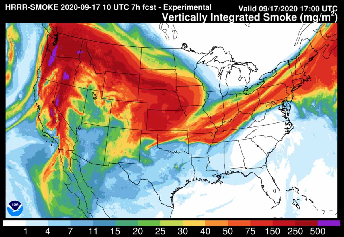
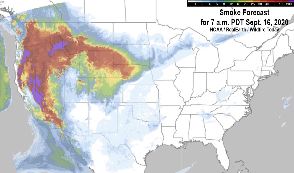
Forecast for vertically integrated smoke
Forecast map for vertically integrated smoke at 1 p.m. MDT Sept. 17, 2020

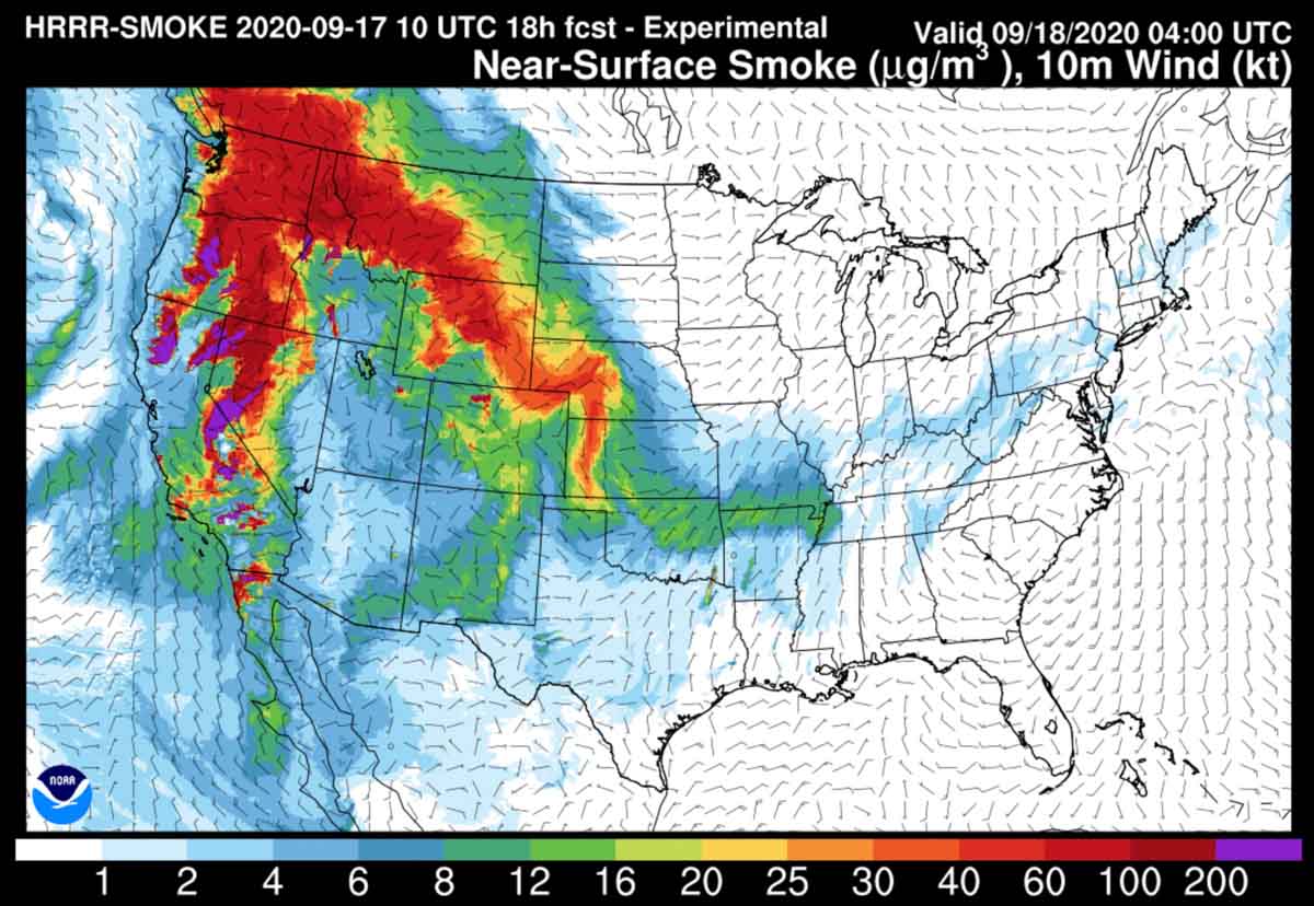
Near-surface smoke refers to the smoke that will hover within 8 meters (26 feet) of the ground—the kind responsible for burning eyes and aggravated asthma.

Vertically integrated smoke depicts all of the smoke in a vertical column, including smoke high in Earth’s atmosphere and can produce red sunrises and sunsets. In some cases where it is only at high altitudes it may not be very noticeable on the ground.

You can bookmark https://wildfiretoday.com/tag/smoke/ to always go to the latest article on Wildfire Today about smoke.

Forecast for near-surface smoke
Forecast map for near-surface smoke at 1 p.m. MDT Sept. 17, 2020
Forecast for near-surface smoke
Forecast map for near-surface smoke at 10 p.m. MDT Sept. 17, 2020.
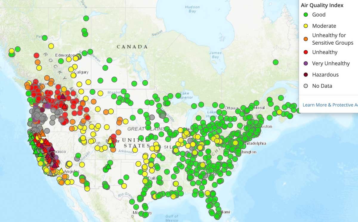
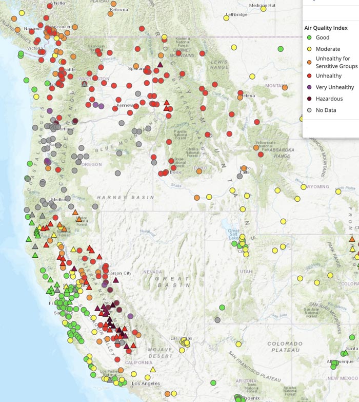
Air quality map 7:30 a.m. MDT September 17, 2020
Air quality map at 7:30 a.m. MDT September 17, 2020. AirNow.
Air quality west coast
Air quality map at 7:30 a.m. MDT September 17, 2020. AirNow.

An additional 250 active duty military personnel assigned to fire suppression duty

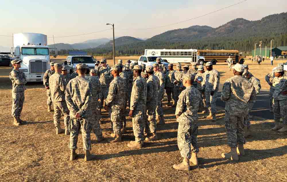
soldiers mobilized fire
File photo. Members of the Army’s Task Force First Round are briefed on the layout of the Incident Command Post after arriving at the Tower Fire, near Newport, Washington August 22, 2015. The 200 soldiers along with support personnel underwent fire suppression training prior to traveling from their home at Joint Base Lewis-McChord to assist in containing the blaze. The last use of active duty soldiers for firefighting duty in the United States was in 2018. Wildfire Today has articles about mobilizations in 200820152017, and 2018..

At the request of the National Interagency Fire Center and in support of the U.S. Forest Service, approximately 250 Marines and sailors will assist wildland firefighting efforts in Central California. The National Multi-Agency Coordinating Group (NMAC), comprised of state and federal wildland fire managers at NIFC, requested the personnel, along with command and support staff, from the Department of Defense (DOD).

The Marine unit from Camp Pendleton, California will receive wildland firefighting training before assisting with response efforts in Central California.

In late August 200 active duty U.S. Army personnel were mobilized to help battle the blazes.

Wildfire Today has articles about other mobilizations of the military in 200820152017, and 2018.

Fire leadership is concerned about the decreasing number of firefighters in the fall months

Strategies are being suggested to mitigate the shortage

Elkhorn Fire, September 3, 2020
Elkhorn Fire, September 3, 2020. Photo by Mike McMillan.

As we move into the fall months Federal fire officials at the national level are expressing concerns about how students leaving and tours of duty ending will affect the availability of firefighting resources. Today September 16 there are over 31,000 personnel nationwide working on wildfires. That is an extremely high number that has not been reached often and will be difficult to maintain if the present rate of wildfire activity continues.

In August when all hands should have been on deck, there were, and still are, severe shortages of engines and hand crews. Many fires organizations have been trying to suppress fires larger than 10,000 acres with about 20 percent of the resources they would normally have on a similar fire, back in the old days of, say 2019. Incident Management Teams were also in short supply. A Type 2 Incident Management Team from the eastern United States was assigned to a large, very complex fire threatening thousands of homes in southern California. (They may have done a great job, but it was unusual.)

As a step toward confronting the problem, the National Multi-Agency Coordinating Group issued a memo dated September 15 suggesting some strategies to mitigate an even worse possible shortage of firefighters in the coming weeks and months.

It is a lengthy letter, but here is a very condensed version of some of their suggestions for local units:

  • Hunt for additional funds to extend employees’ tours of duty.
  • As students leave for school, combine hand crews and engine crews to fill empty spots.
  • Many Incident Management Teams disband for the season; combine what’s left from multiple teams.
  • As contract periods for aircraft used by smokejumpers and helicopters end, assemble the jumpers and helitack personnel into hand crews, fire suppression modules, or have them be available for single resource assignments.

The memo had a list of attachments which were not available to Wildfire Today that appear to offer temporary exceptions to regulations about time and employment limits. We were not able find any information about additional funding.