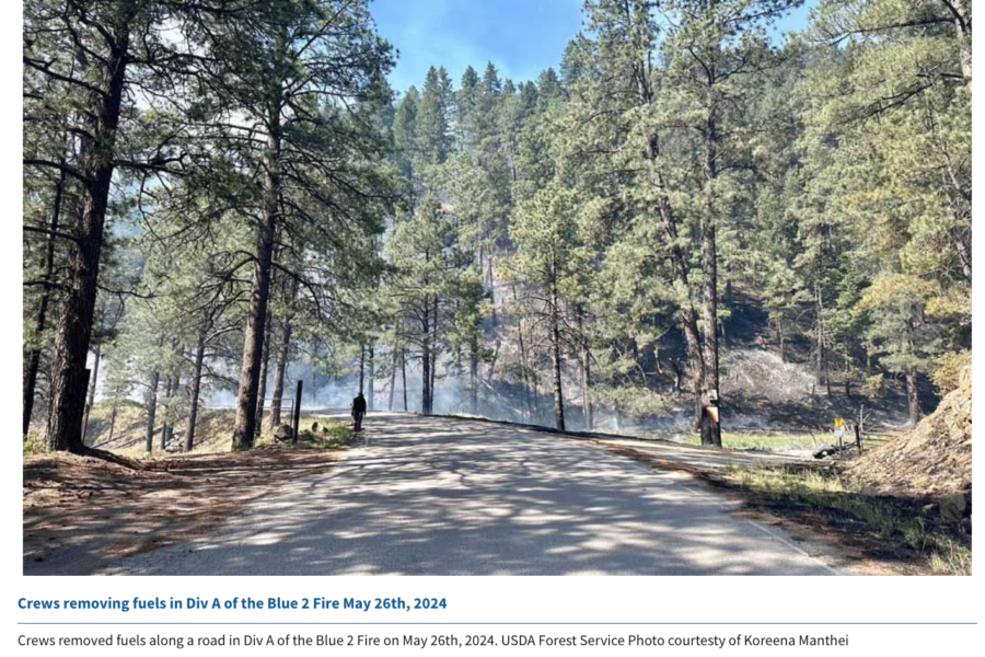
The Lincoln National Forest has issued closure orders for several trails within the White Mountain Wilderness Area on the Smokey Bear Ranger District, and air resources are actively working the 7,200-acre Blue 2 Fire today. The fire has produced more smoke and is still active, even at night, because of high temperatures and dry conditions.
Blue 2 Fire
The western boundary of the restricted area is at the junction of Forest Service Road 107 and Big Bonito trail #36 and the order is intended to protect firefighters and the public on the Blue 2 Fire. The lightning-caused fire’s just a few miles north of Ruidoso and is still at zero containment, burning in timber and understory with 10 crews and 32 engines assigned. Other resources include 6 helicopters, 6 dozers, and 5 watertenders.
According to Ruidoso News, crews are using direct tactics to build line, while aircraft are dropping water and retardant along the firelines. Fire managers are using a feller-buncher in the Ski Run Road area and crews are setting up sprinklers and hoses around local homes for structure protection.
Blue 2 Fire map — click for larger version
Updates are available on the inciweb site, and Lincoln County also has updates online.
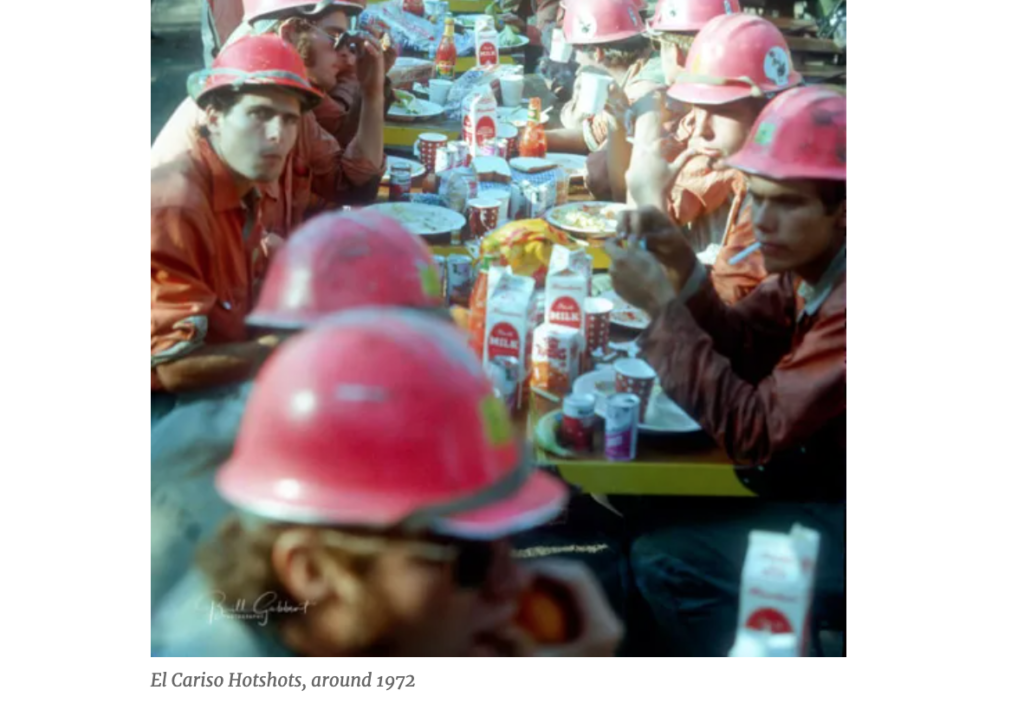
The IAWF will hold its annual national Cohesive Wildland Fire Management Strategy Workshop in Atlantic City, New Jersey from September 16 – 19. Before that, the IAWF (in partnership with the Wildland Fire Leadership Council — WFLC) is asking people to submit recipes for the upcoming “Cohesive Strategy Cookbook” that will be ready in time for the workshop.
But hurry up! Deadline is June 7 and those who submit recipes should provide the following:
Name of recipe
Ingredients with measurements
Step-by-step directions
Prep time, cook time, and total time
Number of servings
Photo of the prepared dish
The association also asks contributors to share the source of recipes if they aren’t original, e.g. Betty Crocker recipes.
Anyone who has been in a fire camp knows firefighters don’t have the privilege of gourmet-level meals. On the contrary, the USFS has received numerous requests to update and elevate firefighters’ food supply. University of Idaho researchers, for example, analyzed standard USFS food vendor menus for fire camps and found that most did not meet firefighters’ nutritional needs, including deficits of micro-nutrients, meals lacking electrolyte balances, and only minimal variety.
“We expect vendors to provide a variety of healthy options during fire season, but along with that firefighters need to understand that making healthier choices can have an impact on their performance,” researcher Heidi Holubetz said.
The USFS is expected to pass along the requests to their contract caterers with the hope of making menu modifications for the 2025 contracts. Down the road, researchers hope they can work directly with vendors for future menu updates.
UPDATE: Zach Garland, the state firefighter injured Thursday on a Kentucky wildfire, is now in stable condition at the burn center in Huntington, West Virginia. On April 25 the Pike County 2 Crew was working a wildfire when the fire shifted; Zach was trapped and burned and critically injured. He was building fireline when fire cut off his escape route. Crew members immediately called for EMS; Zach was flown to the burn center at Huntington, where he is in good spirits. Though he is medically stable, he faces a very long road to recovery; Zach suffered second- and third-degree burns to his face, arms, hands, and knees.
Zach Garland in the burn center at Huntington, West Virginia
His friend and co-worker Trey Beam has started a GoFundMe page to help with medical expenses. “Zach was protecting our Kentucky land,” writes Trey, “as well as wild horses, homes, and civilians. Zach is a dad to two young children, the youngest of whom was born on the day after Zach was injured. We are requesting contributions of any size, to assist with out-of-pocket expenses for medical bills, travel, lodging, and Zach’s lost wages. Zach and his family face a very long road ahead.”
Zach’s unexpected expenses. If you have another $20 in your pocket, he
and his wife need it more than you do — and May the 4th be with you.
Kentucky firefighters Teena Dunn and Zach Garland.
PUBLISHED 27. APRIL 2024 — On Thursday about a mile south of Stopover in Pike County, Kentucky, the Blankenship Hollow Fire early in the afternoon injured a firefighter in a burnover incident. A structure fire in Blankenship Hollow escaped into the woodland and was reported to the Hazard Branch forestry office; volunteer fire departments at the incident requested a forestry crew to assist. The Forest Ranger IC type 5 and a Pike County crew were dispatched just before 2 p.m. and arrived at 3 p.m.
Kentucky firesZach Garland running firing on a burnout operation.
Initial size-up from the IC was 10 acres burning in timber with an uphill run and high spread potential.
The IC reported that several additional structures near the fire would be their initial focus.
About 45 minutes later with structure protection completed, the IC and the crew hiked up the mountain to engage the head of the fire directly. They said they had active behavior with short-range spotting and decided to wait for a break before engaging.
Blower line on the Blankenship Hollow Fire near the site of shelter deployment. The area is hardwood leaf litter — as was 90 percent of the burn area. The area around the deployment zone was 60-100 ft hardwood with 3-12 ft beech, maple, and mountain laurel understory.
At 5:15 the IC reported a break in fire behavior and they re-engaged with direct handline construction. Firefighters began building line down both flanks and at 5:55 IC reported that a firefighter had become trapped by a spot fire, cutting him off. He said he was deploying a shelter; 3 minutes later the IC reached the crew member and began a medical assessment. Kentucky State Police out of Pikeville was contacted by dispatch; they sent EMS units and requested a life-flight medical helicopter be held on standby.
The IC and the fire crew were able to assist the injured firefighter, who walked mainly under his own power off the mountain to the waiting ambulance, where EMTs decided to request helicopter transport to the burn unit at Cabell Huntington Hospital in Huntington, West Virginia. There were no reports of other injuries.
The burned firefighter is in stable condition at the burn center this evening and is in good spirits. He endured burns on the hands, knees, and face; there will be a 72-hour followup report.
A statewide burn ban is in effect through the end of this month.
It’s with genuine sadness that we relay to you that Casey Budlong last weekend ended his battle with brain cancer; he passed away peacefully with his family by his side.
🌟 🌟 🌟 🌟 🌟
[ OBIT ]
His celebration of life is scheduled for May 4 at 2 p.m.
at the Gates Church in Gates, Oregon
🌟 🌟 🌟 🌟 🌟
Casey Budlong was diagnosed with brain cancer in August of 2018 and he went through two brain surgeries, six weeks of chemo and radiation, and another five months of intensive chemotherapy after that. He recovered well, back home in eastern Oregon, but in early 2023 he developed a severe headache and had trouble with the peripheral vision in one eye. An ER visit and a CT scan showed a new tumor in the back right side of his brain. Physicians at La Grande referred Casey and his family back to Oregon Health & Science University (OHSU) in Portland.
Casey had a long career in wildland fire on the Wallowa-Whitman. He was with the La Grande Hotshots and then worked at the airtanker base. He had an infectious smile and a heartwarming laugh.
Casey Budlong family
Casey was able to go easy — he had hospice caregivers working with him and they kept him comfortable toward his last days and mostly not in pain.
For those who haven’t heard the story, when Casey was in the Neuro ICU at OHSU after surgery in the spring, one of his nurses briefed doctors out in the hallway and didn’t realize the family could hear … she told the doctors what he’d endured and said he was amazing. “You’ve got Captain America in there!” she told them.
Scan QR code to donate to Casey’s family ••• $23,255 USD raised of $30,000 goal ••• 202 donations
In true hotshot style, Casey endured all this with strength, bravery, honesty, and humor, more aware of and concerned with others around him than he was with his own needs. His friends and family plan to wear Captain America shirts for his memorial service.
His wife Katy Budlong still has unmet medical expenses for Casey’s care, and staff at the La Grande Airtanker Base established a GoFundMe account for Katy and the family.
By Lance Gomez
It is with profound sadness that I write to announce the passing of a beloved community staple, coworker, friend, partner and father, Mark Gomez, 67.
Mark Anthony Gomez, November 19, 1956 — March 19, 2024
He passed away after a brief, yet fierce, battle with a respiratory illness. A light to all those who knew him, Mark “GoGo” Gomez was fittingly born in Los Alamos, New Mexico, known as the land of Enchantment, on Nov. 19, 1956. The middle child of Hilario and Emily Gomez, he learned from an early age how to become the glue that holds people together through laughter, storytelling and love. His early years were spent hunting and fishing in New Mexico, with some time spent in San Diego, where he honed his love of surfing and baseball. Both locations molded my father into the avid outdoorsman he was for the rest of his life.
After graduating from Pojoaque High School in 1974, this same love for the outdoors led him and his first wife, Wendy Friedman, to La Grande, Oregon, nestled deep among the forests and rivers he called home for the rest of his life. After two beautiful children, Sari and Lance, Wendy and my father parted ways. He settled into his careers at Blue Mountain Sports and on the Union/La Grande Interagency Hot Shot crews, where he forged his lifelong friendships and met my mother, Trish Wallace, his forever partner.
The next 37 years for them were filled with adventure, from backpacking across Mexico and mountain biking through Moab to skiing the mountains of the Northwest, hiking in the Eagle Cap Wilderness and firefighting during the summers on the La Grande and Union interagency crews. From fire to fisheries and recreation to engineering, my dad got to live out his passions in his work alongside his La Grande Ranger District family up until his retirement in 2019.
If I had to describe my dad in one word, it would be “fire.” Fire, for the job he cherished and the coworkers-turned-friends-turned family. Fire for his passion of fishing, exploring, and all things outdoors that fueled his career and lifestyle. Fire, for the one he lit under you when he saw your potential and pushed you toward it. Fire, because though sometimes it will burn you, it will always keep you warm and help you find your way.
In his last days, Dad’s doctor told us that “love cannot be divided, it only can multiply.”
Anyone who was lucky enough to know my dad knows this to be true. To know him is to feel infinite bounds of love. Whether he was yelling at you or for you, he was always in your corner, and I like to think we were all better people for being a part of his life. I dream he is at peace now, fishing and exploring on the great river of life. When the wind blows hard through the trees or thunder rolls in the distance, know that is my dad, sharing a bit of himself with you from above.
After many years apart, he joins his mother and father, and his oldest and youngest brothers in the afterlife. He is survived by his spouse, Trish; his sister, Cheryl; his brother, Jeff; his nieces and nephews, who adore him; his children, Sari, Lance and Logan; and his grandchildren, Tuko and Tule.
A celebration of his life will take place on May 11 starting at 1 p.m. at the Hot Lake RV Park at 65182 Hot Lake Lane, La Grande. Bring a potluck side dish and some stories. Hawaiian shirts are most certainly encouraged. Online condolences may be made to the family at lovelandfuneralchapel.com
Groundbreaking research last year found around 37 percent of burned land across North America can be traced directly back to carbon emissions from 88 major fossil fuel producers and cement manufacturers. Now, environmentalists in Canada are using the research to push for change.
The study, published last May in the journal Environmental Research Letters, used climate, burned area, and global energy balance models to determine what contribution carbon emissions had on increases in vapor pressure deficit (VPD), which partially caused a rise in burned forest area in the United States and Canada. The research concluded, along with the fossil fuel link, that carbon producer emissions contributed to 48 percent of long-term VPD rise between 1901 and 2021.
Smoke from fires in Canada traversed the Atlantic Ocean and drifted over European countries including Portugal and Spain. ~ NASA image of the day for June 27, 2023
“As loss and damage from these hazards mounts, this research can inform public and legal dialogues regarding the responsibility carbon producers bear for addressing past, present, and future climate risks associated with fires and drought in the western U.S. and southwestern Canada,” researchers said. Nearly a year later, Climate Action Network Canada advocates are using that research to advocate a new push for nationwide carbon emission limits.
June 26, 2023 Canada smoke
“To cap wildfires and other climate impacts, the government must cap oil and gas emissions,” said Climate Action Network Executive Director Caroline Brouillette. “Other sectors and everyday Canadians are reducing their emissions, while for decades the oil and gas sector has increased its pollution and pushed back against every form of accountability. Further delay benefits only oil and gas executives’ pocketbooks and climate-denying politicians.”
A survey of nearly 2,000 Canadians found that nearly two-thirds of residents support a greenhouse gas emissions cap for the oil and gas industry. The survey also found that support for an emissions cap is the highest among Canadians aged 60 or older at 71 percent and only 18 percent of Canadians said the industries shouldn’t be required to limit emissions.
Such a cap would prevent 4,800 premature Canadian deaths and yield $45 billion in economic benefits, according to research projections from the Canadian Association of Physicians for the Environment. The results were attributed to projected reductions in air pollution — specifically in nitrogen dioxide, fine particulate matter, and annual ozone — if oil and gas industry emissions are capped at 45 percent below 2005 levels by 2023, which is Canada’s national climate target.


