Above: The red squares on the map represent heat detected on the Canyon Fire by a satellite at 1:52 p.m. not long after it started September 25, 2017. The arrows directly east of the red squares show the approximate spread of the fire over the next seven hours.
(Updated at 11:58 p.m. PDT September 26, 2017)
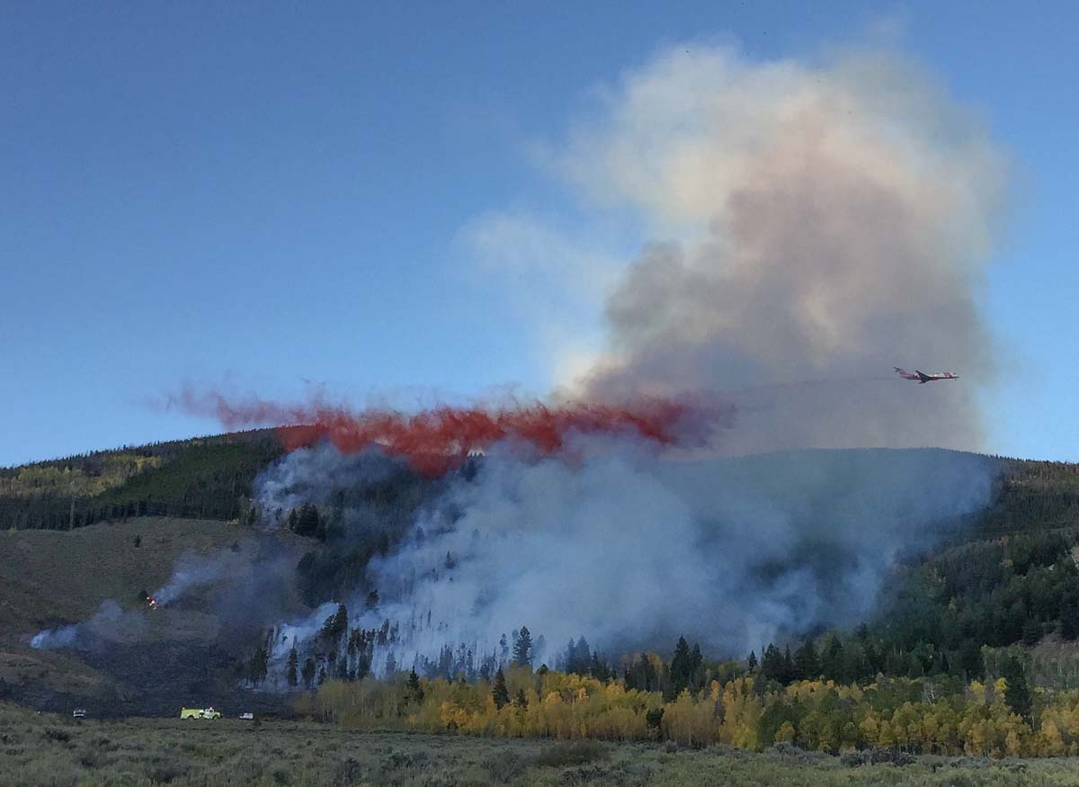
The Canyon Fire was reported around 1 p.m. PDT on Monday in southern California near Coal Canyon Road south of Highway 91. It was initially pushed to the southwest by a northeast wind. With single-digit relative humidities it spread rapidly, but by 4 p.m. the wind direction changed and began coming from the opposite direction, the southwest, at 12 to 15 mph which caused the fire to spread east more than two miles over the next five hours, approaching the outskirts of Corona.
Click HERE for the latest articles about the Canyon Fire on Wildfire Today.
By 6:15 p.m. PDT Monday evacuations had been ordered for all homes in Corona south of Green River Road from the 91 Freeway to Trudy Way, including the Orchard Glen Tract.
Current Evacuation Location: pic.twitter.com/UmyxhWBiXV
— Corona Fire Dept (@CoronaFireDept) September 26, 2017
At about 9 p.m. the Corona Fire Department estimated the fire had burned approximately 2,000 acres.

One of the first heavily populated areas hit by the Canyon Fire were the structures on the west side of Corona on San Ramon Drive and San Alvarado Circle where fire engines from Anaheim and other fire departments battled ember showers for hours, protecting the residences. At times night-flying helicopters supported them with water drops. EPN564 broadcast live several times on Periscope; some of his “scopes” may still be available to view.

The Canyon Fire appeared to start in Orange County then moved into Riverside County and later the city of Corona. There was a report that the communications sites on Sierra Peak in the Cleveland National Forest were seriously threatened. (see map)
The Orange County Fire Authority reported at 11:30 p.m. Monday that one home had been damaged. In addition, the cargo in a trailer pulled by a semi truck caught fire while traveling on Highway 91. The driver pulled over and disconnected the burning trailer from the tractor.
The Corona Fire Department reported that the helicopter water drops would continue Monday night into early Tuesday morning.
Continue reading “Canyon Fire causes evacuations near Corona, California”