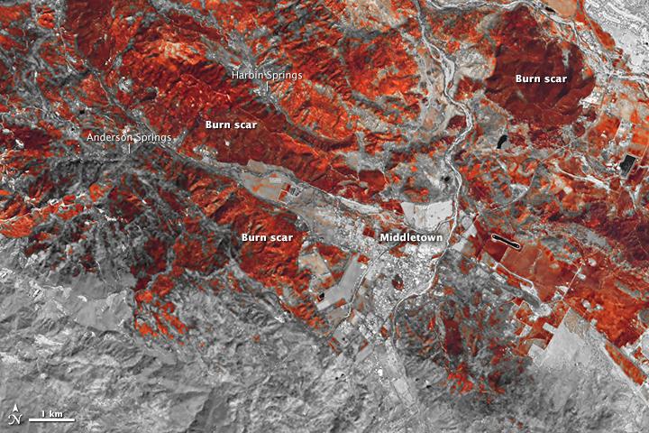
On Tuesday the Lake County Sheriff’s office announced that the body of a fourth person killed in the fire was discovered.
News and opinion about wildland fire
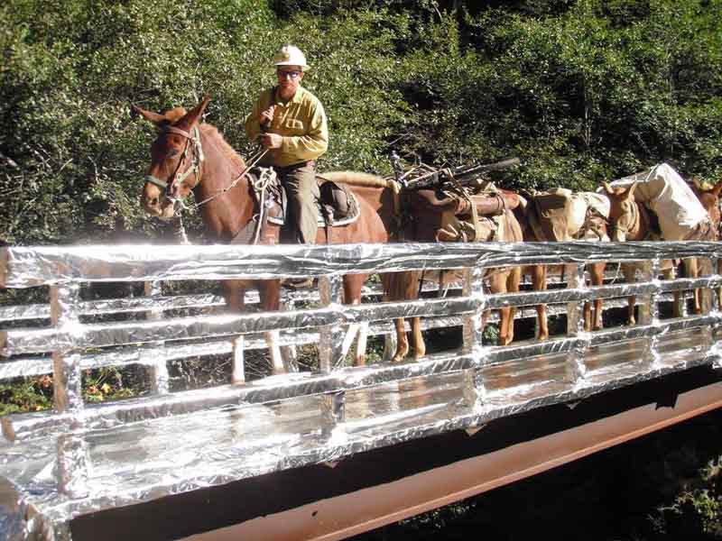
In this video, packer Erik Cordtzon of the Shasta-Trinity National Forest in northern California talks about using the Trinity Alps pack string of mules and horses, one of three pack strings on the forest, to haul cargo in and out of the River Complex of fires.

We appreciate seeing videos like this of firefighters simply talking about their job. It can give the public a better understanding of what they do and what they go through on a daily basis. It’s very easy to do this. One of the keys, however, is to have good audio. An external microphone, as used in this video, is essential — they are even available for smart phones.
If the video is uploaded to YouTube they can be seen by a much, much wider audience than if they are hidden on Drive. And Facebook videos can’t be easily embedded onto other sites.


From the U.S. Forest Service:
****
Smoke from wildfires can have an enormous impact on the public and on fire personnel, affecting health, interfering with transportation safety and upsetting tourism and local economies.
Trent Procter, like all U.S. Forest Service Air Resource Advisors, is a technical specialist with expertise in air quality science, including: air quality monitoring, smoke modeling, pollutant health thresholds and communicating about smoke risks and mitigation.
“Smoke from wildland fire is a significant source of air pollution. It can pose potential risks to health, visibility, safety and general nuisance problems. Forest managers, fire managers and air resource specialists must address these issues when and where appropriate to minimize smoke impacts to public health and welfare,” he explained.
Exposure to smoke is a concern because a large proportion of wildland fire smoke emissions are fine particulate matter that can penetrate to the deepest parts of the lungs.
Air Resource Advisors can be dispatched to an incident to assist with understanding and predicting smoke impacts on the public and on fire personnel. Whenever smoke is a concern, their objective is to provide timely smoke impact and forecast information and messages based on best-available science.
Technology plays a big part in this forecasting process.
“Satellite images, monitoring data and smoke modeling projections all inform the typical smoke forecast,” Procter explained.
The Forest Service works with partner agencies to deploy “real time” monitoring http://app.airsis.com/usfs/fleet.aspx into communities and locations where instant feedback is helpful in keeping the public and health officials informed. The monitors transmit the smoke concentrations to satellites and then back to web-based tools that help provide the smoke concentrations seen in the forecasts.
Air Resource Advisors work with multiple agencies to address public health concerns, smoke risk to transportation safety and fire personnel exposure, as well as how to reduce and mitigate smoke exposure.
As the Pacific Southwest Region’s Air Quality Manager, Procter’s work takes him throughout the state, and during this year’s drought-fueled wildfire season, he’s been busy coordinating with other agencies for appropriate response to smoke.
“The success in bringing helpful information to the public in California is a credit to our partners at the air pollution control districts and the California Air Resources Board. The staffs in these agencies are professional and so very dedicated to an emergency response that helps the public reduce or manage their exposure,” he said.
Before igniting a prescribed fire – a fire being used for specific land management objectives – managers must identify smoke-sensitive areas such as communities, hospitals and highways and use appropriate mitigation and evaluation techniques to minimize smoke impacts. Weather, climate and air quality monitoring data are used by fire managers to customize smoke management techniques as needed in these cases.
“In the case of wildfires, where managers have little or no control over what burns, many times it’s a matter of understanding fire behavior, fuel combustion and suppression techniques,” Procter explained.
“That enables us to understand how those features and management actions will play out with weather forecasts and subsequently allow a credible forecast of where smoke will go — or sometimes, more importantly, where it won’t go. Our recent efforts to improve wildfire smoke forecasting are allowing us to learn much that can improve our smoke management techniques in prescribed fire projects.”
Updated damage assessments for two recent large wildfires in California revealed that a total of 1,770 structures burned on the two fires, including 888 on the Valley Fire south of Clearlake, and 882 on the Butte Fire south of Jackson.
For the purposes of this report, “structures” includes residences, outbuildings, and commercial properties.
(UPDATE at 7:52 a.m. PT, September 21, 2015)
The latest overflight of a heat-sensing satellite at 3 a.m. PT today did not detect any large concentrations of heat on the Tassajara Fire southeast of Carmel Valley, California. That does not mean the fire is out, just that the activity has decreased to the point that the sensors, hundreds of miles above the Earth, can’t detect it.
CAL FIRE’s update at 7:35 a.m. on Monday listed the fire at 1,086 acres with 30 percent containment. There was no change in the status of damaged or destroyed structures. There are 260 personnel assigned, 35 fire engines, 7 hand crews, and 2 helicopters.
The loss of any residence is terrible, but one is especially tragic. The home of a Cachagua Firefighter, Bob Eaton, burned while he was out fighting the fire and working to save the property of others.
****
(UPDATED at 7:34 p.m. PT, September 20, 2015)
A satellite overflight at 1:01 p.m. PT on Sunday did not show much additional spread of the Tassajara Fire, which is burning 9 miles southeast of Carmel Valley in California. The area that showed the most heat was at the north end of the fire, west of East Carmel Valley Road and north of Tassajara Road.
The last update from CAL FIRE said the fire has burned 1,086 acres. They are calling it 30 percent contained. The report on structures was “10 residences damaged or destroyed, numerous outbuildings”.
CAL FIRE reported that there was a civilian fatality in the fire, but released no other details.
From the Monterey Herald late Sunday afternoon
Sheriff’s Office spokesman John Thornburg said firefighters found a car in the burn area, put the fire out, and found the body of a male of unknown age.
Slostringer shot this excellent video at the Tassajara Fire on September 19. It starts off with a retardant drop by a P2V air tanker, but be sure to watch what happens at 3:30, which illustrates a common mechanism of injury for many wildland firefighters.
r
****
(Originally published at 7:47 a.m. PT, September 20, 2015; updated at 8:47 a.m.)

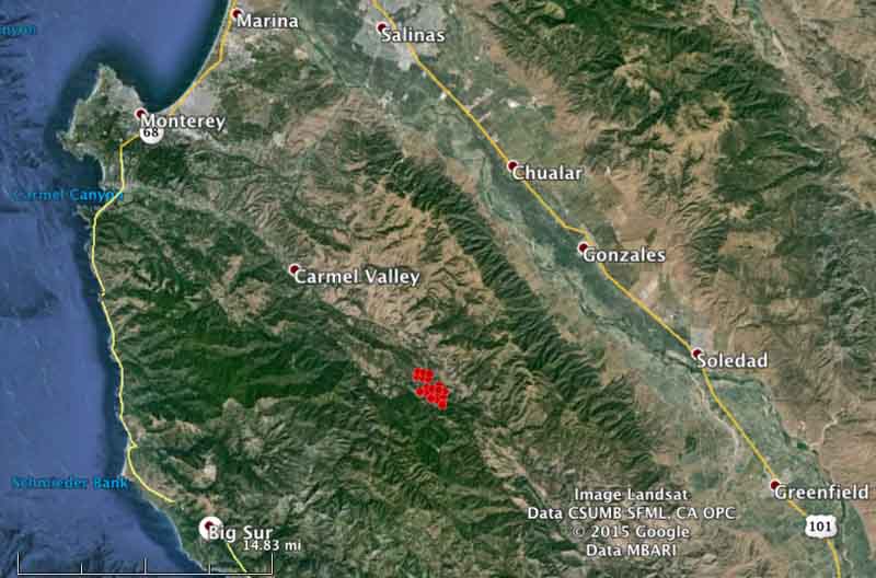
The Tassajara Fire 9 miles southeast of Carmel Valley, California has burned approximately 1,200 acres, according to CAL FIRE in a late Sunday night update. The fire was reported at about 3 p.m. Saturday and grew quickly. Sunday morning CAL FIRE reported it is holding at 1,200 acres, is 10 percent contained, and 10 residences have been damaged.
The fire is just north of Jamesburg, 14 miles west of Soledad, and 13 miles northeast of Big Sur. As of 1:41 a.m. PT on Sunday it was burning west of East Carmel Valley Road, and on both sides of Tassajara Road/Conejo Grade, according to data from a heat-sensing satellite.

Resources working the fire include 5 air tankers, 2 helicopters, 35 engines, and 27 crews. CAL FIRE planned to have their fire aviation assets available or over the fire at 8 a.m. Sunday.
At about the time the fire started, the temperature at the Hastings weather station 2 miles northeast of Jamesburg was 92, the relative humidity was 15 percent, and the winds that afternoon were 8-12 mph with gusts up to 20 mph.
The forecast for Sunday calls for very warm conditions: temperature near 100, variable winds of 2-7 mph, and a relative humidity of 10-15 percent.
