This satellite photo shows smoke from the Decker Fire Wednesday evening as the lights were starting to be turned on in the Denver and Colorado Springs areas.
The fire has burned approximately 4,000 acres.
News and opinion about wildland fire
Unplanned vegetation fires
The fire has burned over 4,000 acres south of Salida, Colorado
This satellite photo shows smoke from the Decker Fire Wednesday evening as the lights were starting to be turned on in the Denver and Colorado Springs areas.
The fire has burned approximately 4,000 acres.
Winds on Wednesday caused some movement to the east
Above: Morning briefing at the Decker Fire, October 3, 2019. IMT photo.
(UPDATED at 9:01 a.m. MDT October 3, 2019)
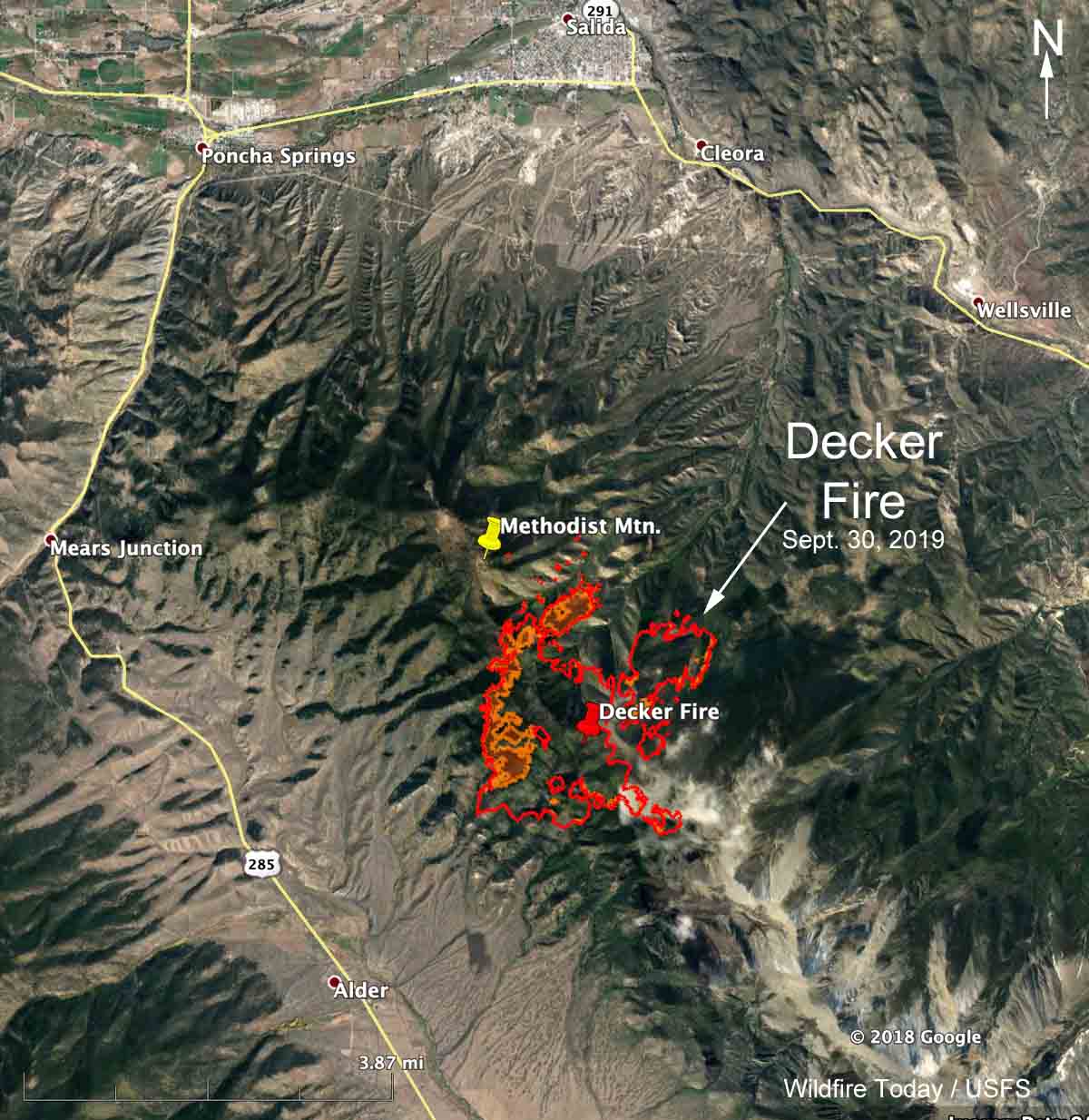
Strong winds gusting at over 25 mph out of the west on Wednesday pushed smoke from the Decker Fire to the east toward Colorado Springs. The wind combined with the relative humidity dipping down to the ridiculously low 2 percent at Salida resulted in the northern portion of the fire to spreading to the east. (see map below)
(To see all articles on Wildfire Today about the Decker Fire, including the most recent, click here.)
There was no fixed wing aircraft mapping flight Wednesday night due to mechanical problems with the plane. The map below shows heat detected by a satellite as late as 3:48 a.m. Thursday, but that data from hundreds of miles overhead is not as accurate as an aircraft 5,000 to 10,000 feet above the ground. So consider the dots that represent heat to be approximate locations. With that in mind, the fire may or may not have approached or crossed the boundary of the Rio Grande National Forest, the green line.


The Rocky Mountain Type 1 Incident Management Team assumed command of the fire at 7 am. Thursday.
Resources assigned to the fire Wednesday evening included 8 hand crews, 10 engines, and 5 helicopters for a total of 259 personnel. Approximately $1.9 million has been spent on managing this less-than-full-suppression fire to date.
We will update this post as more information becomes available.
(UPDATED at 3:50 p.m. MDT October 2, 2019)
Continue reading “Evacuations ordered at the Decker Fire south of Salida, Colorado”
Due to crowning, extreme fire behavior, and rapid growth a Type 1 Team has been ordered
(Originally published at 6:38 p.m. MDT October 1, 2019)
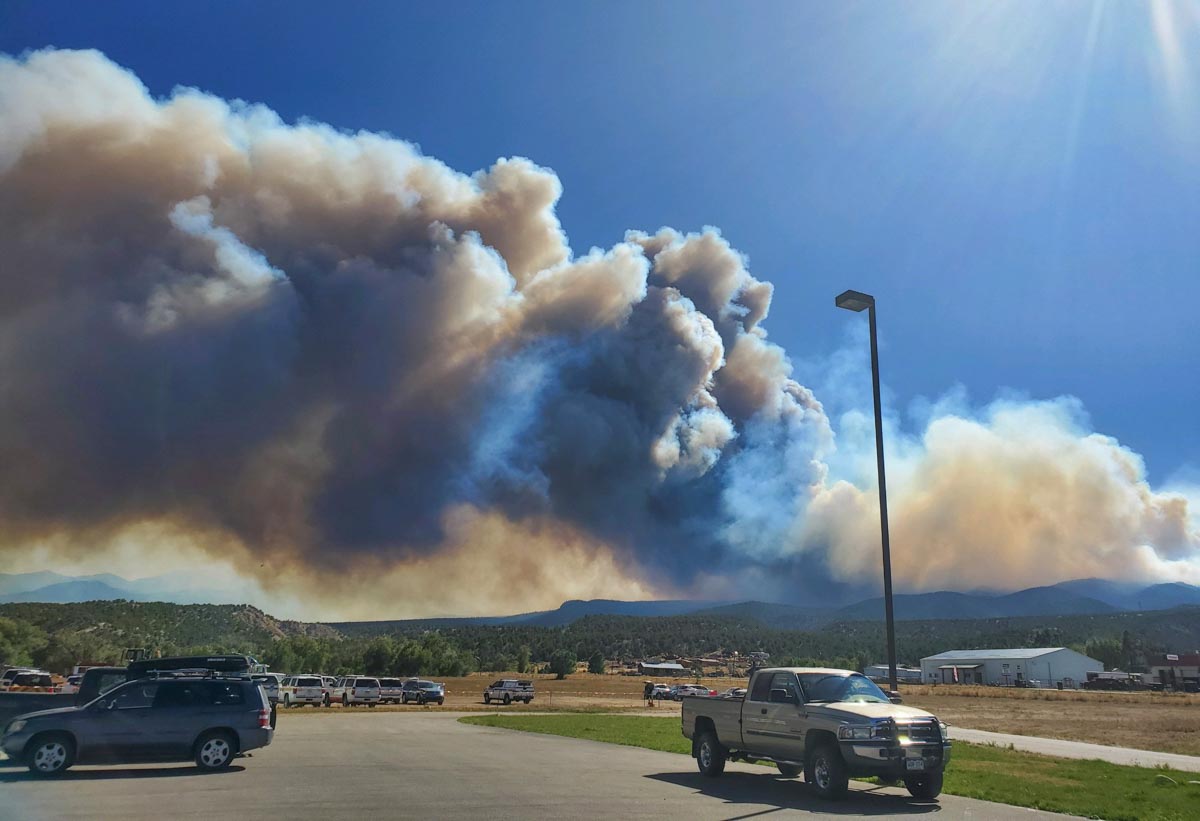
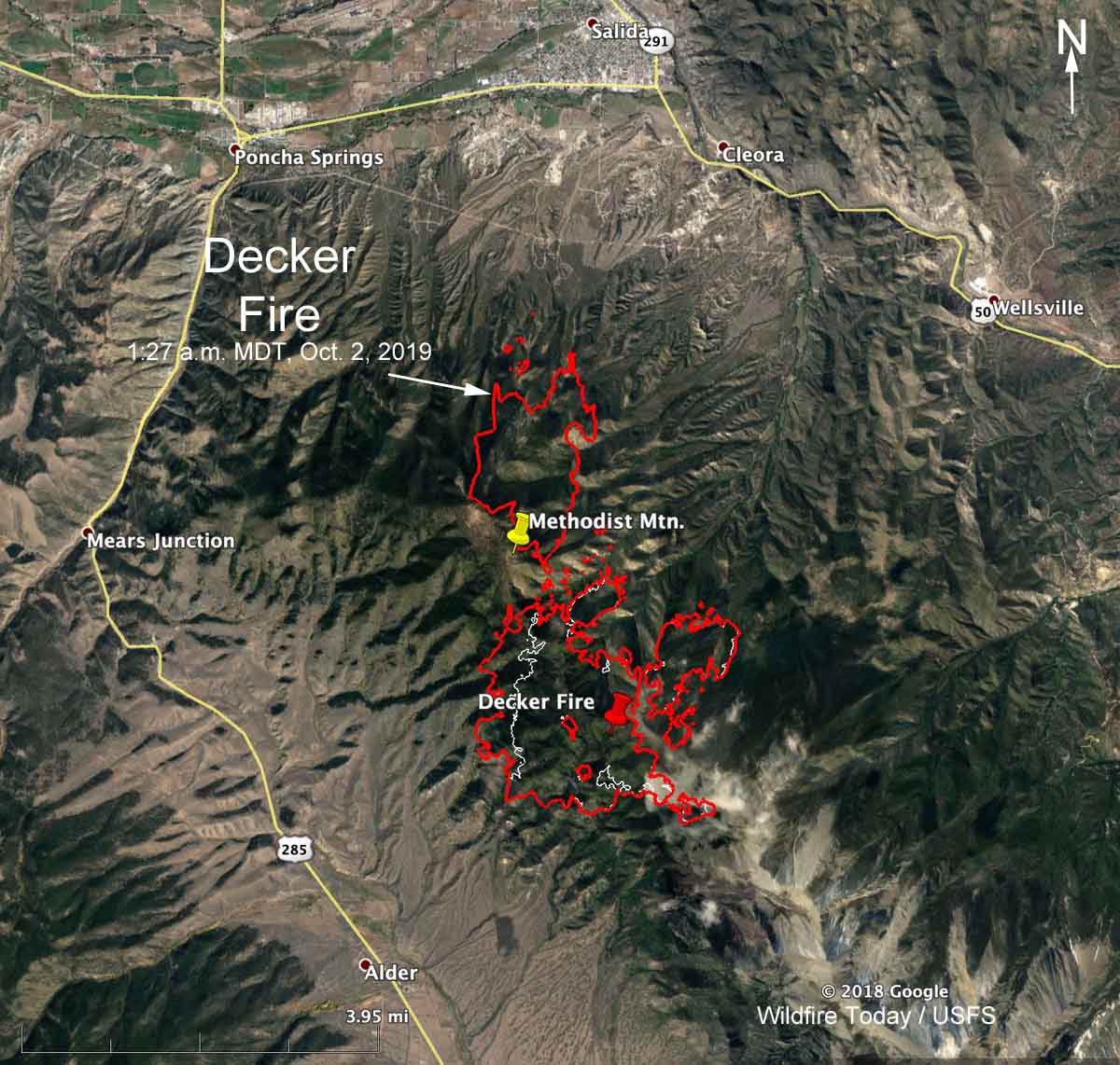
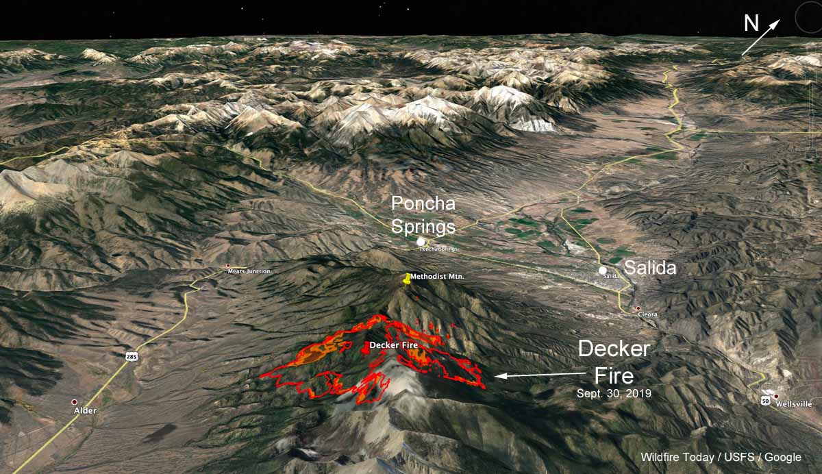
Firefighters have been herding around the Decker Fire that has been burning since September 8 five miles south of Salida, Colorado. (see map) But 16 percent relative humidity and strong winds gusting out of the south at over 40 mph Tuesday afternoon caused the fire to spread toward the north and northeast. Late Tuesday afternoon a very large plume of smoke could be seen by a satellite moving northeast in the general direction of Denver 95 miles to the northeast.
(To see all articles on Wildfire Today about the Decker Fire, including the most recent, click here.)
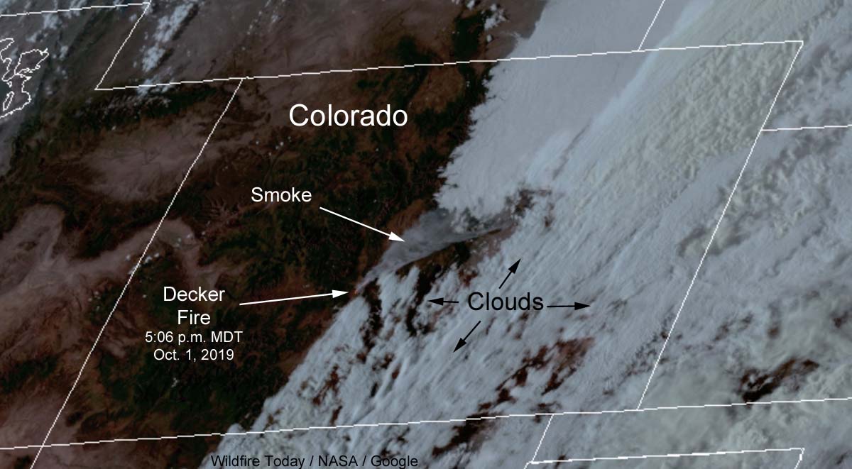
In response to the extreme fire behavior and crown fires seen on Tuesday, a Type 1 Incident Management Team, the Rocky Mountain Team, has been ordered is scheduled to in-brief at 6 p.m. on Wednesday.
A mapping flight Monday night determined that the fire had burned 2,206 acres. At that time most of the fire activity was on the north and northwest sides. Spot fires have occurred east of Methodist Mountain, with one just a quarter mile away from the communications towers on the peak.
Tuesday night the temperature at the elevation of the fire, about 10,000 feet, will drop to 37 degrees but the humidity will remain fairly low for nighttime at that elevation, around 38 percent. The southwest wind at 17 to 23 mph will continue pushing the fire to the northeast. On Wednesday forecasters expect 49 degrees, 11 percent RH, and winds out of the west at 22 gusting to 33 — conditions that could be conducive to additional fire growth.
Maple trees are so valuable and prized by woodworkers, especially those who manufacture musical instruments, that it is a violation of the law in Washington to transport the wood without a state-issued specialized forest products permit. Armed with a permit that authorized the harvesting of maples from private land, Justin Andrew Wilke and Shawn Edward (Thor) Williams and others camped for several days in the Olympic National Forest scouting for big leaf maple trees with the highly desired figured wood pattern. They identified trees containing figuring by “checking” the trees, that is, using an axe to peel back the bark to expose the pattern of the wood, sometimes doing it at night to avoid detection.
When they found a tree they liked they would fell it with a chain saw, buck it up, and transport the wood to a mill in Tumwater, Washington, presenting the permit and saying it had been harvested with permission from private property. According to the federal grand jury indictment, Wilke and/or Williams made more than 20 trips to the mill between April and August of 2018, collecting more than $13,000 by selling illegally harvested National Forest timber.
The theft was going fine for the two men until they ran into a problem on August 3, 2018 near the Elk Lake Lower Trailhead. Their latest target contained a bee’s nest that made it difficult or impossible to fell the tree. Spraying wasp killer was not effective, so they agreed that Mr. Wilke’s plan to burn them out with gasoline was the next step.
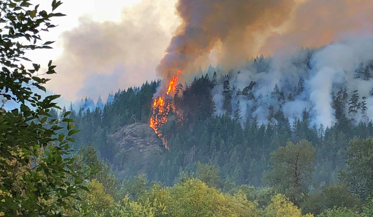
The indictment does not specify if the fire got rid of the bees, but the men were not able to put it out with water bottles. The fire, named “Maple”, ultimately burned 3,300 acres.
When a U.S. Forest Service Law Enforcement Officer questioned Mr. Wilke on August 4 about the fire and his timber-poaching activity, he told the officer that he had not been cutting timber, did not have a chain saw, and knew nothing about the fire. It turned out that he had concealed his saw to hide it from investigators.
Mr. Wilke and Mr. Williams were charged with multiple felonies related to timber theft and starting the fire. Mr. Williams had previously been in trouble with authorities in Florida for firearms violations.
From the Washington Post, October 1, 2019:
A spokesperson with the U.S. attorney’s office told The Washington Post that Wilke pleaded not guilty during a court appearance on Monday and remains detained. His trial will begin in December. Williams is in state custody in California and will be transported to Washington state to be arraigned, the spokesperson said.
Thanks and a tip of the hat go out to Tom. Typos or errors, report them HERE.
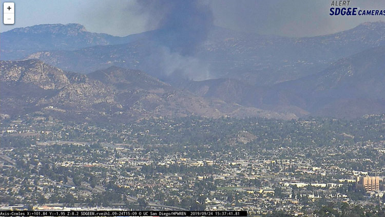
It started Tuesday at 3 p.m. five miles east of El Cajon, California
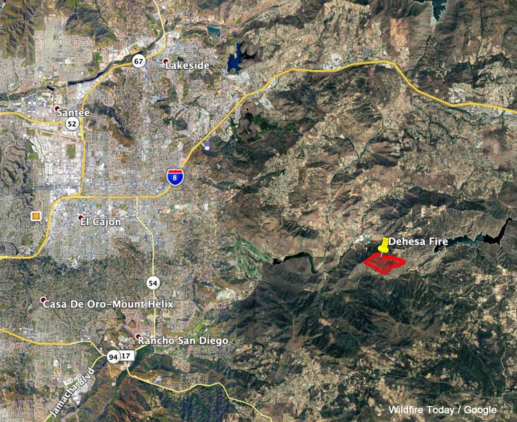
With an aggressive attack from the ground and the air firefighters stopped the Dehesa Fire after it burned 200 acres 5 miles east of El Cajon, California.
The fire spread rapidly south of Dehesa Road between the Sequan Truck Trail and Sloane Canyon Road after it was reported at 3 p.m. Tuesday. By 5:15 p.m. firefighters had the spread knocked down, hemmed in between roads and retardant drops.

Wednesday morning resources assigned to the Dehesa Fire include 20 fire engines, 1 dozer, 5 water tenders, and 8 hand crews for a total of 350 personnel.
#DehesaFire in Dehesa [update] Evacuation orders have been issued for Portions of Sycuan Truck Trail and Sloan Canyon Rd. Evacuation warnings have been issued for Portions of Dehesa Rd east of Sycuan Casino. Sycuan Casino is NOT being evacuated. pic.twitter.com/xk9ZNEhlKX
— CAL FIRE/SAN DIEGO COUNTY FIRE (@CALFIRESANDIEGO) September 25, 2019
#DehesaFire in Dehesa [update] The fire is currently 150 acres and 0% contained. There are 3 homes threatened and none have been evacuated. @calfiresandiego is in unified command with Syrian Fire and @SDSheriff pic.twitter.com/upbe9IttU9
— CAL FIRE/SAN DIEGO COUNTY FIRE (@CALFIRESANDIEGO) September 25, 2019
#DehesaFire in Dehesa [update] PIO en route to Sloan Canyon Road and Dehesa Rd. pic.twitter.com/IX75TBXXBE
— CAL FIRE/SAN DIEGO COUNTY FIRE (@CALFIRESANDIEGO) September 24, 2019

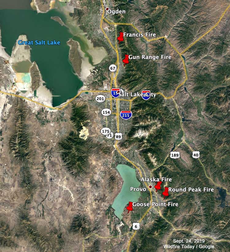
A Utah couple has been cited by the U.S. Forest Service for having a campfire that escaped and started what became the 365-acre Gun Range Fire near Bountiful, Utah on August 30, 2019. The fire was named after the nearby Lions Club gun range.
KSL is reporting that the U.S. Attorney’s Office confirmed that Ashlyn Nelson and Jeremy Flores were issued a ticket for leaving a campfire without fully extinguishing it. Campfires, per se, were not illegal, but allowing it to escape and ignite a wildfire, of course, is.
The fire forced the evacuation of 400 homes and was fought by multiple hotshot crews, air tankers, and helicopters in addition to a large number of local firefighting resources.
Other fires that have occurred recently in the greater Salt Lake City area since July 17, 2019:
