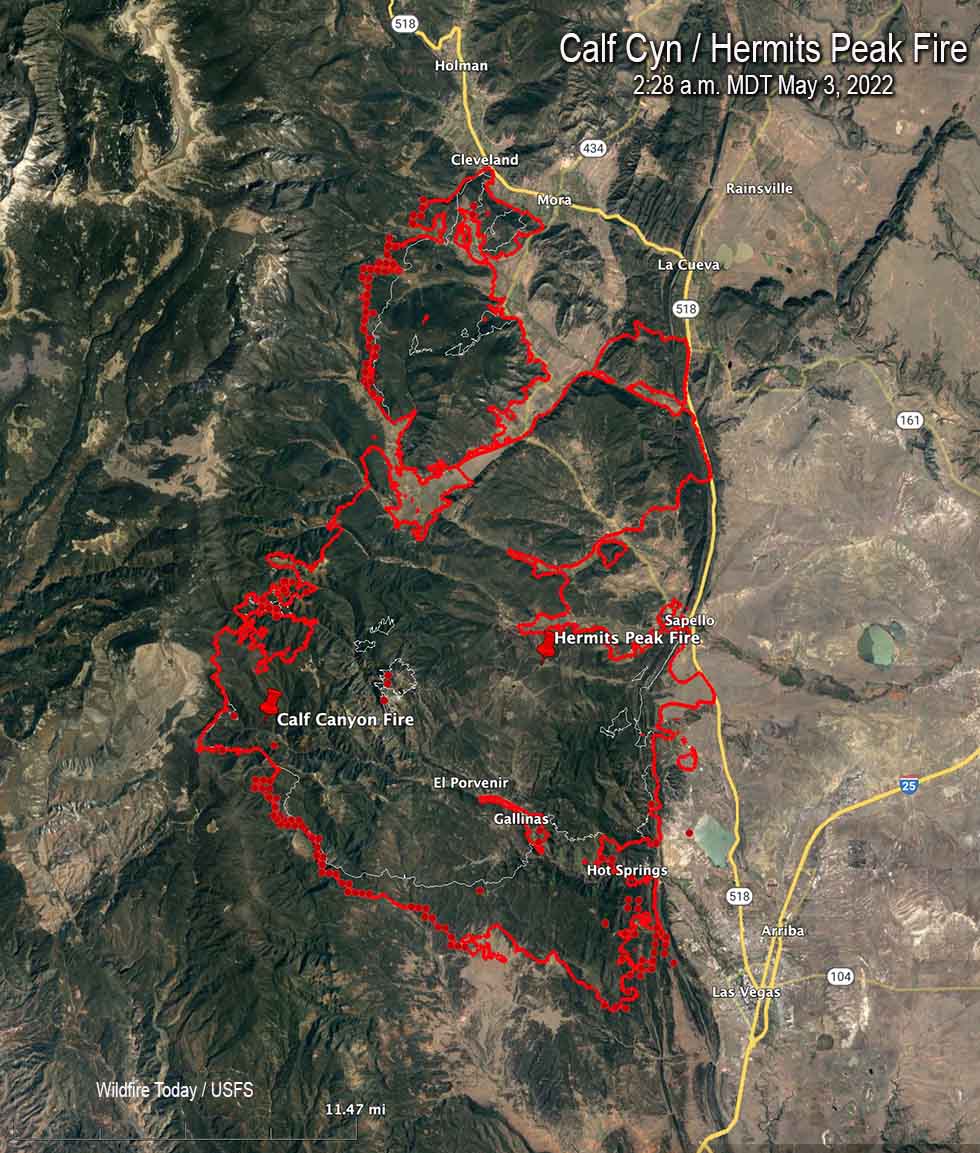
Map of the Calf Canyon / Hermits Peak Fire. The red line was the perimeter at 10:25 p.m. May 2. The white line was the perimeter about 24 hours before. The red dots represent heat detected by a satellite at 2:28 a.m. MDT May 3, 2022.
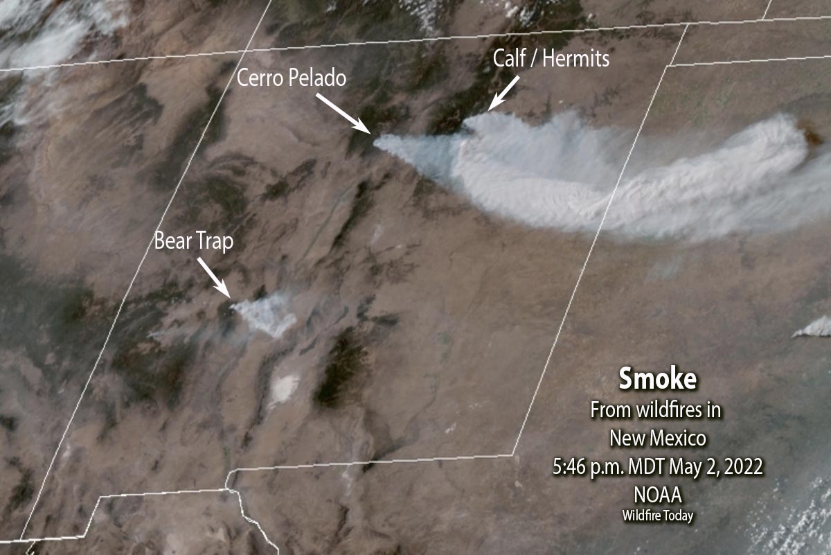
In spite of satellite photos showing massive amounts of smoke being generated by the Calf Canyon / Hermits Peak Fire, information released by the incident management team indicated that firefighters were able to make progress in several key areas of the fire on Monday. Large firing operations were conducted to widen fire lines and remove fuels ahead of a wind shift that could threaten communities.
The fire grew Monday to 145,854 acres, an increase of about 25,000 acres.
Satellite photo showing smoke created by wildfires in New Mexico, 5:46 p.m. MDT May 2, 2022. NOAA.
In addition to other aircraft, three DC-10 Very Large Air Tankers worked the fire Monday, dropping a total of nearly 28,000 gallons of retardant.
Structure protection crews have been removing fuels around buildings and securing lines around populated areas.
A Red Flag Warning is in effect Tuesday for nearly the entire state of New Mexico. The weather forecast is for 25 mph winds gusting out of the southwest at 37 mph with relative humidity of 12 percent. There is a slight chance of showers in the afternoon. On Wednesday the wind speeds will decrease to 20 mph from the west with the minimum humidity remaining at 12 percent.
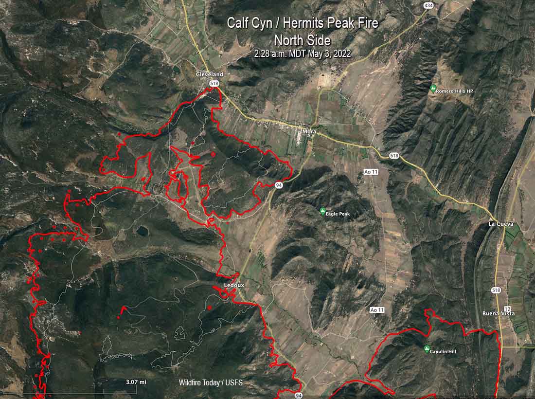
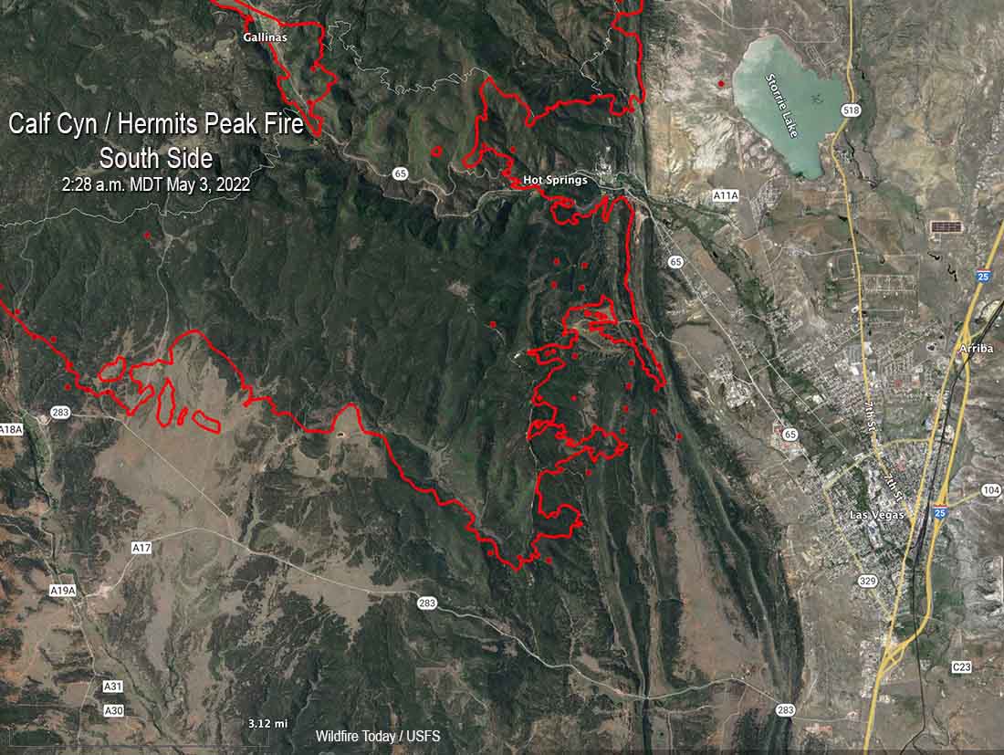
Below are maps of the north and south sides of the Calf Canyon / Hermits Peak Fire.
Map of the north side of the Calf Canyon / Hermits Peak Fire. The red line was the perimeter at 10:25 p.m. May 2. The white line was the perimeter about 24 hours before. The red dots represent heat detected by a satellite at 2:28 a.m. MDT May 3, 2022.Map of the south side of the Calf Canyon / Hermits Peak Fire. The red line was the perimeter at 10:25 p.m. May 2. The white line was the perimeter about 24 hours before. The red dots represent heat detected by a satellite at 2:28 a.m. MDT May 3, 2022.
Resources assigned Monday evening included 20 hand crews, 14 helicopters, and 89 fire engines for a total of 1,085 personnel.
S-2T air tanker drops on the Cactus Fire, April 30, 2022. @BrookesLori.
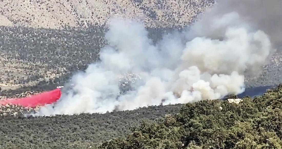
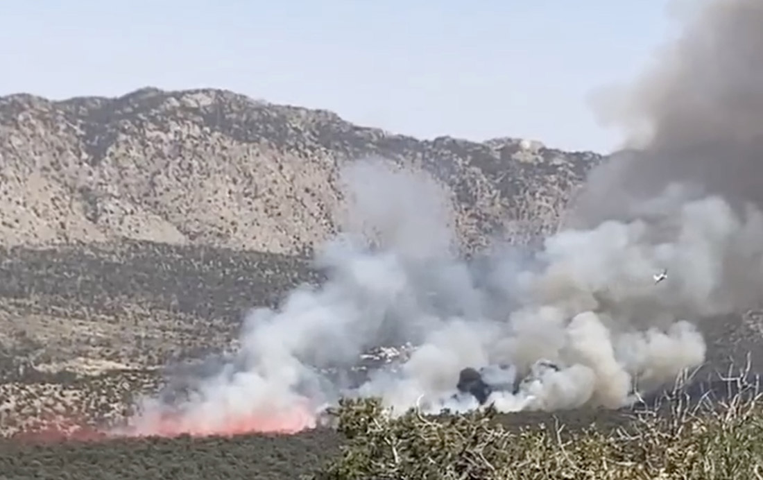
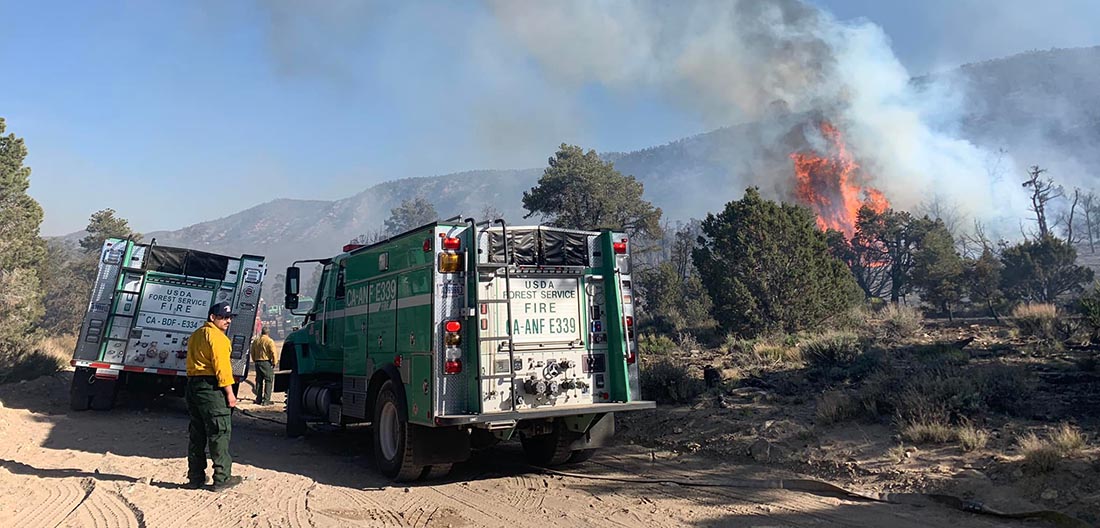
Yesterday firefighters stopped the spread of a wildfire in Southern California in the San Bernardino National Forest after it burned about 35 acres in Cactus Flats east of Big Bear Lake. Soon after it started it was putting up a smoke plume with occasional puffs of dense black smoke. The incident commander ordered a total of six fixed wing air tankers which assisted firefighters as they installed a hose lay around the perimeter.
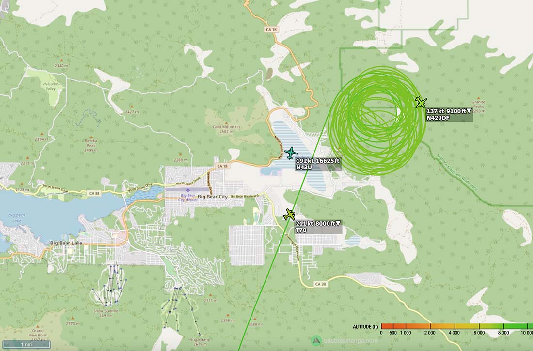
Cactus Fire, April 30, 2022. @jojacalienteCactus Fire, April 30, 2022. San Bernardino NF photo.Map showing the location of aircraft over the Cactus Fire at 3:17 p.m. PDT April 30, 2022. ADS-B Exchange.
The video below was shot by the FIRIS aircraft at 2:22 p.m. PDT April 30, 2022.
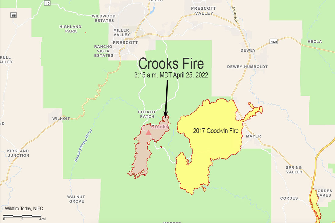
3-D Map of the Crooks Fire, looking north. The red line was the perimeter at 3 a.m. MDT April 28, 2022. The white line was the perimeter two days before.
The northwest side of the Crooks Fire 8 miles south of Prescott, Arizona was very active Wednesday. In the last two days the section of the fire near Golden Eagle Road/Forest Road 97B has spread one mile to the west. Strong winds out of the south with 10 percent relative humidity contributed to the rapid spread. Wind gusts of 30 mph drove the fire west of Lookout Mountain toward Dosoris Canyon, pushing smoke into Prescott and surrounding communities. Crews were successful in holding the 52 Spur Road to keep the fire west of the affected communities. Most of the east side saw little or no movement Wednesday.
According to the Incident Management Team the fire has burned 9,014 acres.
Map of the Crooks Fire. The red line was the perimeter at 3 a.m. MDT April 28, 2022. The white line was the perimeter two days before.
On Thursday dozers and hand crews will work to strengthen the containment lines along Forest Service Road (FSR) 82. Favorable terrain may allow firefighters to access the fire’s edge west of Lookout Mountain, with the assistance of aircraft. Structure protection remains a key tactical objective and crews continue to perform defensive operations throughout the area.
Resources assigned as of Wednesday evening included 20 hand crews, 41 fire engines, and 14 helicopters for a total of 855 personnel.
The weather forecast for Thursday at 7,200 feet elevation calls for 21 mph gusting out of the south and southwest at 30 mph with relative humidity in the mid-teens. The elevation at the fire ranges from 5,000 to 7,000 feet. Friday the winds will decrease to 15 mph with 22 mph gusts from the west with 10 percent relative humidity.
Firefighters set up sprinklers to protect structures in the Mt. Tritle area. USFS photo, April 27, 2022.
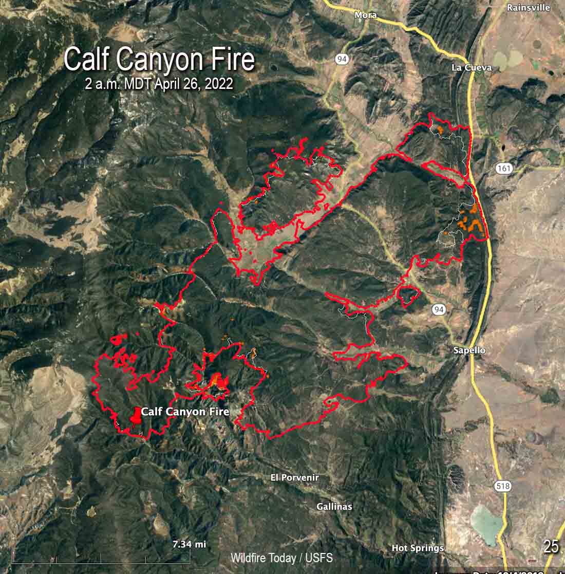
Map of the Calf Canyon Fire after it merged with the Hermits Peak Fire. The red line was the perimeter at 2 a.m. MDT April 26, 2022. The white line was the perimeter about 24 hours before.
With more favorable weather conditions and less active fire behavior on the Calf Canyon and Hermits Peak Fires, on Monday firefighters were able to engage in operations in areas that had previously been difficult to reach safely.
There was incremental growth on Monday. The fire was mapped by an aircraft at 2 a.m. MDT Tuesday and found to have burned 60,173 acres. That is the combined size of the two fires that merged.
Firefighters were able to engage aggressively across the fire area yesterday, capitalizing on the favorable weather conditions.
To see all articles on Wildfire Today about the Calf Canyon and Hermits Peak Fires, including the most recent, click HERE.
“Fire managers are determining where to focus resources based on weather, terrain, predicted fire behavior, and values at risk,” according to a statement issued by the Incident Management Team.”These decisions are based on the highest probability of success and flexible options in the event of sudden changes in weather or fire behavior.”
Law enforcement agencies are assessing impacts the fire had on structures and will be notifying property owners once confirmed.
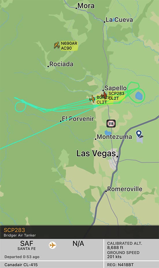
Map shwing two CL-415 air tankers on the Calf Canyon Fire, April 26, 2022. The track of one, Tanker 283, is displayed. FlightRadar24.
Beginning Monday and continuing on Tuesday, four water-scooping air tankers have been obtaining water from Lake Isabel and dropping it on the fire. To date, the scoopers along with other aircraft have delivered over 265,000 gallons. The lake is 8 miles east of the east side of the fire, which would be about a 5 minute one-way trip carrying up to 1,600 gallons of water. The map above shows the track of one of two CL-415 air tankers working the fire at 10:52 a.m. on Tuesday. An icon for a second CL-415 is also seen, but without its track — they often work in pairs.
Hermits Peak Fire by @jennalunaphoto
The wind will be out of the southwest at 20 mph Tuesday increasing to 24 with gusts to 32 on Wednesday. The forecast calls for the relative humidity to be in the high teens Tuesday, and on Wednesday in the 20s with a chance of thunderstorms and a small amount of rain.
The fire is eight miles south of Prescott, Arizona
4:38 p.m. MDT April 25, 2022
Crooks Fire map, 3:15 a.m. MDT April 25, 2022
A wind from the north on April 25 pushed the Crooks Fire three miles to the south in Ash Creek, increasing the size to 5,893 acres according to a fixed wing flight very early Monday morning. The northern edge of the blaze is 8 miles south of Prescott, Arizona. The east side is about a mile west of the Goodwin Fire that burned about 28,000 acres in 2017 (see map above).
The north wind provided good conditions Monday to complete firing operations on the north side to prevent spread to the northwest into Lookout Mountain and Dosoris Canyon. Throughout the day and into the night, firefighters extended the fireline south of Lookout Mountain toward Ash Creek and from Moscow Peak west to Senator Highway.
Crooks Fire as seen from Mt. Union Lookout, April 23, 2022. IMT photo.
Fire managers are planning contingency lines south and west of the fire in case winds push the fire in those directions.
Resources assigned include 19 hand crews, 38 fire engines, and 12 helicopters for a total of 675 personnel.
Weather
At 3:30 p.m. MST Monday at the Prescott Airport (elevation 5,043) the relative humidity was 9 percent, the temperature was 72, and the wind was east-southeast at 3 mph. The elevation at the fire ranges from 5,000 to 7,000 feet.
The weather on Tuesday and Wednesday could produce an increase in the rate of spread of the fire. The forecast for the area on Tuesday is for 20 mph winds out of the south gusting around 30, with relative humidity in the teens and the temperature in the 60s. On Wednesday the conditions will be similar but with winds a little stronger, 23 mph gusting to 26 mph. Thursday will be about the same as Wednesday.
Satellite photo showing smoke from the Crooks Fire at 3:01 p.m. MDT April 25, 2022.
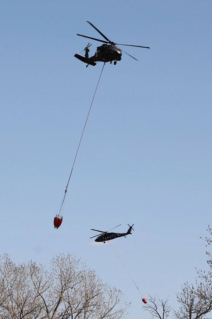
Blackhawk helicopters from the Nebraska National Guard drop water on the Road 702 Fire west of Cambridge. Incident Management Team photo.
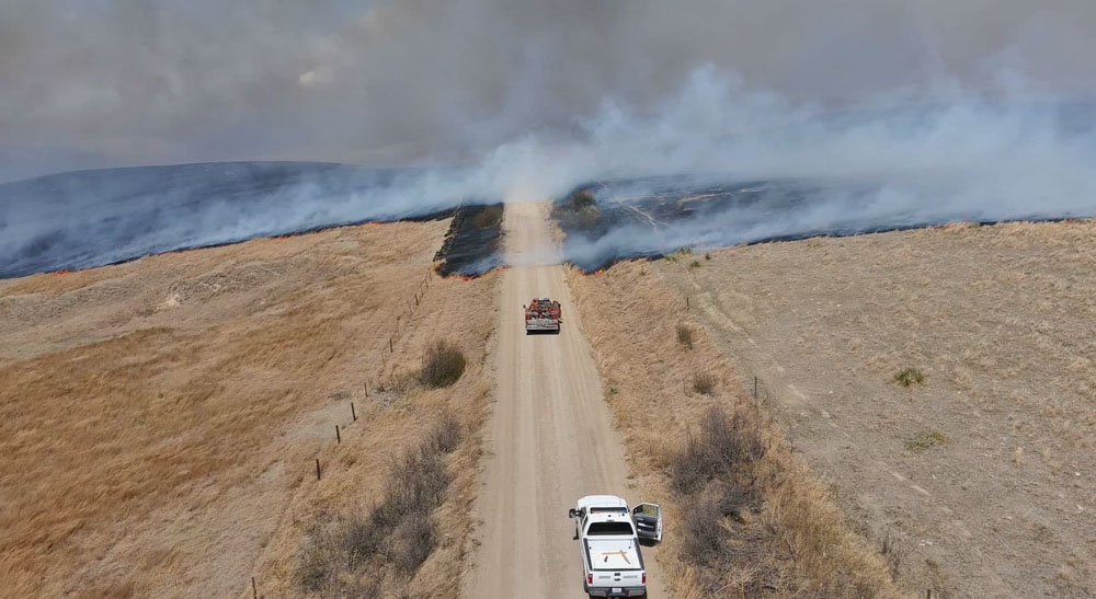
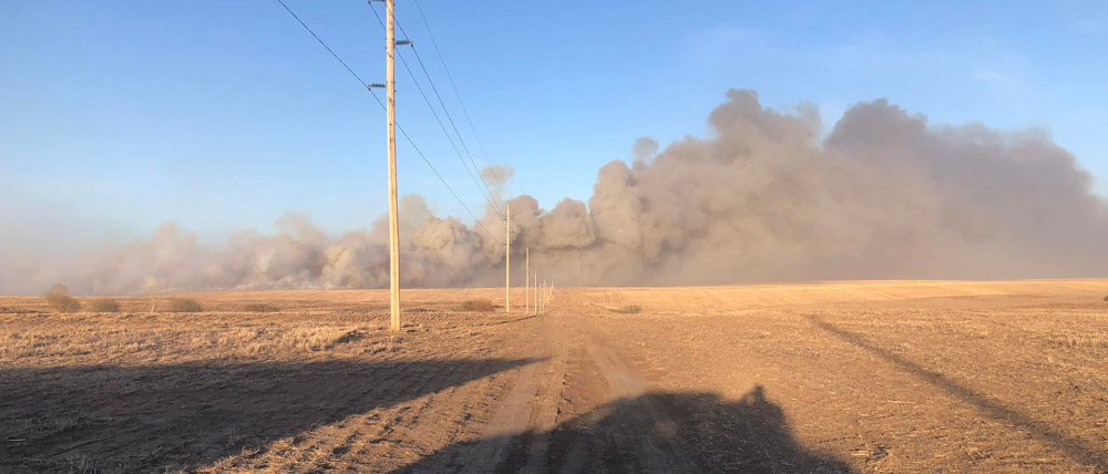
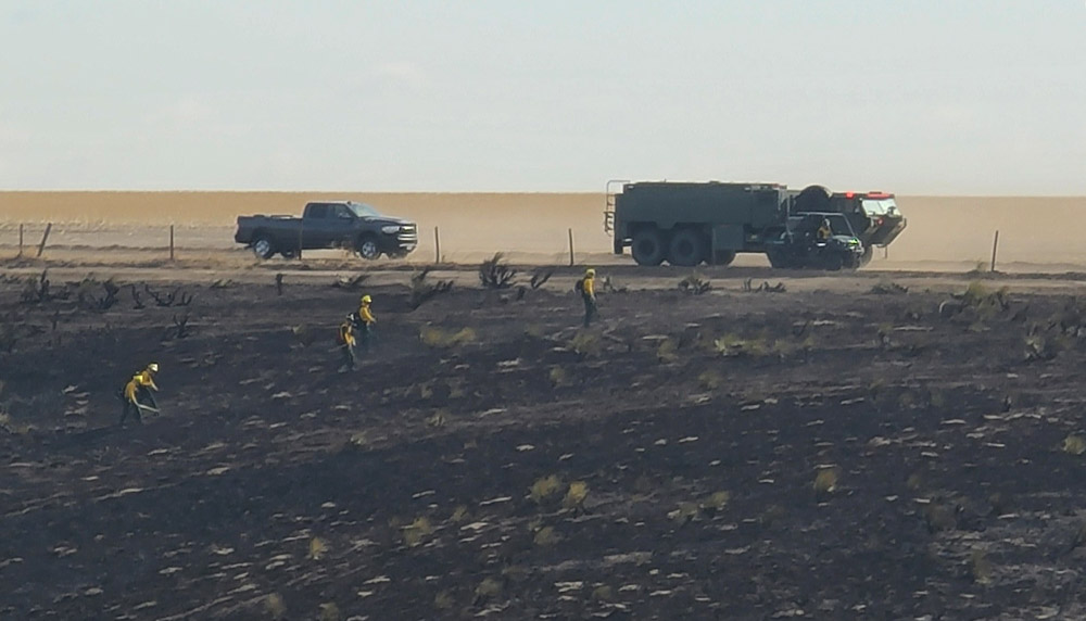
Firefighters made good progress Monday on the Road 702 Fire in southwest Nebraska.
Most of the fire impacted grass and crop lands, but there are woody draws which have heavier fuels, especially on Beaver Creek along Highway 89 and near the Republican River south of US 34. Those areas are receiving more attention from firefighters as they are mopping up. Incident Commander Rob Powell said there will be smoke in those draws for a while.
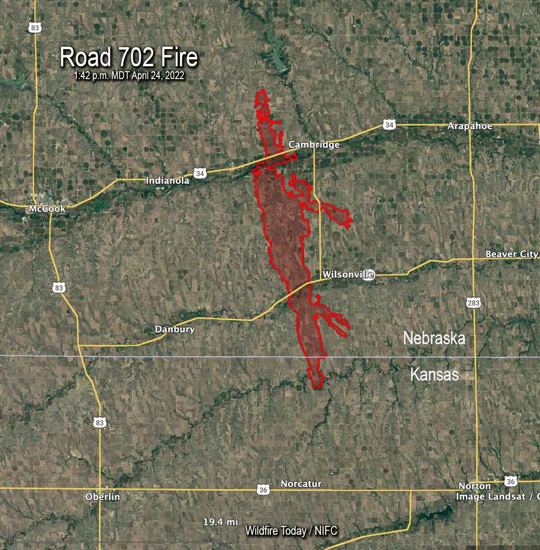
The most recent map produced at 4 p.m. MDT April 25 shows an increase of about 300 acres to bring the total up to 41,448 acres, due to a four mile long finger of fire north of US 34 northeast of Bartley that was not detected during an earlier mapping flight. Fire crews have contained all of the fire north of the highway, including the additional acreage.
The fire started in Kansas on Friday April 22 during a wind event which pushed it north quickly into Nebraska where it continued running. The fire was 27 miles long when firefighters were able to stop it two miles southwest of the Medicine Creek Reservoir.
Video captures a helicopter from the Nebraska Army National Guard dropping water on The #Road702Fire near Cambridge, Nebraska on April 24. The blaze has spread to an estimated 50,000 acres. #NEwx
Map of the Road 702 Fire at 1:42 p.m. MDT April 24, 2022.
A retired fire chief died in a Nebraska fire that has burned 41,155 acres in the southwest part of the state. The Road 702 Fire is west of the towns of Cambridge and Wilsonville and has crossed both US 34 and State highway 89. About 1,500 acres of the blaze is in Kansas.
Alyssa Sanders, with the Nebraska Emergency Management Agency, said 66-year-old John P. Trumble, of Arapahoe, was overcome by smoke and fire after his vehicle left the road Friday April 22 during conditions of poor visibility caused by smoke and dust. His body was found early Saturday. He was assisting firefighters by serving as a spotter in Red Willow County.
Road 702 Fire. Nebraska State Patrol drone photo.
Nebraska National Guard has mobilized three helicopters and several support trucks to help battle the fire.
A Type 1 Incident Management Team from the Rocky Mountain Geographic Area led by Incident Commander Dan Dallas assumed command April 24.
Stephanie Shively with the Incident Management Team said Monday morning that the resources on the fire include 9 engines, one 20-person crew, and the 3 National Guard helicopters for a total of about 100 personnel. They have outstanding orders for dozers and another hand crew.
Ms. Shively said the size of the fire has not changed since it was mapped Sunday.
We send our sincere condolences to the family, friends, and co-workers of Chief Trumble.
Road 702 Fire. Posted April 24, 2022 by Loomis Volunteer Fire & Rescue.Nebraska Army and Air National Guard firefighters work the edges of a burned area near Hayes Center, Neb., April 24, 2022, to extinguish hot spots and prevent reignition. Photos courtesy of Capt. Joshua Miller.