We asked the Forest Service how firefighting will change during the pandemic

“There will be a hard stop on how we traditionally respond to incidents”

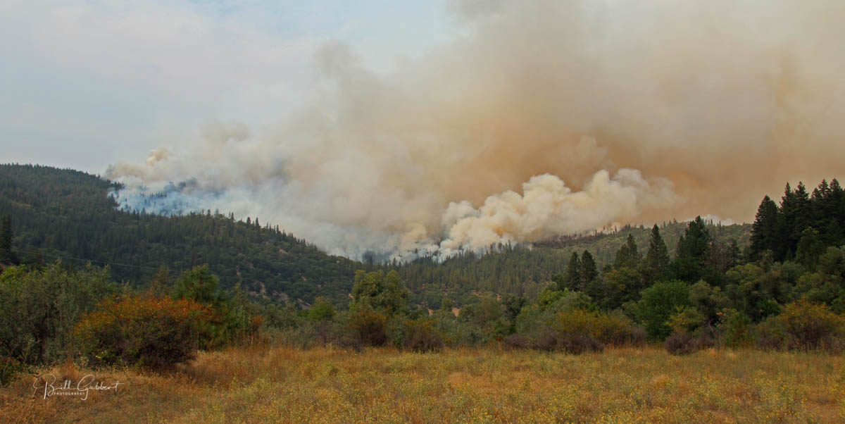
Beaver Fire, northern California August 12, 2014 Beaver Fire, northern California August 12, 2014. Photo by Bill Gabbert.

The COVID-19 pandemic will change the way we attempt to suppress wildfires. In an effort to dispel or confirm some of the rumors floating around, by email I asked Kaari E. Carpenter, a Lead Public Affairs Specialist with the Forest Service, questions about what will be different during this fire year. The responses have been edited for length and applicability.

Q. Will firefighters travel as they always have to fight fires outside their park/forest/district/state? If not, what are the new rules?

R. In this new environment it can be expected that there will be a hard stop on how we traditionally respond to incidents. In order to maintain social distancing for the safety of our firefighters, teams and the public it can be expected that our responses will occur as virtually as possible in the coming months.

There will be firefighters on the ground, but the public will see a different approach to how we organize to suppress a fire.  These new organizations will be smaller in nature using some of the same tactics and strategies for line building and point protection that has been used in the past.  The site of a large fire camps will not be the norm any longer. Most of the efforts will be in small groups and dispersed into isolated camps or other means to provide our firefighters and the public better social distancing and safety from spread of COVID-19.

Question: Are firefighters initially reporting for duty for the season required to quarantine for 14 days?

Response: Currently, the wildland fire management agencies, in close coordination with their state and local partners, are taking the necessary steps to ensure their ability to deploy wildland firefighting resources.

While COVID-19 circumstances are rapidly evolving, wildland firefighting agencies are actively assessing potential risks and developing plans to mitigate those risks as the COVID-19 response continues.

Q. What products have been created by the recently deployed Area Command Teams?

R. Best Management Practices (BMPs) are being developed for all aspects of fire management response. These BMPs are being developed with input from a wide variety of sources including Subject Matter Experts (SME) from Fire Response, Fire Management, Agency Medical Committees, Enterprise Risk Managers, Researchers, Social Scientists, and all National, State and Local Health departments. BMPs will be designed to incorporate direction from Local, State, National and CDC, and Wildland Fire Response Agencies. BMPs will be provide guidance for responding personnel on how to safely implement fire and support tactics and strategies.

These BMPs and the overall Wildland Fire Response Plans are in development with the Geographic Areas (GACCs), but none are approved at this time.  When they are approved they will be housed as living documents at the GACC level with BMPs available online to the public.

Q. How many large air tankers will actually be working on exclusive use contracts this year?

R. The total number of Next Generation Airtankers currently under exclusive use contracts with the Forest Service is 18.

(Note from Bill: The recently awarded Next Gen 3.0 Exclusive Use [EU]contract for five additional large air tankers has been protested. For now, those five air tankers will not be used, and probably will not be until the Government Accountability Office issues their ruling which is due July 15, 2020. That will leave 13 large air tankers on EU contracts, the same as in 2019.)

Q. In light of the COVID-19 pandemic and a probable reduction in ground-based fire suppression capability, what are the plans, if any, to activate and use this year, more than in the past, additional Call When Needed large air tankers, Type 1 helicopters, Type 2 Helicopters, and CL-415 scoopers? Or, is it expected that CWN aircraft will be used with about the same frequency as in previous years?

R. The USDA FS is considering all of the options built into the current aviation contracts.

Update on COVID-19 Incident Management Team assignments

From the National Interagency Coordination Center, here is a list of the Incident Management Teams that were assigned to COVID-19 pandemic related issues on April 10, 2020:

–Area Command teams (Team 1 Stutler, Team 2 Sexton and Team 3 Jalbert) along with IMT2 (EA Silver Team) have been assigned by the National Multi-Agency Coordinating Group (NMAC) to develop a national COVID19 wildland fire response plan.

–NIMO (Houseman) has been assigned to COVID-19 support at Forest Service headquarters in Washington D.C.

–IMT1 (GB Team 2) has been assigned to Intermountain R4 Regional Office COVID-19 Support, providing complexity analysis, risk assessments and short/long-term planning guidance.

–IMT1 (NW Team 3) has been assigned to the Spokane Regional Health District, WA, assisting with strategic planning and building capacity.

Fire aviation in Australia, graphically

Bloomberg graphic fires wildfires air tankers Australia
Bloomberg graphic showing the flight paths of North America based air tankers that travelled to Australia for their 2019-2020 wildfire season.

When a reporter for Bloomberg asked me if she could interview me I said OK, as long as I could have the rights to publish the article on my web site — Mira Rojanasakul said yes. I thought the article, written with Hayley Warren, was going to be primarily about air tankers, and those used in Australia in particular, but now that it has been published today I see that it also covers how climate change is affecting wildfires down under and in the United States.

In addition to being a writer, Ms. Rojanasakul is an accomplished graphics editor for Bloomberg. And that’s why I’m writing about this article and why you should check it out. She takes graphics to a higher level.

Here are some samples.

Bloomberg graphic fires wildfires air tankers Australia
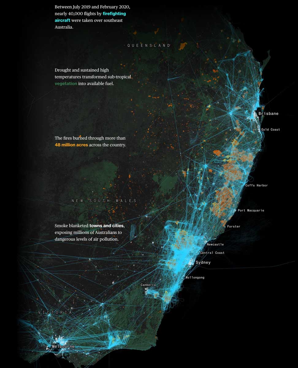
Bloomberg graphic, showing the flight paths of various firefighting and mapping aircraft in Australia.

A very impressive large animated version of the graphic below is on the Bloomberg website.

Bloomberg graphic wildfires bushfires australia fire aviation
Between July 2019 and February 2020, nearly 40,000 flights by firefighting aircraft were taken over southeast Australia.
Bloomberg graphic fires wildfires air tankers Australia
The occurrence of wildfires in Washington, Oregon, and California showing how some of them occurred during the summer bushfire season in Australia. If aviation resources are going to be shared between North America and Australia, this information comes into play. Bloomberg graphic.
Bloomberg graphic fires wildfires air tankers Australia
Bloomberg graphic
Bloomberg graphic fires wildfires air tankers Australia
Bloomberg graphic

Wildfire burns closer to Chernobyl

On April 10 a large wildfire was within a few kilometers of the Chernobyl nuclear reactor that exploded in 1986

Chernobyl Fire Map photo
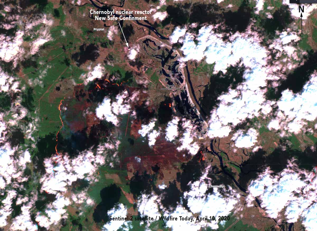
Sentinel-2 satellite photo showing the wildfire burning in the exclusion zone near Chernobyl, Ukraine. April 10, 2020.

(UPDATED at 4:11 p.m. EDT April 11, 2020)

The Sentinel-2 satellite photo above was taken April 10, showing the wildfire approximately 3 kilometers south of the New Safe Containment structure that covers the remains of the Chernobyl nuclear reactor that exploded in 1986 at Pripyat. The area in the photo is similar to that shown in the map below which includes heat detected by a satellite.


(Originally published at 10:59 p.m. EDT April 10, 2020)

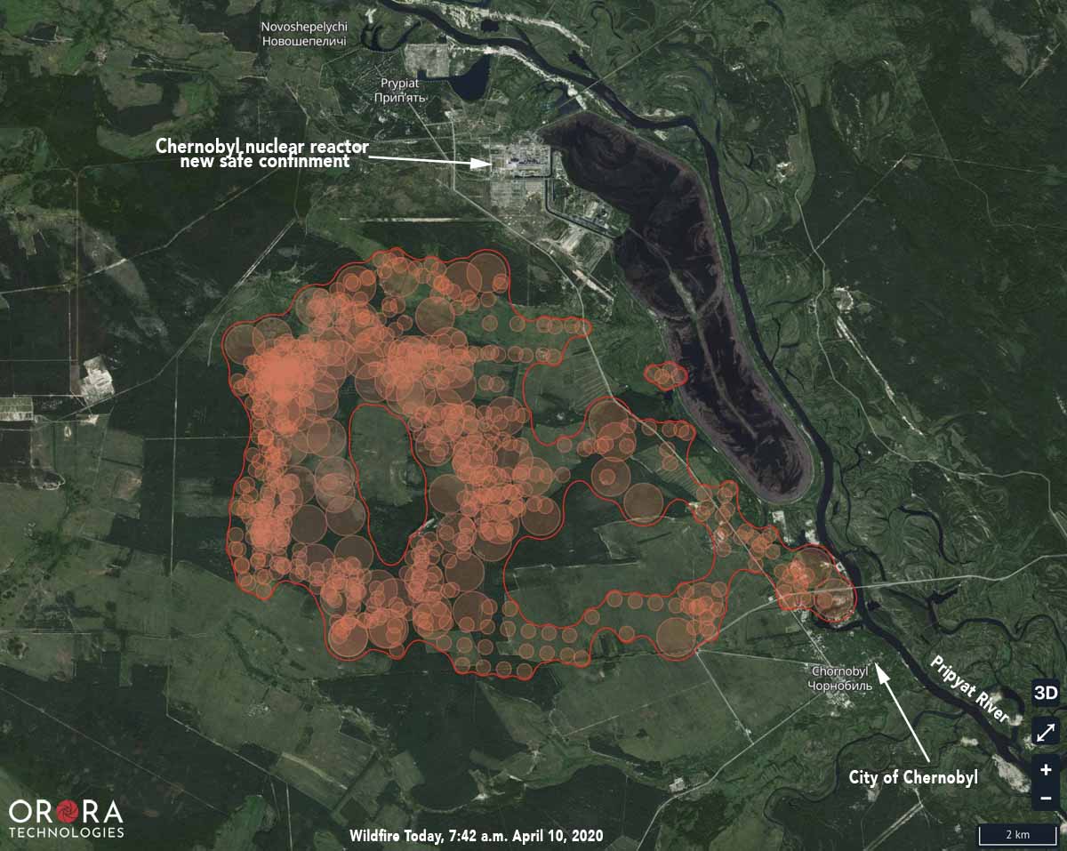
Chernobyl Fire Map
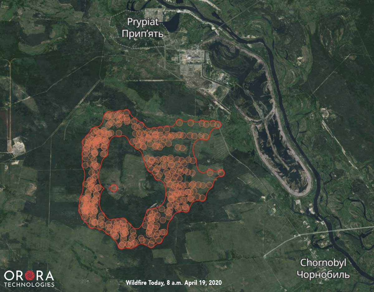
The map shows heat detected over the previous seven days, as late at 7:42 a.m. EDT April 10, 2020 on a wildfire burning in the exclusion zone near Chernobyl. Heat was detected somewhere within each of the circles on the map.

A wildfire that started April 4 in Ukraine has spread rapidly in the last two days to come within approximately 3 kilometers of the New Safe Containment structure that covers the remains of the Chernobyl nuclear reactor that exploded in 1986 at Pripyat.

Satellites detected heat from the fire at 7:42 a.m. EDT April 4 showing the fire extending to the Pripyat River just north of the abandoned city of Chernobyl.

Our very unofficial estimates based on the satellite data put the size at about 7,000 hectares (17,300 acres) as of Friday morning. The fire has been spreading east and southeast.

In recent days elevated radiation levels have been detected near wildfires burning in the exclusion zone around the Chernobyl nuclear power plant. People are not allowed to live within 19 miles of the closed facility, however about 200 people have remained in the area despite orders to leave.

New Safe Containment structure Chernobyl
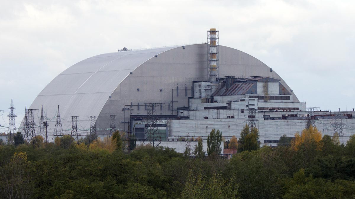
New Safe Containment structure over the remains of the Chernobyl nuclear reactor. Photo by Tim Porter.
Chernobyl Fire Map 8 am EDT 4-9-2020
The map shows heat detected as late at 8 a.m. EDT April 9, 2020 on a wildfire burning in the exclusion zone near Chernobyl, approximately 24 hours before the map at the top of the article.

Meet the Jackson Hotshots

Jackson Hotshots
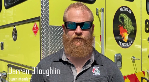
Darren O’loughlin, Superintendent, Jackson Interagency Hotshot Crew. Screenshot from the video below.

The Jackson Interagency Hotshot Crew is the only Bureau of Land Management Hotshot Crew east of the Mississippi River. Formed in 1997, the crew has fought wildfires from Alaska to Florida. They have been called upon to assist with numerous national emergencies, including Ground Zero after 9/11 and search and recovery operations from the Space Shuttle Columbia. The Hotshots were also involved in recovery efforts following several devastating hurricanes, including Katrina, Rita and Sandy. They are based in Jackson, Mississippi.

The crew is supported by Historically Black Colleges and Universities as well as the International Association of Black Professional Firefighters Foundation. The Jackson Hotshots are also committed to working with veterans and veteran organizations such as Team Rubicon.

Split Ditch Fire burns hundreds of acres in southern New Jersey

The fire is expected to grow to 1,500 acres

Map Split Ditch Fire
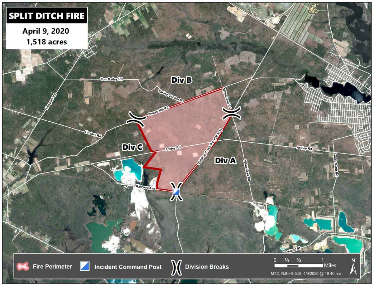
Map of the Split Ditch Fire, April 9, 2020. New Jersey Forest Fire Service.

(Updated at 9:16 p.m. EDT April 9, 2020)

The Split Ditch Fire in southern New Jersey has burned approximately 250 acres 4 miles southwest of the Millville Executive Airport and 12 miles south of Vineland.

“Crews are making an indirect attack utilizing existing fuel breaks and county roads,” said Micheal Achey of the New Jersey Forest Fire Service. “The fire is estimated to be 1,500 acres by the time of containment. Firing operations will continue until morning.”

The blaze has been pushed by winds out of the west-northwest gusting above 40 mph per hour with relative humidity in the high 20s and temperature in the high 50s.

Wind speed Thursday afternoon at Millville Municipal Airport
Wind speed Thursday afternoon at Millville Municipal Airport, NJ.

The Split Ditch Fire is being fought by 30 personnel on 10 Type 6 engines, 4 dozers, and one UH-1H helicopter operated by the state.


(UPDATE at 11:18 a.m. EDT April 10, 2020)