Map showing the location of smoke at 5 p.m. CDT April 14, 2018.
Smoke from wildfires in the southern plains spread Saturday, April 14 through areas in Kansas, Oklahoma, Texas, Arkansas, and Missouri.
News and opinion about wildland fire
Map showing the location of smoke at 5 p.m. CDT April 14, 2018.
Smoke from wildfires in the southern plains spread Saturday, April 14 through areas in Kansas, Oklahoma, Texas, Arkansas, and Missouri.
The man was helping firefighters by operating a motor grader.
Above: Satellite photo showing smoke from some of the fires in western Oklahoma. The red dots indicate heat.
A man working on a wildfire in Oklahoma was killed April 12, 2018. The Oklahoma Office of the Chief Medical Examiner reports the 61-year-old died Thursday in the western part of the state as a result of injuries sustained while working on the Shaw Fire. Television station KOCO reported the man was helping firefighters by operating a motor grader.
Our sincere condolences go out to his family, friends, and coworkers.
The Shaw Fire that started Thursday in Roger Mills County south of Durham is being monitored and is now being mopped up. This fire is approximately 7,250 acres.
By our very unofficial estimates the Reah Fire, another fire in Oklahoma, has burned at least 130,000 acres between Leedy and Putnam. Other towns threatened by this fire are Vici, Taloga, and Camargo where evacuations have been ordered.

Woodward County Emergency Management reports the 34 Complex Fire that started Thursday is still burning. Numerous fire departments and task forces are responding. Oklahoma Forestry Services is supporting the fire with both air and ground assets. This fire is now about 59,000 acres.
The Emergency Price Stabilization Act is in effect for the 52 counties listed in the governor’s executive order, declaring a state of emergency due to wildfires.
More on the Emergency Price Stabilization Act: https://t.co/PKIQrDUyqZ. pic.twitter.com/UmZRpVGx12
— Mike Hunter (@AGMikeHunter) April 13, 2018
A video from Oklahoma:
The early reports on this fatality said that it happened on the Rhea Fire. This article was updated to reflect that it occurred on the Shaw Fire.
The fire occurred Wednesday afternoon south of Geary Oklahoma
A mobile home and two storage buildings were destroyed south of Geary, Oklahoma Wednesday afternoon in a wildfire. According to Brian Snow, Canadian County Emergency Management interim director, a backfire from a vehicle on residential property started the fire. Four acres burned in the fire which was near the Cherokee Trading Post near Interstate 40.
Firefighters have been very busy in Oklahoma in the last few days. A fire near Kaw Lake has burned approximately 600 acres since Wednesday.
The National Weather Service has issued Red Flag Warnings for areas in California, New Mexico, Arizona, Texas, Oklahoma, Colorado, Kansas, Nebraska, Wyoming, and Missouri. Fire Weather Watches are in effect for Kentucky, Ohio, West Virginia, Virginia, and Maryland.
The Red Flag Warning map was current at 1 p.m. MDT on Wednesday. Red Flag Warnings can change throughout the day as the National Weather Service offices around the country update and revise their forecasts.
Two recent fires started on the base burned a total of 5,000 acres, two homes, numerous outbuildings, and dozens of vehicles.
A spokesperson for Fort Carson, a U.S. Army base south of Colorado Springs, admits that 20 fires in the last 12 months have been a result of training activities on the base, according to KOAA. Below is an excerpt from their report:
On March 16, a fire caused by live ammunition training on a Fort Carson artillery range burned nearly 3,000 acres off Mountain Post property, destroying two homes, numerous outbuildings, and dozens of vehicles. Sunday, a wildfire caused by shooting on the Cheyenne Mountain Shooting Complex public shooting range burned more than 2,000 acres and forced the total closure of a roughly 10-mile stretch of I-25 for more than an hour.
 Local residents and elected officials are wondering if there is anything the base can do to reduce the number of fires started by training, such as eliminating dangerous activities during periods of elevated fire danger.
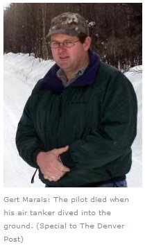
Ten years ago this month the pilot of a single engine air tanker was killed while helping firefighters on the ground contain a fire that started on Training Area 25 at Fort Carson. Wildfire Today wrote about the report released by the National Transportation Safety Board, which indicates there were very strong winds that day when Gert Marais died:
At the time of the crash, a U.S. Forest Service person on the ground who was directing the SEAT estimated that at the time of the crash the wind was out of the southwest at 30-40 knots. Winds at the Fort Carson airfield, 5 miles from the crash site, were between 20 and 40 knots from 1300 to the time of the accident at 1815.
Strong winds like occured on April 15, 2008 often indicate high wildfire danger if the relative humidity is low and the vegetation is dry.
Thanks and a tip of the hat go out to Bean.
Typos or errors, report them HERE.
Above: NPS photo by Nathan King
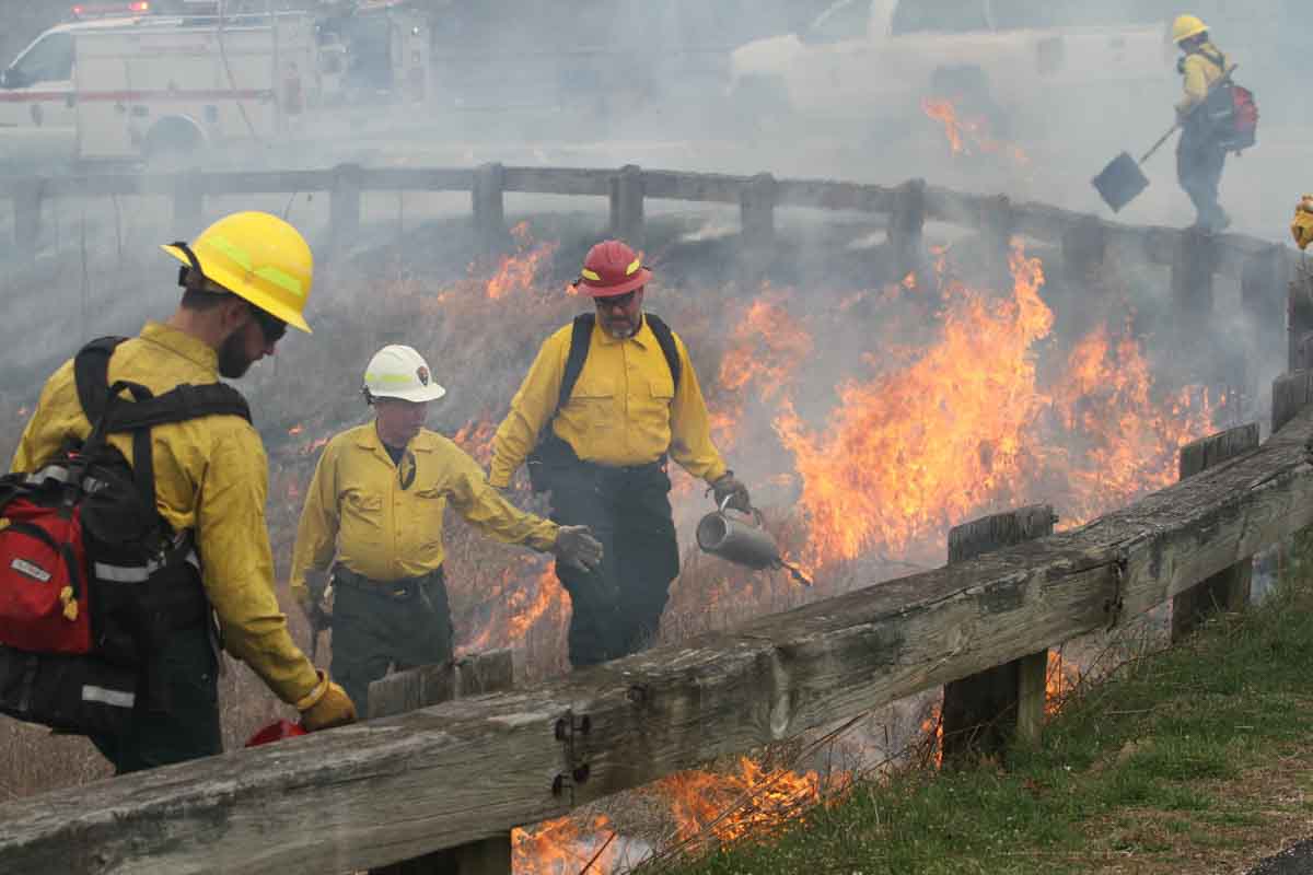
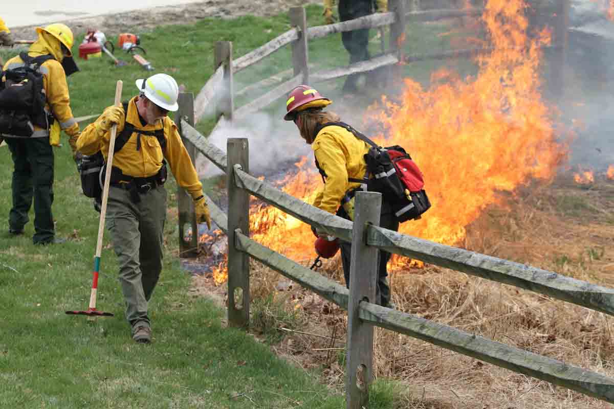
On April 6 firefighters conducted the first prescribed fire in Wolf Trap National Park for the Performing Arts west of the District of Columbia. According to the National Park Service it was also the first prescribed fire in Fairfax County, Virginia. (UPDATE April 11, 2018: Katie said in a comment that Fairfax County Park Authority has been conducting prescribed burns in Fairfax County for many years.)
Fire was introduced to the native meadow in order to help the indigenous vegetation flourish while helping to control non-native plants.

The agencies assisting included Prince William Forest Park, Fredericksburg and Spotsylvania County Battlefields National Military Park, and Fairfax County.

The park is about 8 air miles west of the District of Columbia. It was created by legislation passed in 1966 “… for the performing arts and related educational programs, and for recreation use in connection therewith…”