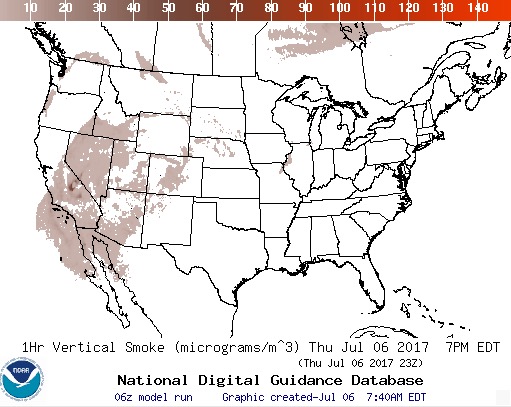
This map showing the distribution of smoke from wildfires was produced at 6:37 p.m. MDT July 7, 2017.
Firefighters saving pigmy rabbits
I’ve never seen anything quite like this.
BLM firefighters save dozens of endangered pygmy rabbits from #wildfire ????? Story: https://t.co/ndkmblhijg ? @WDFW #wildlife pic.twitter.com/7umEScLsDC
— BLM Oregon (@BLMOregon) July 7, 2017
Making rain to extinguish wildfires
The Instagram account below frequently covers wildland fire and smokejumpers in Russia. Here is the automatic Google translation of the caption (without all the hash tags):
“Avialesoohrana” carries out works on artificial precipitation for the purpose of extinguishing forest fires in the regions of Siberia. Details on the site.
Click on the arrows to see two additional photos.
Fires near Reno as seen from space
This satellite photo shows three wildfires near Reno, Nevada as seen by a satellite July 5, 2017 — the Earthstone, Truckee, and Winnemucca Ranch Fires. The burned areas appear very dark and the red dots represent heat.
July fire causes evacuations west of Zortman, Montana
At 6 p.m. on Thursday the incident management team reported that the fire had burned 8,381 acres.
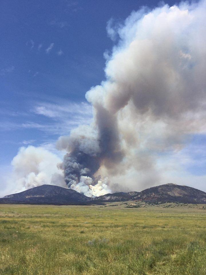
Above: Firefighters on the July Fire near Zortman, Montana
(Originally published at 12:28 p.m. MDT July 6, 2017)
(Updated at 12:50.m. MDT July 7, 2017)
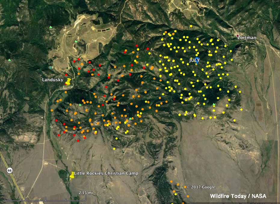
Here is another updated map of the July Fire at Zortman, Montana current as of 3:30 a.m. MDT July 7, 2017. Click the map to see a larger version. We will post additional information when it becomes available.
****
(Updated at 6:04 p.m. MDT July 6, 2017)
The July Fire in northern Montana west of Zortman was very active Thursday. A change in wind direction pushed the fire to the northwest in the general direction of the community of Landusky and the Little Rockies Christian Camp. A mandatory evacuation is in effect for Landusky; the camp is currently vacant and the caretaker has left. The fire is east and southeast of both locations.
The weather forecast for the fire area at 3,600 feet elevation predicts the wind out of the southeast will continue on Thursday, blowing at 9 mph gusting up to 15. The temperature will top out at 90 degrees with a minimum relative humidity of 20 percent. The actual conditions at Zortman at 3:30 p.m. were 86 degrees, 20 percent RH, and winds out of the east and southeast at 8 to 11, gusting to 18.
In the updated map below (click it to see a larger version) which shows data from 1:32 p.m. MDT on Thursday, the fire has moved further to the west and appears to be less than a mile away from Landusky.
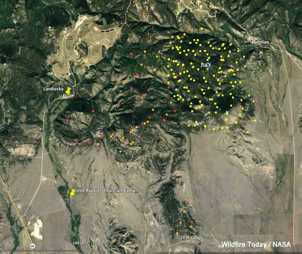
At 6 p.m on Thursday it had burned 8,381 acres, which is about four times the last reported acreage.
A Type 2 incident management team assumed command of the fire at 6 a.m. Thursday.

Four wildfires in Reno area have burned about 115,000 acres
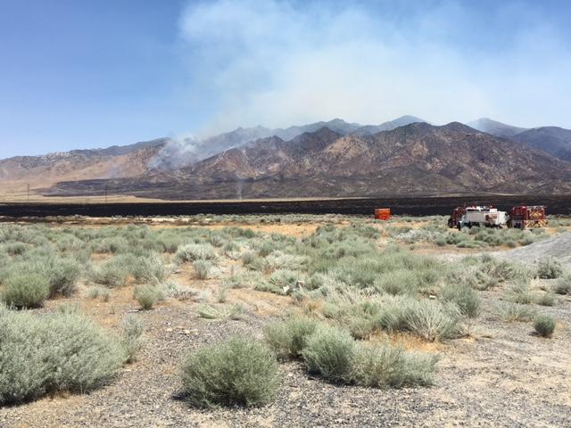
(Originally published at 10:09 a.m. MDT July 6, 2017)
Four large wildfires in the Reno/Sparks, Nevada area have burned a total of about 115,000 acres since the first ones started July 3. Brook Chadwick’s Type 2 incident management team will be assuming command of the Earthstone, Truckee, and Winnemucca Ranch Fires.
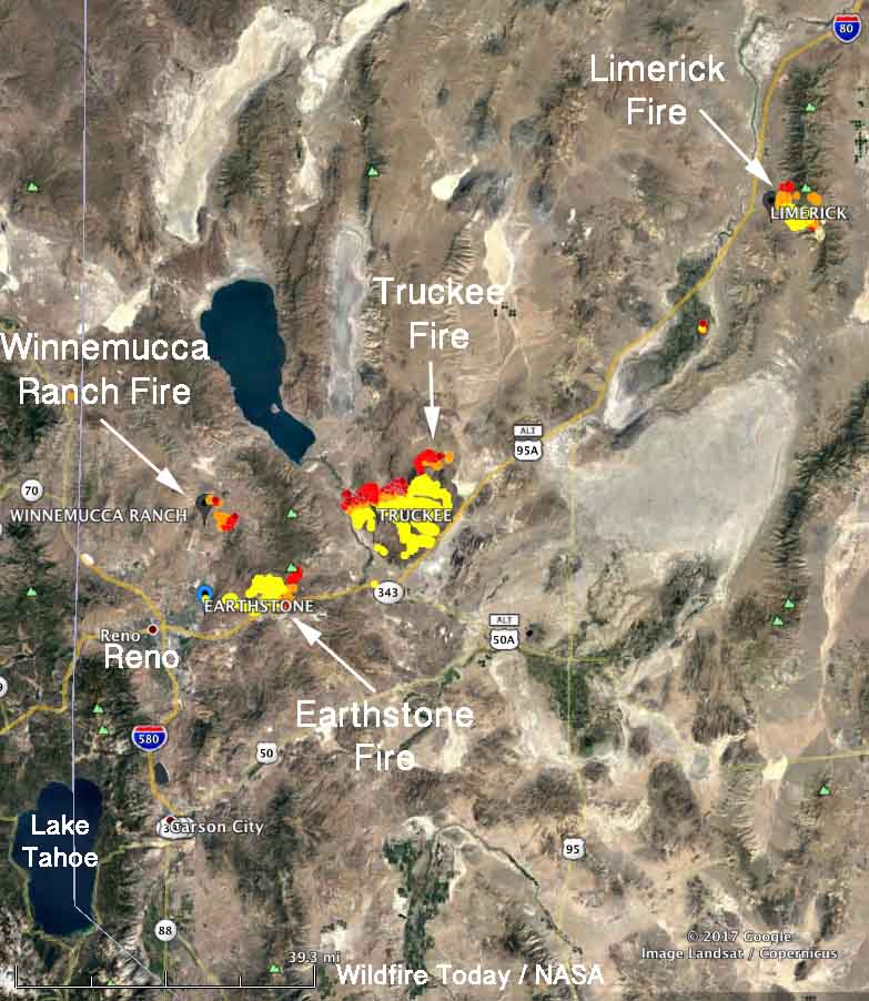

Earthstone Fire, 26,785 acres, just northeast of Reno/Sparks.
Information from Inciweb current as of about 8 p.m. MDT July 5, 2017:
“The Sierra Front Type 3 Incident Management Team assumed control of operations [presumably on Wednesday] and brought in additional resources, including two fire engine strike teams, to allow the releasing of some local fire crews to return to their home districts. A Type 2 Incident Management Team remains scheduled to assume command of the incident on Thursday morning.
Three additional fixed wing aircraft, including one Very Large Air Tanker (VLAT), made retardant drops today. Two Super Scooper air craft, requested from Alaska, are still on order and may arrive as early as Friday, bringing the total number of aircraft on the incident to 18.
Currently, there is no immediate threat to structures; however, residents of the Wadsworth area are encouraged to remain vigilant for the possibility of evacuation and complete their preparations as the head of the fire is now about 10 miles west of the town. Impacts to I-80 are expected in the vicinity of the USA Parkway within the next 24 hours.”
Truckee Fire, 70,546 acres, 28 miles northeast of Reno. Not much information is available, but it is exhibiting extreme fire behavior as it burns in brush and short grass in above normal temperatures and single-digit humidities.
Winnemucca Ranch Fire, 3,000 acres 8 miles north-northeast of Reno. Five structures have been destroyed on this fire and another 175 are threatened. Numerous animals and livestock have been evacuated along rural roads. The fire managers identified competition for firefighting resources as a problem.
Limerick Fire, 14,656 acres 94 miles northeast of Reno and 15 miles northeast of Lovelock. Two outbuildings have burned.
Information from Inciweb current as of about 9:40 a.m. MDT July 6, 2017:
“Firefighters stayed on the fire last night and were able to hold the fire line at the ridge to the south of Wright’s Canyon. Snow is still in the higher elevations and greener grass has helped keep the fire on the ridgetop.
Potential fire weather is predicted for the weekend and a structure protection group has been established as a contingency for active fire behavior.
Crews completed burn outs in the southeast corner of the fire yesterday and were able to connect containment lines to the dozer line near Golden Gate Hill. Crews will continue to secure fire line and begin mop up in the area near Couer Rochester Mine. Fire crews will continue to put in containment line on the eastern side of the fire working their way north.
Limerick Road is open to firefighter and mine traffic only.”
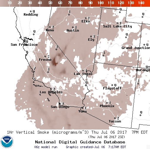
The maps below are forecasts for wildfire smoke at 5 p.m. MDT on Thursday.
****
