Dozens quarantined with strep throat at the Frye Fire


EMT icon
As we reported earlier Sunday, on Saturday June 17 the Inciweb page for the Frye Fire in southwestern Arizona included this statement:

21 additional personnel with unknown illness were demobilized.

It turns out that the illness was strep throat. According to the Tucson News 45 people at the fire have been treated for the disease, also known as streptococcal pharyngitis.

This is being handled as an “incident within an incident”, with a separate Incident Commander and staff managing the situation, which allows the primary firefighting personnel to continue to perform their usual duties.

Below is an excerpt from the Tucson News, dated June 18:

…A medical group was created with doctors and nurses being brought to the Safford area to help with the strep throat outbreak.

[Information Officer Evan] Burks said antibiotics were administered and the affected fire personnel were quarantined, but will not be sent home.

“We have not released those resources. They’re still here. But we have separated them from the healthy firefighters,” Burks explained. “The antibiotics start working within 24 hours, and it looks like the firefighters are getting healthy pretty quickly here. Once they’re healthy, and good to go, they’ll be back to work [on the Frye Fire].”

Medical personnel have identified those with strep throat and they are taking “extra precautions to wash hands, and stay healthy,” Burks explained. “That’s always the number one priority, to keep our firefighters healthy. But there is always that risk out there.”

If the statement in the June 17 Inciweb report is true, that 21 personnel were released with an unknown illness, possibly strep throat, they could be unknowingly infecting their families or coworkers.

Strep throat affects about 3 million people in the U.S. each year. It is treatable by a medical professional and often requires lab tests or imaging. With treatment it is usually resolved within days or weeks. Common symptoms include sore throat, fever, and swollen lymph nodes in the neck. Rarely, complications can involve the heart or kidneys. Treatment is important to reduce complications.

As of Saturday night the Frye Fire had burned about 9,000 acres 8 miles southwest of Safford.

More information about the Frye Fire.

Thanks and a tip of the hat go out to Tom.
Typos or errors, report them HERE.

Frye Fire threatens international observartory

Above: A 3-D map of the perimeter of the Frye Fire at 11 p.m. MDT June 17, 2017. The base satellite image is from June, 2011 and appears to show in the foreground, east of the fire, a previously burned area.

(Originally published at 8 p.m. MDT June 18, 2017; updated at 11:25 p.m. MDT June 18, 2017.))

The Frye Fire grew close to the Mt. Graham International Observatory 62 miles northeast of Tucson, Arizona Sunday afternoon. The Southwest Geographic Area Coordination Center reported that in mid-afternoon the Type 3 Incident Management Team ordered 7 large (heavy) air tankers and one very large air tanker.

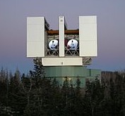
Large Binocular Telescope
Large Binocular Telescope, Mt. Graham.

Photos from the webcam at the observatory showed evidence of retardant drops near the facility, which is the home of the Large Binocular Telescope (LBT) and other very expensive instruments.

As of Saturday night the fire had burned about 9,000 acres, but by Sunday afternoon we estimate that it has grown by at least another 2,000 acres.

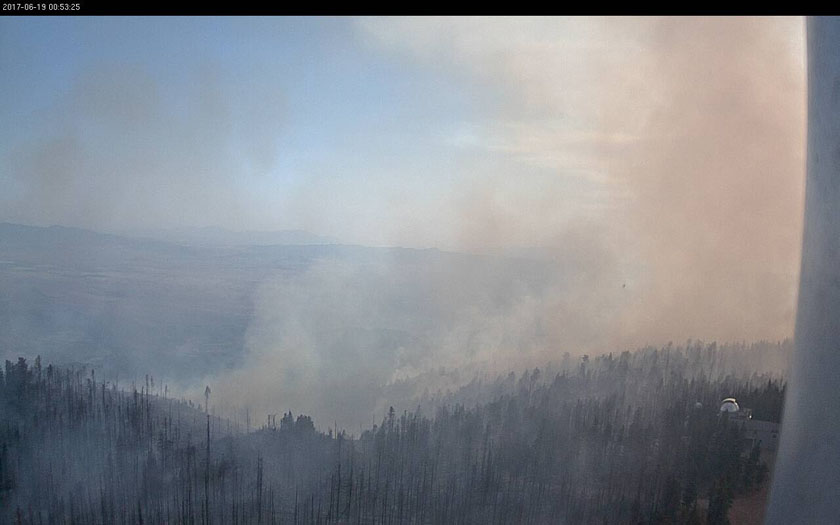
Mt. Graham International Observatory fire
A webcam at the Mt. Graham International Observatory captured this photo at 6:53 p.m. MDT June 18, 2017.

Until late Saturday the fire had been burning mostly uphill on the very steep mountain slope 8 miles southwest of Safford, Arizona, but it has now slopped over onto the west side of the mountain range.

Critically low relative humidity and extreme high temperatures continue to contribute to increased fire activity. On Sunday the temperature was well over 100 at the lower elevations, and it is predicted to reach 110 to 112 each day through Friday June 23. The relative humidity will be 8 to 10 percent. It will be very breezy through Friday except for Wednesday.

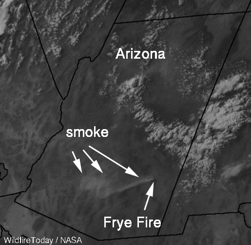
photo smoke from the Frye Fire
A satellite photo of smoke from the Frye Fire in southeast Arizona, at 5:45 p.m. MDT, June 18, 2017.

The lightning-caused fire is not being completely suppressed according to the Team:

An indirect strategy is being taken to confine and contain the fire within the previous burn scar, to provide firefighter safety from the numerous snags, rough terrain and numerous downed logs. Fire personnel are assessing values at risk and options to limit high-severity fire effect to forest resources. Firefighters are monitoring fire behavior and growth and will take appropriate action if fire threatens any values.

Firefighting resources assigned to the fire on Saturday included 9 hand crews, 11 engines, 6 helicopters and a total of 306 personnel. Approximately $1.1 million has been spent to manage the fire.

The Team reported on June 17 that “21 additional personnel with unknown illness were demobilized.” UPDATE: 45 people were diagnosed with strep throat at the Frye Fire.

Wildfire forces evacuation of Brian Head, Utah

Above: The Brian Head Fire at Brian Head, Utah. Photo by Iron County Sheriff’s Office, posted June 17, 2017.

The Brian Head Fire has burned at least one home in the town by the same name, which is 12 miles east of Cedar City, Utah. As of Saturday evening the fire had burned about 957 acres on the north side of the town near the Dixie National Forest. Multiple structures are threatened.

The fire was reported at 12:20 p.m. on June 17 and caused the evacuation of all 500 residents of the town.

A Type 3 Incident Management Team was due to arrive Saturday evening, and a Type 2 Team is expected at mid-day on Sunday.

Brian Head Fire 3-d map
A 3-D map showing the approximate location of the Brian Head Fire as of 4:30 a.m. MDT June 18, 2017.
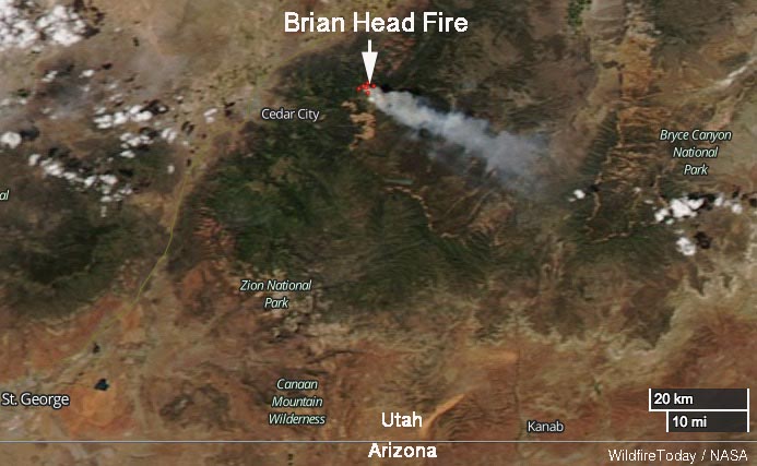
Brian Head Fire map
Satellite photo showing smoke from the Brian Head Fire June 17, 2017.

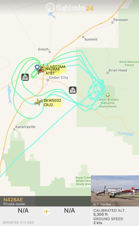
An inversion early Sunday morning trapped smoke, degrading visibility to the point where firefighting aircraft could not be used, but by noon MDT two Air Tractor 802A Single Engine Air Tankers were working the fire. They were reloading at Cedar City 12 miles away so they undoubtedly had short turnarounds in spite of the 4,000-foot climb from the air tanker base to the fire.

Brian Head Fire air tanker
Flight paths of a Single Engine Air Tanker working the Brian Head Fire at 12:50 p.m. MDT June 18, 2017.

The wind on Saturday was from the northwest, but on Sunday it shifted to come out of the north. As you can see in the image above, at about noon on Saturday the flight paths of one of the Single Engine Air Tankers were concentrated south of Brian Head, on the west side of Cedar Breaks National Monument.

The wind on Saturday is predicted to be out of the north at 8 to 10 mph with gusts to 13. The relative humidity should be in the mid-20’s and the temperature will be in the high 60’s. The coolish temperatures are due to the altitude — 8,000 to 10,000 feet above sea level in the fire area, which is about 4,000 feet higher than Cedar City.

The impressive video below posted by the Iron County Sheriff Office shows an air tanker dropping retardant apparently into heavy smoke. Perhaps there were structures or firefighters, or both, threatened in that area.

Satellite photo of wildfires in the Southwest

The image above from the Goes-16 satellite shows smoke from the large fires in Arizona and New Mexico on June 17, 2017.

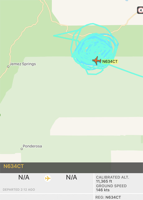
Below: in the two hours since it left the Santa Fe Municipal Airport, an Aero Commander air attack aircraft owned by “N9FX” has orbited the Cajete Fire west of Los Alamos, NM many, many times.Cajete Fire Air Attack Ship

Death toll rises to 62 in Portugal wildfire

Above: Photo by Euronews.

(Updated at (9:55 a.m. MDT June 18, 2017)

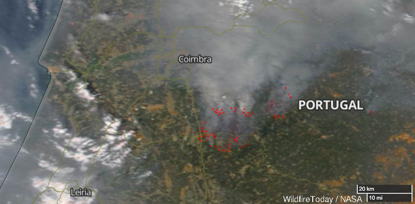
The number of people killed in the wildfire southeast of Coimbra, Portugal has risen to at least 62, according to the BBC. That number will probably increase as many remain missing and not all affected areas have been reached by authorities. Six firefighters have been seriously injured and two that were reported missing have been found with injuries.

Hundreds of firefighters and 300 pieces of fire apparatus are battling the fire southeast of Coimbra, one of 60 that broke out Saturday. Approximately 1,700 firefighters have been mobilized across Portugal during the recent extremely hot weather which brought temperatures over 100F. Dry thunderstorms are one of the possible causes of the fires. The government reports that 360 soldiers are assisting firefighters.

wildfires southeast of Coimbra, Portugal
Map showing the location of the wildfires southeast of Coimbra, Portugal.

Most of the fatalities occurred while residents were attempting to flee in their cars from the Pedrógão Grande area about 30 miles southeast of Coimbra.

Wildfires southeast of Coimbra, Portugal
Wildfires southeast of Coimbra, Portugal.

The European Commission says it is working with EU member states to respond to the call for assistance issued overnight by Portuguese authorities. The Prime Minister of Greece, Alexis Tsipras, said “Greece will offer any help necessary to fight the fires.” Spain and France are both sending several firefighting aircraft.