On November 8 California voters could approve a proposition that would add up to $1 billion to the California Department of Forestry and Fire Protection budget.
Proposition 30 would create an additional 1.75% state tax on personal income above $2 million that would used for zero-emission vehicle subsidies; zero-emission vehicle infrastructure, such as electric vehicle charging stations; and wildfire suppression and prevention programs.
The nonpartisan Legislative Analyst’s Office expects the measure would would raise $3.5 billion to $5 billion annually, growing over time. Of that, 20 percent would be spent on wildfire response and prevention activities. In general, the state would have to prioritize spending to hire, train, and retain state firefighters. The rest of the money could be used for other wildfire response and prevention activities. The proposition would increase state funding for wildfire response and prevention activities by $700 million to $1 billion annually. The state typically spends about $2 billion to $4 billion annually on wildfire activities, mostly on firefighting.
The other 80 percent of the additional revenue would be used to help households, businesses, and governments pay for part of the cost of new passenger zero emission vehicles, as well as electric vehicle charging stations at apartment buildings, single-family homes, and public locations.
In other news about California’s spending on its wildfire program, Governor Gavin Newsom has proposed $800 million over the next two years to implement various efforts to improve forest health and make communities more resilient to future wildfires.
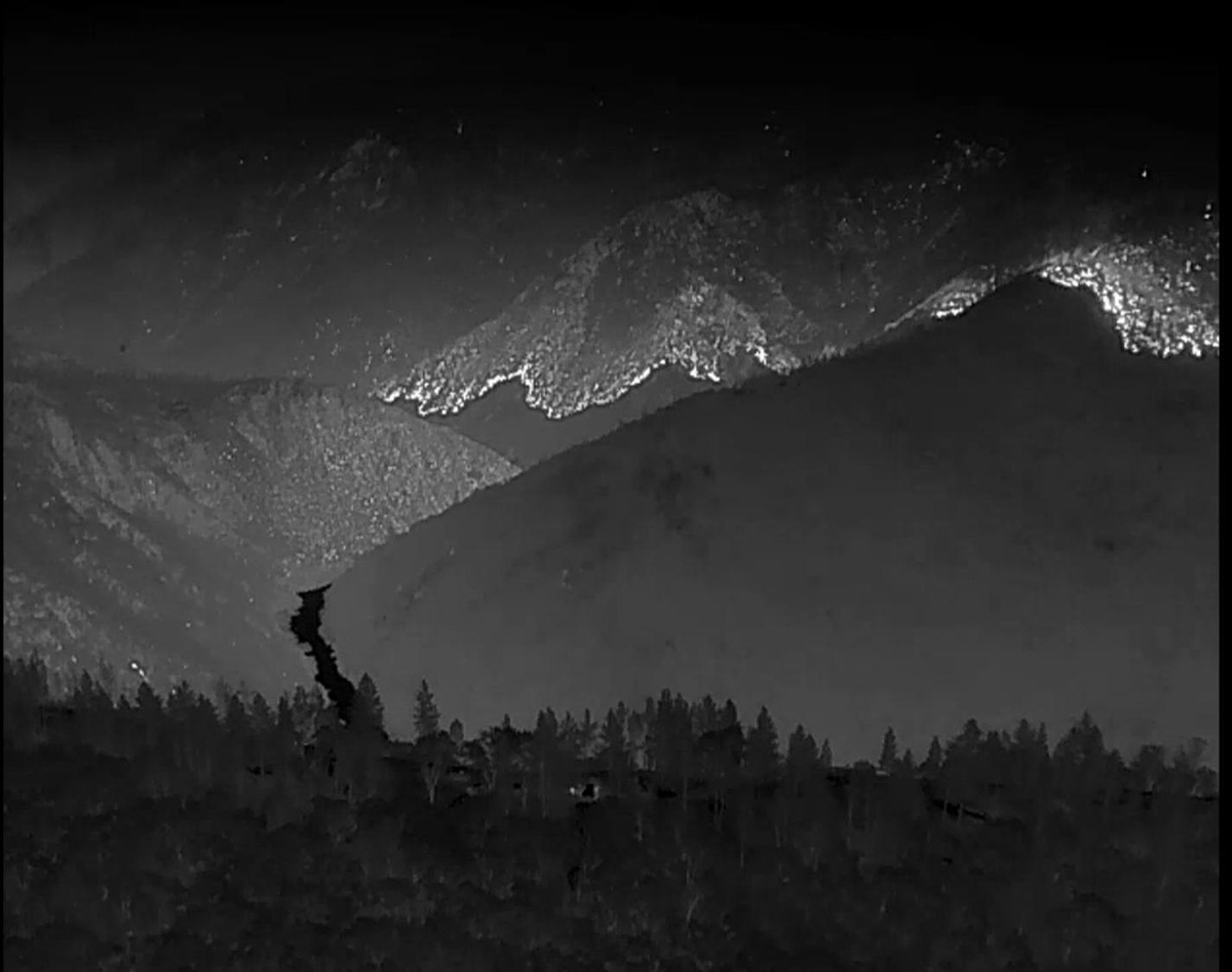
Heat detected by drone a on the Mosquito Fire, nighttime mission Sept. 18, 2022. White represents heat. Darker shades are cooler. USFS.
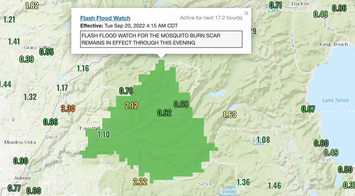
Rain continues to fall on the Mosquito Fire with accumulations in or near the burn area ranging from 0.68″ to 2.22″. A flash flood watch is in effect until Tuesday evening.
Precipitation accumulated, Mosquito Fire area, 72 hours ending at 6:48 a.m. PDT Sept 20, 2022.
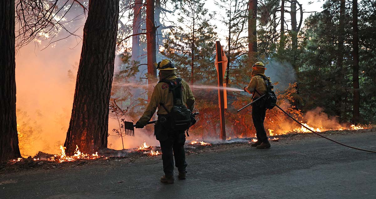
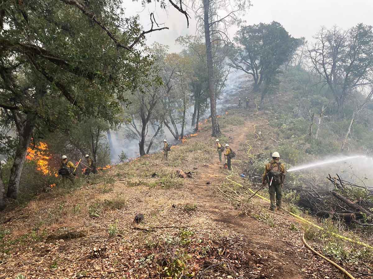
Firefighters are taking the opportunity to work close to the fire’s edge, constructing direct fire line using hand tools and dozers.
The precipitation is expected to taper off Tuesday and Tuesday night, with a few lingering showers on Wednesday. The forecast for the rest of the week shows no chance of rain, moderate winds, and the relative humidity returning to the 40s and 30s.
7:41 a.m. PDT Sept. 19, 2022
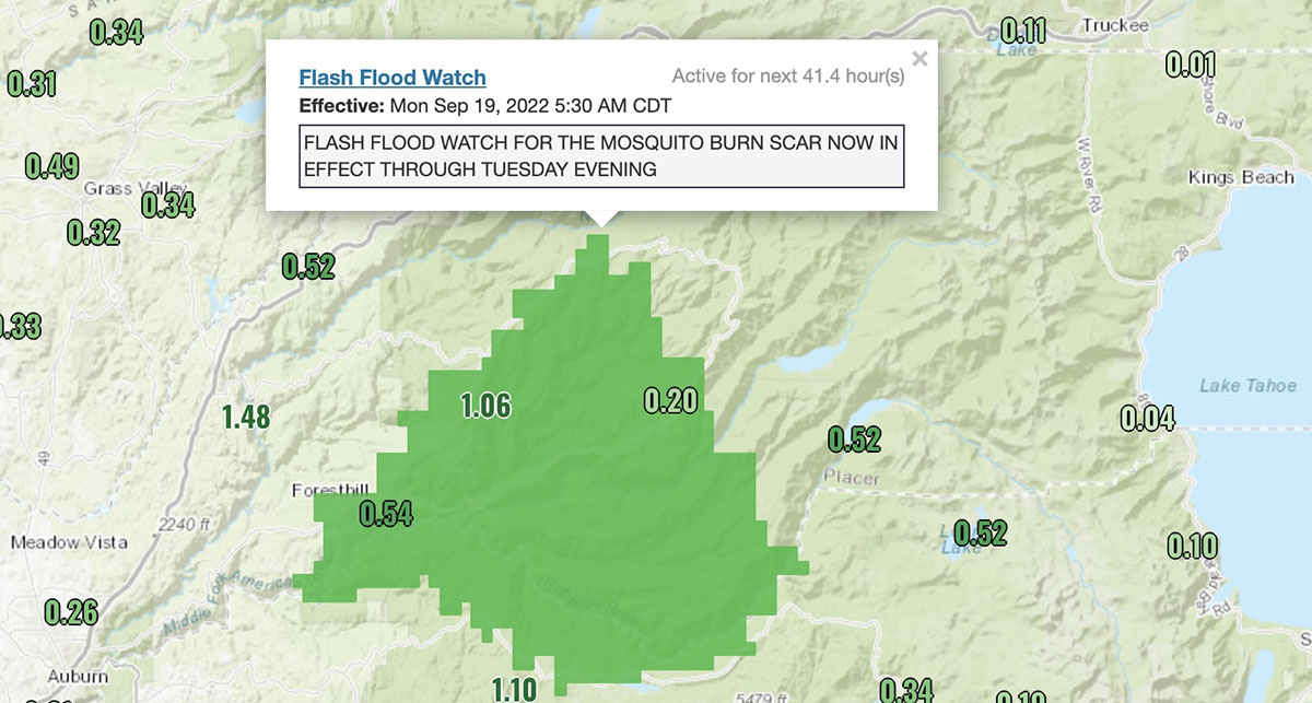
Precipitation, Mosquito Fire area, 48 hour period ending 7 a.m. PDT Sept 19, 2022. The dark green area is under a flash flood watch.
Several weather stations within or close to the Mosquito Fire have recorded more than an inch of precipitation during the 48-hour period ending at 7 a.m. PDT on Monday. Other stations measured 0.20″ to 0.54″.
The National Weather Service has issued a flash flood watch for the burn scar in effect until Tuesday evening.
Firefighters suppressing the Mosquito Fire off Michigan Bluff Road, Sept. 7, 2022. Credit- Robert Foxworthy, CAL FIRE.
The forecast from the NWS predicts there is a greater than 50 percent chance the rain will continue at least through Tuesday with additional amounts that could exceed half an inch.
As a result of the rain, both the Placer and El Dorado County Sheriff Offices downgraded many of the Evacuation Orders and Warnings Sunday afternoon. Updated evacuation maps are available for Placer and El Dorado Counties.
Mosquito Fire map, 5 p.m. Sept. 17, 2022. FIRIS.
On Monday firefighters took advantage of the favorable fire conditions to construct direct control lines along portions of the fire’s edge on the eastern flank. Firefighters with hand tools and heavy equipment, such as dozers, were out in force. Crews worked in the area of the North Fork of the Middle Fork of the American River as well as Interbay Road. Despite the rain showers, crews were able to successfully conduct firing operations along the Interbay Road due to the sustained dry fuel moisture in the vegetation. Crews were able to continue strengthening and holding control lines around the southeast corner near Stumpy Meadows.
The Mosquito Fire has burned 76,290 acres. More than 3,700 personnel are assigned.
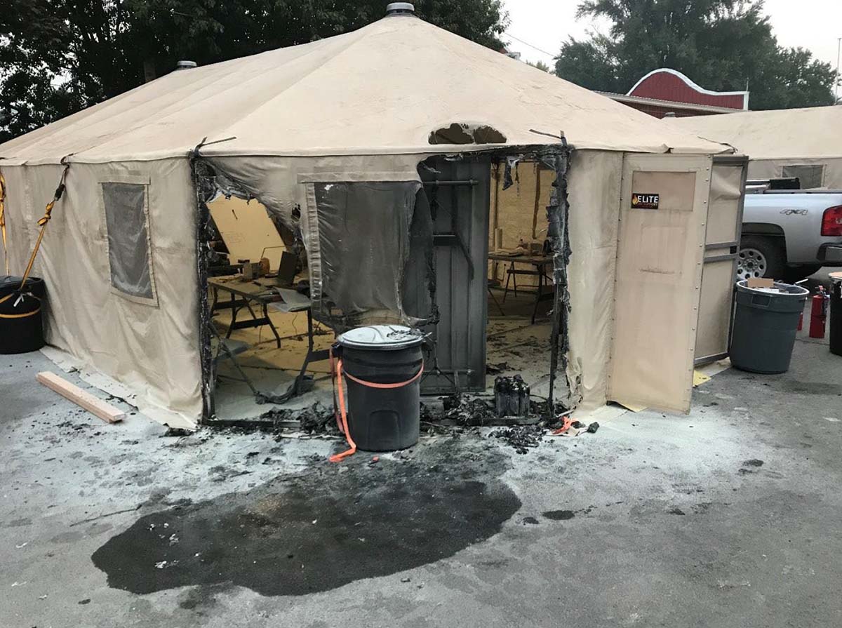
Tent ignites at 3:30 am. at the Kootenai River Complex in Idaho.
What do you do if a large tent at the Incident Command Post catches fire in the middle of the night when people are sleeping inside?
It happened September 12 on the Kootenai River Complex near Bonners Ferry, Idaho. Tents used as offices at an ICP are frequently called “yurts.” In this case at 3:30 a.m. the two workers inside were able to evacuate safely.
The Rapid Lesson Sharing report, below, says arson is suspected. The Incident Management Team developed some ICP fire mitigation measures that other teams may find useful.
[pdf-embedder url=”https://wildfiretoday.com/wp-content/uploads/2022/09/Kootenai-River-Complex-Yurt-Fire-RLS-Final.pdf” title=”Yurt fire Kootenai River Complex – Yurt Fire RLS Final”]
Updated 1:31 p.m. MDT September 17, 2022
Doug Forster pointed out in a comment below that an arrest has been made.
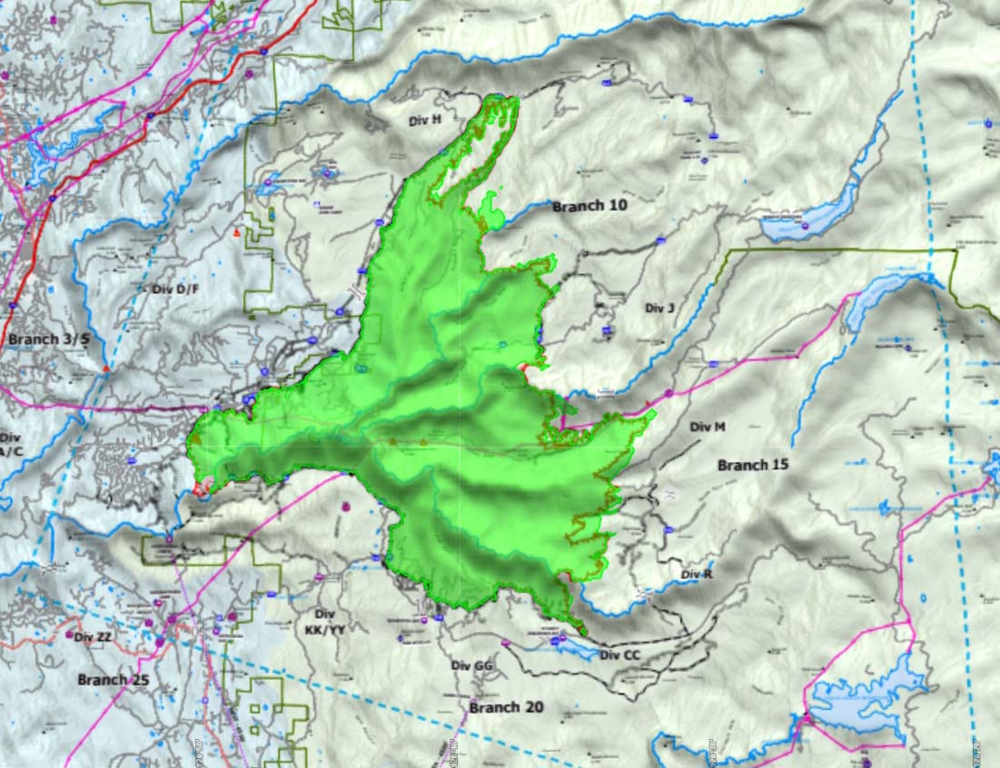
Mosquito Fire map. The red line was the perimeter at 3:58 p.m. Sept. 17, 2022. The white line was the perimeter at 8:45 p.m. September 15.
As expected, when the winds increased Saturday afternoon the activity on the east side of the Mosquito Fire picked up. Wind gusts measured at the Foresthill weather station began exceeding 15 mph at 11 a.m. and peaked at 24 mph at 1:30 p.m. The relative humidity was in the 40s until rising into the 50s at 6 p.m., after which the spread of the fire decreased.
The forecast calls for the RH Saturday night to reach 87 percent while the winds slow to 7 mph out of the south. The winds will increase Sunday out of the south to 15 mph with gusts of 21 to 25 mph. The chance of rain will rise throughout the day Sunday, reaching 66 percent by sunset. Precipitation could continue off and on through Wednesday, possibly exceeding an inch.
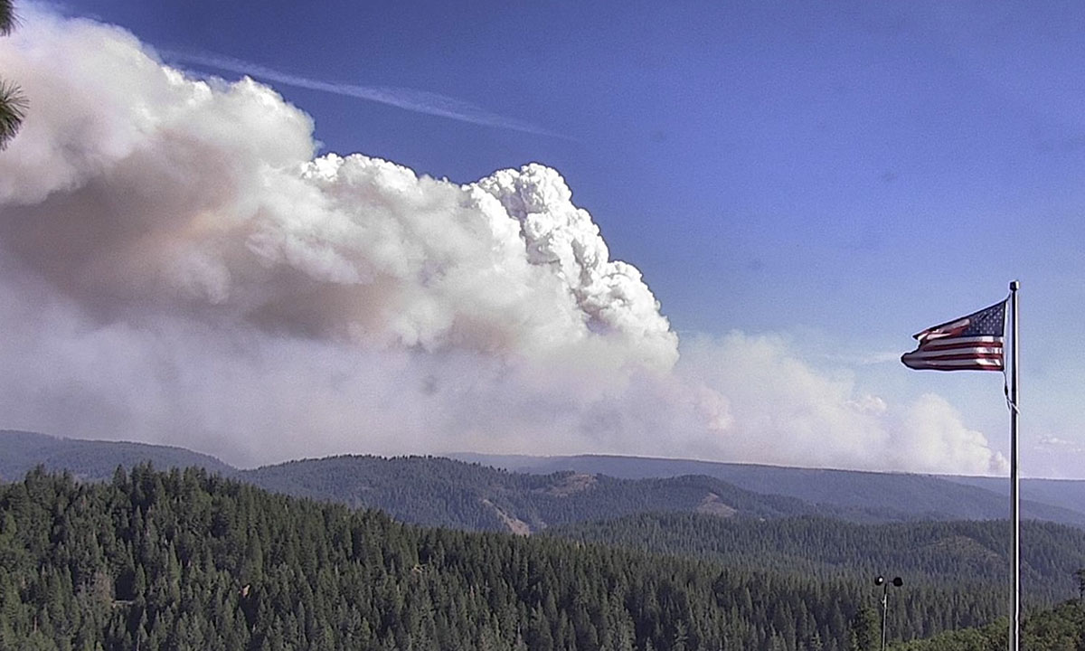
Mosquito Fire, as seen looking southeast from the Blue Canyon camera at 4:16 p.m. Sept. 17.
The fuels, the vegetation, are extremely dry after years of drought. The rain event will not end the fire season in this part of the state, but assuming the precipitation arrives as expected the spread of the Mosquito Fire should slow to a crawl for several days, at least.
The fire was mapped at 3:58 p.m. Saturday at 73,381 acres.
Firefighters continue to make good progress holding the fire along the Eleven Pines Road and other control lines along the eastern flank. Crews were able to successfully engage in strategic firing operations Saturday to continue building a buffer along these control lines. Saturday night firefighters will patrol, mop up, and secure established control and containment lines in an effort to ensure the fire remains within these existing lines while it is being tested by this wind event.
Placer County is maintaining an evacuation map. Approximately 11,277 people are currently under evacuation orders.
Fire officials said 78 structures have been destroyed. On Saturday there were 3,729 personnel assigned to the fire.
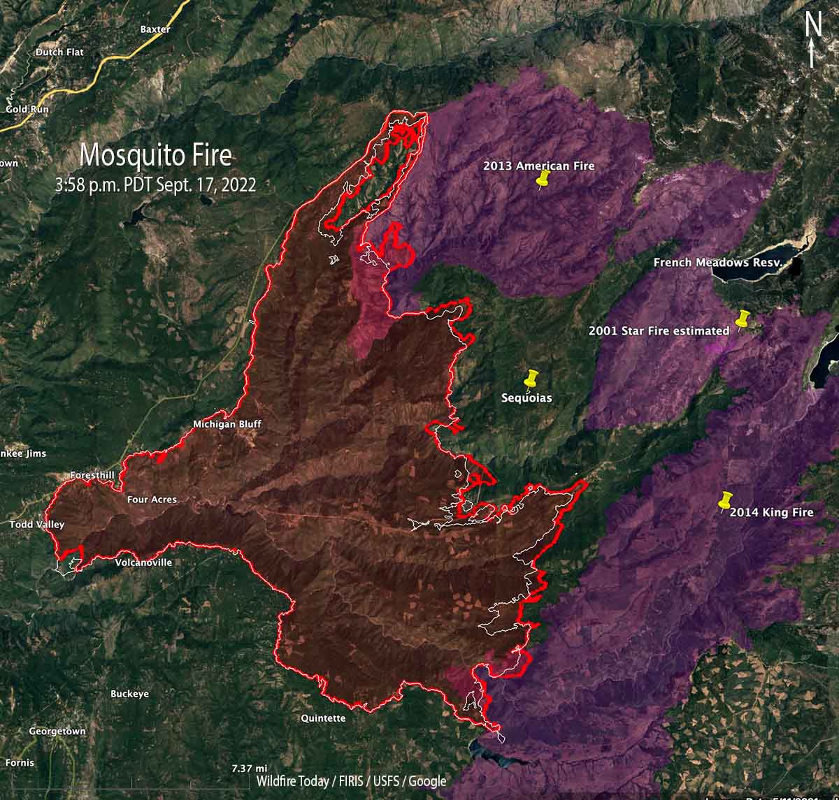
Mosquito Fire map. The red line was the perimeter at 8:45 p.m. Sept 15, 2022. The white line was the perimeter at 4:22 p.m. Sept. 14. Note the location of the Giant Sequoia trees two miles east of the fire.
Firefighters are making good progress on the south, west, and north sides of the Mosquito Fire near Foresthill, California.
On the northeast side, the firing operation along Chicken Hawk, Old Foresthill, and Deadwood Roads is complete and is being mopped up. This will reduce the chance of the fire spreading further to the west and northwest.
Below Todd Valley on the west side, another firing operation is tying in that corner of the fire with the Middle Fork American River. Much of the south side from Volcanoville past Quintette is looking fairly secure.
What is left is the east side which this week, pushed by the prevailing winds out of the southwest, has been moving east about a half mile each day. Firefighters are prepping multiple north-south roads out ahead to the east which could serve as indirect firelines when complete.
Tahoe National Forest’s Truckee Hotshots conducting a firing operation on Buckeye Ridge between Volcanoville and American River. Credit: Dustin Freedman, USDA Forest Service. Posted Sept. 15, 2022.
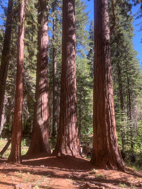
Two miles east of the fire is the northernmost grove of Giant Sequoias (see map above), trees that can live for 3,000 years during normal climate conditions or if managed and protected appropriately. On Thursday firefighters completed a four-acre burn in this small grove. This was to reduce the fuel so that when the main fire comes through hopefully these huge trees will be protected.
Northernmost Giant Sequoia grove, Tahoe NF, Aug. 13, 2022. Note the person, for scale, between the two trees on the right. Photo by Don Hosford.
The weather on Friday will be similar to what we have seen for several days, moderate relative humidity and wind. That will change Saturday as a system comes in that starts in the afternoon with strong southwest winds gusting to 23 mph, but the RH will still be moderate, in the upper 30s. These winds could throw out burning embers far ahead of the fire, starting spot fires that could increase the rate of spread significantly. Saturday night the wind will come out of the south at 14 mph and that is when the chances for rain begin. By Sunday morning the chances increase to 50 percent and through Monday will vary, but could be as high as 80 percent. The NWS forecast predicts the amount of precipitation through Tuesday could exceed one inch.
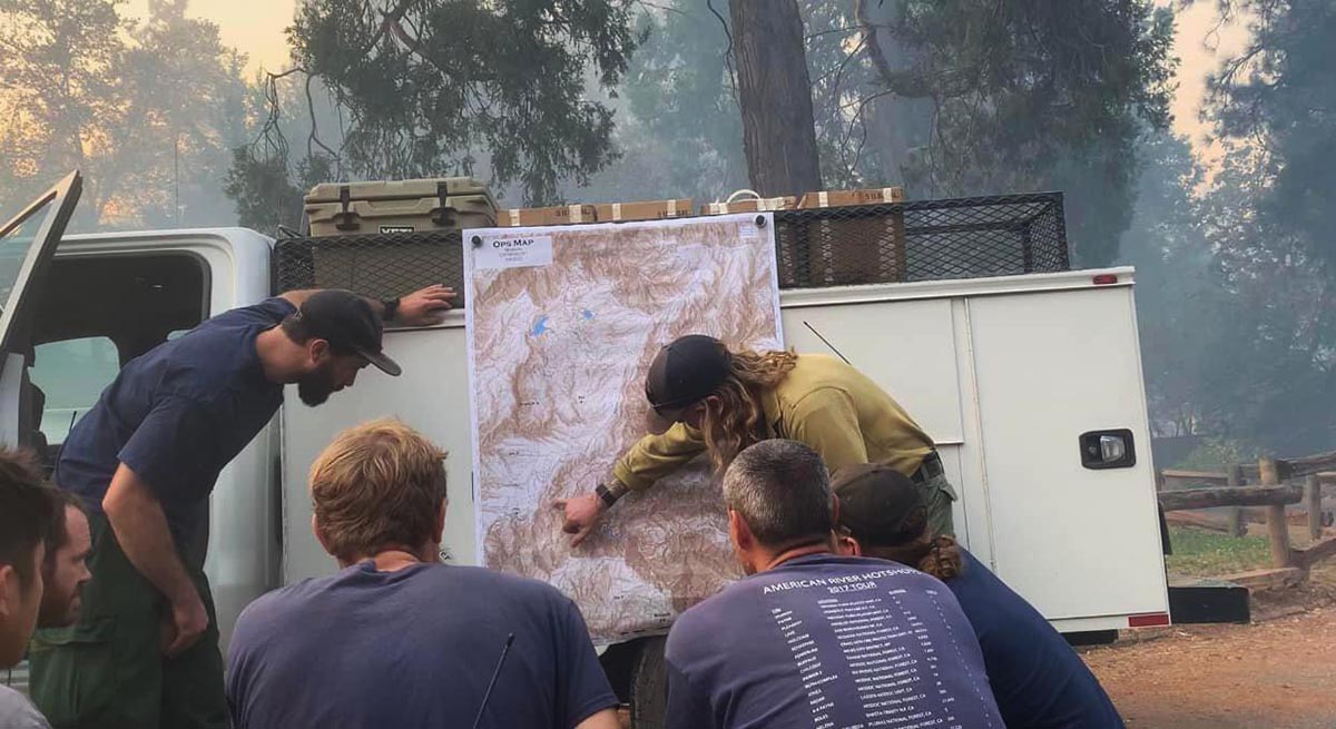
Tahoe National Forest’s American River Hotshots receiving an early morning briefing before heading to the fireline on their home district. Credit: Bobby Blaine, US Forest Service.
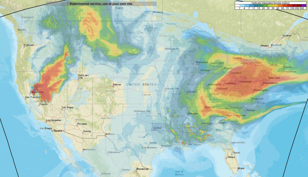
Forecast for distribution of smoke at 1 a.m. PDT Sept. 16, 2022. NOAA.
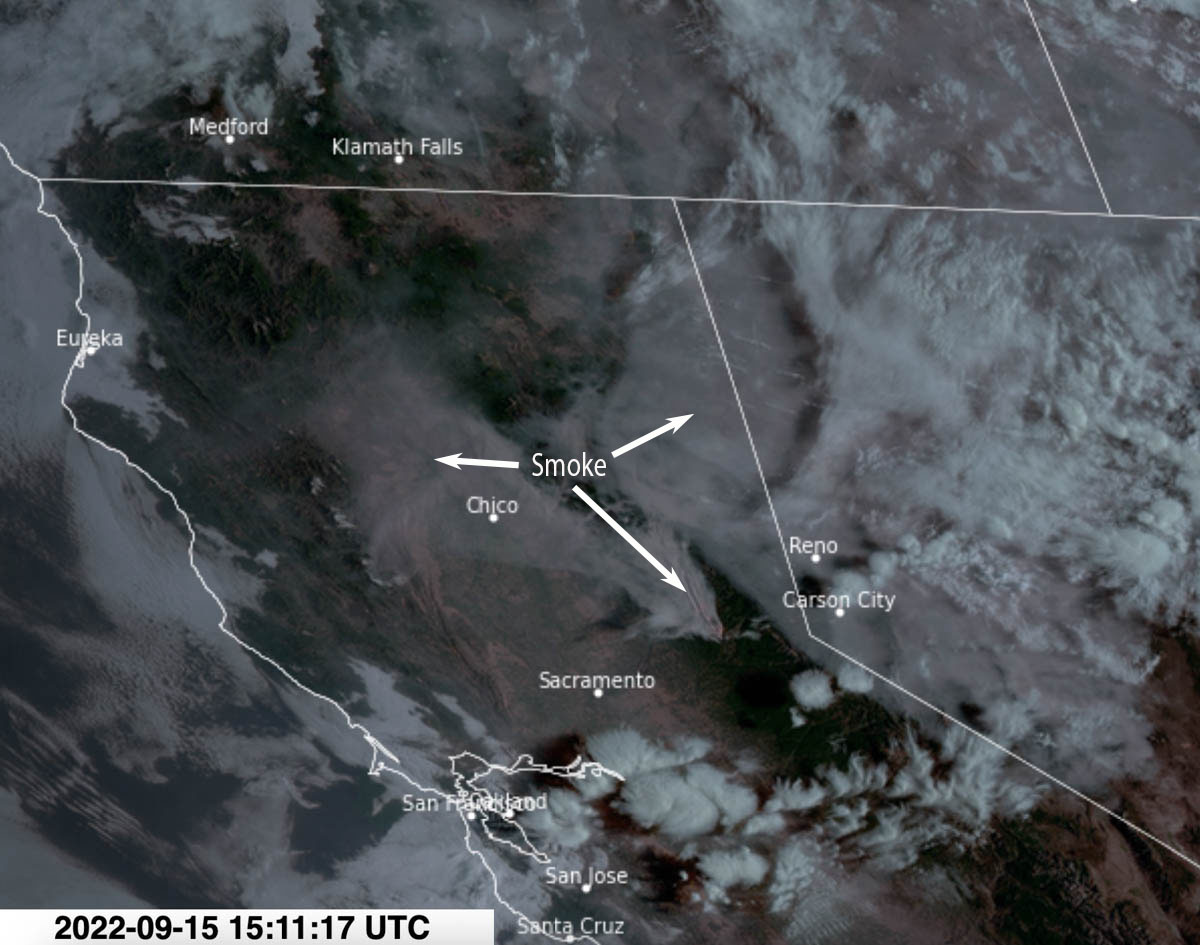
Wednesday afternoon most of the smoke from the Mosquito Fire 35 miles northeast of Sacramento was moving into Northern Nevada. But that changed overnight as it spread northwest toward Chico and Redding in north-central California.
A forecast produced by NOAA expects that by 1 a.m. Friday it will again be moving into Northern Nevada, Eastern Oregon, and Southern Idaho. And from there, most likely Montana.
Satellite photo showing smoke from the Mosquito Fire at 8:11 a.m. PDT Sept. 15, 2022.
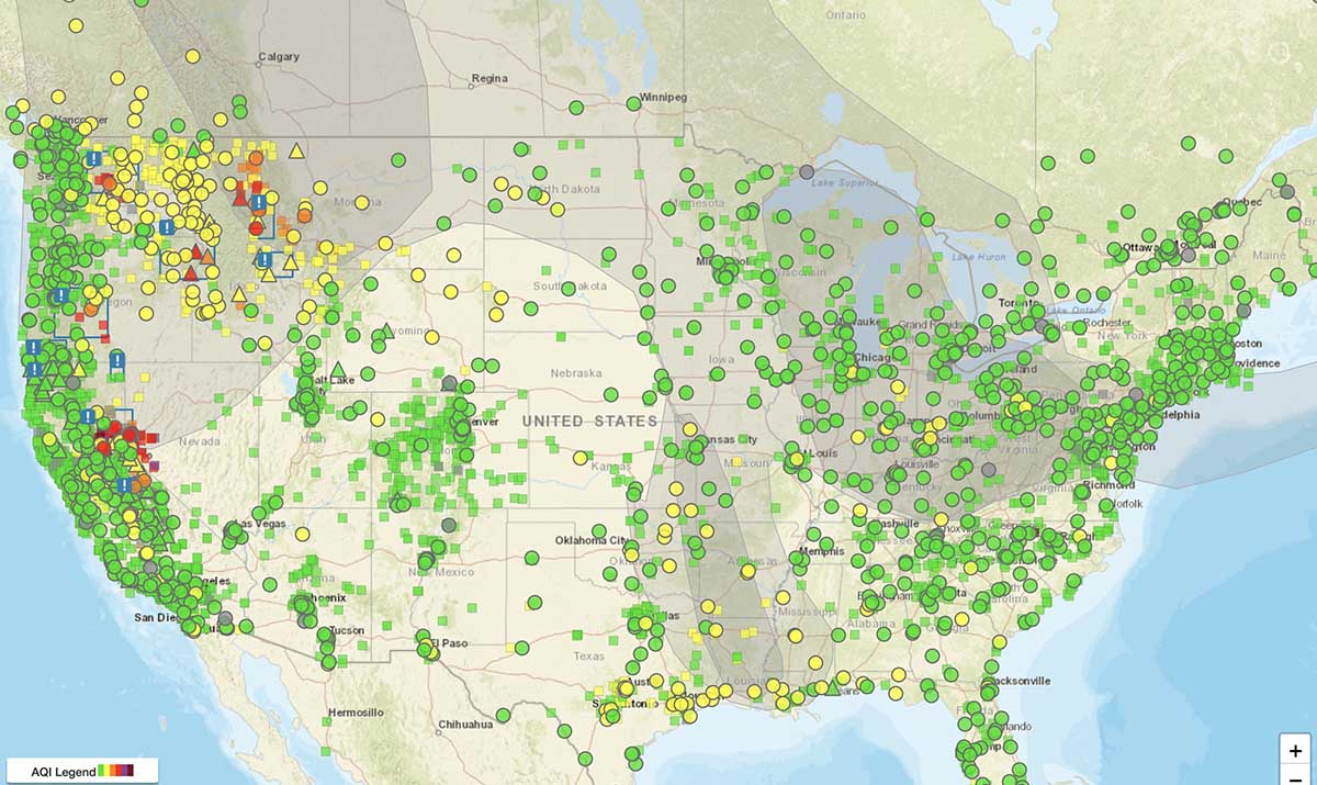
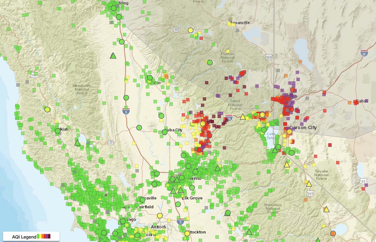
Below is the current air quality, produced by AirNow.
Air quality, from AirNow, at 8:54 a.m. PDT Sept 15, 2022.Air quality, vicinity of Mosquito Fire, from AirNow, at 8:54 a.m. PDT Sept 15, 2022.
Test fire on the Las Dispensas prescribed fire on the Santa Fe National Forest in New Mexico, April 6, 2022. The prescribed fire later escaped, merged with another escaped prescribed fire, and burned more that 341,000 acres and 903 structures. USFS photo.
Forest Service Chief Randy Moore announced that the nearly four-month suspension on prescribed fires has been lifted after receiving the findings and recommendations provided by a National Review Team.
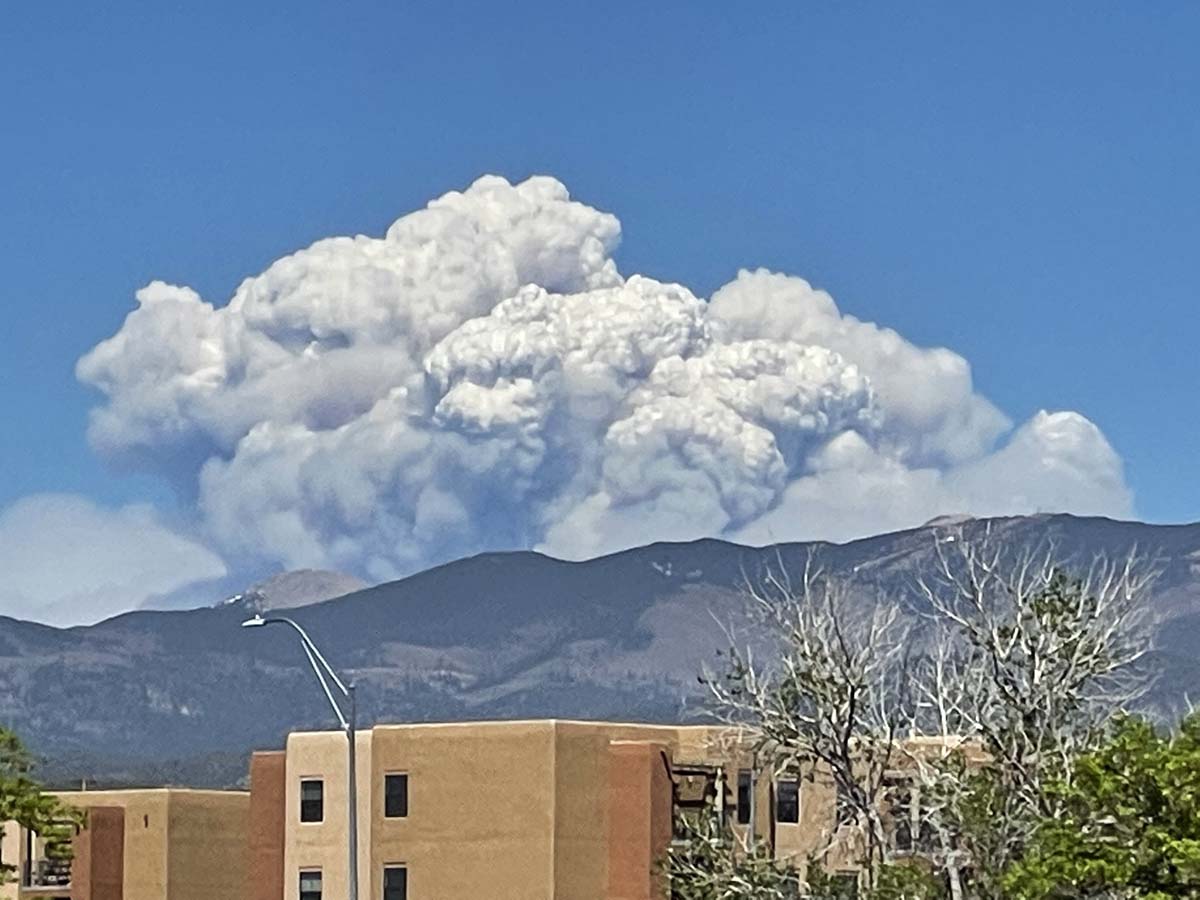
The suspension and review occurred after two prescribed fires on the Santa Fe National Forest in Northern New Mexico escaped in April, merged, and became the Calf Canyon – Hermits Peak wildfire that burned more than 341,000 acres and 903 structures. The area was later hit by flash floods which resulted in more damage. On September 18 the fire will transition from a Type 2 Incident Management Team to a Type 3 Team.
Calf Canyon – Hermits Peak Fire in northern New Mexico, May 10, 2022. Seen from Santa Fe. Photo by Allen Olson.
A report released by the Forest Service in June about the two escaped fires concluded the approved prescribed fire plan was followed for most but not all of the parameters. The people on the ground felt they were close to or within the prescription limits but fuel moistures were lower than realized and increased heavy fuel loading after fireline preparation contributed to increasing the risk of fire escape.
The National Review Team that evaluated the agency’s prescribed fire program produced a 107-page report which included seven recommendations. Chief Moore said in a statement, “I have decided to conditionally resume the Forest Service’s prescribed fire program nationwide with the requirement that all seven tactical recommendations identified are followed and implemented immediately by all Forest Service units across the country. These actions will ensure prescribed fire plans are up to date with the most recent science, that key factors and conditions are closely evaluated the day of a prescribed burn, and that decisionmakers are engaged in those burns in real time to determine whether a prescribed burn should be implemented.”
The seven recommendations in the report:
1. Each Forest Service unit will review all prescribed fire plans and associated complexity analyses to ensure they reflect current conditions, prior to implementation. Prescribed fire plans and complexity analyses will be implemented only after receiving an updated approval by a technical reviewer and being certified by the appropriate agency administrator that they accurately reflect current conditions.
2. Ignition authorization briefings will be standardized to ensure consistent communication and collective mutual understanding on key points.
3. Instead of providing a window of authorized time for a planned prescribed fire, agency administrators will authorize ignitions only for the Operational Period (24 hours) for the day of the burn. For prescribed fires requiring multi-day ignitions, agency administrators will authorize ignitions on each day. Agency administrators will document all elements required for ignition authorization.
4. Prior to ignition onsite, the burn boss will document whether all elements within the agency administrator’s authorization are still valid based on site conditions. The burn boss will also assess human factors, including the pressures, fatigue, and experience of the prescribed fire implementers.
5. Nationwide, approving agency administrators will be present on the unit for all high-complexity burns; unit line officers (or a line officer from another unit familiar with the burn unit) will be on unit for 30-40% of moderate complexity burns.
6. After the pause has been lifted, units will not resume their prescribed burning programs until forest supervisors go over the findings and recommendations in this review report with all employees involved in prescribed fire activities. Forest supervisors will certify that this has been done.
7. The Chief will designate a specific Forest Service point of contact at the national level to oversee and report on the implementation of these recommendations and on the progress made in carrying out other recommendations and considerations raised in this review report.
Chief Moore said two additional actions will occur by the end of this year:
Working with the interagency fire and research community and partners they will establish a Western Prescribed Fire Training curriculum to expand on the successes of the National Interagency Prescribed Fire Training Center headquartered in Tallahassee, Florida.
The Forest Service will identify a strategy, in collaboration with partners, for having crews that can be dedicated to hazardous fuels work and mobilized across the country to support the highest priority hazardous fuels reduction work.