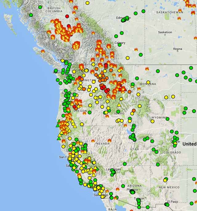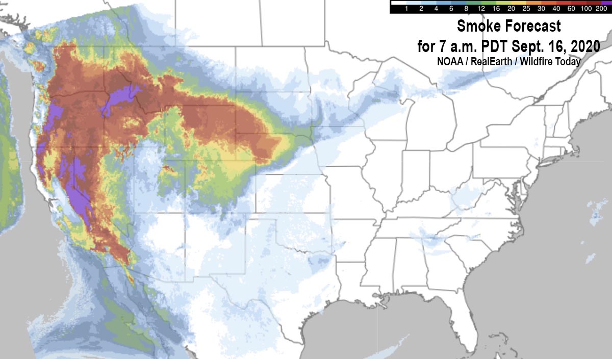


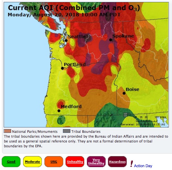
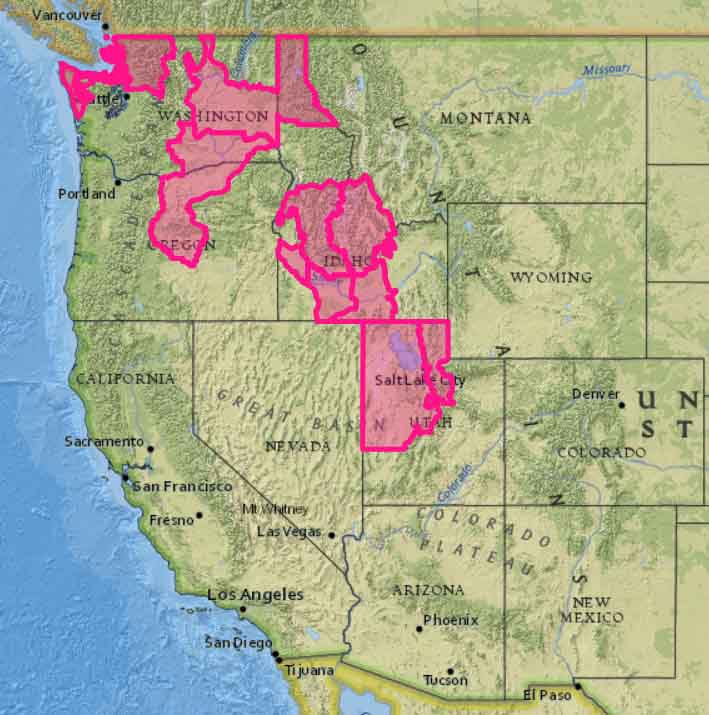
Air quality between Unhealthy and Hazardous is reported in most of Washington, Oregon, Idaho, and northern California
Continue reading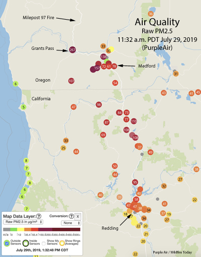
Smoke from the Milepost 97 Fire south of Canyonville, Oregon is significantly affecting air quality in Southwest Oregon and Northern California. In some areas near Medford, Oregon it has reached the “Very Unhealthy” air pollution level which could affect the entire population, especially anyone active and people with respiratory disease.
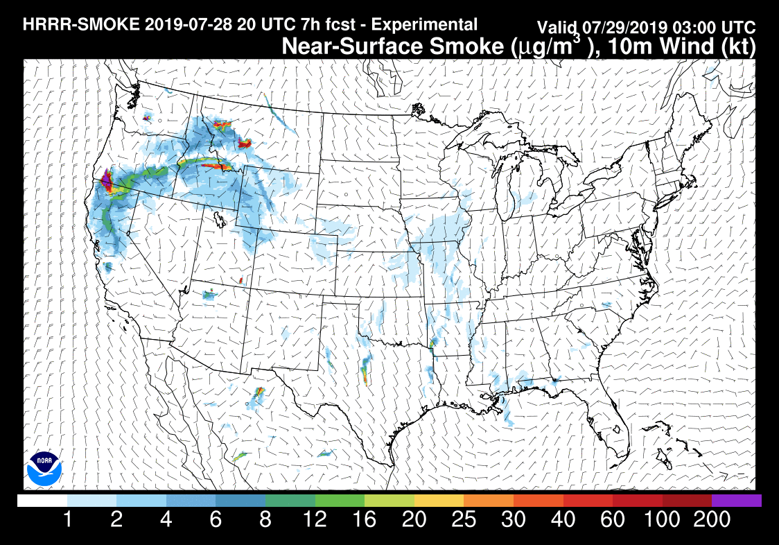
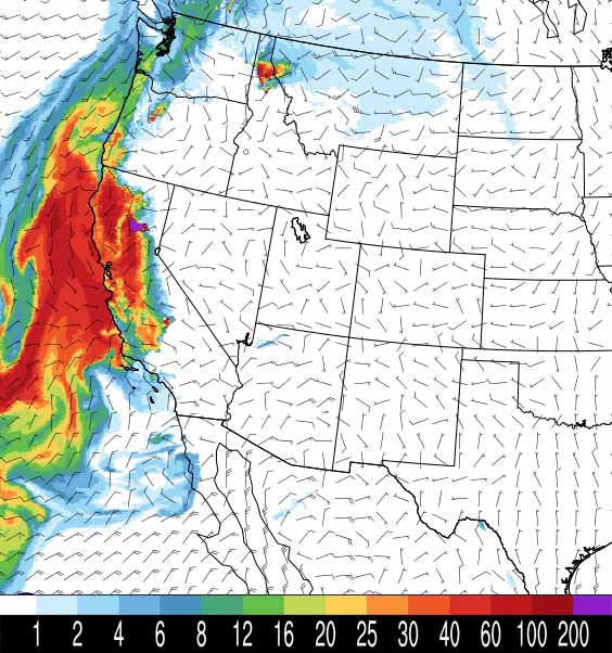
Above is NOAA’s forecast for the distribution of wildfire smoke at 6 p.m. PST November 13, 2018. Much of Central and Northern California has severely compromised air quality and is in the “unhealthy” category.
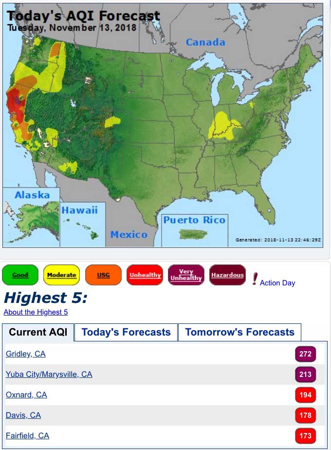
Below is air quality data from AirNow.gov for Tuesday November 13, 2018:

A flying laboratory carrying researchers from the University of Montana has the capacity to change what we know about future fires
Continue readingWildland fires produce significant air pollution, posing health risks to first responders, residents in nearby areas, and downwind communities.
The existing air quality monitoring hardware is large, cumbersome, and expensive, thereby limiting the number of monitoring stations and the data that is available to help officials provide appropriate strategies to minimize smoke exposure. They can’t be easily moved to the latest areas that are being affected by wildfire smoke.
Last year the Environmental Protection Agency in association with the U.S. Forest Service, National Park Service, and other agencies issued a Wildland Fire Sensors Challenge to spur the development of a transportable device that could measure some of the byproducts of combustion produced by vegetation fires. They offered prizes for the first and second place entries of $35,000 and $25,000.
The goal was a field-ready prototype system that could be set up near a fire that was capable of measuring constituents of smoke, including particulates, carbon monoxide, ozone, and carbon dioxide over the wide range of levels expected during wildland fires. It was to be accurate, light-weight, easy to operate, and capable of wireless data transmission, so that first responders and nearby communities have access to timely information about local air quality conditions during wildland fire events.
The winners have been announced:

Jason Gu of SenSevere/Sensit, a co-developer of the first place winning system, said they have a number of units in the field now being tested under real world conditions. They also want to install them near existing air quality monitoring stations to ensure that the data from the new design is comparable to data from the old-school stationary equipment that has been used for decades. When they are satisfied with the results, manufacturing will be the next step.
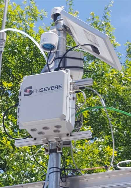
The SenSevere/Sensit unit has a battery that can last for three weeks but will have a solar panel to keep it charged. The device can transmit the data via a cellular connection or a radio. All of the sensors are made by SenSevere/Sensit. Their smoke sensor uses a blower that pulls air through a filter which removes the larger particles, and then a light beam detects the remaining very small PM2.5 particles, the ones that can be ingested deep inside a person’s lungs.
The video below has more information.
The primary cause is smoke from wildfires
Continue reading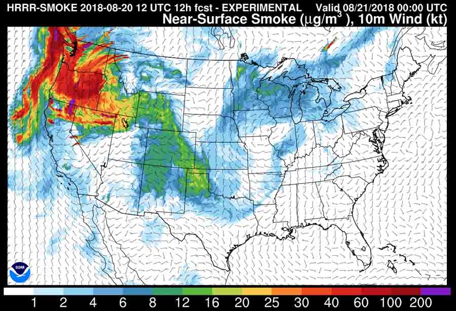

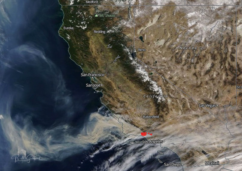
Above: Wildfire smoke forecast for 6 p.m. PST December 10, 2017.
(Originally published at 3:30 p.m. PST December 10, 2017)
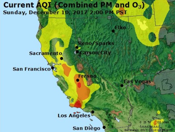
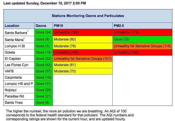
The Thomas Fire is having a significant effect on the air quality in California. Some areas downwind of the fire to the northwest had “unhealthy” conditions at 2 p.m. Sunday, including Santa Barbara and Goleta. Forecasts show that smoke and ash will continue to affect the southern part of Santa Barbara County for the next several days. The Santa Ynez Valley and the northern parts of the County will see increasing impacts.
Massive imposing smoke from #ThomasFire today. Looking west from Newbury Park. pic.twitter.com/gekRcWcPiO
— Greg Vit (@gvitty) December 10, 2017