October 3, 2020 | 10:40 a.m. PDT
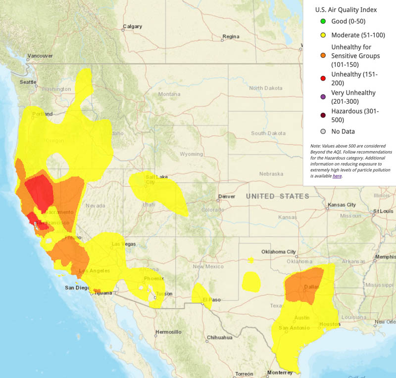
The first two maps are for air quality, from AirNow.gov. The first was current at 10 a.m. PDT October 3. The second is the forecast for Sunday, October 4.


The map below is the forecast for near surface wildfire smoke at noon PDT, Saturday October 3, 2020. The one after that is the forecast for 1 a.m. PDT Oct. 4, 2020. It is interesting that the air quality maps (above) do not detect or predict a serious air quality issue in Colorado around the Mullen Fire.


I was awakened by heavy helicopter traffic in my home by the Benton Air Park in Tedding at 3:45 AM. I am not sure what it is but the Zog fire is playing on my mind and I am unable to locate a source of information on it.
I’m not sure why (AirNow’s monitoring station layout?) but often there seems to be a discrepancy between AirNow and my experienced amount of wildfire smoke at ground level in the area. It’s very confusing.