Review of Discovery Channel’s CAL FIRE series

The limited series premiered Sunday night

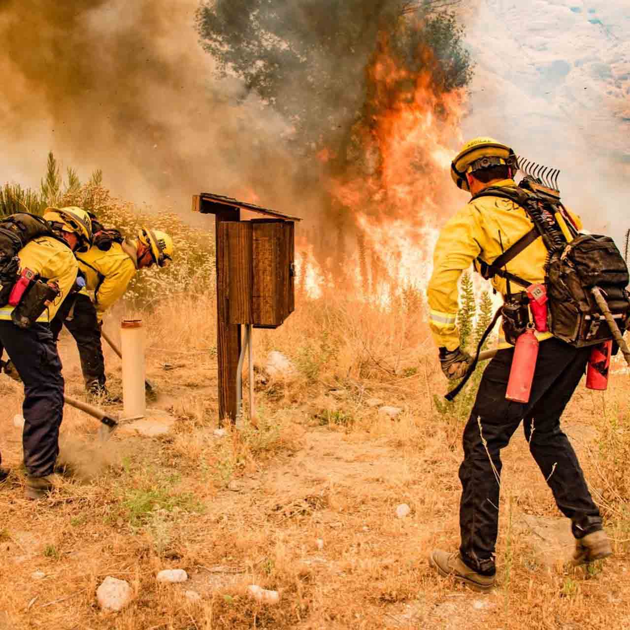
Firefighters responding Apple Fire
Firefighters responding to the Apple Fire. Discovery Channel.

I knew the Discovery Channel’s new series, CAL FIRE, was going to be interesting when the Sunday night premier episode started with a close up of the CAL FIRE director describing his greatest regret.

Thom Porter, CAL FIRE Director"My greatest regret in this job is the time I didn't spend with my family. It's hard to describe to somebody why mom or dad can't be there. We run into places that people should't be. And we do it selflessly as if they're our family members. This job is all encompassing. Firefighting is about sacrifice." Thom Porter, Director of CAL FIRE.

The limited series was filmed by camera crews and reporters who embedded, at least in episode 1, with engine crews. Presumably they went through basic fire training and were outfitted with personal protective equipment since they at times were shoulder to shoulder on the fire line with firefighters who had to tell the camera operator to “watch yourself.”

Apple Fire, Engine 3175

The first engine featured was 3175 in Riverside County, California. Engineer Aaron Dudley is on screen often, talking about his family and what it is like to work for 72 hours on a wildfire.

“I could get a regular job, but I love this one. I definitely could not have peace of mind out there without strong family support.”

The camera was rolling in the station when the crew was dispatched to the Apple Fire which started near Cherry Valley July 31, five or ten miles north of San Jacinto. It eventually burned more than 38,000 acres. Cameras mounted inside the engine filmed the crew and recorded their conversations as they drove to the fire.

After they arrived and worked for a while, the engine ran out of water so they protected a structure using the resident’s garden hose.

Several days after the fire started cameras captured crews igniting a large backfire out ahead of the east side to prevent it from spreading into the Morongo Valley.

Firefighters backfire Apple Fire
Firefighters igniting back fire on the Apple Fire. Discovery Channel

“Our objective is to hold it right here at this dozer line,” explained Captain David Mendoza. “So instead of having 10 feet of protection, we’re going to have half a mile of protection.”

At one point the back fire was burning more intensely than desired, so they had a helicopter drop water from a fairly high altitude — not to put it out, but to slow the spread and decrease the intensity, making it easier to maintain control.

Ponderosa Fire, Engine 47

A camera crew was also in Northern California’s Shasta County as Engine 47 was dispatched to the Ponderosa Fire. It was burning in timber, very different from the Apple Fire which was  primarily brush.

When the crew was struggling on the fire’s edge to charge a hose lay with water a helmet cam captured the action.

Firefighters initial attack the Ponderosa Fire
Firefighters initial attack the Ponderosa Fire. Discovery Channel.

As the flames spread closer to the hose that lay flat with no water, we hear, “Come on boys! Double time it! When you get water take off running”, meaning, when you get water at the nozzle, apply it along the fire’s edge at a fast pace.

“Our life is going to be miserable in a minute if you don’t hurry up.” “We’ve got a busted hose”. “Oh (bleep).”

firefighters Ponderosa Fire
Firefighters initial attack the Ponderosa Fire. Discovery Channel.

The verdict

The Discovery Channel did an admirable job of capturing a few examples of what wildland firefighters see while actually on a fire, and as Engineer Dudley explains, what they think and how the job impacts a family. It is not a complete picture in 42 minutes, of course, but it is a brief glimpse into some aspects of the job.

The production values were very good and the cinematographers recorded, at times, impressive flames and smoke columns — eye candy, to some. Yes, fires at times can be beautiful.

The 42 minutes of Episode 1 were interesting and I will set my device to record more. But, having been a firefighter, I am naturally drawn toward what was my passion for 33 years. Having video cameras and microphones WITH the personnel as they fight fire without an engine visible is something not often seen.

We’ll have to see if every episode shows pretty much the same thing, putting the wet stuff on the red stuff. Maybe if they can generate interest in two or three firefighters with interesting story lines it could add another element. This is a niche in television, wildland firefighting, however there are lots of niche TV shows that are successful on cable channels.

But there will probably be one or two firefighters who will watch the show and try to demonstrate their knowledge by criticizing what they saw on the screen.

You can watch the full version of Episode 1 at the Discovery Channel, plus two shorter episodes, 105 and 106, seven and eight minutes long, about the Glass, Blue Ridge, and Silverado Fires that burned in southern California in 2020.

Additional evacuation warnings issued for Apple Fire

The fire has burned over 29,000 acres north of Beaumont, California

Updated August 7, 2020 | 12:43 p.m. PDT

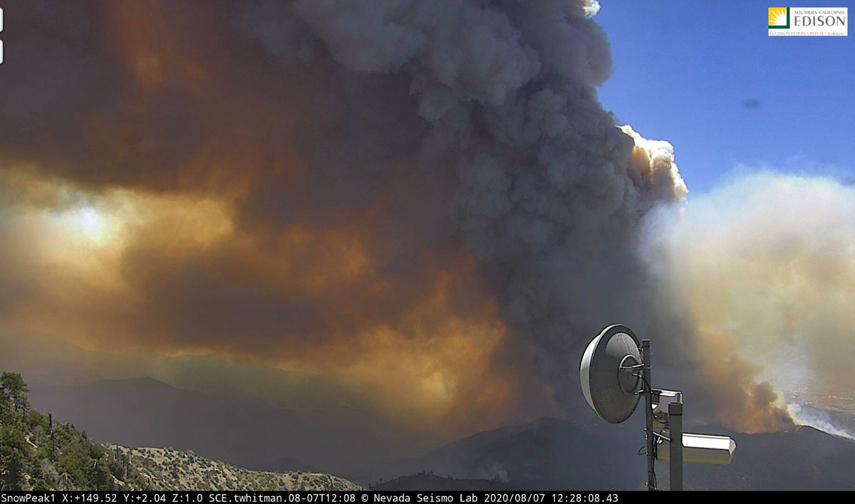
Smoke over the Apple Fire
Smoke over the Apple Fire as seen from Snow Peak, looking southeast at 12:28 p.m. PDT August 7, 2020.

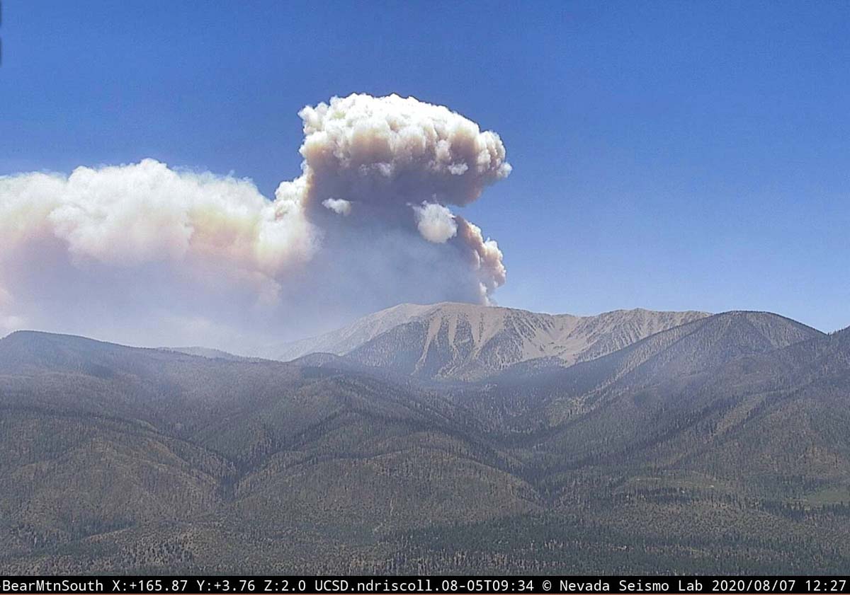
The U.S. Forest Service said at about 11:30 a.m. Friday that the very large amount of smoke on the east side of the Apple Fire is the result of a burn out operation:

This is a planned event and has adequate aerial support and ground resources in the area. The smoke is a result of crews doing a burn out operation to remove fuels in front of the fire.

Smoke over the Apple Fire
Smoke over the Apple Fire as seen from Bear Mountain, looking southeast at 12:27 p.m. PDT August 7, 2020.
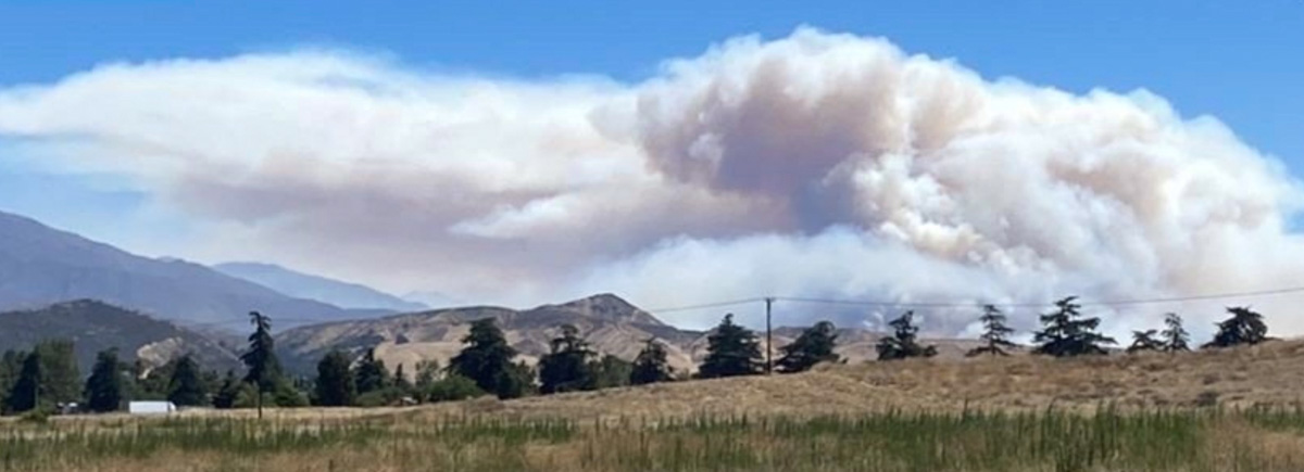
Smoke over the Apple Fire
U.S. Forest Service photo.

August 7, 2020 | 6:50 a.m. PDT

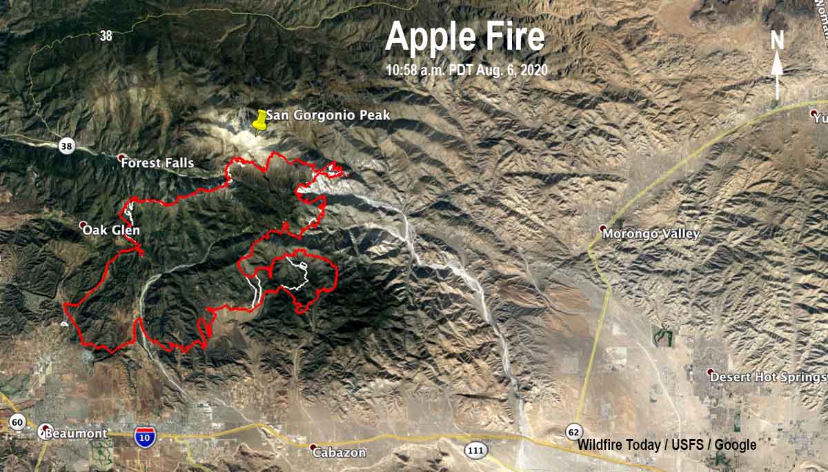
Map of the Apple Fire
Map of the Apple Fire. The red line was the perimeter at 10:58 p.m. PDT August 6, 2020. The white line was the perimeter about 48 hours before.

More evacuation warnings were issued Thursday for the Apple Fire which has been burning since July 31 north of Beaumont and Banning in southern California. One of the areas on the list is the community of Morongo Valley. A warning is one level below an evacuation order.

(To see all articles on Wildfire Today about the Apple Fire, including the most recent, click here.)

“There is a potential threat to life and/or property,” the Sheriff’s Department said. “Those who require additional time to evacuate, and those with pets and livestock should leave now.”

apple fire photo
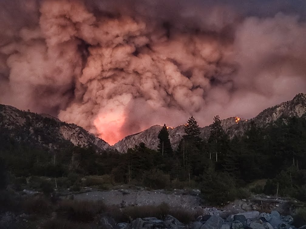
This photo of the Apple Fire was shot by Sandy Wood August 1, 2020. It is looking east from Mill Creek in Forest Falls up to Mill Creek Jumpoff, with Galena Peak burning to the right.

A mapping flight at 10:58 p.m. Thursday determined that the Apple Fire had burned 29,267 acres. The largest concentrations of heat at that time were on the east side as it burned into Willard Canyon and Bear Wallow Spring.  Another area of intense heat was on the northwest side of the fire where it was spreading near Cedar Mountain.

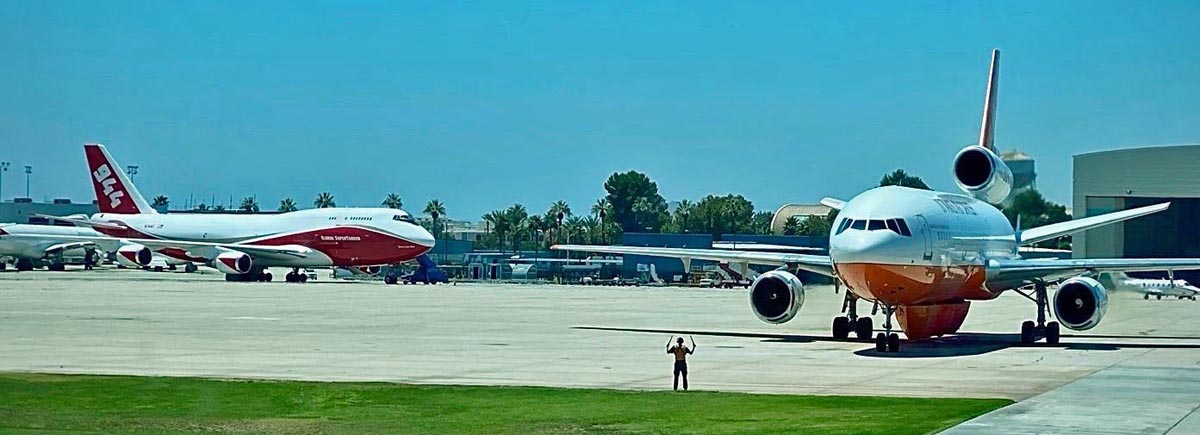
Very Large Air Tankers, a DC-10 and a 747, at San Bernardino Air Tanker Base
Two Very Large Air Tankers, a DC-10 and a 747, at the San Bernardino Air Tanker Base 16 miles northwest of the Apple Fire. USFS photo.

From the Incident Management Team Thursday night:

“Firefighters made good progress in the Oak Glen area and were able to build direct line just below the fire. The fire is headed towards a rocky area. The smoke in this area was due to heavy fuels burning on the top of Yucaipa Ridge.

“The fire burned through heavy fuels in the Millard Canyon area, but stayed in place on the western slopes of Millard Canyon. Planes and helicopters built a line of fire retardant today in preparation for firing out a portion of the vegetation this evening. The goal is to build a containment line to prevent fire movement to the east to the communities of Morongo Valley and Pioneertown.

“The fire has stayed in place in the San Gorgonio Wilderness to the north. Firefighters have made good progress with mop-up and backhaul of trash and excess equipment in the origin area of Cherry Valley and Banning Canyon; this area will be in patrol status tomorrow.”

Growth of the Apple Fire in southern California slows

But it is still spreading and has burned over 27,000 acres

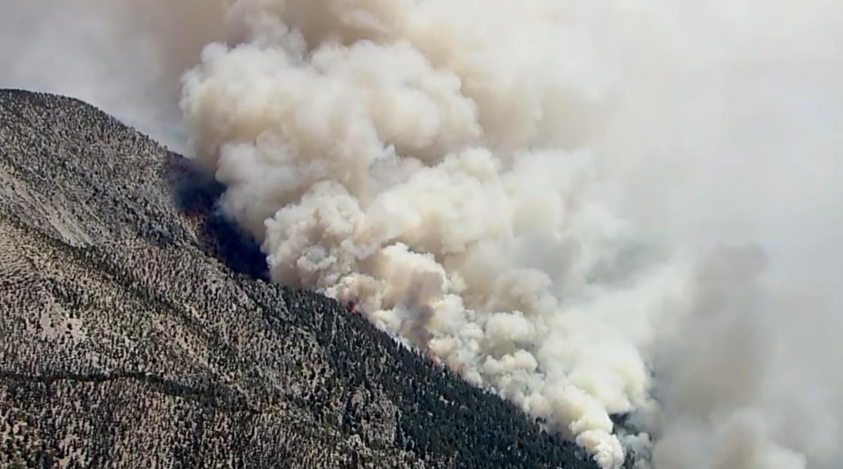
Apple Fire
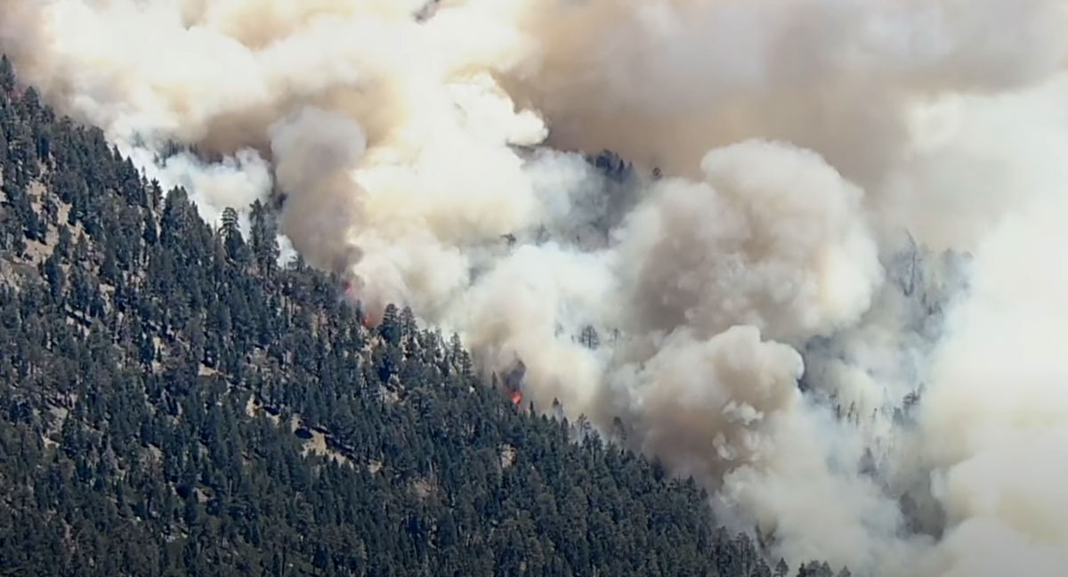
Apple Fire, San Bernardino NF, August 2, 2020. Screenshot from ABC7 video.

Normally a wildfire that adds about a thousand acres a day would be very newsworthy, but now that the Apple Fire has burned over 27,000 acres, an additional 500 or 1,000 acres a day is only about a three percent increase. That is what this large fire north of Beaumont and Banning, California has been doing for the last several days. Much of the fire has reached the very steep rocky slopes of the highest peaks in Southern California and the Transverse Ranges at 7,000 to 10,000 feet where firefighting is even more difficult than it is on flat ground in California.

(To see all articles on Wildfire Today about the Apple Fire, including the most recent, click here.)

Wednesday the incident management team said the fire was mapped at 27,319 acres.

On Tuesday and Tuesday night the fire was active in some areas on the east and west flanks. Ground crews continued to build line in the area of Pine Bench and made good progress on the western perimeter east of Oak Glen. Line building continued Wednesday up to Yucaipa Ridge which is a high priority in order to protect the Forest Falls and Oak Glen communities.

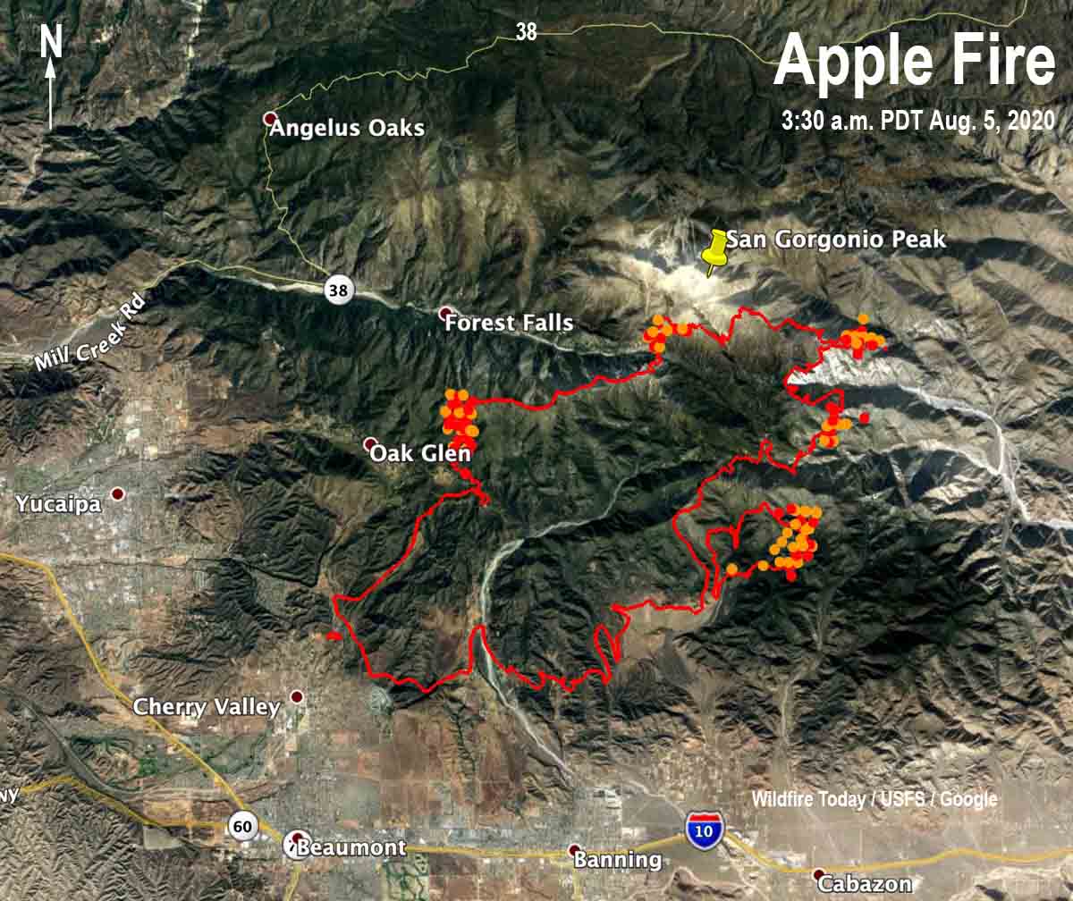
Map of the Apple Fire
Map of the Apple Fire. The red line was the perimeter at 11:10 p.m. PDT August 4, 2020. The yellow and red dots represent heat detected by a satellite in the 24-hour period ending at 2 p.m. PDT August 5, 2020.
CAL FIRE fighters Apple Fire
CAL FIRE fighters on the Apple Fire in the Oak Glen Area. CAL FIRE photo.

Investigators say the Apple Fire was caused by a vehicle

Hot carbon particles from the exhaust created multiple ignition points

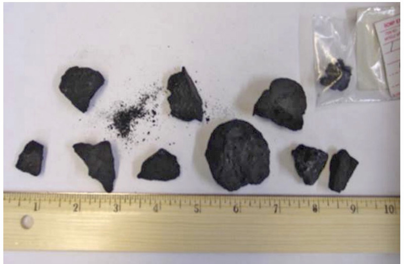
Diesel carbon particles
File photo of diesel carbon particles (Photo from Guide to Wildland Fire Origin and Cause Determination)

Investigators have concluded the Apple Fire in southern California near Cherry Valley was caused by hot carbon particles from the exhaust system of a diesel-powered truck, which is not an uncommon cause of vegetation fires along roadways. Witnesses corroborated the investigators findings. At least three ignition points were found which all merged into one fire.

All internal combustion engines emit carbon particles which is why spark arrestors are required on chain saws, for example. The smallest are invisible, but particles from diesel engines can be much larger than those from small engines or gasoline engines. The bigger the engine, the larger the particles. As a qualified Cause and Origin Investigator I have picked up along railroads particles that were two inches long.

(To see all articles on Wildfire Today about the Apple Fire, including the most recent, click here.)

When a diesel engine begins ejecting carbon particles it can occur over a distance along a road or railroad. Multiple fire ignition points can be created.

Volatile hydrocarbons contained within the particle may extend the time the particle is thermally active. Larger particles may auto-ignite upon ejection and contact with the air.

A Diesel engine is more likely to throw out large carbon particles if it has been idling, it has suddenly been throttled up (such as pulling a heavy load up a hill), or if the engine is not running properly.

A discarded lit cigarette usually will not ignite dry grass unless the relative humidity is less than 22 to 25 percent, but carbon particles have been known to start fires at up to 80 percent. Many fires along roads blindly blamed on “someone tossing a cigarette” are more likely caused by hot carbon particles.

Pieces of catalytic converters can also be discharged from exhaust pipes. Normally catalytic converters can reach up to 1,380°F. When they malfunction and overheat they can break apart at temperatures of 2,400 to 2,800°F. Hot ceramic particles discharge from the exhaust system either through the tail pipe or through failures in the outer shell of the converter itself.

Apple Fire
The Apple Fire, San Bernardino NF, August 2, 2020. Screenshot from ABC7 video.

To learn more about investigating the cause of vegetation fires, spend some time with the 337-page “Guide to Wildland Fire Origin and Cause Determination” (NWCG publication, PMS 412).

Time-lapse video of the Apple Fire

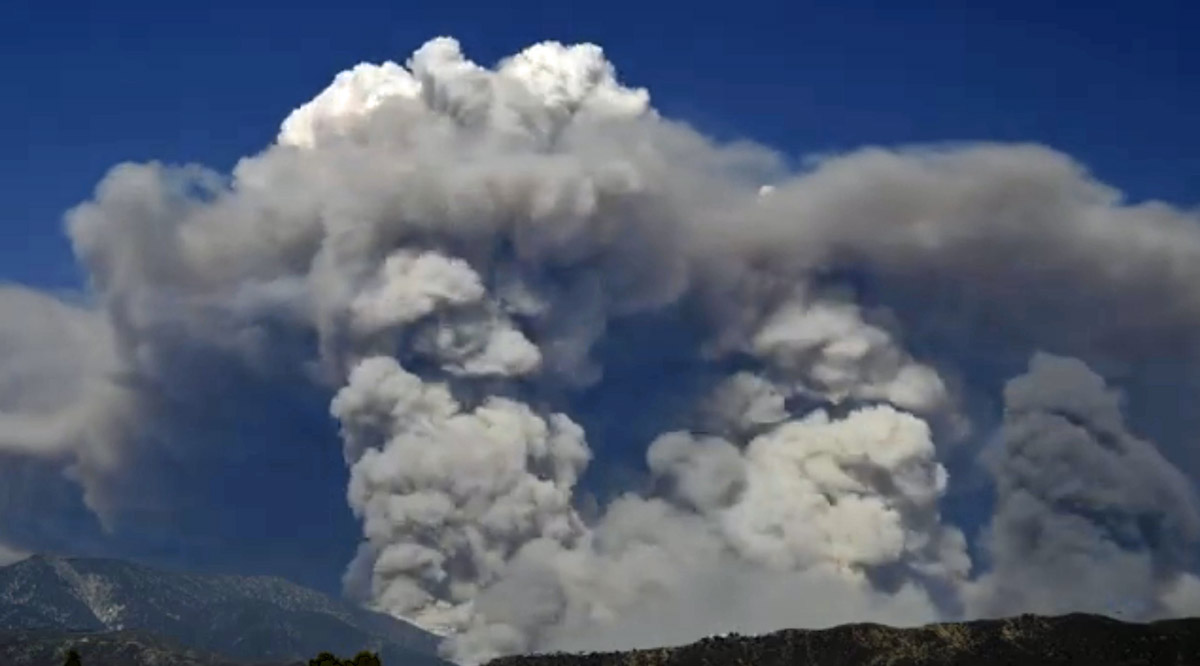
Apple Fire convection column pyrocumulus
Screenshot from the time-lapse video of the convection column on the Apple Fire, shot by Leroy Leggitt.

This video compresses 20 minutes of high intensity wildfire behavior on the Apple Fire into 20 seconds. It was recorded at 4:18 p.m. PDT August 1, 2020 by V. Leroy Leggitt. You can see several areas of condensation at the top of the smoke column as it becomes a pyrocumulus cloud.

The Apple Fire started July 31, 2020 near Cherry Valley, California and is spreading north of Beaumont and Banning. As of August 3, 2020 it has burned over 26,000 acres.

If you are having trouble watching the video, you can see it on YouTube.

(To see all articles on Wildfire Today about the Apple Fire, including the most recent, click here.)

Apple Fire in southern California grows to nearly 25,000 acres

Evacuations are still in effect

August 4, 2020 | 8:35 a.m. PDT

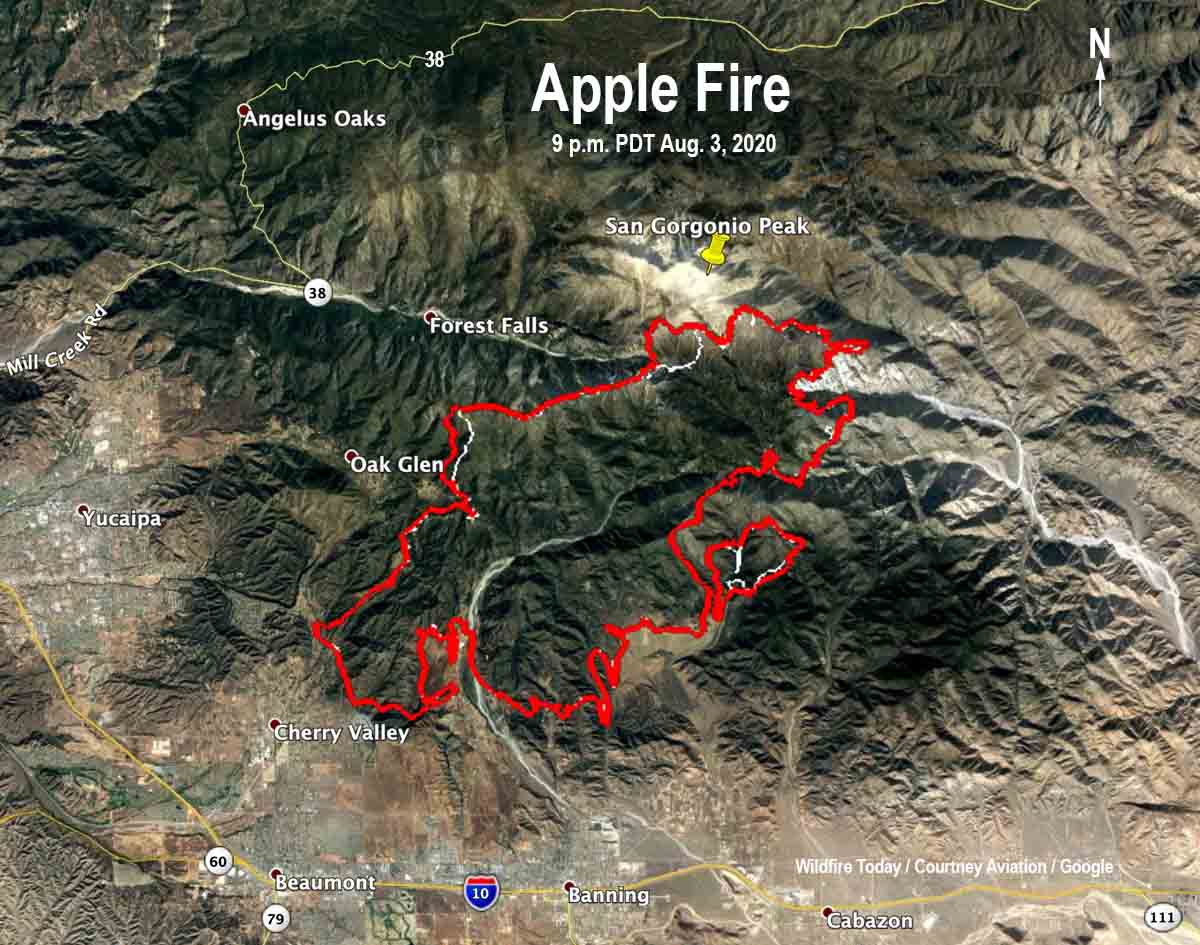
map Apple Fire 9 pm PDT August 3, 2020
Map of the Apple Fire, showing the perimeter (in red) at 9 p.m. PDT August 3, 2020, The white line was the perimeter about 24 hours before.

The growth of the Apple Fire north of Beaumont and Banning in southern California slowed Monday. It chewed through approximately 1,000 more acres primarily on the east side across the head of the Mill Creek Canyon and east into the San Gorgonio Wilderness. The vegetation it is moving into is sparse in some areas, especially in the higher elevations at 8,000 to 11,00o feet. Monday evening the incident management team reported 26,850 acres burned, but that number could be adjusted after they consult the mapping flight conducted at 9 p.m. Monday.

Investigators have concluded the fire was caused by hot carbon particles from the exhaust system of a diesel-powered truck, which is not an uncommon cause of vegetation fires along roadways. All internal combustion engines emit carbon particles and is why spark arrestors are required on chain saws, for example. Carbon particles from diesel engines can be much larger than particles from small engines or those powered by gasoline, and may exceed one inch. Witnesses corroborated the investigators findings. At least three ignition points were found which all merged into one fire.

Damage assessment teams are deployed and will be surveying the fire area for damage to structures and infrastructure.
Evacuation information for Riverside County Residents can be found at www.rivcoready.org/ActiveEvents.

In San Bernardino County, the community of Oak Glen is under an evacuation order. Forest Falls, Pioneertown, and Rim Rock are all under an evacuation warning.

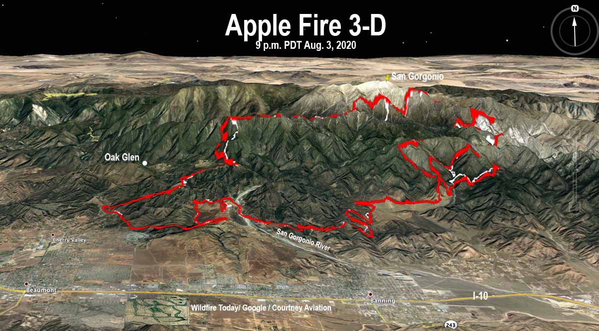
map Apple Fire 3-D 9 pm PDT August 3, 2020
3-D map of the Apple Fire, showing the perimeter (in red) at 9 p.m. PDT August 3, 2020, The white line was the perimeter about 24 hours before.

This is why at Wildfire Today we do not repeat the containment percentages given out by fire officials. From NBCLosAngeles today:

Earlier Sunday morning, fire officials said progress had been made and the blaze was 12% contained. However in a later update after U.S. Forest Service took over command, fire officials said the blaze was 0% contained.

On Sunday thousands of people had been busting their asses on the fire for three days, and the U.S. Forest Service basically said not a single foot of fire perimeter had a good fireline.

Resources on the Apple Fire Monday included 31 hand crews, 321 fire engines, 28 dozers, 12 helicopters, 2 small fixed wing planes, 50 water tenders, and a variable number of air tankers for a total of 2,565 personnel.


Originally published August 3, 2020 | 11:31 a.m. PDT

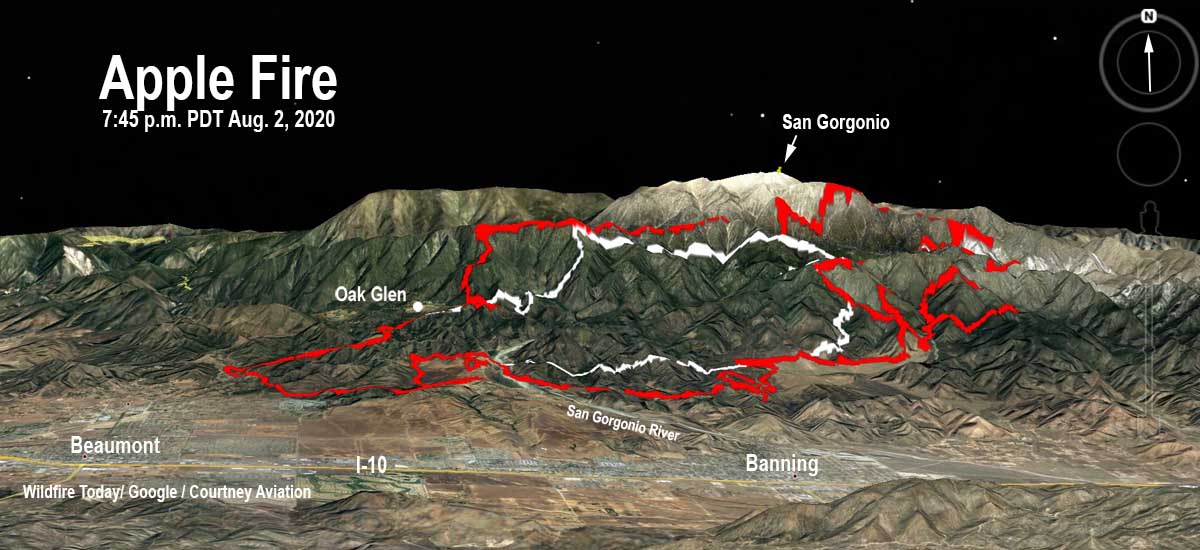
3-d map of the Apple Fire
3-D map of the Apple Fire, showing the perimeter (in red) at 7:45 p.m. PDT August 2, 2020, Looking north. The white line was the perimeter about 24 hours before.

The Apple fire burned actively Sunday, primarily to the north and east. Much of the fire activity is being driven by the record low moisture content of the vegetation in the area combined with high temperatures and low relative humidity. These conditions are contributing to active fire behavior both day and night.

The fire started July 31 near Cherry Valley, California and is spreading north of Beaumont and Banning.

(To see all articles on Wildfire Today about the Apple Fire, including the most recent, click here.)

A mapping flight Sunday evening at 7:45 determined that the fire had burned 24,830 acres, an increase of about 10,000 acres in 24 hours. At about 11 a.m. the incident management team announced it had grown to 26,450 acres.

Sunday night and early Monday morning the fire was very active. Multiple spot fires ignited on the north side which were attacked  by a night-vision equipped helicopter. Two of the spot fires were caught but one grew significantly and will be assessed.

The Apple fire is burning in an area with no recent fire history. It is expected to burn into less dense fuels as it progresses. Firefighters on the ground and in the air  are building fireline directly on the fire’s edge where possible and are protecting structures in local communities. The extremely steep slopes and elevations up to 11,000 feet make this a challenging assignment for firefighters.

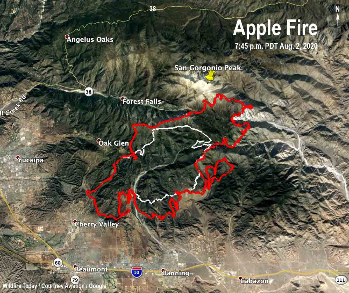
Map of the Apple Fire
Map of the Apple Fire, showing the perimeter (in red) at 7:45 p.m. PDT August 2, 2020, The white line was the perimeter about 24 hours before.

Evacuation information for Riverside County residents is available at the county website where residents can enter an address to see if they are in an evacuation area.

In San Bernardino County, the community of Oak Glen is under an evacuation order. Forest Falls, Pioneer Town, and Rim Rock are all under an evacuation warning.

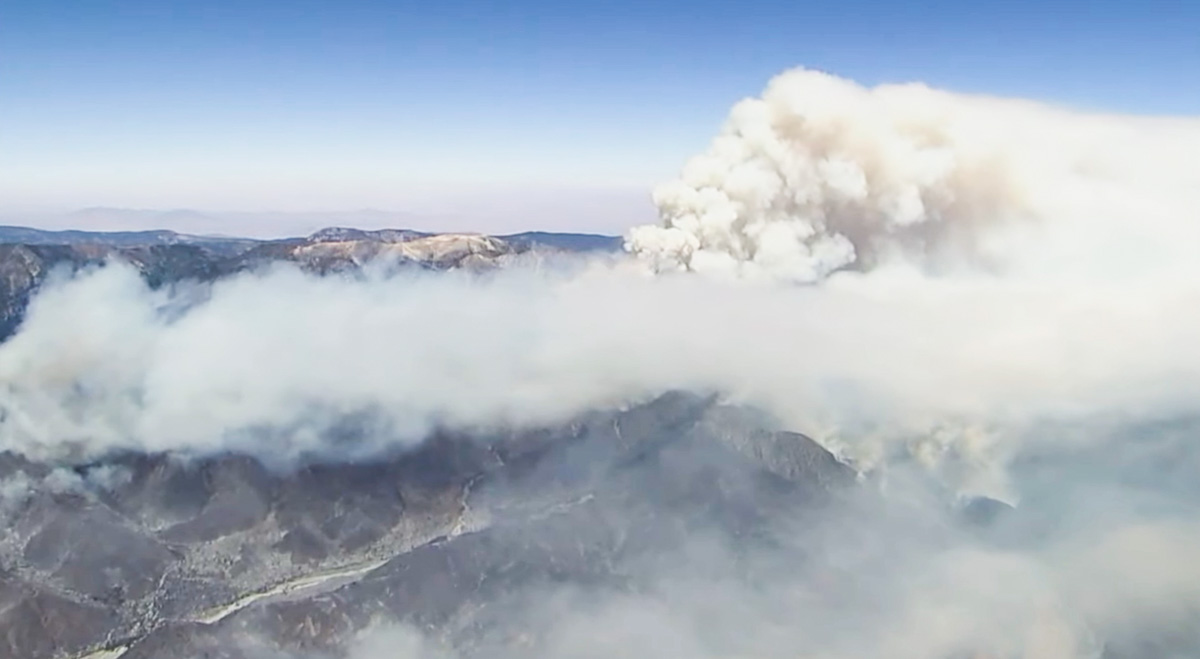
Apple Fire
Apple Fire, San Bernardino NF, August 2, 2020. Screenshot from ABC7 video.

The weather forecast for Monday calls for more of the same conditions that have led to rapid growth of the fire — 91 to 96 degrees, 15 to 20 percent relative humidity, and ridgetop winds out of the west at 20 mph.

It is difficult for meteorologists to create a forecast for a fire like this. It is on very steep topography that ranges from 3,400 feet at Cherry Valley to 11,503 feet at the top of Mount San Gorgonio.

Apple Fire
A steep slope at high elevation on the Apple Fire, San Bernardino NF, August 2, 2020. Screenshot from ABC7 video.