Six bushfires merge in Australia to burn 1.5 million acres

gigafire australia victoria new south wales
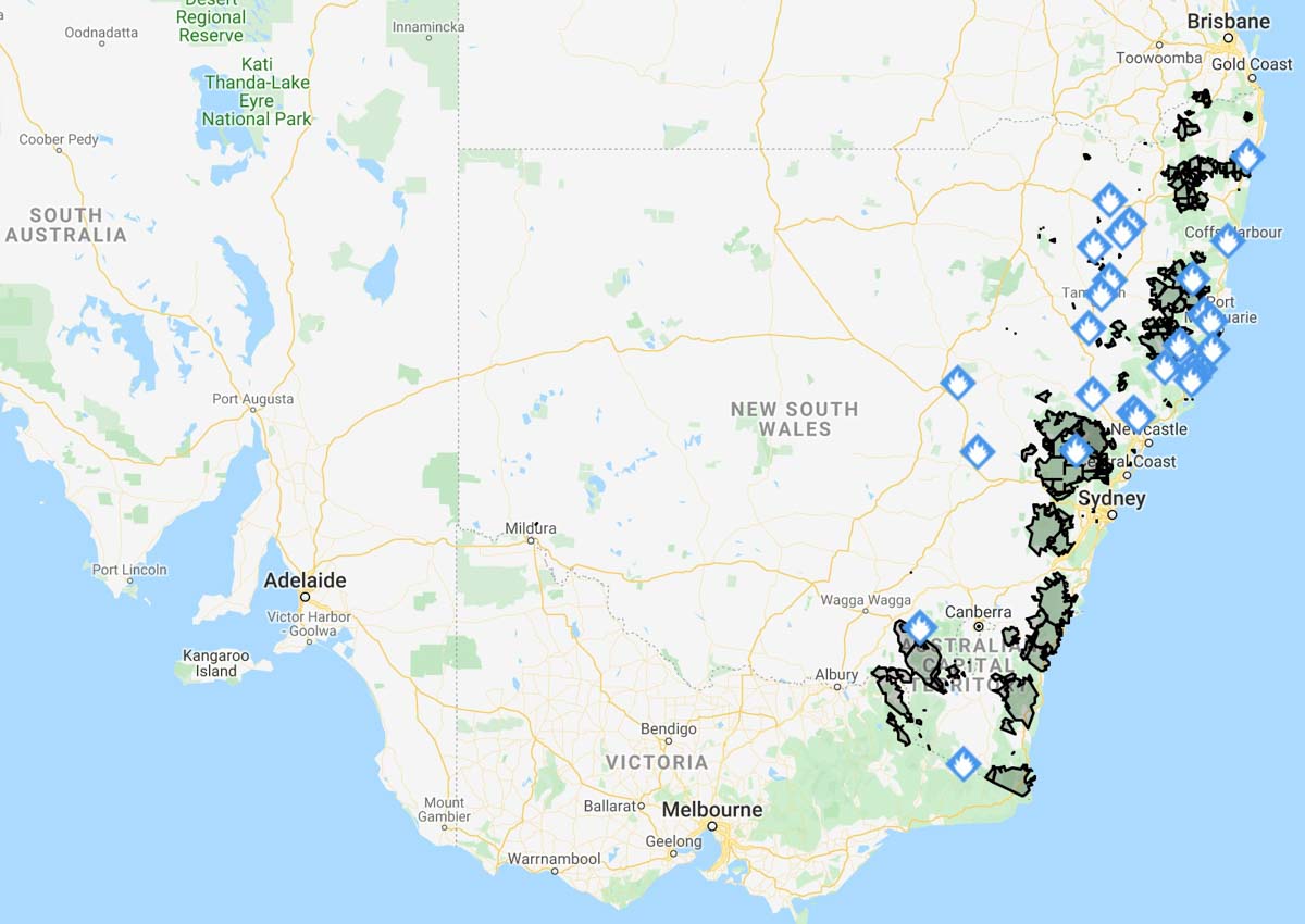
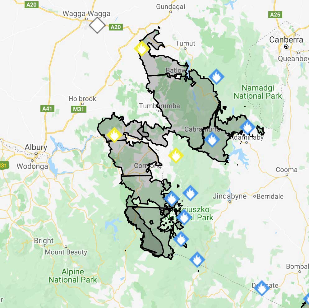
Six bushfires in two Australian states have merged, forming a huge megafire covering 1,532,484 acres (632,315 hectares). To get an idea of the scale, the distance between Canberra and Albury is 134 miles (216 km).  Map: NSW RFS

Six bushfires in two Australian states have merged, forming a huge blaze covering 1,532,484 acres (632,315 hectares) slightly smaller than the size of Delaware in the United States. The fires in Victoria and New South Wales met near Jingellic NSW between Canberra and Albury.

NAME            HECTARES
Dunns Road, 316,754
Doubtful Gap Trail, 48,918
Adaminaby Complex, 28,640
Green Valley, Talmalmo, 233,390
Mount Youngal, 1,000
Pilot Lookout, 3,613

TOTAL: 632,315 hectares (1,532,484 acres)

Below is an excerpt from an article at the Australian Broadcasting Corporation updated Friday night local time:

Firefighters are bracing for a difficult night ahead amid the formation of a second “mega-blaze” and a southerly change sweeping up the New South Wales coast, bringing gusts of up to 90 kilometres per hour.

Emergency warnings were issued earlier for the Dunns Road fire burning near Ellerslie and Tarcutta in the Snowy Valleys, as well as the Green Valley Talmalmo fire and the adjoining East Ournie Creek fire, burning east of Albury.

All three fires have now joined to form the state’s second “mega-blaze” and now covers more than 640,000 hectares, straddling the New South Wales and Victorian borders.

However, these blazes had all been downgraded to watch and act overnight. In total, four fires were at watch and act level last night, including the Erskine Creek blaze burning south of Leura and Wentworth Falls in the Blue Mountains.

NSW Rural Fire Service Inspector Ben Shepherd said warnings for the blaze had been upgraded in anticipation of the southerly hitting the area around midnight and he warned residents to monitor conditions as the front moved through.

In a Facebook post, Blue Mountains Mayor Mark Greenhill told locals it had been a “hard day” for the region ahead of a “night of vigilance for us all”.

“We were worried it would be a hard day. That has been the case,” he wrote.

“We have had fire activity in the Grose Valley a few kilometres from Faulconbridge. This was air-attacked throughout the afternoon. Work will continue tomorrow.

“Crews are working hard to manage this activity. They will have a long night … I am sorry the news is not better but tonight is a night of vigilance for us all.”

NASA has released an animation showing smoke from the Australian fires reaching across the Pacific to South America.

NASA’s description of the video:

“The animation shows RGB color images from NASA’s Moderate Resolution Imaging Spectroradiometer (MODIS) instrument on NASA’s Aqua satellite for December 31, 2019 through January 5, 2020. A plume of brown smoke extends from the southeastern coast of Australia, over the Tasman Sea and beyond into the Pacific Ocean.

“The overlaid vertical cross sections show CALIPSO lidar observations for these same days. The bright colors indicate the presence of small particles (aerosols) and the white color indicates clouds. Visible in each of the cross sections near 40 degrees south is a thick layer of smoke from the fires at altitudes above 9 miles (14.5 km). The dark shading below these layers is due to the absence of lidar signals below the opaque smoke layers. These layers contain very small particles and have optical properties similar to smoke.

“The sequence of CALIPSO and MODIS tracks in the animation indicates the continued transport of the smoke layer to the east. As of Jan. 5, 2020, smoke was detected more than 4,000 miles from the source.

“Credit: NASA Langley/Roman Kowch”

Australia requests U.S. Incident Management Teams to assist with bushfires

They will depart around January 16

Rocky Mountain Type 1 Incident Management Team
File photo. Example of an Incident Management Team, in this case, the Rocky Mountain Type 1 Incident Management Team. Photo from the Team’s website.

Australia has ramped up their requests for firefighting help from the United States. So far during their 2019-2020 southern hemisphere bushfire season Australia has only requested individuals to serve in specific management or specialist positions on bushfires, except for one 20-person crew that left for Australia a few days ago.

But now according to the National Interagency Fire Center in Boise, Australia has asked for “several Type 1 Incident Management Teams” (IMTs).

The logistics and determination of which IMTs will go is being worked out now, with an estimated departure date around January 16, 2020. The basic configuration for Type 1 IMTs is 58 members including 14 trainees, while a “short” Type 1 team has 26 including 6 trainees. We have learned that early indications are that instead of multiple 58-person teams going to Australia, three 10-person teams will respond, but this could change before they are actually mobilized. Maybe they will come up with a new term for 10-person teams.

IMTs are organized in advance to staff the overhead or management structure needed for running a planned or unplanned incident. The organization is based on the Incident Command System, with every position on the team having a title and a position description. Specific training is required for each job.

A Type 1 IMT is the highest level team, comprised of individuals with advanced degrees, so to speak, within their particular area of expertise. In the United States rosters are set in the winter or spring for the following summer fire season. There is always some churn between seasons, but many serve for multiple years. The team concept helps to build relationships, trust, and efficiency — the whole becomes greater than the sum of its parts. Everyone understands their role and they know what to expect from their co-workers.

IMTs that are primarily used on fires are rarely needed between January and April, however that can vary depending on the geographic location. Since this is the time of the year when IMTs might be undergoing change, with some ending their appointment to the team and their replacements not yet having been selected, it could be a challenge reconstructing them. Other complicating factors could also play a role, such as the requirement for passports and being available for an unexpected assignment about twice as long as the typical 2-week mobilization on an incident in the U.S.

But if the teams are stripped down to just 10 people each, it simplifies the process.

Based on requests from the Australian Fire and Emergency Service Authorities Council, the U.S. has intermittently deployed more than 159 wildland USFS and DOI fire personnel throughout December and early January. The U.S. firefighters are filling critical wildfire and aviation management roles in New South Wales and Victoria.

The U.S., Australia, and New Zealand have been exchanging fire assistance for more than 15 years. Until the December deployments the last time the U.S sent firefighters to Australia was in 2010. In August of 2018, 138 Australian and New Zealand wildfire management personnel were sent to the U.S. for almost 30 days to assist with wildfire suppression efforts in Washington, Oregon, and California. The Australian and New Zealand personnel filled critical needs during the peak of the western fire season for mid-level fireline management, heavy equipment, helicopter operations, and structure protection.

The ability for the U.S. to send firefighters to assist Australia and New Zealand is authorized in a formal agreement under the Emergency Wildfire Suppression Act. According to information from NIFC, “The agreement only permits the United States to send federal employees to Australia, which means that legally, the National Interagency Fire Center cannot mobilize non-federal employees, such as state and local firefighters, to Australia.”

Another area of Kangaroo Island evacuated prior to high bushfire danger

Fire has had major impacts on Kangaroo Island’s wildlife, killing thousands of koalas

Ravine Fire Kangaroo Island Australia
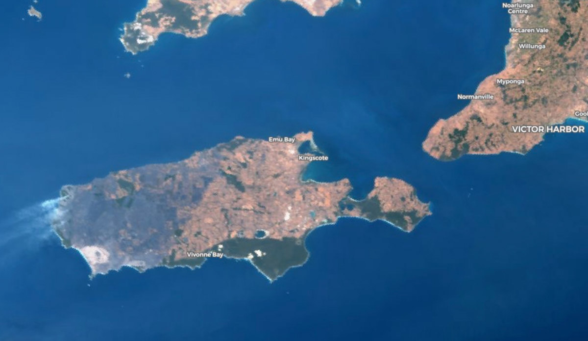
The gray area on the west side of Kangaroo Island has burned in the Ravine Fire. Copernicus image. January 8, 2020 local time.

As the lightning-caused Ravine Fire on Kangaroo Island off the coast of South Australia continues to grow to the east new evacuations have been ordered. In anticipation of high fire danger on Thursday the South Australian Country Fire Service has taken the unusual step of calling on police to help evacuate the town of Vivonne Bay on the south side of the island. There are concerns that the fire could cross control lines and burn into areas with heavy fuel loading near the town of 400 residents.

The weather forecast on Thursday calls for winds east to northeasterly 25 to 35 km/h increasing to 40 km/h before shifting westerly 20 to 30 km/h in the late afternoon.

The red areas represent heat detected on the Ravine Fire on South Australia’s Kangaroo Island. January 8, 2020 local time.

The 164,000-hectare (405,000-acre) fire has had a major impact on the wildlife while burning over a third of the island. It has been called a Noah’s Ark since it supports species that are not found in large numbers in other locations.

Several organizations on the island are caring for koalas that have been injured in the fire. About 50 have been brought to the Kangaroo Island Wildlife Park, but at least one-third had to be euthanized due to extreme burns. The Guardian reports that Sam Mitchell, co-owner of the park, estimates that of the estimated 50,000 koalas on the island “probably more than half” would have perished in the fires, but it was “a guessing game”.

There is also concern about other species including the Kangaroo Island dunnart, glossy black-cockatoo, wallabies, pygmy possums, and the rare green carpenter bee.

Meteorologist explains the weather that is driving the bushfires in Australia

Australia weather explained
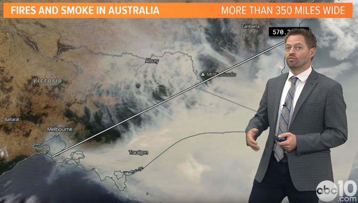
Screenshot from the ABC10 video below.

Rob Carlmark, a meteorologist at Sacramento TV station ABC10, explains the weather that has created the current unprecedented bushfire situation in Australia.

You can follow Mr. Carlmark on Twitter: @rcalrmark

Firefighting conditions ease in Australia before they worsen again Friday

Temperatures in the New South Wales inland areas on Friday will be over 100F accompanied by strong winds

Map New South Wales Rural Fire Service fires
Map from the New South Wales Rural Fire Service January 6 showing fires that are at the “Advice” level, meaning “A fire has started. There is no immediate danger. Stay up to date in case the situation changes.”

On Monday and Tuesday local time in New South Wales some areas west of Sydney received rain, which with the higher humidities and lower temperatures slowed the spread of fires in the area. The cooler weather will continue until Friday when the inland areas of NSW will experience temperatures over 100F, 15 percent relative humidity, 15 mph northwest winds, and a chance of dry lightning which could ignite even more fires. The hot, dry, windy weather is expected to last just for the day after which temperatures should drop back into the 80s for several days.

Smoke from fires in New South Wales satellite photo
Smoke from fires in New South Wales as seen by Sentinel 3, January 6, 2020. Via Copernicus EMS.

In other bushfire news, Australia’s government is committing an additional $2 billion over two years to a new agency tasked with rebuilding bushfire-ravaged communities.

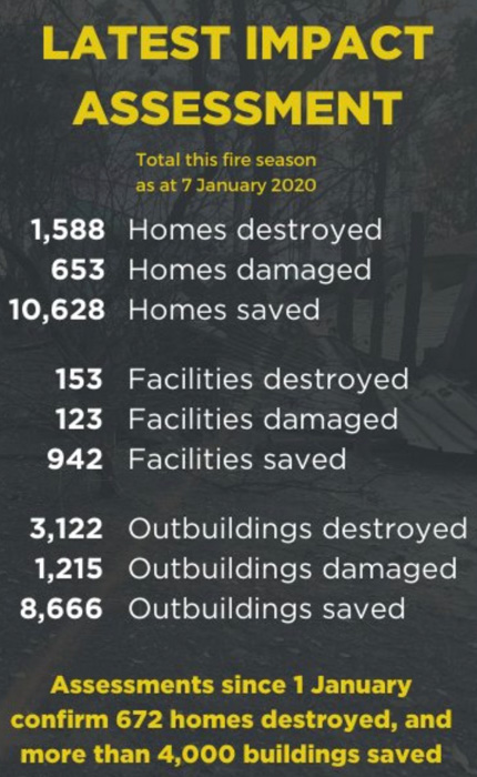
fire stats homes destroyed numbers
Data from NSW RFS .
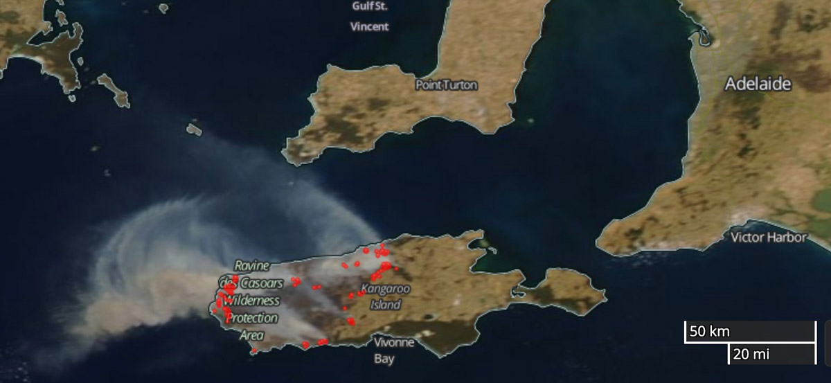
Satellite photo showing the fires on Kangaroo Island
Satellite photo showing the fires on Kangaroo Island South Australia, January 6, 2020 local time. NASA
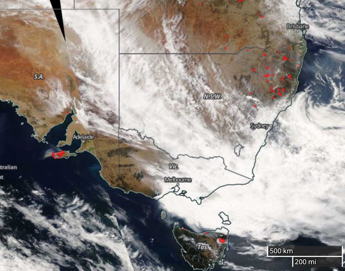
Satellite photo, southeastern Australia, January 6, 2020 local time. NASA
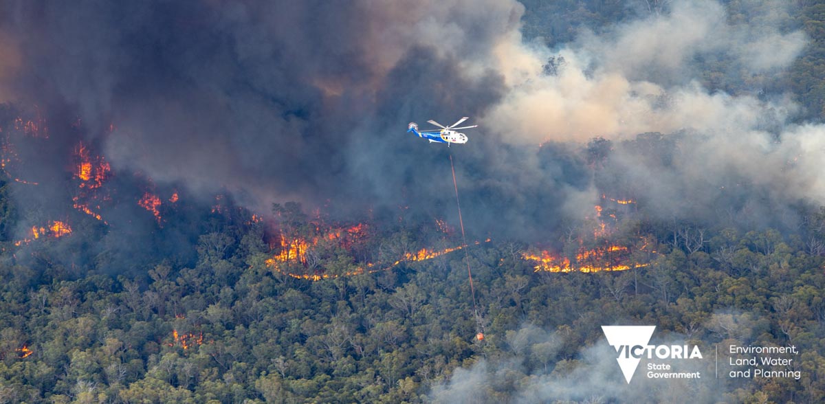
fires in East Gippsland Australia
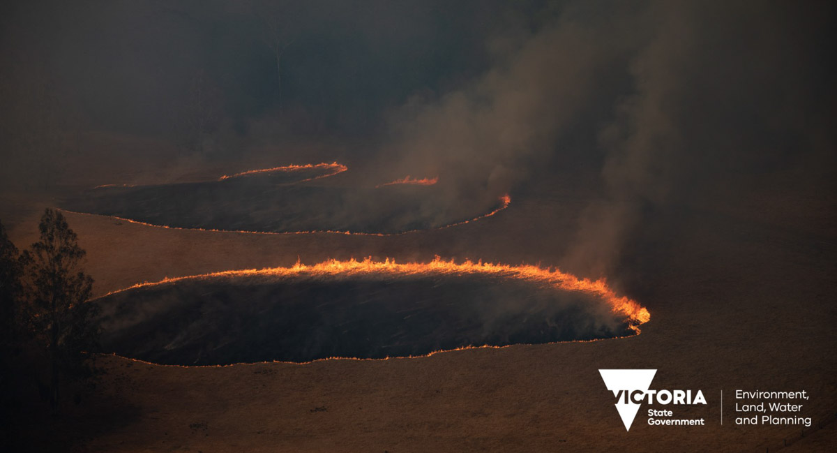
One of the fires in the East Gippsland region of Victoria, December 30, 2019. Photo by Ned Dawson for Victoria State Government.
Spot fires in the East Gippsland region of Victoria, December 30, 2019. Photo by Ned Dawson for Victoria State Government.

Winter task for U.S. and Australia wildfire agencies: create a common operating picture

One source for informing the public and gathering information about mitigating the emergencies, providing relief, managing transportation corridors, electrical power grids, and evacuations

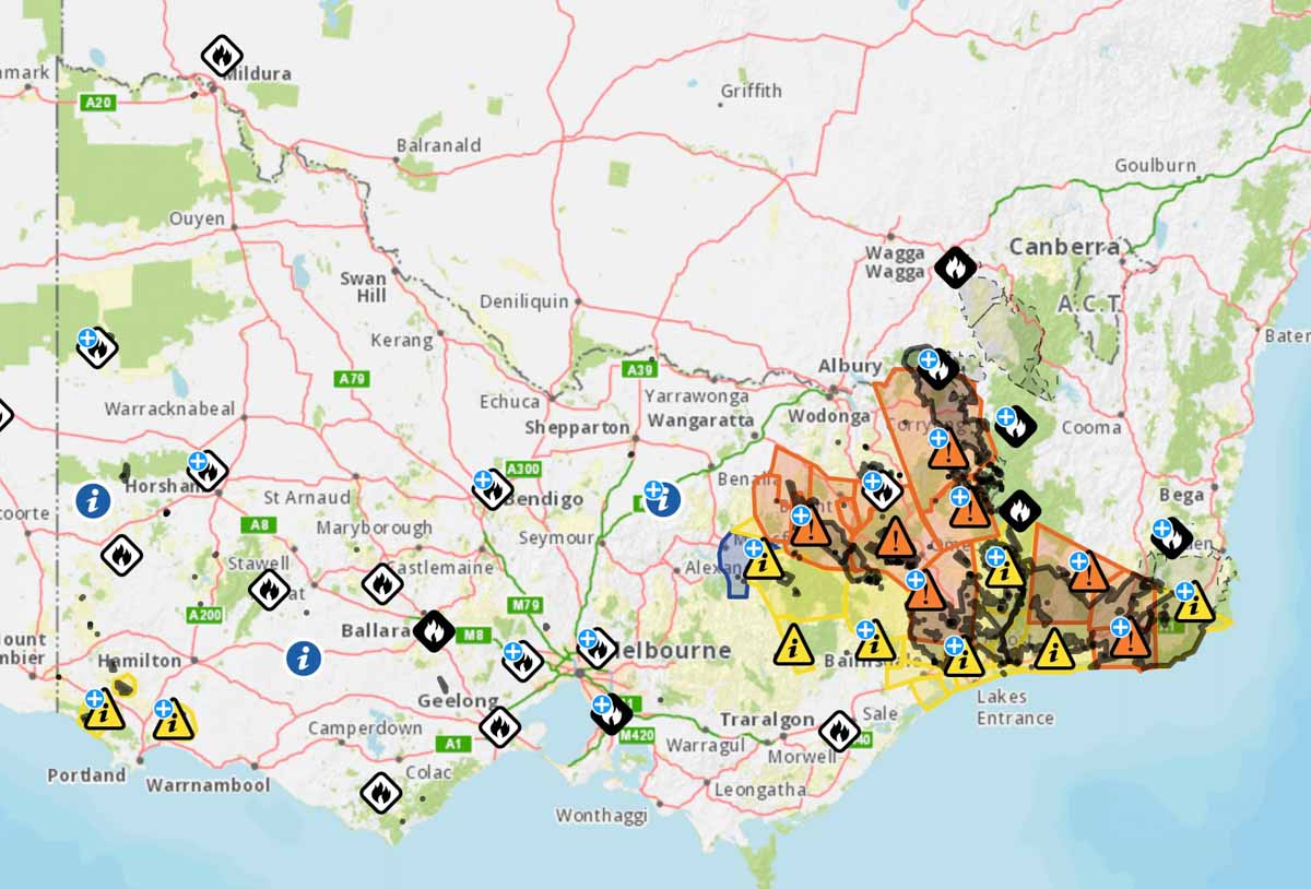
fire map Victoria
Map from Emergency Management Victoria, January 6, 2020.

After the 2019-2020 southern hemisphere bushfire season, emergency management personnel in both the United States and Australia should take the opportunity to evaluate the fire season and determine if there is a better way of distributing information to the public and emergency management agencies.  In neither country is there one key source for information where the public, the media, and the responsible agencies can quickly and efficiently obtain important real-time intelligence and predictive models that they need to make decisions about informing the public, mitigating the emergencies, providing relief, managing transportation corridors, and gathering information about electrical power grids and evacuations.

The military calls this information source a common operating picture (COP).

All of this information is available at hundreds if not thousands of sources, but not everyone that could benefit from the data have access. It needs to be pulled together for safety and efficiency.

In the United States if a citizen needs current information about a wildfire how do they get it? From the county sheriff, local fire department, or a county, state, or federal agency? It makes a difference about where to look if the fire is on federal land, state protected land,  city, county, national or state park. They can try social media, but which application and which account? InciWeb sometimes has information about wildfires managed by federal agencies, but not all. And since law enforcement is responsible for evacuation, InciWeb does not always have current information about the status of evacuations. Information on the website about individual fires may not have been updated for 12 to 18 hours, however some incident management teams are better than others. And InciWeb rarely provides projections of fire spread in a timely manner, if at all. When someone is threatened by a rapidly spreading wildfire they don’t have time to randomly check an alphabet soup of acronyms on dozens of web sites or social media accounts, even if they know the names, handles, or web addresses.

A COP would need to have a sign-in option that would make it possible for authorized personnel to see detailed data that should not be distributed to the whole world, such as exact locations of resources.

Below are examples of fire location information in Australia on January 6, 2020 United States time, in addition to the Victoria map at the top of the page.

Map New South Wales Rural Fire Service fires
Map from the New South Wales Rural Fire Service showing fires that are at the “Advice” level, meaning “A fire has started. There is no immediate danger. Stay up to date in case the situation changes.”
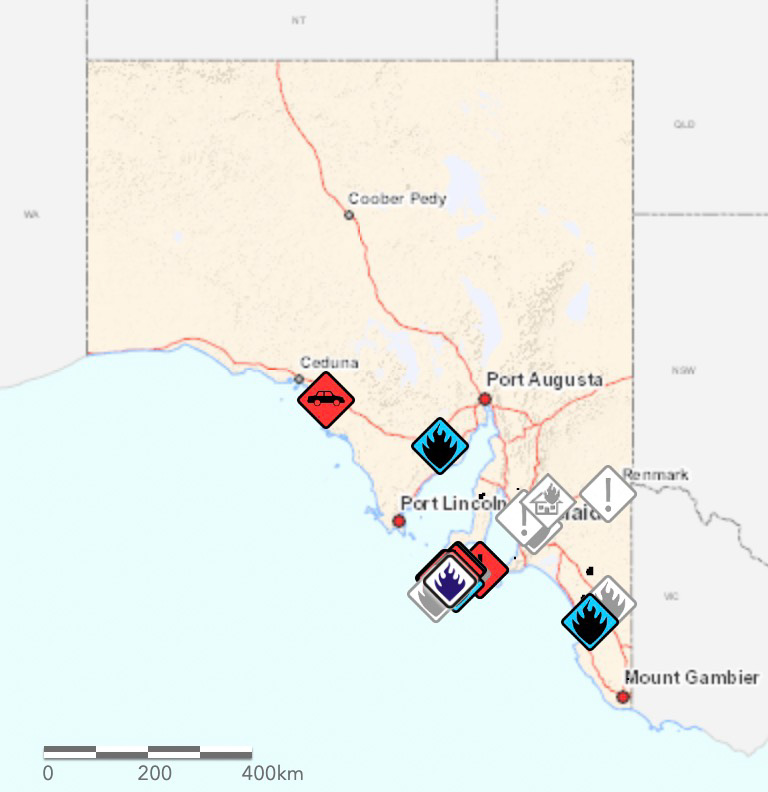
Map in South Australia
Map of fires in South Australia January 6, 2019. From SA Country Fire Service.

The maps produced for New South Wales and South Australia can be more useful upon zooming in, but occasionally they are so cluttered with multiple polygons and symbols that they are difficult to decipher. The Victoria map improves after zooming in, but it tries to include too much information.

The data on these three maps stops at the imaginary line separating the states. This could give someone the false impression that there are no fires just across the state border. If you need information about a location near a state line you need to know how to access the data for both states.

The three Australian states all use different symbology, so an icon or polygon on one map may have a completely different meaning in the neighboring state.

The New South Wales Rural Fire Service occasionally produces detailed maps showing the perimeter of a single fire and the predicted spread, but it is not done on a regular basis and may be difficult to find when it does exist.

But these Australian state maps attempt to include at least some information about all large bushfires in their state. In the United States no agency to my knowledge even attempts this. InciWeb produces a map of the country that shows the location of every fire on federally managed land that is being tracked on the website, but does not include federal fires that are not on the site, or state or locally managed fires.

For both Australia and the U.S. creating a national map for wildfire information would be a great first step toward a common operating picture.

Check out Ellen Broad’s thread on this mapping topic. She has some excellent observations.