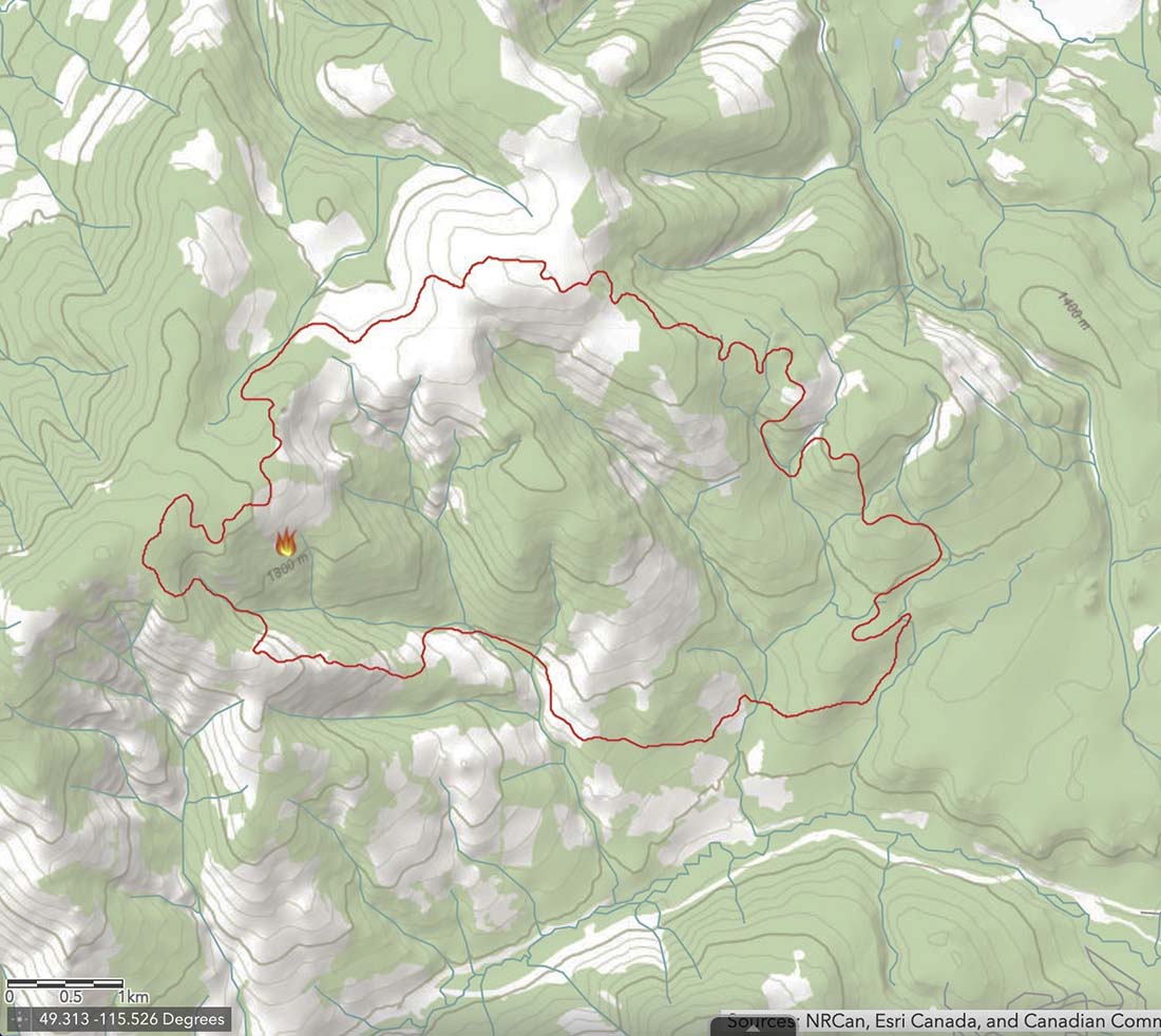
The British Columbia Wildfire Service (BCWS) has been working to contain the 4,230-acre Connell Ridge Fire 14 miles south of Cranbrook since it was reported August 1. It was likely started by lightning.
Crews had already completed burnouts (or planned ignitions) on the south flank and southeast corner but on August 19 a decision had to be made about whether to conduct an additional burnout on the southwest side. After a test burn, the Incident Management Team decided not to conduct the burnout.

The BCWS created the explanatory article and illustrations, below, about some of the considerations and steps taken as the decision was being made. It is rather extraordinary for a land management agency, at least in the United States, to provide this degree of transparency and detail about how a suppression decision was made. This could serve as an example for others to follow, especially when “big box” strategies are used that result in burning thousands of acres of green vegetation, too often with insufficient thought about ignition tactics, second order results, air quality, and long term fire effects.
The article below uses the term “guard” in the first paragraph which I believe in this context refers to a completed control line intended to stop the spread of the fire.
Information Officers on Type 1 Incident Management Teams should be capable of creating valuable content like this:
August 21, 2022
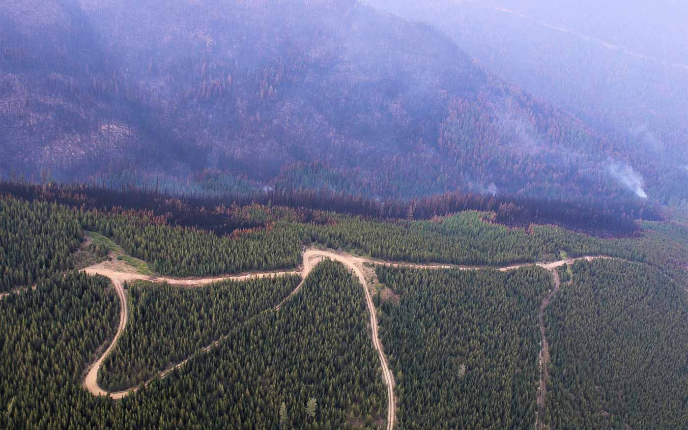
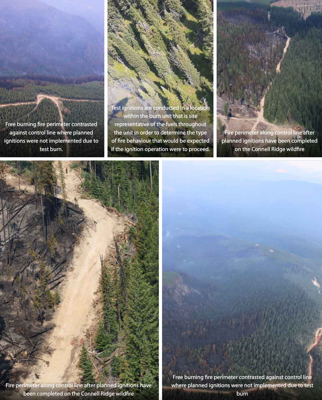
Test ignitions were conducted on the morning of August 19, 2022 on the Connell Ridge (N10989) wildfire, in anticipation of implementing planned ignition operations on the southwest corner. These test ignitions allow our crews and operational staff to determine if the unburnt fuels between the fire perimeter and the guard will be receptive to burning.
The area that the small-scale ignition was planned for is in steep terrain where the fire has been naturally burning in a patchy manner as the fire finds drier fuels that are able to ignite. This means there is a lot of unburnt, greener fuel within this area, between the free burning fires edge and the established control lines.

The purpose of the planned ignition for this area was to remove that unburnt fuel in an intentional way to secure the control line and achieve containment on the southwest ridge of the fire. This unburnt fuel has the potential to burn on it’s own as these greener fuels continue to dry under the hot and dry weather conditions. While the shorter term forecast for the complex shows patches of precipitation, the precipitation will be minimal and is not guaranteed to fall on the fires. With the longer-term forecast returning to a warming and drying trend early next week, these drying green fuels that may not have seen any additional moisture will continue to dry.
Planned ignitions are a very useful tactic in fire suppression and fire management and are often the safer and more efficient operational tactic. It allows us to bring the fire perimeter down to control lines and creates a more uniform and continuous fire edge which is easier for crews to use direct attack methods on and extinguish hot spots to strengthen control lines and achieve containment. This is also more time-efficient and safer for the crews as they have to spend less time chasing hot spots and patches of free burning fire in rough terrain.
Based on test ignitions on August 19 it was determined that the unburnt fuels would not burn in a way that contributes to the strengthening of the existing control line. This means it will take longer to secure this portion of the fire as crews will now need to focus on targeting the patches and hotspots for extinguishment in order to secure this area of the fire.
The Incident Management Team on the Connell Ridge Fire is also working on the Weasel Creek Fire (N11062) and the Cummings Creek Fire (N11051).
