California: Coleman fire, southwest of King City

(UPDATED at 5:15 p.m. PDT June 8, 2016)

The incident management team running the Coleman Fire southwest of King City, California has not revised the reported size in the last two days. They say it’s holding at 2,340 while being attended by about 1,000 personnel, however some of those are being released.

The team’s report Tuesday morning:

Fire crews made good progress again yesterday. Most of the fireline on the south and east side of the fire is contained. Crews were able to access and line several of the “fire fingers” on the west side of the fire in the Ventana Wilderness. The contingency dozer line on the west side of the fire was completed. Crews mopped-up and patrolled the fireline throughout the night on the east side of the fire.

The priority for [Tuesday] and the next several days will be constructing direct fireline on the west side of the fire in the Ventana Wilderness. There is a significant amount of open line that needs to be completed. This area is very steep and remote and line production is slow and difficult. Mop-up and patrol will continue on the other portions of the fire. Air support from both air tankers and helicopters is available to assist ground crews.

****

(UPDATED at 8:58 p.m. PDT, June 6, 2016)

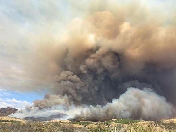
Coleman Fire June 6, 2016
Coleman Fire June 6, 2016 InciWeb photo.

The Coleman fire is not spreading. It fact it is shrinking. Sunday morning the incident management team said it had burned 3,500 acres. Then Monday morning it was 3,200 acres. The latest report from the team has it at 2,340 acres.

Within a few hours of it starting on Saturday the Southern California Geographic Area Coordination Center (OSCC) reported that the fire had “the potential to burn 10,000 to 35,000 acres”. So either the weather cooperated and slowed the spread, or the firefighters did a masterful job of knocking it down. Probably some of both is the answer. There are many residences northeast of the fire between the current perimeter and King City, only 8 miles away. The National Interagency Coordination Center’s Incident Management Situation Report Monday morning reported that one structure has burned in the fire. Considering the very rapid spread during the first few hours, that should be considered a good outcome.

****

(UPDATED at 9:21 a.m. PDT, June 6, 2016)

Coleman Fire
Approximate perimeter of the Coleman fire at 3 a.m. PDT June 6, 2016. There may be additional acres that were not detected by the airborne heat sensors. Click to see larger version.

The Coleman Fire 8 miles southwest of King City, California has not grown much over the last 24 hours. Some of the smoke seen by residents on Sunday was caused by backfires or burnouts conducted by firefighters to secure control lines.

The incident management team is calling it 3,200 acres, down from the 3,500 figure they released on Sunday.

Resources assigned include 658 personnel, 11 hand crews, 80 engines, and 4 helicopters. One structure has burned. The estimated suppression cost as of Sunday was $1.2 million.

The weather forecast for the fire area on Monday predicts 97 degrees, relative humidity of 13 percent, and north to northeast winds at 6 to 10 mph. The conditions on Tuesday will be similar.

Weather forecast Coleman Fire
Weather forecast for Coleman Fire, generated at 9:15 a.m. PDT June 6, 2016. NWS. Click to see larger version.

****

(UPDATED at 12:45 p.m. PDT, June 5, 2016)

At noon today the Southern California Geographic Area Coordination Center (OSCC) stated that the Coleman Fire southwest of King City, California will exhibit “extreme fire behavior as the day goes on” and that multiple residences are out in front of the fire. They are calling it 3,500 acres.

****

(UPDATED at 11 a.m. PDT June 5, 2016)

McGowan’s Type 1 incident management team has been mobilized to the Coleman Fire which has spread to within eight miles of King City, California overnight. The team and will inbrief at 10 a.m.

The Monterey County Sheriff’s Office reported at 10:20 a.m. that deputies assisted with mandatory evacuations and remain in the area in case other evacuations are needed. Deputies started evacuations on Reliz Canyon and worked their way down to Elm Ave. They did the same on Monroe Cyn.

The map of the fire below shows that it spread significantly to the north and northeast in the 12 hours before 3:23 a.m. PDT, June 5. Using the heat data collected by a satellite at that time, we estimate the size to be 1,200 to 1,700 acres. However, some areas within the fire have light fuel such as grass which could burn and then cool before the next satellite overpass and would not be detected, thereby giving us an underestimated acreage count.

The green line is the border of the Los Padres National Forest. The Forest is on the left side of the line. Click on the maps to see larger versions.
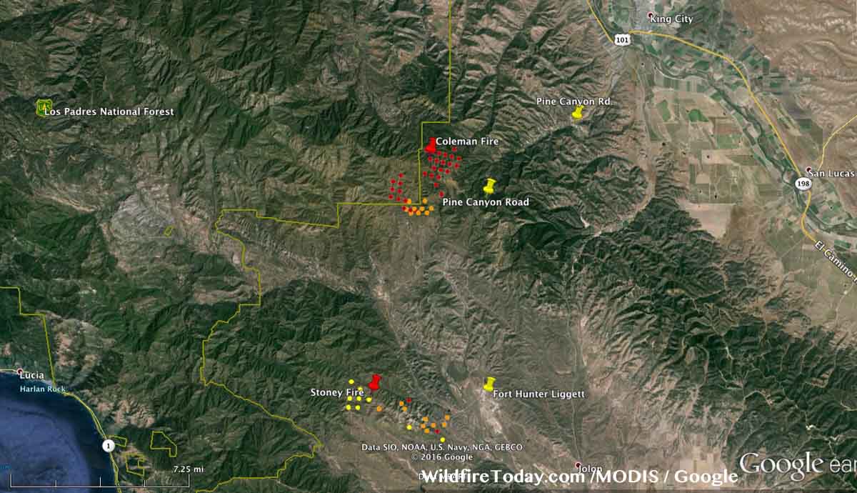
Coleman fire map
Map showing heat detected by a satellite at 3:23 a.m. PDT on the Coleman Fire. The red dots are the most recent. The map also shows the Stoney Fire on Fort Hunter-Liggett, which did not spread as much overnight as the Coleman Fire.

The map of the Coleman Fire below is in 3-D, looking northeast toward King City.

Coleman fire map 3-D
Map in 3-D showing heat detected by a satellite at 3:23 a.m. PDT on the Coleman Fire. The red dots are the most current. We are looking northeast toward King City, California.

Continue reading “California: Coleman fire, southwest of King City”

Do California’s beetle-killed trees constitute an emergency?

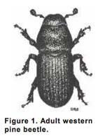
Western Pine BeetleSome of the forests in California are experiencing a natural phenomenon that other areas in the Rocky Mountains, the Pacific Northwest, and British Columbia have been dealing with for years. Pine beetles, in this case Western Pine Beetles (WPB), are attacking and killing millions of trees. These things run in cycles and in this case the extended severe drought in the state has stressed the trees making it more difficult for them to fend off insects.

Politicians, residents, and even some individuals in fire organizations look at the hillsides with numerous dead or dying trees and intuitively think — dead vegetation — increased wildfire hazard.

Here are examples from the California Department of Forestry and Fire Protection (CAL FIRE):

From a 2015 news release:

These dead and dying trees create an environment more readily susceptible to dangerous and destructive wildfires.

In a video on YouTube the narrator says when referring to a beetle-attacked stand of trees:

…an increase in extremely flammable vegetation which could lead to larger, more intense and damaging wildfires.

SFGate quoted spokesperson Daniel Berlant:

“No level of rain is going to bring the dead trees back,” Berlant said. “We’re talking trees that are decades old that are now dead. Those larger trees are going to burn a lot hotter and a lot faster. We’re talking huge trees in mass quantity surrounding homes.”

A phone call to Mr. Berlant was not returned.

Those warnings are not 100 percent accurate. In increasing numbers, scientists are determining that generally, insect damage reduces burn severity. In one of the more recent studies, researchers from the University of Vermont and Oregon State University investigated 81 Pacific Northwest fires that burned in areas affected by infestations of two prevalent bark beetle and defoliator species, mountain pine beetle (Dendroctonus ponderosae) and western spruce budworm (Choristoneura freemani). The fires spanned the years 1987 to 2011.

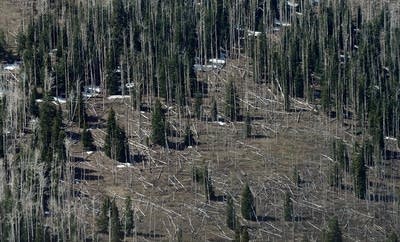
Pine trees killed by bark beetles
Pine trees killed by bark beetles. Photo by Ethan Miller.

Few of the 81 fires occurred in forests while the needles were still on the trees in the red highly flammable stage of the outbreak shortly after the trees were killed by mountain pine beetles, so more research is needed about this phase. Aside from the one to two year red stage, the burn severity decreased for more than 20 years following a MPB attack. It makes sense that fewer fine fuels in the canopy would reduce the fire intensity and make it less prone to transition from a ground fire to a crown fire. This data was derived from fire behavior and data on actual fires, not laboratory experiments.

We contacted one of the researchers that conducted the study in the Pacific Northwest, Garrett Meigs, a Postdoctoral Research Associate at the University of Vermont, and asked him if their conclusions about reduced fire severity following a Mountain Pine Beetle attack in the Northwest could be compared to California’s situation — a drought combined with a Western Pine Beetle attack:

I am aware of the impressive amount of tree mortality in California but have not seen it with my own eyes. As such, I am hesitant to comment on the current conditions in California forests, which are beyond the scope of our recent studies in Oregon and Washington. My understanding is that most of the dying/dead trees are ponderosa pines, which have been affected by intensive drought and the western bark beetle (whereas in the PNW, we studied lodgepole pines affected by mountain pine beetle and mixed-conifers affected by western spruce budworm).

Another thing that is a bit different in California is that many of these forests are generally closer to large human populations, so there are more human values/resources at risk…and these forests at the wildland-urban interface have elevated fuel/fire hazard with or without dead trees (whether caused by insects or drought).

Regarding your specific questions, I would expect that fire behavior and effects would be similar in forests with similar amounts of dead trees, whether the tree mortality was caused by bark beetles or drought (or some combination).

This does not mean that residents near insect-damaged forests can ignore the dead trees. There is legitimate cause to be concerned about fires during the one or two year red needle stage after a pine beetle attack when fire intensity may be temporarily increased, although more research studying actual fires is needed in this area. And there is danger from falling snags (dead trees) 5 to 20 years after an attack. Snags are dangerous for firefighters and any structures, hikers, traffic on roads, and any improvements that could be damaged by the falling trees.

In a fire prone environment, residents should remove any dead vegetation within 100 feet of structures. If there are numerous trees near homes, thinning them so that the crowns are at least 10 feet apart will not only reduce the intensity of an approaching wildfire, but will make more water and nutrients available to the remaining trees, giving the them a better chance of fighting off an insect attack.

California: Chimney Fire causes evacuations northwest of Indian Wells

(UPDATED at 2:56 PDT June 2, 2016)

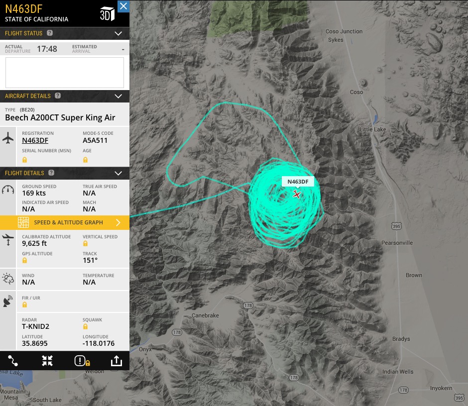
The CAL FIRE air attack ship appears to have located the Chimney Fire.

CAL FIRE Air Attack N463DF

****

(Originally published at 11:05 a.m. PDT, June 2, 2016)

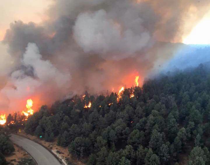
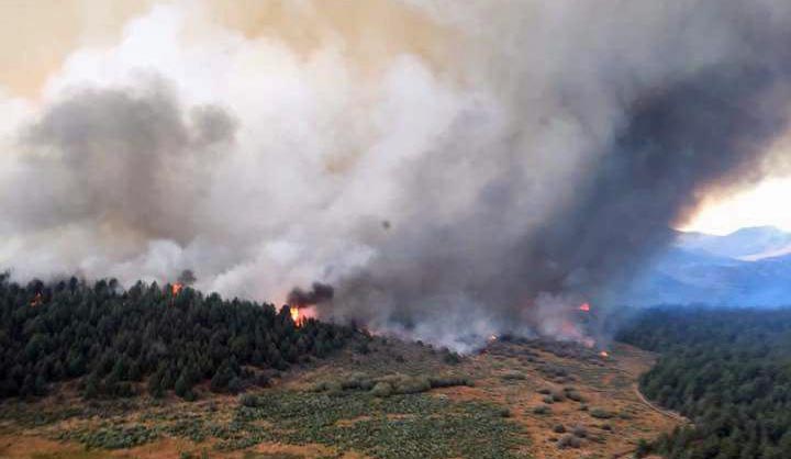
Chimney Fire
Chimney Fire, June 1, 2016. CAL FIRE photo.

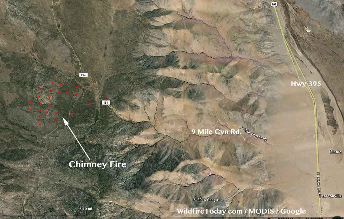
The Chimney Fire has caused evacuations in the community of Chimney Rock in California. Since it started on Wednesday, it has burned approximately 1,000 acres, and is located 7 miles west of Highway 395, 15 miles northwest of Indian Wells, and 25 miles northeast of Isabella Lake.

The video below was shot on Wednesday and gives a good overview of the fire at that time.

The fire is burning on Bureau of Land Management public lands in and adjacent to the Owens Peak and Chimney Peak wilderness areas. The Pacific Crest Trail, Nine Mile Road, and Canebreak Road are closed. Approximately 300 firefighters were on scene Thursday morning.

map Chimney Fire
Vicinity map of the Chimney Fire.
map Chimney Fire
The red dots on the map represent heat on the Chimney Fire detected by a satellite at 2:39 a.m. PT, June 2, 2016.

The National Weather Service forecast for the fire area Thursday afternoon predicts a temperature of 73, 16 percent relative humidity, and winds out of the south and southeast at 10 mph, increasing to 10 to 23 mph out of the west and northwest after 6 p.m.

A Type 2 incident management team, with Incident Commander Mills, will assume command of the fire today.

Chimney Fire
Chimney Fire, June 1, 2016. CAL FIRE photo.

California: Wheatland Fire near Lake View Terrace

Above: the approximate location of the Wheatland Fire near Lake View Terrace in southern California.

A brush fire that has blackened about 183 acres put up an impressive amount of smoke today. The fire broke out in mid-afternoon on Monday and by evening had slowed considerably. Fire officials called it 35 percent contained at 6 p.m.

The Wheatland Fire is north of the 210 freeway in the Lake View Terrace area above Wheatland Avenue in southern California. It burned north away from homes until its progress was impeded by a deepening marine layer and by ridgelines, making it feasible for aircraft to drop water and retardant in those areas, assisting firefighters on the ground and slowing the fire.

California: Metz Fire burns thousands of acres near Soledad

Metz Fire
Metz Fire. Photo via NPS.
The Metz Fire was reported mid-afternoon on Sunday southeast of Soledad, California and within about six hours was mapped by CAL FIRE at 3,878 acres. At that point the spread slowed and it was still reported at the same size the next morning at 8:15 a.m. PDT. One of our readers told us there were seven air tankers assigned.

The fire is about three miles southwest of Pinnacles National Park.

Map Metz Fire
Map of the Metz Fire, May 23, 2016. CAL FIRE.

Using a dozer to mop up a structure fire

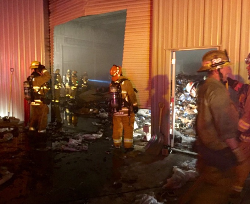
Dozers are commonly used on vegetation fires, but it is unusual to see them at a structure fire. In the video above, Los Angeles County Fire Department used a dozer to assist firefighters during the overhaul or mop up stage of a structure fire in Lancaster, California Thursday night. Apparently there was a large quantity of material inside the commercial building that would have been difficult to completely extinguish without spreading out the burning debris. It looks like they were using foam or a wetting agent in the water to achieve greater penetration.

Lancaster structure fire
Commercial building fire in Lancaster, California. Via @LACoFDPIO