Bobcat Fire spreads closer to foothill communities of Arcadia and Monrovia in southern California

Evacuation order issued Sunday morning for a portion of Arcadia

Updated September 13, 2020  |  8:22 p.m. PDT

Bobcat Fire, Sept 13, 2020
Bobcat Fire Sept. 13, 2020. USFS photo.

Firefighters on the ground and in the air fought back the Bobcat Fire as it spread downhill toward Chantry Flat in Santa Anita Canyon Road Sunday afternoon. There was significant western growth towards Mt. Wilson and Mt. Harvard where hand crews and dozers are working to protect the area. Crews conducted strategic firing operations on the north side and six large air tankers dropped retardant. Some of the drops were between the Mt. Wilson Observatory and Sierra Madre.

At the top or north end of the fire crews stopped the spread of spot fires near Buckhorn Flat and Highway 2.

Sunday night the priority will be to protect the foothill communities using the additional resources that recently arrived.

Sunday evening fire officials said the Bobcat Fire had burned 33,312 acres.

firefighters Bobcat Fire
Firefighters constructing fireline on the Bobcat Fire, Sept. 13, 2020.

September 13, 2020  |  10:40 a.m. PDT

 map of the Bobcat Fire
Map of the Bobcat Fire. The white line was the perimeter at 10:24 p.m. PDT Sept 12, 2020. The red dots represent heat detected by a satellite at 3 a.m. PDT Sept. 13, 2020.

The Bobcat Fire in Southern California remained active Saturday night and early Sunday morning, continuing to burn downhill toward Monrovia, Sierra Madre, and Duarte. It is also moving north toward SR2 in the Buckhorn Flat area, and there is significant western growth toward Mt Wilson. The fire has burned 31,991 acres.

Sunday morning an evacuation order was issued for residents north of Elkins Avenue and East of Santa Anita Avenue in Arcadia. Evacuation sites have been set up at Santa Anita Racetrack. The most current information for Arcadia residents is at the city’s website.

Crews are constructing hand line and dozer line where possible to stop the downhill progression. Indirect lines are being used where direct attack is not possible. As visibility allows, helicopters, when available, are being used to support the ground forces. Elsewhere on the fire the focus will be on keeping it south of Highway 2 and west of Highway 39. Indirect dozer line continues to be constructed to keep the fire away from Mount Wilson and to herd it into the Station Fire scar where there will be significantly reduced fire behavior. This fire has mainly been driven by steep terrain and dry fuels, some of which have not seen fire activity in at least 60 years.
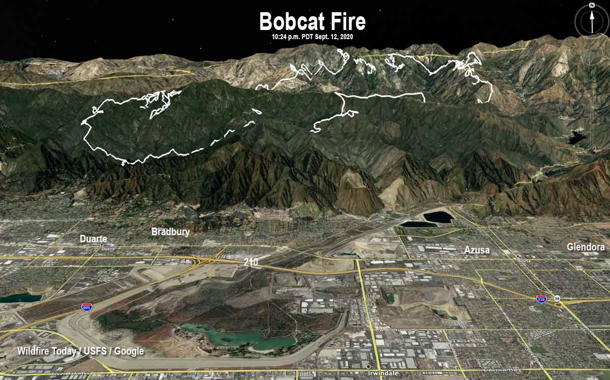
 map of the Bobcat Fire
3-D map of the Bobcat Fire at 10:24 p.m. PDT Sept 12, 2020.

Resources assigned to the fire include 18 hand crews, 72 engines, 5 helicopters, and 7 dozers for a total of 813 personnel.
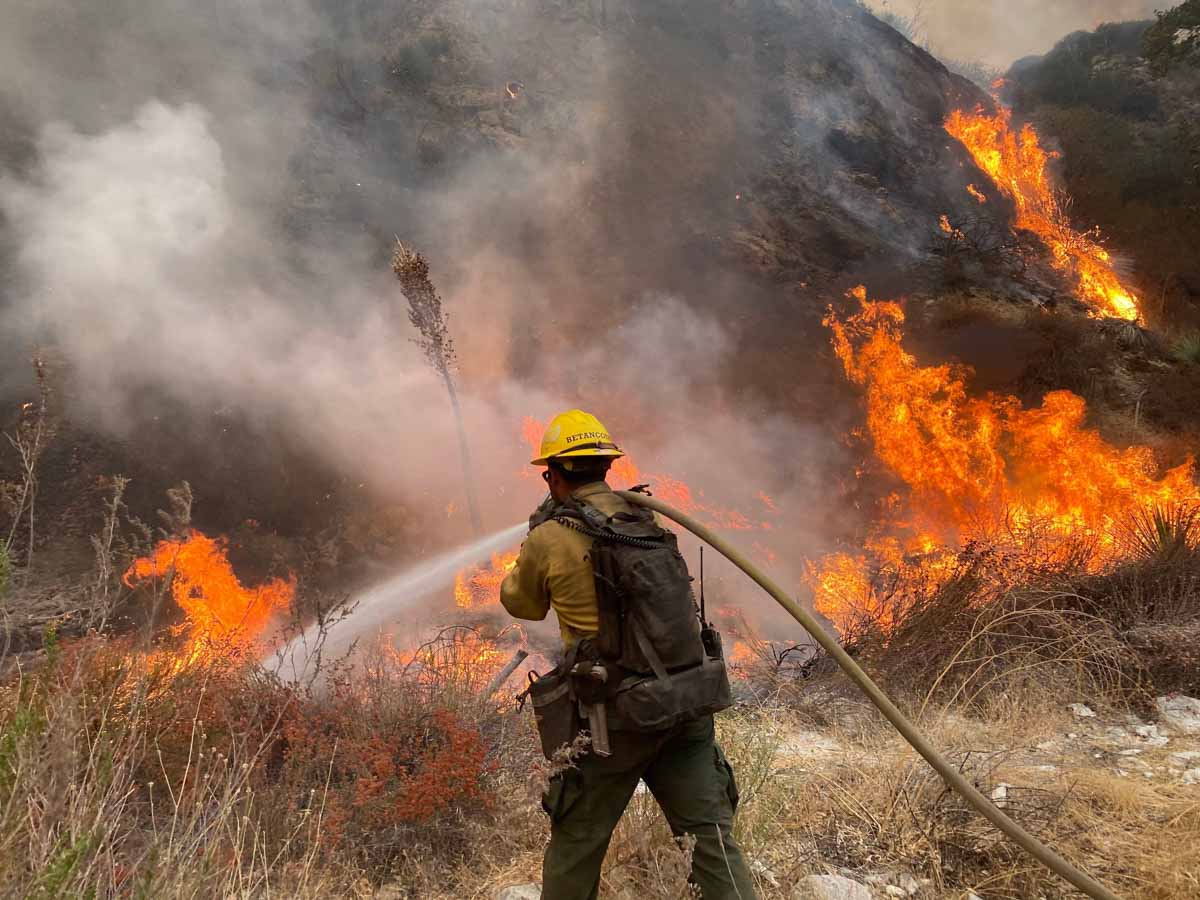
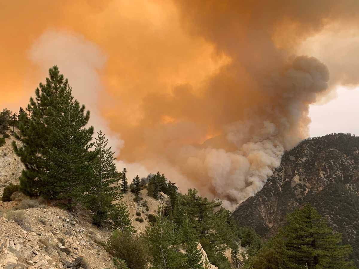
Bobcat Fire
Bobcat Fire September 12, 2020. InciWeb.
Bobcat Fire
Bobcat Fire September 10, 2020. Photo by Tim Dunfee.

Air quality and smoke forecasts for September, 13, 2020

Smoke Forecast fire September 13, 2020
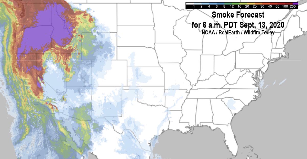
Smoke forecast for 6 a.m. PDT Sept 13, 2020.

The map above shows the forecast for the distribution of near-surface smoke at 6 a.m. PDT September, 13, 2020.

It appears that severe impacts will occur in areas of Washington, Oregon, Idaho, and Montana.

(UPDATED smoke and air quality maps for September 13 can be found HERE)

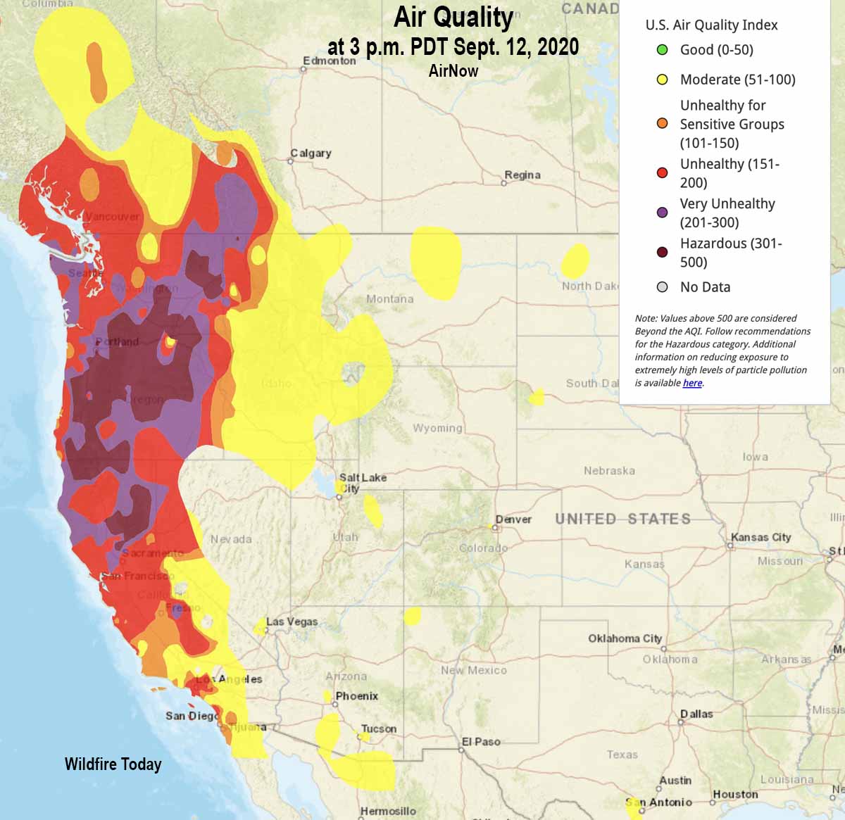
Air quality from AirNow at 3 p.m. PDT September 12, 2020 is below. Most of Oregon, Washington, and northern California are in the categories of Unhealthy, Very Unhealthy, or Hazardous. If you’re in those areas and are lucky enough to have an N95 mask, this is a good time to use it. Being indoors does not help much unless you are aggressively filtering the air with a HEPA category filter. (Information about how to reduce your exposure to smoke.)

Air quality at 3 p.m. PDT Sept. 12, 2020
Air quality at 3 p.m. PDT Sept. 12, 2020. AirNow.

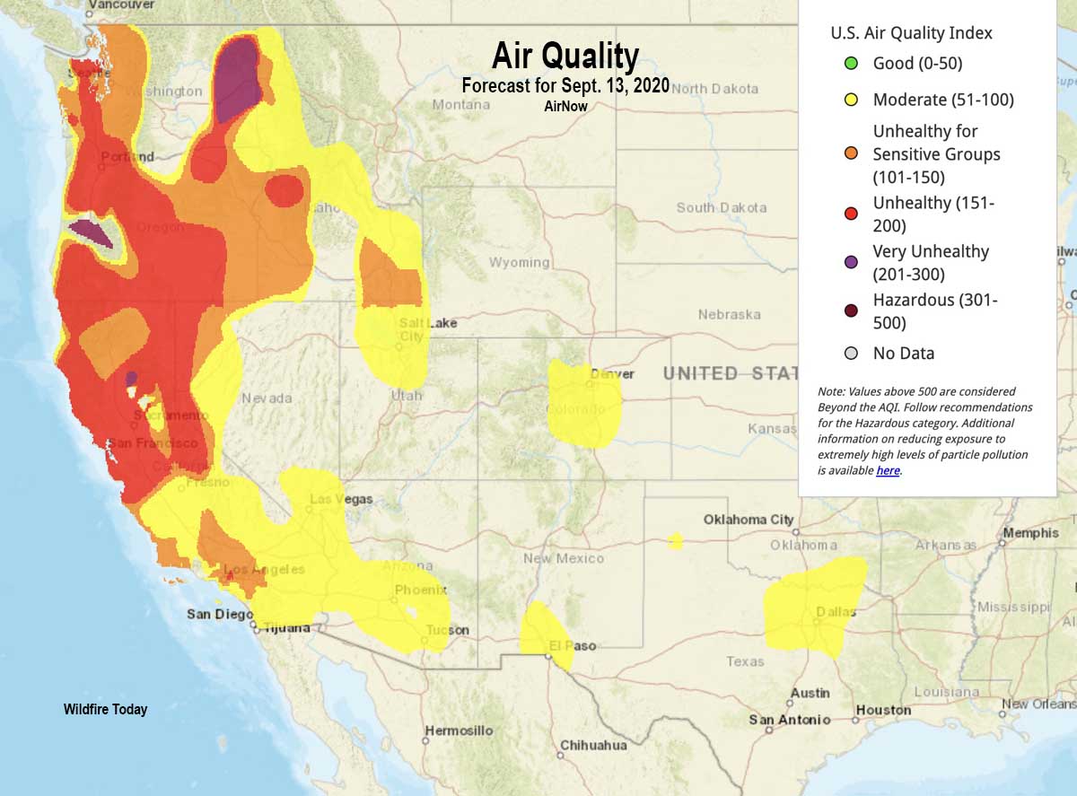
Below is the air quality forecast for Sunday September 13, 2020.

Air Quality forecast for September 13, 2020
Air Quality forecast for September 13, 2020. AirNow.

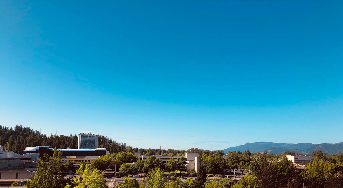
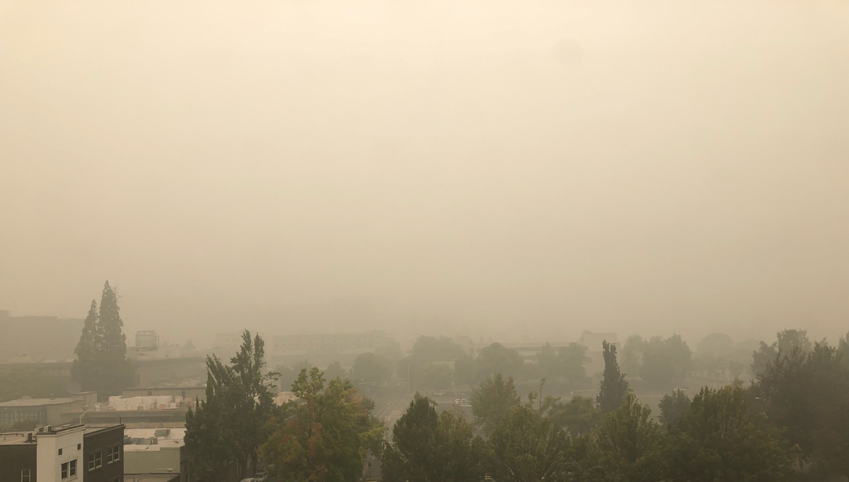
The photos below compare visibility in Eugene, Oregon on a clear day and today, September 12, 2020.

Visibility Eugene, Oregon clear day
Visibility in Eugene, Oregon on a clear day.
Visibility Eugene, Oregon today September 12, 2020 smoke fires
Visibility in Eugene, Oregon today, September 12, 2020.

Crew on North Complex in California overrun by fire deploys fire shelters

And, an update on the shelter deployment at the Dolan Fire

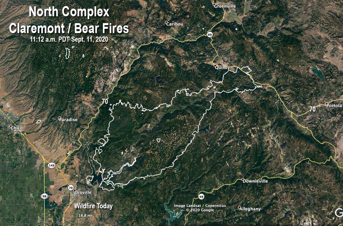
Map of the North Complex, Claremont & Bear Fires
Map of the North Complex, Claremont & Bear Fires 11:12 a.m. PDT Sept 11, 2020.

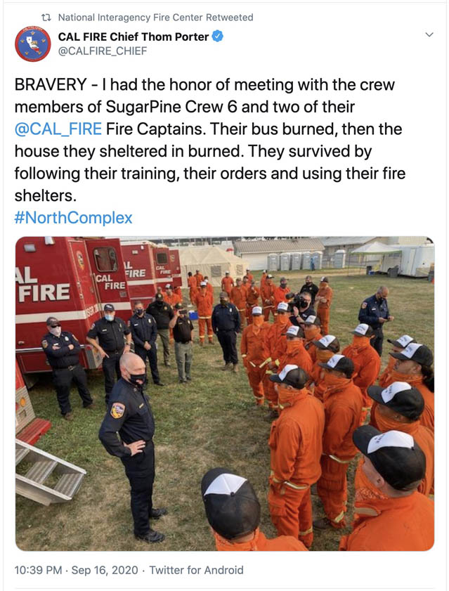
A firefighting hand crew was overrun by the fire they were fighting September 9 and had to deploy their fire shelters. It happened on the Claremont/Bear Fire, two merged blazes that are part of the North Complex.

The California Department of Forestry and Fire Protection explained that the fire  became unpredictable due to erratic weather and dry fuel conditions. The agency said the personnel were “virtually unharmed except for two minor injuries.” The incident is under review.

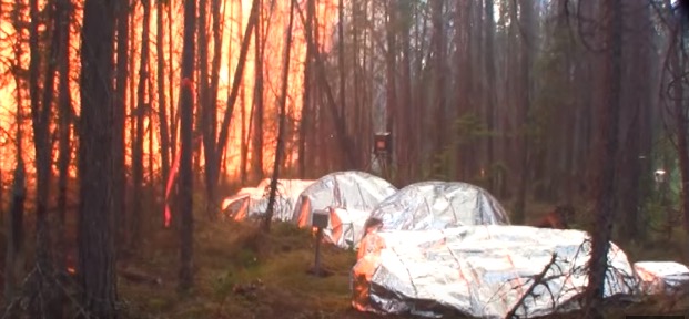
Fire Shelter Test
Fire Shelter Tests in Canada, June, 2015.

Fire shelters are small foldable pup tent-like fire resistant devices that a wildland firefighter can unfold and climb into if there is no option for escaping from an approaching inferno. The shelters can resist radiant heat, and if the person inside can seal the edges under their body, convective heat as well, but there are limits. Many firefighters have used the devices successfully, but others have been killed inside them.

The North Complex has burned 252,534 acres east of Oroville, California. Approximately 1,000 structures have been destroyed and 10 civilians have been killed. Resources assigned include 73 hand crews, 18 helicopters, 254 fire engines, 76 dozers, and 98 water tenders for a total of 3,108 personnel.

On September 5, three firefighters on the Bridger Foothills Fire northeast of Bozeman, Montana were forced to deploy and take refuge in their fire shelters when their safety became compromised by the proximity of the blaze, fire officials said.

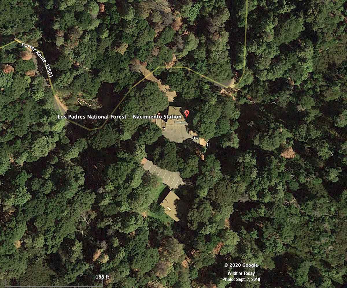
September 8 on the Dolan Fire south of Big Sur, California, another crew of firefighters was entrapped and deployed their fire shelters. Updated information from the U.S. Forest Service is slightly different from what was originally released shortly after the incident. Andrew Madsen, an information officer for the fire, explained that of the 14 that were entrapped, three were flown to Community Regional Hospital in Fresno. One was initially in critical condition and the other two were in serious condition. As of today, September 11, the two that were serious have been released, and the critically injured individual is much better and is expected to be released in a day or two. Mr. Madsen said some of the other 11 members of the crew had “smoke inhalation” issues, but were evaluated at the scene and are OK. The crew was attempting to protect the Forest Service’s Nacimiento Fire station as the blaze approached.

Nacimiento Station
Nacimiento Station, satellite photo, September 7, 2018.

Update: September 20, 2020:

North Complex burnover

Thanks and a tip of the hat go out to Tom.

Bobcat Fire spreads east across Highway 39

In the Angeles National Forest above Arcadia and Glendora, southern California

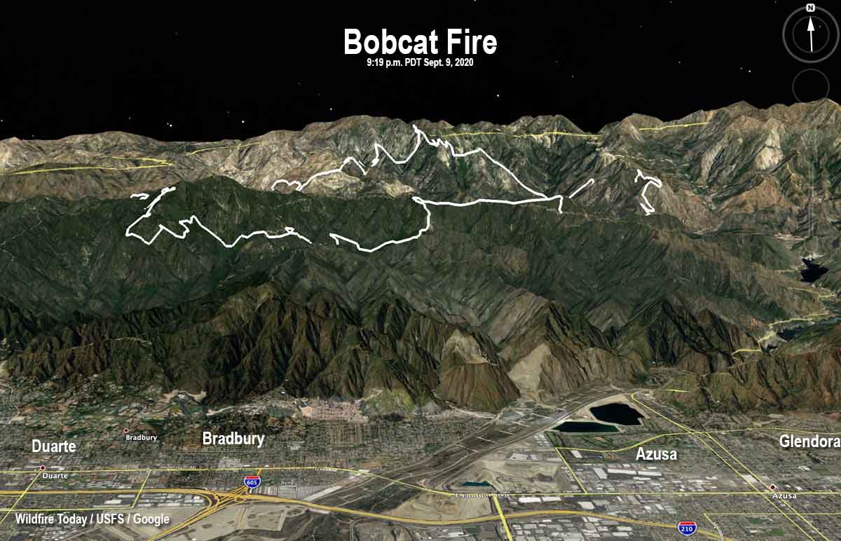
map Bobcat Fire Los Angeles California wildfire
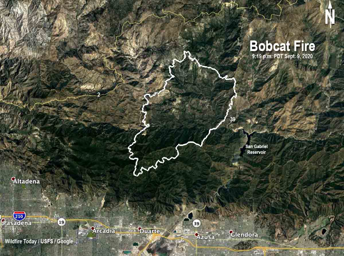
3-D map of the Bobcat Fire at 9:19 p.m. PDT Sept. 9, 2020. Looking north.

The Bobcat Fire burning in the mountains above Arcadia in southern California grew substantially to the east Wednesday crossing Highway 39 above San Gabriel Reservoir. The latest size estimate from the U.S. Forest Service is 19,796 acres.

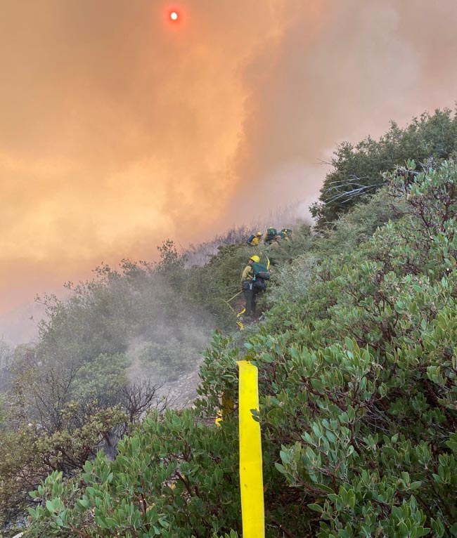
Firefighters described the fire behavior as very active to extreme with long-range spotting, tree torching, and visible slope runs. With the fire moving to the east there was an opportunity to work on the southern flank to help protect the foothill communities. The main objective was to prepare and strengthen fire lines constructed by dozers and hand crews. As the day progressed and the dense smoke lifted, two air tankers, including a DC-10, were able to make several drops of fire retardant on the southwest portion of the fire to reinforce and strengthen the fire lines. Later in the day a sky crane helicopter arrived on scene.

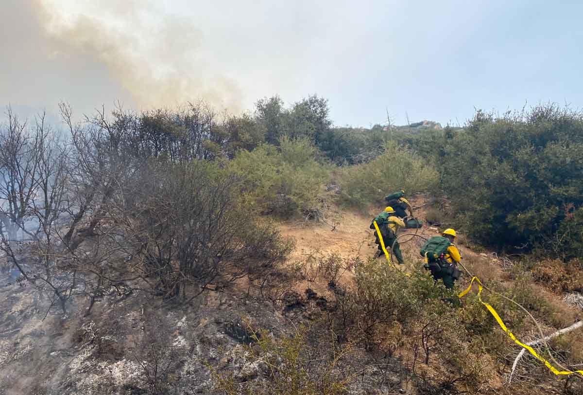
firefighters Bobcat Fire Los Angeles California wildfire
Firefighters put in a hose lay on the Bobcat Fire September 9, 2020. Photo by Rob Robledo.

Local fire departments continued their structure protection planning and triage efforts within the growing list of foothill communities that are under evacuation warnings — Monrovia, Arcadia, Sierra Madre, Bradbury, Altadena, Duarte, and Pasadena.

(To see all articles on Wildfire Today about the Bobcat Fire, including the most recent, click HERE.)

The number of resources assigned to the incident has grown, and now includes 19 hand crews, 35 engines, and 1 helicopter, for a total of 652 personnel.

The fire is being managed by a Type 2 incident management from the eastern United States.

These are low numbers for a 20,000-acre wildfire threatening seven high density communities in the wildland-urban interface of the Los Angeles area.

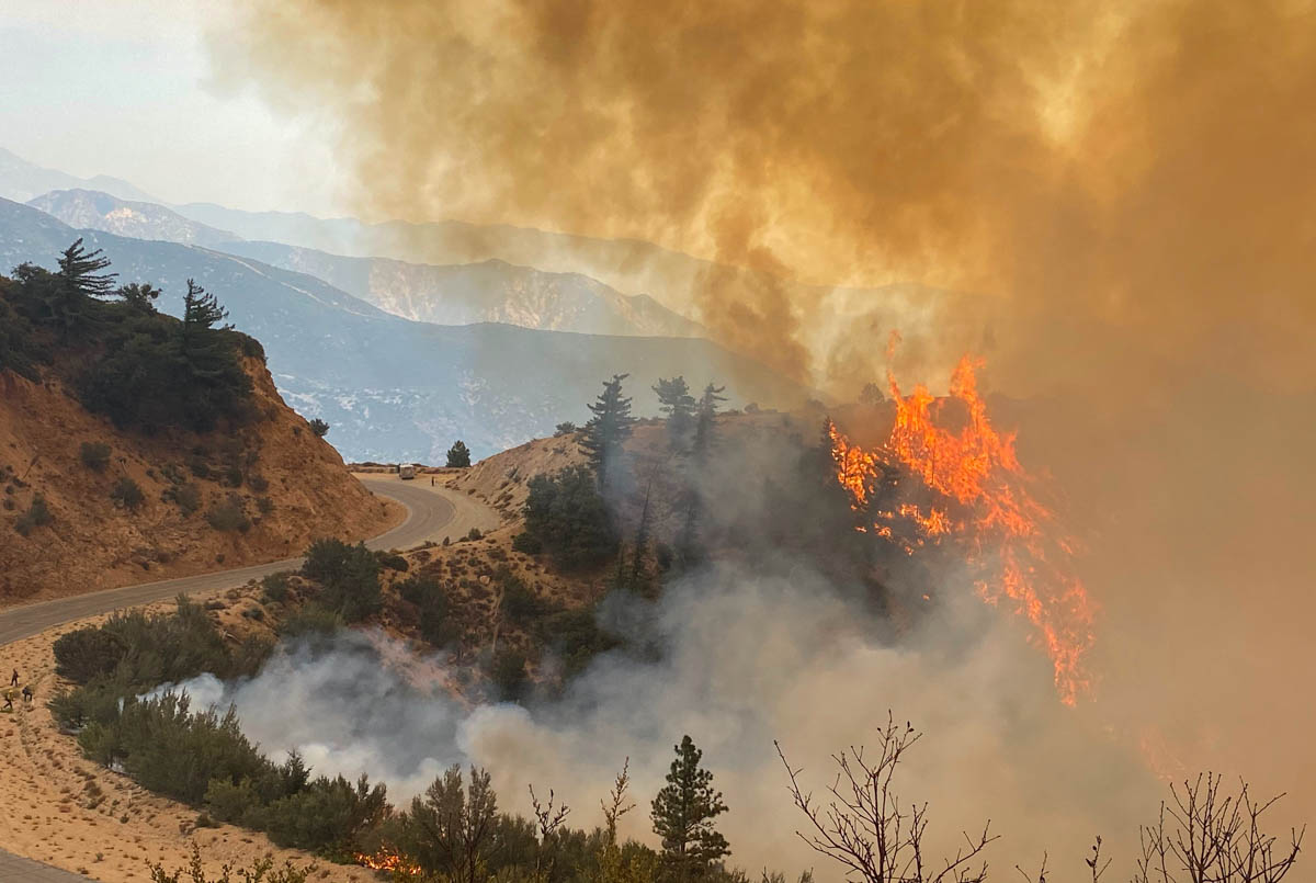
firefighters Bobcat Fire Los Angeles California wildfire
Bobcat Fire September 9, 2020. Photo by Rob Robledo.

Weather forecasters expect northeast winds to continue Thursday, becoming south or southwest in the afternoon. On the higher elevation ridgetops the wind speeds will be 10 to 15 mph gusting to 20 mph. With the relative humidity in the teens on the upper slopes, it is likely that the fire will be active Thursday.

map Bobcat Fire Los Angeles California wildfire
Map of the Bobcat Fire at 9:19 p.m. PDT Sept. 9, 2020. The fire spread further to the east after this perimeter data was collected.
firefighters Bobcat Fire Los Angeles California wildfire
Firefighters put in a hose lay on the Bobcat Fire September 9, 2020. Photo by Rob Robledo.

North Complex of fires estimated at a quarter of million acres after explosive growth

September 9, 2020 | 4:20 p.m. PDT

Claremont and Bear Fires
North Complex of Fires, 11:36 p.m. PDT Sept. 8, 2020. The Claremont/Bear Fire, two fires that merged.

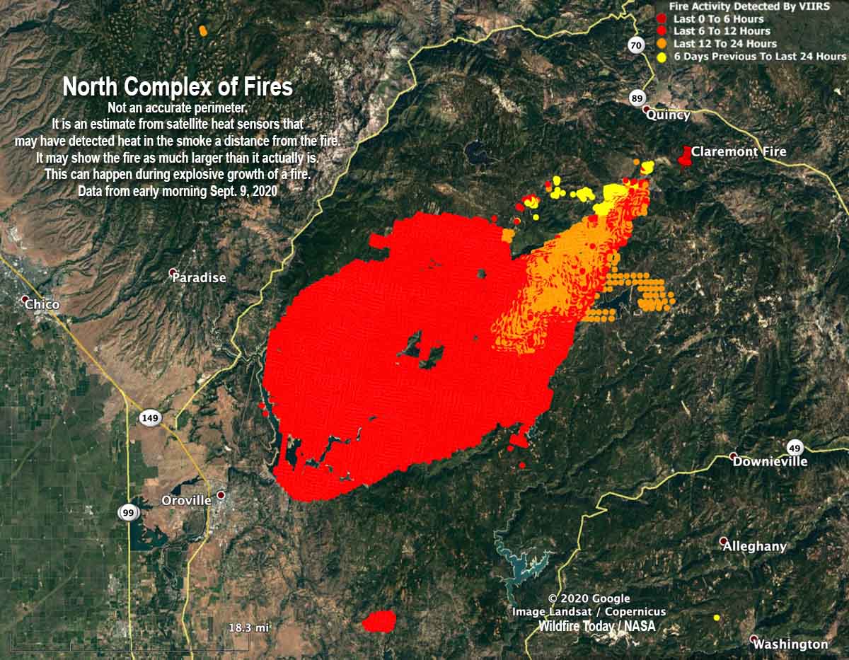
One of the fires on the North Complex of fires east of Chico, California apparently grew by about 100,000 acres Tuesday. Operations Section Chief Jake Cagle said Wednesday morning that 45 mph winds pushed the Claremont/Bear Fire to the southwest for miles until it reached Lake Oroville east of the city by the same name. But it didn’t stop there. According to the map produced by the incident management team it worked its way around the south side of the lake and may have even spotted across the lake.

With the extremely rapid growth, firefighters were unable to have the luxury of containing the fire’s edge, their time had to be spent on the urgent matters of firefighter and public safety, notifying citizens of mandatory evacuations, and protecting structures.

Evacuation information can be found at the Plumas National Forest’s Facebook page. A virtual community meeting will be available there at 6 p.m. PDT today (Wednesday).

The exact location of the fire’s edge was not certain at mid-day Wednesday because an aircraft scheduled to map the fire Tuesday night became unavailable due to a maintenance issue. Without the more accurate mapping system, the incident management team used heat-sensing data collected by satellites to evaluate the size, which is far less reliable. Mr. Cagle estimated Wednesday morning that the fire at that time was about 45 miles long and 30 miles wide.

The incident management team believes the North Complex of fires has burned approximately 254,000 acres, an increase of about 104,000 acres over the figure released earlier in the day.

The North Complex is comprised of multiple fires, most of which were suppressed, but remaining were the Bear and Claremont blazes. The map below shows where they were on August 20 before they burned together. The team fighting the fire now is referring to it as Bear Fire, or the North Complex.

Claremont and Bear Fires
The Claremont and Bear Fires, August 20, 2020.

The map below is not an accurate perimeter. It is an estimate from satellite heat sensors that may have detected heat in the smoke a distance from the fire, in addition to the fire itself. It may show the fire as being much larger than it actually is. This can happen during explosive growth of a fire that is burning very intensely and putting up a very large column of smoke containing a great deal of ash and debris.

Claremont and Bear Fires
North Complex of Fires. Early morning Sept. 9, 2020. Not an accurate perimeter. It is an estimate from satellite heat sensors that could have detected heat in the smoke a distance from the fire. It may show the fire as much larger than it actually is. This can happen during explosive growth of a fire.

15 firefighters on Dolan Fire became entrapped by the fire and deployed fire shelters

One injury is critical and another is serious, the U.S. Forest Service reported

September 8, 2020  |  5:05 p.m. PDT

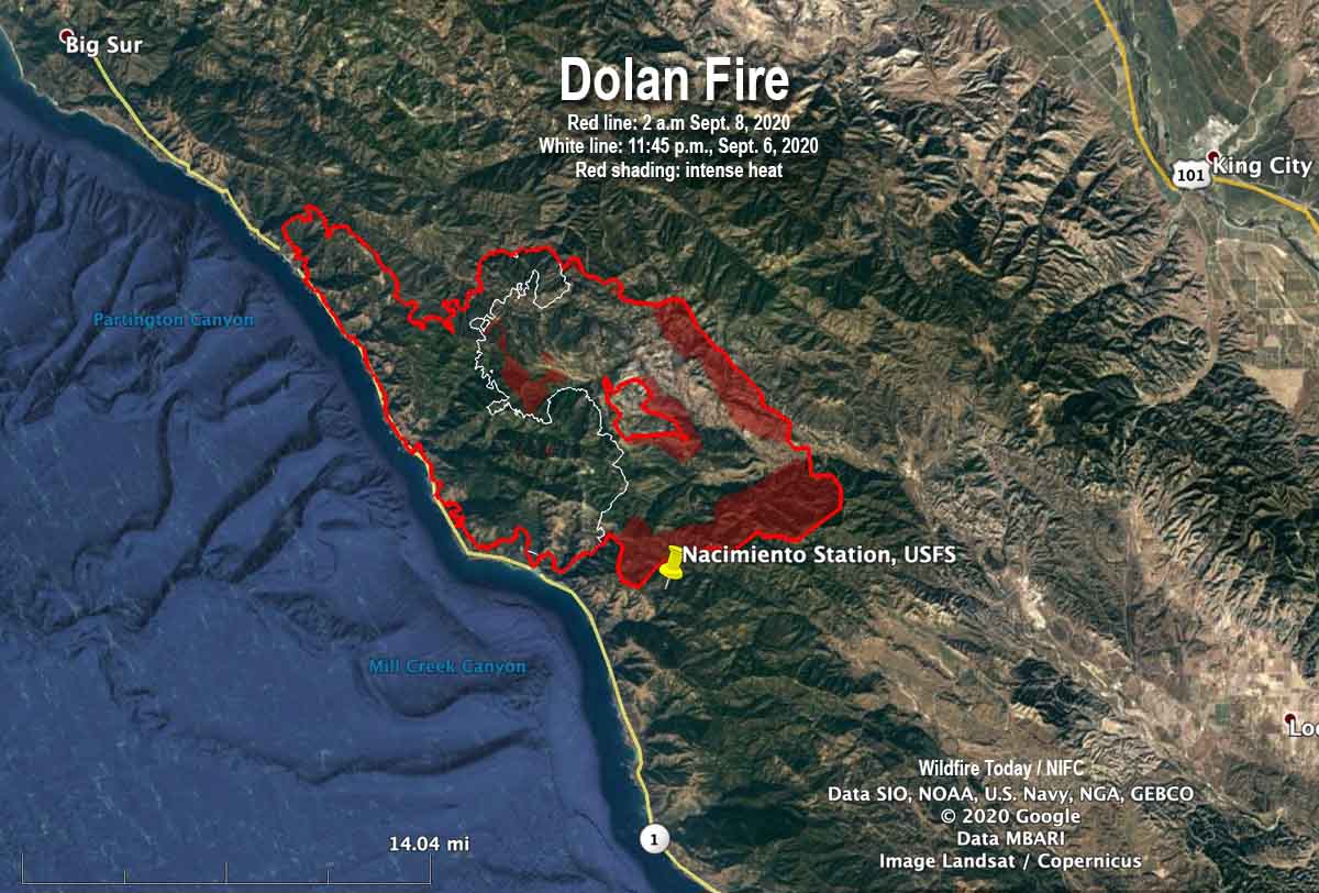
Map of the Dolan Fire
Map of the Dolan Fire. The red line was the perimeter at 2 a.m. PDT September 8, 2020. The white line was the perimeter about 26 hours earlier. Red shading represents intense heat when the fire was mapped.

Fifteen firefighters attempting to prevent a structure from burning in a California wildfire were entrapped and overrun by the fire, the U.S. Forest Service announced today.

Two firefighters were injured, one critically and the other seriously, the release said. Both patients were transported by Life Flight to Community Regional Hospital in Fresno.

(Update September 11, 2020: New information from the U.S. Forest Service is slightly different from what was originally released shortly after the incident. Those new details are in an article published Sept. 11 about another crew that had to deploy fire shelters.)

It occurred at the Dolan Fire at about 8:31 a.m., September 8, 26 air miles southeast of Big Sur.

The firefighters deployed the fire shelters they carry for this type of situation.

The Forest Service said the incident occurred while the personnel were defending the Nacimiento Station from the approaching fire.

The release from the Forest Service implied more than two of the 15 personnel may have been injured to some degree. Here is an excerpt:

A shelter deployment involving fifteen firefighters from the Dolan Fire occurred approximately at 0831 on Tuesday, Sept 8, 2020, in the vicinity of Nacimiento Station. These dedicated firefighters received injuries including burns and smoke inhalation while defending the Nacimiento Station on Dolan Fire on the Los Padres National Forest in California. Nacimiento Station was destroyed.

When a fixed wing aircraft mapped the Dolan Fire at 2 a.m. PDT September 8 about six hours before the incident, the fire was 74,591 acres, more than twice the size mapped the previous night when it was 36,213 acres. The heat sensing equipment detected intense heat at the fire’s edge at 2 a.m., 0.7 miles northwest of Nacimiento Station.

Fire shelters are small foldable pup tent-like fire resistant devices that a wildland firefighter can unfold and climb into if there is no option for escaping from an approaching inferno. Many firefighters have used the devices successfully, but others have been killed inside them.

Three days before, on September 5, three firefighters on the Bridger Foothills Fire northeast of Bozeman, Montana were forced to deploy and take refuge in their fire shelters when their safety became compromised by the proximity of the blaze, fire officials said.

Nacimiento Station
Nacimiento Station, satellite photo, September 7, 2018.

Thanks and a tip of the hat go out to Al and Tom.