River Fire prompts evacuations south of Salinas, California

August 17, 2020  |  6:22 p.m. PDT

Map River Fire at 2:28 p.m. PDT August 17, 2020
Map of the River Fire at 2:28 p.m. PDT August 17, 2020.

Not much additional information is available about the River Fire. Monterey County has current evacuation information. CAL FiRE has not updated the size since they announced it was 2,800 acres this morning.

(To see all of the articles on Wildfire Today about the lightning-caused wildfires in California, including the most recent, click HERE.)

Five structures have been damaged and there have been four “Confirmed Fire Personnel and Civilian Injuries” according to CAL FIRE.

Resources assigned include 10 hand crews, 2 helicopters, 55 fire engines, 9 dozers, and 6 water tenders for a total of 520 personnel.


August 17, 2020  |  7:13 a.m. PDT
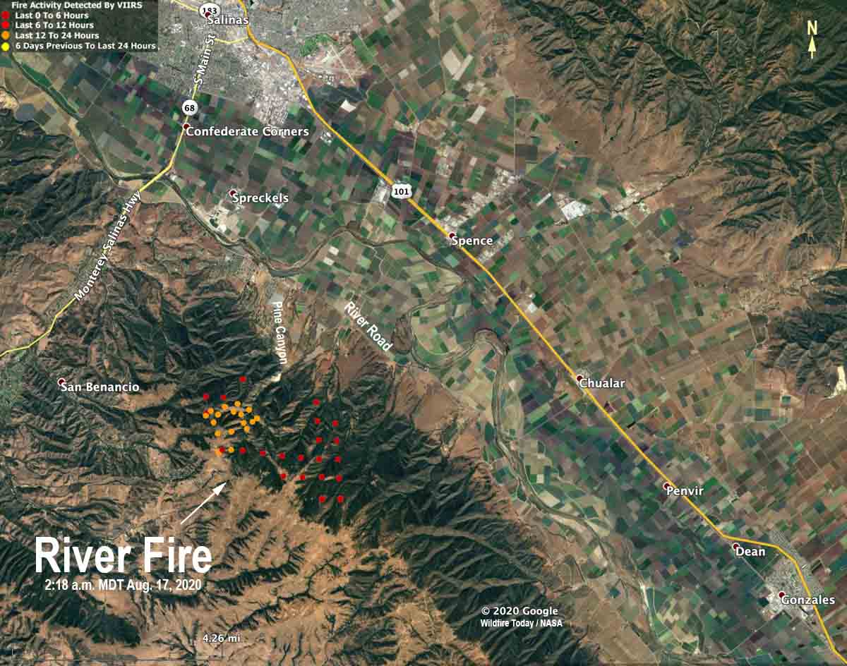
map River Fire Salinas California
The red and yellow dots on the map represent heat detected by a satellite on the River Fire at 2:18 a.m. PDT August 17, 2020. The locations are estimates and the fire has continued to spread since then.

Monday morning at 6 a.m. PDT CAL FIRE reported that the River Fire five miles south of Salinas has burned 2,800 acres and threatens 1,500 structures. Five structures have been damaged but none destroyed. Four firefighters have suffered heat-related injuries.

The fire has crossed Pine Canyon Road, CAL FIRE said, and is moving south toward River Road.

Mandatory evacuations were in effect at 6 a.m. PDT August 17 for Pine Canyon Road, Parker Road, Laurel Lane, and Trimble Hill Lane. The evacuation center is at Buena Vista Middle School, 18250 Tara Drive in Salinas. More information about evacuations can be found at CAL FIRE.


August 16, 2020 | 8 p.m. PDT
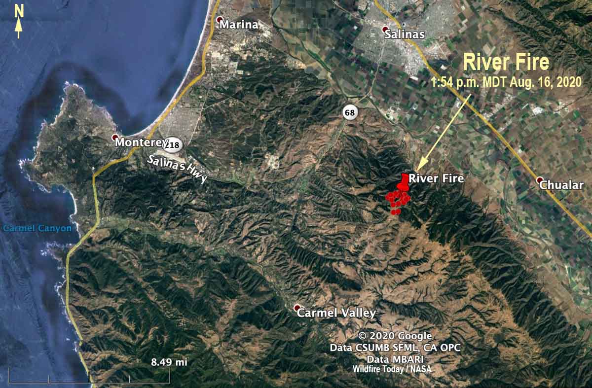
map River Fire
The red dots represent heat detected by a satellite on the River Fire at 1:54 p.m. PDT August 16, 2020.

CAL FIRE said at 5:40 p.m. Sunday that the River Fire reported at 3:14 a.m. PDT Sunday morning had burned 500 acres. It is in northern California about 5 miles south of Salinas and 6 miles northeast of Carmel Valley. Evacuations are in effect.

Sunday afternoon the wind recorded at the Rana Creek Tower near the fire was out of the north at 6 to 12  mph with gusts between 12 and 18. After 6 p.m. it switched to come out of the southwest at 10 mph with gusts to 13, pushing the fire to the northeast toward the valley. The relative humidity in the afternoon was around 30 percent with the temperature in the high 80s.

The forecast for Monday is for a high temperature around 90, relative humidity in the afternoon of 35 percent, and wind out of the west at 5 to 10 with gusts up to 21 in the afternoon.

The area has not been visited by fire for many years, so there should be abundant fuel available, offering firefighters a high resistance to control.

Loyalton Fire burns tens of thousands of acres northwest of Reno, NV

Fire tornadoes were spotted at the fire Saturday

August 17, 2020  |  6 a.m. PDT

map loyalton fire Reno California wildfire
The red line was the perimeter of the Loyalton Fire at 4:30 p.m. PDT August 16, 2020. The white line was the perimeter at 2:19 a.m. August 16, 2020.

The map above was updated using data from a fixed wing mapping flight over the Loyalton Fire Sunday afternoon at 4:30. It is more accurate than the map below from an earlier flight that was supplemented with the red dots representing heat detected by a satellite. That flight plus data collected later by other means determined the fire had burned 36,295 acres


August 16, 2020  |  7:02 p.m. PDT

map Loyalton Fire California Reno Nevada
The red line was the perimeter of the Loyalton Fire at 2:19 a.m. PDT August 16, 2020. The red dots represent heat detected by a satellite at 2:48 p.m. PDT August 16, 2020.

The Loyalton Fire in northeast California 12 miles northwest of Reno, Nevada started at about 4:30 p.m. August 14 east of Loyalton, California. It burned north and east adjacent to the areas of Beckwourth Pass and Hallelujah Junction. Early Sunday morning a mapping flight calculated it had burned 29,829 acres. That was confirmed later in the day by the Tahoe National Forest.

Sunday afternoon it was pushed to the east and southeast by an 8 to 15 mph wind out of the northwest and was approaching the Nevada border at 2:48 P.M. MDT.

On August 15 meteorologists with the National Weather Service in Reno observed on radar a very rare fire tornado in real time at the Loyalton Fire about 12 miles northwest of the city. They used emergency warning systems to transmit tornado warnings as quickly as possible to firefighters and the general public. It is believed that this is the first time a real time warning for a fire tornado has ever happened, at least in the United States. More information about this very unusual event is at Wildfire Today.

Sunday at 5 p.m. the Lassen County Sheriff’s office issued the following evacuation information:

“LOYALTON FIRE #LoyaltonFire
ROAD CLOSURE AND EVACUATIONS

  • State Route 70 is now open to thru traffic. Please continue to use caution due to first responders working in the area. US 395 is now open without restrictions. Please continue to use caution due to first responders working in the area.
  • A Mandatory Evacuation Order has been lifted for residents from US 395 at Red Rock Road south to US 395 at State Route 70.
  • A Mandatory Evacuation Order has been downgraded to an Evacuation Warning for residents along roads accessed by State Route 70 on the north and south side of State Route 70.
  • A Mandatory Evacuation Order has been downgraded to an Evacuation Warning for residents from the intersection of State Route 49 and 70 east to State Route 70 and US 395. US 395 south to the Sierra County line. This encompasses everything south of State Route 70 and west of US 395.”
Loyalton Fire August 15, 2020 Reno Nevada wildfire
Loyalton Fire August 15, 2020. InciWeb.

NWS tweets fire tornado

NWS issued fire tornado warning for Loyalton Fire northwest of Reno Saturday

At least five tornado-strength/scale vortices are likely to have occurred in the fire Saturday

August 16, 2020 | 5:04 p.m. PDT

Fire tornado Loyalton Fire
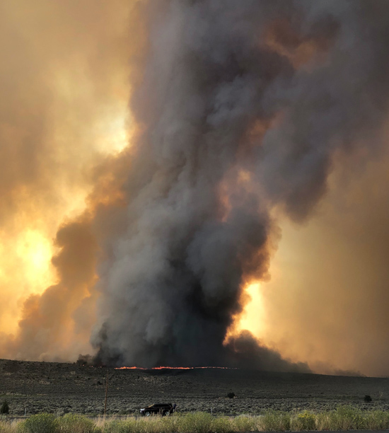
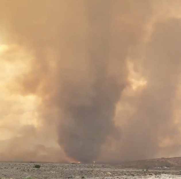
Fire tornado on the Loyalton Fire, by @DVRockJockey August 15, 2020.

On August 15 meteorologists with the National Weather Service in Reno observed on radar a very rare fire tornado in real time at the Loyalton Fire about 12 miles northwest of the city. They used emergency warning systems to get the word out as quickly as possible to firefighters and the general public. It is believed that this is the first time a real time warning for this type of event has ever happened, at least in the United States.

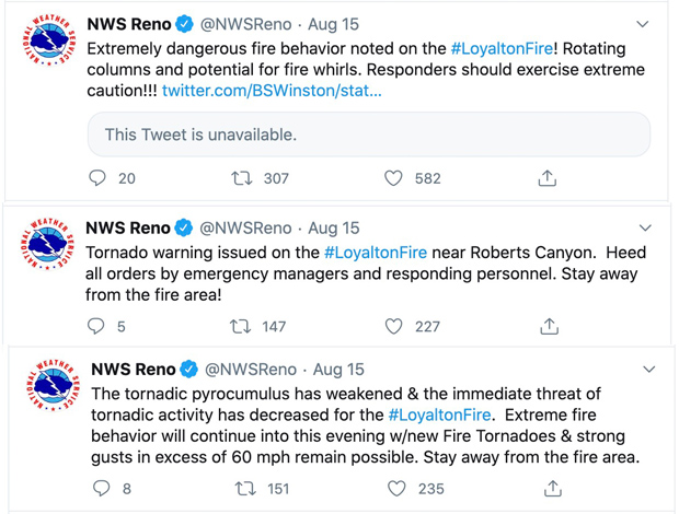
They also sent out tweets, of course:

NWS tweets fire tornado

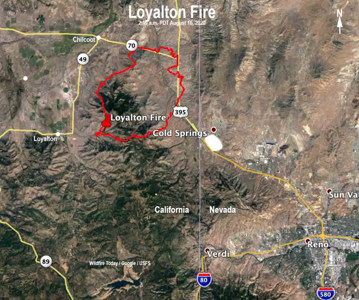
Loyalton Fire map
Map of the Loyalton Fire the morning of August 16, 2020, time uncertain, but possibly about 2 a.m.
The Loyalton Fire started at about 4:30 p.m. August 14 east of the town of Loyalton and southwest of Mount Ina Coolbrith. It burned north and east adjacent to the areas of Beckwourth Pass and Hallelujah Junction. Early Sunday morning it was estimated at 29,829 acres. More information about the Loyalton fire on Wildfire Today.

A fire tornado is just like it sounds — a large column of rotating air over a vegetation fire. Inside it and around it are extremely strong winds, very high temperatures, and flying debris.

On July 26, 2018 a firefighter was killed as a fire tornado burned and scoured a mile-long path as the Carr Fire moved into Redding, California. A Redding Fire Department Inspector was burned over in his truck and died on Buenaventura Boulevard. Three dozer operators were entrapped and one of them was also killed.

According to a Green Sheet report by CAL FIRE the conditions that resulted in the entrapment of three dozers and the Redding Fire Department Fire Inspector that day were due to the fire tornado — a large rotating fire plume that was roughly 1,000 feet in diameter. The winds at the base were 136-165 mph (EF-3 tornado strength), as indicated by wind damage to large oak trees, scouring of the ground surface, damage to roofs of houses, and lofting of large steel power line support towers, vehicles, and a steel marine shipping container. Multiple fire vehicles had their windows blown out and their bodies damaged by flying debris.

The strong winds caused the fire to burn all live vegetation less than 1 inch in diameter. Peak temperatures likely exceeded 2,700 °F.

Here is an excerpt from an article in the Washington Post about the fire tornados yesterday:

Fire tornadoes in and of themselves are rare; being able to detect them in real time on radar is something new. Wendell Hohmann is the meteorologist at the Reno office who issued the precedent-setting warning. He described it as a “once-in-a-lifetime, career event.”

“We were just trying to get the message out of the extreme fire behavior from this fire given the rotation and the tornadic potential,” Hohmann said. “We figured we could do a severe [thunderstorm warning], but we decided to do a tornado warning to get [the emergency alert system] and [wireless emergency alerts] to activate.”

Matthew Cappucci believes at least five tornado-strength/vortices are likely to have occurred on the Loyalton Fire August 15.

The news media sometimes calls any little fire whirl a “fire tornado”, or even a “firenado”. These and related terms (except for “firenado”) were, if not founded, at least documented and defined in 1978 by a researcher for the National Weather Service in Missoula, David W. Goens. He grouped fire whirls into four classes:

  1. Fire Devils. They are a natural part of fire turbulence with little influence on fire behavior or spread. They are usually on the order of 3 to 33 feet in diameter and have rotational velocities less than 22 MPH.
  2. Fire Whirls. A meld of the fire, topograph, and meteorological factors. These play a significant role in fire spread and hazard to control personnel. The average size of this class is usually 33 to 100 feet, with rotational velocities of 22 to 67 MPH.
  3. Fire Tornadoes. These systems begin to dominate the large scale fire dynamics. They lead to extreme hazard and control problems. In size, they average 100 to 1,000 feet in diameter and have rotational velocities up to 90 MPH.
  4. Fire Storm. Fire behavior is extremely violent. Diameters have been observed to be from 1,000 to 10,000 feet and winds estimated in excess of 110 MPH. This is a rare phenomenon and hopefully one that is so unlikely in the forest environment that it can be disregarded.”

It was just two days ago that I wrote extreme fire behavior and massive pyrocumulus are becoming much more frequent. If we are going to see more fire tornados, that is a scary thought. The west coast is expected to have very high temperatures this week.

Loyalton Fire
Loyalton Fire at 1:39 p.m. PDT August 15, 2020, looking north.

Thanks and a tip of the hat go out to Chris and SST.

Lake Fire near Lake Hughes, CA was very active Friday and Saturday

Spreading to the northeast

UPDATED August 15, 2020  |  6:17 p.m. PDT

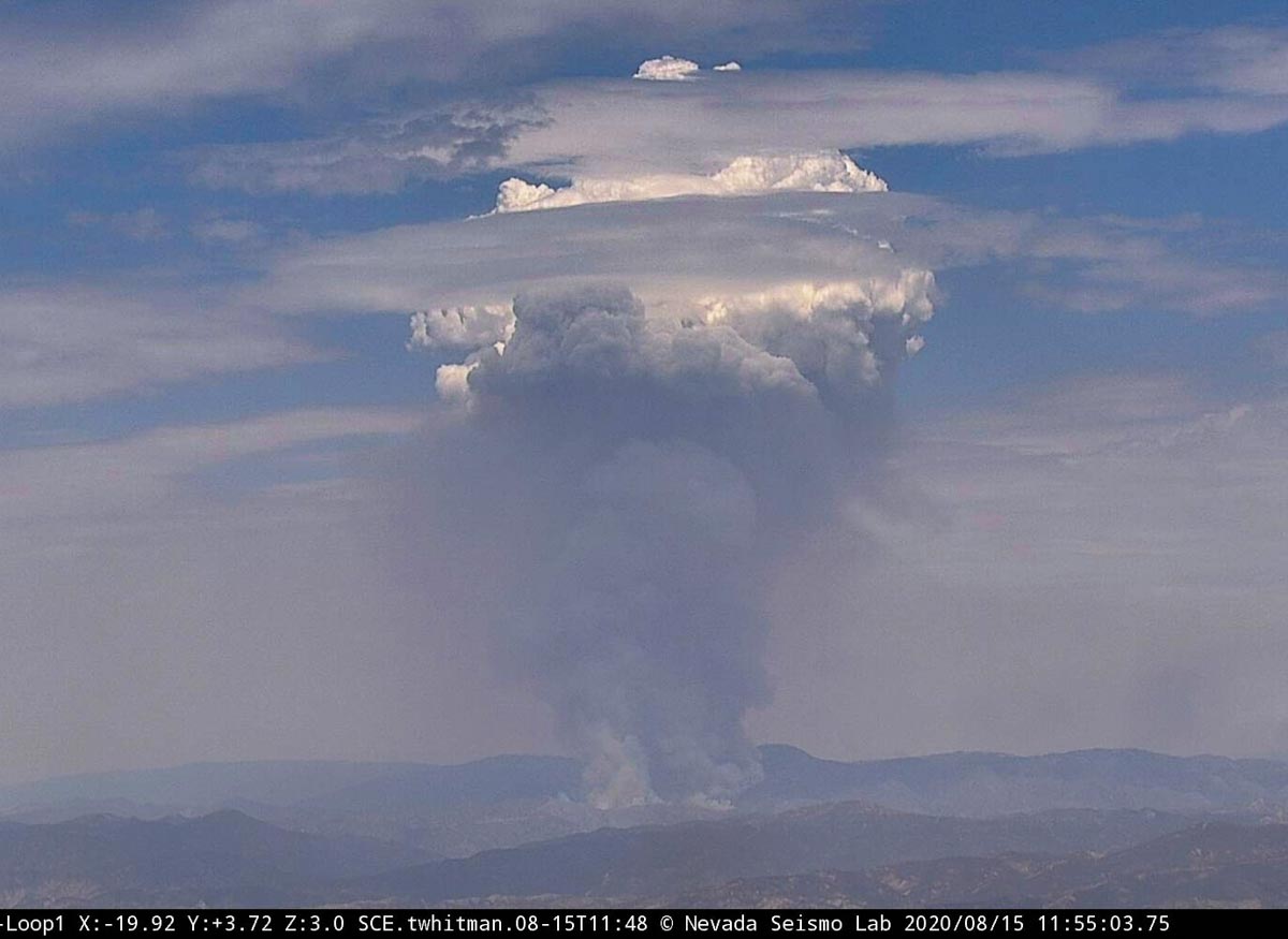
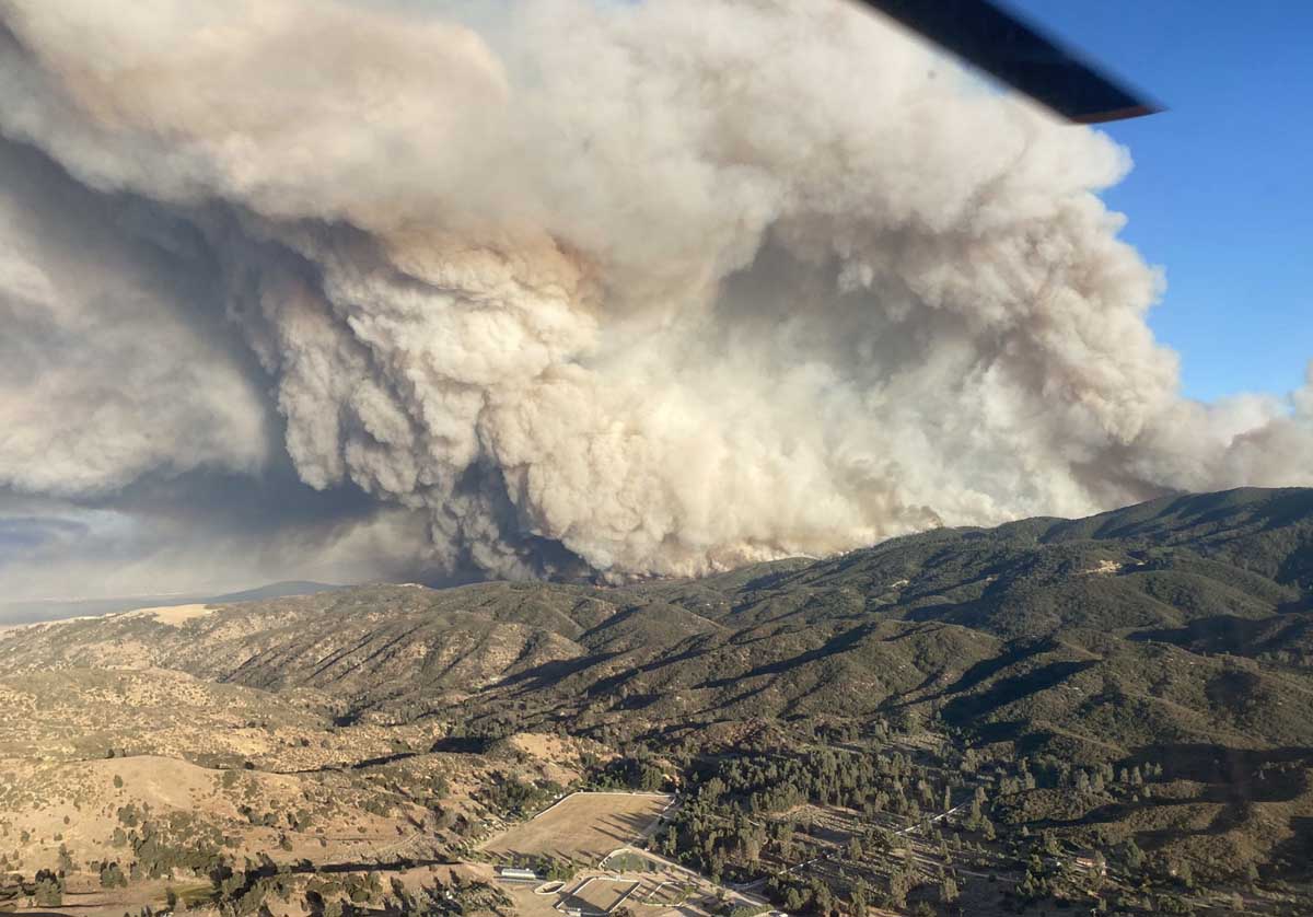
Lake Fire smoke pyrocumulus
Lake Fire 11:55 a.m. PDT August 15, 2020.

The Lake Fire west of Lancaster, California is up to its old pyrocumulus tricks again as you can see in the photo above taken just before noon Saturday. In the afternoon it was very active and in one location forced firefighters to withdraw to a safer location.

Fire photographer Jeff Zimmerman said, “We are getting hundreds of down strikes to the north of the fire.” This can happen under certain conditions when extreme fire behavior creates a massive pyrocumulus cloud that can generate lightning. The phrase “a fire can create its own weather” is overused, but creating its own lighting is an example.

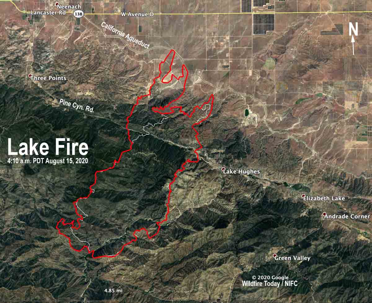
On Friday it made a three-mile run to the northeast down into the Antelope Valley but firefighters were able to keep it from crossing the California Aqueduct.

map lake fire lancaster california wildfire
The red line was the perimeter of the Lake Fire at 4:10 a.m. PDT August 15, 2020. The white line was the perimeter about 24 hours before.

Air Tanker 944, the 747, was over the fire at 11:45 a.m. Saturday and returned to San Bernardino. As this was being written at 1:35 p.m. Saturday the aircraft was again en route to the same general area, probably to drop another 17,500 gallons.


August 14, 2020 | 4:15 p.m. PDT

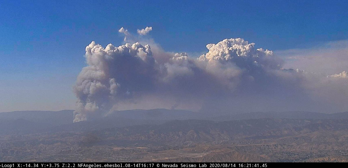
Lake Fire
Lake Fire from Loop1 camera, looking N-NW at 4:21 p.m. PDT August 14, 2020.

The Lake Fire in southern California near Lake Hughes 17 miles west of Lancaster was very active again Friday afternoon. It is well established east of Pine Canyon road and at 4:30 p.m. was moving to the northeast approaching the California Aqueduct in the Antelope Valley.

Early Friday morning the Lake Fire was mapped at 11,637 acres.

To see all articles on Wildfire Today about the Lake Fire, including the most recent, click HERE.

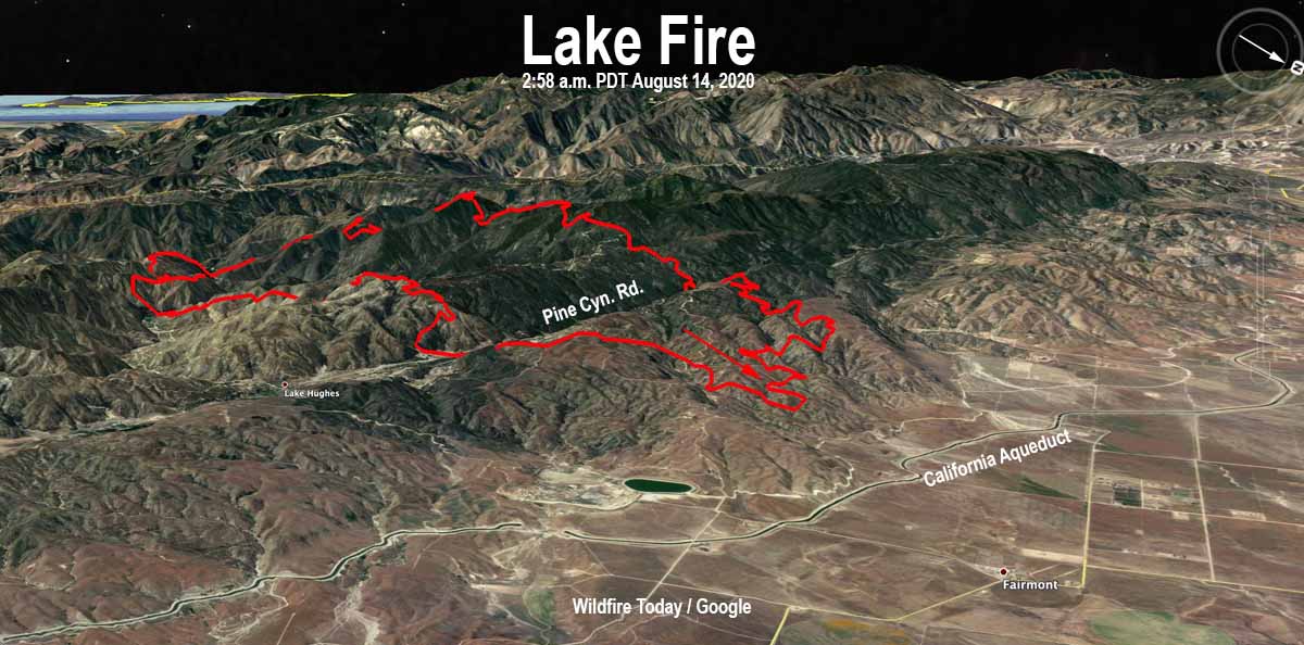
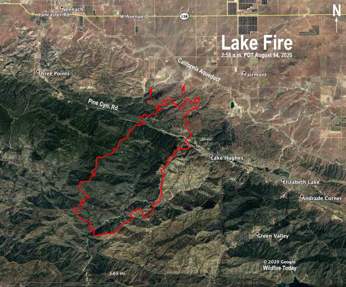
Map of the Lake Fire
3-D Map of the Lake Fire, looking southwest at 2:58 a.m. PDT August 14, 2020.
Map of the Lake Fire
Map of the Lake Fire at 2:58 a.m. PDT August 14, 2020. The arrows show one of the locations where there was significant spread on Friday.

Lake Fire spreads 7 miles in 12 hours, burns over 12,000 acres

The fire is 15 miles west of Lancaster, California

Updated August 13, 2020 | 10 a.m. PDT

Map of the Lake Fire
Map of the Lake Fire at 4:04 a.m. PDT August 13, 2020. USFS

The Lake Fire started August 12, 2020 between Castaic Lake and Lake Hughes in southern California. When the first units arrived on scene the fire was about 100 acres burning on both sides of Lake Hughes Road, spreading to the northeast.

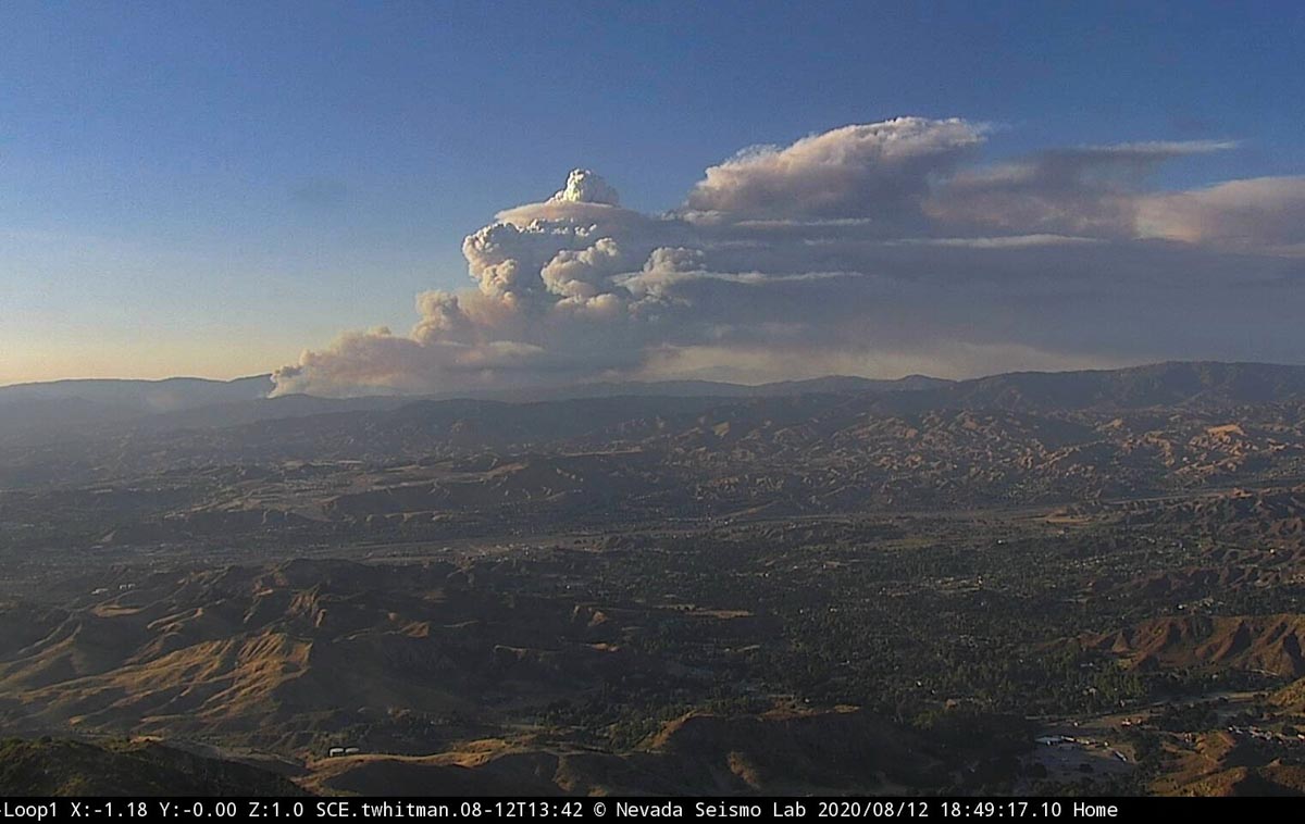
It was reported at 3:40 p.m. and within 29 minutes was creating pyrocumulus clouds indicating extreme fire behavior. It is very unusual for a fire to grow that quickly with that intensity.  Three and one half hours after it was reported the size was estimated at 10,000 acres. The rapid spread was aided by burning embers starting spot fires one mile ahead. A map released by fire officials with data from 4:04 a.m. Thursday indicated the fire had burned 12,681 acres. (At 7:10 a.m. Thursday PDT the Angeles National Forest Twitter account said it was 10,500 acres.) At that time the northeast end was on the slopes leading down to the desert after crossing Pine Canyon Road.

(To see all articles on Wildfire Today about the Lake Fire, including the most recent, click here.)

“It’s pretty explosive fire behavior,” said Angeles National Forest Fire Chief Robert Garcia. “It’s typically what we see a little bit later in the season and often driven by wind. The fuel, moisture conditions and the fire at this particular location with the slope, it really created the recipe for rapid fire growth.”

Lake Fire August 12, 2020
Lake Fire August 12, 2020, by Bill Neckels.

The records of a weather station at Elizabeth Lake showed that the fire was pushed to the northeast by a 7 to 13 mph wind gusting at 15 to 22 mph, with relative humidity in the teens and temperature in the low 90s. Western U.S. firefighters would not consider the weather conditions extreme. This begs the question, what kind of fire behavior will Santa Ana winds bring in the next several months?

Early in the incident, fire officials considered the possibility of the fire impacting homes along Pine Canyon Road, almost six miles to the northeast, and that it could keep going into the desert to the east. The Incident Commander placed orders for strike teams of Type 1 engines for structure protection, with 5 engines in each strike team. The orders were placed in multiples of 5 and 10 as the fire rapidly spread. By 6 p.m. a total of 20 strike teams, 100 engines, had been requested. The fire crossed Pine Canyon Road at about 7 p.m. Wednesday.

Evacuations were ordered along Pine Creek Road and for the community of Lake Hughes as well as other areas, affecting about 100 homes. Traffic on the road became very congested as large numbers of media vehicles, fire apparatus, and evacuees tried to occupy the space at the same time. Fire officials requested that all media leave the area in order to reduce the congestion.

Weather conditions moderated after 10 p.m. Wednesday with much calmer winds of less than 4 mph, but there was little humidity recovery, hovering around 20 percent during the night. The forecast for Thursday is for 92 degrees, 18 percent relative humidity, and variable winds generally out of the west at 9 to 15 mph gusting at 20 to 24 mph. There is a 15 percent chance of rain.

The Lake Fire is burning in an area that hasn’t burned since 1968, according to fire officials. The fire started in brush at about 2,300 feet and as it approached Pine Canyon road at over 4,000 feet it got into heavier fuels.

Firefighters, media, and residents were all trying to evacuate or withdraw at the same time.

Lake Fire spreads rapidly near Lake Hughes, California

Evacuations are in effect

August 12, 2020 | 7:29 p.m. PDT

map Lake Fire Lake Hughes California
Map showing the approximate location of the Lake Fire in southern California, at 5:30 p.m. PDT August 12, 2020.

A very rapidly spreading fire broke out Wednesday afternoon in the Angeles National Forest about 19 miles west of Lancaster, California. When units first arrived the fire was about 100 acres burning on both sides of Lake Hughes Road, spreading to the east and northeast.

(To see all articles on Wildfire Today about the Lake Fire, including the most recent, click here.)

At 5:50 p.m. firefighters reported it was generating spot fires one mile ahead and had already grown to about 7,000 acres;  at 7:05 p.m. the estimate increased to about 10,000.

At 6 p.m. the Incident Commander ordered additional strike teams of  Type 1 fire engines for structure protection to bring the total up to 20. With five engines per strike team, that is 100 engines. Evacuations are in effect.

At 7:05 p.m. the fire had crossed Pine Canyon Road and was well established on the east side.

Lake Fire
Lake Fire from Loop, at 6-49 p.m. PDT August 12, 2020


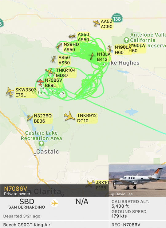
Aircraft over the Lake Fire
Aircraft over the Lake Fire at 7:26 p.m. PDT August 12, 2020. The green line is the track of the King Air in the photo, probably serving as a lead plane. FlightRadar24