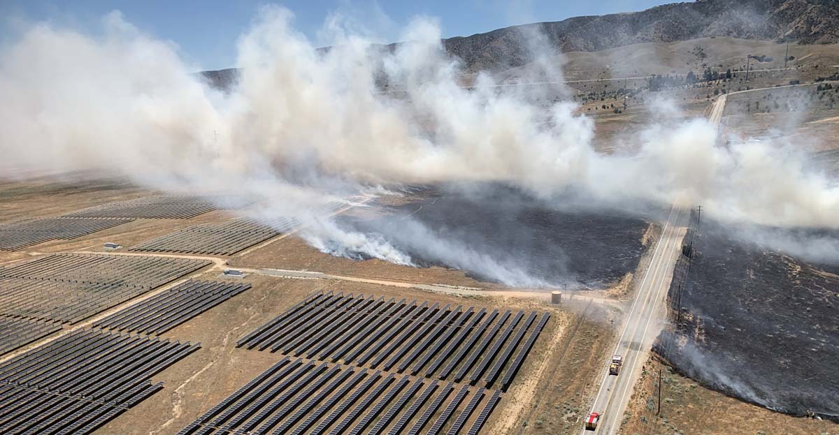
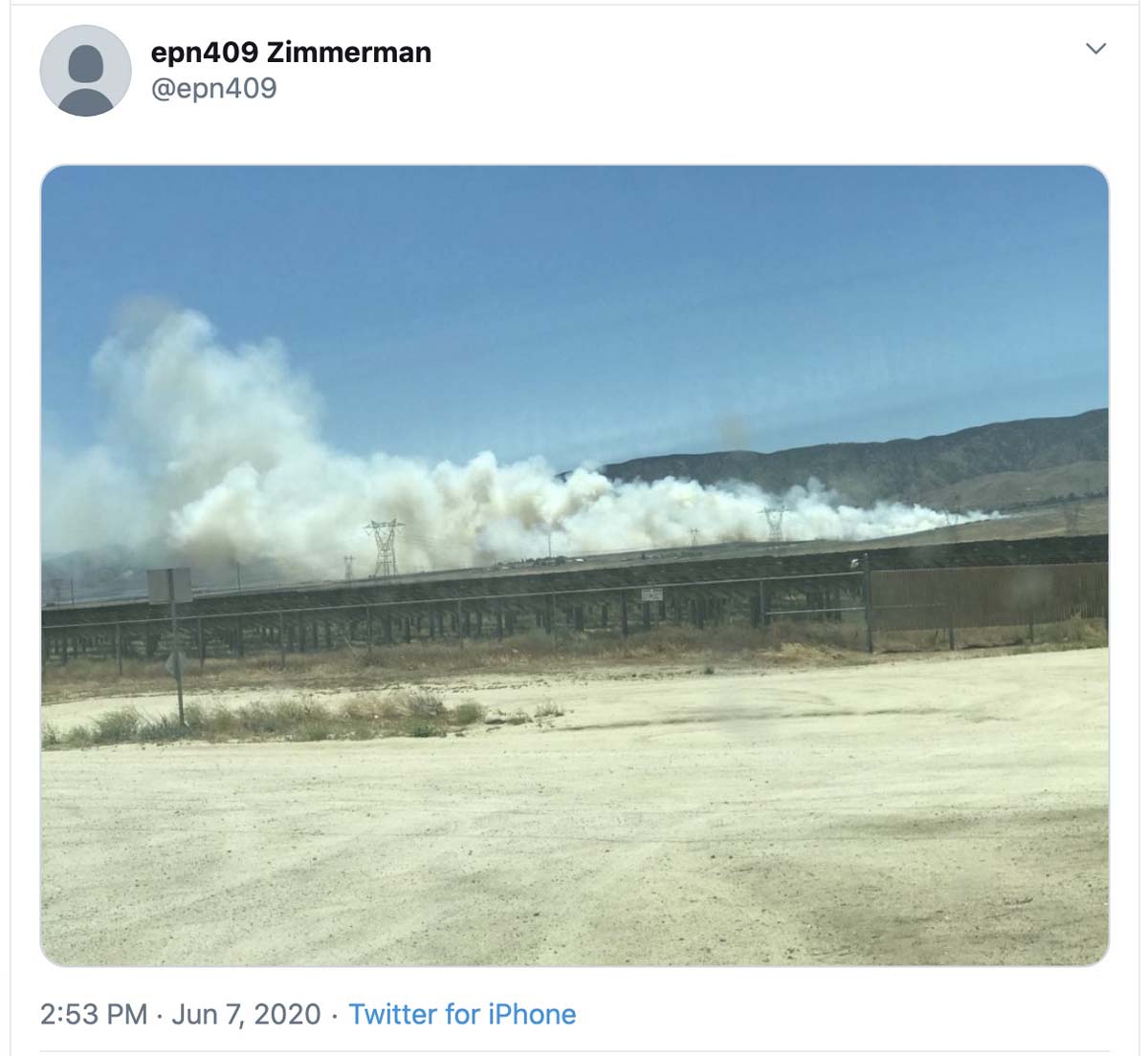
A vegetation fire near Lancaster, California burned very close to a solar generating facility at 110th Street West and West Avenue K on Sunday.
The Kilo Fire went to two alarms but the spread was stopped at 65 acres.
News and opinion about wildland fire
Near Lancaster

A vegetation fire near Lancaster, California burned very close to a solar generating facility at 110th Street West and West Avenue K on Sunday.
The Kilo Fire went to two alarms but the spread was stopped at 65 acres.

Smoke spreads toward Sacramento
(UPDATED at 5:58 p.m. PDT June 7, 2020)
The Quail Fire southwest of Winters, California has been mapped at 1,837 acres. CAL FIRE reports that mandatory residential evacuations have been lifted.
The number of structures destroyed remains at three.
(UPDATED at 9:25 a.m. PDT June 7, 2020)
CAL FIRE reported at 8 a.m. Sunday that the Quail Fire southwest of Winters, California has burned 1,400 acres with three structures destroyed and 100 structures still threatened. They also report that it is 10 percent contained, however for many agencies containment numbers are extremely subjective and may or may not accurately reflect the percent of the fire perimeter that is contained.
Evacuations are still in effect.
Resources assigned include 30 engines, 7 hand crews, and 9 dozers for a total of 600 personnel.
(UPDATED at 6:21 a.m. PDT June 7, 2020)
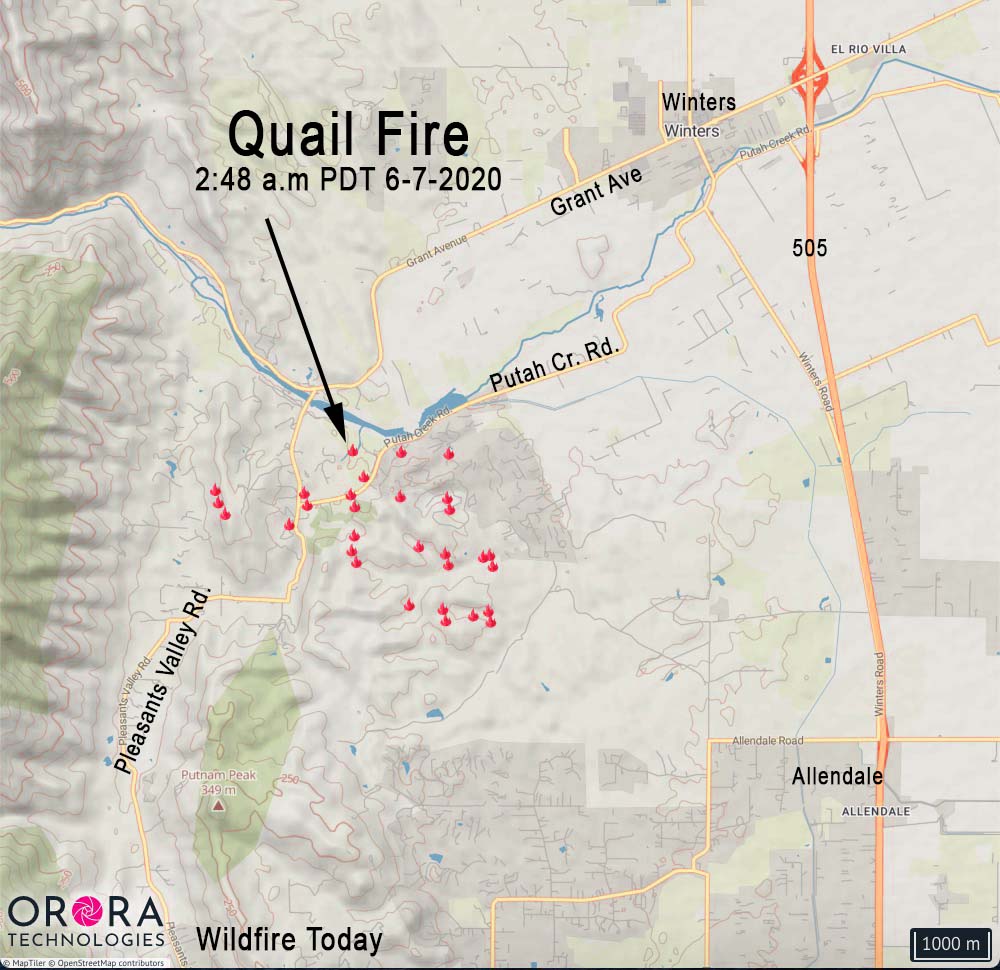
The spread of the fire slowed considerably overnight.
At 6:50 a.m. Sunday at a weather station south of the fire it was 53 degrees, 56 percent relative humidity, and the wind was out of the west-northwest at 7 mph gusting to 16.
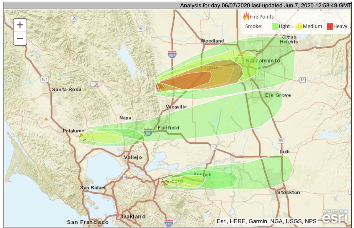
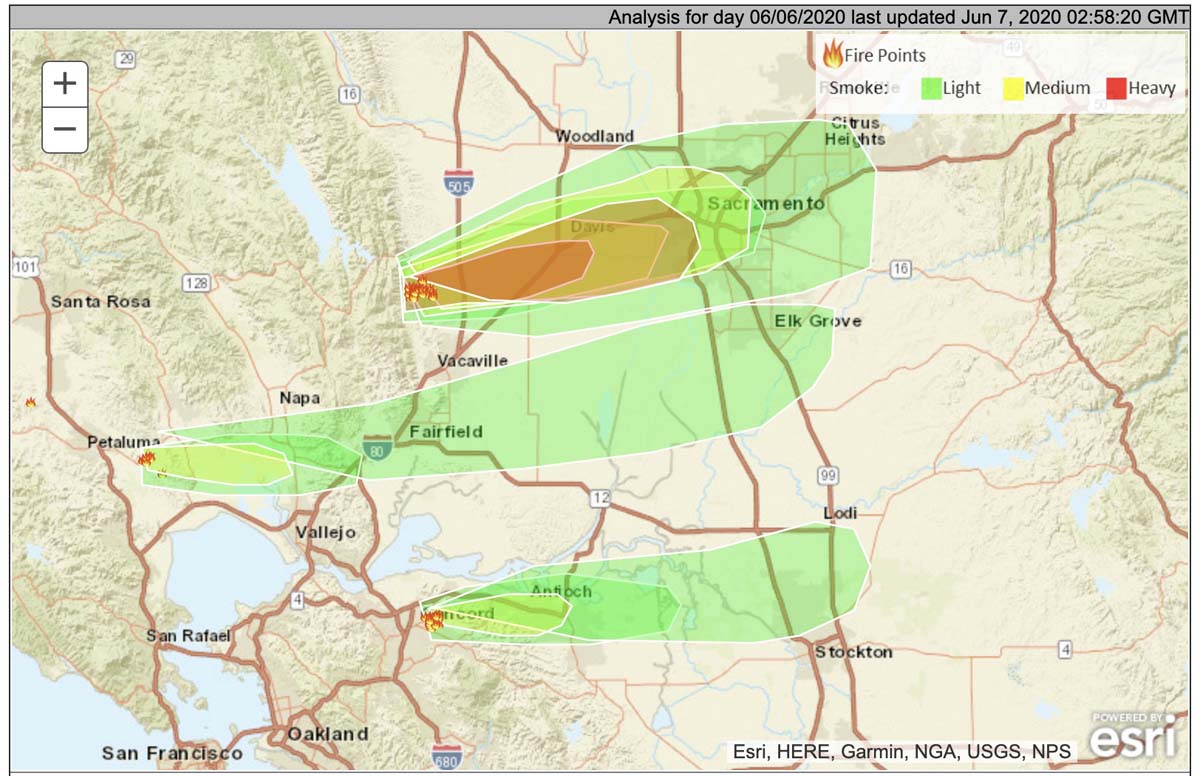
NOAA predicts the smoke will continue to spread to the east toward Sacramento.
(12:22 a.m. PDT June 7, 2020)
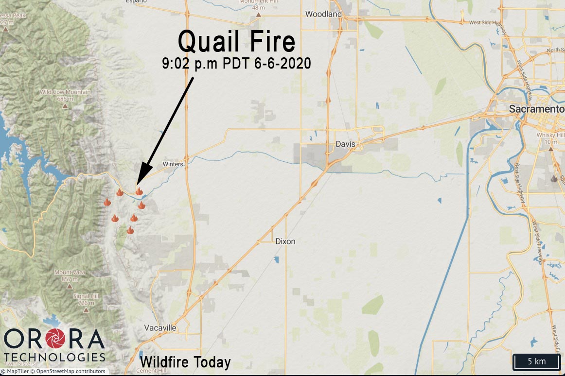
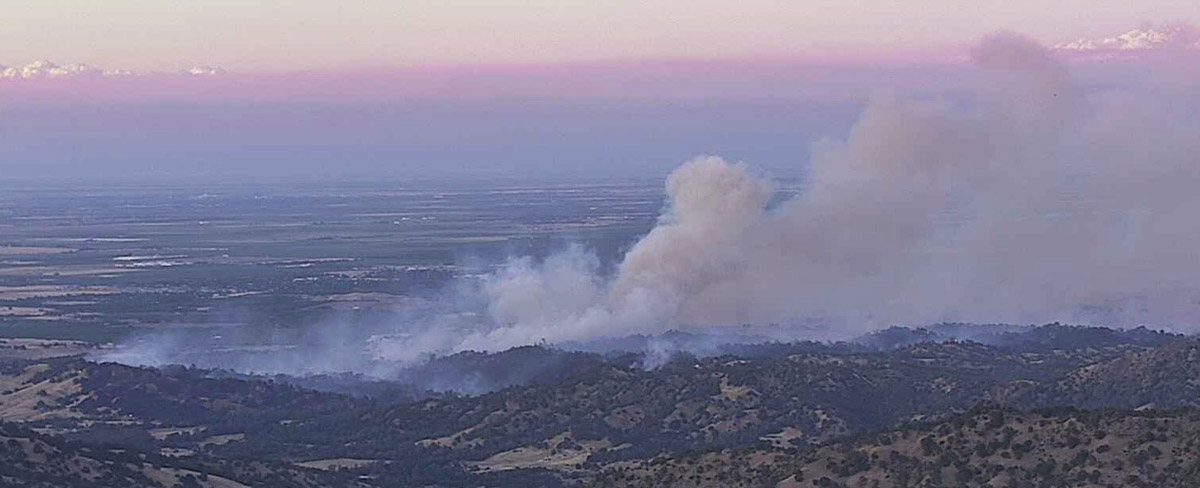
The Quail Fire that started Saturday afternoon southwest of Winters, California has burned about 1,200 acres west of Davis according to a 9 p.m. PDT update from CAL FIRE. Evacuations are in progress.
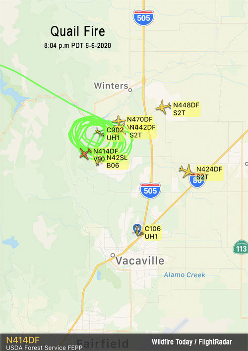
It was initially reported near the intersection of Quail Canyon Road and Pleasants Valley Road south of Highway 128 approximately 9 miles north of Vacaville and 13 miles west of Davis.
An evacuation Center is located at 3 Oaks Community Center, 1100 Alamo Dr., Vacaville, CA 95687.
At 9:45 p.m. MDT the Incident Commander requested an additional four strike teams (5 engines each) of any type of engines, immediate need. Approximately 100 structures were threatened, according to CAL FIRE.
Smoke from the Quail and other fires in the North Bay area is predicted to spread to the east affecting residents in Davis, Sacramento, Fairfield, Elk Grove, and Concord.
The wind in the fire area is predicted to be out of the west-northwest Saturday night at 16 gusting to 23 mph at 10 p.m., decreasing to 9 mph by sunrise. The maximum relative humidity overnight will be 65 percent, then will drop into the low 20s by Sunday afternoon, with an air temperature of 75 degrees.
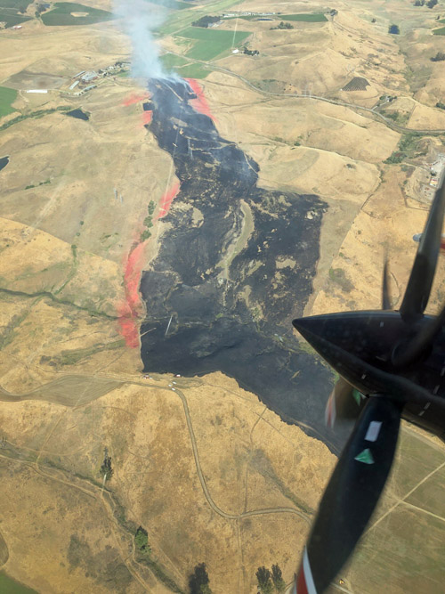
Yesterday the Lakeville Fire southeast of Petaluma, California burned about 141 acres before being suppressed by firefighters assisted by air tankers. The origin of the fire was near the 4500 block of Lakeville Highway.
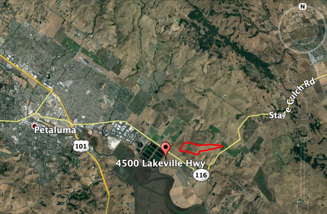
If the firefighters in the photo below (at top/right) are carrying drip torches as it appears, they may be burning out from a retardant line to consume the fuel between the retardant and an already burned area.
#LakevilleFire from Stage Gulch Rd. Petaluma / Sonoma around 5PM pic.twitter.com/xYroypfe8Y
— Guthrie Ikat (@GuthrieIkat) June 6, 2020
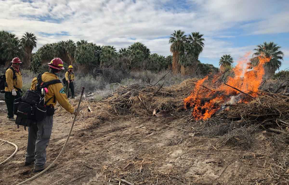
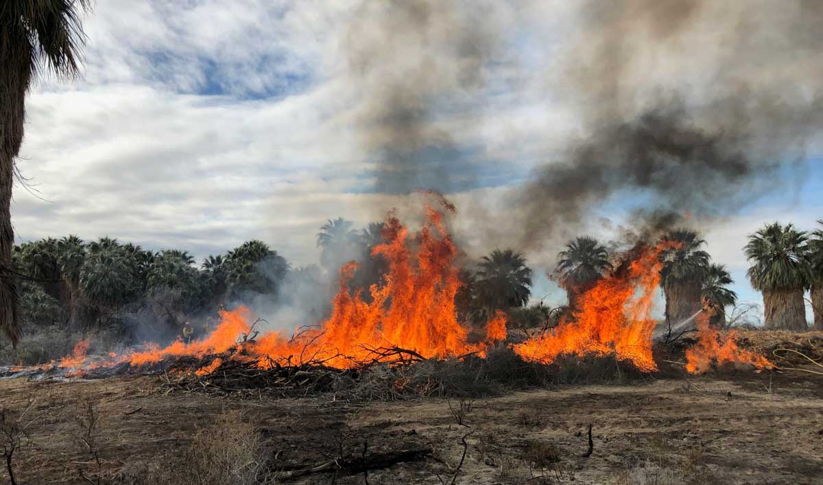
The U.S. Forest Service cancelled or postponed all new ignitions on prescribed fires last month, but the Bureau of Land Management announced on April 7 that they conducted a prescribed fire in southern California:
BLM fire crews remain hard at work to prepare for this year’s fire season. Today, a crew from the BLM Palm Springs-South Coast Field Office conducted prescribed burns at the Dos Palmas Preserve near the North Shore of the Salton Sea.
These three photos were posted with the text on Facebook.

Former Superintendent of Little Tujunga Hotshots in southern California
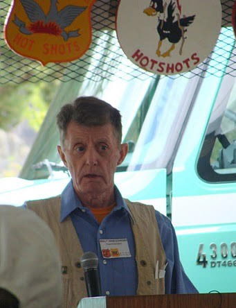
Walt Sniegowski passed away Tuesday morning, March 31, a victim of the coronavirus.
Walt was a charter member of the Little Tujunga Hotshots when the crew was formed in 1970 on the Tujunga District of the Angeles National Forest in southern California. Rod Wrench was the Superintendent then and Walt and Gary Glotfelty were the crew foremen. Walt was promoted to Superintendent in 1974 and served in the position through 1976. He later worked in fuels management and at the Riverside Fire Lab, retiring in 1990 after 31 years of service.
He left active fire suppression in 1978 because as one former Angeles National Forest veteran said, “he had so much lung damage from years of being on the fire lines that he could no longer continue.”
A person has to wonder if his career as a firefighter made him more vulnerable to the virus.
The excellent biography of Walt below was written in 2010 by Rod Wrench around the 40th anniversary of the Little Tujunga Hotshots.
Since Little T’s inception not a more familiar face could be found than that of Walt Sniegowski. Crew members from 1970 through 1977 could stop what ever they were doing, drive up to Little T Station, roll down their window and yell ―”Hey Walt!” and from somewhere in the bowels of the Little T complex echos the gruff reply, “Hey What!”
Born and raised in a rural area of Western Massachusetts, Walt Sniegowski attended school in the town of Chicopee in the Connecticut River Valley. His family was always involved with hunting or fishing and owned several fishing camps and cabins for that purpose. If it was fresh water fishing the big rivers of Canada or fishing in the ocean Walt could be found on ocean going vessels, power boats and canoes for that purpose. He’s mother said in her diary that Walt was born with a fishing rod in his hand and spent 150 + days per year fishing or hunting right out the back door of the family home. Walt became so accurate with bow and arrow that he competed in regional field archery tournaments in the junior and intermediate categories and helped build tournament courses in Vermont and Massachusetts that still exist today. The career path for Walt was set. He would work for Fish and Game or the Forest Service. The United States Forest Service landed him.
Walt attended and graduated from the Stockbridge School at the University of Massachusetts in Amherst. Armed with an Associates Degree in Forest and Wildlife Management, Walt accepted a position with the Fremont National Forest in Lakeview, Oregon in 1958 & 1959 and became a “Timber Beast” timber estimating, cruising, and marking timber with a little log scaling thrown in. While learning his craft on the Fremont he became a Red Carded Smoke-chaser and made a few lightning fires and one shift on the only campaign fire in those two years. “I had not yet inhaled enough smoke to get hooked into a fire career”.
Encouraged by his District Ranger, Walt attended the University of Idaho in 1960 & 1961 and worked for the USFS experiment station at Intermountain and then in watershed management at San Dimas.
Everything appears to be on track in young Sniegowski’s life but who wants to be on track? “I know…I’ll join a Hot Shot crew.” In 1964 Walt applied for and accepted a position with the Dalton Hot Shots on the Baldy District of the Angeles National Forest. It became his spiritual awakening. “Young” Chuck Hartley was the Superintendent and Walt worked alongside three would be “Lifers” — Lorenzo Armas (Interagency Dispatch Center @ Bishop), Paul Gleason (Supt. Of the Zig Zag and Pike Hot Shot crews), and Lou Yazzie (Dalton Hot Shot Foreman and Supt.).
In 1965 Walt accepted a permanent position with the USFS as a Fire Prevention Technician at Dalton and later Rincon Station. During this time Walt gained a lot of fire experience on sector teams supervising inmates, lemon pickers, and the military. Chosen to organize and train the Y.A.C.C. Crew at Camp Fenner on the Valyermo District, Walt accumulated more fire experience but it wasn’t the same as the Hot Shot world. “I was looking for a supervisors position on a Hot Shot crew but few were available. Positions in Arizona and Idaho were offered but they were temporary and I turned them down”.
In 1970 Walt was offered a supervisory position working for Charlie Caldwell on the Redding Inter-regional Hot Shot Crew. Then lo and behold the Foreman’s position on the Little Tujunga Hot Shots was offered at the same time. “I agonized over the decision for several days, however friends like Woody Hite, Hugh Masterson, and others convinced me of the unique opportunity to start from day one with a brand new crew. Not many people get an opportunity like that and I never regretted the decision.”
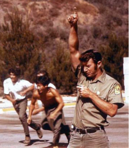
This decision must have been the right one because 8 years later, 4 years as Foreman and 4 years as Superintendent, Walt Sniegowski took into his hands the responsibility to protect, guide, and defend the lives of twenty young men every fire season. During his time with the Little Tujunga Hot Shots, not one fire shelter was deployed or one major lost time accident was recorded.
In 1978 health reasons forced a move out of primary fire fighting positions and into the start of the Angeles National Forest Fuels Program. To get things jump started Walt was stationed at Oak Grove, Then, the program eventually moved into the Supervisors Office in 1980 at Arcadia, California. In 1983 he accepted a new position with the Prescribed Fire Project at the Riverside Fire Laboratory.
In 1990, after 31 years, 6 months, and 16 days Walt Sniegowski retired from the United States Forest Service. But wait!….the telephone never stopped ringing. “Hey Walt!”….”Hey What!”…”It’s the Bureau of Indian Affairs, The Federal Emergency Management Agency, and the Department of Justice requesting you put your Whites back on. What do I tell them?”…”Tell ’em I’ll be there!”
For those that don’t know, Walt celebrates and shares his life with his wife Sarita, 4 children and 10 grand children. They live a very active life in Palm Springs, California and never miss the opportunity to be active members of that community.
(end)
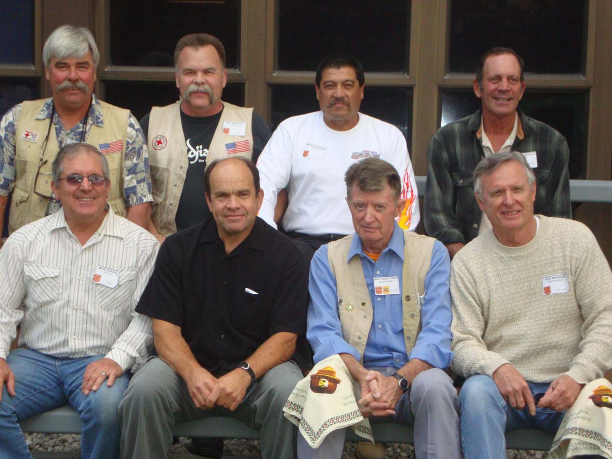
Our sincere condolences go out to Walt’s family, friends, and co-workers.
Thanks and a tip of the hat go out to Robert. Typos or errors, report them HERE.
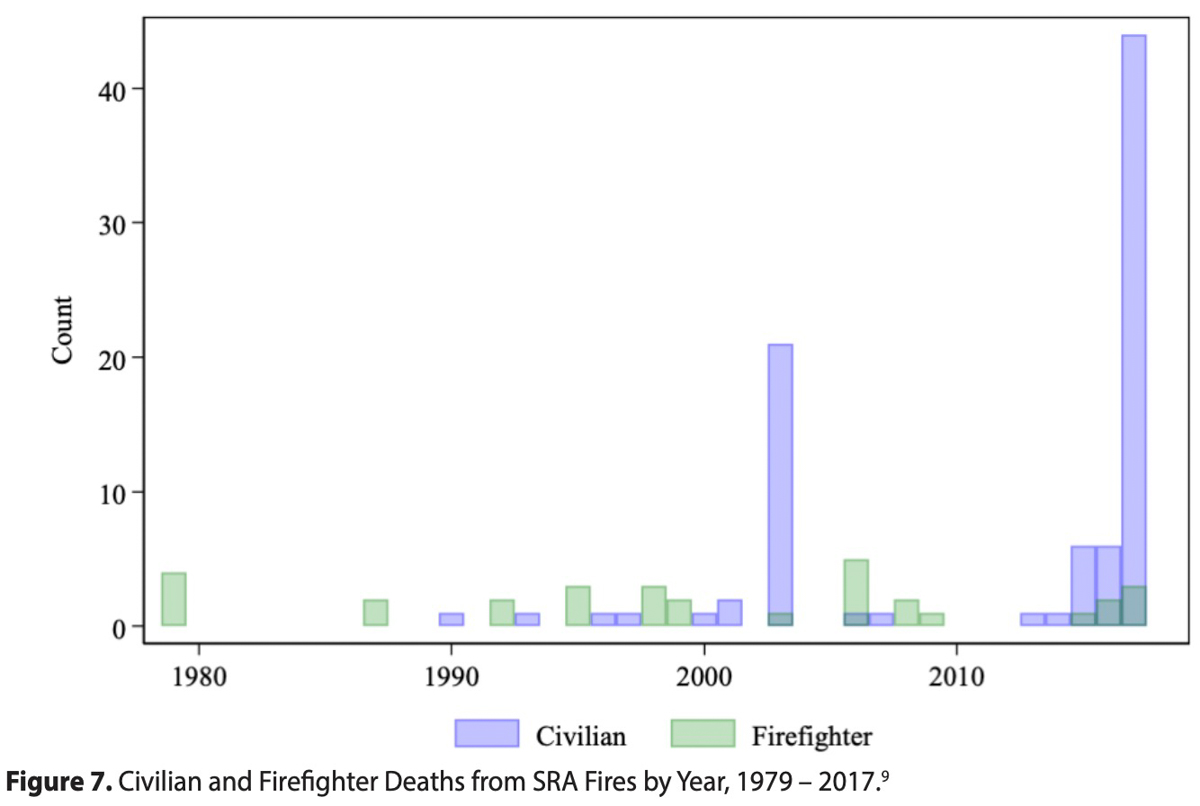
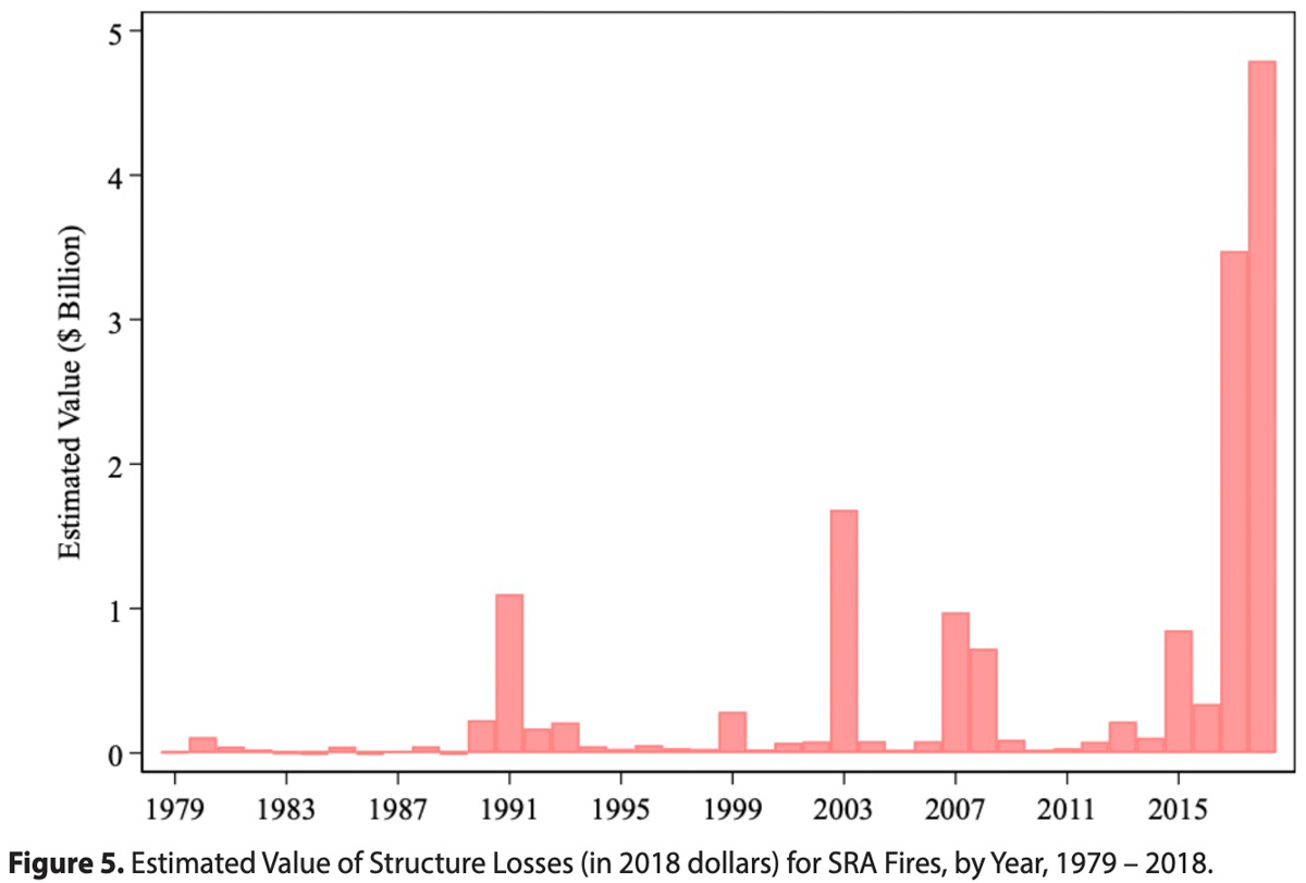
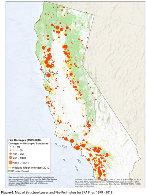
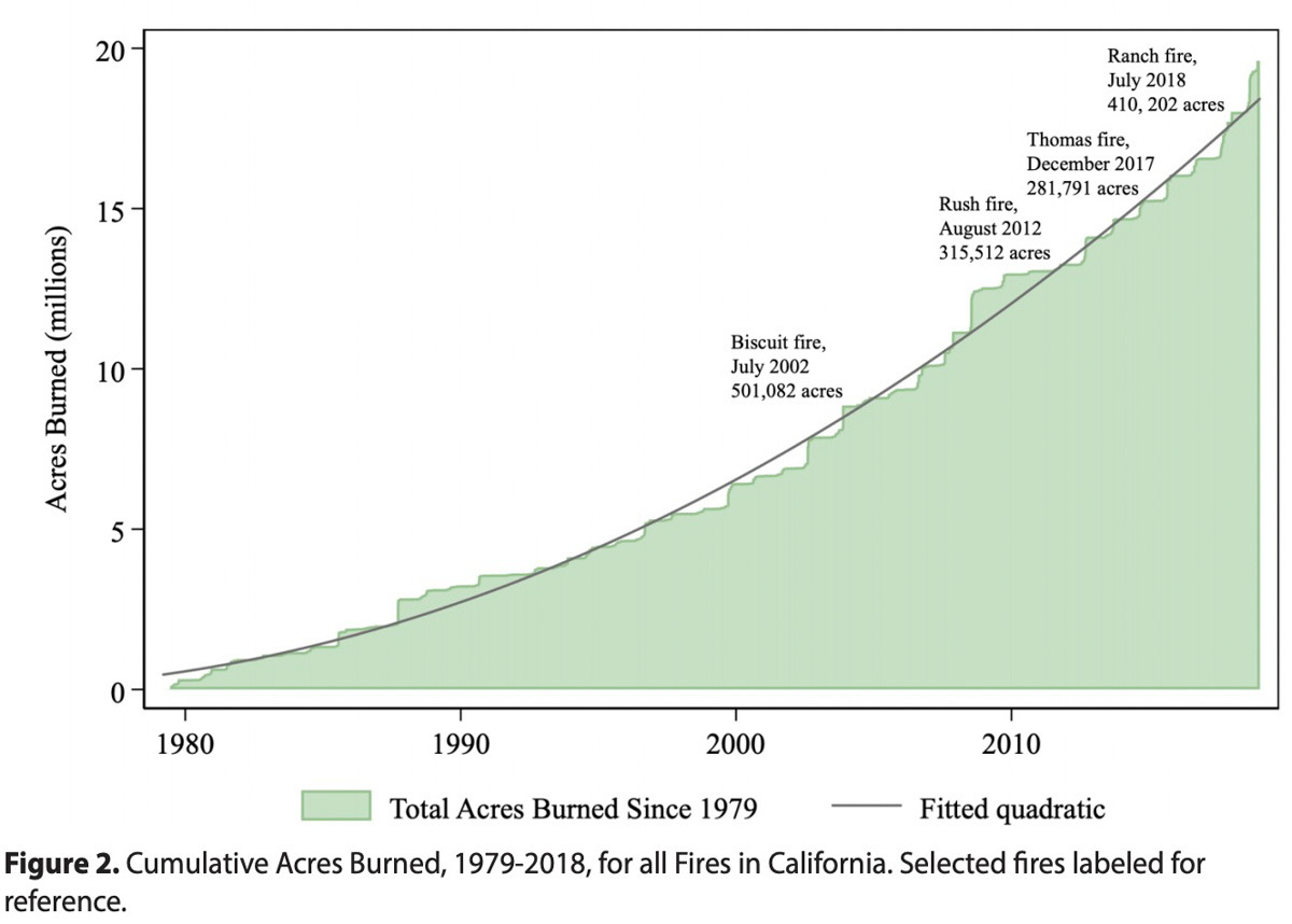 It’s clear to most citizens of California that wildfires have become more intense over the last few years. Researchers at UC Santa Barbara and the Nature Conservancy have compiled a new dataset of damage caused by wildfires in California in areas protected by the state of California. (Some of the data does not include fires on lands protected by federal agencies, such as the U.S. Forest Service, National Park Service, and the BLM). The report illustrates how the recent set of severe fires fits into a broader trend of increasing burn area and damage over the past 40 years.
The report was written by: Hanna Buechi (Environmental Market Solutions Lab, UCSB), Dick Cameron (The Nature Conservancy), Sarah Heard (The Nature Conservancy), Andrew J. Plantinga (Environmental Market Solutions Lab, UCSB), and Paige Weber (Environmental Market Solutions Lab, UCSB).
The researchers studied data on fire perimeters and estimates of damages for each fire and used the information to calculate trends involving the number and timing of fires throughout the state by time of year. They also calculated the total area burned and specifically identified the amount of wildland urban-interface burned. These are areas where houses intermingle with wildland vegetation, and are of particular concern to those studying wildfire.
“The main finding is that the recent severe fires in California — including the Thomas fire in 2017 and the Camp fire in 2018 — are part of a trend in California over the past four decades,” said Andrew Plantinga, an economics professor at UC Santa Barbara’s Bren School of Environmental Science & Management. “The trend is toward more wildfires that burn larger areas and cause more damage.”
The number of acres burned per year has not only been increasing, the report found, it is also accelerating. And this increase isn’t only during the season’s peak, from June through October. The state is also seeing a longer fire season, with more acres burned in late fall than in the past. And while greater burn areas don’t automatically translate to greater damages, the researchers found that these, too, have been on the rise.
“I expected the recent severe fires to be outliers, and they are,” said Plantinga, “but it’s also clear that they represent part of a trend toward larger and more damaging fires.”
The report is part of a larger effort to estimate the costs associated with a business-as-usual approach to development in California, when considering the potential impacts of climate change. The team had previously found that interventions on natural and working lands — like forests, farms and rangelands — can contribute 2.5 times the emissions reductions by 2050 as residential and commercial sectors combined.
What’s more, for every dollar spent on implementing land-use strategies, close to fifty cents would be recouped in economic benefits. And that’s without accounting for other positive impacts, the previous report states.
