It is burning season in British Columbia

The map above shows the number of current registrations for Category 3 open fires in British Columbia. Registrations are required for a fire that burns material in piles larger than two meters high and three meters wide, windrows, or grass over an area larger than 0.2 hectares (0.49 acres) in size.

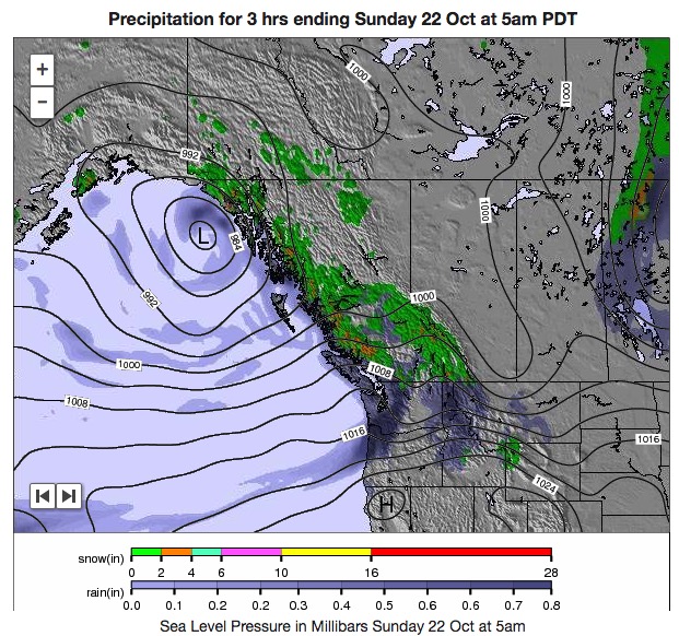
Most areas in southern British Columbia are expecting to receive precipitation over the next couple of days, so landowners are probably wanting to get the burns in before the rain or snow.

The BC Wildfire Service sent out a notice Friday morning saying, “Burn Registration line is currently receiving a high volume of calls. Pls be patient if you are waiting in queue.”

bc weather forecast

Alberta firefighter killed in water tender crash

James Hargrave
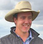
James Hargrave. Photo from the office of Agriculture Minister Oneil Carlier.

A volunteer firefighter from southeast Alberta was killed in a vehicle accident Tuesday night October 17.

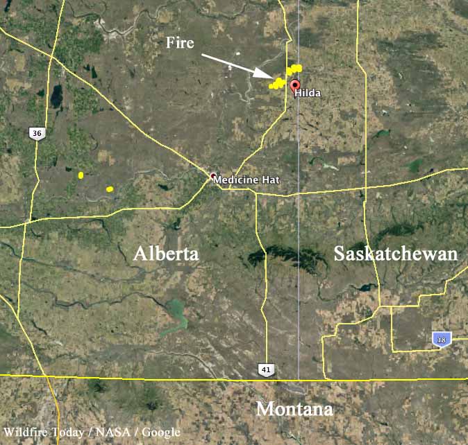
James Hargrave, a 34-year old firefighter with Cypress County Fire Services was working on a wildfire that started in Alberta and spread into Saskatchewan where it was moving toward the towns of Leader and Burstall.

Mr. Hargrave was driving a water tender that collided with a pickup. The Royal Canadian Mounted Police said he died at the scene. The driver of the pickup had minor injuries.

“James was very community-minded and joined the fire services to help and protect residents far and near. He was a great father and will be dearly missed by his wife, children, extended family, friends, neighbours and fellow first responders,” Cypress County said in a news release. “He was a great father and will be dearly missed by his wife, children, extended family, friends neighbours and fellow first responders.”

Our sincere condolences go out to Mr. Hargrave’s family, coworkers, and friends.

map fires alberta
Map showing fires detected in southeast Alberta by a satellite at 2:55 p.m. MDT October 17, 2017.

Diamond Creek Fire burns into Canada

Above: The image shows heat detected by a satellite August 31 and September 1, 2017. The red dots are the most recent, early Friday morning.

The Diamond Creek Fire in the Pasayten Wilderness in the Okanogan/Wenatchee National Forest has crossed the Washington/British Columbia border and spread three miles into Canada. The Incident Management Team reports the total size of the fire is over 52,000 acres.

A magic trick, or a peat fire?

This almost looks like a magic trick, but it shows what can happen with very deep-seated fires, such as peat. Smouldering underground with limited oxygen, the very hot material and gasses can transition into flaming combustion once introduced to an atmosphere with a higher concentration of oxygen.

Mesmerizing.

“Let’s be careful out there”.

Watch smoke from Canadian wildfires get blown over the North Atlantic Ocean

Scientists have tracked smoke plumes that have circumnavigated the Earth multiple times.

Protecting a historic site above the Arctic Circle

In recent weeks a wildfire in northern Yukon Territory on the Alaskan border threatened the Rampart House historic site. It occurred at 67 degrees North Latitude, which is about the same distance from the equator as the fires burning in Greenland.

Rampart House was the location of one of the first encounters of traders, missionaries, and police with the native people of the region. The archaeological resources and 21 historic structures are cooperatively owned and managed by the Yukon Government and the Vuntut Gwichin First Nation.

Rampart House

Doug Cote was assigned to the fire and sent us these photos along with this description:

A number of fires threatened the site over the two week period we were there.  Once our trigger points were breached we pulled out our fall back ignition plan which went off like text book. Aerial ignition from above and hand ignition on the ground for close to 2km along the base of the slopes above the site.  The area should be safe from fires for a good long while now.

There were a number of large fires burning north of the arctic circle in Alaska and Canada’s north west this summer with higher than average temperatures and higher than average amounts of lightning.  It would be real interesting to crunch the numbers and see the total burned area and how it compares to previous years and whether there is any evidence of an upwards trend.

Rampart House Rampart House

Thanks Doug!