14 aircraft and 367 firefighters are battling the Cellar Fire 14 miles east of Yarnell, Arizona

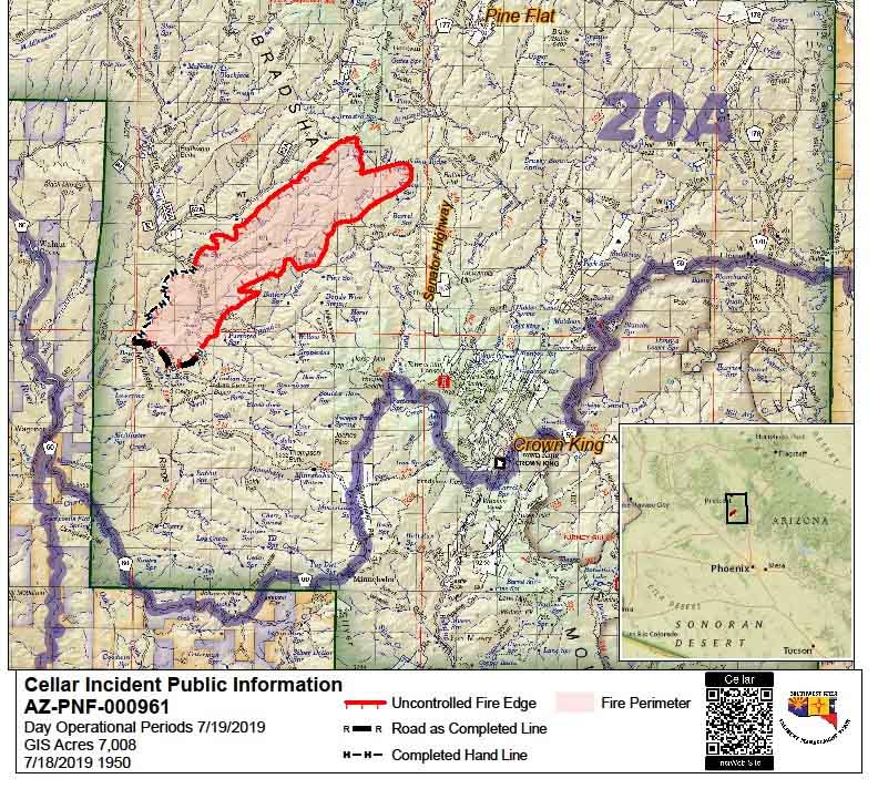
Map of the Cellar Fire
Map of the Cellar Fire, at 7:50 p.m. July 18, 2019 by the Incident Management Team.

The 7,000-acre Cellar Fire 15 miles south of Prescott, Arizona was active Thursday afternoon primarily on the northeast side as 7 air tankers, 7 helicopters, and 13 hand crews worked to limit the spread (see the map above). A total of 367 personnel are assigned to the fire.

The overall strategy of the Type 1 Incident Management Team led by Alan Sinclair is full 100 percent suppression. Structure protection is in place on the 52 Road (the Senator Highway). The highway may be used as a holding feature if the fire continues to move east.

The Incident Management Team reported that a DC-10 Very Large Air Tanker was effective in slowing the fire’s spread on the east side. Additional air tankers continued to support hotshot crews working on the northwest flank of the fire.

The Yavapai County Sheriff’s Office issued a Code Red ‘GO’ mandatory evacuation for the residents in Pine Flat affecting 41 residences and 21 outbuildings. A total of 690 structures are threatened. A shelter has been established at the Prescott High School.

The weather at Crown King, 6 miles southeast of the fire, is predicted to be about the same Friday and Saturday as it was on Thursday — temperature in the high 80s and relative humidity in the teens. The wind will be a little stronger, generally out of the west or southwest at 10 to 15 mph with gusts to 20. This translates to no relief for the firefighters, however there are some fire scars out ahead of the Cellar Fire that could decrease the intensity and resistance to control.

Map of the Cellar Fire
Map of the Cellar Fire — from a mapping flight at 10 p.m. MDT July 18, 2019.


Forest Service is managing a 7,000-acre wildfire south of Prescott, Arizona

The Cellar Fire is 16 miles south of Prescott

Cellar Fire Arizona
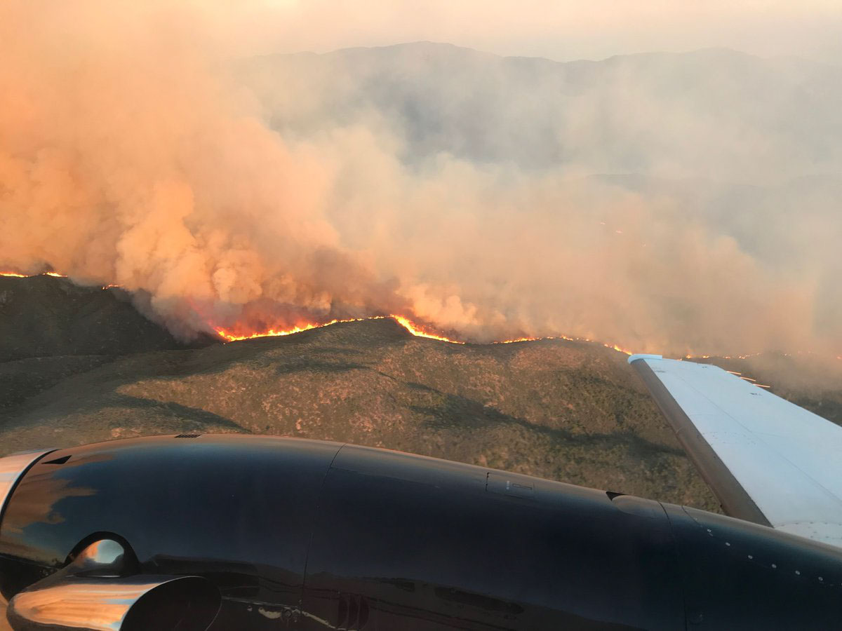
The Cellar Fire in Arizona. July 16, 2019. USFS photo.

A wildfire 10 miles southwest of Mayer, Arizona (see the map below) has burned about 7,000 acres in the Prescott National Forest. According to the National Situation Report the agency is not intending to fully suppress the fire, but instead is managing it to enhance the natural resources. They will take action as needed to herd it around or protect values at risk.

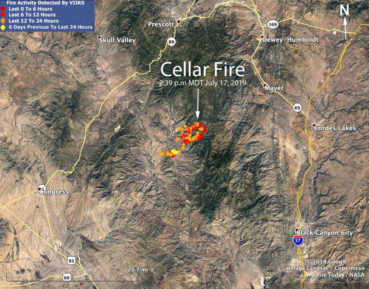
Map showing location Cellar Fire Arizona
Map showing the location of the Cellar Fire 16 miles south of Prescott, Arizona. The red dot represent heat detected by a satellite at 2:39 p.m. MDT July 17, 2019.

Believed to have been started by lightning, it was reported on July 14 burning in grass and brush but is spreading northeast into ponderosa pine west of the Senator Highway (FR 52).

A Type 1 Incident Management Team is expected to assume command of the fire Thursday, July 18 at 6:00 am.

As a precaution the Yavapai County Sheriff’s Office issued a Code Red for the community of Pine Flat. The ‘SET’ alert was issued last night by the Sheriff’s Department. There are NO evacuations currently in effect. For information on the Code Red issued call (928) 771-3321.

The US Forest Service and the Air Tanker Base at Prescott Regional Airport expects heavy aircraft activity out of airport over the next couple of days as they continue to assist with the fire.

Cellar Fire Arizona
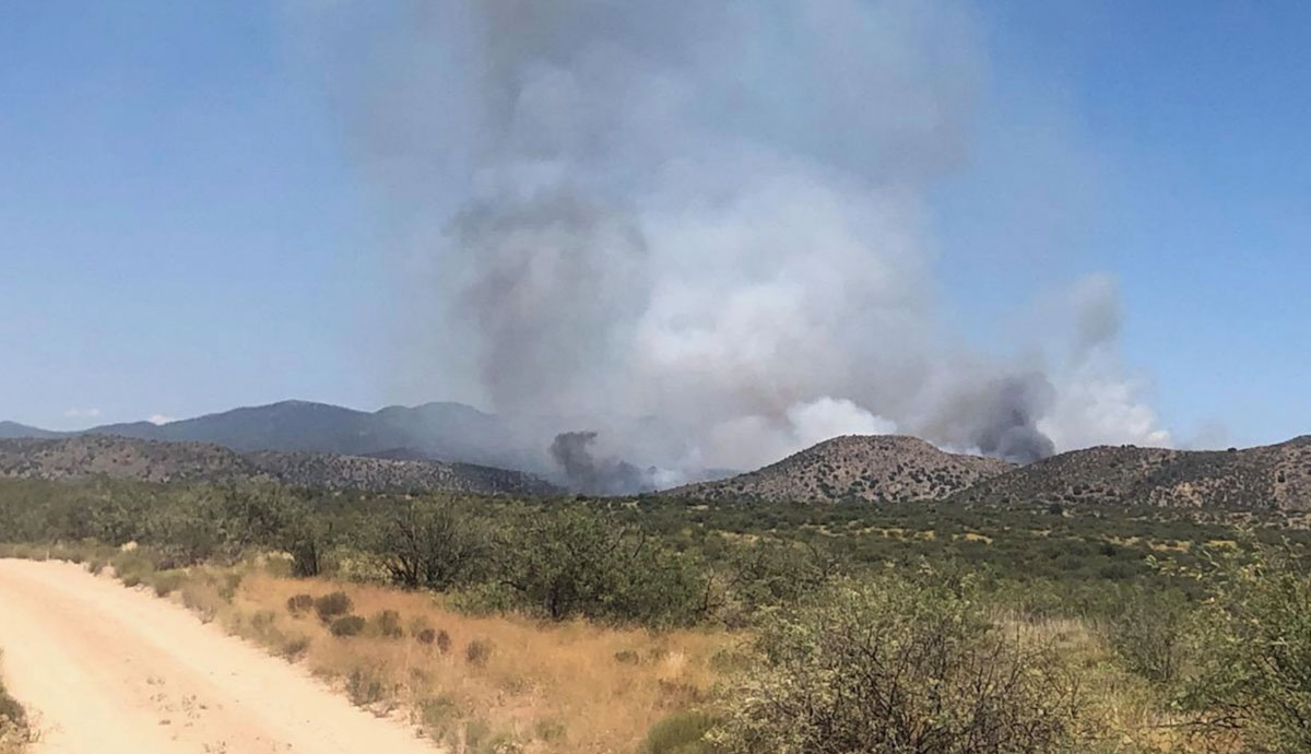
Cellar Fire in Arizona. July 16, 2019. USFS photo.