And the next day, July 4, we see the Operations Section Chief on the Corner Creek fire briefing firefighters:

More information about the Corner Creek Fire, 9 air miles south of Dayville, Oregon.
News and opinion about wildland fire

And the next day, July 4, we see the Operations Section Chief on the Corner Creek fire briefing firefighters:

More information about the Corner Creek Fire, 9 air miles south of Dayville, Oregon.
(UPDATE at 8:40 a.m. PT, July 5, 2015)
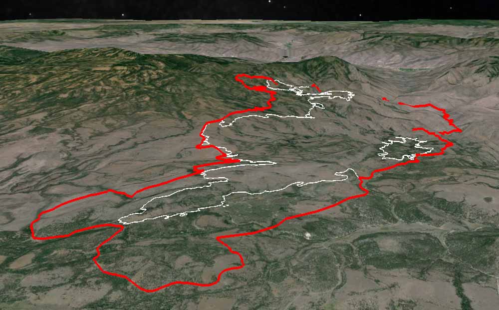
Over the last two days the Corner Creek Fire in central Oregon has continued to spread on the south and west sides and has blackened approximately 27,000 acres.
Here is an excerpt from the incident management team’s description of the activity on Saturday:
On Saturday, winds on the Corner Creek Fire pushed the blaze against firelines being built along its south and west flanks, prompting swift action from helicopters and air tankers. Cooling water and retardant dropped from the aircraft helped firefighters to keep fire growth to a minimum.
**** (UPDATE at 9 a.m. PT, July 4, 2015)

The Corner Creek Fire 9 air miles miles south of Dayville, Oregon continued to grow Friday to the south and northwest. Extremely hot and dry weather conditions are causing the fire to run, spot, and torch into timber and rangeland. Firefighters continue to work to protect structures near the fire and prevent it from crossing onto the east side of the South Fork John Day River. The area is under a Red Flag Warning on Saturday for gusty winds and low relative humidities. A weather forecast for the fire area on Saturday calls for a high temperature in the high 90s, relative humidity around 10 percent, and 5 to 10 mph winds out of the northwest. The weather on Sunday should be about the same. **** (UPDATE at 9:45 a.m. PT, July 3, 2015)
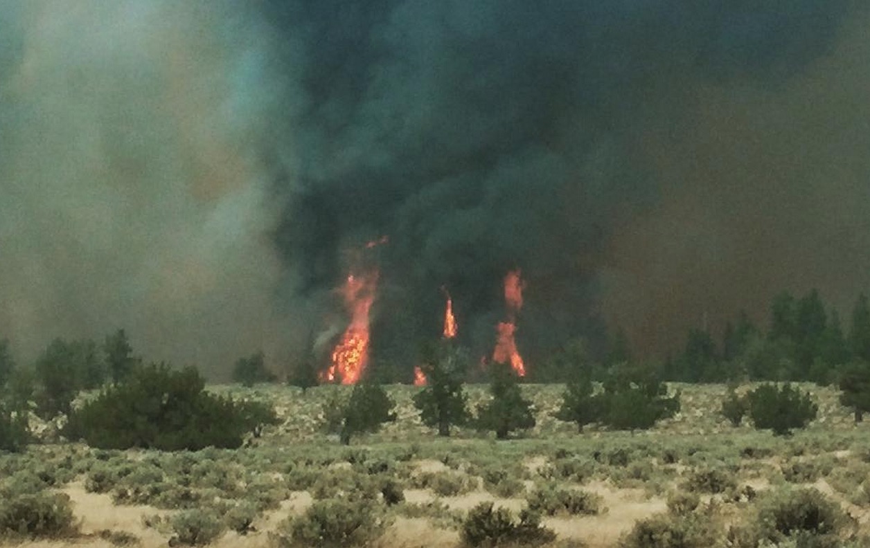
The Corner Creek Fire in Central Oregon grew by more than 6,000 acres on Thursday to 19,232 acres. It was most active on the south
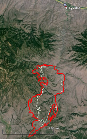
and west sides and progressed an additional three miles to the southwest. On the west side it is near the Turnpike and Upper Bronco Reservoirs. The fire still has not crossed the South Fork John Day River on the east side. Firefighters are protecting structures and looking for opportunities to control the fire spread, including clearing fuels near forest roads to the south and west which may be used as fire lines for burnout operations. The area will be under a Red Flag Warning from noon Saturday until 8 p.m. Saturday. The Corner Creek Fire is 9 air miles miles south of Dayville, 29 miles southwest of John Day, and 85 miles northeast of Bend. **** (UPDATED at 11:05 a.m. PT, July 2, 2015)
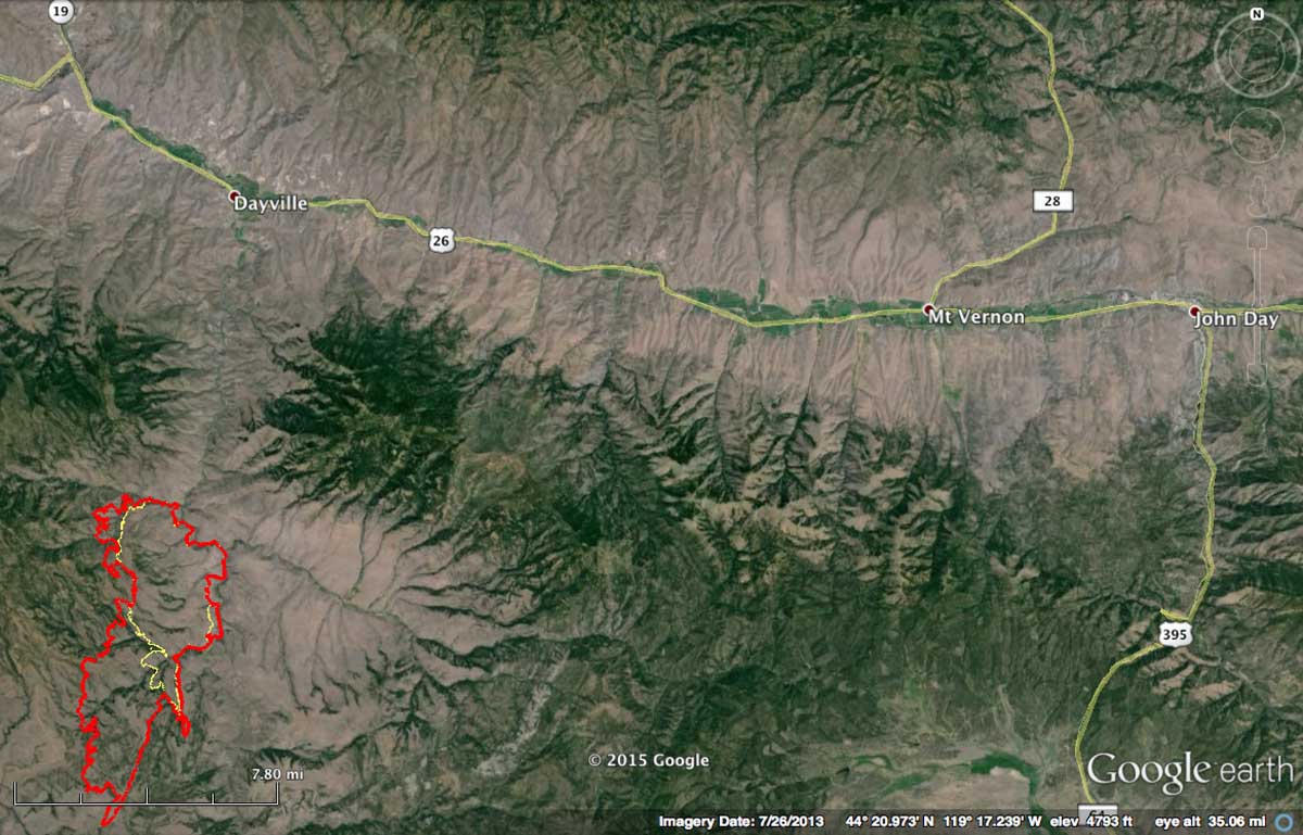
The Corner Creek Fire in central Oregon more than doubled in size in 24 hours. Late Wednesday night it was mapped at about 12,700 acres. The fire moved east to the South Fork of the John Day River but did not cross it, yet, and it spread about five miles to the southwest. Very little information about the fire has been made public by Buckman’s Oregon Department of Forestry Team 1. But, the term “extreme fire behavior” was used in a very brief description released by the Northwest Coordination Center.
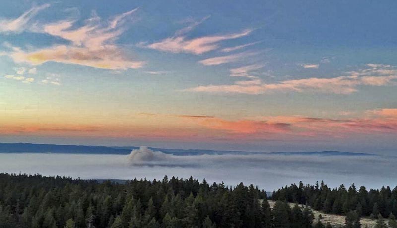
High temps, wind and low humidity means fire behavior is picking up on Corner Creek (photo by Wolf Mountain Lookout). pic.twitter.com/bSCoHnbW1A
— Central OR Fire Info (@CentralORFire) July 2, 2015
Crew wading the South Fork of the John Day River on Corner Creek Fire. Black Canyon Wilderness. pic.twitter.com/iGikkPmk34 — Prineville IHC (@PrinevilleIHC) July 2, 2015
****
(Originally published at 7:23 a.m. PT, July 1, 2015)
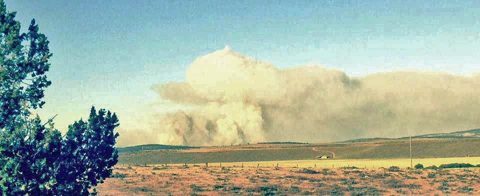
Firefighters have been busy in central Oregon for the last week after the area got hammered by lightning.
The spread of the Sugarloaf Fire, 7 miles north of Dayville, is slowing and some of the resources are being sent to the Corner Creek Fire 16 miles to the south. A satellite still detected some heat on the northeast side of the fire late Tuesday night on the 5,016-acre blaze. The Oregon Department of Forestry’s Incident Management Team 1 is managing this fire plus the 300-acre Blue Basin Fire just to the west along Highway 19.
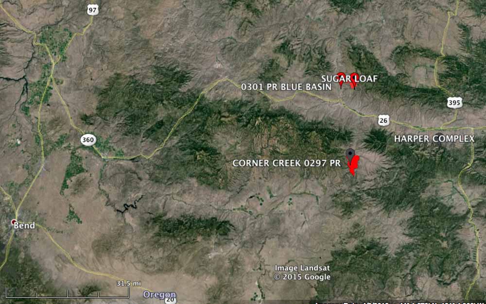
Another fire, the 6,300-acre Corner Creek Fire, was added to the Team’s workload Wednesday morning. Located on the west side of the South Fork John Day River, it was reported on June 29, a lightning-caused fire that held over from last week’s storms. High temperatures and low relative humidity yesterday contributed to the growth of the fire. Numerous aviation resources were used Tuesday for structure protection of cabins and outbuildings along Wind Creek, including three large tankers, one very large air tanker (DC-10), four single engine air tankers, and three helicopters.
The Corner Creek Fire is 9 air miles miles south of Dayville, 29 miles southwest of John Day, and 85 miles northeast of Bend.
