Wildfire activity increases in the Black Hills

(Originally published at 10:12 MDT June 26, 2016; Douglas fire updated at 2:10 p.m. MDT June 25, 2016))
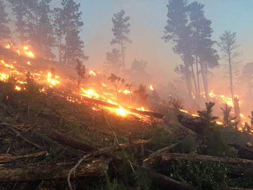
Crow Peak Fire
Crow Peak Fire June 25, 2016. Photo by Robert Cota, Boxelder Job Corps Crew 15 Fire Program Manager, Black Hills National Forest.

Firefighters are suppressing four wildfires in the Black Hills of Wyoming and South Dakota, ranging from 64 to 5,000 acres.
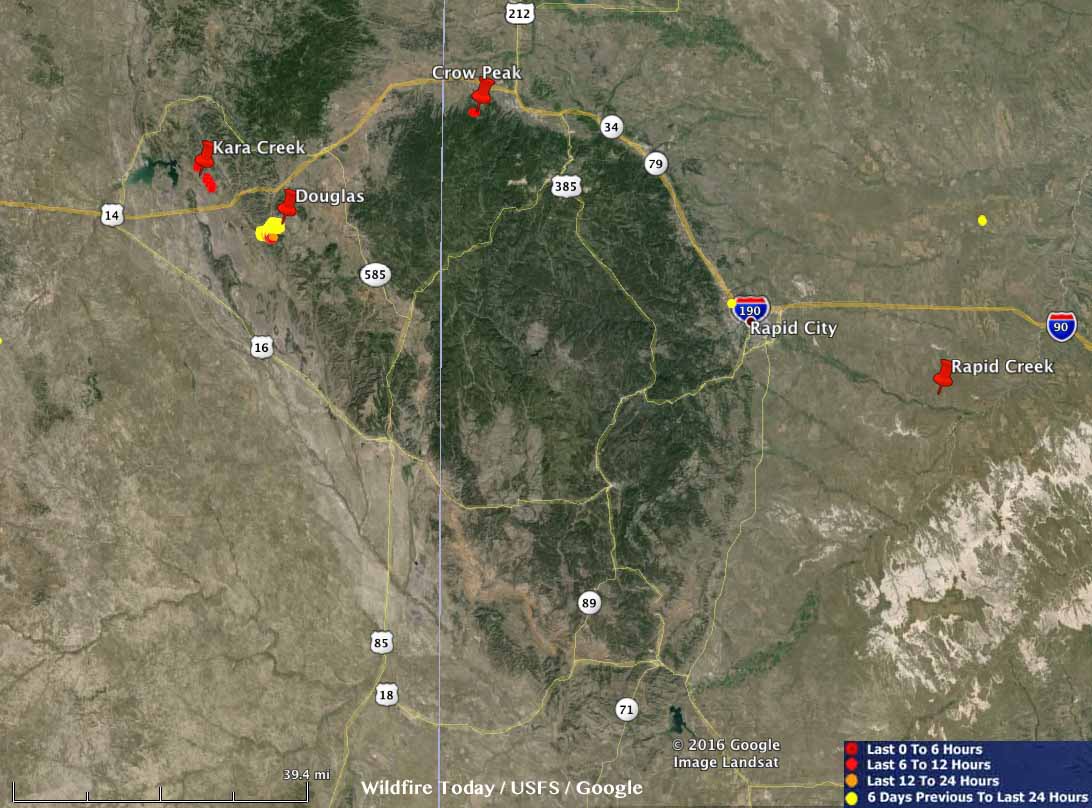
Fires Black Hills
Fires in the Black Hills June 25, 2016. Click to enlarge.

Kara Creek: 5,000 acres 4 miles east of Keyhole Reservoir, 15 miles west of Sundance, Wyoming, and about 3 miles north of Interstate 90. Before the fire was reported Friday evening a lightning storm accompanied by very strong winds hit the area. Air tankers, Type 1 hand crews, and Type 2IA hand crews have been ordered.

A resident of Upton, Wyoming told us that the clouds were generating rain but it evaporated before hitting the ground. They said the fire was putting up a large amount of smoke Friday evening.

(UPDATE at 5:54 p.m. MDT June 25: with the growth of the Kara Creek fire to 12,000 acres, we dedicated a separate article to just that fire. It has much more information about this fire.

Douglas: 1,785 acres; it started Thursday 10 miles southwest of Sundance, Wyoming and is being managed by a Type 3 incident management team. On Friday the fire was most active on the southwest side where, according to the Rapid City Journal, new evacuations were ordered. More information is in our earlier article about the Douglas Fire, and we have a gallery of photos here.

(UPDATE for the Douglas Fire at 2:10 p.m. MDT June 25, 2016)

At about 11 a.m. today fire officials for the Douglas Fire released this information:

The Douglas Fire saw growth early in the day yesterday but stabilized as the day went on. The fire is estimated at 2000 acres and is now contained.

Incident Command of the Douglas Fire shifted to Type 4 Incident Commander Dallas Roth this morning. Four fire engines and one handcrew will remain on the Douglas Fire to ensure the fire stays contained.

The evacuation of Sundance Canyon Ranch subdivision has been lifted.

Rapid Creek: 1,000 acres. It was reported Friday afternoon near the intersection of 158th Avenue and East Highway 44, 24 miles southeast of Rapid City in the Farmingdale area. The heat-sensing satellites did not detect any heat overnight from this fire, which may indicate that it burned in light fuels, such as grass, and was relatively cool during the subsequent overflight.

Crow Peak: 64 acres, 5 miles west of Spearfish, SD. A Type 3 incident management team has been ordered. Great Plains dispatch office reported that firefighters were pulled off the fire Friday night due to the passage of a cold front bringing strong winds. The fire was reported Friday afternoon.

UPDATE at 8:48 a.m. MDT June 26, 2016:  More recent information about the Crow Peak and Kara Creek Fires. A Type 2 incident management team, with Incident Commander Shane Greer, has been ordered. The Forest Service reports the Crow Peak Fire has burned 250 acres.
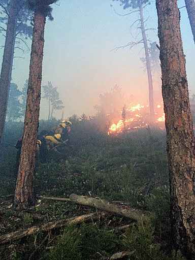
Crow Peak Fire
Crow Peak Fire June 25, 2016. Photo by Robert Cota, Boxelder Job Corps Crew 15 Fire Program Manager, Black Hills National Forest.

Douglas Fire photo gallery

Above: smoke from the Douglas Fire. Photo by Ryan Cutter.

This gallery of photos of the Douglas Fire southwest of Sundance, Wyoming consists of pictures taken on June 22 and 23, 2016.

As noted in the captions, the photos were taken by Ryan Cutter of Classic Helicopters, and a resident who eventually had to evacuate, Kathy Loveland. The images by Bill Gabbert are identified by a watermark in the bottom-left corner.

Details about the Douglas Fire are in our main article about the fire.

If you click on one photo you’ll see a much larger version. Then you can click the left or right arrows to see others at the same size.

Wyoming: Douglas Fire southwest of Sundance

(UPDATED at 7:25 a.m. MDT June 23, 2016)

The Incident Management Team on the Douglas Fire 10 mile southwest of Sundance, Wyoming reported Thursday evening that the fire grew from 257 acres the day before to 1,400 acres. The evacuation orders have been lifted, but 50 residences are still threatened.

map Douglas Fire
Map showing heat detected on the Douglas Fire by a satellite at 3:23 a.m. MDT June 2,4 2016.

****

(UPDATED at 9:10 a.m. MDT June 23, 2016)

helicopter bell 206
Pilot Ryan Cutter gets the Bell 206 ready for another day shift on the Douglas Fire, June 23, 2016. Photo by Bill Gabbert.

The Douglas Fire southwest of Sundance, Wyoming has burned approximately 700 to 800 acres, according to an early rough estimate from Incident Commander Dick Terry at 8:25 a.m. MDT on June 23. Mr. Terry had just finished a helicopter recon flight and said the biggest challenge today would be the “nasty winds”. They  will have a more accurate size estimate after a GPS flight.

Douglas Fire, June 23, 2016. Photo by Bill Gabbert.


Evacuations ordered yesterday are still in effect for the small number of people that had to leave their homes.

One structure has burned, described by Mr. Terry as not just an outbuilding but a “good shop”.

Approximately 120 personnel and one Wyoming state helicopter are assigned.

We created a gallery of more photos from the Douglas Fire.

****

(Originally published June 22, 2016)

Douglas Fire
The Douglas Fire as seen from Sundance, Wyoming, 7 p.m. MDT June 22, 2016. Photo by Bill Gabbert.

I drove past this fire on I-90 Wednesday. It is the Douglas Fire 11 miles southwest of Sundance, Wyoming. It was reported at about 10 p.m. on Tuesday. It is listed at 300 acres, but was very active Wednesday afternoon.

Map Douglas Fire
Map showing heat detected by a satellite over the Douglas Fire at 1:45 p.m. MDT June 22, 2016.