Firefighters to begin firing operations on Crow Peak Fire near Spearfish, South Dakota

Above: Air Tanker 161, an RJ85, drops on the north side of the Crow Peak Fire at 4:56 p.m. MDT June 27, 2016. Photo by Bill Gabbert.

(UPDATED at 9:20 a.m. MDT June 30, 2016)

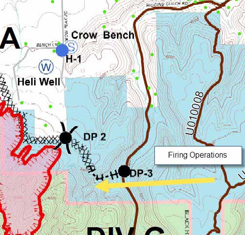
As the 1,350-acre Crow Peak Fire near Spearfish, South Dakota enters its seventh day firefighters will begin firing operations Thursday morning on the southwest and northeast sides. Local residents will see an increase in fire activity as the unburned fuels are removed between the main fire and the prepped lines firefighters have been working on in recent days.

Sell Art Online

The Incident Management Team reports that structure protection is in place for all structures in the vicinity of the firing operations, and air resources will be used as needed.
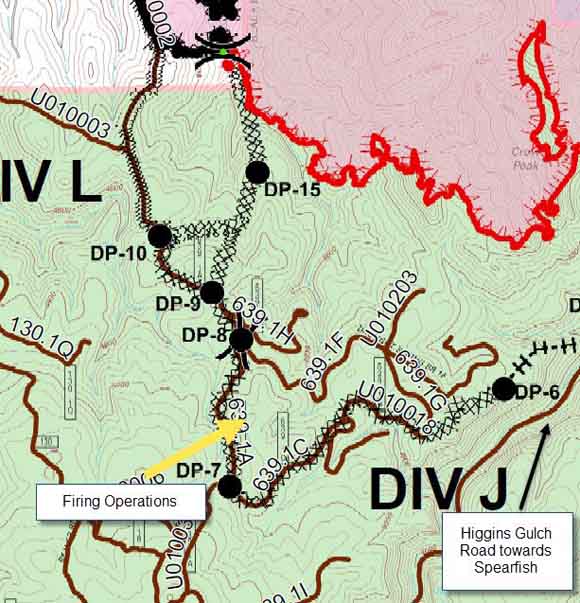
Map Crow Peak Fire
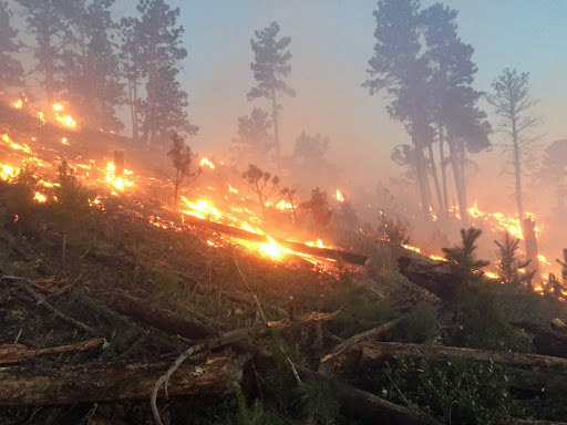
Firing operation on the southwest side of the Crow Peak Fire, June 30, 2016.
Map Crow Peak Fire
Firing operation on the northeast side of the Crow Peak Fire, June 30, 2016.

Voluntary and pre-evacuation notifications remain in effect along Crow Peak Bench Road. Voluntary evacuation notices were made along Crow Creek Road.

****

(UPDATED at 5:34 p.m. MDT June 28, 2016)

Crow Peak Fire

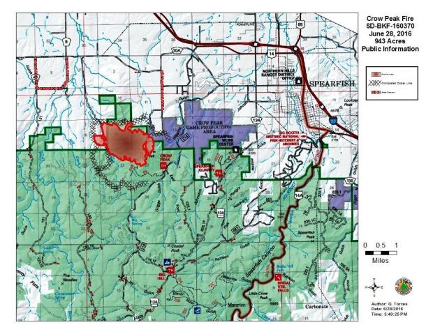
The Incident Management Team on the Crow Peak Fire near Spearfish, South Dakota reported that a Monday night flight by a heat-sensing fixed wing aircraft determined that the fire has burned 943 acres.

In addition to the large air tankers that have been flying out of Rapid City Regional Airport assisting firefighters on the Crow Peak Fire, four single engine air tankers (SEATs) have been working out of the permanent SEAT base at the Gillette, Wyoming airport (map). It is our understanding that the equipment at the base was given to Campbell County Fire by Weston County to assist in suppressing fires in northeast Wyoming, southeast Montana, northwest South Dakota, and southwest North Dakota.

Art Prints

****

(UPDATED at 10:30 p.m. MDT June 27, 2016)

The Crow Peak Fire was actively backing down the steep slopes of Crow Peak again on Monday. We were 21 miles away in Sturgis at 3:15 when it put up a convection column for a while (scroll down to see the photo). Later we got closer and grabbed a few photos.

At 4 p.m. on Monday the Incident Management Team estimated the size at 1,000 acres. They explained that the increase in smoke was due to interior burning on the southern portion of the fire. Firefighters are continuing burning operations on the north side.

The air tanker photo above was taken on the north side of the fire. The aircraft may have been supporting a burnout.

From a distance we saw several air tanker drops by P2V and RJ85 tankers, but only got decent photos of Tanker 161, an RJ85. At  one point on Monday there were four air tankers working out of Rapid City Tanker Base. By the end of the day one had been sent to a fire near Billings, one was relocated somewhere else, and another was down for maintenance.
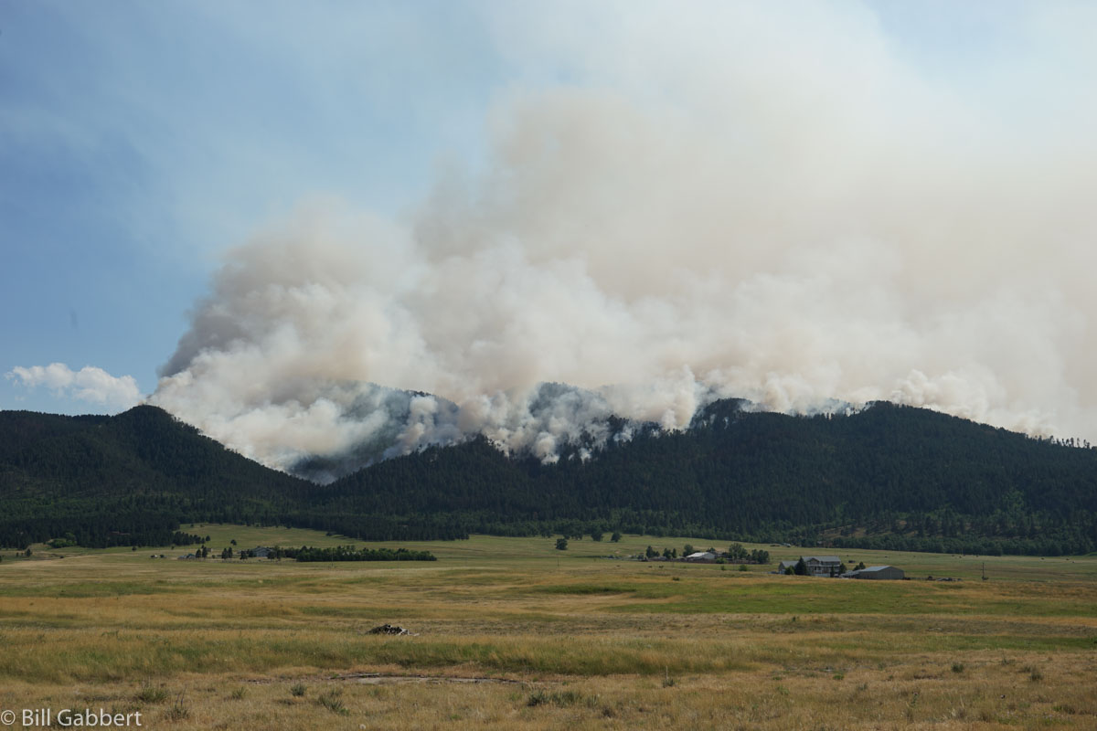
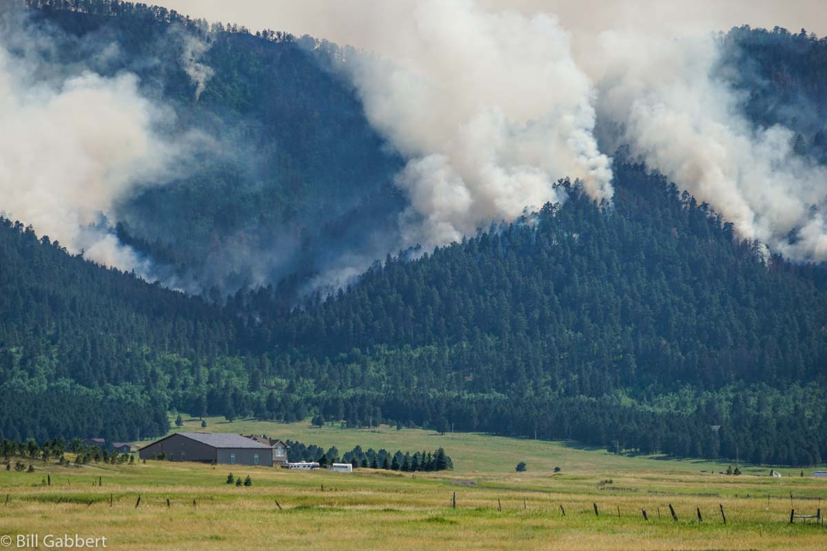
Crow Peak Fire
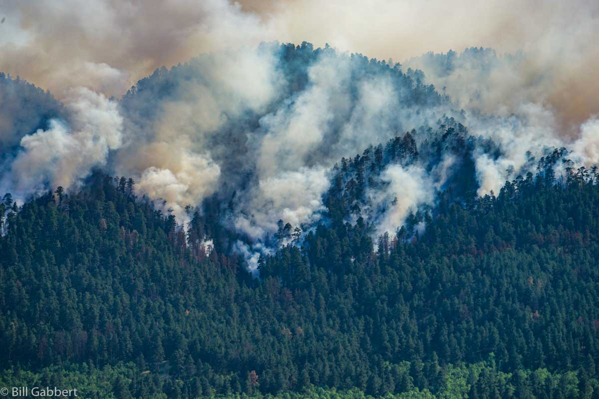
The Crow Peak Fire at 4:59 p.m. MDT June 27, 2016. Photo by Bill Gabbert.
Crow Peak Fire
The Crow Peak Fire at 4:50 p.m. MDT June 27, 2016. Photo by Bill Gabbert.
Crow Peak Fire
The Crow Peak Fire at 4:59 p.m. MDT June 27, 2016. Photo by Bill Gabbert.

****

(UPDATED at 3:30 p.m. MDT June 27, 2017)


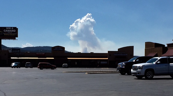
As you can see from this quick cell phone picture above taken from Sturgis (21 miles away), the Crow Peak fire was pretty active at 3:15 p.m. today.

****

(UPDATED at  7:55 a.m. MDT June 27, 2016)

Evacuations remain in effect as the 313-acre Crow Peak Fire burns into its fourth day about four miles southwest of Spearfish, South Dakota. As the fire backs down the steep slopes of Crow Peak, large helicopters and air tankers are assisting the 135 firefighters on the ground.
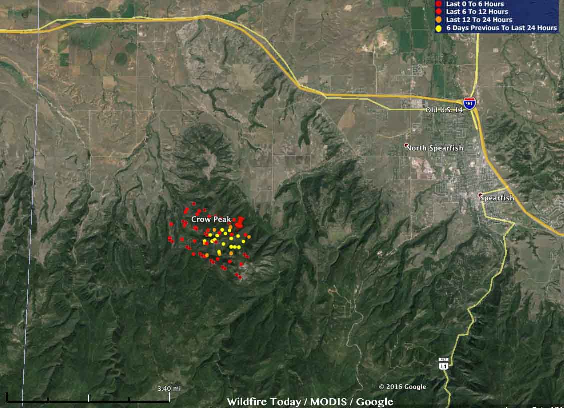
Map Crow Peak Fire
Map showing heat detected by a satellite over the Crow Peak Fire at 4:07 a.m. MDT June 27, 2016. Click to enlarge.

Continue reading “Firefighters to begin firing operations on Crow Peak Fire near Spearfish, South Dakota”

Wildfire activity increases in the Black Hills

(Originally published at 10:12 MDT June 26, 2016; Douglas fire updated at 2:10 p.m. MDT June 25, 2016))

Crow Peak Fire
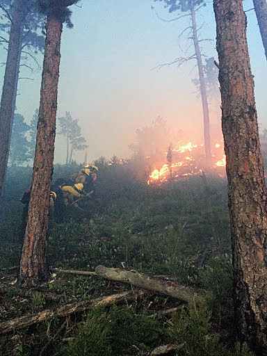
Crow Peak Fire June 25, 2016. Photo by Robert Cota, Boxelder Job Corps Crew 15 Fire Program Manager, Black Hills National Forest.

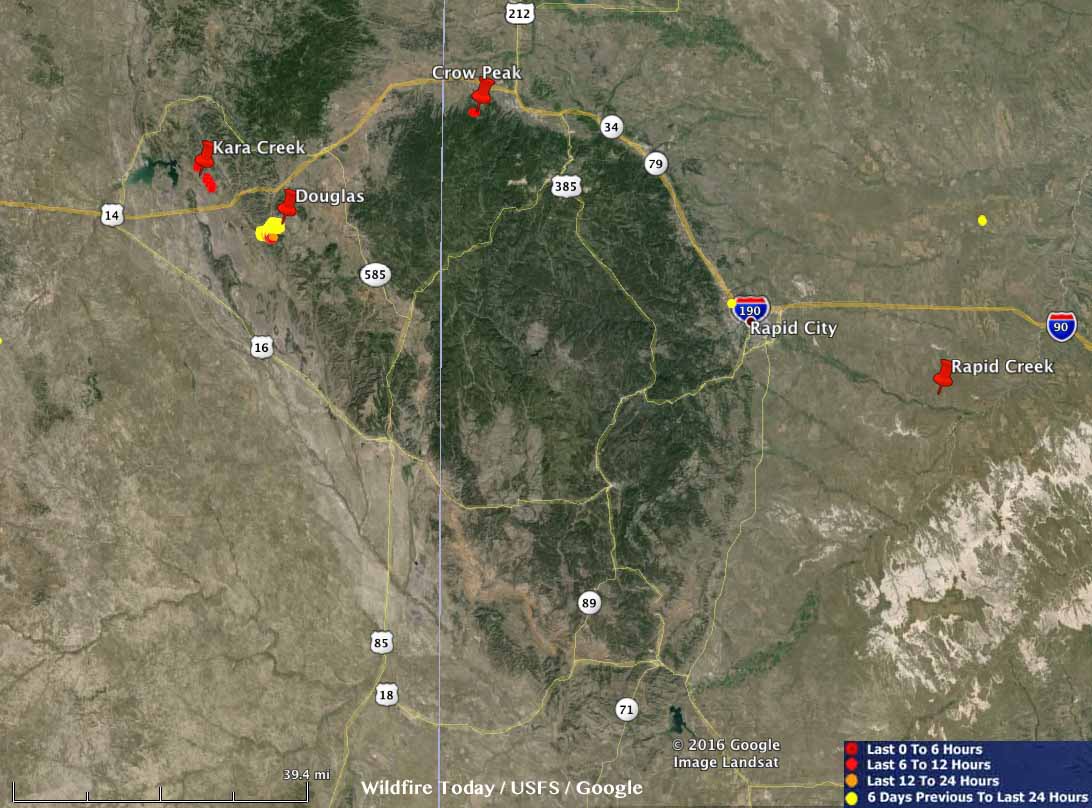
Firefighters are suppressing four wildfires in the Black Hills of Wyoming and South Dakota, ranging from 64 to 5,000 acres.

Fires Black Hills
Fires in the Black Hills June 25, 2016. Click to enlarge.

Kara Creek: 5,000 acres 4 miles east of Keyhole Reservoir, 15 miles west of Sundance, Wyoming, and about 3 miles north of Interstate 90. Before the fire was reported Friday evening a lightning storm accompanied by very strong winds hit the area. Air tankers, Type 1 hand crews, and Type 2IA hand crews have been ordered.

A resident of Upton, Wyoming told us that the clouds were generating rain but it evaporated before hitting the ground. They said the fire was putting up a large amount of smoke Friday evening.

(UPDATE at 5:54 p.m. MDT June 25: with the growth of the Kara Creek fire to 12,000 acres, we dedicated a separate article to just that fire. It has much more information about this fire.

Douglas: 1,785 acres; it started Thursday 10 miles southwest of Sundance, Wyoming and is being managed by a Type 3 incident management team. On Friday the fire was most active on the southwest side where, according to the Rapid City Journal, new evacuations were ordered. More information is in our earlier article about the Douglas Fire, and we have a gallery of photos here.

(UPDATE for the Douglas Fire at 2:10 p.m. MDT June 25, 2016)

At about 11 a.m. today fire officials for the Douglas Fire released this information:

The Douglas Fire saw growth early in the day yesterday but stabilized as the day went on. The fire is estimated at 2000 acres and is now contained.

Incident Command of the Douglas Fire shifted to Type 4 Incident Commander Dallas Roth this morning. Four fire engines and one handcrew will remain on the Douglas Fire to ensure the fire stays contained.

The evacuation of Sundance Canyon Ranch subdivision has been lifted.

Rapid Creek: 1,000 acres. It was reported Friday afternoon near the intersection of 158th Avenue and East Highway 44, 24 miles southeast of Rapid City in the Farmingdale area. The heat-sensing satellites did not detect any heat overnight from this fire, which may indicate that it burned in light fuels, such as grass, and was relatively cool during the subsequent overflight.

Crow Peak: 64 acres, 5 miles west of Spearfish, SD. A Type 3 incident management team has been ordered. Great Plains dispatch office reported that firefighters were pulled off the fire Friday night due to the passage of a cold front bringing strong winds. The fire was reported Friday afternoon.

UPDATE at 8:48 a.m. MDT June 26, 2016:  More recent information about the Crow Peak and Kara Creek Fires. A Type 2 incident management team, with Incident Commander Shane Greer, has been ordered. The Forest Service reports the Crow Peak Fire has burned 250 acres.

Crow Peak Fire
Crow Peak Fire June 25, 2016. Photo by Robert Cota, Boxelder Job Corps Crew 15 Fire Program Manager, Black Hills National Forest.