Colorado: Hayden Pass Fire causes evacuations south of Salida

(UPDATE at 8:40 a.m. MDT July 15, 2016)
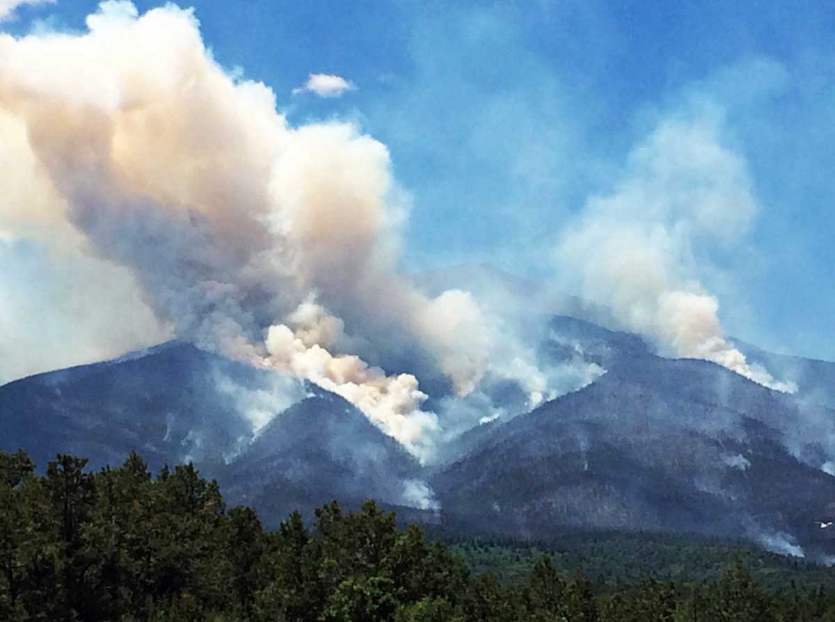
Hayden Pass Fire
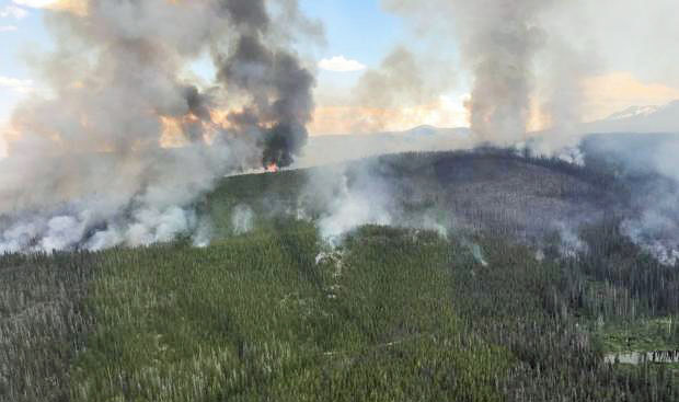
Hayden Pass Fire at noon July 14, 2016. InciWeb photo.

The Hayden Pass Fire near Coaldale, Colorado grew by about 1,000 acres on Thursday and has now burned approximately 15,700 acres.

The incident management team reported Thursday night that they received more helicopters and seemed to imply that suppression of the fire had been hampered by a shortage of aircraft:

Additional helicopters arrived, enabling firefighters to utilize seven ships this afternoon, performing water drops and vital reconnaissance for fires that begin outside the fire perimeter.

Evacuations, road, area and trail closures are in effect and one structure has been destroyed.

The fire has spread south towards the Lake Creek drainage and west of the Duckett fire scar of 2011. Structural protection teams are installing sprinkler systems and removing vegetation around some structures out ahead of the fire.
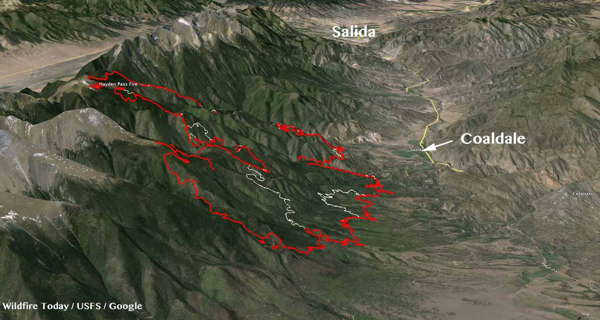
3-D Map Hayden Pass Fire
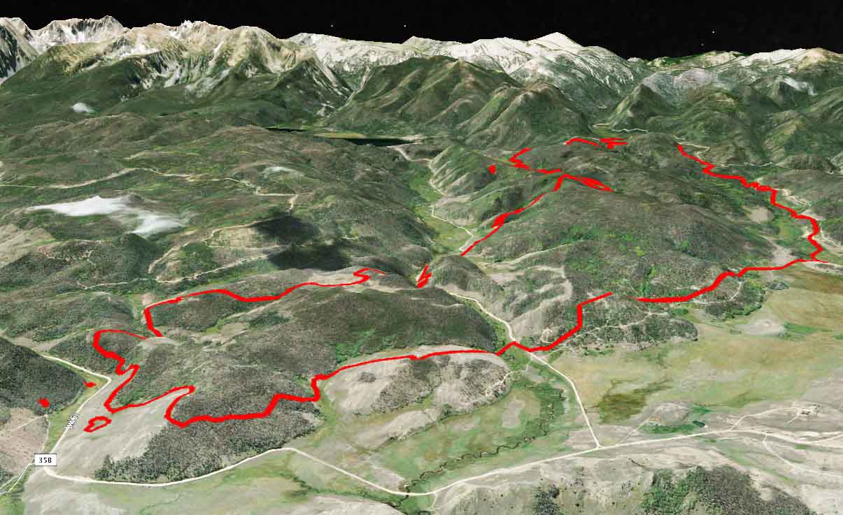
3-D Map of the Hayden Pass Fire looking northwest toward Salida. The red line was the perimeter at 10 p.m. MDT July 14, 2016. The white line was the perimeter two days earlier. Click to enlarge.

The weather forecast for the Coaldale area for Friday and Saturday predicts temperatures in the low to mid-80s, southwest winds at 8 to 10 mph, and relative humidities in the low teens with very little chance of rain. Parts of Colorado will be under Red Flag Warnings or Fire Weather Watches Friday and Saturday.

****

(UPDATE at 1:30 p.m. MDT July 14, 2016)
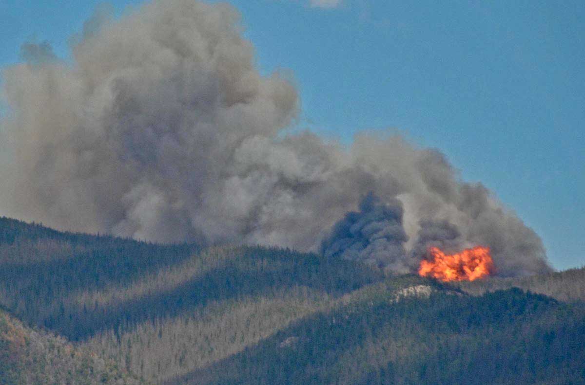
Hayden Pass Fire
Hayden Pass Fire at 3 p.m. July 10, 2016. InciWeb photo.

The incident management team for the Hayden Pass Fire issued the information below as part of a Thursday morning update:

…Crews are actively suppressing the fire outside of the Sangre de Cristo Wilderness utilizing structure defense, direct and indirect fire control strategies. Helicopters and air tankers are supporting these strategies, to include retardant drops for structural protection. Firefighting resources are shifting as priorities are completed and new risks are prioritized. Firefighters will continue to suppress the fire using resources and tactics to minimize firefighter risk with the highest probability of success.
The fire continues to burn in the Sangre de Cristo Wilderness. Crews are not currently engaging the fire within the wilderness due to complex terrain causing safety concerns; rather, they will closely monitor fire movement and assist Forest Service staff by informing recreationists of area closures…

The update on the fire posted today at InciWeb did not include the revised size of the fire. Members of the media who attended a press conference this morning reported it had grown to more than 14,500 acres.

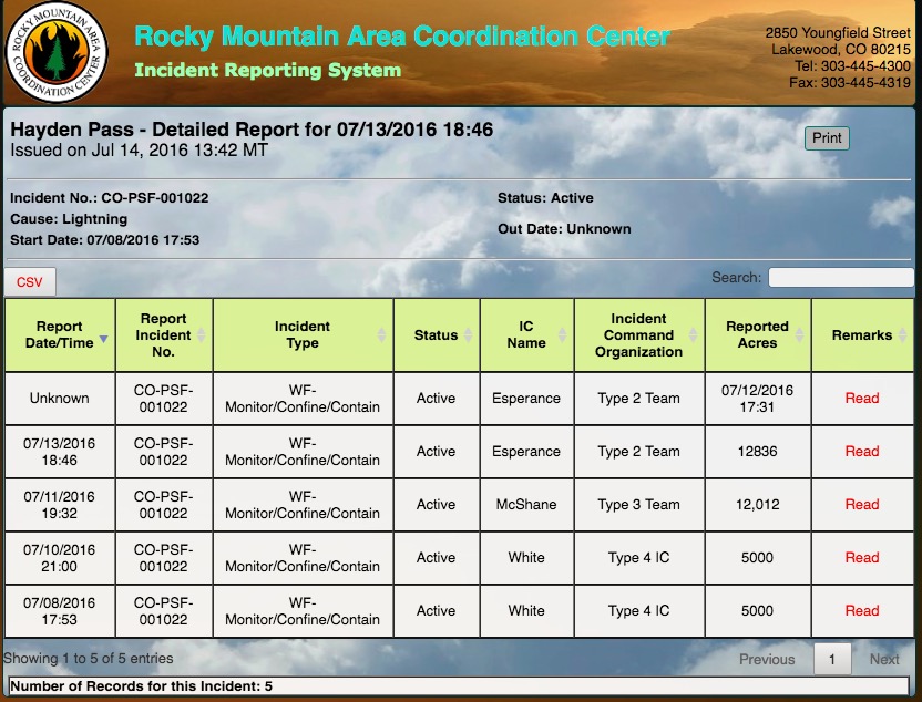
The way the U.S. Forest Service describes the management strategy of these less-than-full-suppression wildfires is confusing — to the public and even some firefighters. Officially the Hayden Pass Fire is listed as a “monitor/confine/contain” fire rather than “full suppression” like most fires. But the agency and the Information Officers communicating with citizens do not like to discuss that publicly. It can be scary to some when they hear that the government is not pulling out all the stops in order to put out a fire quickly. And it can be disconcerting to think about a fire within sight of hundreds of homes burning from early July until October 1, which is the “completion” date for the Hayden Pass Fire listed in the excerpt below from the National Situation Report. (See “Cnt/Comp” which refers to Contain or Complete, with Contain being suppression, and Complete referring to less-than-full-suppression.)

Hayden Pass Fire information
Information about the Hayden Pass Fire from the National Situation Report, July 14, 2016.
Hayden Pass Fire information
Information about the Hayden Pass Fire, from the Rocky Mountain Coordination Center, July 14, 2016.
Cold Springs Fire information
For comparison, this is information about the Cold Springs Fire, from the Rocky Mountain Coordination Center, July 14, 2016.

Below are two video briefings that were posted on Thursday. The first features Incident Commander Jay Esperance. Following that is Operations Section Chief Travis Lipp. Click on the full screen icons to see larger versions.

****

(UPDATE at 21:20 p.m. MDT July 13, 2016)

At a 10 a.m. press briefing today a spokesperson for the Hayden Pass Fire said it grew yesterday by about 600 acres to just under 13,000 acres

****

(UPDATED at 8:20 a.m. MDT July 13, 2016)
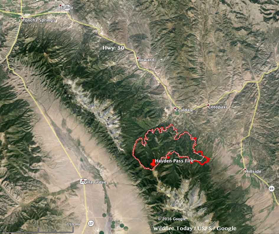
map Hayden Pass Fire
The red line was the perimeter of the Hayden Pass Fire at 11 p.m. MDT July 12, 2016. The white line was the perimeter 25 hours before. Click to enlarge.

The Hayden Pass Fire 17 air miles southeast of Salida, Colorado added less than 1,000 acres on Tuesday mostly through activity on the southeast side but also on the north side. Dozers constructed fireline from Hayden Creek toward Big Cottonwood drainage while a hotshot crew built line from Big Cottonwood drainage toward Hayden Creek and the dozer line. Aircraft were used in those areas to slow the fire and support firefighters on the ground.

The fire is still 1 to 2 miles southwest of Coaldale.

The weather on Wednesday could be conducive to additional fire spread. The forecast for the fire area 3 miles south-southwest of Coaldale predicts 85 degrees, relative humidity in the low teens, and a west wind at 10 to 13 mph.

Evacuation information is at the Fremont County Sheriff’s Facebook page.

Continue reading “Colorado: Hayden Pass Fire causes evacuations south of Salida”

The spread of the Beaver Creek Fire in northern Colorado slows

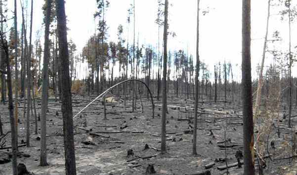
Above: Varying burn intensities on the Beaver Creek Fire.

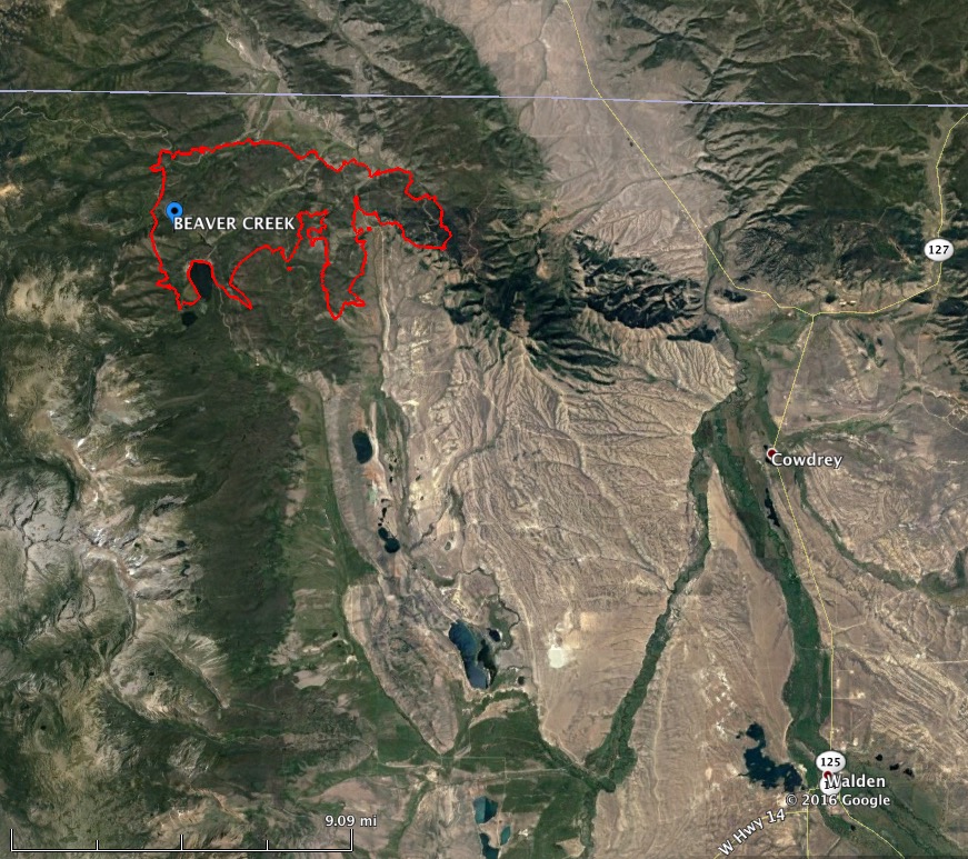
The spread of the Beaver Creek Fire in northern Colorado one mile south of the Wyoming border has slowed over the last week. It has been listed at 13,275 acres since June 30 and according to the incident commander is 5 percent conplete after burning for 18 days. The strategy is not to put it out, but to manage it for “multiple objectives”.

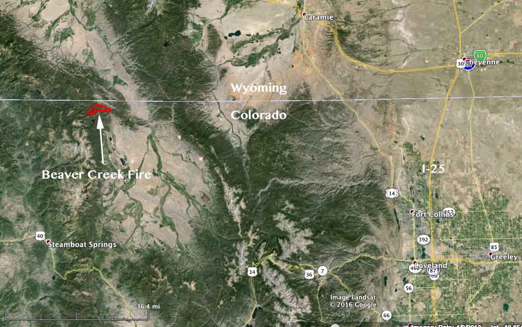
The fire is 17 miles northwest of Walden, Colorado and 52 miles southwest of Laramie, Wyoming.

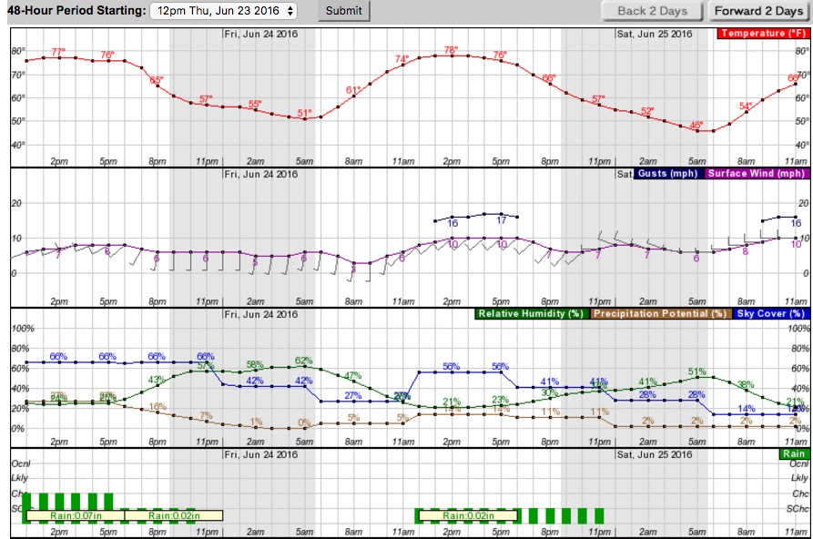
Within the last 48 hours the fire received about 0.2 inches of rain but the fuels should dry out today, aided by a 9 mph southwest wind gusting up to 23 mph.

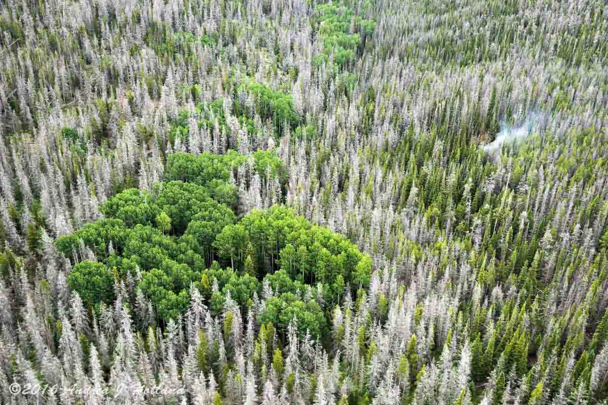
Beaver Creek Fire beetles intensity
Photo of a portion of the Beaver Creek Fire in an area with heavy beetle kill. One smoke is visible. USFS photo by Andrea Holland.

People who are extremely worried about forests attacked by beetles and assume fire intensity will be greatly enhanced in those areas, should examine the photo above that was taken within the fire area.

Jay Esperance’s Type 2 incident management team will transition to the West Slope Type 3 Team B on Thursday.

The photos were provided by the Medicine Bow-Routt National Forests and Thunder Basin National Grassland. Except as noted the photographer and dates taken were not given.

More information about the Beaver Creek Fire.

Beaver Creek Fire map
Map of the Beaver Creek Fire July 3, 2016. USFS.
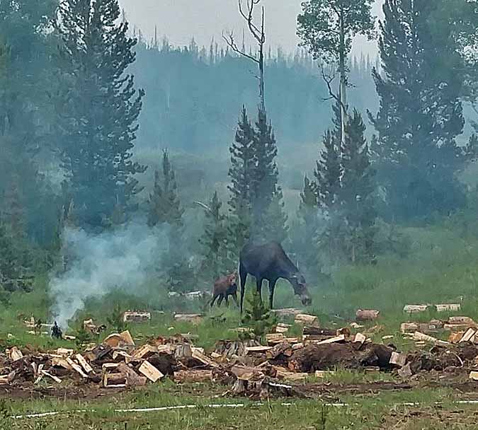
Beaver Creek Fire moose
A moose and her calf investigate evidence of firefighter activity on the Beaver Creek Fire.
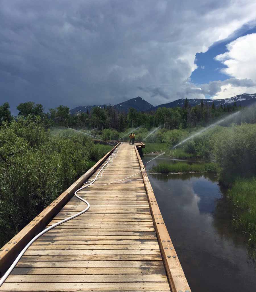
Beaver Creek Fire sprinklers
Sprinklers are set up on an ATV bridge near the Beaver Creek Fire.
Beaver Creek Fire Chinook
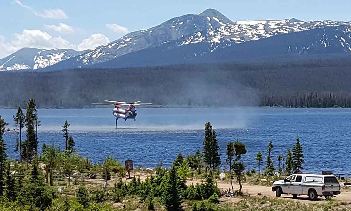
A Chinook helicopter uses its snorkle to refill its internal water tank while working on the Beaver Creek Fire.
Beaver Creek Fire
AN area of high burn intensity on the Beaver Creek Fire.

Colorado: Beaver Creek Fire

Campers are being evacuated from dispersed areas.

Above: Beaver Creek Fire June 20, 2016. USFS photo by Alison Richards.

(Click here to see updated information on the Beaver Creek Fire as of July 6, 2016)

****

(UPDATE at 10:42 p.m. MDT June 22, 2016)

On Wednesday afternoon the Beaver Creek Fire northwest of Walden, Colorado was very active again, almost doubling in size to 7,000 acres. The fire spread further to the east, becoming well established on Independence Mountain.

The evacuation orders implemented on Tuesday are still in place.

The “Blue” Rocky Mountain Incident Management Team with Incident Commander Jay Esperance will assume command of the fire at 6:00 a.m. on Thursday.

****

(Originally published at 2:48 p.m. MDT June 22, 2016)

In the four days that the Beaver Creek Fire has been burning 20 miles northwest of Walden, Colorado it has grown to 3,800 acres. Most of those acres were accumulated on Tuesday.

A wind shift on Tuesday afternoon drove the fire to the east, pushing it across two main roads and establishing spot fires on BLM-managed Independence Mountain. The majority of the Beaver Creek Fire remains on the Routt National Forest in northwest Jackson County, Colo about 1 mile south of the Wyoming border.

Local fire staff were working late Tuesday with Jackson County and the BLM to evacuate dispersed campers on Independence Mountain.

(Click on the images below to see larger versions.)

weather Beaver Creek Fire
Weather forecast for the area of the Beaver Creek Fire. NWS.

The weather on Wednesday and Thursday will be moderate, but will become more problematic on Friday and Saturday with humidities around 20 percent, 10 mph southwest or west winds gusting up to 17 mph, and a chance of thunderstorms.

map Beaver Creek Fire
Vicinity map of the Beaver Creek Fire.
Beaver Creek Fire 3-D map
3-D map of the Beaver Creek looking SW. Perimeter data from 9 p.m. June 21, 2016. CO Div. Fire Prev. & Control.
Beaver Creek Fire
Beaver Creek Fire June 20, 2016. USFS photo by Alison Richards.

Thanks and a tip of the hat go out to Chris.

Colorado: East Peak Fire

(UPDATE at 8:30 a.m. MDT, June 25, 2013)

There was no major change in the East Peak Fire over the last 24 hours. Below is a Monday evening update from the Incident Management Team:

In spite of high winds, low humidity and critical fuel conditions, growth on the East Peak Fire was minimal and containment increased to 50%. The estimated size of the fire is 13,388 acres. Due to the wind, helicopters were grounded for most of the day. Despite the challenge of high winds, firefighters made progress in mop up and patrolling the fire perimeter and engine crews ensured structure protection. Mop up and patrol will continue for the overnight shift and into tomorrow. Resources continue to arrive, totaling in 631 personnel assigned to this fire.

****

(UPDATE at 8:25 a.m. MDT June 24, 2013)

Under overcast skies on Sunday there was not much change in the East Peak Fire. It was most active on the west and southeast sides and grew by a few hundred acres, bringing its total to about 12,800 acres.

****

(UPDATE at 8:55 p.m. MDT, June 23, 2013)

East Peak Fire
East Peak Fire, unknown date. Photo by Don Degman

Below is an update from the Incident Management Team at about 6:30 p.m. Sunday:

Overcast conditions set up a successful burnout operation on the East Peak Fire today. ““I’’m very pleased with the results of the burnout today. It went really smoothly”,” said Craig Beckner, Operations Section Chief. Aided by favorable winds from southeast, the burnout operation helped to reinforce control line on the southern boundary of the fire.

On the western perimeter, a very large airtanker made a retardant drop that will assist firefighters with constructing handline tomorrow in very steep terrain.

Cooler conditions and overcast skies kept the fire from gaining much acreage and is now at 12,996 acres.

Mandatory evacuations are still in effect for a large portion of the fire area. However, Huerfano County Sheriff, Bruce Newmann, started letting residents back into some closure areas.

Air Tanker 910, a DC-10, dropped 46,400 gallons of retardant on the fire today in four sorties.

****

(UPDATE at 8:24 a.m. MDT, June 23, 2013)

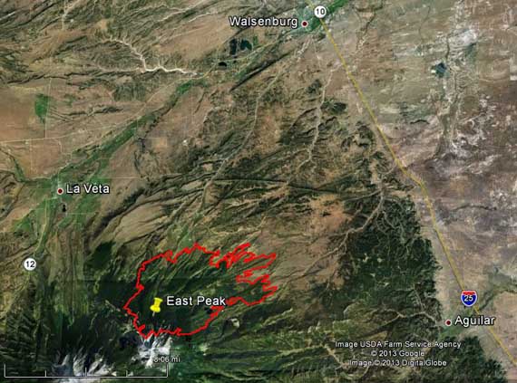
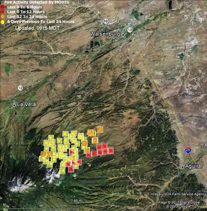
Map of East Peak Fire, 2 a.m. MDT, June 23, 2013

The East Peak Fire in southern Colorado grew by about 1,000 acres Saturday, bringing its total to approximately 12,000 acres. It is 11 miles southwest of Walsenburg and about 9 miles west of Aguilar.

There are an estimated 300 properties within the evacuation area. An American Red Cross shelter has been established at the John Mall High School in Walsenburg, Colorado. Evacuated animals, large or small can be taken to the Fairgrounds in La Veta, Colorado.

The Incident Management Team reports that 10 “primary” structures have burned along with 4 outbuildings.

****

Map of East Peak Fire
Map of East Peak Fire, showing heat detected by a satellite at 11:05 p.m. MDT, June 21, 2013. (click to see a larger version)

(UPDATE at 5:15 p.m. MDT, June 22, 2013)

The incident management team running the East Peak Fire sent this Tweet at 3:21 p.m. Saturday:

****

(Originally published at 9:47 a.m. MDT, June 22, 2013)

The East Peak fire has burned about 11,000 acres in the southern part of Colorado 25 miles from the New Mexico border. As you can see from the map above, at 11 p.m. Friday night it was approximately 7 miles west of Aguilar and about 10 miles southwest of Walsenburg, according to the data provided by the satellite. The location of the square icons can be as much as a mile in error.

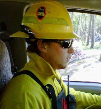
Rocky Mountain Type 2 Incident Management Team C, with Incident Commander Jay Esperance, assumed command of the Fire at 6:00 pm, Friday, June 21.

Trampus Haskvitz golf tournament to benefit the WFF

Trampus Haskvitz
Trampus Haskvitz

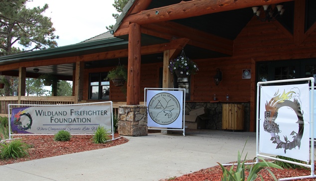
On Saturday 144 firefighters, golfers, and other good-hearted people participated in the Second Annual Trampus Haskvitz golf tournament in Hot Springs, South Dakota. The event benefits the Wildland Firefighter Foundation (WFF) which was instrumental in assisting the family of Trampus when he was killed while fighting the Coal Canyon Fire northeast of Edgemont, SD on August 11, 2011. One of the organizers estimated that the proceeds from the entrance fees which will be forwarded to the WFF will be well into five digits.

Trampus Haskvitz Golf Tournament

At the severe risk of leaving out people, some of the folks that should get credit for pulling off this fund-raising event for the second year in a row include the Hot Springs Fire Department, South Dakota Division of Wildland Fire, the Haskvitz family, the Wildland Firefighter Foundation, and the Black Hills National Forest.

Trampus Haskvitz Golf Tournament
Current and former Directors of the Division of Wildland Fire Suppression in South Dakota, Jay Esperance and Joe Lowe, on the 16th tee.
Trampus Haskvitz Golf Tournament
Pennington County Fire Coordinator Denny Gorton, in a tricked-out golf cart, indicates he is on his way to the 1st tee.

Continue reading “Trampus Haskvitz golf tournament to benefit the WFF”

Incident Management Team coffee

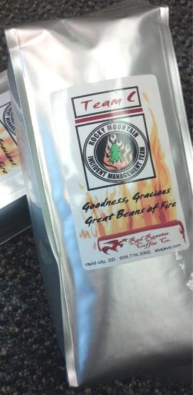
Team C coffeeOne of the Type 2 Incident Management Teams in the Rocky Mountain Geographic Area has developed their own coffee. Jay Esperance’s Rocky Mountain Team C voted on a custom blend of beans (dark roast) and then worked with Absolute Java in Rapid City, South Dakota which blends, roasts, packages, and labels the bags. The label was created by the talented staff at Absolute Java.

The Team held a competition to choose a name. Some of the runners-up included: Monday Morning Mop-up, Grounds for Safety, In the Black Blend, and Smoky Ridge Roast. The winner was Goodness, Gracious Great Beans of Fire.

Jeni Lawver, a spokesperson for the South Dakota Division of Wildfire Suppression, the agency for which Mr. Esperance works, told us that anyone can purchase Goodness, Gracious Great Beans of Fire from Absolute Java, but it might take a while for them to blend, roast, and print up the label for the coffee.

Ms. Lawver said:

It’s been a fun, team bonding experience and we’re looking forward to brewing our locally roasted, good quality custom blend at ICP!