This was on the Liberty Fire December 7 east of Murrieta, California.
(UPDATED September 14, 2018)
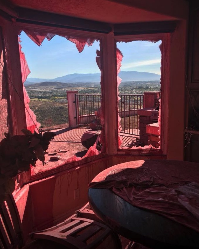
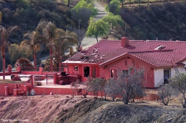
The photos below from Flashover.com (referred to in the comments below) show the results of a low drop by a DC-10 on the Liberty Fire, December 7, 2017. They were taken by Jenny Crane.
The result of a low drop by a DC-10, Liberty Fire, 2017. The result of a low drop by a DC-10, Liberty Fire, 2017.
Above: The Liberty Fire east of Murrieta, California, December 7, 2017. Screengrab from the KTLA video.
(Originally published at 7 p.m. PST December 7, 2017)
KTLA shot some excellent stabilized video from a helicopter Thursday of the Liberty Fire that has burned about 300 acres northeast of Murrieta, California. This is a new fire that erupted this afternoon 17 miles north of another new fire, the Lilac Fire south of Temecula which was 3,000 acres at 7 p.m. PST.
The video, which is almost 2 hours long, has at least 8 shots of air tankers dropping. We skimmed through it quickly and noted where the drops occur, probably missing a few.
Above: Satellite photo from August 27, 2017 showing smoke created by fires in the Northwestern United States, including Chetco Bar, Liberty, Rice Ridge, and Jolly Mountain Fires. The red dots on the map represent heat detected by the satellite on August 28.
(Originally published at 9:55 a.m. MDT August 28, 2017)
The Chetco Bar Fire in Southwest Oregon has not been growing as quickly in recent days as it did earlier when it quadrupled in size over four days and crossed the 100,000-acre threshold. The most recent mapping puts it at almost 108,000 acres. The area is under a Red Flag Warning on through Tuesday for gusty southwest winds and low humidities which could result in increased burning intensity and rapid fire growth.
The 4,400-acre Jolly Mountain Fire in Central Washington is near a Red Flag Warning area. Fire officials’ expectations for Monday:
Southern and western flanks of the fire will become active with uphill crown runs both on the east and west sides of West Fork drainage. SE flank will continue to back downslope. Fire will become increasingly active as it spreads to the south, where it loses its downslope effect and in more exposed to general winds. Fire likely to cross Sasse Ridge to the west.
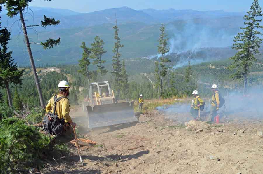
A dozer passes through an area where firefighters are working on the Liberty Fire. Undated & uncredited Inciweb photo.
The 12,800-acre Liberty Fire has been burning northeast of Missoula, Montana since July 15 while the Rice Ridge Fire, not far away, has spread over 27,800 acres since it started two weeks later. Hot, dry weather on Monday could cause both blazes to become more active.
Above: Satellite photo of smoke from fires in Western Montana and Northern Idaho, August 22, 2017. The red dots represent heat detected by a satellite.
(Originally published at 3:03 p.m. MDT August 22, 2017)
It has been many days since we were able to find a satellite photo free of clouds enough to see smoke from the wildfires in Western Montana and Northern Idaho, but today there were few clouds in the area. This photo from Tuesday afternoon shows less heat (the red dots) than what we were seeing one to two weeks ago.