Wildfire briefing, September 12, 2014

Three homes damaged in Washington wildfire

A fire near White Salmon, Washington in the Columbia River Gorge damaged three residences Thursday afternoon. The spread of the Copper Fire was stopped at 10 acres and it was almost contained by 9 p.m. Thursday.

Bears are a problem on the fire in Yosemite

Firefighters on the Meadow Fire in Yosemite National Park in California are having to deal with bears as well as the fire. The critters are described as a “major issue” for the safety of fire crews that are staying overnight in spike camps in remote areas near the fire. Measures are being taken to not attract bears to the food and other supplies. Trash is being backhauled daily.

The Meadow Fire started on July 19 and was monitored but not suppressed until it grew substantially on September 7. It is now 4,906 acres and the incident management team is saying it is 50 percent controlled.

Slow wildfire season saves Montana money

The wildfire season that has been much slower than normal in Montana has led to the lowest spending on firefighting in a decade. The number of acres burned in the state this year has been 12 percent of the five-year average. The $1.7 spent so far leaves about $44 million in the fire suppression fund that will be available to use next year.

New system to determine fire danger during Santa Ana winds

The U.S. Forest Service has worked with San Diego Gas & Electric and UCLA to develop a new system to calculate localized fire danger during the strong Santa Ana wind events that typically blow across southern California during the last months of the year. In addition to considering the typical inputs such as temperature, wind speed, relative humidity, and vegetation moisture, the “Fire Prep” program will also analyze the history of each target area over the previous 30 years. The USFS plans to send alerts designed to help fire agencies, other emergency responders and the public take appropriate action based on the threat level.

The system will be unveiled on September 17.

Nine naturally occurring eternal flames

An article at mnn.com lists and has photos of nine sites around the world that have naturally occurring fires burning almost non-stop – many of them for centuries. Most of the fires are fueled by natural gas or methane. There are dozens or hundreds of underground coal fires burning that are not listed, but those are typically difficult or impossible to see or photograph.

Lava flow less than half a mile from subdivision

The lava flowing from the Kilauea volcano in Hawaii is now less than half a mile from the Kaohe Homestead subdivision boundary.

Target practice banned in some areas of California during drought

Excerpts from the Ramona Home Journal:

Cal Fire recently announced restrictions on recreational shooting of guns on public lands due to the extreme risk of wildfire that can result from discharging weapons during the current dry conditions.

Shooting is restricted by County Code when the California Department of Forestry proclaims a “high fire hazard,” which it did on June 20, 2014, making it unlawful for any person to discharge a firearm within State Responsibility Areas until the proclamation is lifted.

According to Cal Fire, there has been an increase in fires caused by recreational shooting across San Diego County, including the General Fire in 2013, and the Border Fire last month. Fire suppression costs for shooting-related incidents in San Diego County cost taxpayers more than two million dollars a year. The announcement from the agency also cited the Health and Safety Code, which states that persons who are responsible for starting a fire will be liable for the costs resulting from that fire.

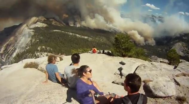
Video of hikers evacuated by helicopter from Yosemite’s Half Dome

When Shelby Seabaugh began her hike to the top of Half Dome in Yosemite National Park in California on September 7, she had no idea she would be flown off the mountain in a helicopter. This video documents her adventure that day.

When she reached the top, the Meadow Fire burning east of their location caused Park officials to decide that all 85 of the hikers on Half Dome would have to be evacuated by helicopters.

Four agencies supplied the ships that hauled the hikers off the mountain: the California Highway Patrol, U.S. Forest Service, Sequoia & Kings Canyon National Parks, and CAL FIRE.

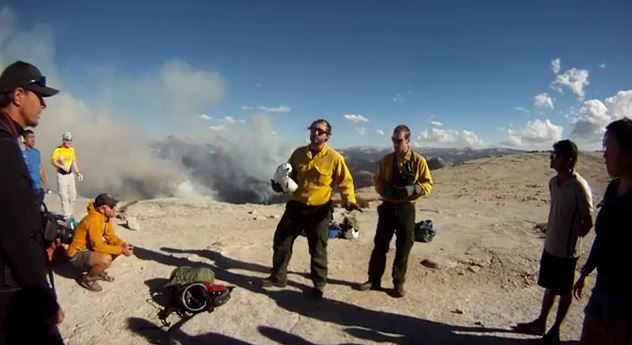
If you are not inclined to watch the entire 17-minute video, which includes the hike from the bottom to the top, and the helicopter ride back down again, you can start at about 10:30 which is when the group was near the top and includes some interesting views down onto the Meadow fire. At 11:30 it appears that helitack personnel are briefing the hikers about their upcoming helicopter ride.

More information about the Meadow Fire.

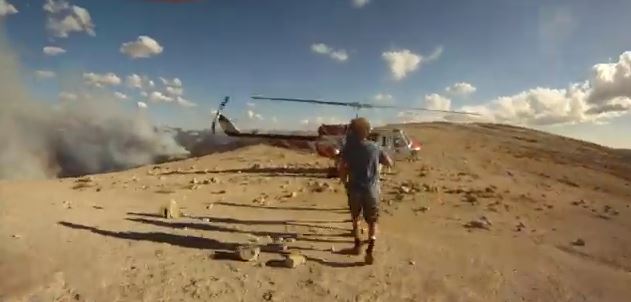
Below are some screen grabs from the video (which can be viewed on YouTube).

helicopter evacuation from Half Dome

helicopter evacuation from Half Dome

helicopter evacuation from Half Dome

The Tweet below appears to be from another group of hikers that were flown off Half Dome that day.

Meadow Fire — Yosemite National Park

(UPDATE at 8:55 a.m. PDT, September 10, 2014)

The spread of the Meadow Fire in Yosemite National Park in California has slowed, but still grew by about 100 acres on Tuesday to a total of 4,500 acres. As predicted, sunny weather and much lower relative humidity enabled some spot fires to become more active. There was also some isolated crowning and torching. On Wednesday the weather will be similar, but with stronger winds gusting up to 15 mph out of the west in the afternoon.

Firefighters are staying overnight in spike camps at several locations to reduce helicopter flights into the wilderness, but helicopters are being used to support crews with water drops. The highest priority is to secure the west flank to allow the trail to Half Dome to open.

The National Park Service has settled the issue of the origin of this fire, writing on InciWeb that it was an expansion of the fire that had been monitored since July 19, exacerbated by a wind event, rather than it being a new fire that started on Sunday.

Professional photographer Michael Frye posted some excellent photos of the fire on his web site.

****

(UPDATE at 8:35 a.m. PDT, September 9, 2014)

3-D Map of the Meadow Fire
3-D Map of the Meadow Fire at 11 p.m. September 8, 2014. Looking east. Half Dome can be seen in the center of the image, between Yosemite Valley and the fire. (Click to enlarge.)

The Meadow Fire in Yosemite National Park has grown to about 4,400 acres and was still very active when it was mapped Monday night. Rain showers passed through the area Monday morning but the precipitation may have evaporated before much of it hit the ground, since a weather station in Yosemite Valley did not detect any rain. Another weather station about 12 miles northwest of the fire measured 0.07 inches.

The Meadow Fire was first reported on July 19 but was not suppressed. It had spread to cover 19 acres while it was being monitored, until Sunday, September 7 when it began to grow rapidly pushed by a very strong wind.

On Sunday 85 hikers and climbers were evacuated from the summit of Half Dome by helicopters from the California Highway Patrol, U.S. Forest Service, Sequoia & Kings Canyon National Parks, and CAL FIRE.

High humidities assisted firefighters on Monday, slowing the spread of the fire, but the RH will lower into the 20s on Tuesday and no rain, in fact no clouds, are in the forecast for several days.

Cooper’s Type 2 Incident Management Team assumed command of the fire Monday. No information about the fire has been posted on InciWeb, however we found some updates on Facebook and the park’s website.

Map of the Meadow Fire at 11 p.m. September 8, 2014
Map of the Meadow Fire at 11 p.m. September 8, 2014. North is up. (Click to enlarge.)
 Meadow Fire
Half Dome reaches above the smoke created by the Meadow Fire, as seen from Sentinel Dome at 8:51 a.m. PDT, 9-9-2014.

****

(UPDATE at 5:11 p.m. PDT September 8, 2014)

The NPS announced Monday morning that the fire in Yosemite has been mapped at 2,582 acres, up from the 700 acres reported late Sunday.

This time-lapse video of the fire is fascinating. It gets better at 0:21 after the camera is moved out of the bottom of the valley.


Continue reading “Meadow Fire — Yosemite National Park”