Three universities receive $20 million to make fuel management data more usable for managers

Will also evaluate outcomes to see what works

Cameron Peak Fire
Cameron Peak Fire smoke plume at Boyd Lake, InciWeb, Oct. 14, 2020.

In an effort to improve forest resilience and reduce the risk of catastrophic wildfires in the Interior West, three organizations are receiving a total of $20 million from the U.S. government.

The funds are part of the Infrastructure Investment and Jobs Act passed by Congress with bipartisan support and signed by President Joe Biden in 2021, which will go to enhancing key systems and processes to mitigate the impact of forest fires.

The award will be made to the Southwest Ecological Restoration Institutes (SWERI) which includes the Colorado Forest Restoration Institute (CFRI), Highlands University’s New Mexico Forest and Watershed Restoration Institute, and Northern Arizona University’s Ecological Restoration Institute. The SWERI were created through congressional legislation passed in 2004 which charged the three institutes with promoting adaptive management practices to restore the health of fire-adapted forest and woodland ecosystems of the Interior West.

The Colorado Forest Restoration Institute is housed in the Department of Forest and Rangeland Stewardship in CSU’s Warner College of Natural Resources.

The three institutes will work collaboratively on three key components with the funding, to:

  • Develop a national database of existing data on fuel treatments and wildfires,
  • Work with managers, planners, and policymakers to facilitate use and applications of the data, and,
  • Research outcomes of forest management and wildfires to learn what works.

“The work we’re charged with developing under the Infrastructure measure will create opportunities for land and fire managers, scientists and community stakeholders to co-produce actionable knowledge to lessen the harmful effects of wildfire events to people and the environment,” said Tony Cheng, director of the CFRI and professor in the Department of Forest and Rangeland Stewardship.

CFRI geospatial mapping products
Land and fire managers and community stakeholders in Boulder County huddled around CFRI geospatial mapping products aided by CFRI’s science and outreach staff. Photo by Tony Cheng.

According to Cheng, the new funding aligns with the CSU land-grant mission and offers an opportunity to grow CFRI’s existing data management, application, and research efforts to be accessible for a wider audience.

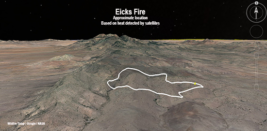
The funding is prompted by climate change-driven increases in fire activity and fire season length, continued development in the wildland-urban interface, and interactions between fire and disturbances like pest and pathogen disturbance.

The CFRI recently completed a statewide database of forest vegetation management and wildfires for Colorado, complementing a similar effort for New Mexico and southern Colorado led by the New Mexico Forest and Watershed Restoration Institute. The data serve as a foundation for the decision support tools and collaborative processes that CFRI deploys around the state and throughout the Interior West. The national database will be developed using similar types of data across the country.

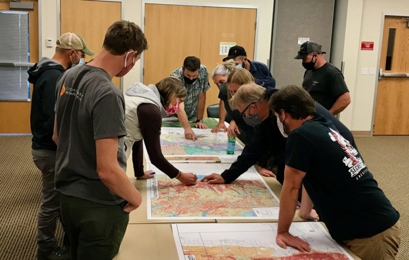
The data are only the starting point, said Brett Wolk, one of CFRI’s assistant directors. Making data meaningful for land and fire managers, scientists, policymakers, and community stakeholders working in their specific places is a critical function the institutes excel at and is called out in the Infrastructure provisions.

“Unless the data is situated within a social context where people can understand how it applies to their work, all the best data and science in the world won’t change decisions or outcomes on the ground,” said Wolk. “That’s why SWERI works to co-develop solutions with partners and empower decisions that are science informed but also locally relevant.”

A third component of the funding is researching outcomes of past treatments to improve future decisions. This will build on deep research expertise at the Arizona and Colorado institutes, exemplified by a recent CFRI co-led publication and accompanying podcast evaluating accomplishments of the Forest to Faucets partnership aimed at protecting Denver’s water supply from devastating wildfires.

The challenge, Wolk said, is applying the collective institutes’ knowledge and expertise across the entire U.S. At the same time, there is an opportunity for other states to benefit from the collective knowledge across the institutes.

“It’s a massive opportunity to help fast-track implementation of what’s working in forest and fire management. But research also shows big gaps in who has access to and contributes knowledge towards these forestry data and decision-making processes. If we can increase the application of science, while making incremental change to expand equity of ideas and resources among wider audiences, those will be our measures of success.”


From Colorado State University

Thanks and a tip of the hat go out to Gerald.

Forest Service smokejumper injured on a wildfire in New Mexico

Was parachuting into a fire 9 miles north of the Mexico border

Updated 9 a.m. MDT May 29, 2021

Tim Hart

A Gofundme account has been set up for Tim Hart who was critically injured while parachuting into the Eicks Fire in southeastern New Mexico. He works out of the jumper base at West Yellowstone, Montana.

Below is the text from Gofundme, May 29, 2021:


On May 24th, West Yellowstone Smokejumper Tim Hart suffered multiple injuries after a hard landing during a fire jump in southern New Mexico. Tim was flown via air ambulance to a hospital in El Paso, Texas where he remains in critical condition.

Tim has been a wildland firefighter since 2006.  He began his career working on an engine  for the Coconino National Forest, and continued in that capacity on the  Fremont-Winema NF and the Shoshone NF.  After his engine time, he became a Lead Firefighter and Squadleader on the Asheville Interagency hotshot crew.  He later held squadleader positions on  Augusta IHC  and  Ruby Mountain IHC.  Tim accepted a rookie smokejumper position in  2016 at Grangeville, Idaho.  He moved to the West Yellowstone Smokejumper Base as a squadleader in 2019. Tim’s talents and natural leadership have been a big part in the success of all the functional areas here in West.  He is willing to take things on very thoughtfully and methodically, and with a sense of humor.

Whatever the task is in front of him- whether it’s preparing for fire jumps or cargo drops, building furniture for his new home in Cody, WY or improvising a musical jam session with his wife Michelle, he rises to the challenge!  His “get- it- done” attitude will serve him well on his journey to recovery.

Thank you for supporting Tim and his family during this incredibly difficult time. They have a long road ahead of them, and any burden we may be able to lift would be greatly appreciated.

Keep Tim in your thoughts and prayers…. and keep the whiskey nearby to celebrate all of Tim’s victories down the road.


6:37 p.m. MDT, May 26, 2021

3D Map of Eicks Fire
3D map showing the approximate location of the Eicks Fire, May 25, 2021. Looking North.

This article was first published at FireAviation.com

6:34 p.m. MDT May 26, 2021

A U.S. Forest Service smoke jumper was seriously injured Monday after a hard landing at a wildfire in New Mexico. Tim Hart of Cody, Wyoming was dispatched to help suppress the Eicks Fire in the Animas Mountains of southeastern New Mexico, nine miles north of the Mexico border. He works out of the jumper base at West Yellowstone, Montana.

Mr. Hart was flown by air ambulance to a hospital in El Paso and was in critical condition. “The Forest Service’s first priority is to provide for him and his family right now,” said Marna Daley, Forest Service spokeswoman. “We are working with the smokejumper and firefighter community to make sure those needs are being met.”

Map of Eicks Fire
Map showing the location of the Eicks Fire.

The Eicks Fire has burned 850 acres of grass and brush since it was reported May 24, 2021 in very rugged terrain along the Continental Divide. No structures have burned and none are threatened.

Some media outlets initially reported that the injured person was a Hotshot firefighter, but in a Congressional hearing on Tuesday Chief of the Forest Service Vicki Christiansen said it was a smokejumper.

Thanks and a tip of the hat go out to Tom.

More snow and rain slow the Three Rivers Fire in New Mexico

Precipitation is predicted for the fire area through Thursday

Updated at 11:30 a.m. MDT April 29, 2021

Precipitation continues  to fall on the Three Rivers Fire 8 miles northwest of Ruidoso, New Mexico. The “Smoky Bear” weather station near the city recorded more than half an inch since 1 a.m. Thursday.

Information from the incident management team (IMT) says firefighters are constructing direct fireline to further secure the blaze. As of Wednesday evening the team was still calling it 12,000 acres, but that number could change significantly when they are able to map the fire from the air without interference from clouds.

The IMT reported that evacuations have been lifted in the following areas: Nogal Canyon Area (up to the Nogal Peak Trailhead), Bonito Canyon Area up to the Bonito Lake Dam, Church Mountain, Ranchman’s Camp, Loma Grande, Cora Dutton, Magado, Ski Apache up to the Eagle Lakes turn, and Villa Madonna.


Three Rivers Fire April 27, 2021
Three Rivers Fire April 27, 2021. USFS photo.

More rain and snow Wednesday morning has at least temporarily slowed the spread of the Three Rivers Fire eight miles northwest of Ruidoso, New Mexico. An additional six-tenths of an inch of precipitation is in the forecast for the fire area through Thursday, which could deposit more than five inches of snow in the higher elevations. The greatest chance of precipitation will be Wednesday night and Thursday morning. The live camera at Ruidoso showed wet streets in the city at 8:30 a.m. Wednesday.

Clouds for the last two days have prevented satellites and fixed wing aircraft from mapping the fire to determine exactly where it has burned. Fire officials for the last 24 hours have been using the 12,000-acre figure as their estimate for the size, before the rain and snow paused the spread. They hope to refine that number Wednesday afternoon and expect it to decrease after they can actually see the fire from the air and more accurately map unburned areas.

The Type 1 Incident Management Team assumed command of the fire at 6 a.m. Wednesday morning.

The fire has burned into the Little Bear Fire scar from 2012, where there is less vegetation to fuel the blaze.

Three Rivers Fire forces evacuations in Southern New Mexico

8 miles northwest of Ruidoso

Updated at 7:16 p.m. MDT April 26, 2021

Three Rivers Fire map
The Three Rivers Fire has spread into the Little Bear Fire of 2012.

The 6,100-acre Three Rivers Fire 10 miles northwest of Ruidoso, New Mexico has spread into the footprint of the Little Bear Fire of 2012. Residents of the area will remember that fire because it stirred up a great deal of controversy.

(To see all articles on Wildfire Today about the Three Rivers Fire, including the most current, click here.)

Much of the criticism of the Little Bear fire was focused on what appeared from a distance to be less than aggressive suppression tactics, even though it was a suppression fire. Two firefighters worked the fire on the first day, June 4, 2012, and from day two through day five, while the fire was only four acres, a hotshot crew was assigned, but they had very, very little aerial firefighting support; limited use of one helicopter and no air tankers. On the fifth day the wind increased, a tree in the interior of the fire torched, and spot fires took off. The fire grew from 4 acres to 44,000 acres and destroyed 254 structures.

Rep Steve Pearce House of Representatives speech, western wildfiresIn June, 2012, Representative Steve Pearce was extremely critical of the way the U.S. Forest Service was managing the fire and the 297,000-acre Whitewater Baldy Complex in New Mexico, mentioning the name of Tom Tidwell, Chief of the Forest Service, many times during a 22-minute speech on the floor of the House of Representatives.

Rep. Pearce had five reports written about the two fires


Updated at 6:49 p.m. MDT April 26, 2021

Three Rivers Fire, satellite photo map
Three Rivers Fire, satellite photo 5:46 p.m. MDT April 26, 2021.

At about 5 p.m. Monday the Lincoln National Forest lengthened the list of locations under evacuation notices for the Three Rivers Fire northwest of Ruidoso, New Mexico:

• Nogal Canyon Area
• Bonito Canyon Area
• Tanbark
• Church
• Ranchman’s Camp
• Loma Grande
• Cora Dutton
• Magado
• Ski Apache

Evacuation Centers
• Nazarean Church Camp, 200 Bonito Park Rd. Alto, NM 88316
• Capitan Senior Center at 412 Tiger Drive Capitan, NM 88316
• Ruidoso Downs Senior Center at 393 Highway 70 West Rd. Ruidoso Downs, NM 88346.

The latest size estimate is 6,100 acres. The fire is spreading very rapidly.


Within hours of the Three Rivers Fire detection on the Lincoln National Forest in New Mexico, evacuations were ordered. The fire is about 10 miles northwest of Ruidoso. It is one-half mile above Three Rivers Campground near the White Mountains on the Smokey Bear Ranger District between Tularosa and Carrizozo.

Evacuation notices are in effect according to the U.S. Forest Service for Nogal Canyon, Bonito Canyon, and the Ski Apache area.

At about 11 a.m. officials estimated the size at 30 acres, but judging from the live video from Ruidoso at 2:40 p.m. it appears to be growing rapidly. The latest report puts it at approximately 4,000 acres.

The fire is being pushed by a strong wind gusting out of the southwest at up to 38 mph. That wind speed was recorded at a weather station in Ruidoso which at 2:35 p.m. April 26 showed 66 degrees and 7 percent relative humidity. The forecast is for wind gusts up to 55 mph in the afternoon. These conditions will make it very difficult to impossible for firefighters to get out in front and stop the forward progress of the fire —  or for retardant-dropping aircraft to be effective.

A Type 1 Incident Management Team has been ordered. Other resources ordered or onsite as of 2:10 p.m. MDT included 2 single-engine airtankers, 1 hotshot crew, 2 other hand crews, and 5 engines.

A fire with an interesting name

And, Contain vs. Control

Ojo de los Casos Fire
Ojo de los Casos Fire. Undated Inciweb photo.

It is unusual for a large fire to have more than two words in the fire’s name, not counting the word “fire”. And it is not common for a fire name to be a multi-word phrase. Fire agency employees whose jobs entail completing forms or maintaining records get grumpy when they have to write or type over and over, a long fire name or one that may lead to misspelling.

A fire 17 miles southeast of Albuquerque, New Mexico on the Cibola National Forest is named “Ojo de los Caso Fire”. Since it was reported on July 8 the blaze has burned 180 acres of timber, brush, and grass.

The names for many fires are derived from a nearby landmark. I asked the Fire Information Officer Andrea Chavez how the fire was named and what it means in English:

Depending on the map you look at, there are various colloquial names for a spring in Cañon de Chilili near the origin of this fire, including “ojo la casa” and “ojo los caso”. Therefore, firefighters initially on scene dubbed the fire Ojo de los Casos

Ojo de los Casos colloquially translates to Spring of the Cause. However, it is possible this name was derived from an older nomenclature, Ojo de Casa (House Spring), which has been found on older maps of the area.

On Wildfire Today we rarely regurgitate containment percentages that are put out by Incident Commanders, because the numbers are unreliable. I have seen too many large fires that had miles of cold fireline that officially had zero or 10 percent containment. Too often this number appears to be grabbed out of the air with no effort to be accurate. Other times it can be a conscious effort to deceive. An incident commander may think that by publicizing a low containment number, it can be easier to hang on to resources, or to rank higher in priority among fires that are competing for scarce resources. They may also think it makes it easier to justify maintaining evacuations. Other incident commanders actually base the containment on the portion of the perimeter where the spread has been stopped by a fireline.

The National Wildfire Coordinating Group has a very extensive glossary of wildland fire terms. Their definition of “contain” is:

The status of a wildfire suppression action signifying that a control line has been completed around the fire, and any associated spot fires, which can reasonably be expected to stop the fire’s spread.

The incident management team on the Ojo de los Casos Fire posted on InciWeb July 11 that the fire was 10 percent contained. They also described on InciWeb what containment means to them:

Percent containment is based off the actual amount of containment line that is safe enough to leave unattended without worries of heat, embers or hot spots flaring up and having potential to cross that line allowing additional growth of the fire.

I asked Ms Chavez where they got their definition. She said:

Our incident commander and operations personnel elaborated on [the NWCG] definition to provide more detail based on their many years of experience and training.

Later that day an update appeared on the fire’s InciWeb page that was devoted to the concept of containment. It reads in part,

Complete “containment” is the ultimate goal for the fire management team in command of fire suppression activities.


My Opinion

The ultimate goal of firefighters is to put out a fire, or “declare it out”. The step before that is control. And before that, containment.

NWCG Glossary:

Controlled — The completion of control line around a fire, any spot fires therefrom, and any interior islands to be saved; burned out any unburned area adjacent to the fire side of the control lines; and cool down all hotspots that are immediate threats to the control line, until the lines can reasonably be expected to hold under the foreseeable conditions.

The Incident Commander and the operations personnel on the Ojo de los Casos Fire are conflating Contain and Control.

In my mind, Contain is to have a good, solid fire line without a great deal of residual heat near the line. It would still require patrol and mopup but the spread has been stopped at that location. That leaves open the unlikely chance that the fire can cross that section of line if something unexpected happens.

Control is the next step — mopup is complete near the fire line, burning out is complete, snags have been dealt with. At 100 percent control the Incident Commander and the Operations Section Chief are staking their reputation on their assessments that the fire will not spread beyond the established firelines.

When a fire is “Out”, there is no combustion occurring.

Ojo de los Casos Fire
Ojo de los Casos Fire. Undated Inciweb photo.

Forecast for wildfire smoke, June 20, 2020

Forecast for the distribution of smoke from wildfires Saturday evening

Forecast for wildfire smoke
Forecast for the distribution of smoke from wildfires at 7 p.m. MDT June 20, 2020. NOAA HRRR-Smoke

The forecast for the distribution of smoke from wildfires at 7 p.m. MDT Saturday looks rather bleak for areas of Arizona, New Mexico, Texas, and Oklahoma.