Two very large wildfires in Western Oklahoma winding down after burning 348,000 acres

Above: Water tenders on the 34 Complex of Fires. Posted to Inciweb April 19, 2018. 

The two very large wildfires in Western Oklahoma are downsizing their staffing as they move closer to full containment. Few smoking areas have been observed on recent overflights.

The larger of the two, the Rhea Fire, has burned over 286,000 acres. There are currently 223 personnel assigned. The most significant event Monday was when resources responded to a new fire that started when a hawk flew into a power line, causing arcing and ignition of the grass. It was fully contained at 5 acres. T

The Incident Management Team is being released from the 34 Complex of Fires which has burned over 62,000 acres. On Monday there were still 186 personnel assigned who continue to patrol firelines.

The video below was filmed on the Rhea Fire by Mississippi firefighters while the blaze was still very active.

Oklahoma wildfires: 34 Complex slows, Rhea continues to spread

The two fires have burned more than 316,000 acres and 63 homes

Above: Map of the Rhea Fire, April 16, 2017. Incident Management Team.

Two wildfires that are 20 miles apart in Western Oklahoma have burned more than 316,000 acres and 63 residences.

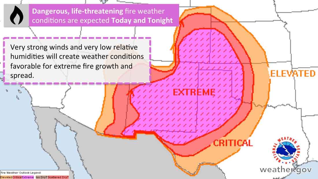
The spread of the 34 Complex of Fires north of Woodward has slowed, but the strength of the firelines could be tested Tuesday with fire weather conditions called “historic”. The forecast includes winds out of the southwest at 35 to 45 mph with gusts up to 65 along with humidities as low as 7 percent.

map rhea 34 complex wildfires
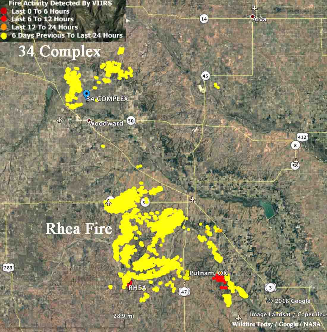
Map showing heat detected by a satellite on the 34 Complex and Rhea Fires in Western Oklahoma, current at 2:22 a.m. CDT April 17, 2018. The satellite flying over the area twice a day can’t detect heat in light vegetation that burns and then cools before the next pass.

The same conditions will affect the huge Rhea Fire 20 miles south of the 34 Complex. Some areas of the 248,589-acre fire are quiet, but it was still spreading Monday east of Putnam (shown in red on the map above). Those active areas could be challenging for firefighters with the extreme weather predicted for the area Tuesday and Tuesday night.

Fire weather april 17, 2018 dangerous wildfire
Fire weather conditions predicted for Tuesday and Tuesday night.
Rhea Fire
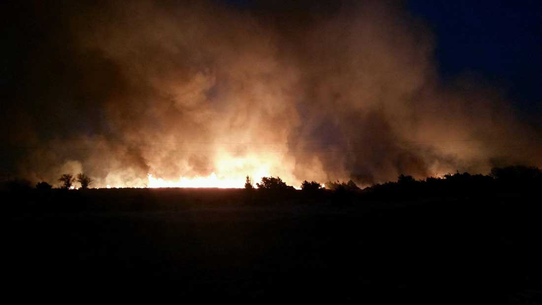
Rhea Fire, April 16, 2018. Oklahoma Forestry Services photo.

Rhea Fire in Oklahoma grows to 241,000 acres

A civilian fatality was reported Saturday

Above: Map of the Rhea Fire in Western Oklahoma, current at 2 p.m. CDT April 15, 2018

The Rhea Fire in Western Oklahoma has long since exceeded the 100,000-acre threshold to qualify as a “mega fire”. The most recent size estimate puts it at 241,280 acres.  More than 500 firefighters are assigned along with three large air tankers, two type 1 helicopters, four single engine air tankers, two CL-415 scooping air tankers, an air attack plane, and two National Guard helicopters.

Dewey County Sheriff Clay Sanders reported Saturday that a female died in her vehicle at a residence near Seiling. He did not release her name, pending family notifications.

On Saturday strong winds out of the northwest pushed the fire through drainages toward Thomas and Fay in Dewey county.

Firefighters will not get a break from the weather anytime soon. The forecast calls for escalating fire danger through Tuesday with the potential for temperatures back up into the 90°’s and relative humidity values below 15 percent in western Oklahoma and below 25 percent along the I-35 corridor. Sustained southwest winds up to 30 mph and gusts of 40-45 mph will again present a very concerning fire behavior scenario with extreme rates of fire spread anticipated.

Firefighting resources from across the country are arriving to assist the local agencies and departments, not only in Oklahoma, but also in New Mexico and Arizona where wildfire activity is increasing.

Fatality on wildfire in Oklahoma

The man was helping firefighters by operating a motor grader.

Above: Satellite photo showing smoke from some of the fires in western Oklahoma. The red dots indicate heat. 

A man working on a wildfire in Oklahoma was killed April 12, 2018. The Oklahoma Office of the Chief Medical Examiner reports the 61-year-old died Thursday in the western part of the state as a result of injuries sustained while working on the Shaw Fire. Television station KOCO reported the man was helping firefighters by operating a motor grader.

Our sincere condolences go out to his family, friends, and coworkers.

The Shaw Fire that started Thursday in Roger Mills County south of Durham is being monitored and is now being mopped up. This fire is approximately 7,250 acres.

By our very unofficial estimates the Reah Fire, another fire in Oklahoma, has burned at least 130,000 acres between Leedy and Putnam. Other towns threatened by this fire are Vici, Taloga, and Camargo where evacuations have been ordered.

satellite wildfires Oklahoma
The red and orange dots represent heat on fires in Oklahoma detected by a satellite. The red dots were seen at about 2 p.m. CDT April 13, 2018.

Woodward County Emergency Management reports the 34 Complex Fire that started Thursday is still burning. Numerous fire departments and task forces are responding. Oklahoma Forestry Services is supporting the fire with both air and ground assets. This fire is now about 59,000 acres.

A video from Oklahoma:

The early reports on this fatality said that it happened on the Rhea Fire. This article was updated to reflect that it occurred on the Shaw Fire.

Backfiring vehicle starts wildfire, three structures burn

The fire occurred Wednesday afternoon south of Geary Oklahoma

A mobile home and two storage buildings were destroyed south of Geary, Oklahoma Wednesday afternoon in a wildfire. According to Brian Snow, Canadian County Emergency Management interim director, a backfire from a vehicle on residential property started the fire. Four acres burned in the fire which was near the Cherokee Trading Post near Interstate 40.

Firefighters have been very busy in Oklahoma in the last few days. A fire near Kaw Lake has burned approximately 600 acres since Wednesday.

Strong winds recorded in CO, NE, KS, and OK

Above: Map showing maximum wind gusts in Nebraska at 1:25 p.m. MST March 5, 2018.

(Originally published at 1:32 p.m. MST March 5, 2018)

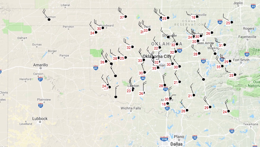
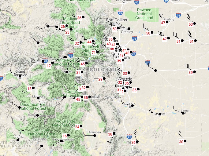
As predicted in the Red Flag Warnings Monday morning, strong winds are are occurring in Nebraska, Colorado, Kansas, and Oklahoma.

These maps of the four states show maximum wind gusts updated at 1:25 p.m. MST March 5, 2018.

Kansas

Kansas strong wind
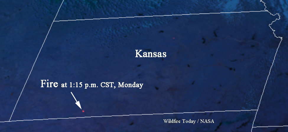
Matt told us about a fire in Clark County, Kansas. The GOES 16 satellite detected it.

fire clark county kansas
The map below shows a fire detected by a satellite in Clark County Kansas at 1:15 p.m. CST March 5. It is south of Dodge City and west of Ashland.

UPDATE at 1:54 p.m. MST March 5, 2018: the satellite is detecting another fire in Kansas, farther west, near Hugoton.

UPDATE at 3:19 p.m. MST March 5, 2018. The fire in Clark County is reportedly contained. That fire and the one farther west are no longer being detected by the satellite.

Oklahoma

Oklahoma wind

Colorado

Colorado strong wind