Piute fire update

Posted on Categories UncategorizedTags

The Piute fire is about 30 miles east of Bakersfield and 7 miles southeast of Lake Isabella. As of 0900 it is 14,523 acres and 15% contained. From Kern County this morning:

The fire has been slowly progressing in an easterly direction towards Kelso Creek. Yesterday, air operations made significant water and retardant drops on the fire. Firefighters continue constructing and securing hand line, mopping up and providing structure protection along the S flank of the fire. On the W flank, crews have completed hand line and dozer line construction from Brown Meadow to the Liebel Peak area and are continuing S toward King Solomon Ridge today.

Hotshot crews are scouting the N flank of the fire in Erskine Creek, looking for opportunities to establish an anchor point and begin fire line construction. Firefighters continue to construct hand line into Landers Meadow, tying in with the existing dozer line. A contingency line north of Claraville has been completed. Firefighters continue their work securing Erskine Creek Road and providing structure protection along Piute Mountain Road, Rocky Point, Valley View and Erskine Creek.

Here is a grab from the web cam.

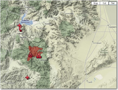
The latest map:
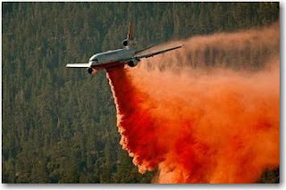
Picture of Air Tanker 910 dropping on the Piute fire, courtesy of AFP

California: Piute fire

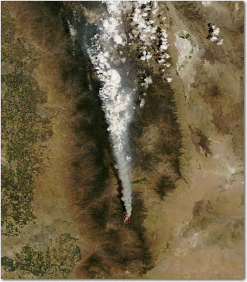
The Piute fire south of Lake Isabella was very active on Tuesday.

Information about the fire from South Zone, at 1800, July 1:

11,514 acres, 11% contained. Extreme conditions led to high rates of spread and torching. This resulted in significant eastward movement in Division X. The fire remained active throughout the Operational Period. Long-range spotting continues to be a dominant factor in fire progression. Growth potential continues to be high.

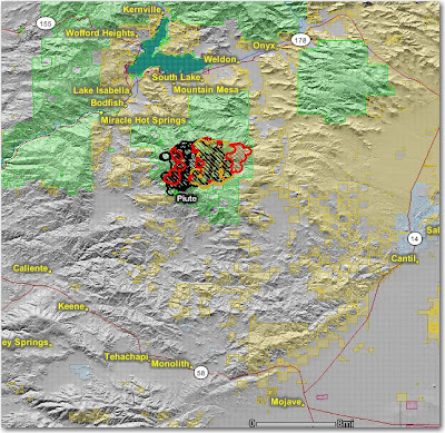
The map below shows heat, in red, orange, and black, detected by satellites last night, with the red areas being the most recently burned. The yellow lines are the perimeters uploaded by the incident management teams yesterday. Click on the map to see a larger version.

California: Piute fire

The Piute fire, about 6 miles south of Lake Isabella, was very active again yesterday, growing by 4,840 acres. This fire has a lot of potential to be a problem. It is now 7,040 acres and 6% contained.

South Zone reported this at 1800 yesterday:

The West side of the fire is unsafe for direct attack. The north end of the fire is running towards numerous camping areas and the communities and structures in Lake Isabella, Bodfish, Liebel Ranch, Valley View Sub-division, French Meadow, Historic Rocky Point Mining area, Red Mountain, and Claraville. Road closures were initiated today.

The map below shows heat in red and black detected by satellites last night, with the red areas being the most recently burned. Click on the map to see a larger version.

California: Piute fire

The Piute fire on the Sequoia NF started yesterday and is moving out. HERE is a link to an almost-live web cam view of the fire.

Piute (CA-SQF-1356) 2,560 acres and 4% contained. Protection of the USFS Repeater Site, the Buston Mill, historic town sites and critical habitat areas are a priority. Closure was ordered for area campgrounds, resulting in the evacuation of campers. Road closures include Piute Mountain Rd., Saddle springs Rd. and Cold Springs Rd. Evacuations were put in place for residences and visitors in Brown’s Meadow and French Meadow. An evacuation advisory notice was issued to residents and visitors of the Claraville Town site. An Evacuation Center was opened in Lake Isabella at the VFW/Senior Citizens’s Center.