Map and update of Davis escaped prescribed fire near Helena

UPDATE @ 9:15 p.m. MT, Aug. 27

The U. S. Forest Service has lifted the evacuation orders for some areas. More information is at InciWeb. They are now saying the fire has burned 2,050 2,800 acres as of approximately 6 p.m. today and it is 20% 5% contained. Jess Secrest’s Type 2 Incident Management Team will assume command of the fire at 9 p.m. tonight.

The weather forecast for the fire area brings some good news, including a 50-60% chance of rain Saturday night and Sunday morning. On Saturday the temperature will be 55 to 70, depending on the elevation, and winds should be light and variable, becoming 5-10 out of the northeast on the ridge tops in the afternoon.

Ellen Bacca, the meteorologist for the Helena NBC station, posted some photos related to the fire. I believe they were taken from Helena.

======================================================

UPDATE @ 11:00 a.m. MT, Aug. 27

The weather forecast is more favorable for firefighters on the Davis fire today than the weather conditions were on Wednesday and Thursday. The temperatures will be much cooler, maxing out at 53-58 at the fire, however it will still be breezy with west winds of 15-25 gusting up to 35 in the morning . The RAWS weather station at Lincoln, 11 miles northwest of the fire, received 0.04″ of rain at 2 a.m. today, Friday.

======================================================
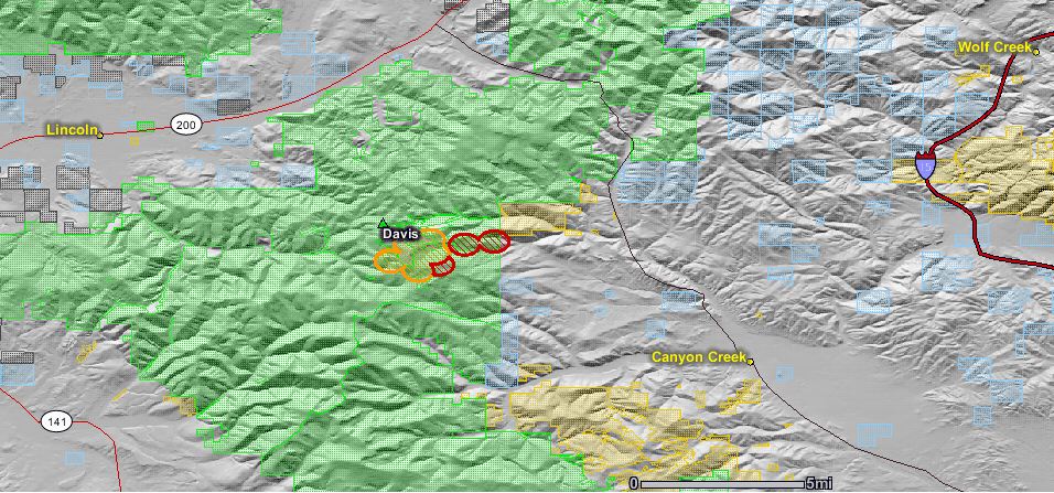
map of davis fire August 27 2010
The map of the Davis fire shows heat detected by satellites during the early morning on Aug. 27. Click to see a larger version of the map.

The updated map of the Davis fire, an escaped prescribed fire between Lincoln and Helena, Montana, shows that the fire has spread to the east near the eastern boundary of the Helena National Forest.
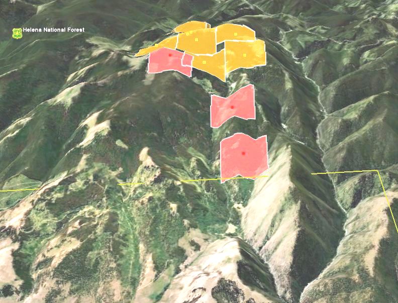
Davis fire map 3-D 8-27-2010
A 3-D map showing heat detected on the Davis fire by satellites early on Aug. 27. We are looking West. Stemple Pass Road is on the right side of the map and the USFS boundary is the yellow line. The Red areas indicate the most recent heat. Click to see a larger version of the map.

The latest official update from the U.S. Forest Service late Thursday night said the fire had burned 2,000 acres and that “Lewis & Clark County Sheriff Leo Dutton has ordered evacuations of homes located at the top of Stemple Pass over to Highway 279 (Lincoln Road)”. There are some media reports that the fire has burned 2,800 acres.

Helenair.com has an article describing a public meeting on Thursday at which the USFS District Ranger for the area, Amber Kamps, talked about what they were thinking when they decided to conduct the prescribed fire on Wednesday. On Thursday the high temperature of 97 set a new record in Helena. Here is an excerpt from the article:

Continue reading “Map and update of Davis escaped prescribed fire near Helena”

Escaped prescribed fire near Helena, MT

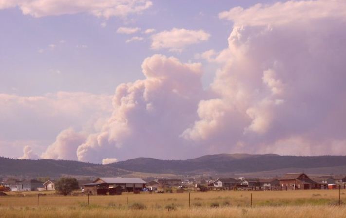
Davis fire near Lincoln Montana
The map shows heat detected by satellites at 3:35 p.m. today from the Davis fire — in red southeast of Lincoln. Click to see a larger map.

UPDATE at 10:00 p.m. August 26:

KXLH is reporting that the fire has now burned about 2,800 acres and is threatening almost two dozen homes. Also:

On Thursday evening, fire officials held a town hall meeting to explain the situation. Forest Service Ranger Amber Kamps told the residents that when Forest Service officials began the prescribed burn on Wednesday, the weather was good. She said, “I can not tell you how sorry I am that we have to meet under these conditions. That you are having to go through this. I can’t make it up to you. I can just tell you I am sorry and we will do the best we can from this point forward,” Kamps says.

====================================================

Davis fire near Helena and Lincoln
Davis fire, Aug. 26, 2010. Photo: markholyoak

Yesterday the Helena National Forest in Montana initiated a prescribed fire in the Virginia Creek area 11 miles southeast of Lincoln and 28 miles northwest of Helena. The fire weather forecast for today for western Montana included red flag warnings in three areas with the possibility of dry thunderstorms. Today the high temperature of 97 in Helena set a record that was two degrees higher than the highest ever recorded for this date. That, combined with strong winds and low humidities today contributed to “active burning and some spotting outside the planned fire area”, according to a news release from the U.S. Forest Service.

At 1 p.m. today the Davis fire was officially declared escaped and was designated a wildland fire. Helenair.com reported that the fire was spotting a half mile to a mile ahead. The Associated Press reported that the fire was pushed by 30 to 35 mph winds.

As of 5 p.m. today it had burned about 1,000 acres, structures were threatened, and the Sheriff had ordered evacuations of homes located at the top of Stemple Pass Pass over to Highway 279 (Lincoln Road).

Yesterday at the RAWS station in Lincoln the maximum temperature was 86 degrees, the minimum relative humidity was 13%, and the winds gusted up to 15 mph. Today at the same weather station the high was 91, the RH was 14%, and the maximum wind gust was 25 with an average wind speed of 5-10 in the afternoon.

The USFS said the prescribed fire was within prescription when they ignited it on Wednesday.

The video below is from KXLH.

UPDATE on August 27, 2010

Effects of prescribed fire on archaeological artifacts

collecting fire effects data
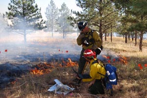
Research team collecting data during burn experiments.

The National Park Service has completed a research study that analyzed the effects of prescribed fire in their Midwest Region on archaeological artifacts. Researchers placed artifacts in areas to be burned in six park units in South Dakota, Arkansas, Iowa, Minnesota, and Kansas. Using thermocouples and data loggers, they measured the temperature every five seconds as fire moved through the plots containing the artifacts, while human Fire Effects Monitors recorded the type of fire spread (head, backing, or flanking) and the flame length, flame depth, and rate of spread.

Their major findings include:

  • The majority of artifacts subjected to fire during the six prescribed burns did not experience any significant impacts.
  • The adherence of combustive residue to artifacts was the most frequent impact observed on artifacts. Between 48 and 75 percent of each assemblage exhibited low to high amounts of combustive residue. With effort, combustive residue was removed from the more durable classes of artifacts, such as glass and stone.
  • Artifacts after grass fire
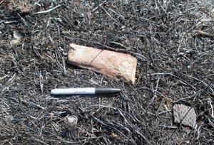
    Experimental artifacts in situ following a prescribed burn at Effigy Mounds National Monument.
  • Cleaning and weathering experiments on archeological materials demonstrated that most impacts to surface artifacts were of a non-permanent nature and could be removed with light to moderate cleaning.
  • Serious impacts to artifacts such as scorching, fracturing, or melting were observed in only 5-10 percent of the assemblages.
  • The incidence of serious or significant impacts to the artifact assemblages was a combination of fuel type/fuel load and artifact material. Artifacts such as bone, shell, leather, wood, and lead exhibited more frequent serious impacts when compared to materials such as ceramic, stone, metal, and glass.
  • Experimental prescribed burns demonstrated a significant amount of variability in fire conditions resulting from non-uniform fuel types and loads, particularly in wooded environments.

New Mexico prescribed fire escapes, burns into Colorado

A prescribed fire ignited on May 21, 50 miles west of Raton, New Mexico, planned to be 600 acres, escaped on May 23 when it was too windy to fly air tankers and has now burned 3,800 acres. It has crossed the state line and scorched about 40 acres in Colorado. The name of the fire is H12. The prescribed fire was on the Vermejo Park Ranch a few miles south of the Colorado border.

Today they are transitioning from Kyle Sahd’s Type 3 incident management team to Pruett Small’s Type 2 team. In New Mexico the fire is in the jurisdiction of the Cimarron District, New Mexico State Forestry.