University professor admits setting fires behind Dixie Fire firefighters

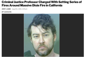
A former university professor who taught criminal justice (you can’t make this stuff up) has pleaded guilty to setting fires behind firefighters on the 2021 Dixie Fire in northern California, which was at the time the second-largest fire in state history.

arsonist "Professor" Gary Maynard
Arsonist Professor Gary Maynard

Gary Maynard, 49, of San Jose was in federal court this week on three counts of arson on federal property, according to the U.S. Attorney’s Office in Sacramento. The fires that Maynard started effectively surrounded the firefighters, according to the U.S. Attorney’s Office. The Mercury News reported that the Dixie Fire burned through five counties over 963,300 acres, destroying 1,311 structures and killing one person, according to Cal Fire.

Also, Marcus Pacheco, an assistant fire engine operator for the Lassen National Forest, died of Covid while working the fire, as did two water tender operators, Jose T. Calderon and Cessar Saenz, both of San Diego County.

Maynard faces up to 20 years in a prison and a $250,000 fine for each of the three counts of arson on federal property, the U.S. Justice Department said in a press release following his plea on Thursday; sentencing is set for May.  He was charged with setting four fires — Cascade, Everitt, Ranch, and Conard — and under the plea agreement he admitted to three of the four counts.

The Dixie Fire itself was ignited when Pacific Gas & Electric powerlines came in contact with a nearby pine tree, according to Cal Fire. PG&E paid $45 million to settle the lawsuit.

At Santa Clara University and Sonoma State University, Maynard lectured in criminal justice, cults and — seriously — deviant behavior.

Gary Maynard, arsonist

USFS agents started their investigation of him and his activities back in July of 2021 after the Cascade Fire was reported on the slopes of Mt. Shasta; an investigator found Maynard underneath his black Kia Soul, which was stuck in a ditch with its undercarriage high-centered. A second fire took off on Mt. Shasta the next day, and investigators found tire tracks similar to those of the Kia. They set a tracking device under Maynard’s Kia in August, which recorded his travel  to the area where the Ranch and Conard fires started on the Lassen National Forest.

As part of his plea, Maynard also agreed Thursday to pay up to $500,000 in restitution to the federal government.

~ Thanks and a tip of the hardhat to Jim. 

Firefighters gaining containment on the Ranch Fire

The fire has burned 2,534 acres 21 miles southwest of Red Bluff, Calif.

Map of the Ranch Fire November 8, 2019
Map of the Ranch Fire November 8, 2019. CAL FIRE map cropped by Wildfire Today.

10:58 a.m. PST November 8, 2019

Firefighters working on the Ranch Fire have completed a control line around almost half of the perimeter (see map above). Satellites have not detected very many large sources of heat on the western three-quarters of the incident for a couple of days.

The fire is 21 miles southwest of Red Bluff, California and one mile east of the Mendocino National Forest.

Evacuations are still in effect along Colyear Springs Road from Red Bank Road to the Mendocino National Forest Boundary.

CAL FIRE reports that the fire has burned 2,534 acres, which is a reduction from 3,768 acres due to more accurate mapping.

(To see all of the articles on Wildfire Today about the Ranch Fire, including the most recent, click here.)

Resources assigned to the fire include 65 fire engines, 10 water tenders, 36 hand crews, 5 helicopters, and 13 dozers for a total of 1,123 personnel.

The Ranch Fire burns hundreds of acres southwest of Red Bluff, Calif.

Ranch Fire map
Map showing heat detected by a satellite on the Ranch Fire at 1:06 p.m. PDT Nov. 4, 2019.

UPDATED at 6:42 p.m. PDT Nov. 4, 2019

CAL FIRE reported Monday at 6:25 p.m. that the Ranch Fire 21 miles southwest of Red Bluff, California has burned 1,308 acres. Early Monday morning it was 550 acres.

(To see all of the articles on Wildfire Today about the Ranch Fire, including the most recent, click here.)

The fire was very active Monday afternoon as firefighters on the ground were assisted by numerous air tankers and helicopters.

The fire was originally reported at Colyer Springs Road and Raglin Ridge Road in Tehama County.

The weather forecast for the fire area on Tuesday calls for moderate fire weather; 77 degrees, relative humidity of 20 percent, and winds from variable directions at 6 mph. Early in the morning the wind will be out of the northwest but will shift throughout the day, becoming southeast by sunset. Similar conditions are expected on Wednesday except the wind will be 6 to 10 mph out of the north after 9 a.m.

Ranch Fire map satellite photo
Sensors on the GOES-17 satellite detected heat and smoke from the Ranch Fire at 3:06 p.m. PDT Nov. 4, 2019.

Continue reading “The Ranch Fire burns hundreds of acres southwest of Red Bluff, Calif.”

Video of extreme firefighting at the 2018 Ranch Fire

Ranch Fire Clear Lake California
Screenshot from video of the Ranch Fire shot by 564 Fire in 2018.

A photographer who specializes fires shot some incredible video of firefighters dealing with what must have been hundreds of spot fires in a meadow of dead grass. In the dry, windy weather they spread immediately after burning embers blown by the wind fell into the abundant fuel. There were far more rapidly spreading spot fires than the resources on scene could pick up, so they had to withdraw and come up with another plan.

It was shot by 564 Fire at the Ranch Fire, part of the Mendocino Complex of Fires that burned near Clear Lake in northern California in July and August of 2018. The total size of the complex, which included the River and Ranch Fires, was 459,123 acres. The video was uploaded to YouTube June 18, 2019.

Mendocino Complex fire Ranch California map
The red line on the map was the perimeter of the Ranch Fire at 9:15 p.m. PDT August 26, 2018. The white line was the perimeter on August 14. The red and yellow dots represent heat detected by a satellite in the 24 hour period ending at 2:31 a.m. PDT August 27, 2018.

Investigators determine Ranch Fire caused by spark from hammer

Mendocino Complex of Fires
Map showing heat detected on the Ranch and River Fires at 3:31 a.m. PDT July 28, 2018, about 15 hours after they started. Click to enlarge.

Investigators for the California Department of Forestry and Fire Protection, CAL FIRE, determined that the Ranch Fire that started east of Ukiah, California July 27, 2018 began when a man used a hammer to drive a 24-inch metal stake into the ground.

An hour after the Ranch Fire began during Red Flag Warning conditions, the River Fire started about 13 miles to the south, west of Clear Lake. The two fires were later managed as the Mendocino Complex, named after the county in which they started. The Ranch Fire consumed 410,203 acres and damaged or destroyed 280 structures.

The investigators talked with a property owner who explained that he was installing a shade cover over a water tank when he agitated an underground yellow jacket’s nest. Being allergic to bees, he retreated until after they stopped swarming, then using a claw hammer he drove the metal stake 10 to 12 inches into the ground to plug the hole. He smelled smoke and saw a fire that was about two feet by two feet. His efforts to put it out with a shovel and two different water lines were not successful.

While he was riding his four-wheeler to try to get out ahead of the fire, the vehicle rolled downhill, lodging itself between the water tank and a cut bank.

The investigator said that at the time of the interview the man appeared to be suffering from smoke inhalation and heat exhaustion but he refused an ambulance and medical treatment.

The recently released investigator’s report was written March 28, 2019.

Mendocino Complex fire Ranch California map
The red line on the map was the perimeter of the Ranch Fire at 9:15 p.m. PDT August 26, 2016, a month after the fires started. The white line was the perimeter on August 14. The red and yellow dots represent heat detected by a satellite in the 24 hour period ending at 2:31 a.m. PDT August 27, 2018. Click to enlarge.

Social media can help identify evacuation patterns

Data can help determine when people relocate in or out of an evacuation area

social media evacuation pattern Ranch Fire wildfire
August 5, 2018

In July 2018, a spark near the Mendocino National Forest ignited California’s largest wildfire on record. As the Ranch Fire spread rapidly, officials declared mandatory evacuations in several areas and counties. But where did people go, when did they leave, and when did they return? Researchers have turned to a new data source to observe population movements during a crisis: social media.

“We wanted to analyze evacuation patterns and factors that can influence the speed of evacuations during a crisis,” said Shenyue Jia, a remote sensing specialist at Chapman University.

Analyzing evacuation and recovery patterns could help researchers understand how humans behave in the face of a disaster, which could inform emergency response efforts. Jia said nobody was able to provide population movements during a disaster, especially at a high temporal and spatial resolution—until Facebook.

Almost 2.5 billion people per month actively use Facebook. When a disaster strikes, many of those users log on during an evacuation. Facebook’s disasters map initiative uses aggregated, anonymized Facebook data in disaster areas to estimate population densities, movements between neighborhoods, and where people mark themselves as “safe” during a crisis. The company also works with mobile phone carriers to observe the number of connections to surrounding cell phone towers.

social media evacuation pattern Ranch Fire wildfire
August 8, 2018

The images on this page show the population data during the Mendocino Complex Fire in Northern California for 10,000 people, as provided by the Facebook disaster map dataset. The first map above shows the area on August 5, 2018, two days after mandatory evacuations were in place. The second map below shows the area on August 8, one day after the evacuation orders were lifted.

During the Mendocino Complex fire, most people fled the fire perimeter when an evacuation was in place, which was not surprising. But what surprised Jia was where people were headed—or not headed.

“Originally, I thought this data could be nice to track which places people decide to go, but the information didn’t show any significant pattern for this fire,” said Jia, whose research was funded by NASA. “I was expecting a very simple trend, but evacuations are more complicated to understand.”

Jia thinks that perhaps people had more shelter options to flee to (FEMA shelters, neighboring towns, etc.), so the evacuation patterns were dispersed.

However, when the evacuations were lifted, the data showed a much clearer trend of where people were headed: most were returning back to their homes and hometowns. Jia said that how the population bounces back post-disaster is an important indicator of whether the evacuated areas may be safe for residing. In the Mendocino Complex fire, most areas saw people returning.

But that’s not always the case. Jia also analyzed population data from Facebook for the Camp Fire that occurred in November 2018. The data showed a large portion of the evacuated area did not see a sustainable population return since many of those areas were destroyed.

“This research demonstrates that social-network data can be a valuable tool to monitor human behaviors in response to disasters, such as wildfires in areas that have been exacerbated by urbanization,” said Son Nghiem, remote sensing expert at NASA’s Jet Propulsion Laboratory, who oversaw this research.

According to Nghiem, this frequently updated social media data can add another dimension to satellite remote sensing data from NASA and other international agencies used to monitor land cover and land use change.

“With remote sensing data, we don’t know the immediate socioeconomic and demographic impacts,” said Nghiem. “This innovative use of demographic data opens up new possibilities to advance research on how humans respond to abrupt physical changes in disaster situations.”

This article first appeared on the NASA website. NASA Earth Observatory images by Joshua Stevens, using data courtesy of Shenyue Jia/Chapman University. Story by Kasha Patel.