Above is the forecast for the distribution of smoke from wildfires at 6 p.m. MDT August 9, 2018.
The Red Flag Warnings and Fire Weather Watches for today are below.
News and opinion about wildland fire
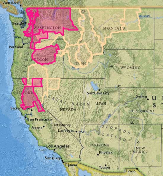
And Red Flag Warnings
Above is the forecast for the distribution of smoke from wildfires at 6 p.m. MDT August 5, 2018. It looks like the air will be pretty nasty in areas of California, Oregon, Nevada, Idaho, Utah, Washington, and Wyoming.
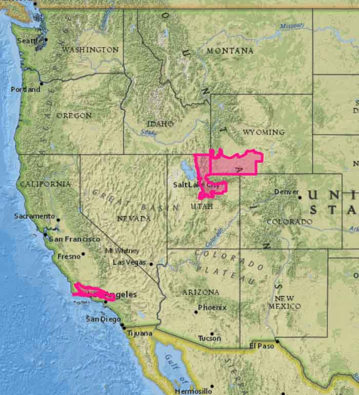
The map below shows the Red Flag Warnings in effect for Sunday, August 5 in portions of California, Utah, and Wyoming.
CAL FIRE reports 500 structures have been destroyed
(Originally published at 9:10 a.m. PDT July 28, 2018)
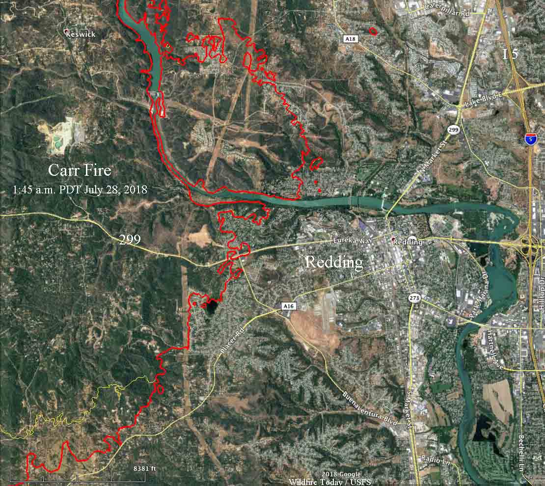
Firefighters on Friday were able to minimize any additional growth of the Carr Fire into Redding but the fire spread significantly on the north and sides. Thursday night CAL FIRE reported the fire had burned 28,000 acres. A 1:45 a.m. mapping flight on Saturday showed it had expanded to over 80,000 acres.
To see all articles about the Carr Fire on Wildfire today including the most current, click here.
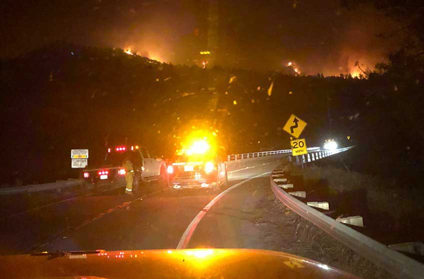
Early Saturday morning the fire was very active two to five miles south of Highway 299 burning toward Placer Road near Igo, and on the north side of 299 it had grown five miles north of French Gulch.

Mandatory evacuations affecting 37,000 people and road closures are in effect for numerous locations around Redding.
Two firefighters were killed in the fire. Friday afternoon the Redding Fire Department confirmed that Inspector Jeremy Stoke perished. A bulldozer operator has not yet been identified.
A spokesperson for Mercy Medical Center in Redding, Mike Mangas, said eight people, including three firefighters, were treated for injuries. All were expected to survive.
CAL FIRE reports that 500 structures have been destroyed, but has not broken them down by residences and outbuildings. On Friday an Associated Press reporter counted at least 125 burned homes. Typically on fires like this about 60 to 80 percent of “structures” destroyed are sheds, detached garages, or similar outbuildings.
Below is an excerpt from an AP article:
Located on the western side of Redding, KRCR-TV was forced to go off the air and evacuate their studio in the middle of a Thursday night broadcast. As the fire advanced, a high school that was used to shelter evacuees was suddenly in danger of being in the path of the flames, and evacuees had to move again to Shasta College, according to NBC News.
“When it hit, people were really scrambling,” Cal Fire spokesman Scott McLean told the AP. “There was not much of a warning.”
The fire also reportedly burned structures in Shasta, located 10 miles west of Redding, and in Keswick. Early Friday morning, the entire town of Shasta Lake, population 10,000 was ordered to evacuate, the Redding Record Searchlight reported.
The weather forecast for the south part of the Carr Fire near Igo for Saturday calls for a high of 110 degrees, 11 percent relative humidity, and variable winds at 5 to 10 mph gusting up to 13. The conditions should remain about the same through Friday of next week, but with decreasing winds. High temperatures will be above 100 each day.
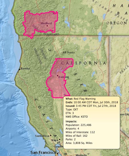
The Red Flag Warning that was in effect for the Redding area on Friday is still in effect Saturday and is due to expire at 10 a.m. Monday.

With fewer aircraft available this year, and 14,000 firefighters already committed, suppressing multiple new large fires could be a challenge.
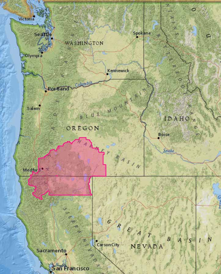
While Southwest Oregon is still dealing with the lightning-caused fires that started a week ago, forecasters expect another round of lightning starting Sunday afternoon. The locations affected will be Southwest Oregon and Northern California, including National Forests in the area: Siskiyou, Rogue River, Shasta-Trinity, Fremont-Winema, and Klamath.
The best chance for lightning is Sunday, but it could linger through Tuesday.
Adding to the lightning threat is low relative humidity which is expected to reach into the teens in most locations Sunday.
And piling on to the wildfire danger is the current condition of the fuels. Oregon and Washington are at or over the historic high Energy Release Component (ERC). The ERC is a number related to the available energy (BTU) per unit area (square foot) within the flaming front at the head of a fire. A high ERC indicates more resistance to control — fires are harder to suppress.
With large numbers of firefighting resources already tied up on fires in Oregon, Utah, and California another flurry of rapidly spreading fires could severely test the mobilization capacity of the wildland firefighting agencies. Today over 14,000 personnel are committed to fires, including 362 hand crews, 926 engines, and 126 helicopters.
Before the 2018 fire season started the U.S. Forest Service reduced the number of large air tankers on exclusive use contracts by one-third, leaving only 14 to be shared across the United States. Other air tankers on Call When Needed contracts can supplement the fleet, if they are available, but their daily availability costs average 54 percent higher than those on season-long exclusive use contracts. Their hourly costs average 18 percent higher.
In 2017 the Type 1 helicopters on exclusive use contracts were cut from 34 to 28, and that continues in 2018.
The National Weather Service is describing the lightning that is in the forecast for south-central Oregon and extreme northern California as “abundant”. It should begin by early Sunday afternoon and continue into the evening.
Lightning is also predicted for southwest Idaho and northern Nevada. There could be wetting rain with the thunderstorms except in Nevada, where dry strikes could occur. All of these areas are under a Red Flag Warning Sunday.
Some land managers in Oregon have brought in additional firefighting resources to assist in initial attack of any new lightning-caused fires.