USGS introduces new strategy for their 100 scientists engaged in studying wildland fire

It defines critical, core fire science capabilities for understanding fire-related and fire-responsive earth system processes, and informing management decision making

USGS wildland fire strategic plan

The U.S. Geological Survey (USGS) is rolling out a new Wildland Fire Science Strategic Plan that guides the activities of their 100 scientists whose research focuses on fire-related topics.

The plan has four integrated priorities, each with associated goals and specific strategies for accomplishing the goals:

  • Priority 1: Produce state-of-the-art, actionable fire science;
  • Priority 2: Engage stakeholders in science production and science delivery;
  • Priority 3: Effectively communicate USGS fire science capacity, products, and information to a broad audience; and
  • Priority 4: Enhance USGS organizational structure and advance support for fire science.

Here is how the USGS describes the plan:


To help address growing wildfire-related challenges in America, the U.S. Geological Survey is rolling out a new Wildland Fire Science Strategy that lays out the critical needs for wildfire research over the next five years. Released today, this strategy can be used to better understand the balance between fire’s benefits and its detrimental impacts.

Wildfires in the United States can be devastating, with 2017, 2018 and 2020 being particularly damaging and deadly years. The new fire strategy will guide future USGS research and help the agency provide timely and relevant information for land managers to tackle fire risks before they occur, during wildfire response and after the flames go out. It also addresses emerging priorities such as climate change and supporting underserved rural communities and tribes.

fire monitoring
Fire monitoring during wildfires helps researchers understand the complex relationships among fuels, fire behavior and fire effects. Fire behavior instruments are deployed during wildfires and prescribed fires to provide data on the types of fire environments that damage archaeological resources. In the photo, equipment is seen being tended to by U.S. Forest Service employees Dan Jimenez and Cyle Wold. The instruments, developed and owned by the USFS Missoula Fire Science Lab, quantify fire behavior on the landscape.(Credit: Rachel Loehman, USGS)

“Now is the time to act, and USGS science is leading the way,” said David Applegate, USGS Associate Director exercising the delegated authority of the USGS Director. “This new fire science strategy provides the roadmap for developing the research, data and technologies that are critically needed to help the country better face future wildfire challenges.”

The USGS employs more than 100 scientists whose research focuses on fire-related topics, including using high-resolution remote sensing to characterize vegetative fuel loads; applying the latest satellite technology to detect fires and map wildfire perimeters; evaluating best practices to reduce wildfire risks; and assessing post-wildfire flooding and debris-flow hazards. This work also includes creating and sharing best practices to support recovery across landscapes. Together, USGS expertise and monitoring capabilities are greatly improving the safety of first responders and the public-at-large.

The new strategy also emphasizes the importance of bridging fire and post-fire science to develop the most effective response, recovery and pre- and post-fire mitigation strategies to reduce risk. It highlights the use of computer simulations to help predict burn severity, which can then pinpoint areas that would likely be vulnerable to hazards during and after fires. Recognizing that post-fire hazards span many branches of science, the strategy integrates different research branches to improve planning for and response to fire-related disasters.

“Cutting-edge research and multidisciplinary teamwork are key to better understanding and addressing wildfire challenges in the 21st century,” said Anne Kinsinger, Associate Director for USGS Ecosystems. “Scientists from different fields – fire ecology, hydrology, geology, remote sensing and botany – are pooling their expertise to evaluate wildfires, linking initial fire behavior to post-fire hazards and applying that information to ecosystem recovery.”

Researchers across the USGS are working with the interagency fire community to expand the use of artificial intelligence, machine learning and other rapid-computing capabilities. For example, the USGS uses artificial intelligence with satellite imagery to detect fire boundaries and develop burn severity maps, and to identify distribution and abundance of fire-adapted invasive species like cheatgrass in the Great Basin.

“This strategy will help the local, state, tribal and federal collaboration to address the wildfire issue that our nation is experiencing,” said Jeff Rupert, Director of the Department of the Interior’s Office of Wildland Fire. “The science needs identified in the strategy will support firefighters that respond to wildfires and prevention efforts to protect communities, resources and people.”
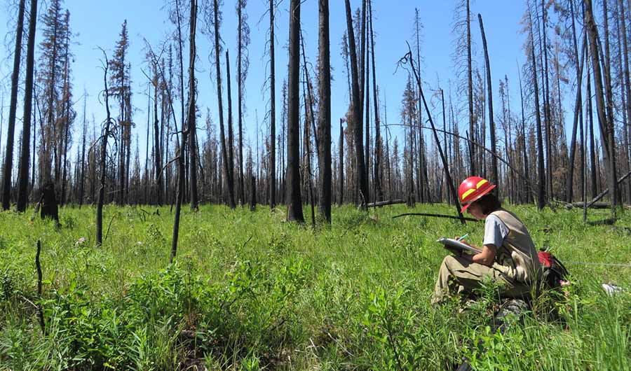
fire effects monitoring
Pre- and post-fire measurements of fire effects help ecologists, fire scientists and managers determine how the severity of wildfires affects plants, animal habitat and ecosystem services. (Credit: Rachel Loehman, USGS)

For example, the USGS is partnering with the Los Alamos National Laboratory and Tall Timbers Research Station to model fire behavior, fire weather patterns, 3D fuel loads and smoke conditions to evaluate how fuel treatments can reduce fire risk across a changing landscape. The USGS is also strengthening its partnerships with the Fire Science Exchange Network to foster increased access and use of its fire information, data and tools while learning about needs of practitioners in the field.

The USGS Wildland Fire Science Strategy aligns with national initiatives as defined in the National Cohesive Wildland Fire Management Strategy. Developed by a broad swath of stakeholders at all levels, the Cohesive Strategy calls for science and management that promote resilient landscapes and fire-adapted communities for safe and effective wildfire responses.

For more details about the new USGS Wildland Fire Science 2021-2026 Strategic Plan, read the full report.

For more information about USGS fire science, visit www.usgs.gov/fire.


The caption in the second image was edited to correctly indicate that the personnel in the photo are USFS employees and the equipment seen was developed and owned by the USFS Missoula Fire Science Lab.

More than 110 plant species in Australia had their entire ranges burned in the 2019-2020 megafires

Most are resilient to fire, however the scope of the blazes may leave some ecosystems susceptible to landscape-scale failure

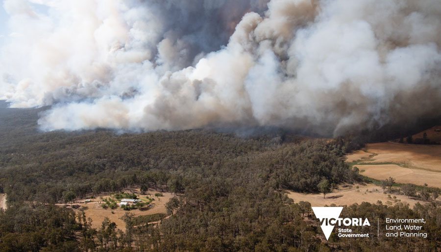
Bushfire in Victoria, December, 2020

More than 19 million acres in Australia burned in the bushfires of the 2019-2020 season, with seven individual fires exceeding 1 million acres. Researchers who have studied the impacts on the vegetation have determined that the entire ranges of 116 plant species burned along with 90 percent of the ranges of 173 species.

Most of the affected species are are resilient to fire. However, the massive scope of the megafires may leave some ecosystems, particularly the rainforests, susceptible to regeneration failure and landscape-scale decline.

Below are excerpts from a study by Robert C. Godfree, Nunzio Knerr, and Francisco Encinas-Viso, et al., published in Nature Communications February 15, 2021.


Our data indicate that 816 vascular plant species in mainland south-eastern Australia were highly impacted by the Black Summer fires, of which 325 and 173 were >75% and >90% burnt, respectively. All known populations of an estimated 116 species (14% of the total) burnt, which is more than double the number of plant species endemic to the British Isles.

The fires clearly impacted a broad range of species that contribute to both floristic diversity and habitat heterogeneity of forests and woodlands on local to bioregional scales. These characteristics underpin crucial ecosystem services that include biomass production and carbon sequestration, surface-atmosphere interactions and the provision of foods and habitat for animal assemblages, and transformational changes in these processes are likely to be of great importance in the wake of the fires.

Extremely and very range-restricted species experienced fire over an average of 90–95% of their ranges compared with 57–60% for the most widespread species.

Despite the immediate potential impacts on south-eastern Australian vegetation revealed in this study, the ability of many plant communities and species to recover and regenerate after megafires of this scale remain poorly understood. As we have shown, the size of species ranges and the geographic position of the fires both played an important role in determining the diversity and composition of the fire-affected flora. The demographic impact of the fires on specific taxa will also depend on their ability to survive and recover from fire

Our data show that the majority of species affected by the fires are primarily found in sclerophyll forests and woodlands or shrublands and heathlands. Fire is a natural part of these ecosystems and many species are highly fire-adapted with traits such as a soil-stored seed bank, serotinous cones or fruits, smoke- and/or heat-induced seed germination, fire-cued flowering, thick protective basal bark, epicormic buds or underground lignotubers that either provide protection from fire and/or ensure subsequent recovery. Evidence from 270 species in our study confirms this pattern: 251 (93%) across 93 genera are reportedly fire persisters that can resprout or regenerate via propagules after fire, or both.

For widespread endemic species with ranges of 500 km or more the demographic consequences of the 2019-2020 fires are likely unprecedented over at least the past two centuries. While the majority are also likely to be fire-persisters, they are now at risk of novel range-wide threats during the recovery phase such as dieback and inhibited post-fire recovery caused by myrtle rust (Austropuccinia psidii), herbivory of regrowth by invasive animals, and drought. Rainforest taxa capable of surviving fire but unable to compete with subsequent incursion of weeds or sclerophyllous species may be under similar pressure. Obligate seeding woody species such as the ash eucalypts (e.g., Eucalyptus fraxinoides) are likely to be under threat if fires return prior to completion of their typically long sexual maturation periods.

Collectively, there are grounds for cautious optimism that most plant species identified here will recover from all but the most intense fire. Despite this resilience, however, recent evidence from forested ecosystems globally suggest that catastrophic fire events are increasingly catalysing dramatic changes in species composition across large areas. In the most extreme cases tipping points are being reached, resulting in transitions from forest to non-forested vegetation.

Impairment of post-fire regeneration has been specifically linked to thresholds in vapour pressure deficit, soil moisture and maximum surface temperature, as well as fire intensity and seed availability. This is particularly concerning because much of the vegetation affected by the Black Summer fires was already suffering from extreme drought, record high temperatures and patchy canopy dieback prior to the onset of the 2019-2020 fire season. Even in the absence of fire these factors can drive rapid shifts in the dynamics and distribution of forest ecosystems. In regions where the Black Summer fires burnt areas that had only recently recovered from previous fires, increasing fire frequency will be an additional stressor.


From: Godfree, R.C., Knerr, N., Encinas-Viso, F. et al. “Implications of the 2019–2020 megafires for the biogeography and conservation of Australian vegetation.” Nat Commun 12, 1023 (2021). https://doi.org/10.1038/s41467-021-21266-5

Combined, bark beetle outbreaks and wildfire spell uncertain future for forests

Bark beetle outbreaks and wildfire alone are not a death sentence for Colorado’s beloved forests — but together, their toll may become more permanent

Aspen trees regenerate fire beetles
Aspen trees regenerate from their roots in the San Juan range of the Rocky Mountains, amidst many dead Engelmann spruce trees. (Credit: Robert Andrus)

Aspen trees regenerate from their roots in the San Juan range of the Rocky Mountains, amidst many dead Engelmann spruce trees. (Credit: Robert Andrus)

New research from the University of Colorado Boulder found that when wildfire follows a severe spruce beetle outbreak in the Rocky Mountains, Engelmann spruce trees are unable to recover and grow back, while aspen tree roots survive underground. The study, published last month in Ecosphere, is one of the first to document the effects of bark beetle kill on high elevation forests’ recovery from wildfire.

“The fact that Aspen is regenerating prolifically after wildfire is not a surprise,” said Robert Andrus, who conducted this research while working on his PhD in physical geography at CU Boulder. “The surprising piece here is that after beetle kill and then wildfire, there aren’t really any spruce regenerating.”

Andrus’ previous research found that bark beetle outbreaks are not a death sentence to Colorado forests — even after overlapping outbreaks with different kinds of beetles — and that spruce bark beetle infestations do not affect fire severity.

This new research, conducted in the San Juan range of the Rocky Mountains, shows that subalpine forests that have not been attacked by bark beetles will likely recover after wildfire. But for forests that suffer from a severe bark beetle outbreak followed by wildfire within about five years, conifers cannot mount a comeback. While these subalpine forests can often take a century to recover from fire, this research on short-term recovery is a good predictor of longer-term trends.

“This combination, the spruce beetle outbreak and the fire, can alter the trajectory of the forest to dominance by aspen,” said Andrus, who is now a postdoctoral researcher at Washington State University.

For those worried about the future of Rocky Mountain forests farther north, more research is needed on areas burned in the 2020 East Troublesome Fire to understand how the mountain pine beetle outbreak prior to that fire will affect forest recovery, according to Andrus.

The next generation

Each bark beetle species specializes in attacking — and usually killing — a specific host tree species or closely related species. Several species of bark beetle are native to Colorado and usually exist at low abundances, killing only dying or weakened trees. But as the climate becomes hotter and drier, their populations can explode, causing outbreaks which kill large numbers of even the healthiest trees.

spruce seedling fire beetles
An Engelmann spruce seedling survives where few seeds have fallen following spruce beetle outbreak and wildfire. (Credit: Robert Andrus)

An Engelmann spruce seedling survives where few seeds have fallen following spruce beetle outbreak and wildfire. (Credit: Robert Andrus)

These large, healthy Engelmann spruce and subalpine fir trees are the ones that produce the most seeds. When bark beetles kill these trees and then fire sweeps in, the researchers found there simply aren’t enough seeds being produced in the burned areas to regenerate the forest.

Aspens, however, regrow from their root systems. While all three of these higher elevation trees have thin bark and die when exposed to fire, with their regenerative roots underground, aspens can bounce back where conifers cannot.

The researchers focused specifically on areas of forest affected by spruce bark beetle outbreaks, which attack Engelmann spruce, where fires such as Papoose, West Fork and Little Sands burned in 2012 and 2013 in Rio Grande National Forest. They found that for forests that suffer from a severe bark beetle outbreak followed by wildfire within about five years, Engelmann spruce and subalpine fir trees failed to recover in 74% of the 45 sites sampled.

This information will help inform land managers and policy makers about the implications for high elevation forest recovery following a combination of stressors and events.

And it’s more important information than ever. Not only do bark beetle outbreaks leave behind swaths of dead, dry trees — and fewer trees to produce seeds — but the climate is getting hotter and droughts are becoming more frequent, promoting larger fires.

“Bark beetle outbreaks have been killing lots and lots of trees throughout the western United States. And especially at higher elevation forests, what drives bark beetle outbreaks and what drives fire are similar conditions: generally warmer and drier conditions,” said Andrus.

But there is good news: The aspens that may come to dominate these forests can anchor their recovery, and keep forests from transitioning into grasslands.

“Where the aspen are regenerating, we expect to see a forest in those areas,” said Andrus.

The name of the paper that was published January 22, 2021 is “Future dominance by quaking aspen expected following short‐interval, compounded disturbance interaction.” Additional authors on this publication include Thomas Veblen at CU Boulder; and Sarah Hart and Niko Tutland of Colorado State University.

Researchers conduct detailed case study of the Camp Fire

Establish a fire progression timeline

firefighter battles flames Camp Fire
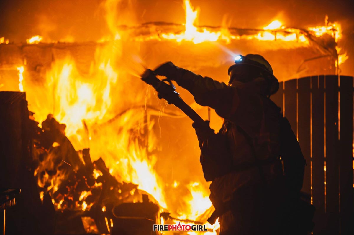
A firefighter battles flames at the Camp Fire. Photo by FirePhotoGirl used with permission.

On a brisk November morning in 2018, a fire sparked in a remote stretch of canyon in Butte County, California, a region nestled against the western slopes of the Sierra Nevada mountains. Fueled by a sea of tinder created by drought, and propelled by powerful gusts, the flames grew and traveled rapidly. In less than 24 hours, the fire had swept through the town of Paradise and other communities, leaving a charred ruin in its wake.

The Camp Fire was the costliest disaster worldwide in 2018 and, having caused 85 deaths and destroyed more than 18,000 buildings, it became both the deadliest and most destructive wildfire in California’s history, two records the fire still holds today.

What made the Camp Fire so devastating? And what lessons can we learn to prevent another disaster of this scale? Researchers at the National Institute of Standards and Technology (NIST) have begun to answer these questions by investigating the conditions leading up to the fire and meticulously reconstructing the sequence of events describing the first 24 hours of its progression. A new report containing the timeline identifies areas where more research is needed to improve life safety and reduce structural losses. It also offers a detailed look at how a large and deadly fire advances — information that will become increasingly valuable as fire seasons continue to intensify.

“Going forward, there’s no reason to believe that fire activity and severity is going to lessen anytime soon. We’re never going to get rid of wildfires, natural or human-caused. But we can learn how to live with and work together to mitigate them.” —Steven Hawks, CAL FIRE chief and report co-author

“The information we collected on the timeline is extremely powerful by itself, not only for Paradise but for other similar communities, to help them understand what they may encounter and better prepare, whether it is at a community or at the first responder level,” said NIST fire protection engineer Alexander Maranghides, who led the timeline reconstruction.

To piece together the puzzle of the Camp Fire, the team carried out discussions with 157 first responders, local officials and utilities personnel who were present during the fire. The team documented sightings of fire or smoke and efforts to fight the fire or evacuate, as well as insights into community preparedness and weather conditions.

NIST Report Camp Fire
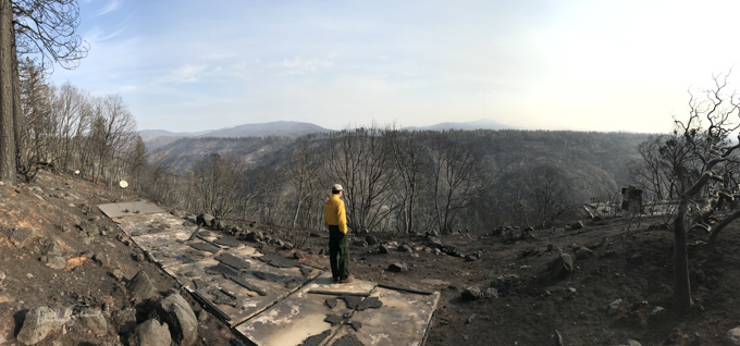
NIST researcher and fire protection engineer Alexander Maranghides views a landscape marred by the Camp Fire during a field data collection deployment. Credit: NIST.

The researchers sought to back up observations made during the fire with additional data sources before adding new puzzle pieces to the timeline. With the help of the California Department of Forestry and Fire Protection (CAL FIRE), Paradise Police Department and others, the team gained access to and reviewed large data sets, including radio logs, 911 calls, dashboard and body camera recordings, and drone and satellite images. They also looked to images in social and news media to corroborate the sightings of discussion participants.

By the end of the painstaking process, the authors of the report incorporated more than 2,200 observations into the timeline, which is broken up into 15 separate segments to capture concurrent events throughout different sections of Butte County.
Continue reading “Researchers conduct detailed case study of the Camp Fire”

NASA uses UAVs and satellites equipped with radar to monitor recovery from vegetation fires

They observe fire fronts and burn scars during and shortly after fire moves across a landscape

remote sensing to monitor wildfire recovery
2010-2020

For the past few decades, scientists have been using satellite- and airplane-based radar instruments to detect damage caused by wildfires and human-caused blazes. Radar instruments can observe by day or night and can see land through clouds and smoke, so they are helpful for observing fire fronts and burn scars during and shortly after fire moves across a landscape.

Landscape ecologist Naiara Pinto and colleagues at NASA’s Jet Propulsion Laboratory are now taking a longer view. They are trying to decipher where and how well forests and scrublands are recovering in the years after a fire.

Synthetic aperture radar (SAR) instruments send out pulses of microwaves that bounce off of Earth’s surfaces. The reflected waves are detected and recorded by the instrument and can help map the shape of the land surface (topography) and the land cover—from cities to ice to forests. By comparing changes in the signals between two separate satellite or airplane overpasses, scientists can observe surface changes like land deformation after earthquakes, the extent of flooding, or the exposure of denuded or bare ground after large fires.

NASA research aircraft
One of the aircraft NASA equips with synthetic aperture radar or other sensors. This is a medium-sized UAV-NASA SIERRA. SIERRA medium UAV at NASA Ames Research Center, Moffett Field, California. (Photograph: NASA.) NASA SIERRA Pilot and Range Safety Officer Mark Sumitch shown for scale.

SAR instruments are carried on the European Space Agency’s Sentinel-1 satellites, while NASA currently deploys its Uninhabited Aerial Vehicle Synthetic Aperture Radar (UAVSAR) via research aircraft. NASA and the Indian Space Research Organization are planning to launch the NISAR satellite in 2022.

remote sensing to monitor wildfire recovery
2010-2020

Mounted on the bottom of NASA research planes, UAVSAR has been flown over the same portions of Southern California several times since 2009. Pinto and JPL colleagues Latha Baskaran, Yunling Lou, and David Schimel analyzed that data and developed a mapping technique to show the different stages of removal and regrowth of vegetation (chapparal and forest).

The maps above are essentially mosaics of the observations across a decade. Radar signals bounce off burned, barren terrain differently than they reflect from unburned, brush-covered hillsides or from fresh growth. The colors indicate the relative amount of vegetation observed by different UAVSAR flights at different times. Yellow lines on the maps indicate the extent of several major fires: StationColbySan Gabriel (SG) ComplexLa Tuna, and Bobcat.

“Overall, the colors are telling us that the Angeles National Forest contains a patchwork of plant communities at different stages of regeneration,” said Pinto, who is a science coordinator for UAVSAR. For instance, areas with more red had more vegetation in 2010 than they do now. Areas with more blue and green shading had more vegetation (regrowth) in recent years. Yellow indicates areas burned in 2020 that had a higher volume of vegetation in 2010 and 2017 (red+green) but lower volume in 2020 (blue).

remote sensing to monitor wildfire recovery
2010-2020

The image above illustrates how those maps were assembled. Radar data were collected during UAVSAR flights in 2010, 2017, and 2020 over Angeles National Forest and other areas northeast of the greater Los Angeles metropolitan area.

The project has been supported by NASA’s Earth Applied Sciences Disasters program, which generates maps and other data products for institutional partners as they work to mitigate and recover from natural hazards and disasters. The SAR technique is still being tested and validated, but the intent is to monitor forest regrowth and fire scar change over time, which are important information for forest and fire managers working to manage risks.

NASA Earth Observatory images by Joshua Stevens, using UAVSAR data and imagery courtesy of Anne Marie Peacock, Naiara Pinto, and Yunling Lou and NASA/Caltech UAVSAR. Story by Michael Carlowicz.

Do fuel reduction treatments increase resistance to insects and drought?

Not always, according to researchers

Prescribed fire at Mount Rushmore National Memorial
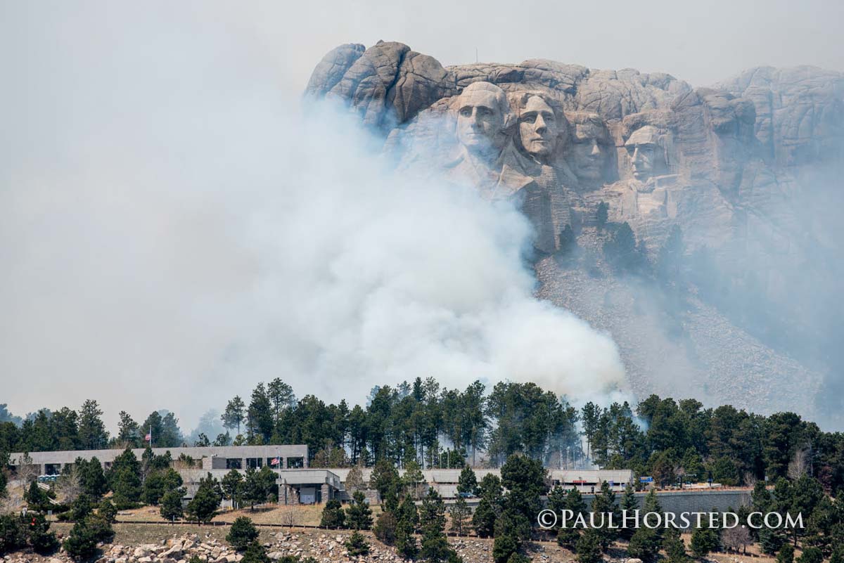
Prescribed fire at Mount Rushmore National Memorial, April 29, 2020. Photo by Paul Horsted.

Intuitively we might think that fuel reduction treatments and prescribed fire would lead to more resistance to drought and attacks by beetles. While that is sometimes the case, it turns out that following the extreme 2012-2016 drought in California, prescribed burning increased beetle infestation rates and increased mortality of red fir and sugar pine in an area studied by scientists.

Researchers studied 10,000 mapped and tagged trees in a mixed‐conifer forest following mechanical thinning and/or prescribed burning treatments in 2001 through the extreme drought in California. The work was conducted in the Teakettle Experimental Forest (36°58′ N, 119°2′ W) located in the High Sierra Ranger District of Sierra National Forest, in California’s Sierra Nevada. Elevation of the forest ranges from 1,880 to 2,485 m.

While prescribed burning is an important tool for increasing resistance to wildfire their results suggest prescribed burning does not necessarily also instill drought resistance.

Below is an excerpt from a paper  titled, “Do forest fuel reduction treatments confer resistance to beetle infestation and drought mortality?” It was written by: Z. L. Steel, M. J. Goodwin, M. D. Meyer, G. A. Fricker, H. S. J. Zald, M. D. Hurteau, M. P. North, and published by the Ecological Society of America January 22, 2021.


Management challenges
Density reduction treatments that rely on mechanical thinning alone had neutral to positive effects on conifer survival during the 2012–2016 drought (Figs. 7, 8). The overstory treatment that removed medium to large trees (e.g., ≥25 cm) was most beneficial to residual individuals, suggesting such a strategy could be used broadly to increase drought resilience for some species (i.e., Jeffrey pine and white fir). While removal of smaller trees (e.g., ≤25 cm) may be less effective at mitigating drought mortality, treatments focused on ladder and surface fuels may still be preferred when considering non‐drought objectives such as reducing fire hazard or maintaining wildlife habitat (Stephens et al. 2012).

Prescribed burning appears less effective than mechanical thinning at reducing drought mortality and in some cases can lead to higher beetle infestation and mortality rates (Fig. 8). This is most striking in the case of large sugar pines which died at much higher rates in prescribed burn plots during the drought. The negative effect of burning on tree survival is somewhat surprising given that the fire regime under which these forests developed was characterized by frequent (i.e., 11–17 yr) low‐ to moderate‐severity fire (North et al. 2005, Safford and Stevens 2017), and that the prescribed burn occurred approximately a decade prior to the drought.

Mortality and probability change
Indirect effect of forest treatment on drought mortality. Treatment abbreviations are UU for Unburned/Understory Thin; UO for Unburned/Overstory Thin; BN for Burned/No Thin; BU for Burned/Understory Thin; and BO for Burned/Overstory Thin. Value distributions represent change in probability of mortality relative to controls for two tree sizes. The scale of the x‐axis varies among species. (From the research)

Further, van Mantgem et al. (2016) observed decreased tree mortality associated with prescribed fire elsewhere in the Sierra Nevada following the initial two years of California’s drought, and Meyer et al. (2019) found no difference in mortality between paired burned and unburned plots in red fir forests during the middle and late periods of the drought. The forests Meyer et al. (2019) sampled were at higher elevations than Teakettle where soil moisture is substantially higher and temperatures lower.

The results presented here could be unique to the Teakettle Experimental Forest, but we suspect they are more likely attributable to the historic severity of the 2012–2016 drought. When beetle populations are less than epidemic such as at higher elevations, during moderate droughts, or early in severe droughts, previous fire and its associated reduced density may be neutral or ameliorating for conifer mortality.

Our sugar pine results may indicate a tipping point beyond which the combination of extreme water stress from drought, bark beetle outbreaks, and fire result in increasingly high rates of tree mortality (Nesmith et al. 2015), and subsequent forest structural changes outside the natural range of variation (Young et al. 2020).

These results suggest cautious low‐intensity and small (i.e., stand) scale prescribed burning, as it is often applied by managers, may only benefit forests under short duration drought stress while contributing to higher mortality in red fir and sugar pine during prolonged and exceptional droughts.

High mortality rates of large sugar pines may be related to prescribed fires consumption of deep litter and duff layers that have accumulated around the base of pine species under fire suppression, suggesting removal of litter and duff through raking could protect individual trees. Nesmith et al. (2010) found raking increased survival and reduced bark beetle activity when fire intensity was moderate (<80% crown scorch) and when fuel depth was ≥30 cm. Thus, protecting individual trees of high ecological value may be possible prior to prescribed burns. However, such targeted measures are infeasible at broad scales in fire‐prone landscapes of the Sierra Nevada. In the long run, retaining sugar pine in these pyrogenic landscapes may hinge on fostering sunny, bare mineral soil conditions favorable for sugar pine regeneration and in the future reducing surface fuels on a regular basis.

Infestation probability
Marginal effects on beetle infestation. (C) host species basal area within a 10‐m radius, and (D) whether a tree experienced a prescribed burn treatment. Beetle and tree species abbreviations are jpb for Jeffrey pine beetle; rtb for red turpentine beetle; mpb for mountain pine beetle; eng for fir engraver; pije for Pinus jeffreyi (Jeffrey pine); pila for Pinus lambertiana (sugar pine); abco for Abies concolor (white fir); and abma for Abies magnifica (red fir). For C, thick lines show mean effect estimates with labeled solid lines represent relationships where the 90% credible interval does not include zero. To illustrate the spread of credible effects, 30 model posterior draws are also drawn as faint lines. Note the y‐axis scale differs for (D). (From the research)

Treatment effects on large diameter trees are often the focus of management restoration efforts since these structures have been reduced from past logging, take a long time to develop, and are associated with important ecosystem services (e.g., sensitive species habitat and carbon storage). Treatments using only thinning consistently reduced mortality of large (>75 cm DBH) trees across species, albeit with different effect sizes. For incense‐cedar and especially white fir, there was a greater reduction in mortality for small versus large trees, which are often the target of fuel reduction treatments. Prescribed fire has mixed effects, reducing mortality of large Jeffrey pine and slightly reducing small white fir mortality when combined with thinning, but increasing mortality of large red fir, incense‐cedar, and significantly increasing large sugar pine mortality.

While prescribed burning is an important tool for increasing resistance to wildfire (Stephens and Moghaddas 2005, Prichard et al. 2010), our results suggest such fuel treatments do not necessarily also instill drought resistance. There is general benefit to all species in reducing density, but the means (i.e., mechanical vs. prescribed fire) of treatment matters, suggesting caution in widespread use of fire in drought‐prone areas where managers want to retain large sugar pines and red fir.