
About 1,000 feet wide
Continue readingDo fuel reduction treatments increase resistance to insects and drought?
Not always, according to researchers
Continue readingEnvironmental groups sue BLM over plans to construct 11,000 miles of fuel breaks
The projects would be in California, Oregon, Washington, Idaho, Nevada, and Utah
Continue readingSuccess story — fire prevention along Interstate 84 in Idaho
Average fire size decreased by 95 percent
Continue readingSome prescribed fires are more challenging than others
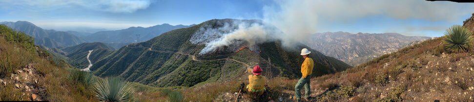
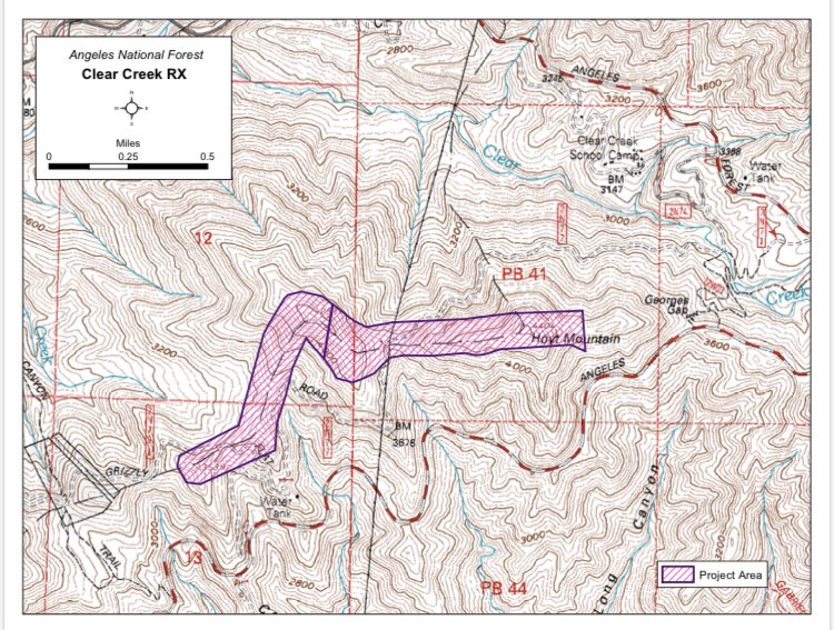
Firefighters on the Angeles National Forest are using prescribed fire on the Clear Creek fuel break north of Los Angeles that separates the Arroyo Seco from the Big Tujunga drainages.
“It helps to protect some of the largest communication sites anywhere, some of LA’s drinking water storage, and major communities,” said Robert Garcia, Fire Chief on the Angeles National Forest. “It is also on some of the toughest ground we have on the ANF making initial attack very difficult. The adjacent slopes are unfortunately known from such incidents as Woodwardia, Bryant and more recently the origins of the 2009 Station Fire.”
When I worked on the Laguna and El Cariso Hotshots nearby on the Cleveland NF, to us the ANF was infamous for its extremely steep slopes, which are evident in these photos.
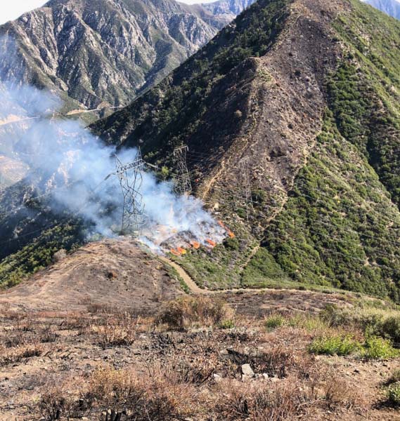

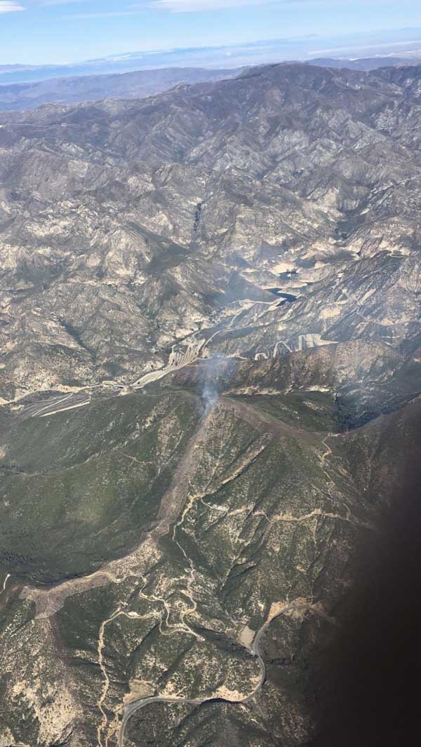
In most other locations super-steep slopes are not a serious obstacle while conducting prescribed fires, as in the example below.

BLM plans to build 11,000 miles of fuel breaks

On Friday, February 14 the Bureau of Land Management (BLM) released the Final Programmatic Environmental Impact Statement (PEIS) for Fuel Breaks in the Great Basin. This Final PEIS provides for the construction and maintenance of a system of up to 11,000 miles of fuel breaks within a 223 million acre area to aid in the control of wildfires in portions of Idaho, Oregon, Washington, California, Nevada, and Utah.
The Preferred Alternative outlined in the PEIS analyzes manual, chemical and mechanical treatments, including prescribed fire, seeding, and targeted grazing to construct and maintain a system of fuel breaks. These treatments would be implemented along roads and rights-of-way on BLM-administered lands to minimize new disturbance and wildlife habitat fragmentation and to maximize accessibility for wildland firefighters.

The estimated total cost of developing and producing the PEIS was $2.3 million.
“Wildfires pose an enormous threat to rangelands in the Great Basin – rangelands that people depend on for both recreational opportunities and their livelihoods, and that wildlife rely on for habitat,” said BLM Deputy Director for Policy and Programs William Perry Pendley. “Fuel breaks are one of the most important tools we have to give wildland firefighters a chance to safely and effectively contain rapidly moving wildfires and potentially reduce wildfire size.”

Wildfires in sagebrush communities in the Great Basin states are becoming more frequent and larger, fueled by large, unbroken swaths of grasses, brush and other vegetation. Over 13.5 million acres of historically sagebrush communities on BLM land burned within the project area between 2009 and 2018. Wildfires that consume sagebrush provide the opportunity for invasive annual grasses to increase, making future large and severe wildfires more likely.

The concept behind fuel breaks is to break up or fragment continuous fuels by reducing vegetation in key locations. When a wildfire burns into a fuel break, the flame lengths decrease and its progress slows, making it safer and easier for firefighters to control.
An electronic copy of the Final PEIS and associated documents is available for public review for 30 days on the BLM Land Use Planning and NEPA register at https://go.usa.gov/xnQcG. Other documents related to the EIS are at the BLM’s ePlanning website. The BLM will issue a Record of Decision after the end of the public review period.
A ball and chain is not always a bad thing
At least not when it is used to reduce a fire hazard
Continue readingBLM to develop EISs for fuel breaks and fuel reduction

The programmatic Environmental Impact Statements would streamline approvals for projects
Continue readingBLM: fuel breaks stopped spread of Centennial Fire

The BLM fuel breaks are initially created by using herbicides
Continue readingUSGS to study fuel break effects on wildfires, sage-grouse
Above: Roads through areas prone to wildfire act as fuel breaks, disrupting the fuel continuity, potentially reducing the rate of fire spread. The areas on either side of the road have also been mowed to reduce vegetation height. Photo courtesy of BLM.
The U.S. Geological Survey is gearing up for a project across the Great Basin studying how effective fuel breaks are, simultaneously evaluating their ecological costs and benefits.
Fuel breaks like sandy roads or other barriers are intended to reduce fire size and frequency by slowing or altogether halting fire’s spread to the other side of the break. Still, questions remain about whether fuel breaks protect sagebrush and sage-grouse, the USGS said in a comments discussing the new research.
“We want to determine the extent to which fuel breaks can help protect existing habitat from wildland fires, paying particular attention to how such breaks affect sagebrush habitat, sage-grouse, and other sagebrush-dependent species,” the USGS said in a statement.
Additional information about the research can be found on the USGS site.