Above: Wildfires in Western Montana, July 25, 2017.
(Originally published at 10:30 a.m. MDT July 25, 2017)
Residents of Missoula, Montana are used to the impacts wildfire season brings to the area. Occasionally the area is inundated with smoke for days or weeks at a time. Today at least a dozen large wildfires are burning within 70 miles of Missoula. Most of them are south or east of the city so the northwest wind predicted today will blow much of the smoke from the fires away from town.

The national Incident Management Situation Report groups fires by Geographic Area and lists those Areas by priority, and within each Area the fires are listed by priority. The Northern Rockies Geographic Area, identified as the highest priority today, is comprised of Northern Idaho, all of Montana, most of North Dakota, and relatively small portions of Wyoming and South Dakota.

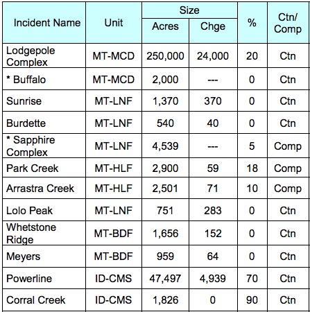
Today’s report lists 21 large fires in the Northern Rockies with 18 of them being in Montana. The first 10 priorities are in Montana and 8 of them are in the western part of the state.
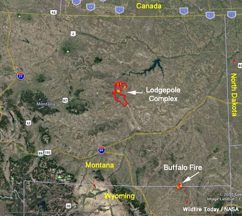
The two that are in the eastern part are the top two priorities in the Area:
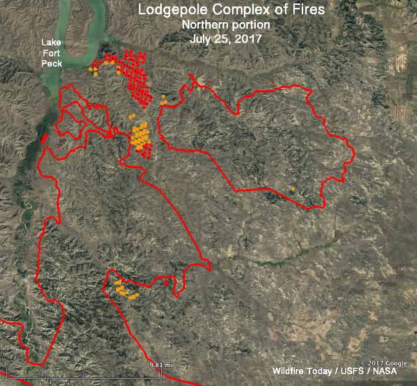
Lodgepole Complex of Fires: 250,000 acres, 16 homes have been destroyed. Firefighters are making good progress. Over the last 48 hours the only large growth has been on the northern end near Lake Fort Peck. More information.
Buffalo Fire: This is a new fire reported July 24. At last report it had burned 2,000 acres and is near the Wyoming/Montana state line. An Incident Management Team from Alaska that was staged in the state has been assigned.


Below is some information about a couple of fires closer to Missoula:
Lolo Peak Fire; 1,090 acres 17 miles southwest of Missoula and 10 miles southwest of Lolo. It was active Monday and Monday night on the north, west, and south sides, spotting across a drainage and advancing to Lantern Ridge.
Sapphire Complex comprised of Sliderock, Little Hogback, and Goat Creek fires: 20 to 31 miles southeast of Missoula. All three fires were active Monday, primarily on the east and southeast sides. Combined they have burned 4,539 acres.
An executive order signed by the Governor of Montana Sunday will enable the state to mobilize National Guard helicopters (Blackhawks and CH47), some firefighters, and kitchens. It also makes it possible for local governments to access the Governor’s emergency fund if they have enacted their own 2 mil levy.

